
When Is the Best Time
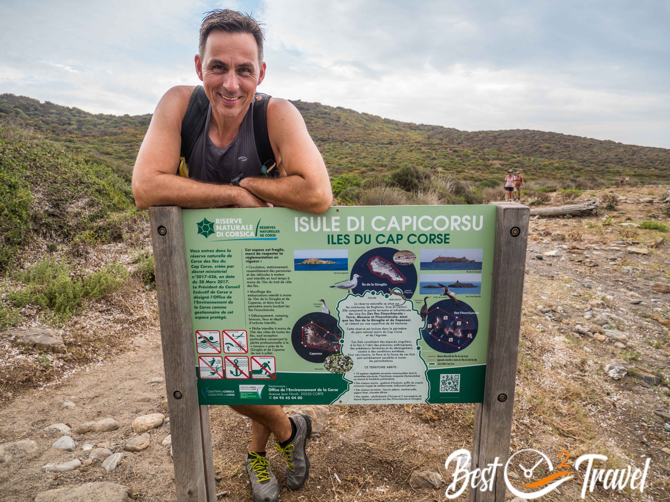
The Sentier des Douaniers is one of the most beautiful coastal hikes in Corsica. Following a historic customs officers' path on the remote Cap Corse peninsula, the trail offers spectacular sea views, hidden coves, Genoese watchtowers, and the intoxicating scent of the Mediterranean maquis. Once used to patrol the coastline and watch for smugglers, this scenic route is now a favorite among hikers looking to experience one of Corsica's most unspoiled landscapes.
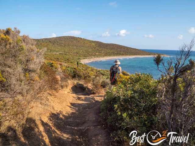
If you arrange a boat transfer from Barcaggio back to Macinaggio in advance, the hike is relatively easy. Without a boat transfer, however, the return journey significantly increases the distance and difficulty.
Heat & Trail Conditions
One thing to keep in mind is the complete lack of shade along the route. Even during spring and autumn, temperatures can become surprisingly high under the Corsican sun. During our September hike, temperatures exceeded 30°C, but thankfully a refreshing sea breeze made the conditions much more comfortable.
Sentier des Douaniers Hike Description
The Sentier des Douaniers is one of the most scenic coastal hikes in Corsica. The well-marked trail follows the rugged coastline of Cap Corse, offering spectacular views of the Mediterranean, hidden coves, and historic Genoese watchtowers.
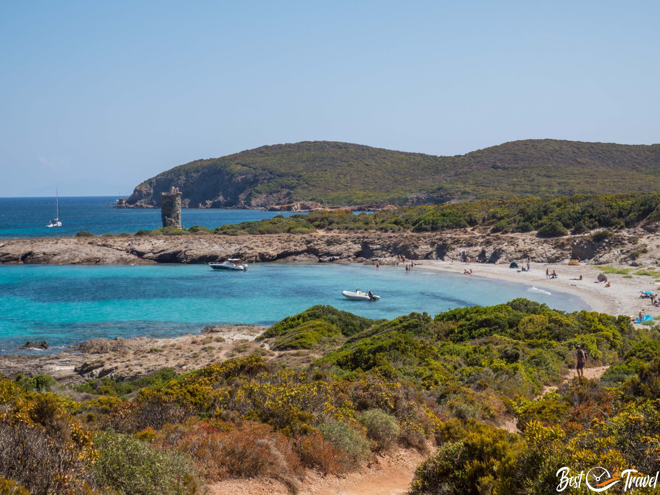
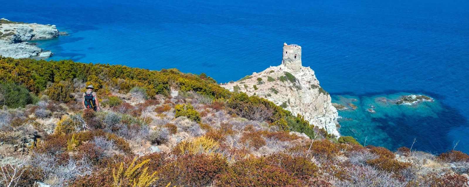
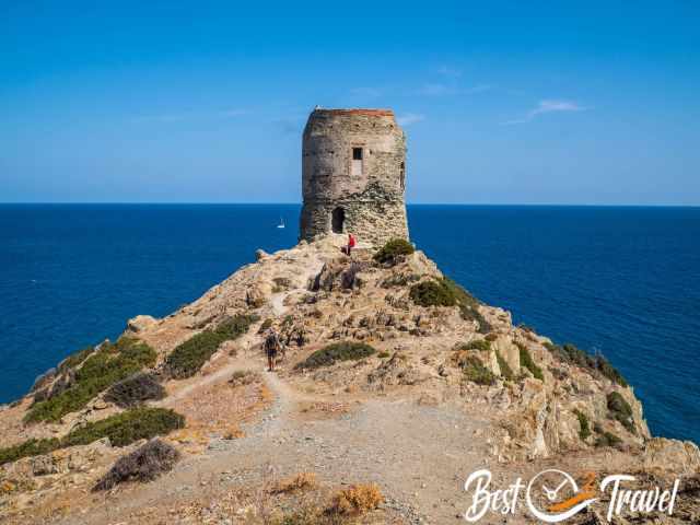
After about 1.5 hours, you reach the beautifully located ruins of the Santa Maria di a Chjappella Tower, the first Genoese tower along the route. Perched above the sea, this historic monument was partially destroyed at the end of the 18th century. If you prefer a shorter hike, this is an excellent turnaround point and still allows you to experience some of the most beautiful scenery on the Sentier des Douaniers.
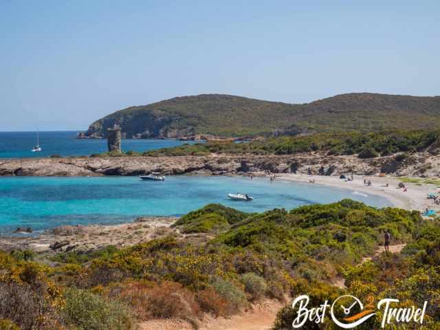
Just ten minutes later, the trail descends to the stunning bay of Cala Genovese. With its crystal-clear turquoise water and peaceful setting, it is one of the highlights of this Cap Corse coastal hike. We took the opportunity to cool off with a refreshing swim before continuing towards Barcaggio.
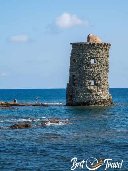
From Cala Genovese, it takes roughly another hour to reach the Torra Ghjenuvese d'Agnellu, the second Genoese watchtower on the route. Located just before Barcaggio, this tower marks the final highlight of the hike and is close to the boat pickup point. Although access is limited to the middle section of the tower, the panoramic views over the coastline and the Mediterranean are absolutely magnificent.
Trailheads for the Sentier des Douaniers Hike
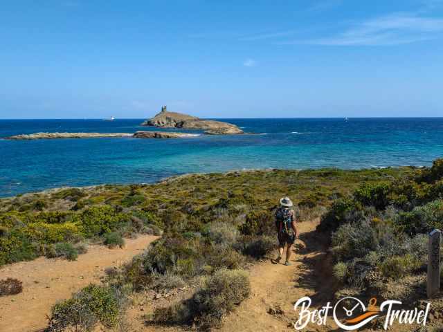
The hike can be started from several locations on Cap Corse, depending on your preferred route and whether you plan to return by boat.
- Macinaggio village (Google Maps) where the boat returns to
- Plage de Tamarone, where a bumby road leads to, which I can't recommend.
There is a parking lot (Google Maps) at the beach and the U Paradisu restaurant. The restaurant is beautifully situated, but the service could have been better. - Camping de la Plage U Stazzu (Google Maps), where we started from
Sentier des Douaniers Distance, Difficulty & Elevation
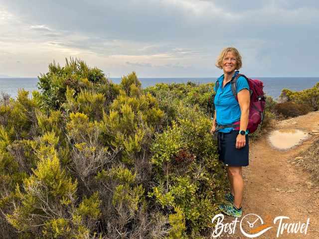
The Sentier des Douaniers is considered a moderately easy hike if you arrange a boat transfer from Barcaggio back to Macinaggio. Without a boat transfer, the return journey considerably increases the distance and makes the hike much more demanding.
- Full-day hike: 10.5 km one way from Macinaggio with boat return
- From Plage de Tamarone: 9 km one way
- From Camping de la Plage U Stazzu: 10 km one way
- Alternative short version to the first Genoese tower: 10 km return hike
- Elevation gain: approximately 150 m
- Difficulty: Moderate, mainly due to the distance and lack of shade
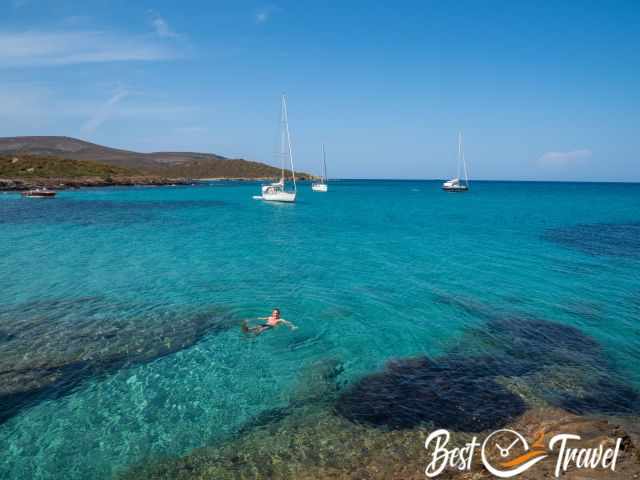
The beach Cala Genovese is also an excellent place for a swim, making this one of the most rewarding coastal hikes in Corsica. Be sure to pack swimwear, snorkel gear, plenty of water, snacks, and reliable sun protection.
Where to Stay Near the Sentier des Douaniers in Cap Corse
During our stay on Cap Corse, we found Macinaggio to be the perfect base for hiking the Sentier des Douaniers. The village is located right at the start of the trail and offers accommodation, restaurants, a marina, and boat transfers from Barcaggio for the return journey. We can recommend the following places to stay:
- U Libecciu: A great choice for exploring Cap Corse and hiking the Sentier des Douaniers. The hotel offers comfortable rooms with balconies, a generous breakfast, friendly staff, and a peaceful setting just minutes from Macinaggio's marina and beaches.
- Marina D'oro: Perfectly located directly opposite the marina in Macinaggio and just steps from restaurants, cafés, and shops. Newly renovated rooms, comfortable beds, and attentive staff make it an excellent base for hiking the Sentier des Douaniers and exploring Cap Corse.
More Corsica Hiking Guides

If you like hiking as much as we do, here are my other hiking suggestions and everything you need to know about camping on the island of beauty.
- 7 Top Hikes in Corsica and the Best Time and the history of the ancient Genoise Towers.
- Girolata Hike in Corsica: How to Reach the Remote Fishing Village
- King Aragon's Staircase of Aragon: Bonifacio's Most Spectacular Landmark
- Capo Rosso Hike in Corsica - My favourite Hike in Corsica
- Camping in Corsica
FAQ
Is the Sentier des Douaniers one of the best hikes in Corsica?
Yes, the Sentier des Douaniers is widely considered one of the most beautiful coastal hikes in Corsica. The trail on Cap Corse combines spectacular Mediterranean views, turquoise bays, Genoese watchtowers, and the fragrant Corsican maquis, making it a highlight for nature lovers and hikers.
How difficult is the Sentier des Douaniers hike?
The hike is moderately difficult. With a pre-booked boat transfer from Barcaggio back to Macinaggio, it is a relatively easy one-way walk. Without a boat transfer, the return journey significantly increases the distance and difficulty.
How long is the Sentier des Douaniers?
The classic route from Macinaggio to Barcaggio is approximately 10.5 km one way. Starting from Plage de Tamarone shortens the hike to about 9 km one way.
How much elevation gain does the Sentier des Douaniers have?
The trail has only around 150 metres of elevation gain. The main challenge comes from the distance and the lack of shade rather than steep climbs.
Can you swim during the Sentier des Douaniers hike?
Yes. Cala Genovese is one of the most beautiful swimming spots along the route. Its crystal-clear turquoise water provides the perfect opportunity to cool off on warm days.
Are there Genoese towers along the Sentier des Douaniers?
Yes. The trail passes two historic Genoese watchtowers: the ruins of Santa Maria di a Chjappella Tower and the Torra Ghjenuvese d'Agnellu near Barcaggio. Both are among the highlights of the hike.
Is there shade on the Sentier des Douaniers?
No. The trail is almost completely exposed to the sun. Even in spring and autumn, temperatures can feel surprisingly hot, so carrying plenty of water, sun protection, and a hat is essential.
What is the best time to hike the Sentier des Douaniers?
Spring and autumn offer the most pleasant hiking conditions. The trail can become very hot during summer because there is virtually no shade along the route.
Where does the Sentier des Douaniers start?
Most hikers start in Macinaggio, Plage de Tamarone, or at Camping de la Plage U Stazzu. Macinaggio is often considered the most convenient starting point, especially if you plan to return by boat from Barcaggio.
What should I pack for the Sentier des Douaniers hike?
Bring plenty of water, snacks, sun protection, sturdy footwear, and swimwear. If you enjoy snorkeling, Cala Genovese is a great place to bring a mask and snorkel.
Best Months to Visit
Location and Tips

Follow the historic Sentier des Douaniers on Cap Corse for stunning coastal scenery, crystal-clear swimming spots, and fascinating traces of Corsica's past.