
When Is the Best Time
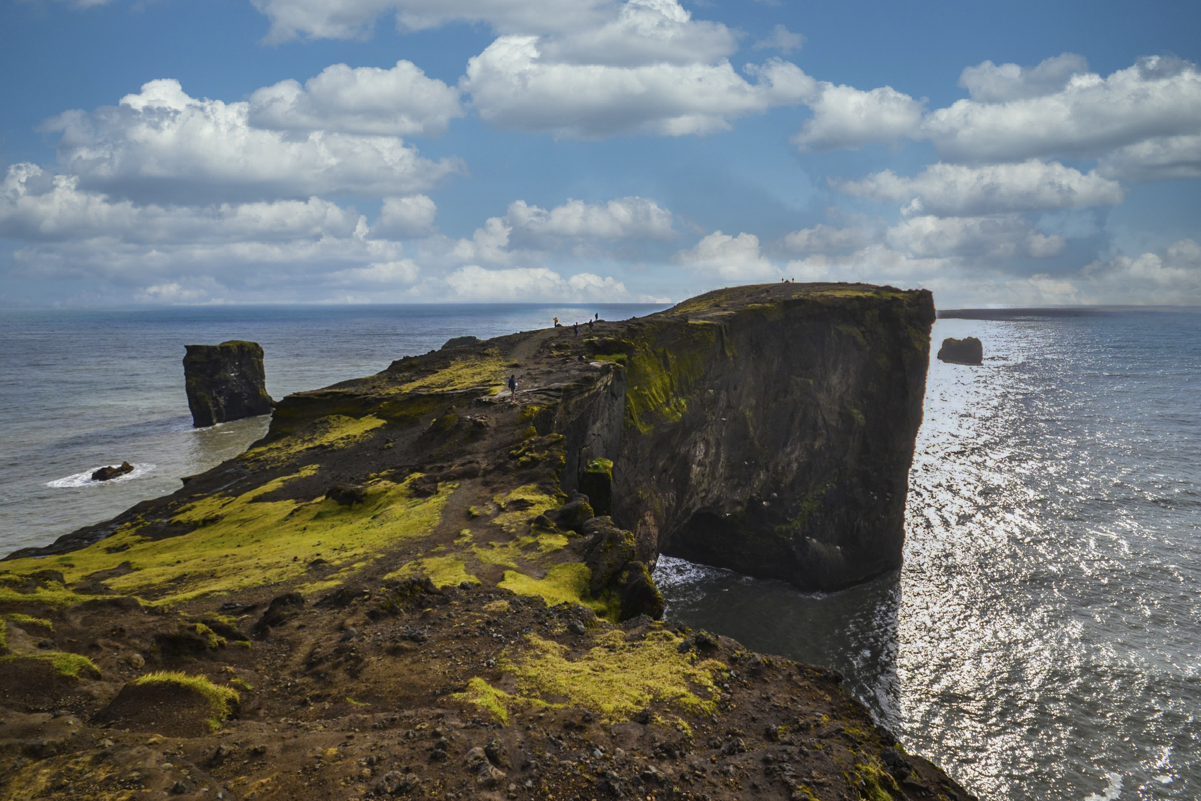
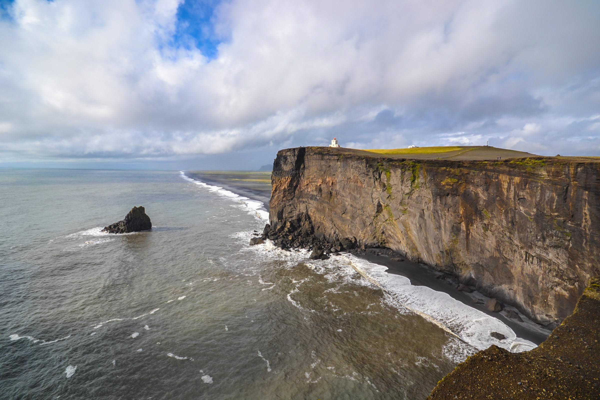
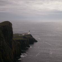
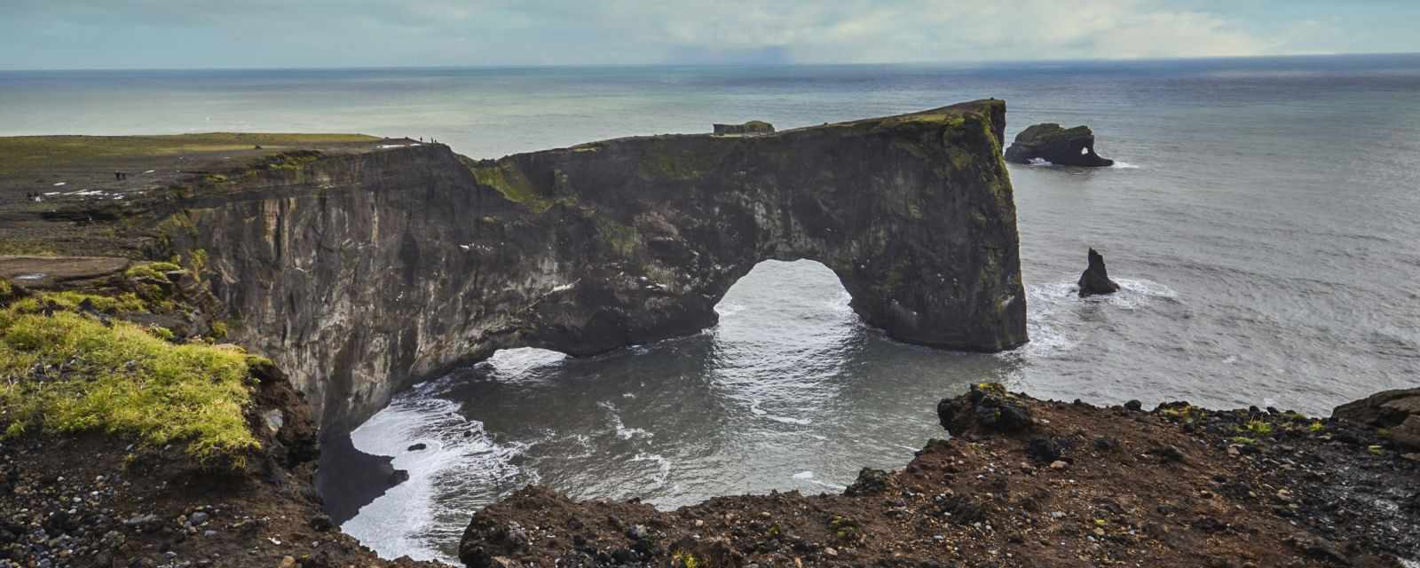
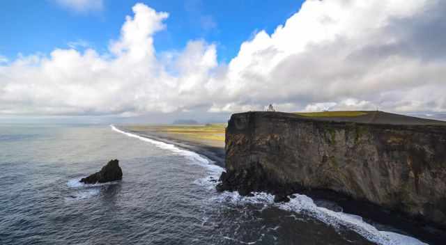
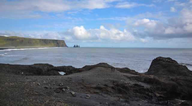
Dyrhólaey is one of the most spectacular viewpoints on Iceland’s south coast, famous for its puffins, dramatic cliffs, volcanic arch and lighthouse. The peninsula lies just 2.5 hours from Reykjavík and only 20 minutes from Vík, making it an easy stop on any South Coast itinerary.
Why Dyrhólaey Is So Popular
Dyrhólaey gets busy during summer days, especially in July and August. If you want to enjoy the views without the crowds — and increase your chances of seeing puffins — visit early in the morning or in the evening when the tour buses haven’t arrived or have already left.
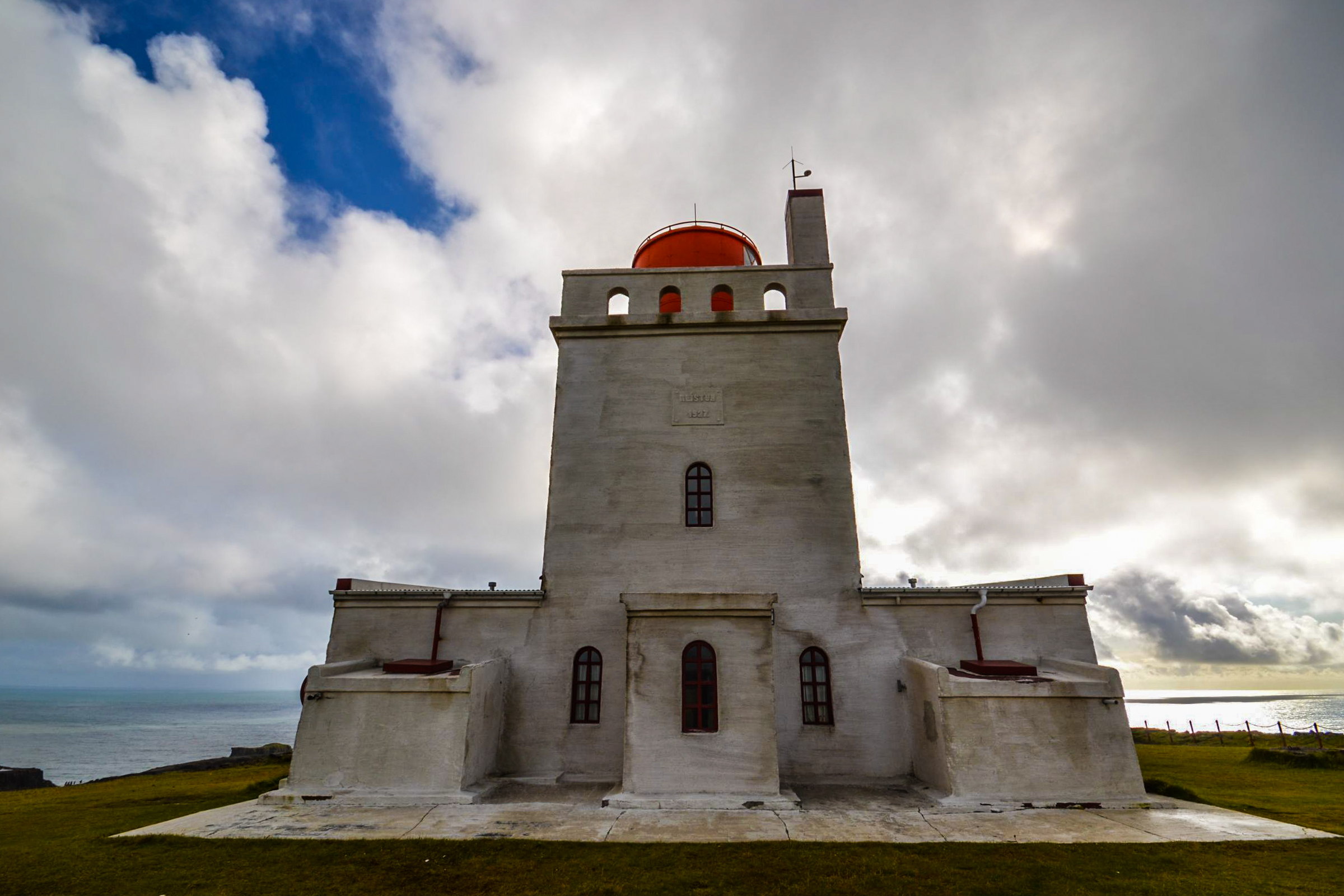
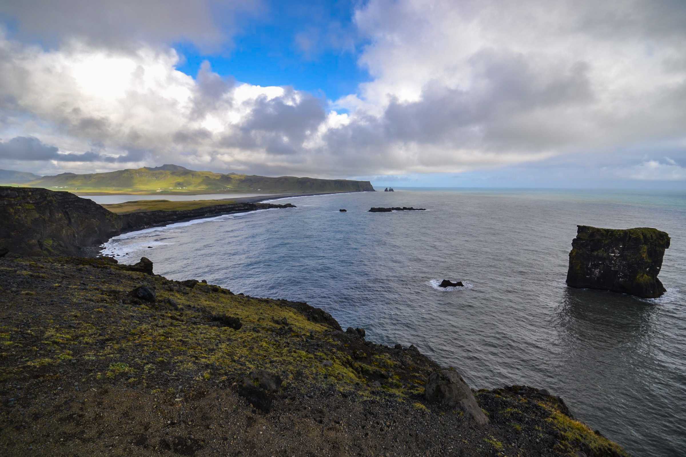
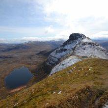
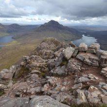
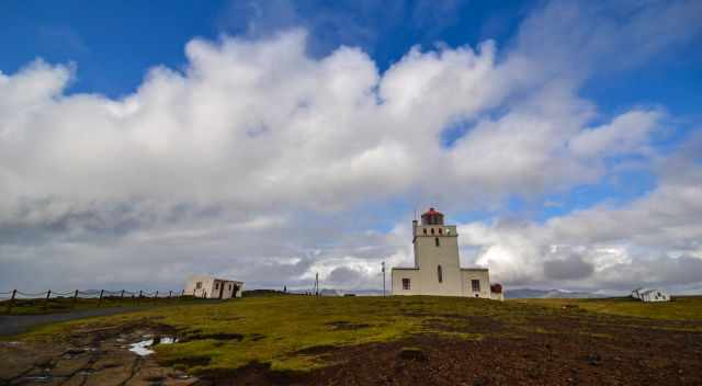
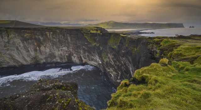
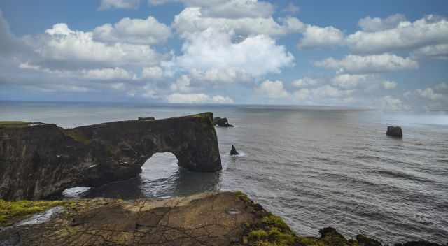
The peninsula marks the southernmost point of mainland Iceland and became a protected nature reserve in 1978. The name means “door hill island”, referring to the massive rock arch that rises 120 meters above the Atlantic. You can walk right onto the promontory, and both the reserve and parking are free of charge.
This dramatic coastline even appeared in Game of Thrones as Eastwatch‑by‑the‑Sea in Season 7 — a fitting choice for such a wild and cinematic landscape.
Parking at Dyrhólaey
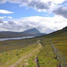
You can park your car about 1.5 km below the viewpoint at the bottom of the hill. The parking area offers restrooms, and the walk up is a beautiful coastal path with wide‑open views of the black‑sand shoreline. Parking Google Maps
A bumpy gravel road leads from the lower parking area up to the lighthouse, but it’s suitable only for 4WD vehicles. Everyone else can simply enjoy the scenic walk to the top.
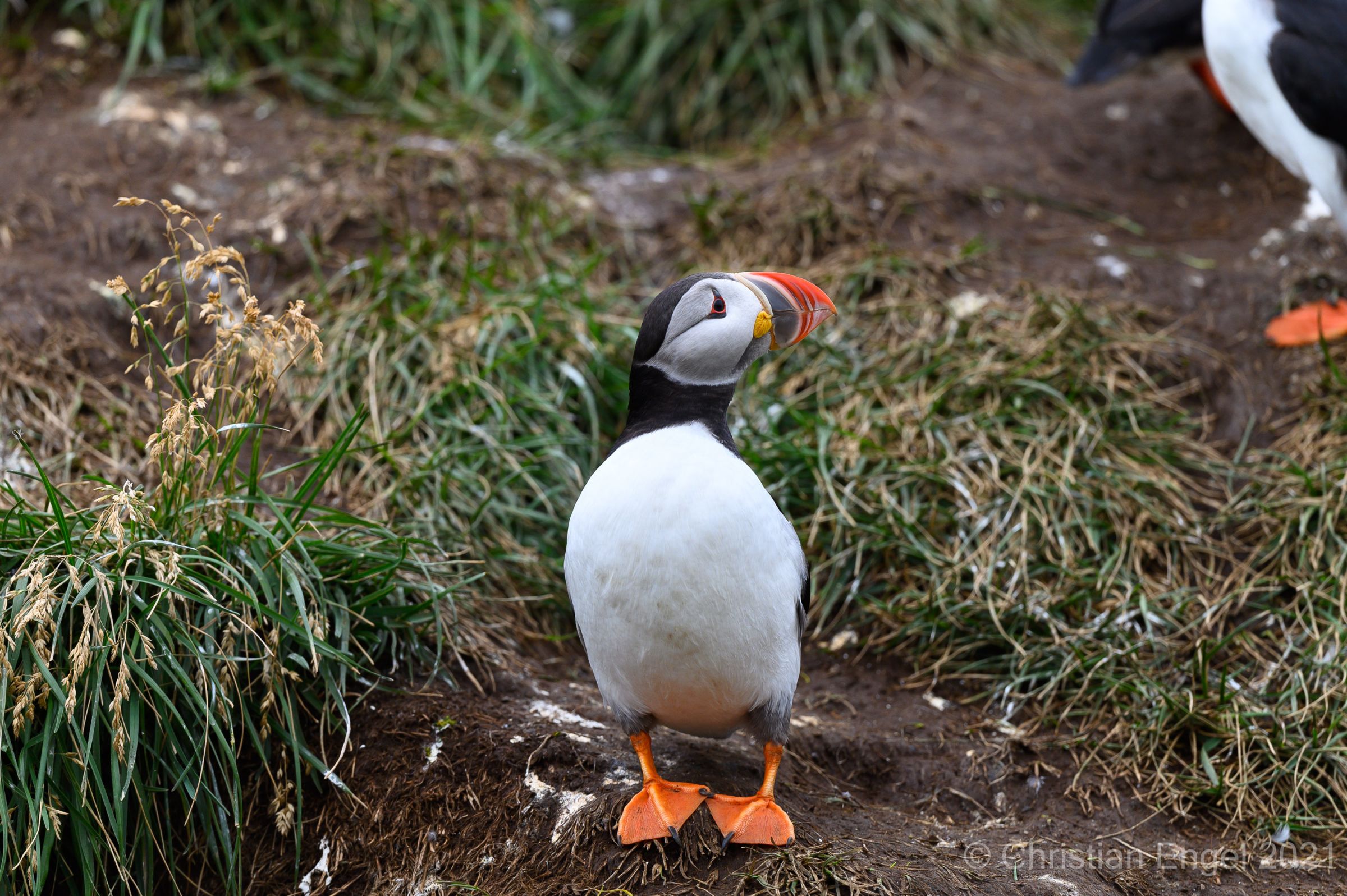
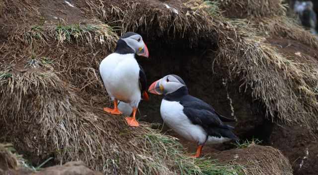
Can You See Puffins at Dyrhólaey?
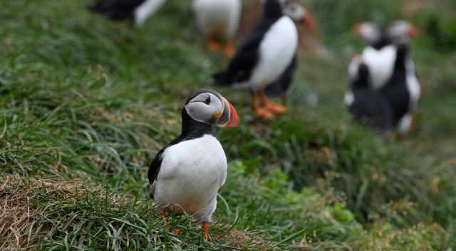
Yes — Dyrhólaey is one of the best puffin‑watching spots in Iceland. The birds arrive at the cliffs in April to start breeding and usually stay until the end of August, sometimes even into mid‑September. You’ll see the most puffins early in the morning or in the evening, when they rest on the cliffs close to the viewpoint. During the day, they’re mostly out at sea catching fish.
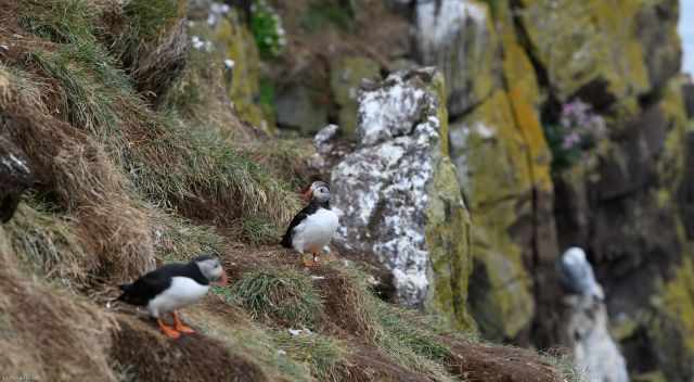
Puffins are a true sign of spring in Iceland. When they return from the ocean, locals know that summer is just around the corner. May and June are wonderful months to visit — plenty of puffins, fewer tourists, and long daylight hours. Some birds sit close to the viewpoint, while thousands more dot the cliffs in the distance.
Opening Hours Dyrhólaey
Dyrhólaey is open year‑round, but access may be restricted during the nesting season in May and June. Rangers occasionally close the upper area or limit access to protect puffins and Arctic terns. When open, you can visit at any time of day. Always follow the signs at the gate.
4 Top Tips for Visiting Dyrhólaey
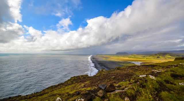
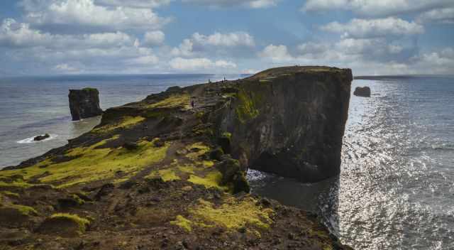
- Walk the coastal path — Take the scenic trail from the parking area up to the viewpoint. The 120‑meter‑high promontory offers breathtaking views of cliffs, black beaches and the Atlantic.
- Bring a softshell jacket — The wind at Dyrhólaey is strong and cold year‑round, even in summer.
- Pack a zoom lens or binoculars — Puffins often sit close to the viewpoint, but many more dot the cliffs in the distance.
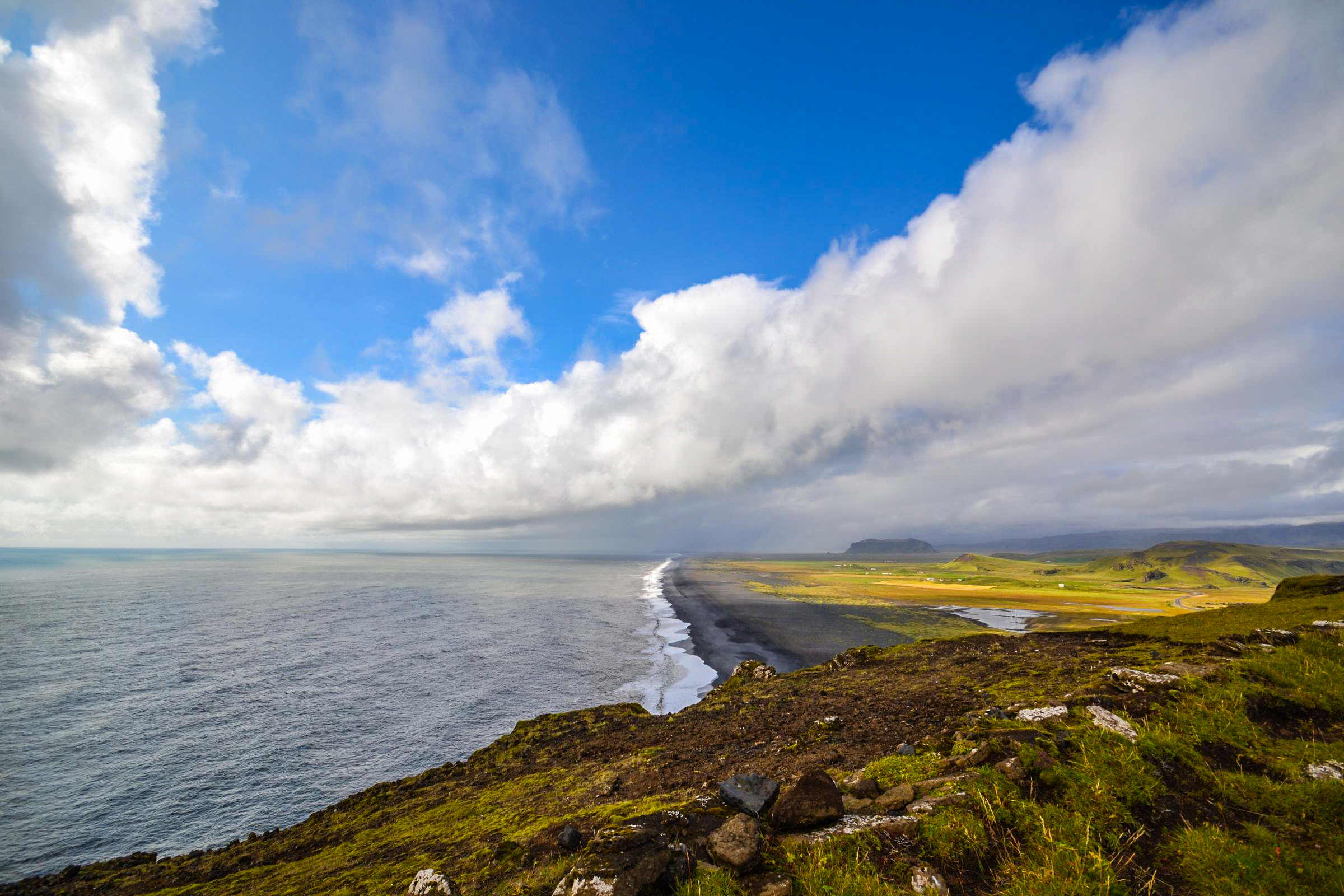
- Explore the black‑sand beaches — Don’t miss Dyrhólafjara and Reynisfjara with their basalt columns. With a bit of luck, you may even spot seals along the shoreline.
Plan Your Visit to Dyrhólaey
Dyrhólaey is a popular and often crowded spot, especially from 10 a.m. until early afternoon and again later in the day. For the best experience — and the best chance to see puffins — visit early in the morning or in the evening when the cliffs are quieter.
Plan to spend at least two hours here. That gives you enough time to walk up to the rock arch, enjoy the sweeping coastal views, and watch the puffins. If you also want to explore the nearby black‑sand beaches, you can easily spend half a day in the area.

Don’t let a rain shower ruin your visit. Weather changes quickly on Iceland’s South Coast — if it starts raining, simply wait it out. The showers often pass fast, and as a bonus, the crowds thin out.
Weather in the South of Iceland
The south coast of Iceland has a subpolar oceanic climate, with Vík being one of the “warmest” places in the country. From May to September, temperatures are the most pleasant, usually ranging between 7–13°C, and occasionally reaching 20°C on rare summer days.
The driest months are April to July. From August to January, rainfall increases significantly, often exceeding 200 mm per month. Winter temperatures from November to March hover between 1–4°C during the day, with freezing nights. Snow and ice on roads and walking paths are common.
Overall, May to July offer the best combination of mild temperatures and lower rainfall for exploring Iceland’s south coast. No matter the season, expect strong winds at Dyrhólaey — a windproof or softshell jacket is essential.
Where to Stay Near Dyrhólaey (Vík Area)
Accommodation near Dyrhólaey and in the Vík area is limited, so it’s best to book early to avoid long drives. Use the Booking.com link to explore nearby stays. I truly appreciate your support — booking through my website helps keep this travel resource free for everyone.
Nearby Tip: Seljalandsfoss & Skógafoss

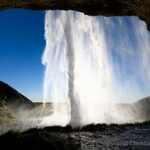
Coming from Reykjavík, you’ll pass two of Iceland’s most iconic waterfalls on the Ring Road: Seljalandsfoss and Skógafoss. Seljalandsfoss is especially unique because you can walk behind the waterfall and enjoy the view from inside the cave-like opening — a magical experience in any weather.
Both waterfalls are easy stops on the way to Dyrhólaey, and I’ve written detailed guide for them. They’re absolutely worth including in your South Coast itinerary.
Author’s Note
This is one of the few articles on my website not based on my own visit — yet. I learned a lot about Dyrhólaey from my friend Milan and my brother René, and I’ve done extensive research while planning my own trip to Iceland.
The beautiful Dyrhólaey photos in this guide were taken by Milan and René, and the puffin images are courtesy of my friend and photographer Chris, who recently explored Iceland. I’m grateful for their support in helping me create a detailed and reliable guide for you.
These are my recommended tours via GetYourGuide. Thx for booking via my website! With your support, I am able to provide all information first-hand. Tour prices are at no extra cost!
Best Months to Visit
Location and Tips

Dyrhólaey is an outstanding spot for puffins and the southernmost point on the mainland of Iceland.