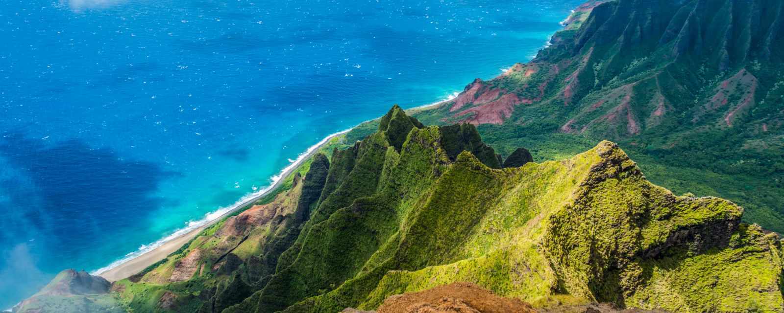
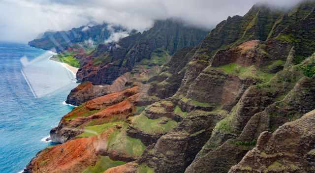
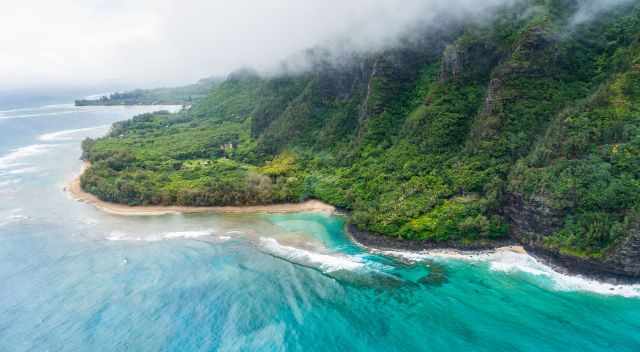
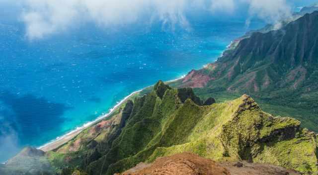
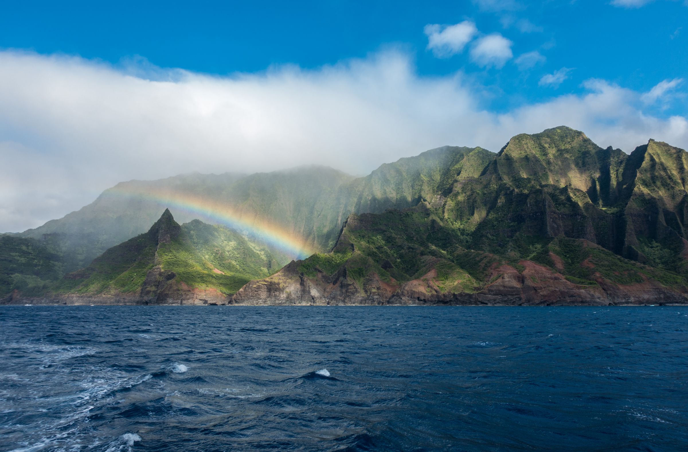
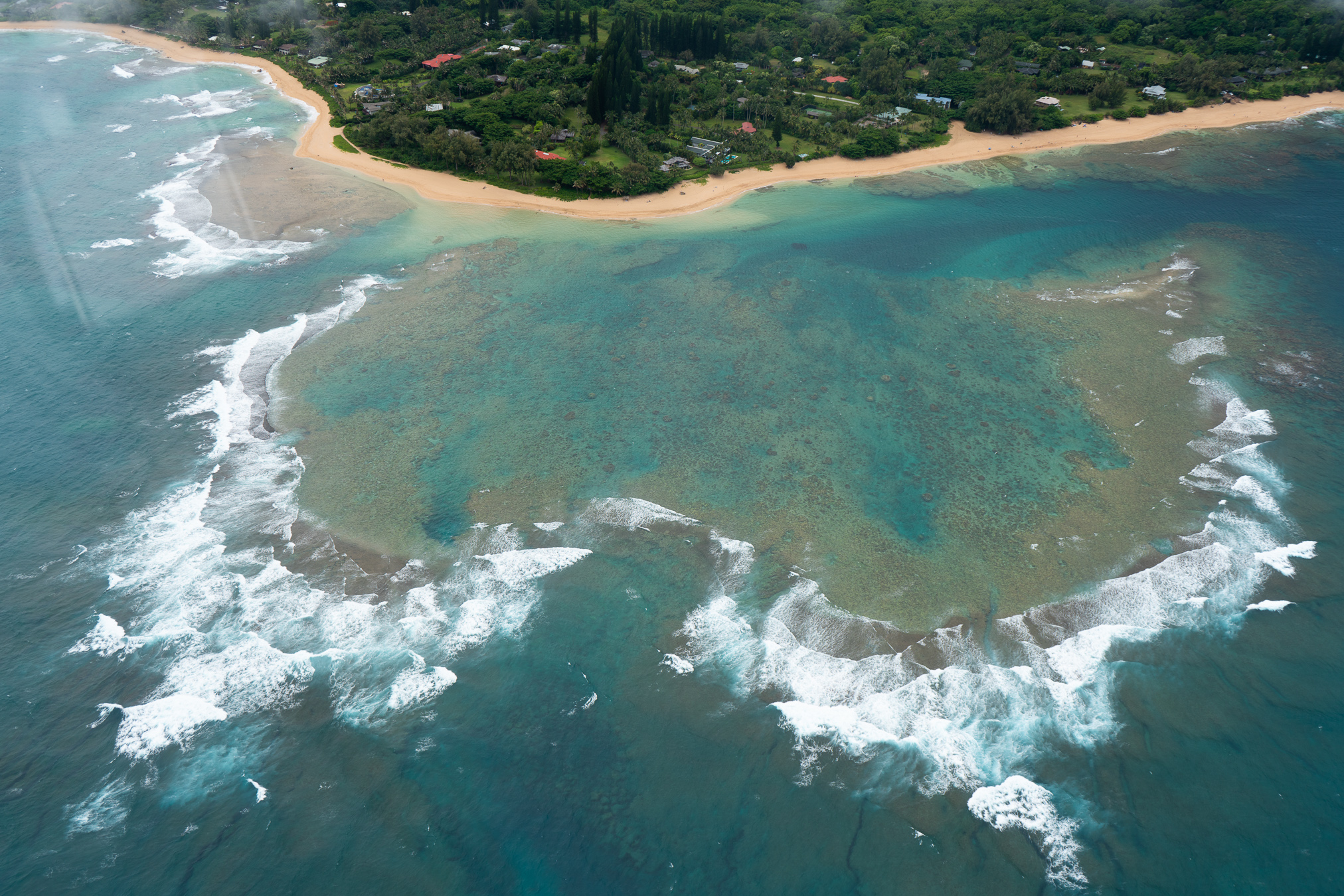
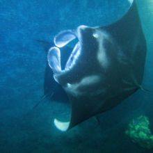
Kauai called the Garden Isle; mother nature at its best full of vibrant colours. Kauai is famous for the breathtaking Kalalau Trail, the Napali Coast, and more fascinating hikes.
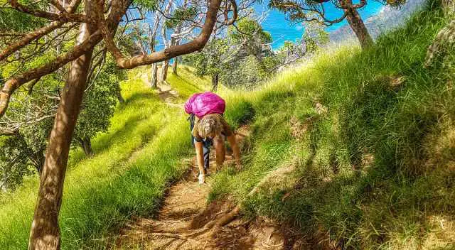
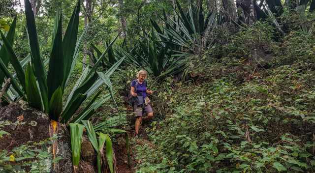
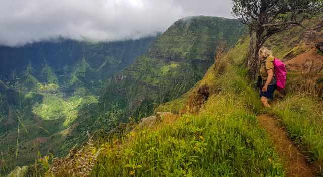
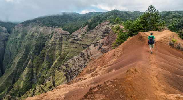
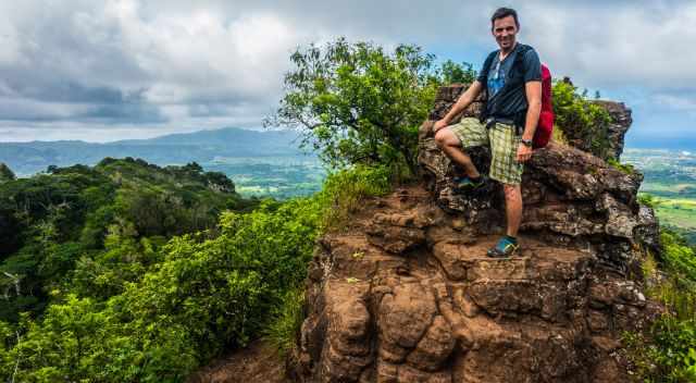
Hiking on Kauai is a new experience - That's me on the Kalepa Ridge Trail.
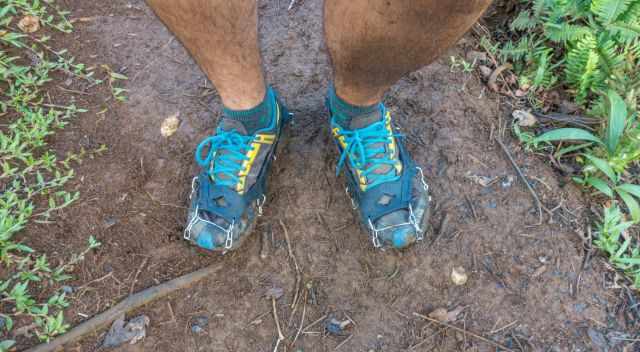
The island of Kauai is one of the wettest places on earth, the reason for the stunning lush vegetation. The best time for hiking on Kauai, especially the Kalalau trail is the drier season, between May and October; showers frequently occur throughout the year. It is very slippery and muddy on many trails and narrow footpaths. Our best solution was a pair of mini-crampons to stay safe on the tracks. To make it more convenient for you, check out my Table of Contents for all hikes below.
There is always a place where it is sunny and where it rains. I just want to give you an idea of the tropical climate in Kauai. Regarding the temperatures, Kauai is an excellent destination throughout the year. Kauai is wetter than the other Hawaiian Islands, therefore, called "The Garden Island". It frequently rains on Kauai throughout the year. But the amount of rain also depends on the location on Kauai.
Dry Season
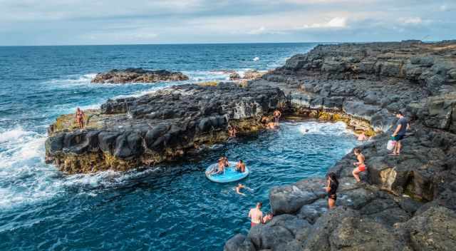
Next to Queens Bath
The drier season starts in April and lasts until mid-October. Also, in the drier season, showers occur, but the south and the east, like Lihue, are much drier. It is often sunny or partly clouded with pleasant temperatures ranging from 80-89°F/26-29°C in Lihue and in the night in the high 60s°F/above 20°C. In comparison, in higher elevations like Kokee temps range from mid to high 60s°F/17-20°C and nights are cold in the 50s°F/around 10°C.
The so-called rainy season starts in November and lasts until March. The north and west coast gets twice the amount of rain as the south and east. Most showers are short, often at night, and the sun returns quickly. The wettest place on Kauai is Mount Kawaikini and Mount Waialeale, the highest points, inactive shield volcanos in Kauai's centre. During the rainy season, the weather is less predictable. Infrequent thunderstorms can cause flash floods. Temperatures are in the mid to high 70s°F/23-25°C at the coast and in the Kokee State Park in the mid 60s°F/ below 20°C. Night temperatures range from 15-17°C at sea level and around 50°F/10°C in Kokee at higher elevations.
Crowds
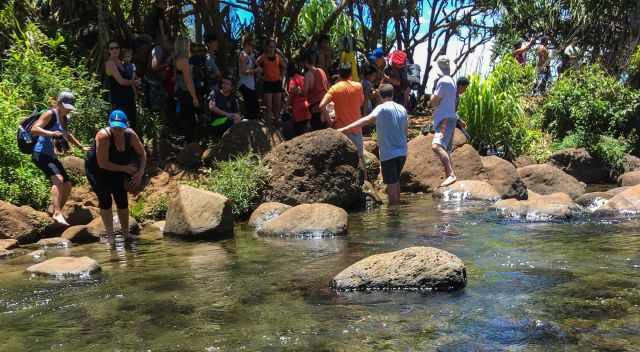
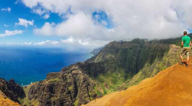
The crowded Kalalau Trail at Hanakoa Stream before the permit system
With far more than one million visitors annually, Kauai is usually busy. Shoulder season with fewer crowds in spring from mid-April to mid-June except for Memorial Day and week in May and fall in September after Labour Day to October. Crowded during summer, Christmas, New Year's Eve, and Independence Day when the sky is the limit for hotel rates.
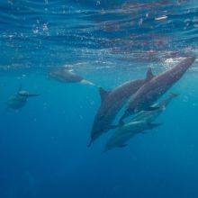
Most of Kauai can only be seen on foot, by boat cruise or by air, the reason you have to hike to get a glimpse of the Napali coast and this stunning island. Kauai has eight beautiful State Parks waiting for you to be explored.
These are my recommended tours via GetYourGuide with 24 hours advance cancellation policy. Thx for booking via my website! With your support, I am able to provide all information first-hand. Tour prices are at no extra cost!
Kauai is the fourth biggest and oldest island of the volcanic Hawaiian archipelago. This raw beauty is a hotspot for Hollywood film producers like the Waimea Canyon in Jurrasic Park. Kauai is truly magical, one of the most beautiful islands on our planet.
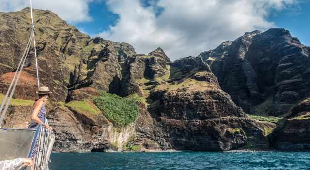
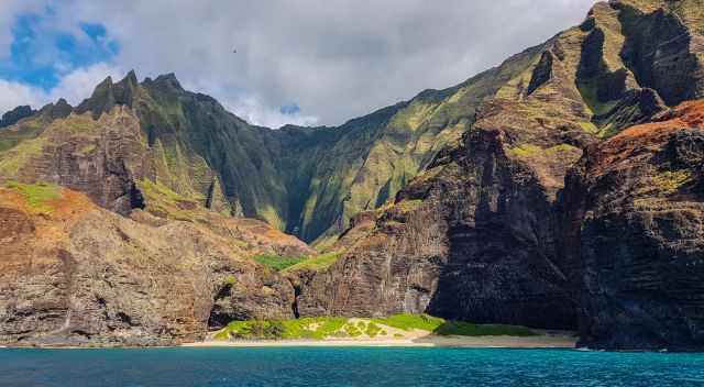
Boat Cruise along the Napali Coast to the famous Kalalau Beach
How Many Days Needed for Kauai?
The more, the better, at least an entire week. If you are into hiking, Kauai will not disappoint. But there is so much more, from beautiful beaches to excellent snorkel spots and outstanding tours to get a glimpse of the beauty of Kauai and, of course, the food quality.
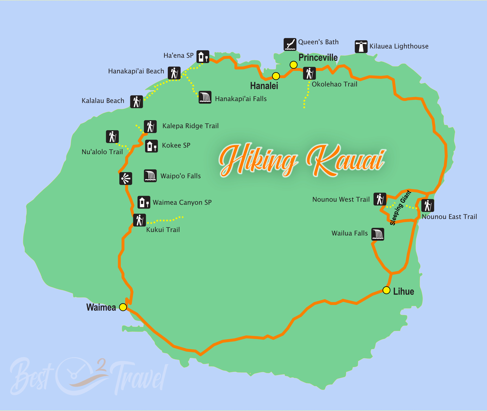
Read my detailed Kauai Hiking Guide, including trails off the beaten path, for an exceptional vacation on one of the most beautiful islands on earth. I added a Table of Content so you can jump to your whished hiking track.
7 Outstanding Hikes on Kauai
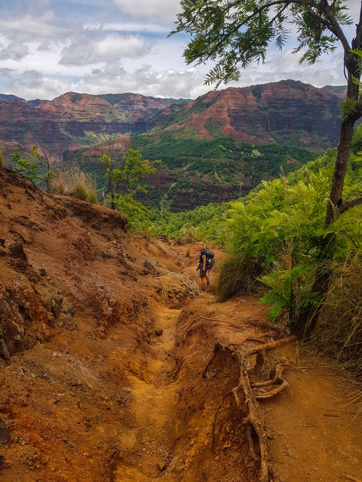
Me almost at the bottom of the Waimea Canyon on the Kukui Trail
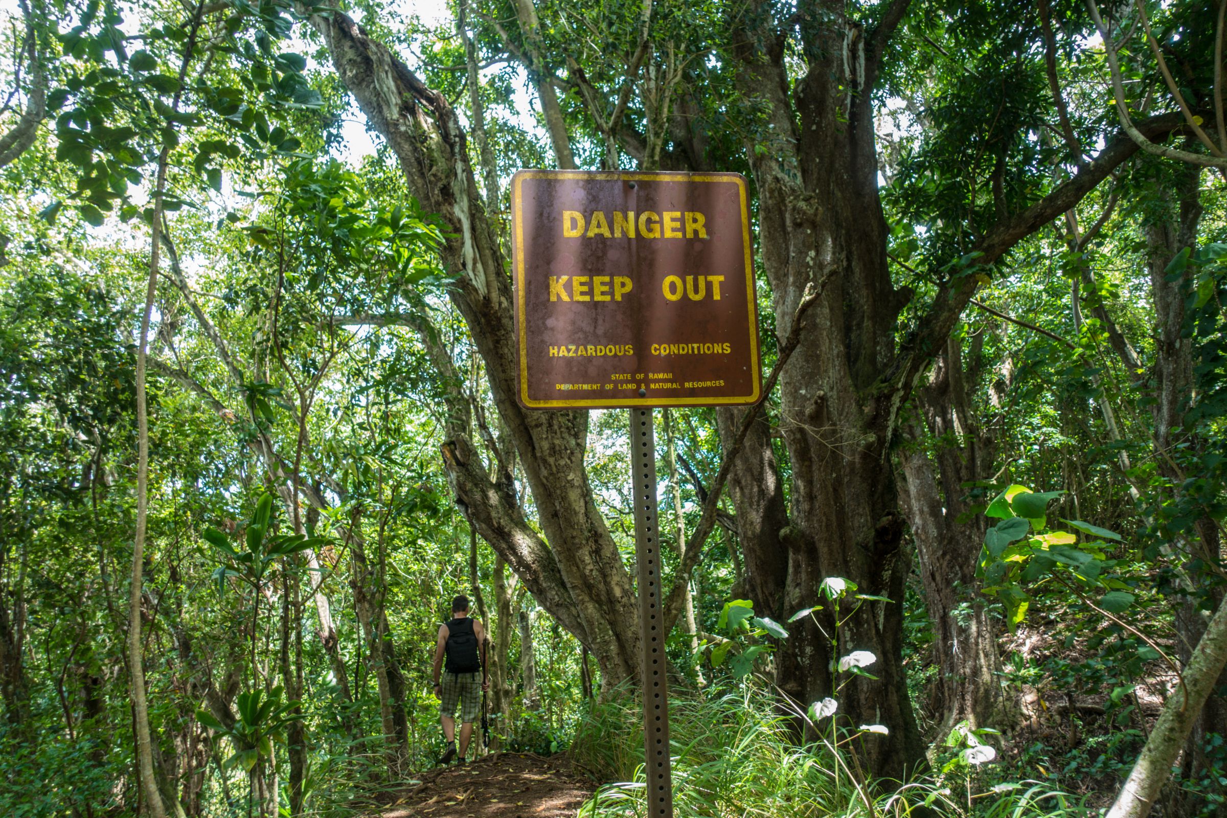
If hiking on the Hawaiian Islands, extreme caution is essential for some of the hikes. The paths are often muddy and slippery; the reason I recommend hiking poles and crampons. What is new in 2022? Most parks require an entrance fee plus an additional parking fee for non-residents. This affects Haena State Park, Waimea Canyon, and Kokee State Park, which means some of the mentioned hikes.
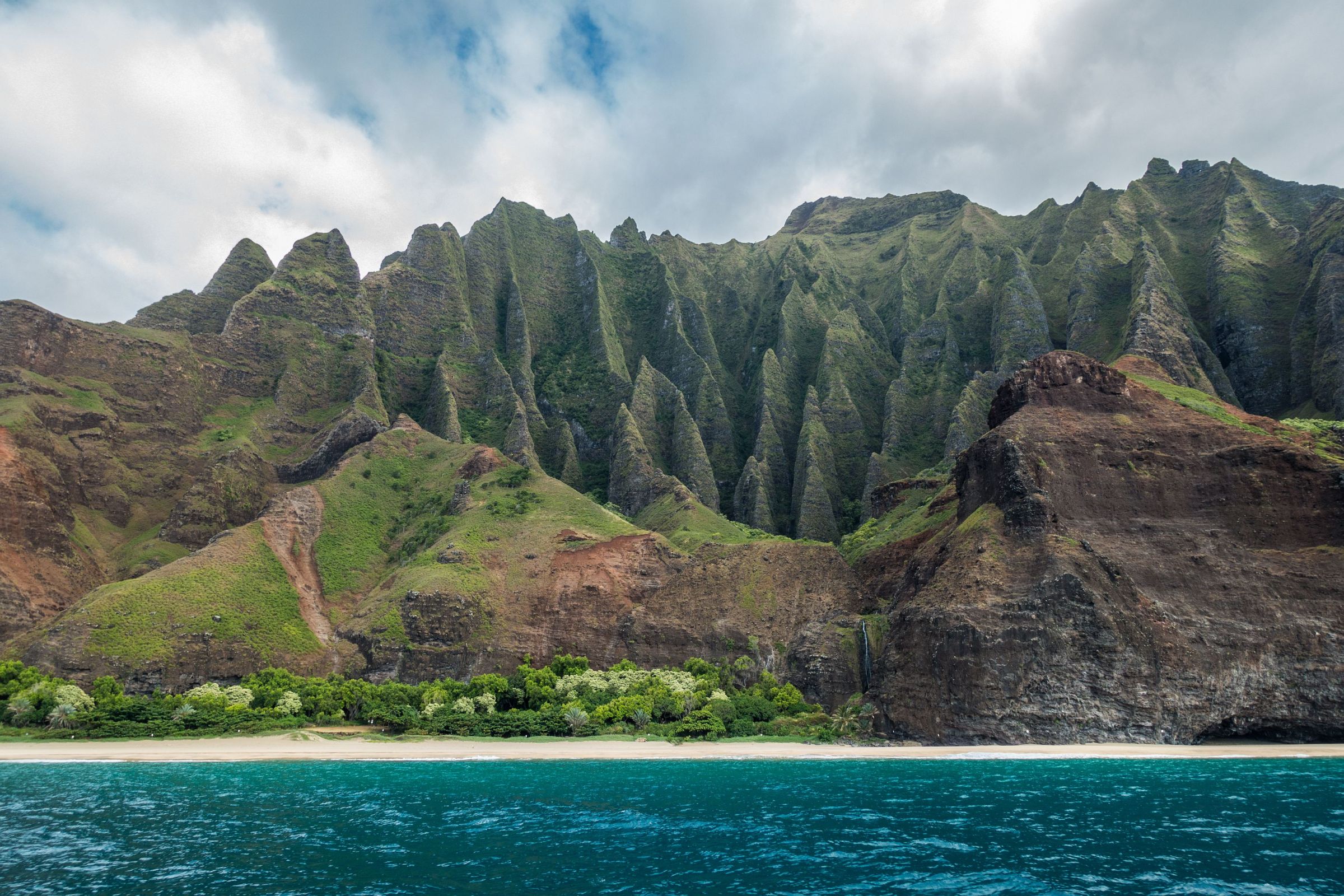
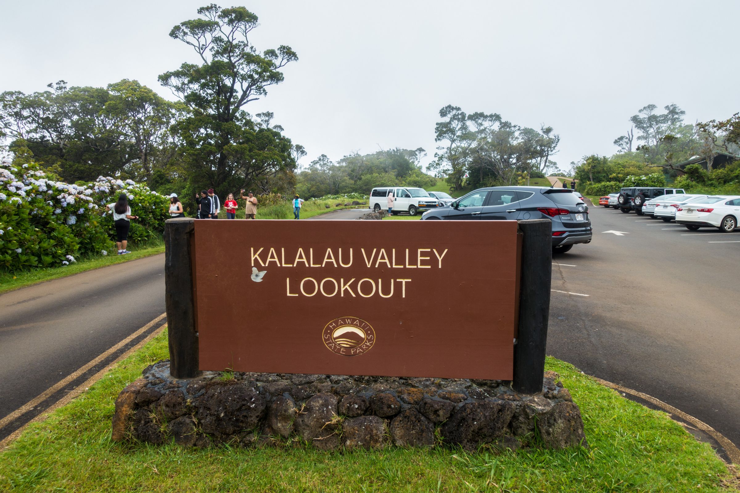
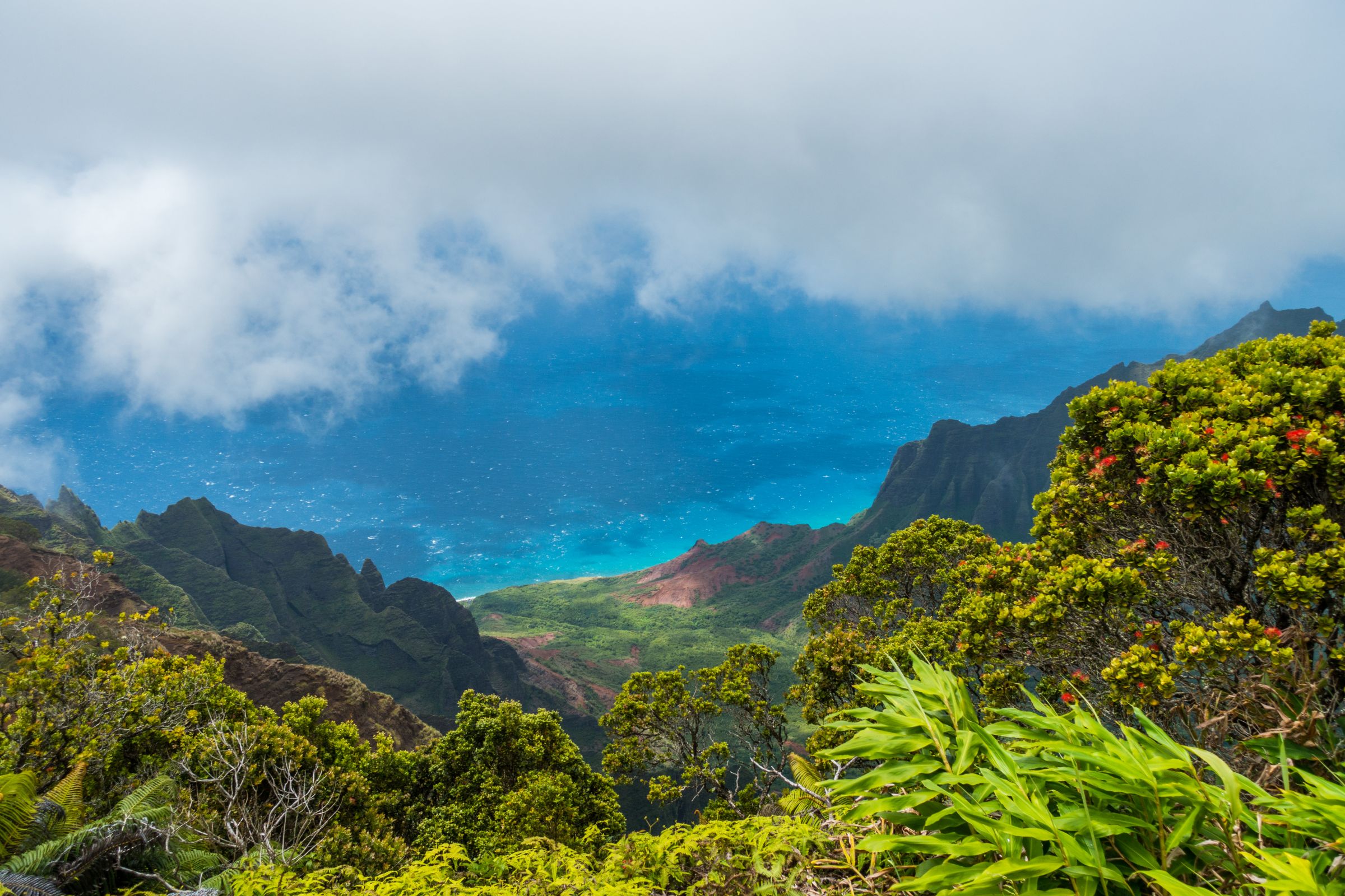
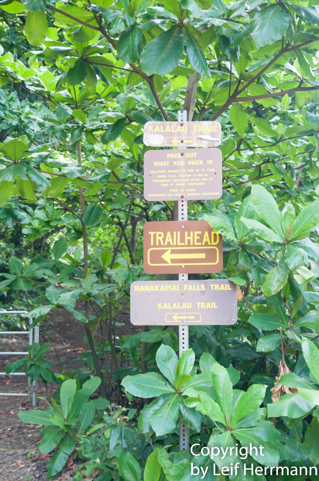
Kalalau Trail
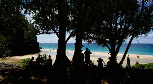
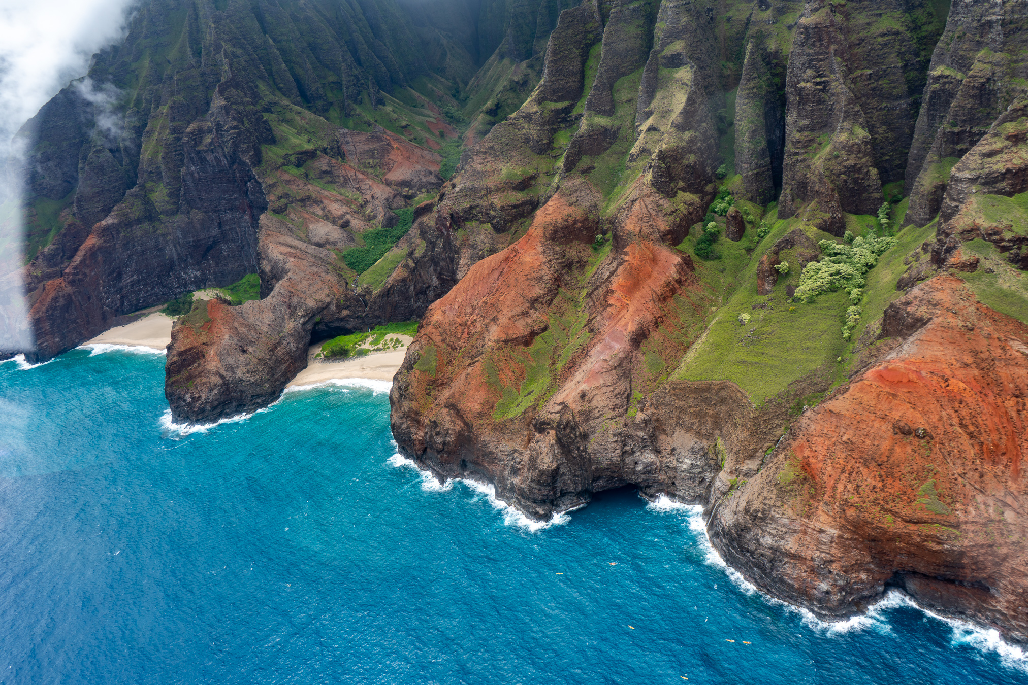
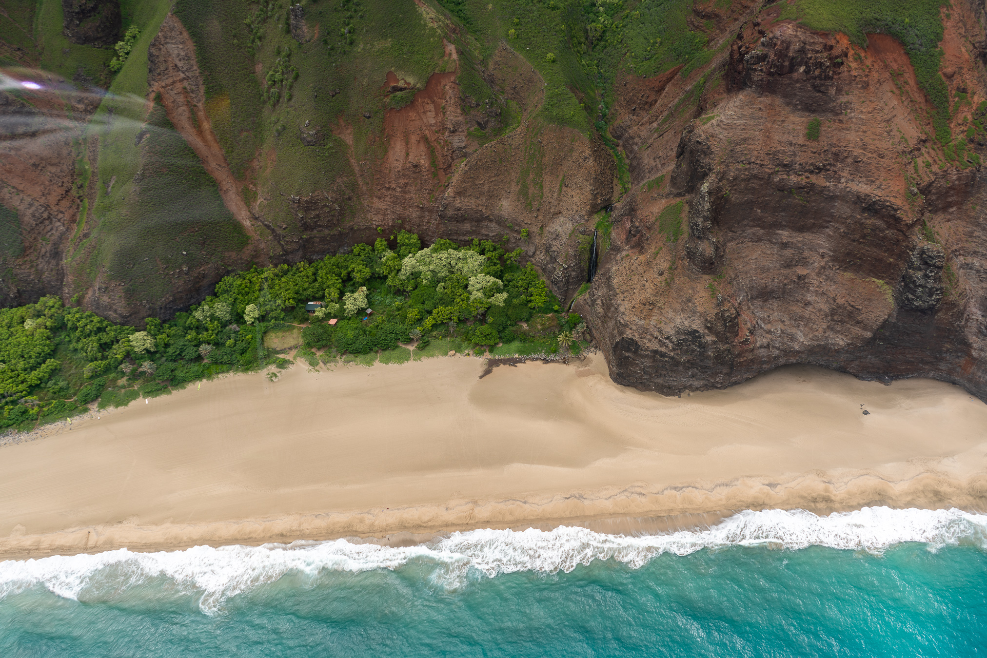
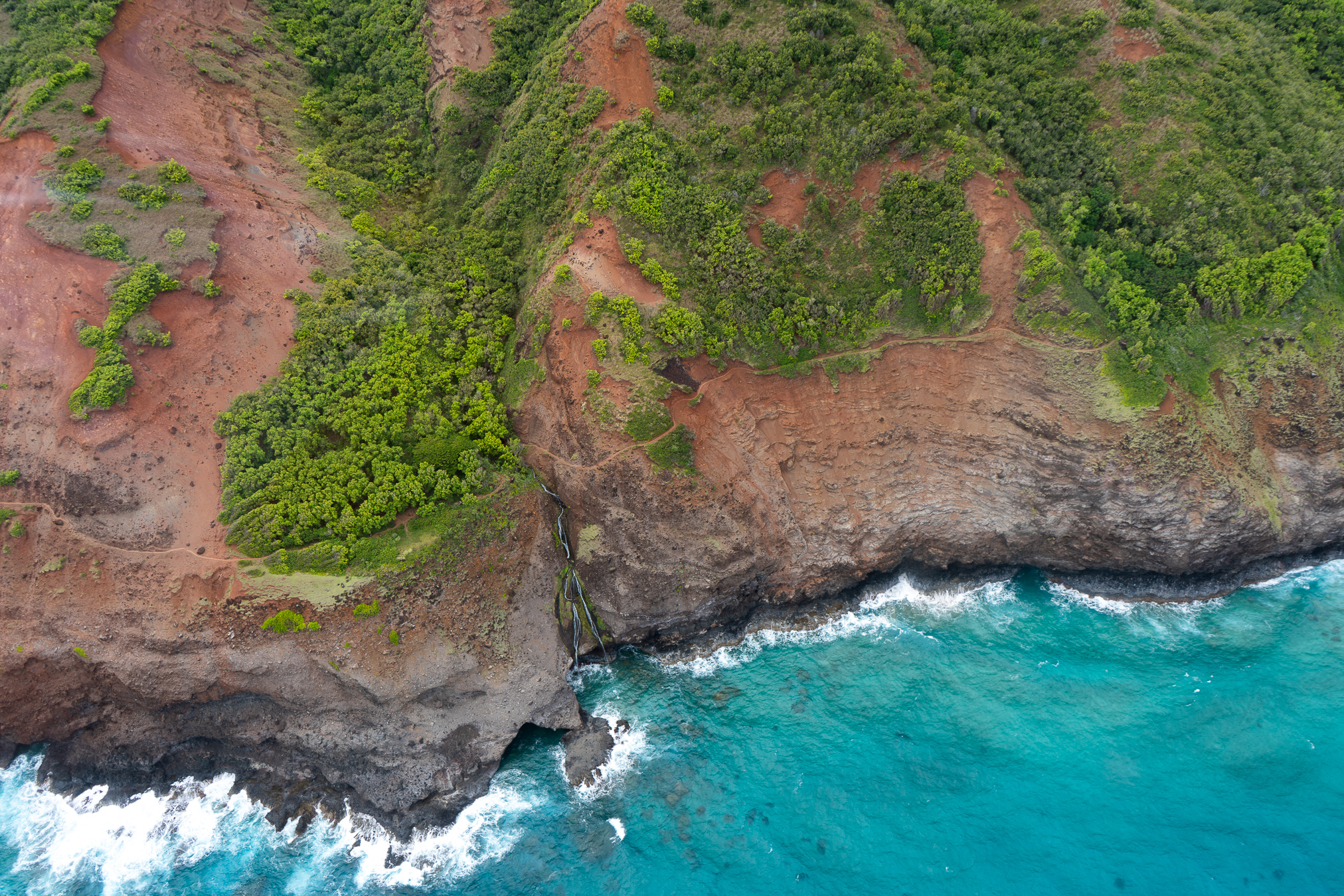
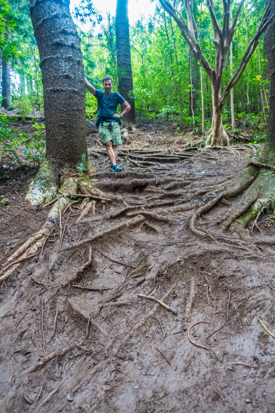
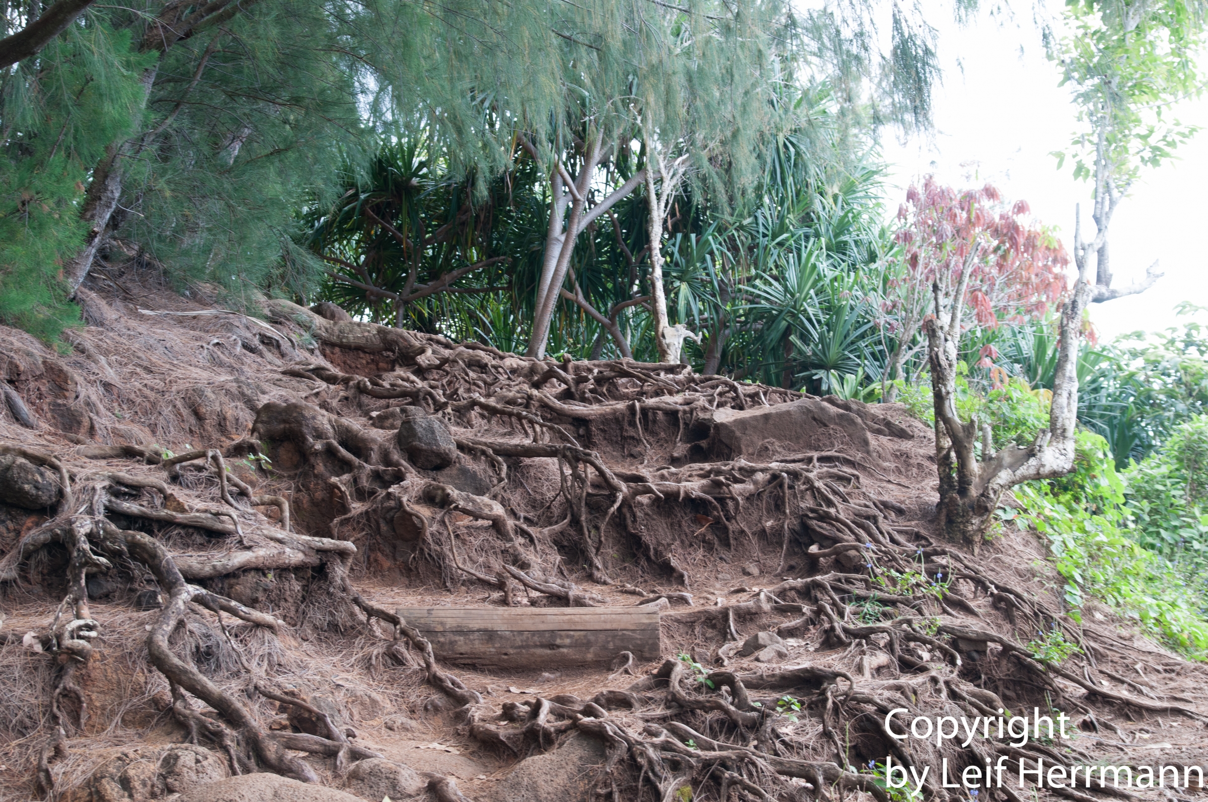
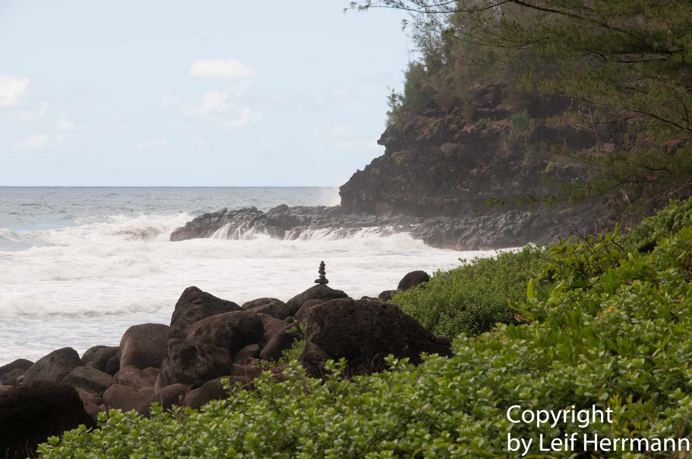
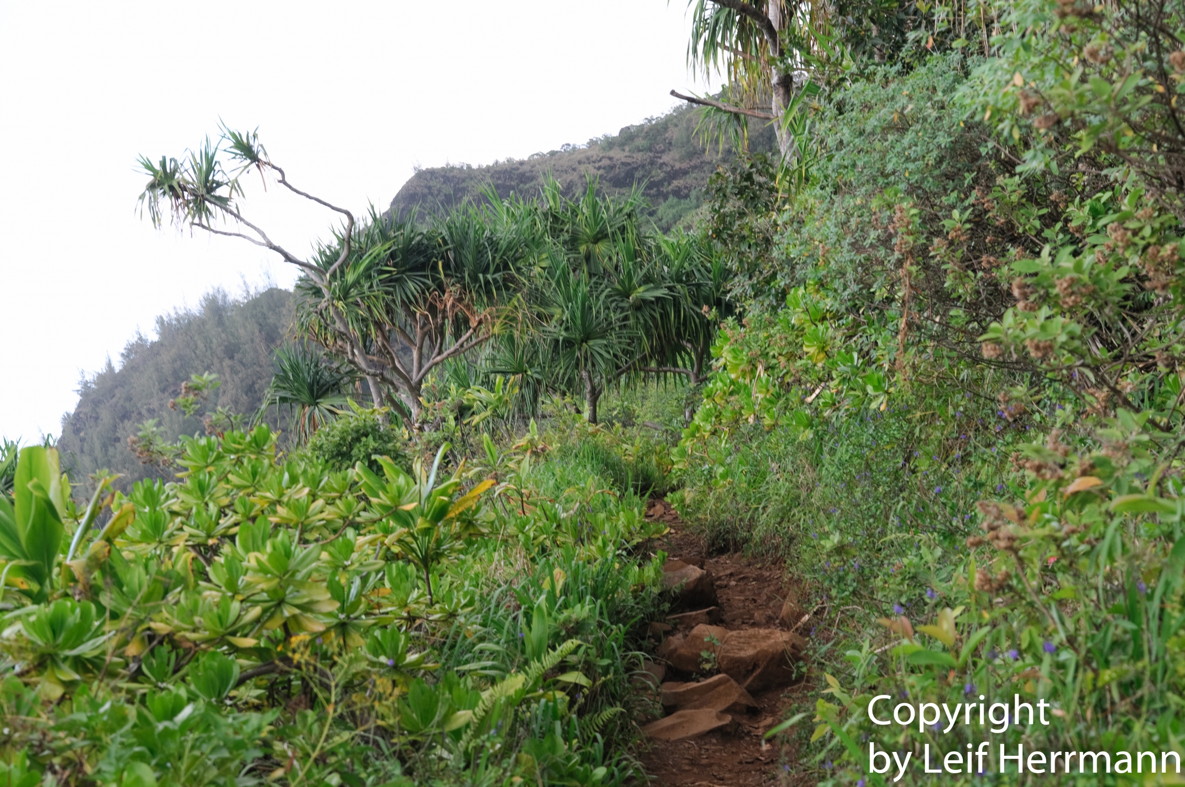
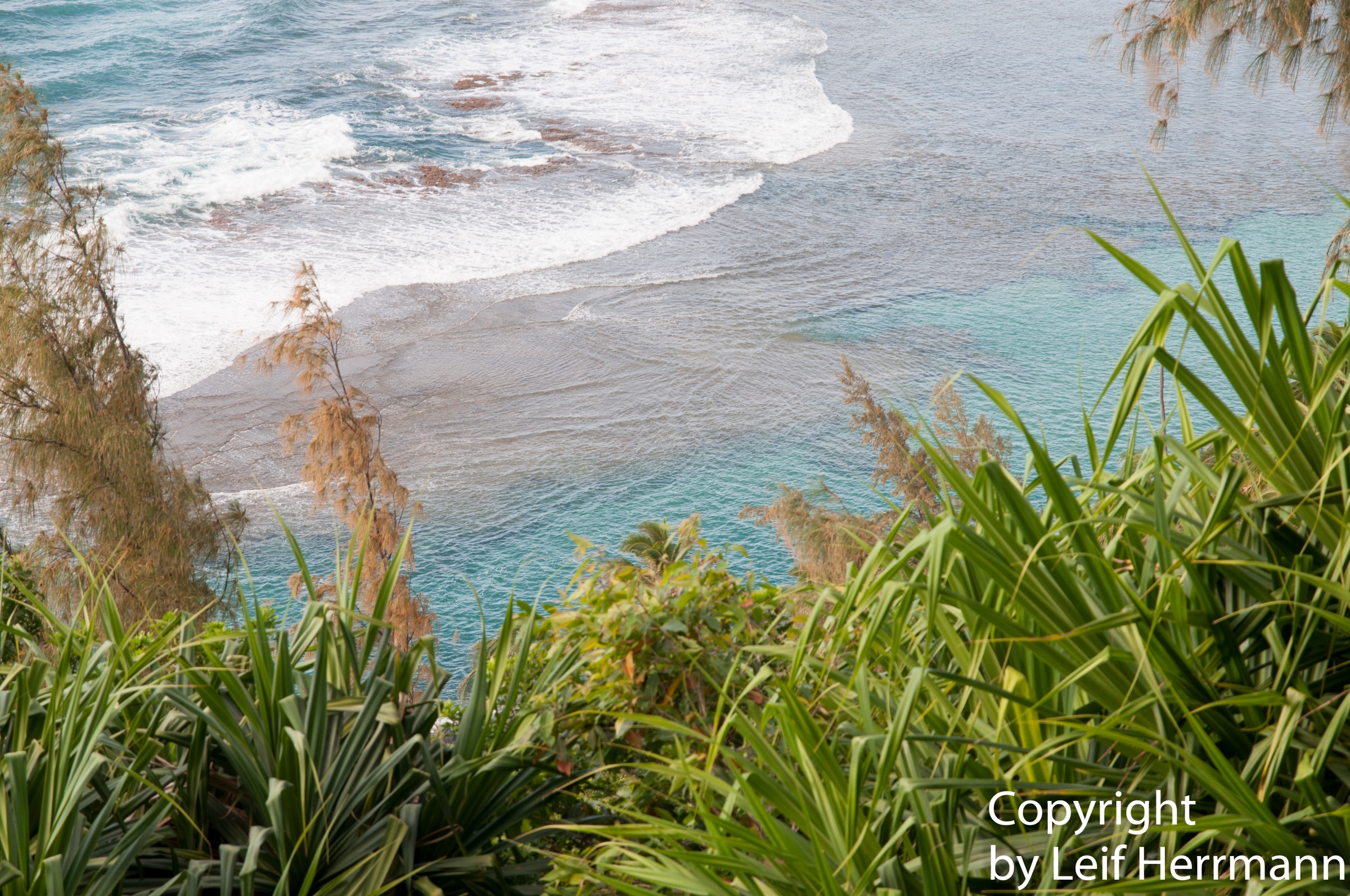
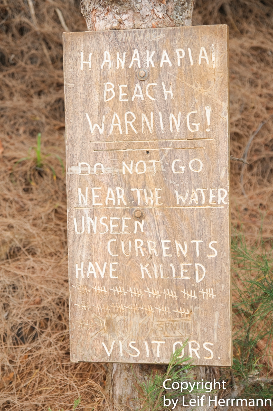
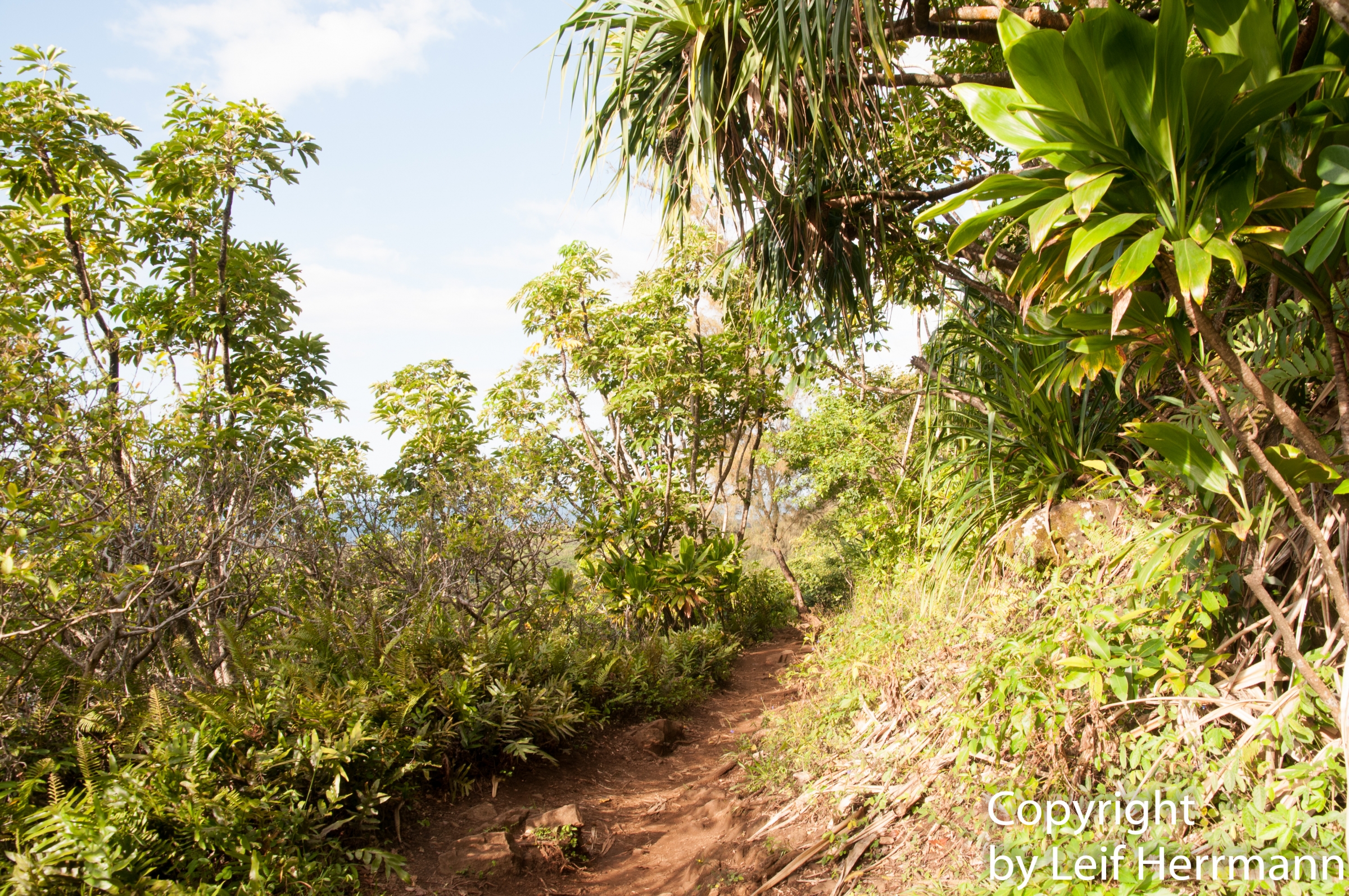
The crowded beach before the permit system. **This hiking trail in the north of Kauai is called to be the most beautiful trail in Hawaii. The trail is 15 km long and takes at least 6 hours in one direction, leading along the stunning Napali Coast. It is a tough trail to watch for roots, and sometimes the narrow path is washed out. During rain or storm, or if the level is too high, don’t cross the streams, especially not the Hanakoa Stream at the six-mile mark. Torrential and dangerous flash floods can occur. Always observe the sky for dark clouds. Rain may occur in Waimea Canyon. Several hikers got flushed away while they tried to ford the stream in 2018. After Hanakāpīʻai Beach, it is almost impossible to hike this trail in very wet conditions. It is very slippery and muddy on the narrow footpath. The only option is a pair of mini-crampons see above. Napali Coast and Kalalau Beach To walk the entire track, you need to stay overnight at the campground at Kalalau Beach. An alternative walk is until Hanakāpīʻai Beach and then along the stream to the Hanakāpīʻai Falls. This track is shorter, just 11 km, lasts about 6 hours, and you already get a glimpse of one of the most breathtaking landscapes.
Permit and Parking ReservationA flight to the Napali Coast and Kalalau is an unforgettable experience - Tour GYG **A Park Entry Reservation or Day-Use Parking Reservation for Hāʻena State Park is mandatory and can be purchased 14 days in advance to hike to Hanakāpīʻai Beach and Falls. A permit is required for camping and hiking. Limited parking of 100 spaces is only divided into three slots. Due to the popularity and accidents during poor weather, new regulations were enforced. The first part of the trail until the Hanakāpīʻai Beach is not any longer accessible without a reservation. It'll be less busy in the future. Reservations and permits for Kalalau are limited, and it is necessary to book almost one year in advance for the peak season. The fee is 20 $ p.p. per day plus the reservation fee.
Hiking without a permit can cause big trouble with a show-up at court! Overnight parking at Ha'ena State Park is finally allowed again but also here, a reservation is necessary. You can purchase the reservation up to 30 days in advance. A shuttle bus reservation is needed for the Kalalau Trail as well. However, we had already applied twice, and when we arrived, the Kalalau Trail was closed due to flooding. There is no guarantee, and safety is always first! The area has still not fully recovered yet from the massive flooding in 2018. Link for Haena State Park plus parking reservation
Permits for the Kalalau trail are more likely to get for the winter season. Hiking this trail in the wetter is always a risk. Be prepared for the elements; always check the weather forecast before! Safety first! Our permit got cancelled twice, and we were seeking alternatives - Nualolo Trail offers stunning viewsKalau was closed for 14 months due to immense flooding in mid-April 2018, when we had a permit for June. The highway and bridges to the Haena State Park also got flooded and destroyed. The Haena State Park and Kalalau trail got reopened in mid-June 2019.
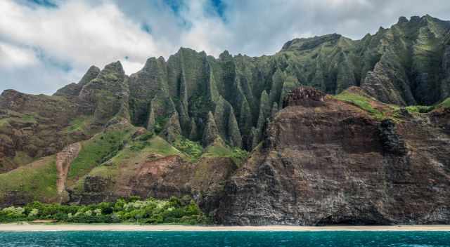
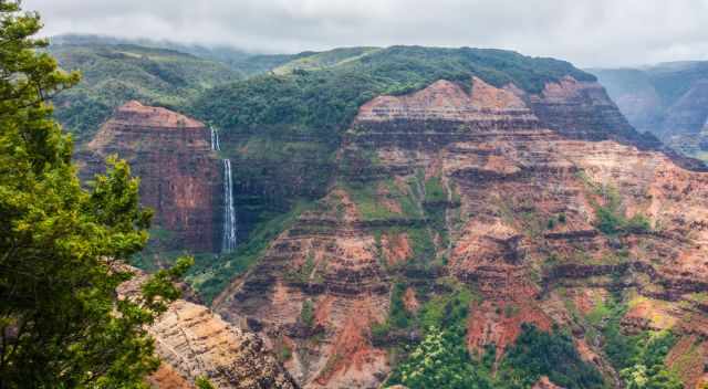
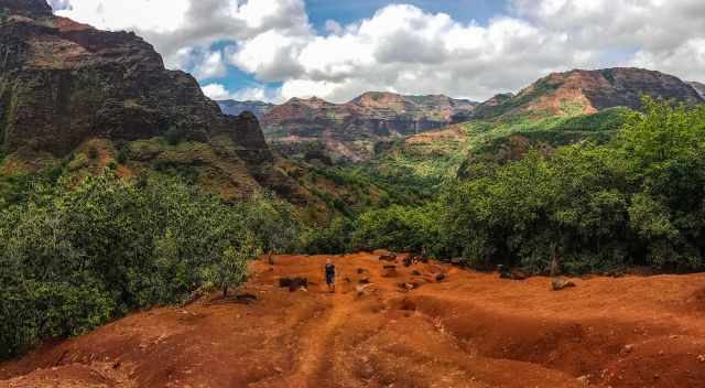
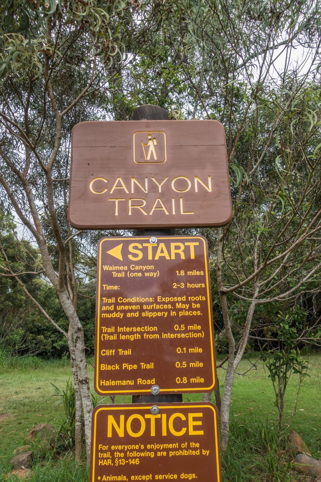
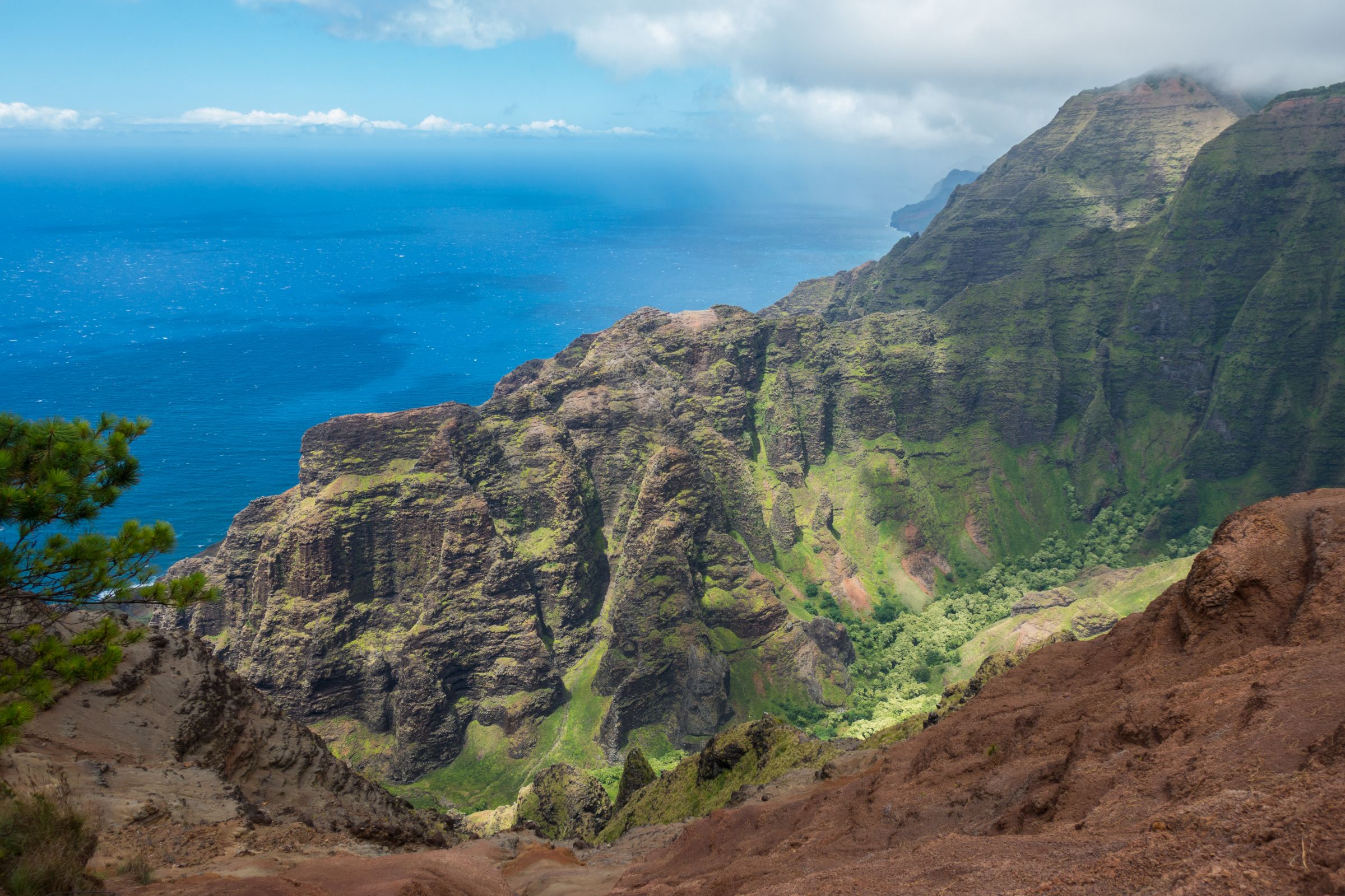
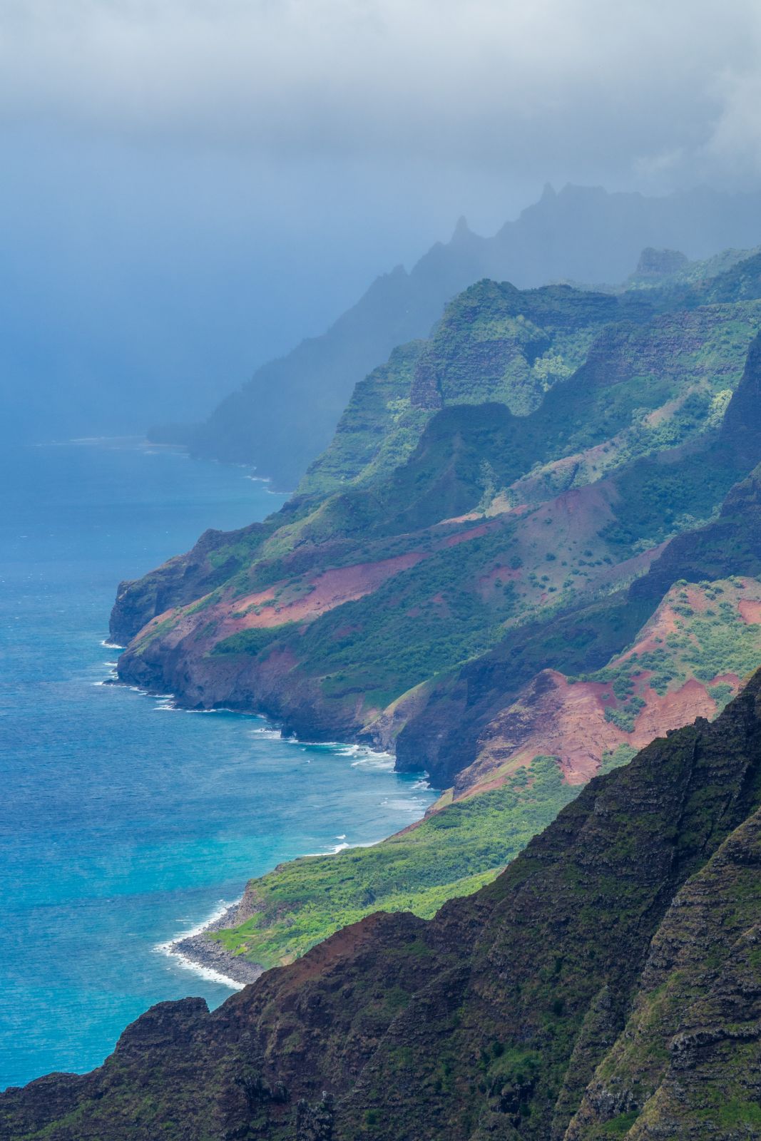
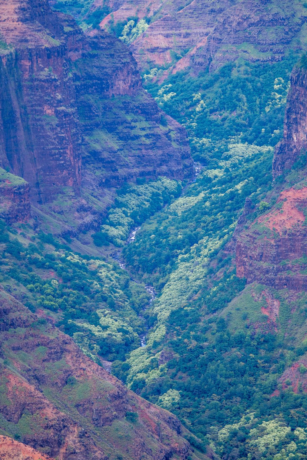
Do you look for alternatives to explore the Napali Coast? Check out my other hiking recommendations. Waimea Canyon; is often called the Grand Canyon of Hawaii. The Canyon is more than 14 miles long, one mile wide, and 3600 feet deep. Free admission. Waimea Canyon and Waterfall, famous from Jurassic ParkThe Waimea Canyon Drive leads along the Canyon with hikes into the Canyon on the right. Trails on the left side go to the dramatic Na Pali Coast, offering some of the most spectacular views. The drive ends at Kokee State Park, excellent for hiking and camping.
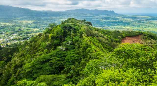
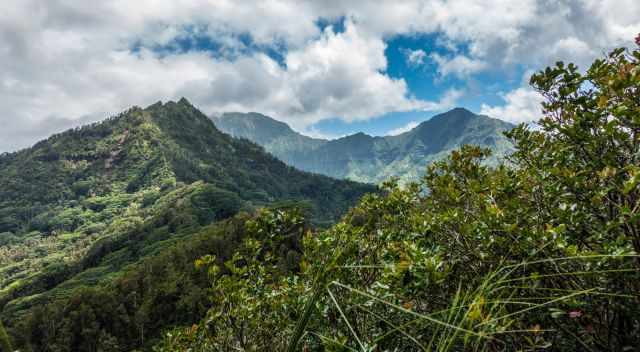
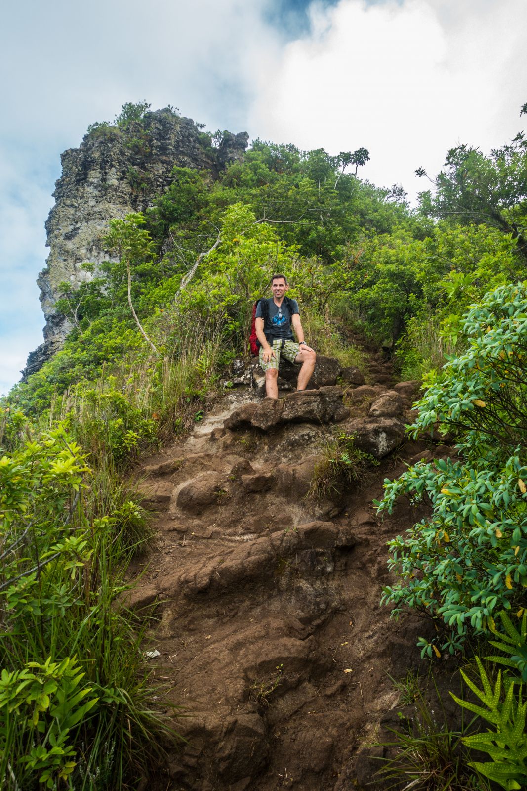
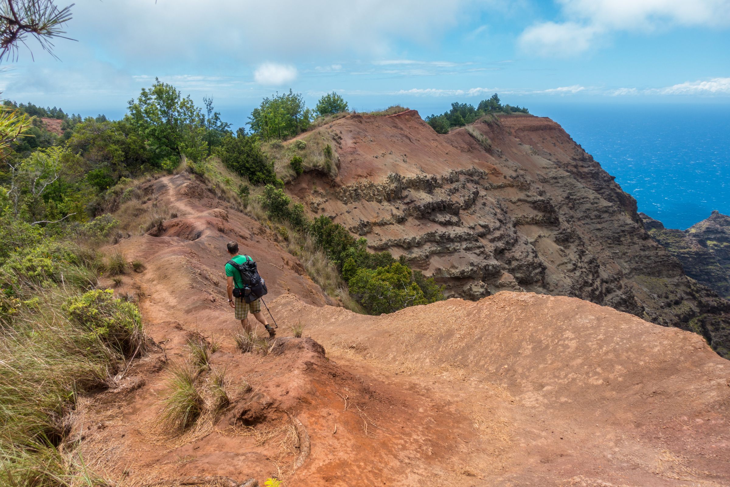
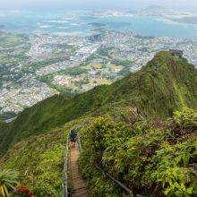
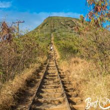
Kalepa Ridge Trail
View of Kalalau Beach from the Kalepa Ridge Trail2 miles/3.5 km - A Must-Do
Officially this track is closed. If you wish to get these unique views, good prep is essential. I don't encourage you to hike the Kalepa Ridge Trail. I am not responsible for any injury, death, or consequences of any actions taken based on the information provided here. This is just my experience! Updated February 20, 2022.
We hiked the short but very steep trail for one of the most stunning views ever. The track is not well maintained, muddy, slippery, and poorly signed. Both of us used one hiking pole, and with the other hand, we grabbed roots and trees. It is one of the Hawaiian Islands' most spectacular and difficult hikes. Although a short hike, it is also tricky and not easily done. The views are breathtaking throughout the whole hike. It is an exposed trail - safety first! If you have any fear of heights, don't go! If it had been rainy before, the trail would have been even more dangerous and slippery. The first spectacular view after the strenuous decentBring at least hiking poles, better crampons, and a bottle of water. It is a short but strenuous climb, always down and up on the way back. The trailhead is not marked. This amazing hike starts at the Kalalau Lookout in the Koke'e State Park close to Waimea Canyon. The lookout is fenced. Trailhead Entrance to Kalepa Ridge TrailGo to the left through a gate and just follow the shoeprints. The outlook at the edge was second to none and one of my personal highlights in Hawaii. Hiking duration of 2 hours. If you plan to do this hike, it is at your own risk. Proper hiking boots and hiking pools are essential for this steep and difficult track. Trailhead Google Maps location
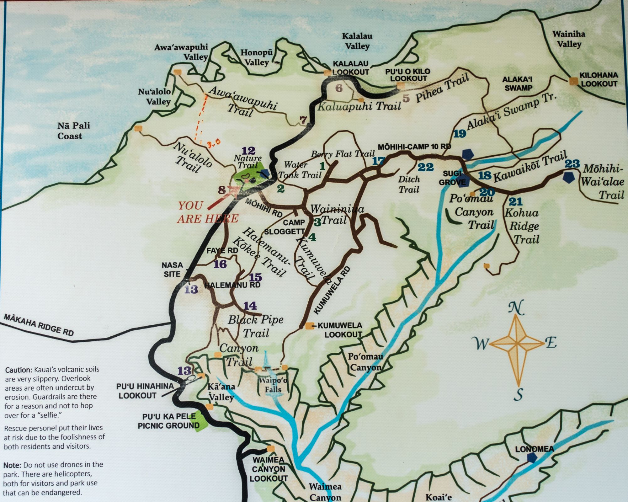
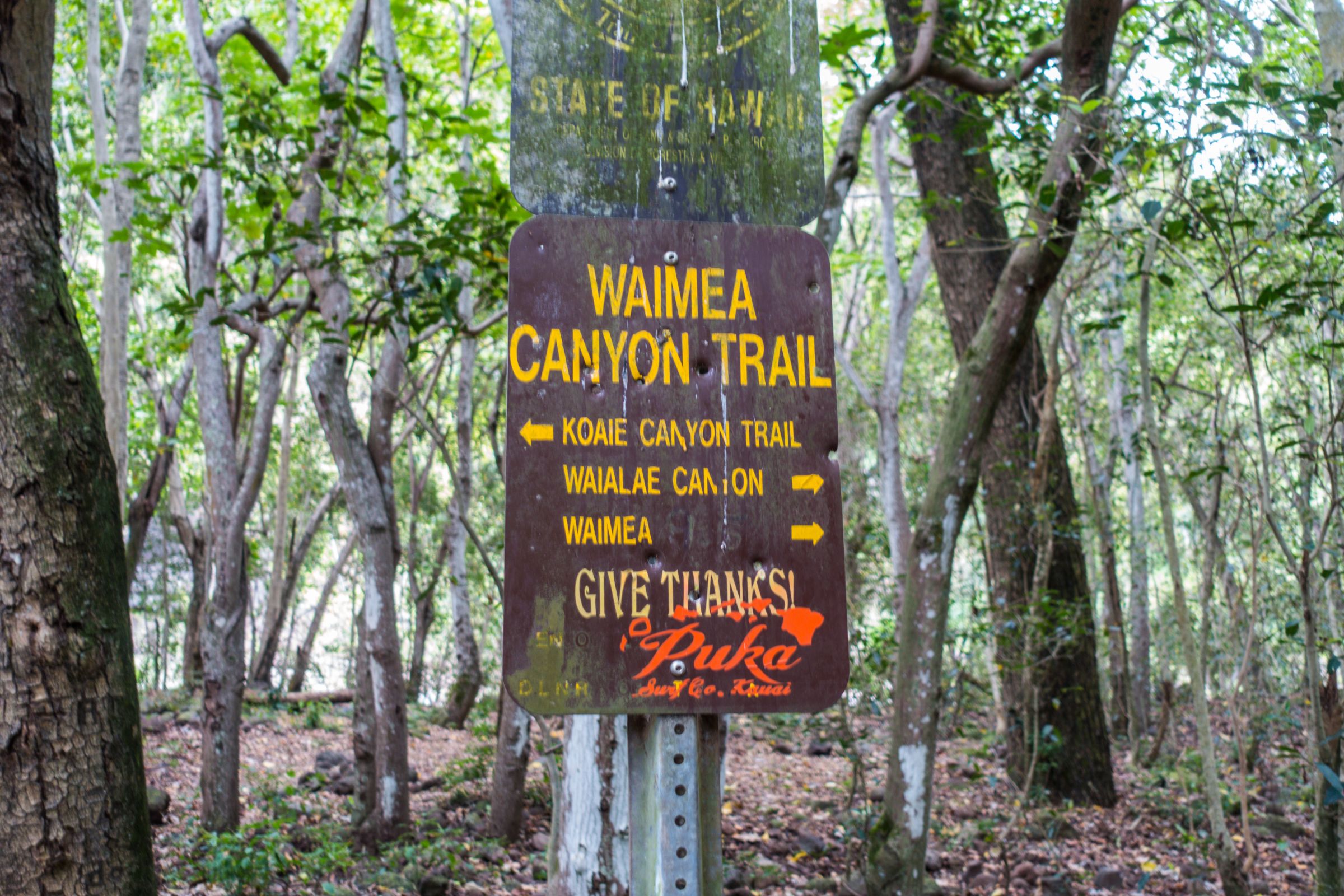
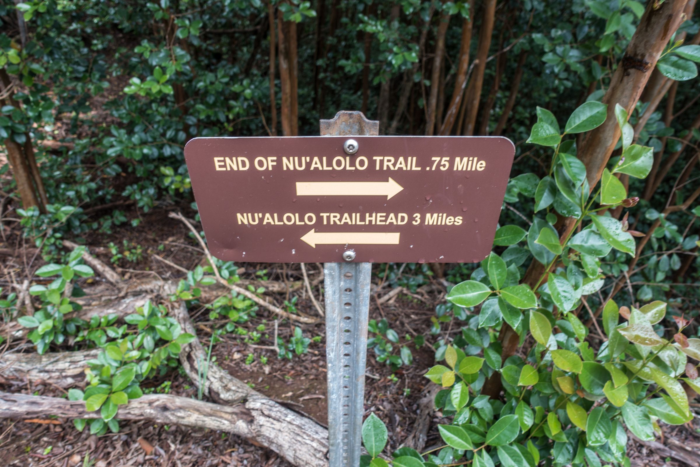
Nu’alolo Trail
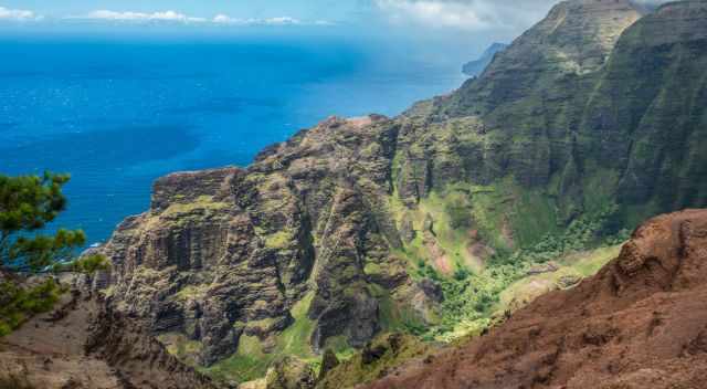
View from Nualolo to the amazing Napali Coast7.5 miles/12km - A Must-Do
The trailhead is located next to Kokee Lodge. This trail is easier to hike, leading through the forest. After almost 2 hours, we reached the viewpoint of the coastline. We enjoyed our picnic and the breathtaking scenery for more than an hour with the constant change due to clouds and sunshine. From time-to-time helicopters pass by, bringing passengers close to the sea cliffs. I assume the view from the helicopter was spectacular, but we felt sorry for the people who just saw all of it in a rush.
This trail is another hiking jewel on Kauai and can be combined with the Awa'awapuhi Trail. The fantastic cliff trail to Awa'awapuhi is occasionally closed due to erosion and landslides. Hiking duration 4 hours - gaining elevation 1.480 feet/450 m. Trailhead GoogleMaps location
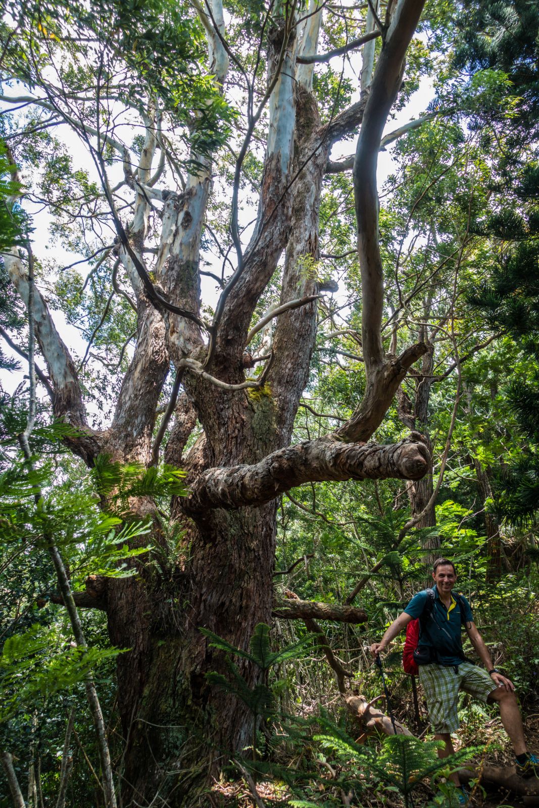
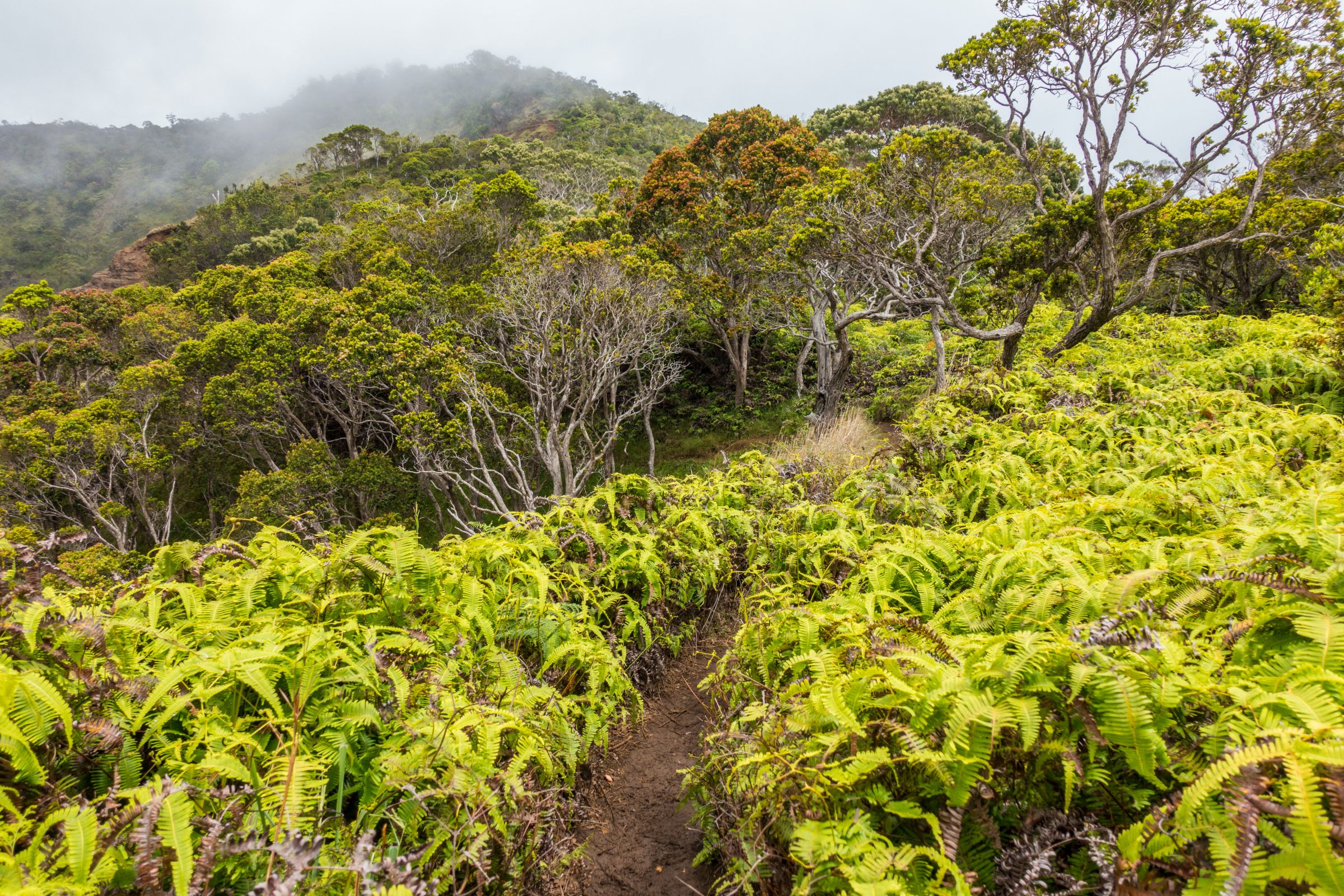
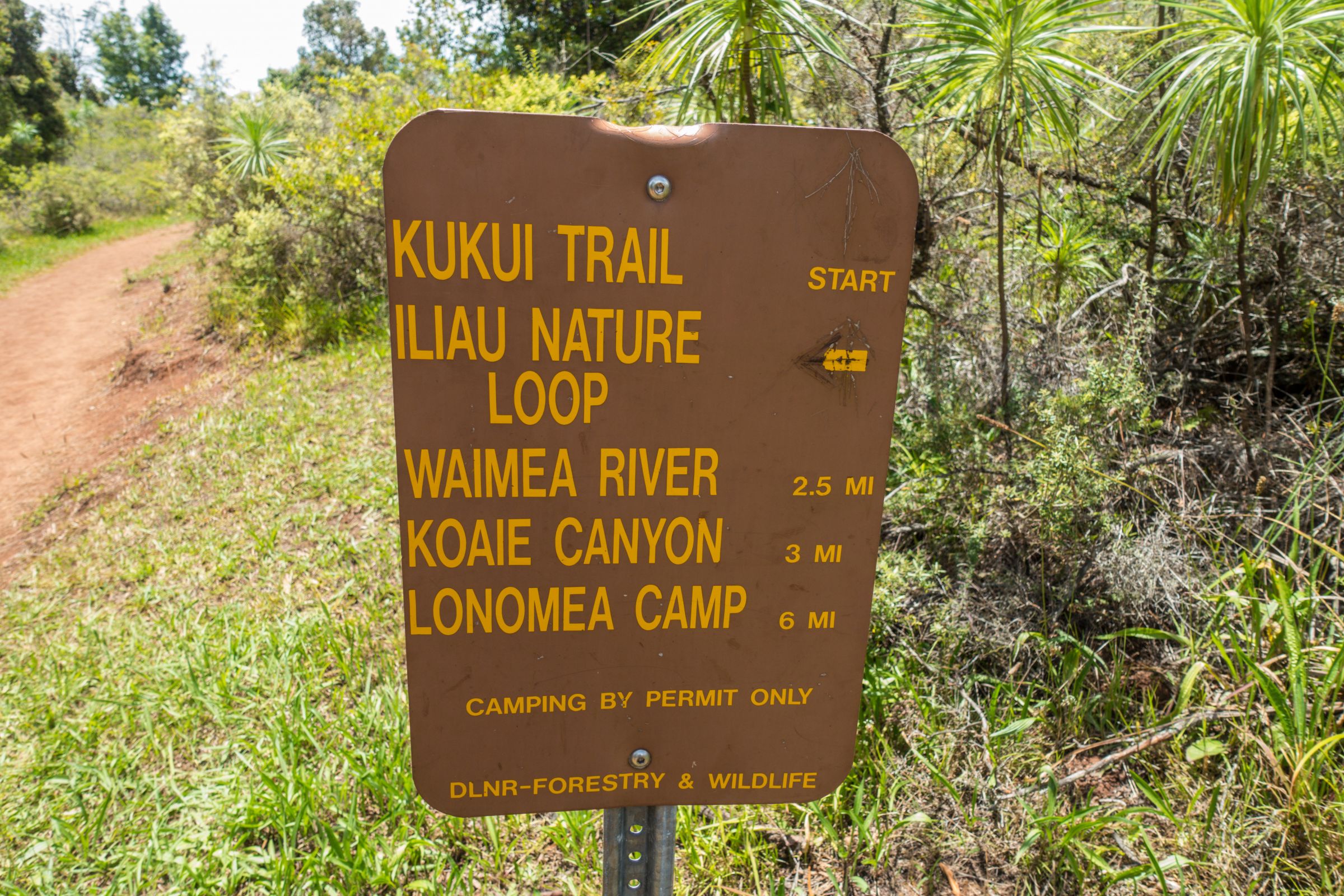
Kukui Hike
5 miles/8km 3.30 hours
Our last hike in the Waimea Canyon State Park took us down the Waimea Canyon. Very similar, looking like the Grand Canyon but deep and much smaller in size. Two-thirds of the hike was great, and we stopped on a plateau for lunch. Then the trail approached a forest full of mosquitos. Therefore, carry insect repellent in your backpack. The trail continues until the Wiliwili campground is on the floor of the canyon. Hiking duration 4 hours - gaining elevation 2.460 feet/750 m. Trailhead Google Maps location
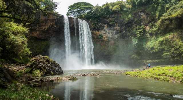
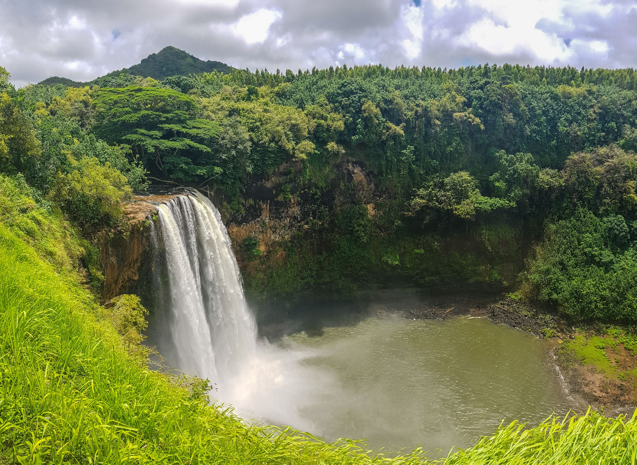
Wailua Waterfall
Short waterfall hike close to Lihu’e - Trespaasing can cause a high fine!
The view from the street, which ends shortly after the fall, was good, but we were looking for more. We found a way to descend the very steep slope down to the water after the lookout. There is a sign indicating that this is not a track. Luckily, many roots and some ropes saved us at the steepest and muddiest part. Hiking Poles or, even better, crampons are helpful for the poor, muddy and slippery track. Limited Parking, busy during the day and weekends. No through road. The very steep and muddy trackTake insect repellent before hiking to the bottom of the fall; otherwise, mosquitos will eat you up. I know what I am talking about. I got lots of bites. The hiking duration plus a break at the bottom of the falls is one hour. Disclaimer: I am not responsible for any injury, death, or consequences of any actions taken based on the information provided here. This is just my experience! This track is very slippery and muddy. At least proper hiking boots and hiking poles are essential for this difficult track. Bear in mind trespassing can cause a fine of up to $1000. Trailhead Google Maps location
Sleeping Giant – Nounou East
3.5 miles/6.2 km 3-4 hours
Hiking to the top of the sleeping giant is easy from the trailhead on the eastern side, located near Kapaʻa. It is a zigzagging moderate hike. The descent to the top takes roughly 1.5-2 hours, gaining an elevation of roughly 250 m. This hike is much longer than the access from the western side. Trailhead Nounou East Google Maps
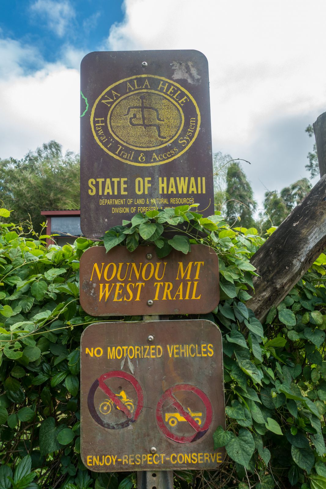
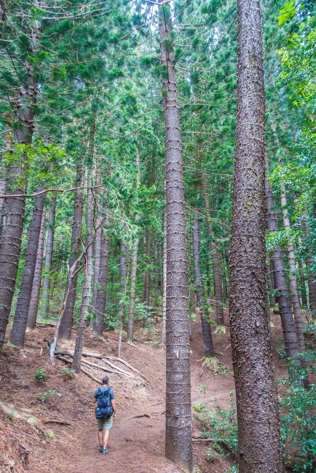
Sleeping Giant – Nounou West
1.8 miles/3.0km 1.5 hours
This trail starts close to Wailua. In the beginning, the track leads through a grove of Cook pine trees. Follow the trail to the left when the track branches in the grove. Watch the tangled roots on the track. After roughly half an hour, the western trail meets the eastern track.
The eastern and western branches are merging on top for the last 0,4 miles/ 600m or so. In the end, some rock climbing is required. You get a spectacular 360° view from the top. The official track stops shortly before you reach the head and nose of the sleeping giant. However, many people ignore the sign and climb to the very end.
Very limited parking at both trailheads and some roadside spaces; therefore, come either early morning or late afternoon. Local people told me the sunrise is breathtaking from the top, but honestly, I am not an early riser. Trailhead Nounou West Google MapsEnjoy the breathtaking view from here before you continue.
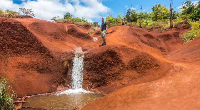
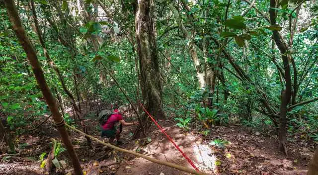
Okolehao Trail
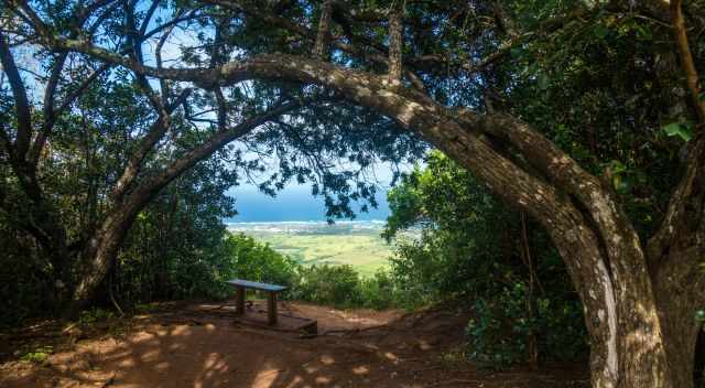
This is the view from the first bench.Not busy - perfect to beat the crowds.
Before I go into detail, this first part of the hike is a Must-Do. The hike can be split into three parts. The first is an easy to moderate hike of 1.3 miles/2 km taking 2 hours until reaching a bench and the final outlook. If you like to continue until you get to two benches, add another mile which takes more than an hour. Climbing the last part until Kauka'opua on 388 m elevations is recommended for experienced and well-prepared hikers only. Kauai is a hiker's dream, and when reaching the summit, a new trail comes up called Hihimanu Trail to two more peaks. We hadn't hiked the last part; too dangerous, IMO. Depending only on ropes is nothing I recommend. One of the muddiest trails in allOkolehao is a less known trail; therefore not busy. The beginning is easy but don’t underestimate this steep and difficult climb to the top. It is a muddy tangle of roots track. If the creek is flows, you get wet shoes and socks already at the beginning. At 1.3 miles/2 km, you get to a wooden bench, a great resting spot that offers beautiful views of Hanalei Bay. I recommend going back to the car park. View to the top of Kauka'opua on 388 m elevation and two more peaksAt 1.7 miles, the trail narrows and is less maintained now. The path is a little overgrown from the scrub. I recommend long trousers for this part of the track. After another 0.5 miles, there are two benches for a break, offering also excellent views. Halfway to the top, the real challenge starts. The trail gets extremely rugged and narrow on either side if you continue hiking. If you have any fear of heights, don’t continue after the benches. From now on, it is a treacherous path difficult at spots. Fortunately, many ropes are set up when needed most, but I prefer climbing with a harness for safety reasons. Good preparation is the key, and know your limits! Wear proper hiking boots and carry plenty of water. Plenty of onside road parking at the trailhead. Trailhead Google Maps location
7 Packing List Tips
Wear proper hiking boots; most of the trails are slippery and muddy.
Hiking poles are helpful on most of the steep trails, which are usually slippery from the mud.
We even bought crampons which became a lifesaver on some of our most adventurous tracks.
It is frequently muggy, especially during the day. You break a sweat during the hikes, and plenty of water is necessary.
I also recommend energy food and electrolytes in the backpack for an energy kick.
of the question, sun protection, especially for the face, is essential.
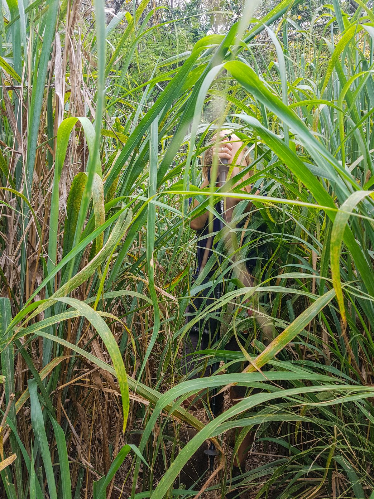
Adventurous trails are less maintained and often overgrown. To protect our legs from scratches, I recommend light-tracking trousers.
Tip for Parking - Safety
When we visited Kauai, we saw a couple of rental cars with broken side windows and glass on the ground, respectively, especially at Waimea Canyon. Don’t leave anything in the car, and check out if it is closed properly before leaving.
Kauai Chickens
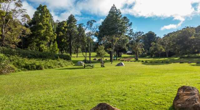
The campground in the Kokee State Park
We discovered in Kauai, our enemy, right away. Frequently one of the many roosters woke us up before 5 am, especially while camping. We asked ourselves why a Hawaiian Island does have so many chickens and roosters. We counted on the Kokee campground more than 30 individuals. The reason was even on display in our motel, where we spent a couple of nights afterwards:
“Kauai chickens have always been part of the island, but not as much since after Hurricane Iniki in 1992. The story goes that the hurricane blew out all of the chicken crops throughout the island, leaving the chickens to run wild.”
As they robbed us of our needed sleep from time to time, they became our personal enemies. This is actually the opposite of what the Kauai people do. They protect the chickens and even stop their vehicle in the middle of the road to let them pass.
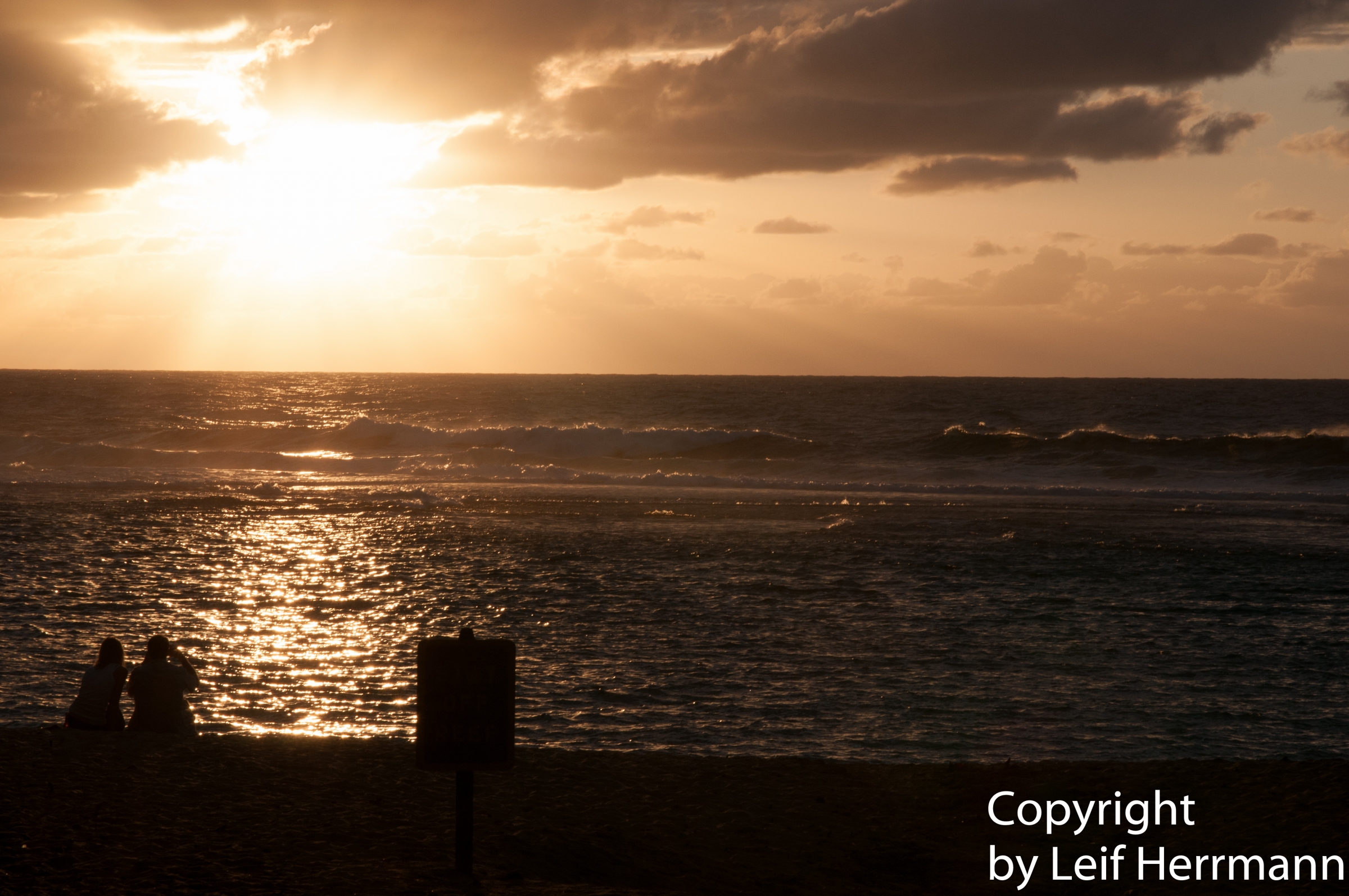
I hiked the beginning of the trail in the winter. It was cloudy and showers occurred. Nevertheless a beautiful trail. After I returned I had an amazing sunset at the beach.