
When Is the Best Time
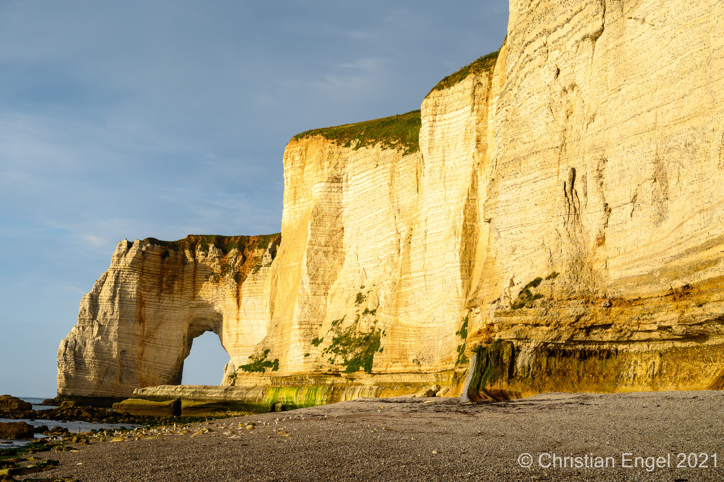
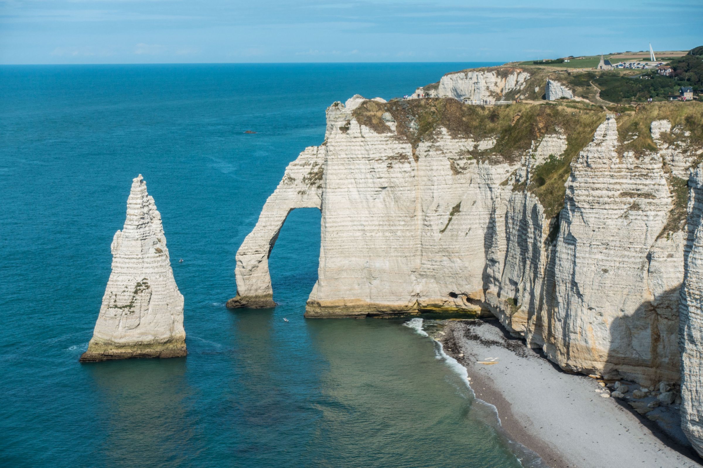
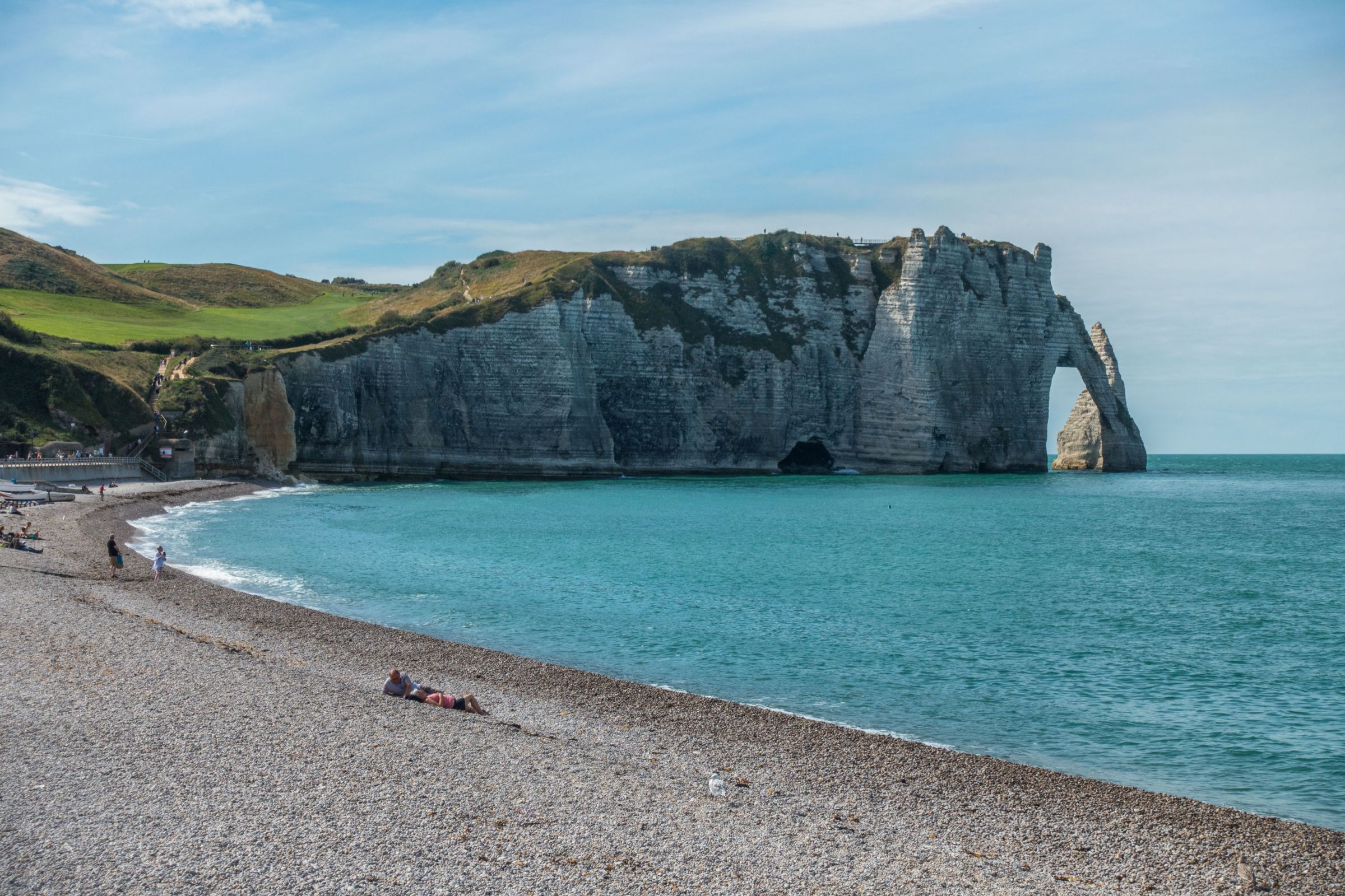
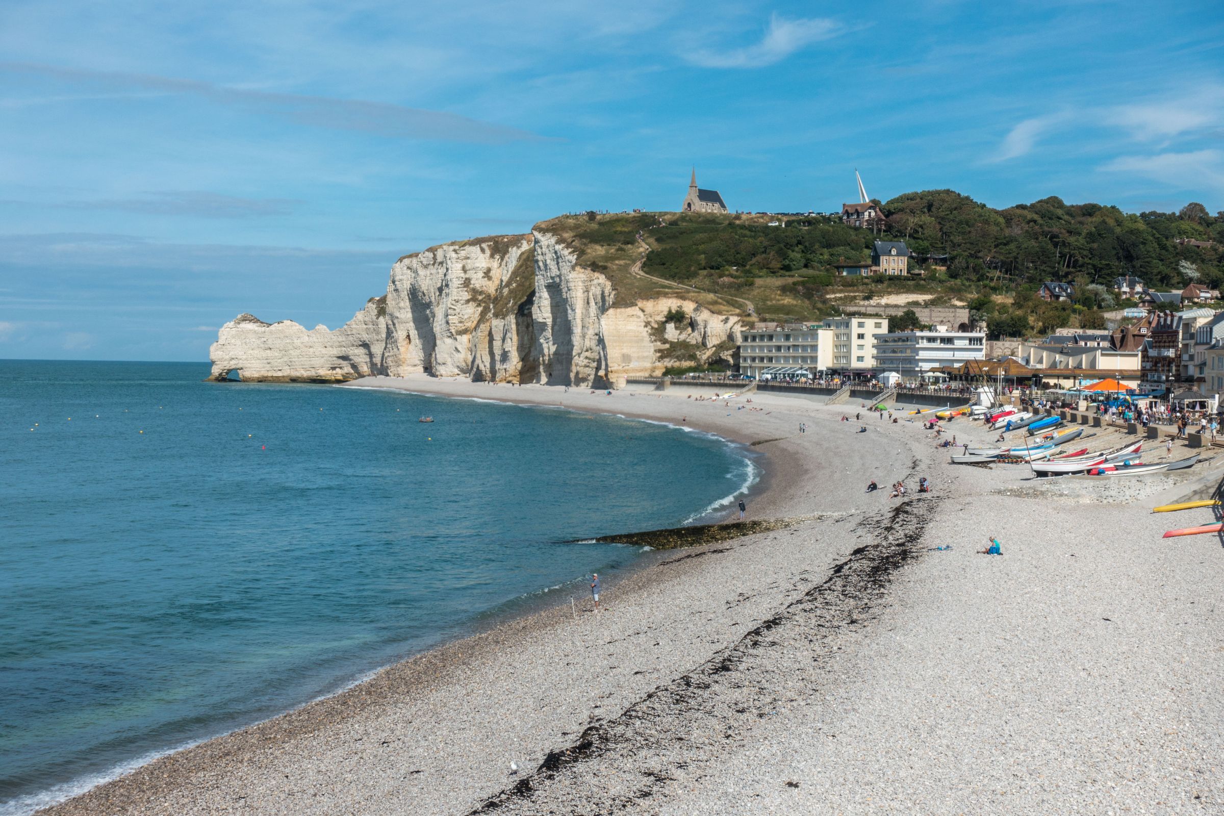
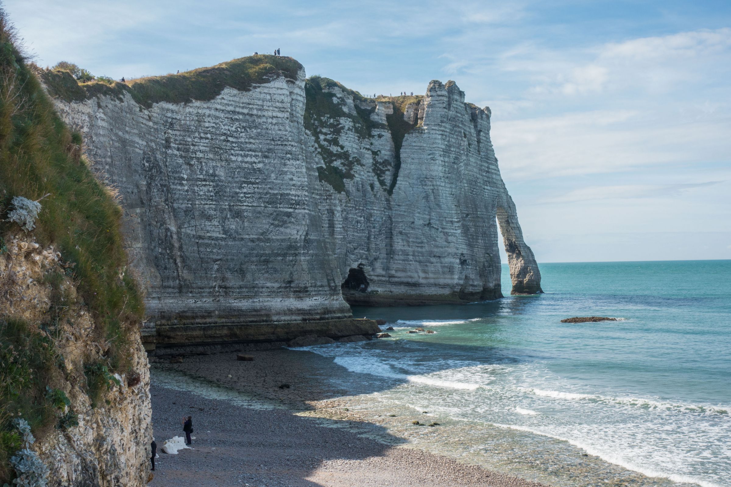
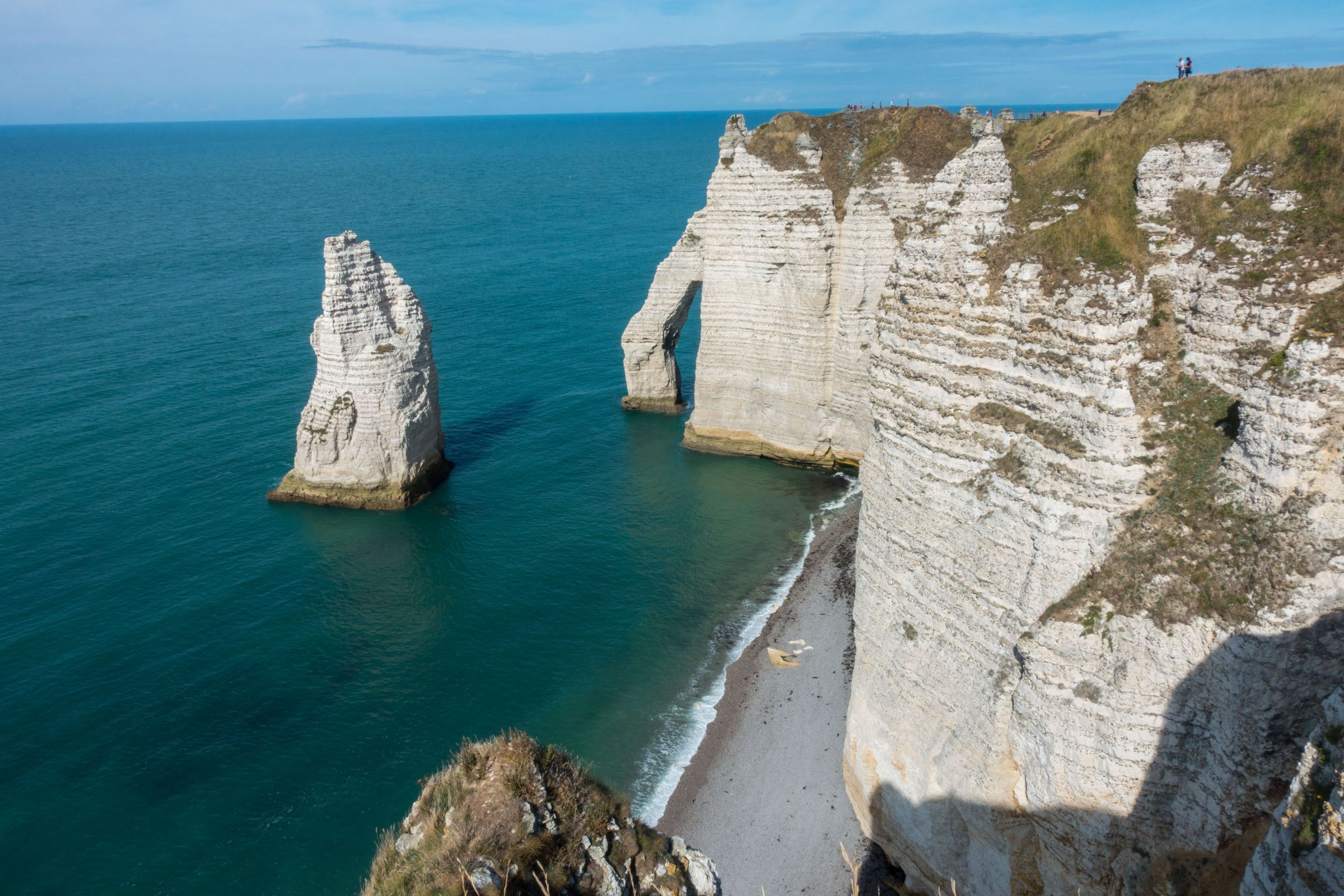
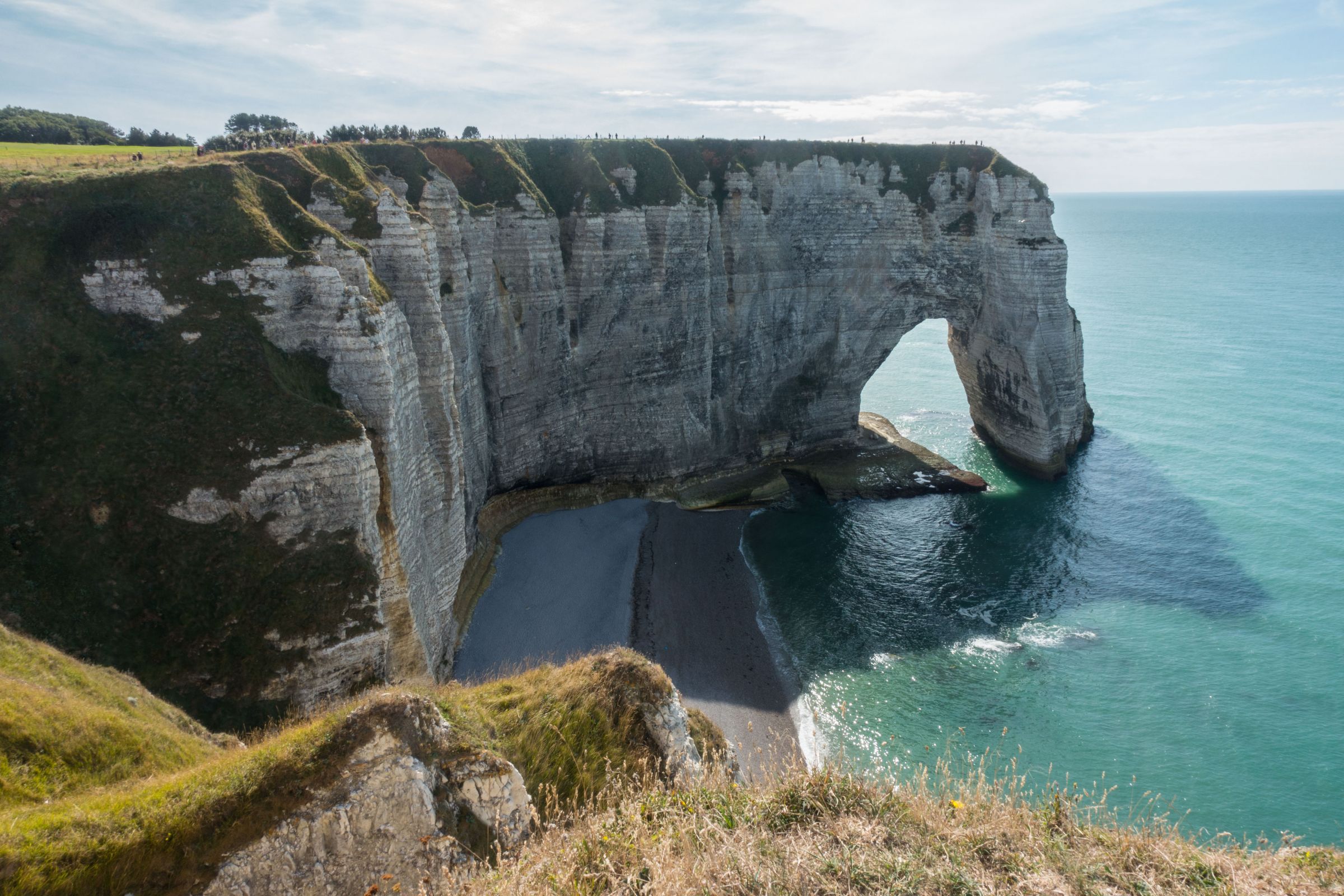
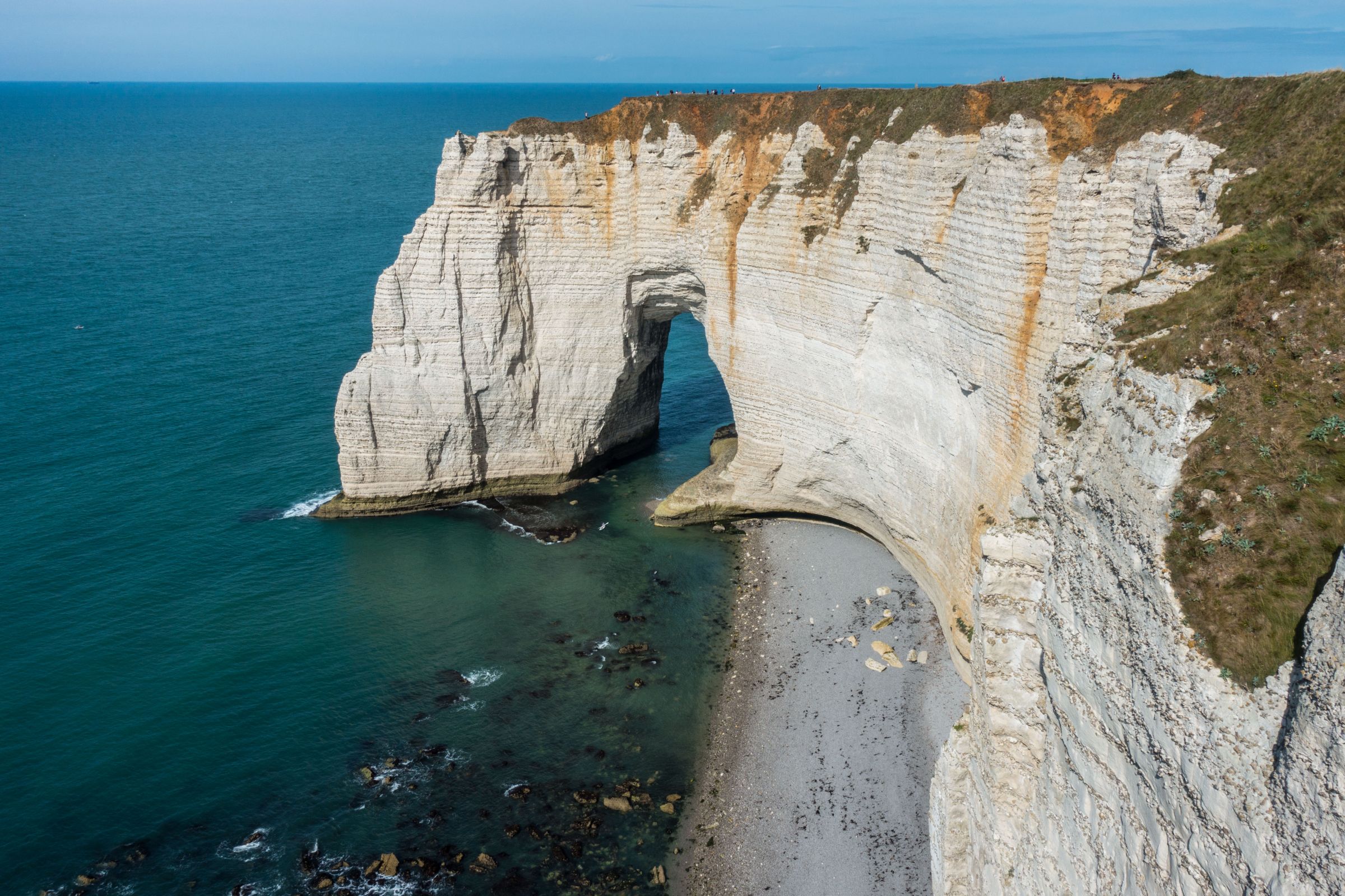
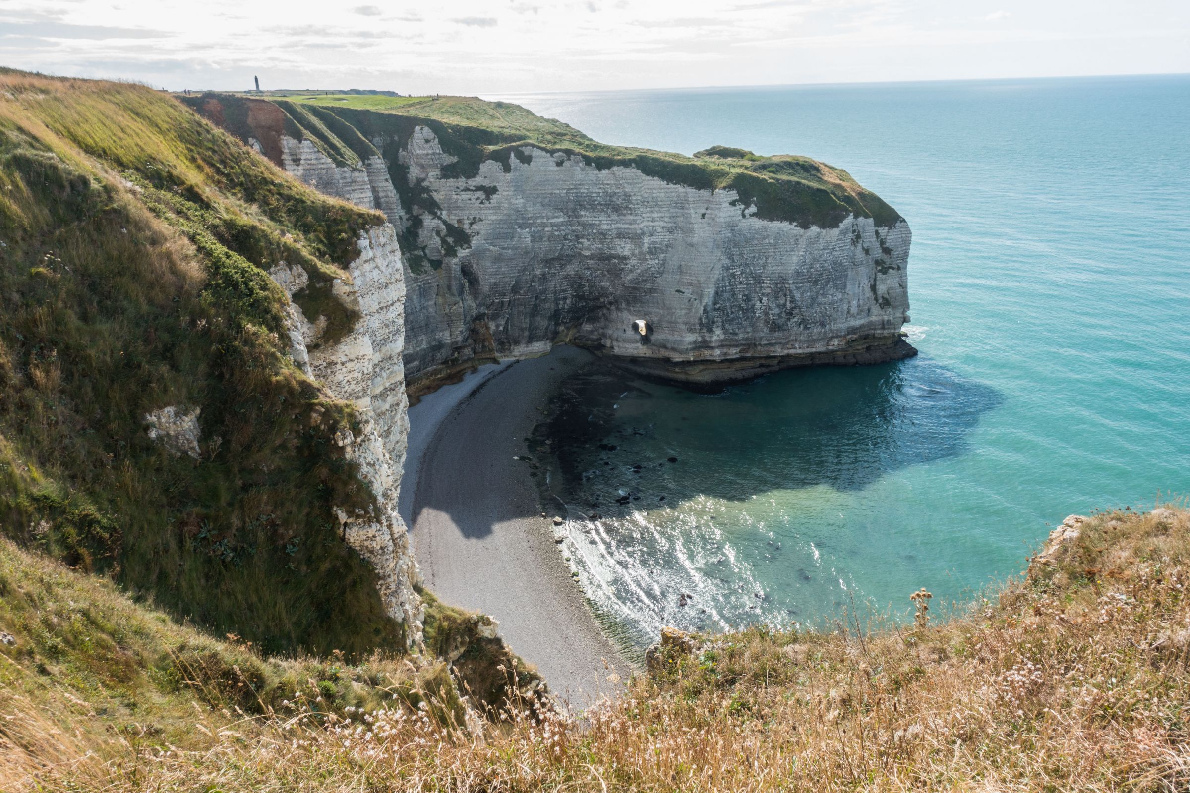
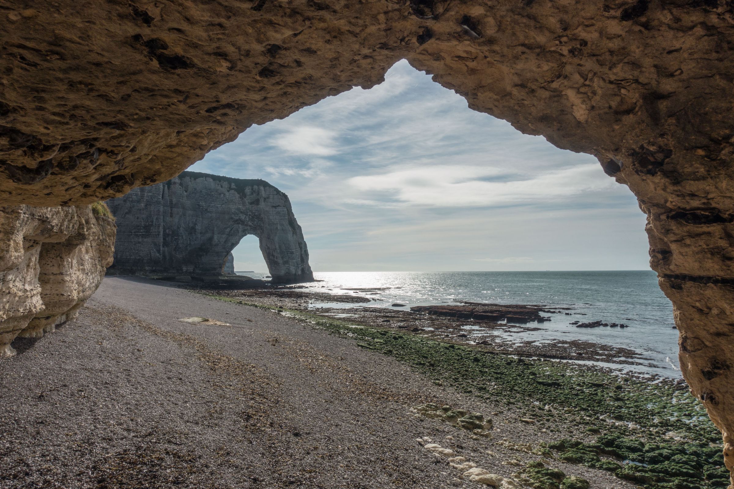
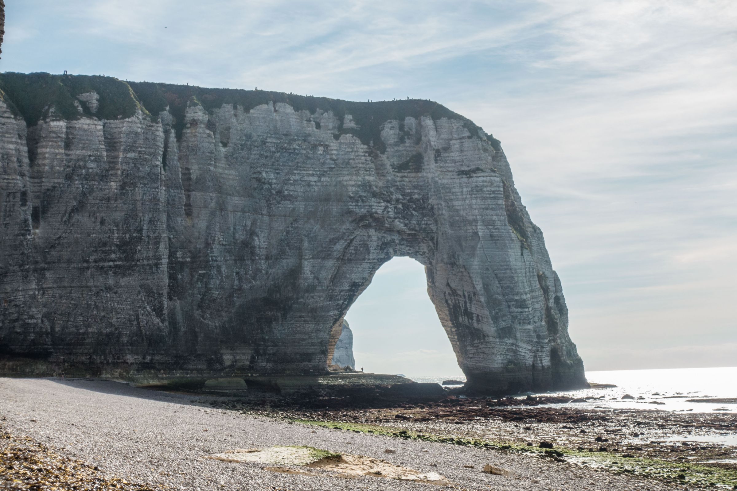
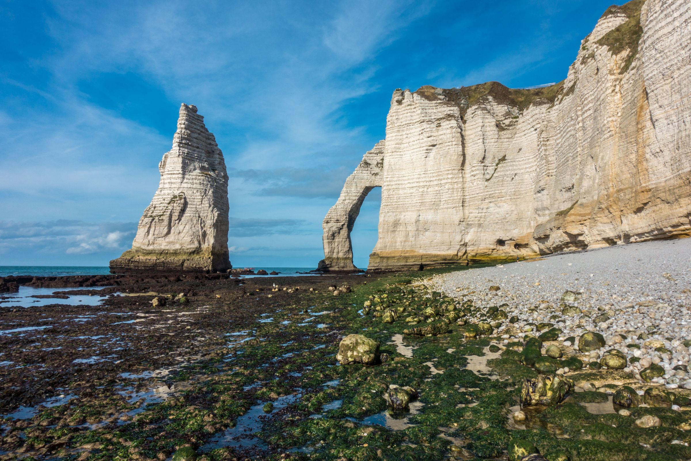
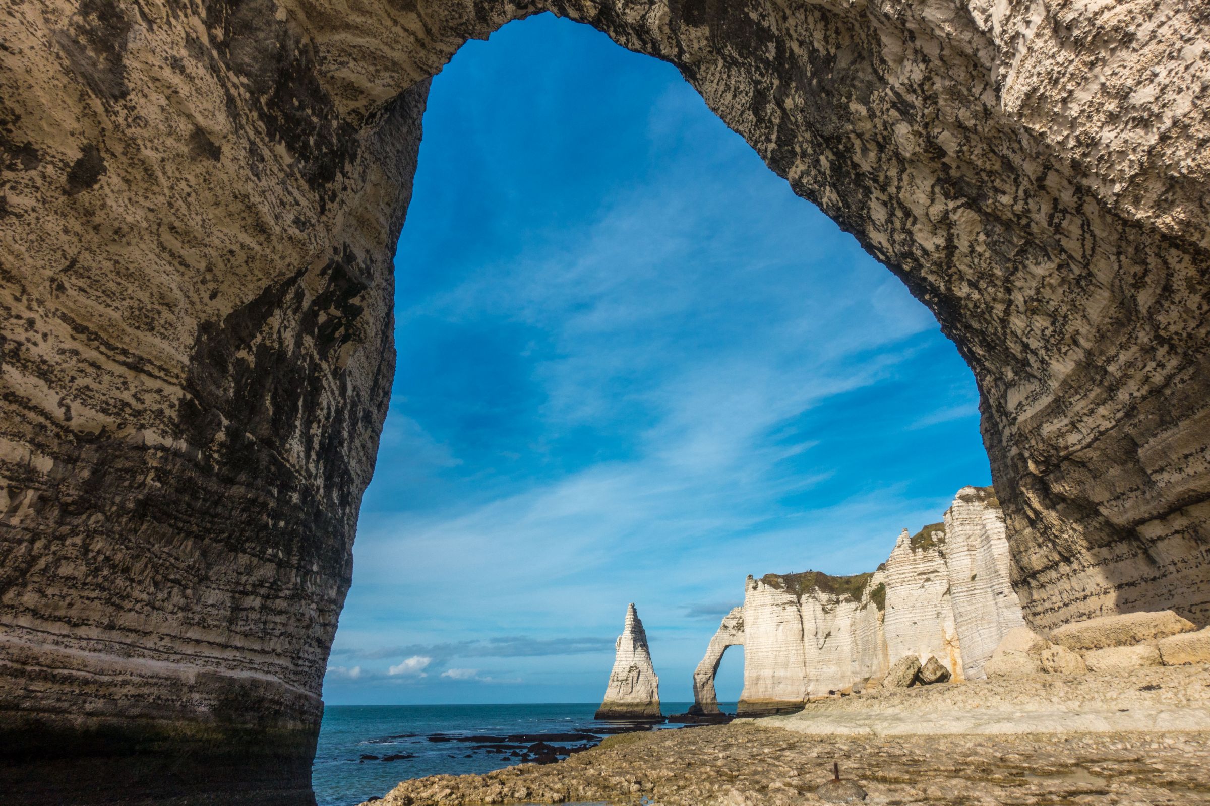
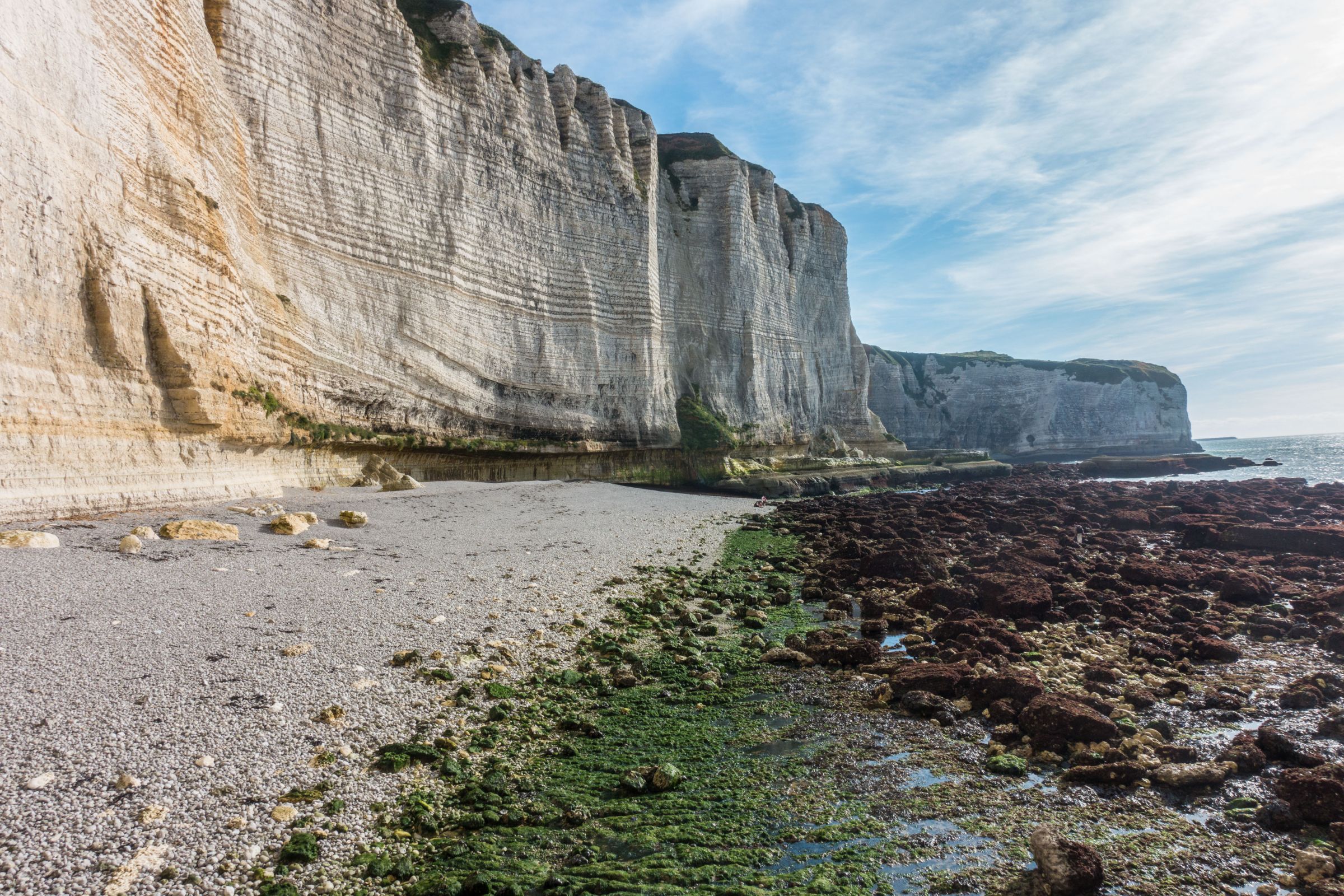
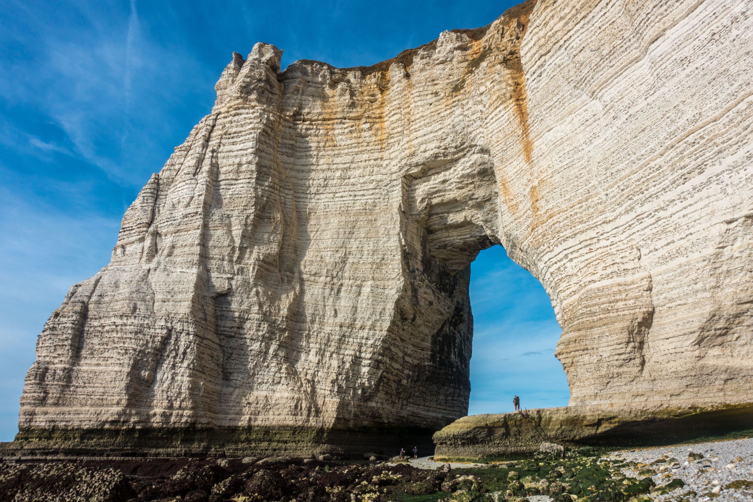
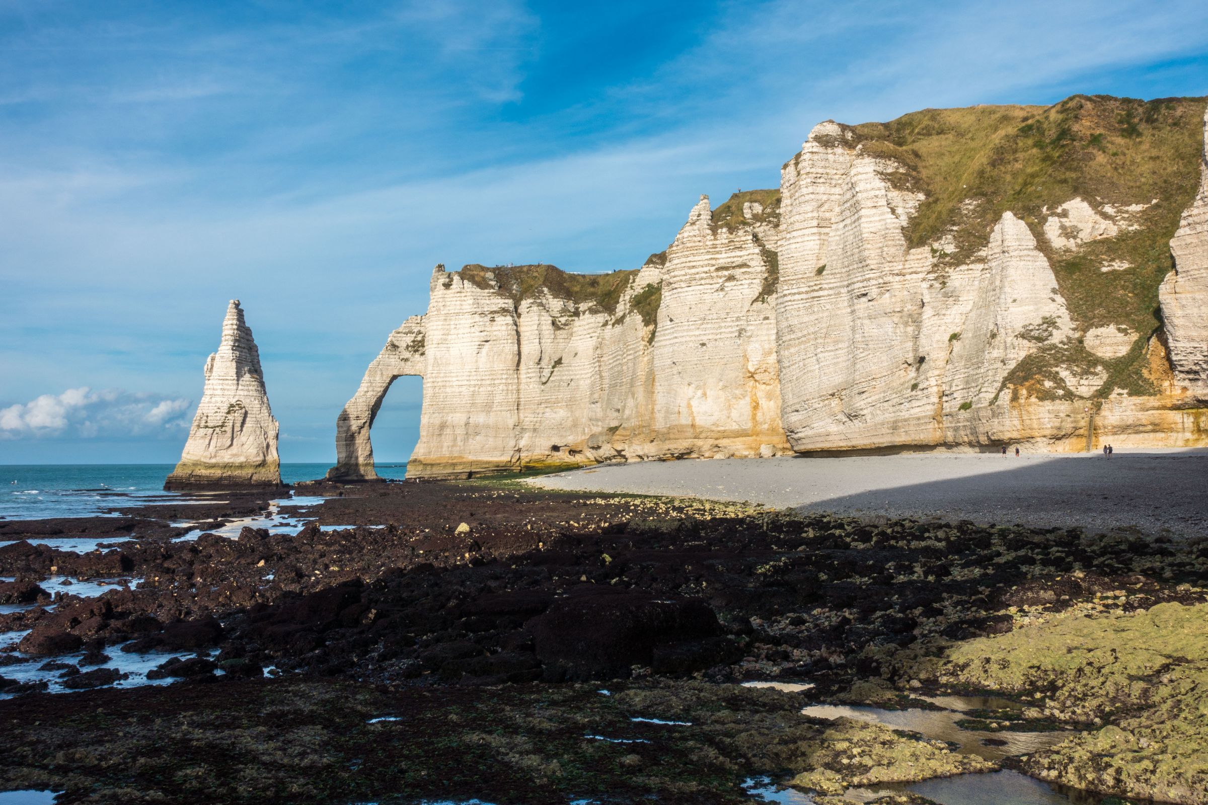
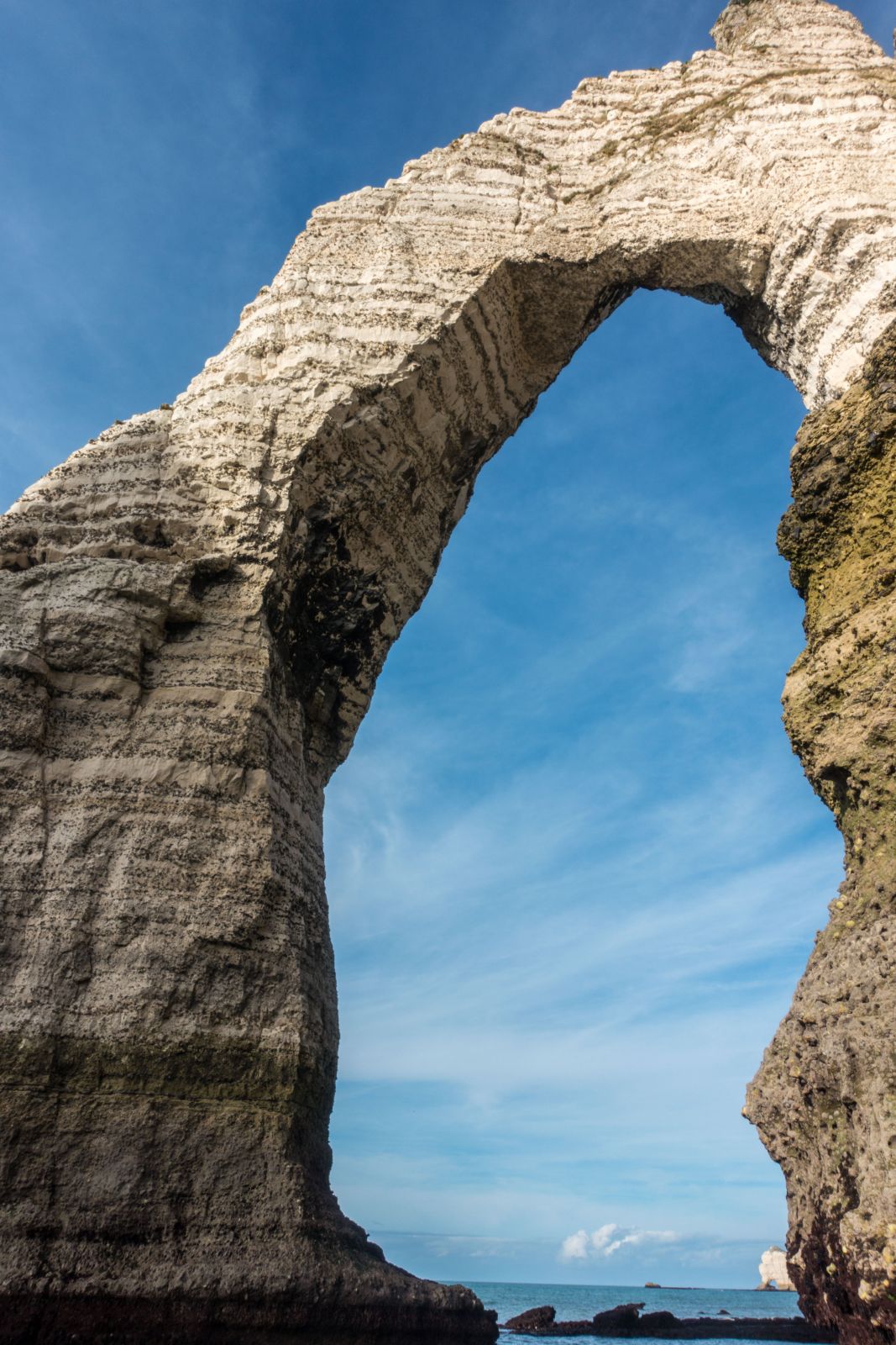
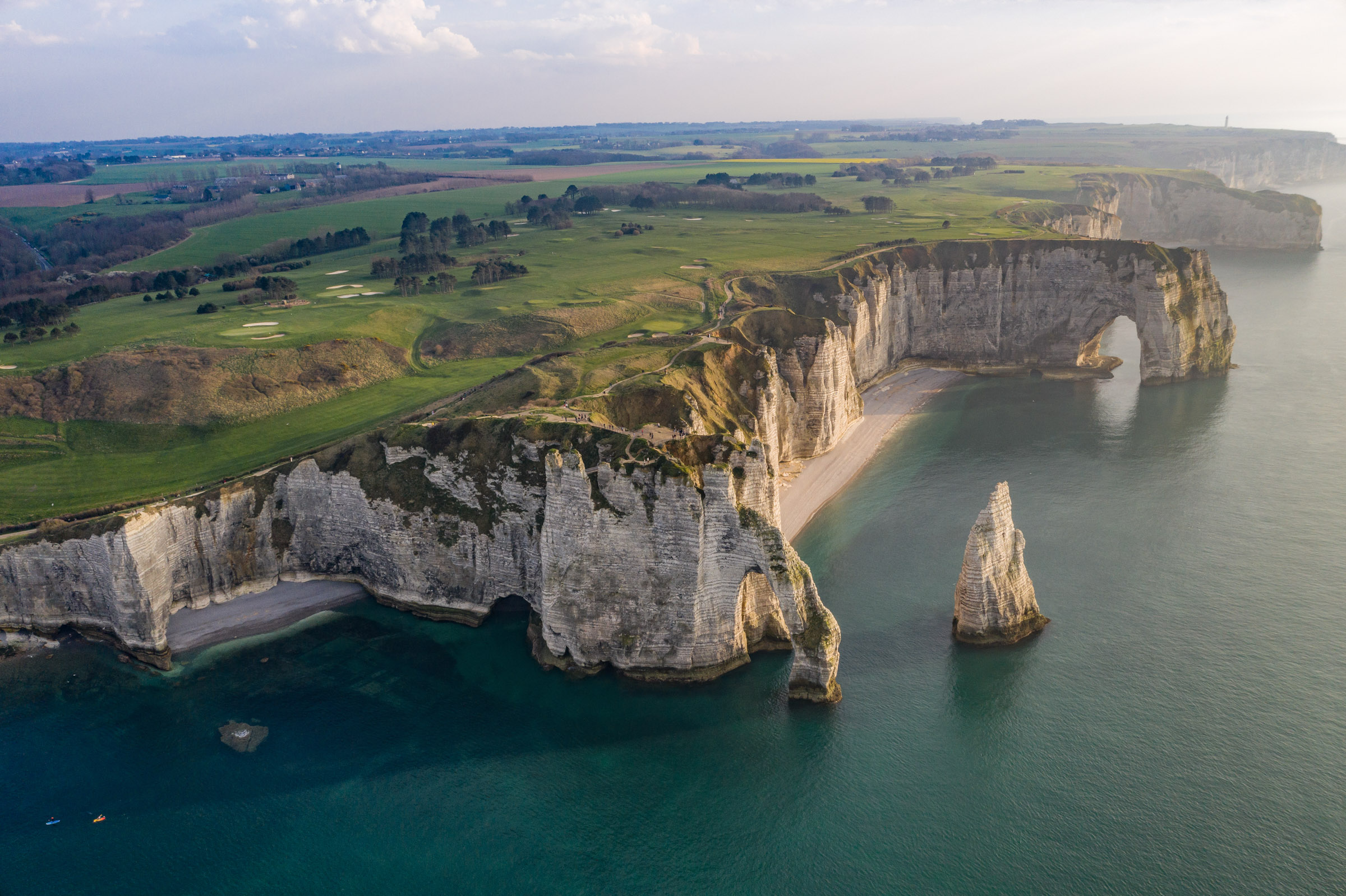
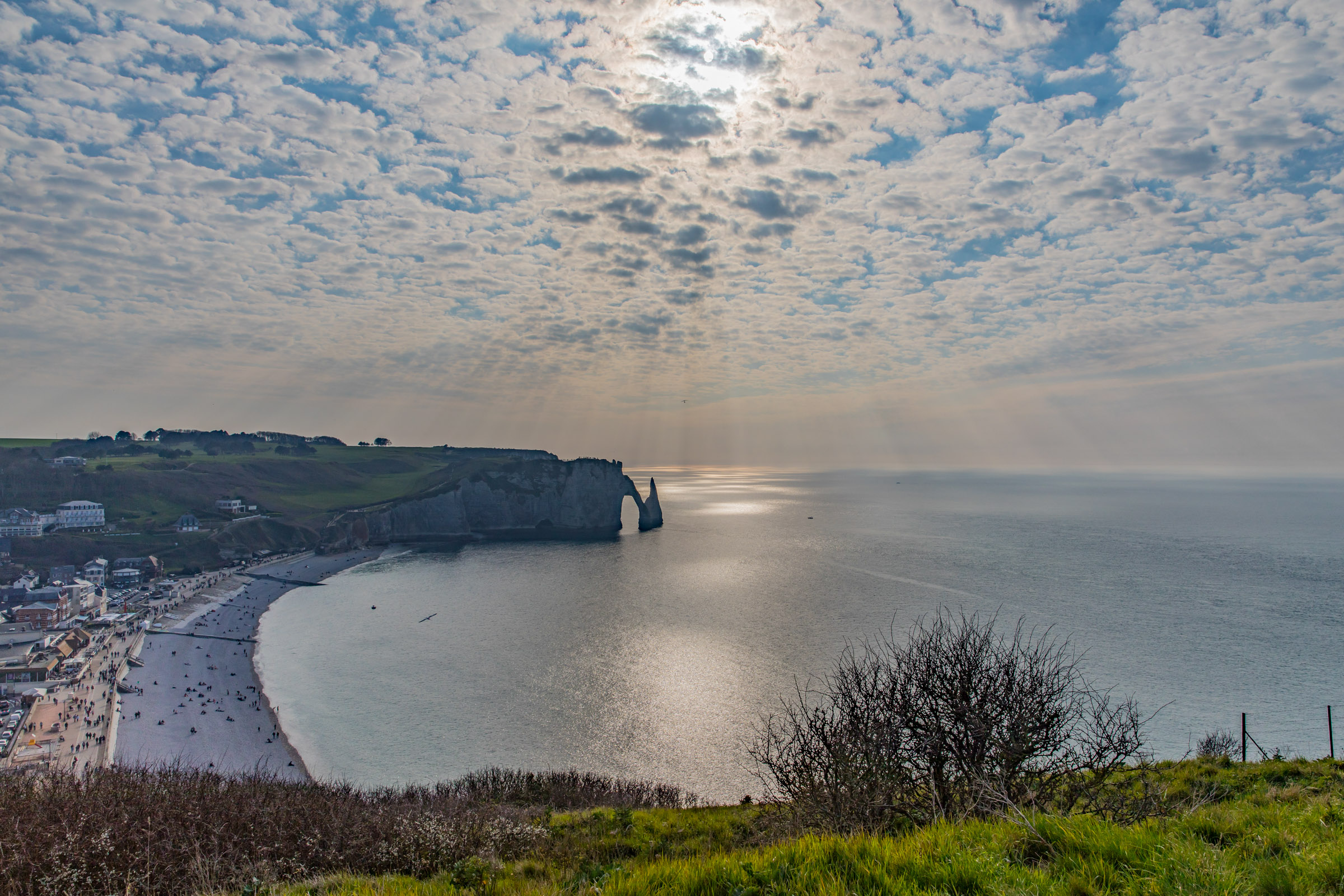
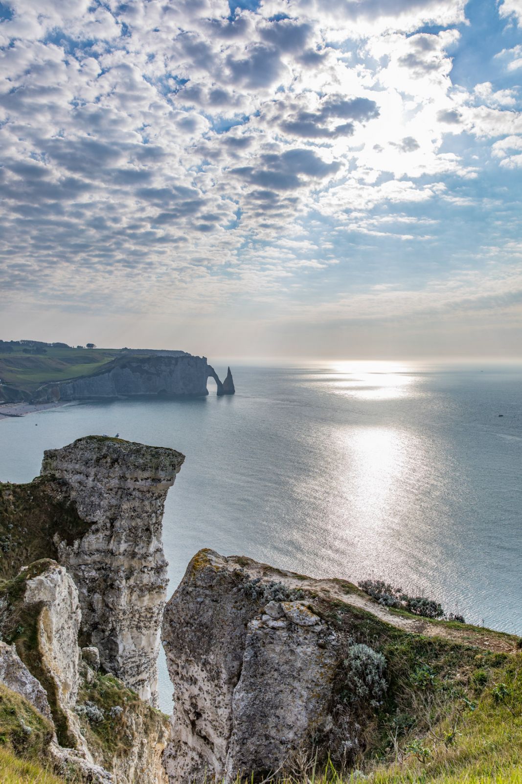
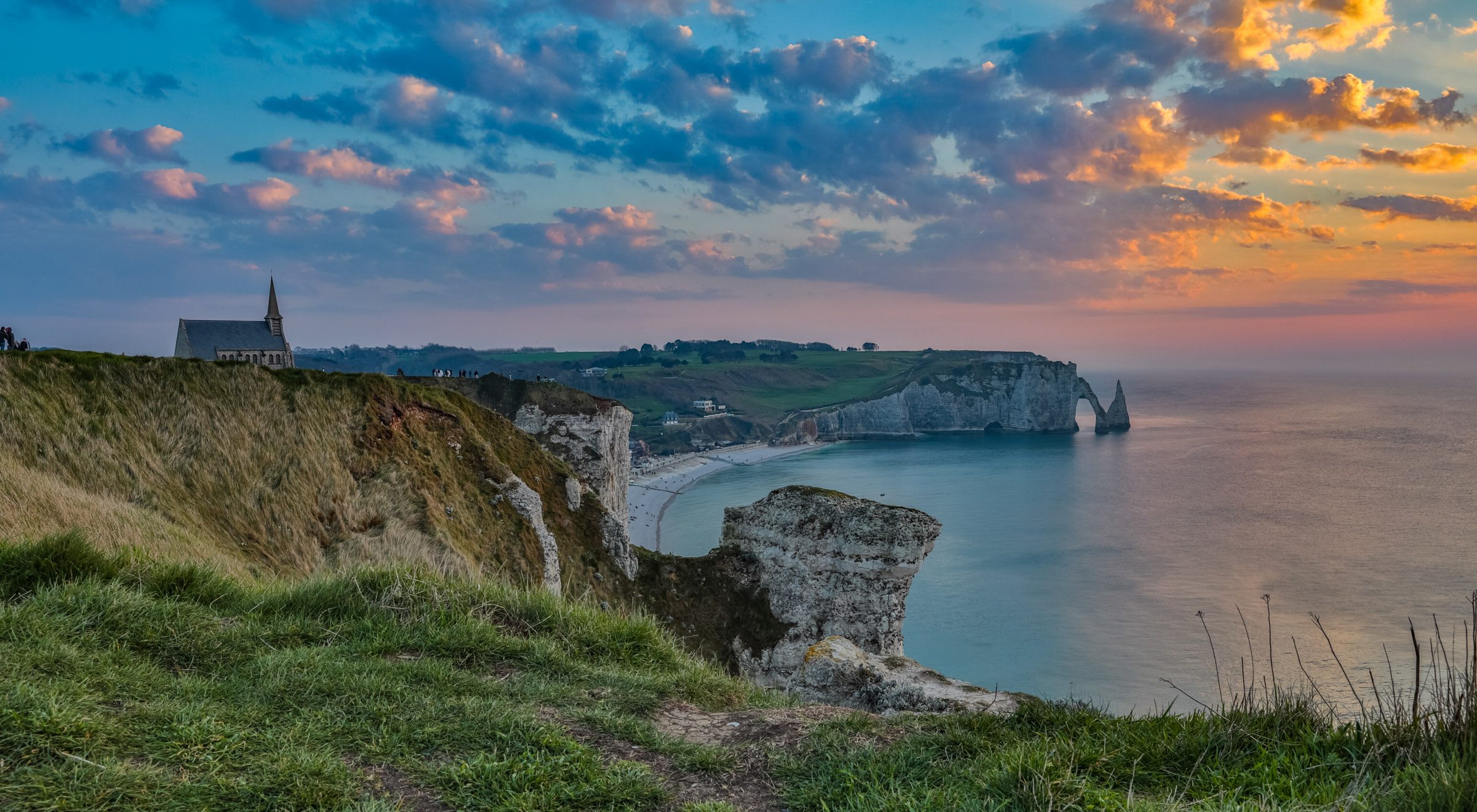
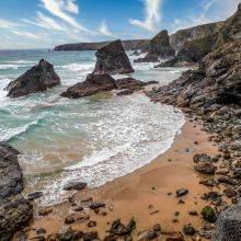
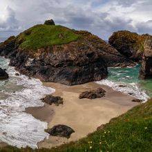
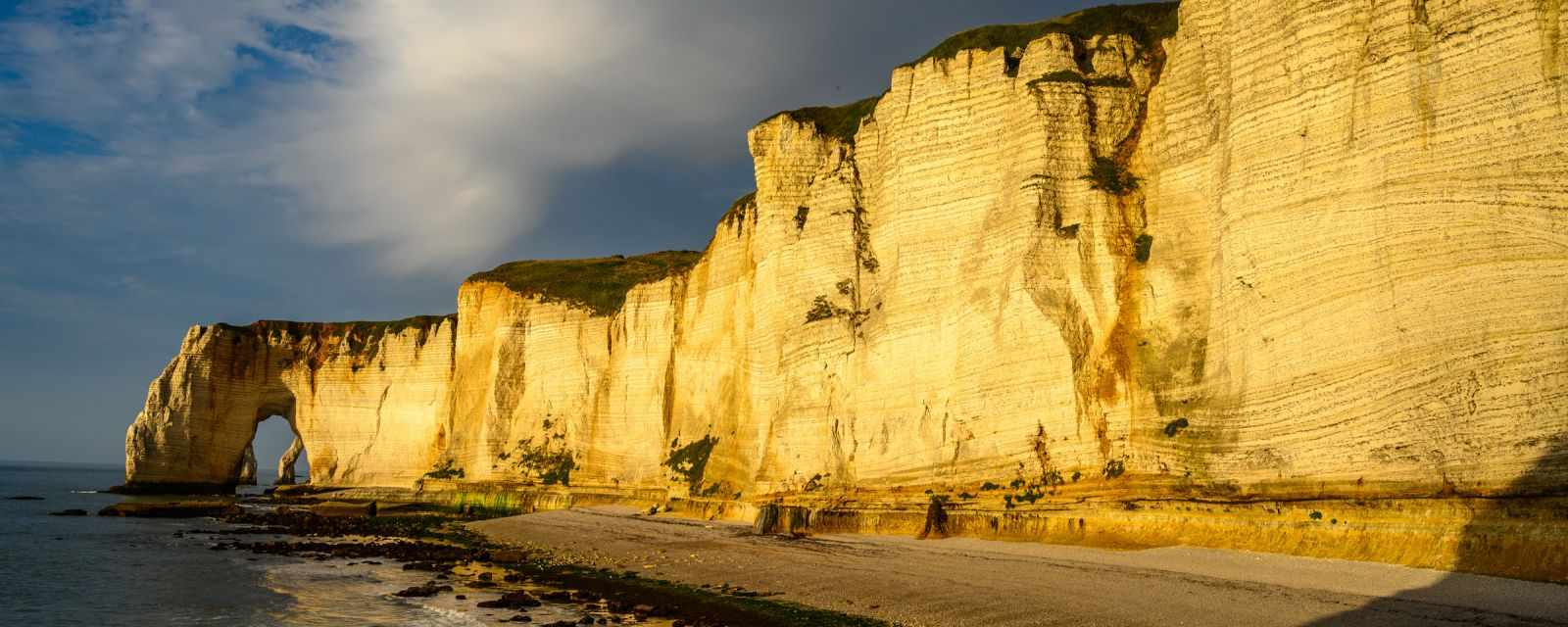
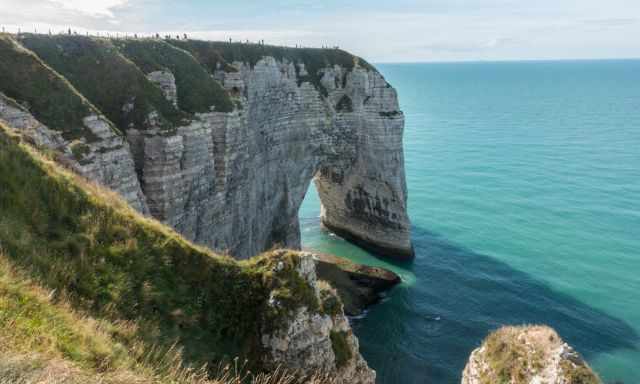
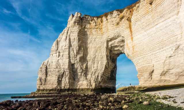
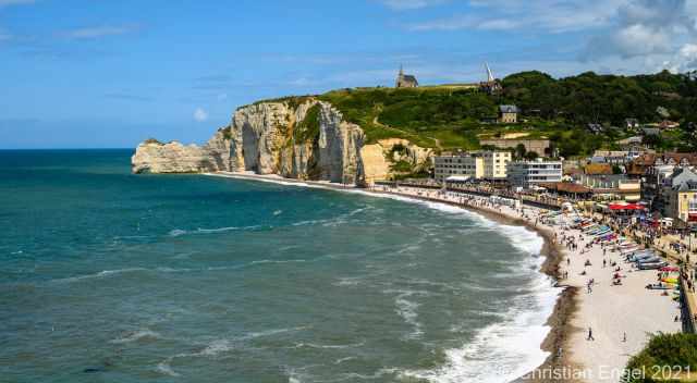
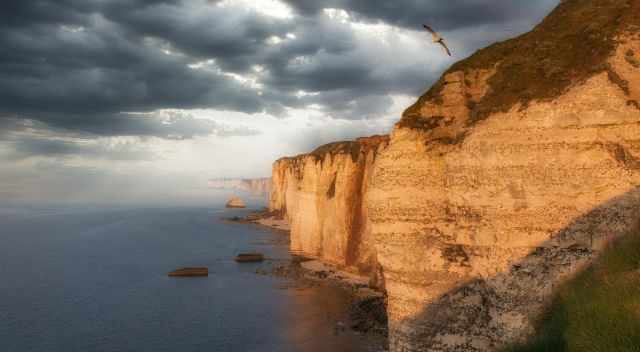
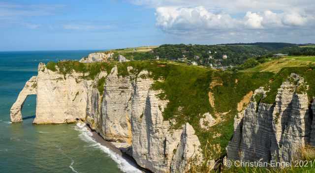
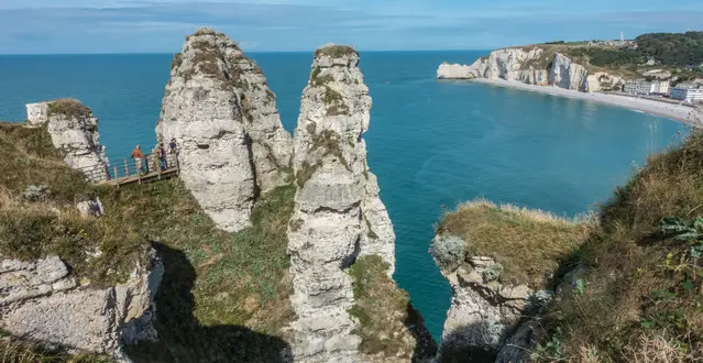
The white cliffs of Etretat are one of the most popular sights in Normandy and are famous for Monet’s paintings. The impressive three rock arches “falaises” created by incredible forces of nature thousands of years ago are a Must-Visit sight.
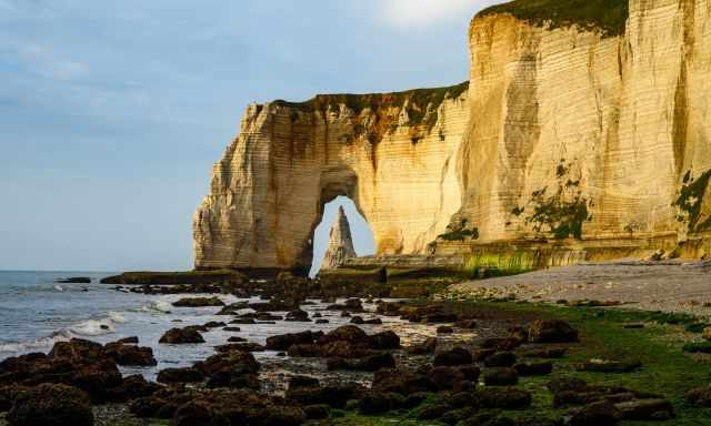
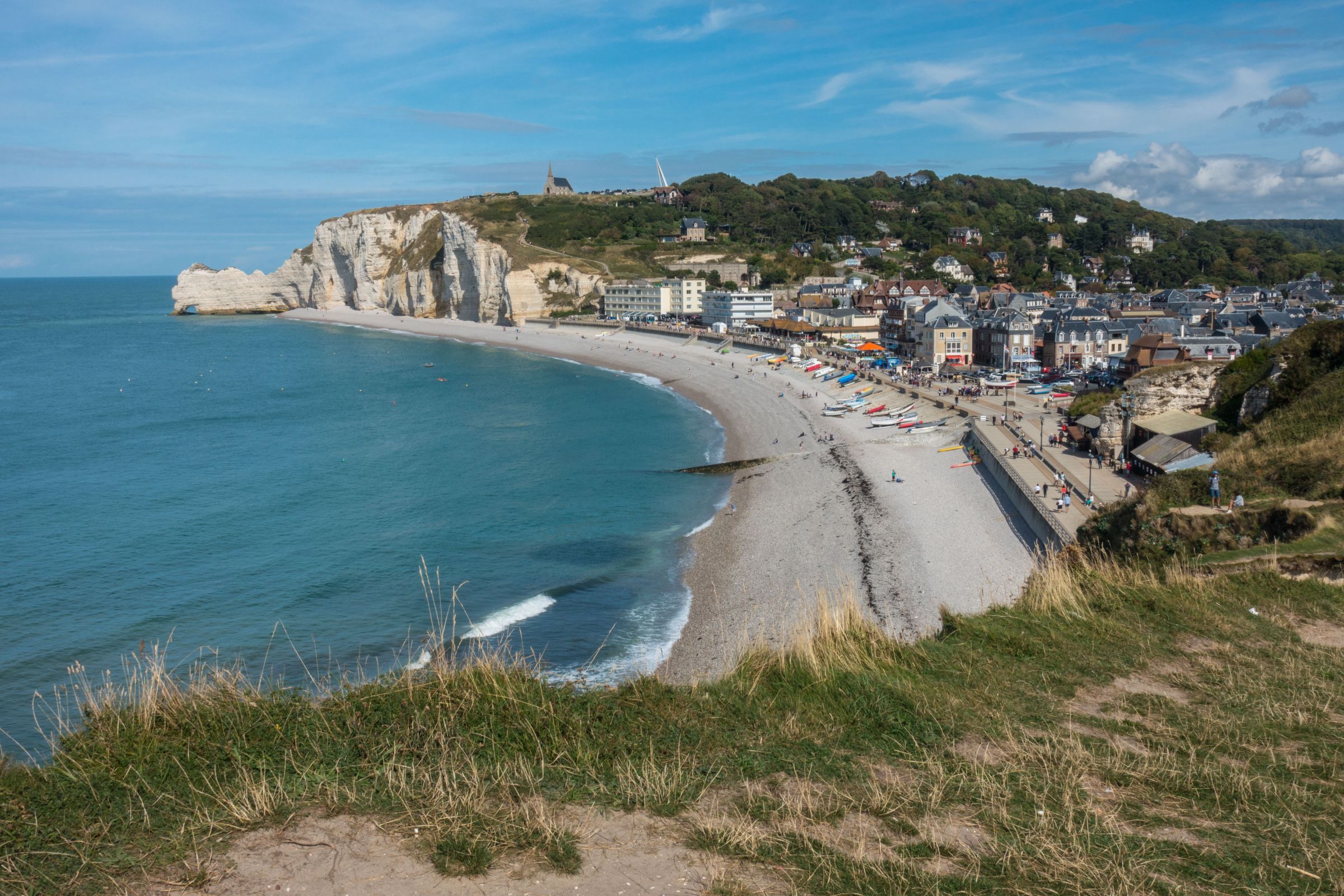
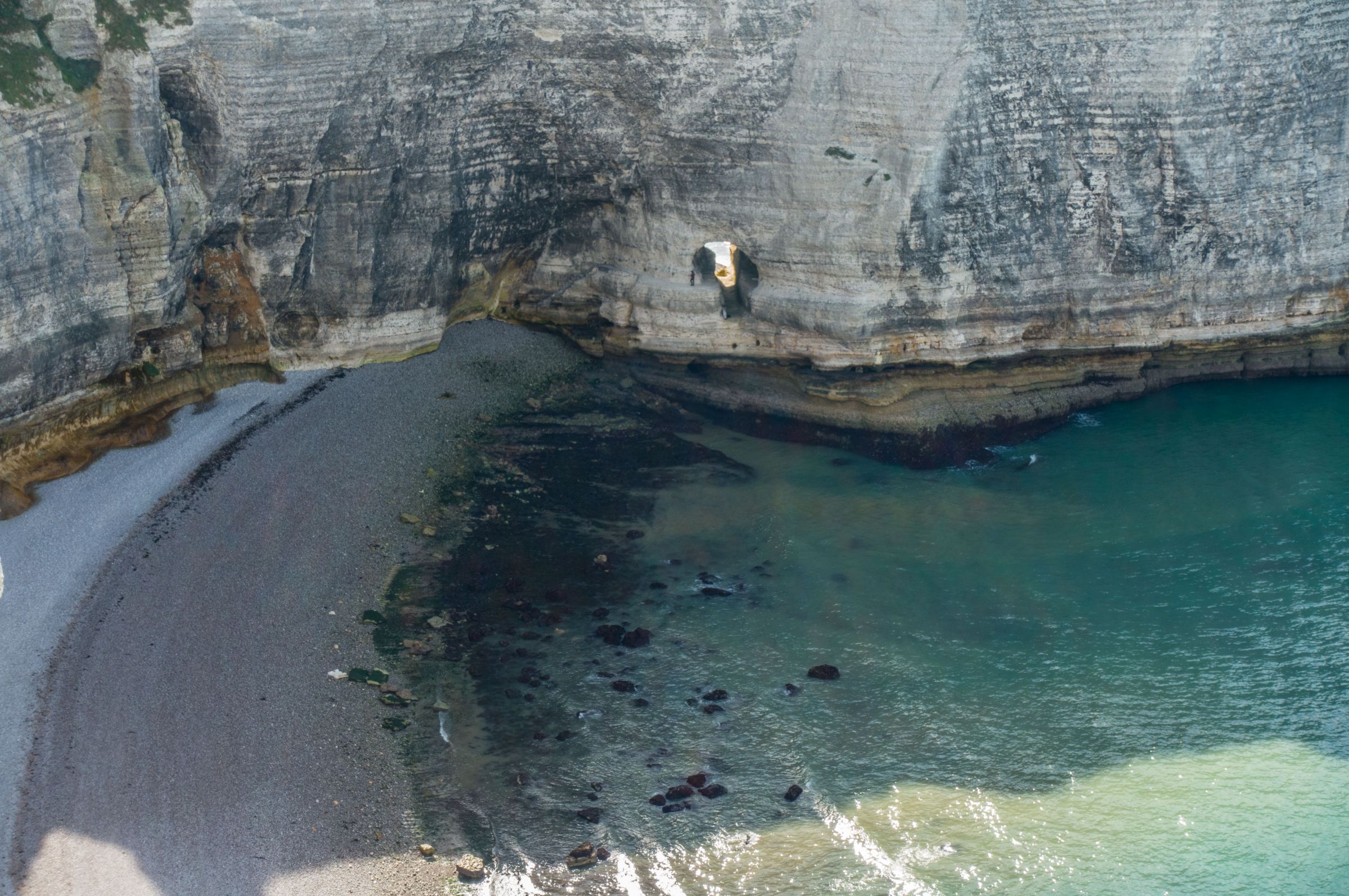
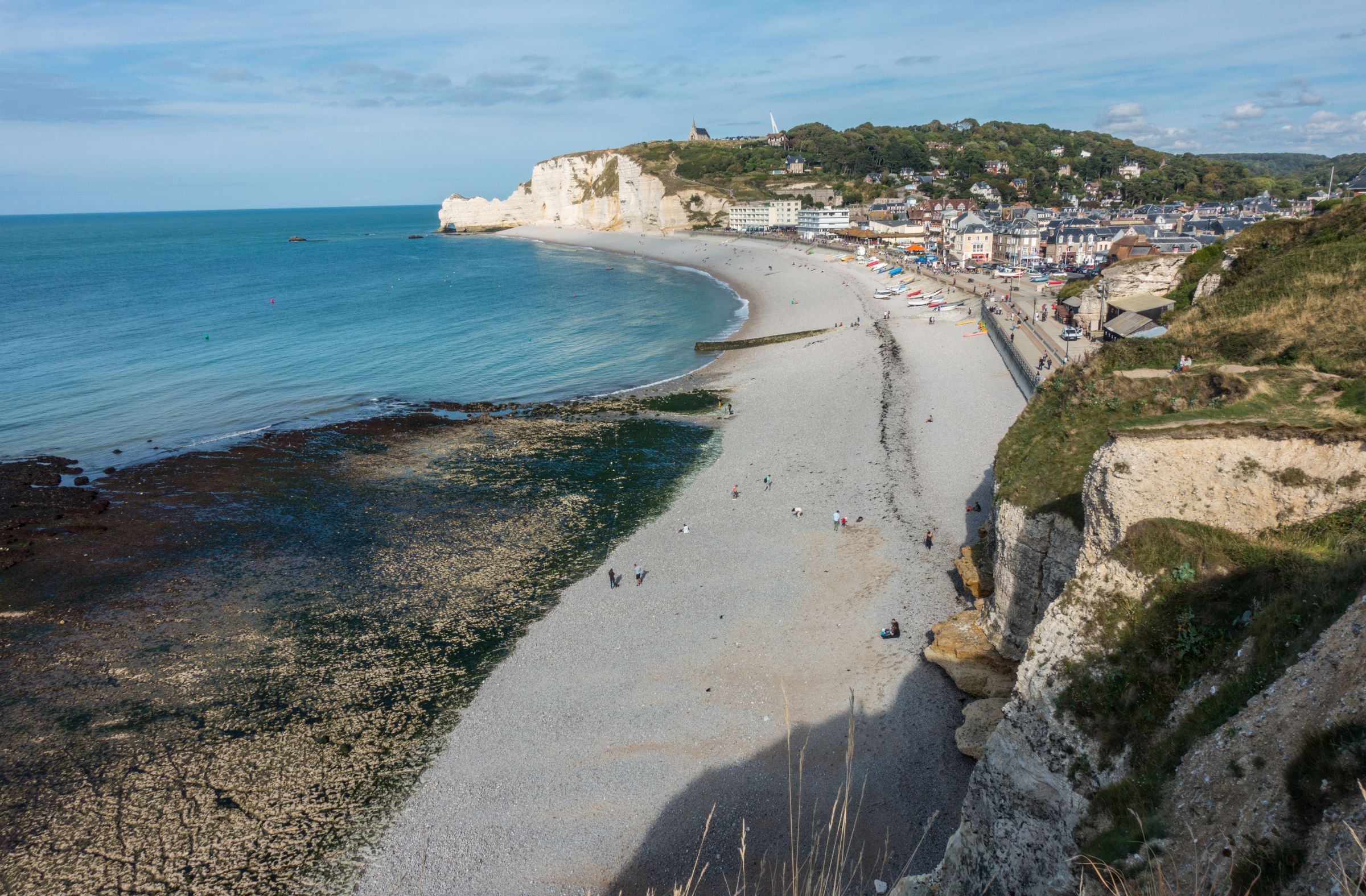
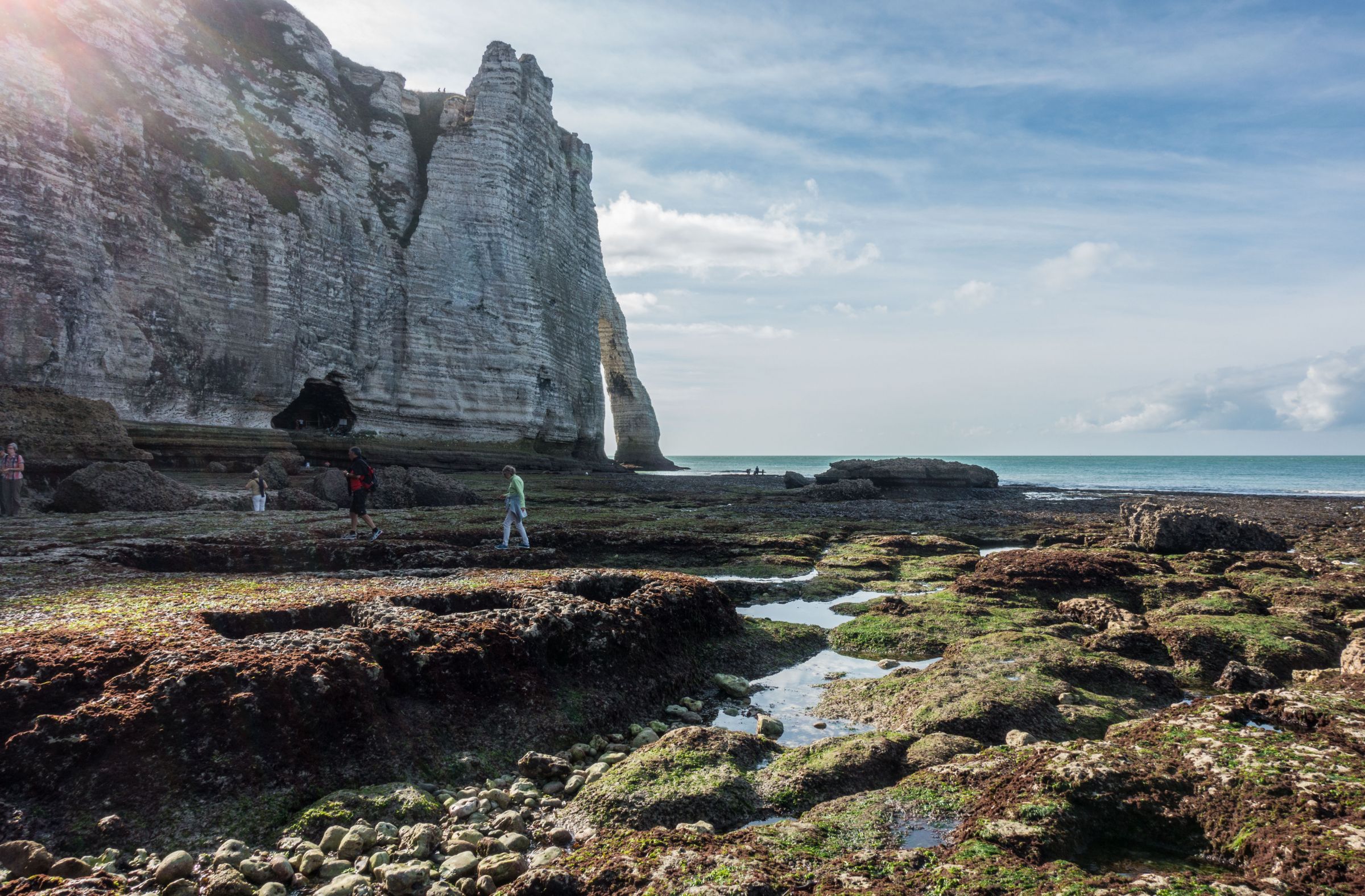
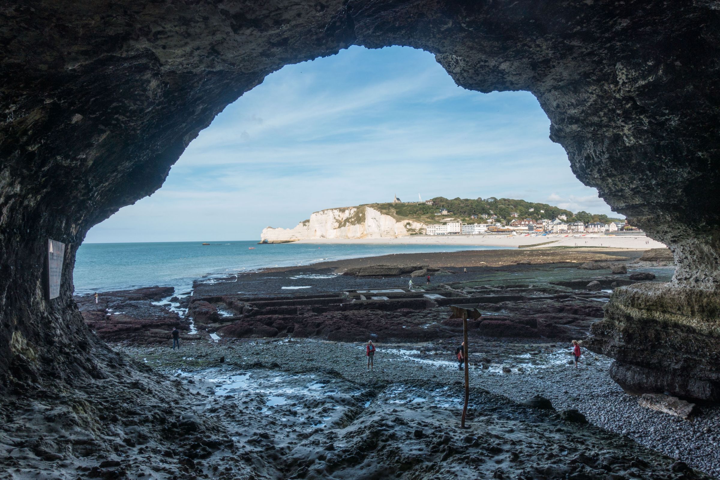
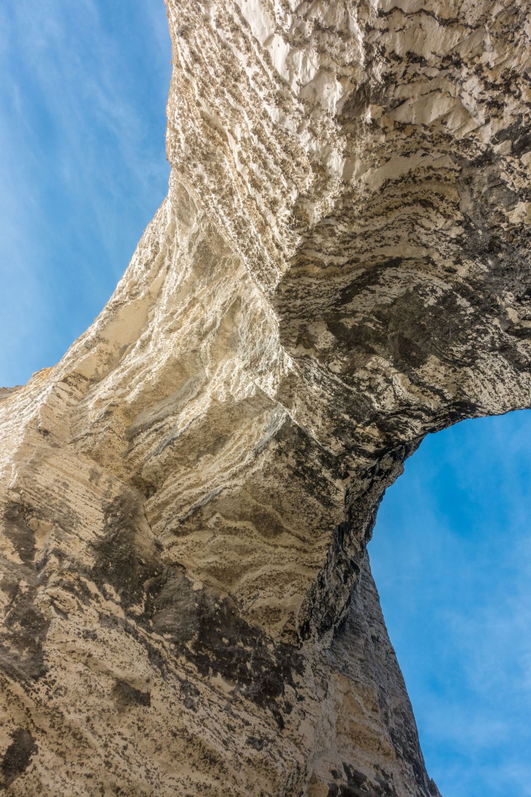
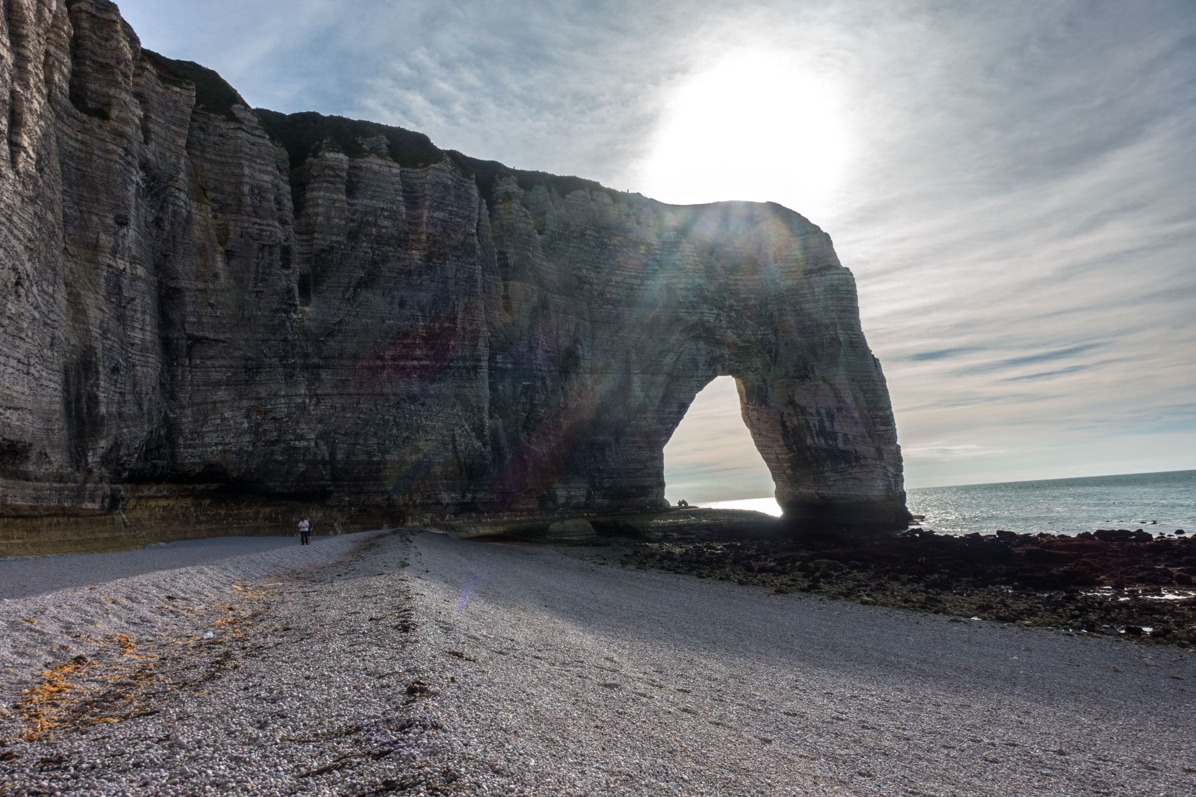
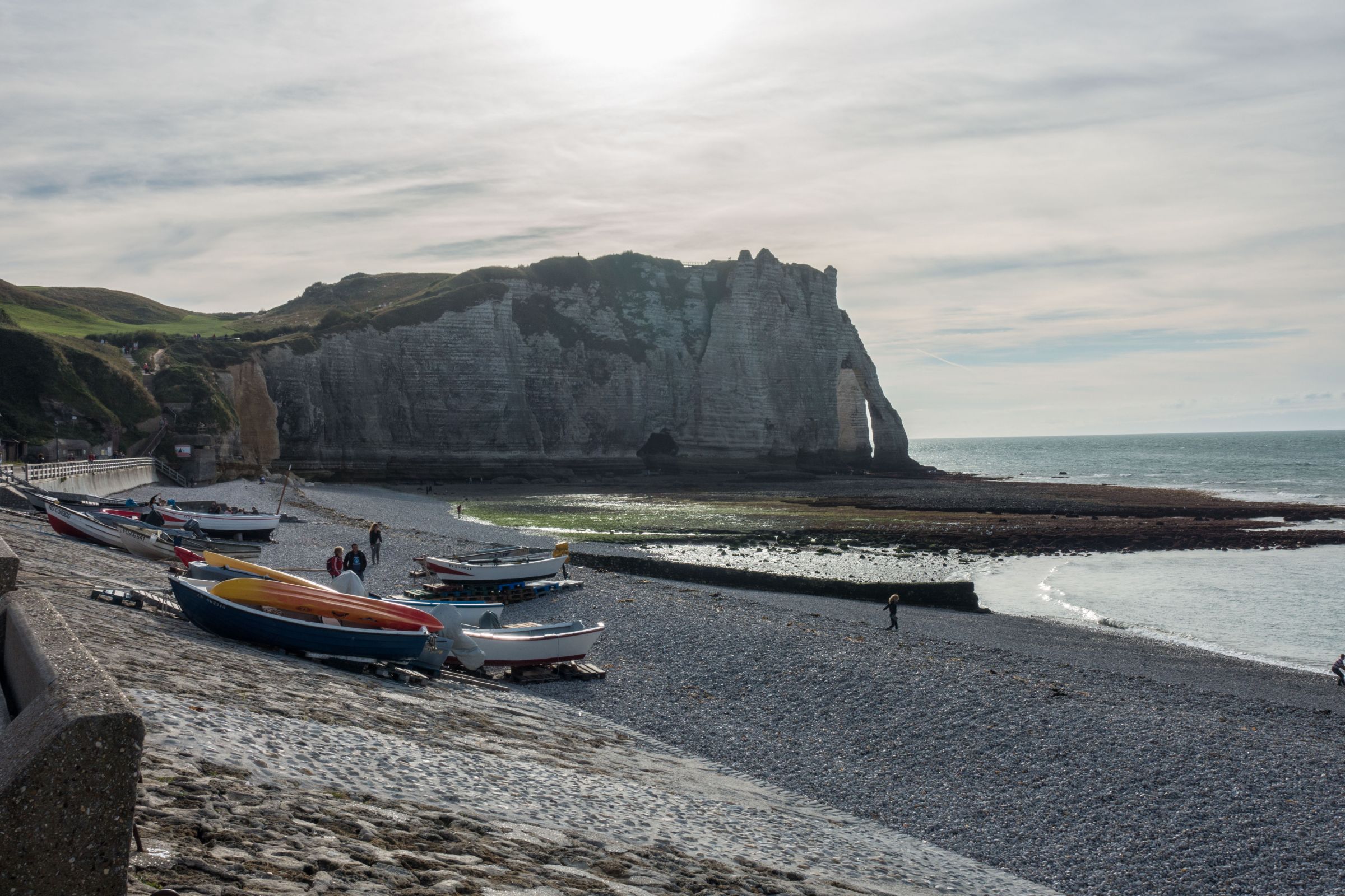
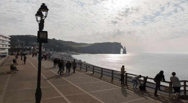
It’s breathtaking to watch the waves crashing against the arches. They are accessible during low tide only. When I walked through these arches, I felt like a tiny person amongst mother nature. The two arches Porte d'Aval and Falaise d'Amont can be already seen from the popular promenade in Etretat.
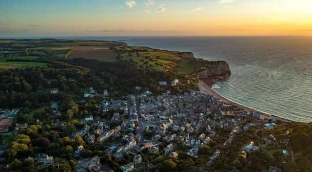
Visit this spectacular coast, and spend at least a day around Etretat. It is just a 30 km drive north of Le Havre.
The best time for Etretat is spring and fall. It’s a pleasant time and not too overrun. The arches are accessible at low tide and most breathtaking at sunset.
July and August, with school holidays in Europe, is the worst time of the year. Continue reading to get detailed information about the weather, crowds, parking, history, hiking, accommodations, and camping.
3 Highlights and Tips

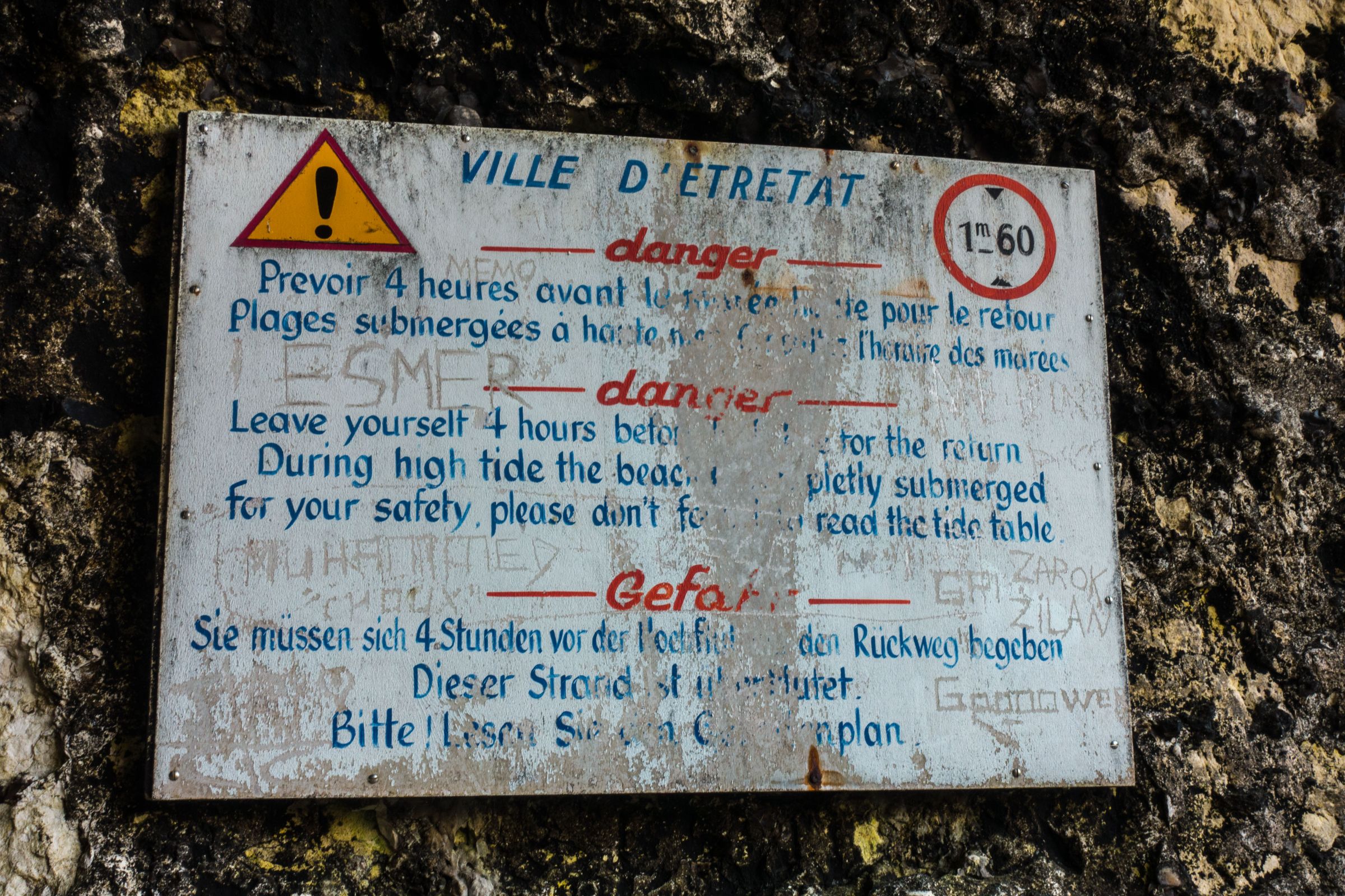
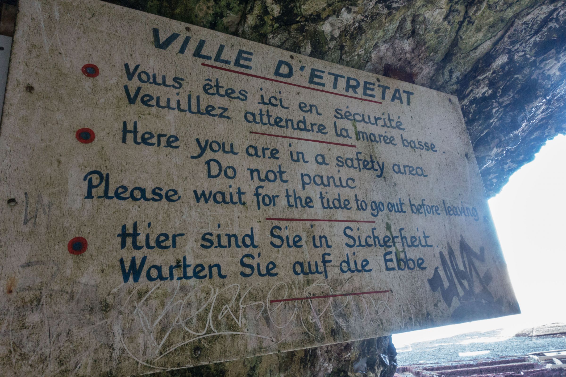
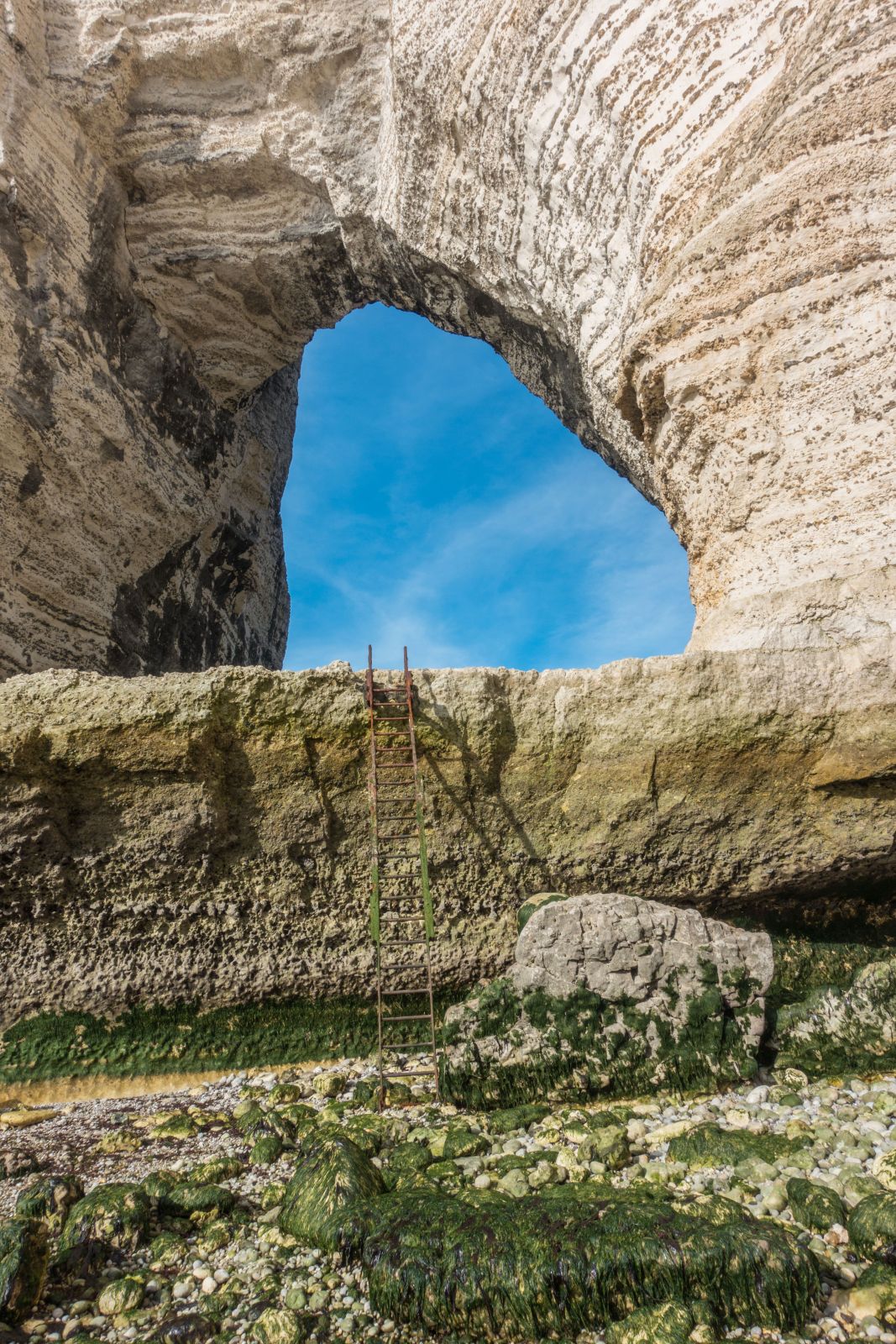
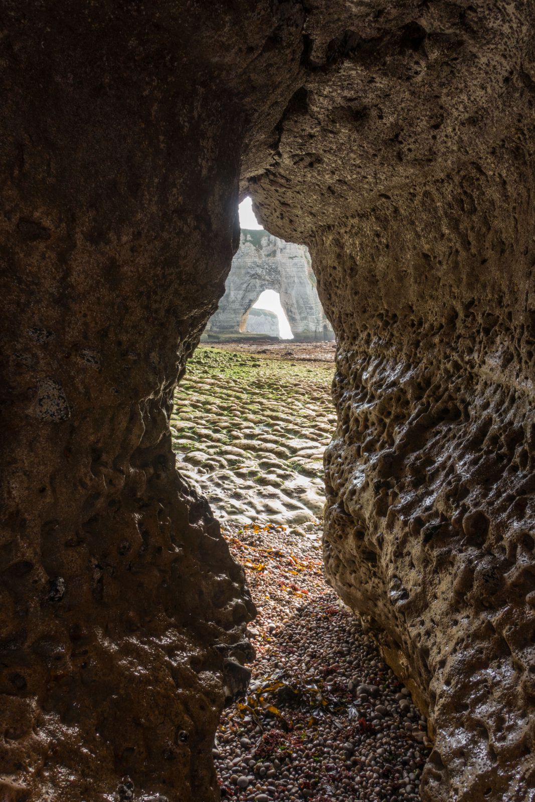
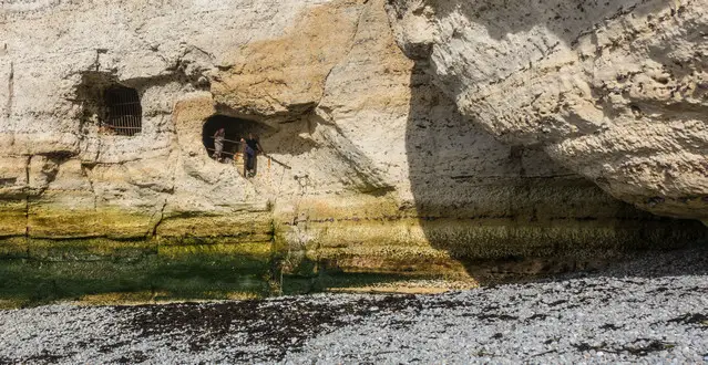
Sometimes visitors are trapped in this cave with the incoming tide. Check out the tide times first!
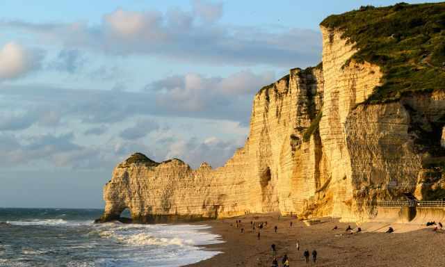
- Watch the arches during high tide from the different viewpoints from the top of the white cliffs.
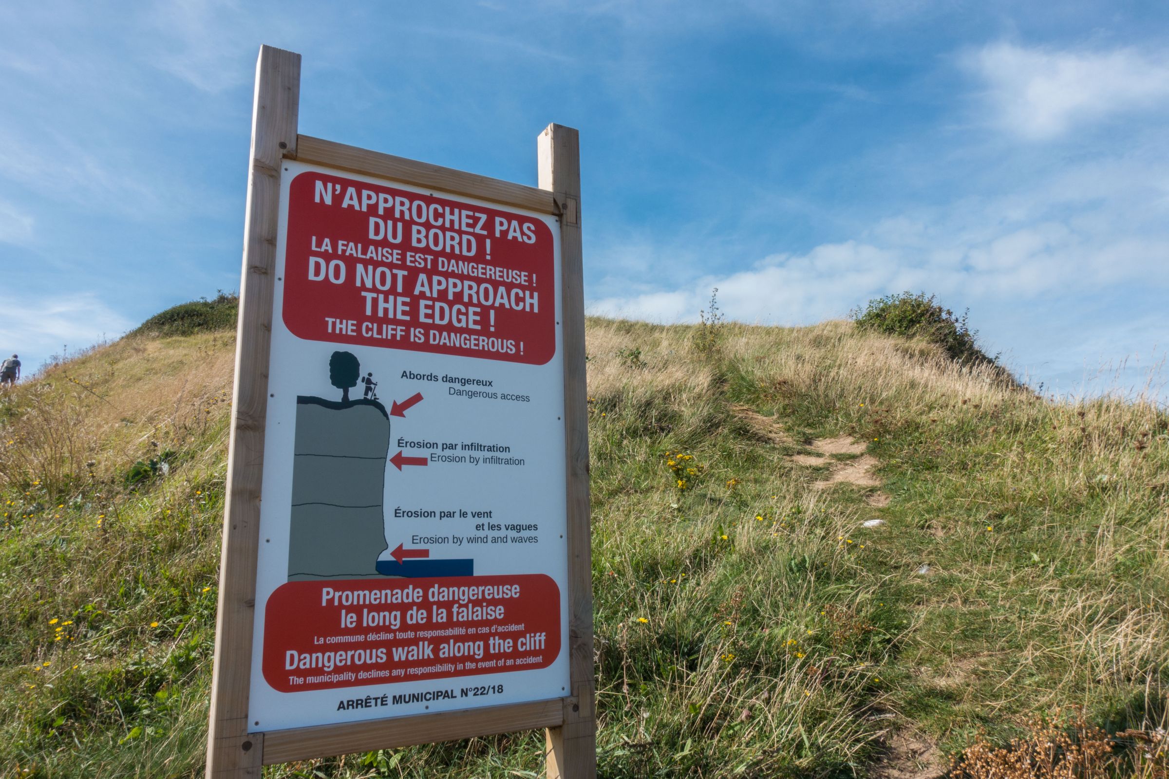
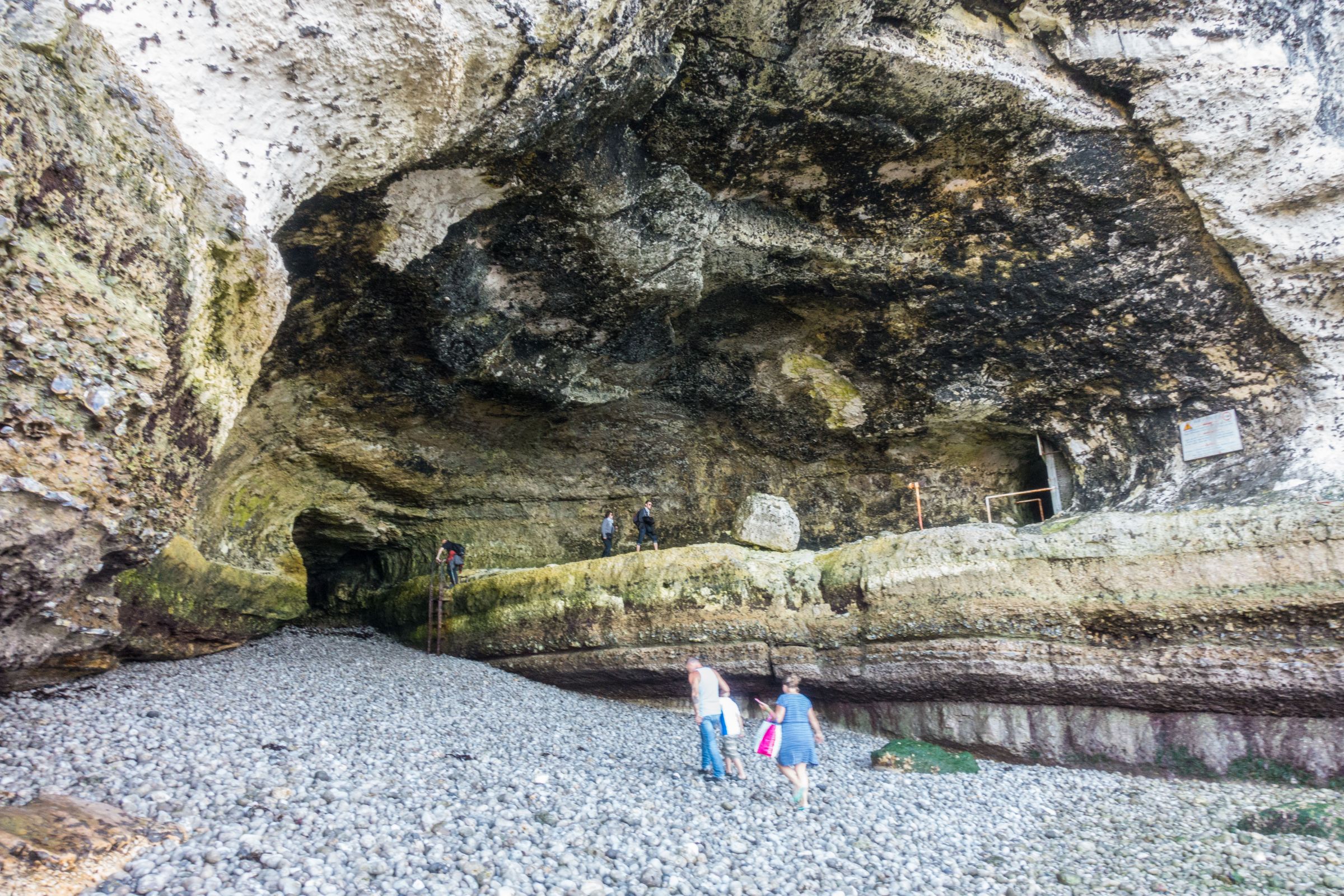
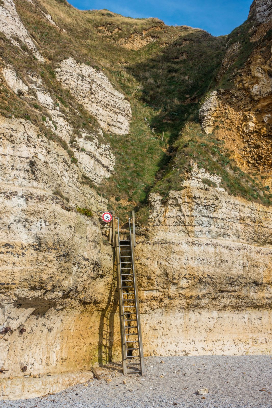
- Walk to and through the arches during low tide, between two hours before and one hour afterwards. Check the tides properly; otherwise, you may get trapped in the cave, but it is safe to stay in there. There is one ladder and a steep trail up at the end of the arches to escape the flood. Tide Times Etretat
- The late afternoon light is the best time of the day for perfect shots of this fascinating piece of nature. In addition, the crowds thin out at this time of the day.
Weather and Crowds by Seasons
The Atlantic Ocean mildly influences the climate at Etretat and the coast of Normandy. Weather is unpredictable, and rain occurs throughout the year. Summer is the driest time, and November is the wettest month. Strong winds frequently occur at the coast, and it's often partly cloudy or overcast.
Spring (March-May)
Comfortable temperatures from April to May ranging from 15-17°C. Night temperatures usually drop below 10°C. Busy during easter and especially in May at Labour Day, Victory Day, and Ascension Day. It's warming up in April and May, but a warm jacket is needed due to the wind and sea breeze. Precipitation occurs throughout the year it rains on average every second day.
Summer (Juni-August)
Day temperatures are pleasant, around 20°C on average but topping 25°C as well. Nights are cold temperatures ranging from 15-13°C. The sea temperature is pretty cold between 15-19°C from July to October. June to September are the driest months. July and August, the summer holidays, are the best months regarding the weather and the busiest at the same time. However, there is plenty of space and you get away from the crowds when you hike through the arches or to the clifftops. Weekends, the Bastille Day in July, and Assumption Day in August are the worst during summer. Try to avoid these days.
Autumn (September-November)
September is still pleasant at around 20°C. It’s getting cooler in October but still an awesome month with temps around 16°C during the day. November is cold, around 12°C, and the wettest month of all. Increasing precipitation from the end of September. September is still busy, but crowds are bearable. From October onwards fewer people come to Etretat. The weather is unpredictable, and strong winds can occur.
Winter (December-February)
Decreasing rainfall from February onwards. It can be pretty chilly during this time of the year, although the temperatures are mild, slightly below 10°C. Storm occurs often. However, nights are rarely near freezing. Despite the weather, the scenery is spectacular, and impressive pictures can be taken.
Accommodations and Camping in Etretat

Many holiday homes are available, but if you plan to stay here for a night or two, we highly recommend the 400 years old half-timbered Hotel La Residence. The rooms and bathrooms got modernized; however, it still has the former time's cosy charm. The hotel is fantastically located, just a two-minute walk to the famous beach. The staff is charming. The food in the restaurant ("Moules Normande" – steamed mussels in calvados and wine cream) was excellent, and the cidre as well.
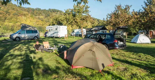
If you plan to camp in Etretat, I only recommend the shoulder season but not the summer months. There is just one campground next to the road. Camping Municipal d'Étretat (Google Maps) is usually super busy from June to September. The sites in the back were nicely located but next to the road all campervans and tents were packed together without any privacy. We chose a campground next to the river Seine. It took us some time to get to Etretat, but it was quiet with lots of privacy. So, it depends on what you want; staying close or quiet with space. That is our tent, and my husband enjoyed the sunset in his chair.
My Top Tip
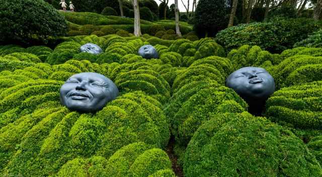
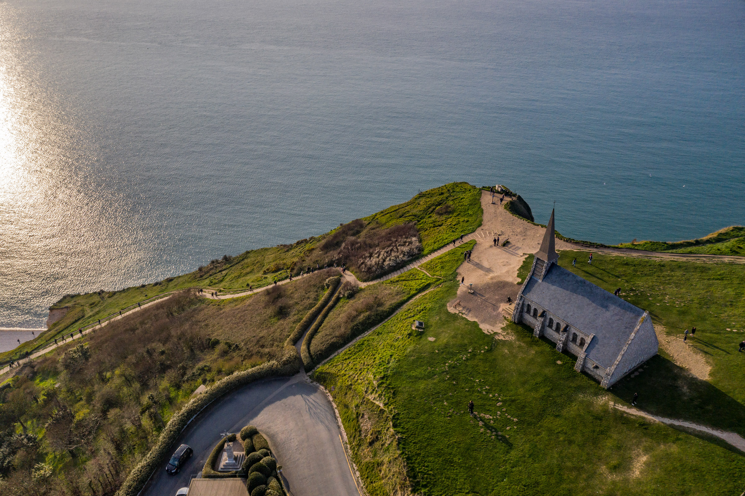
Don't miss Les Jardins d'Etretat - The Etretat Garden inspired by the painter Claude Monet. This garden is separated into seven parts. It is a beautiful mix of art and garden with music compositions in the background and exceptional scenery. Best of all, it is not crowded but instead quiet and peaceful.
Location Google Maps Etretat Garden is close to the chapel.
Best Months to Visit
Location and Tips

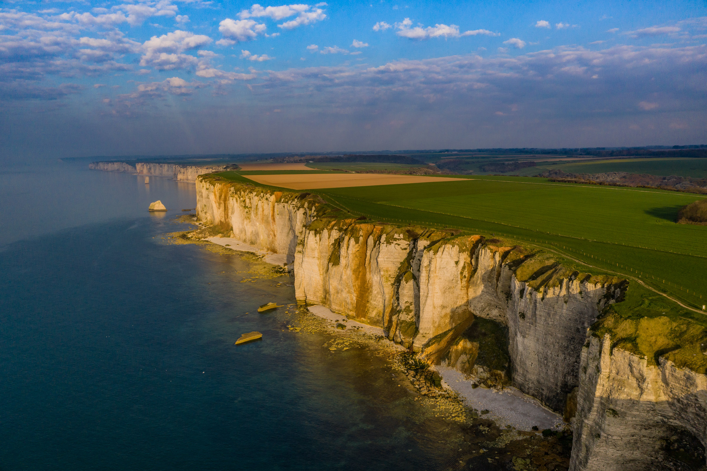
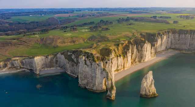
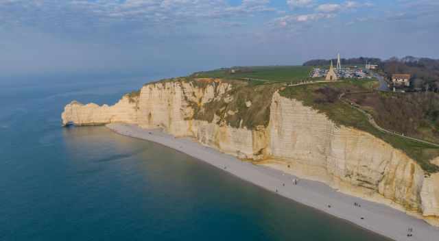
Etretat is located just half an hour north of Le Havre. The almost 80 km long Alabaster Coast "Cote d'Albatre" in the "Haute-Normandie" stretches from Dieppe to Etretat. The famous cliffs are made from chalk built up over millions of years. In my opinion, the cliffs look similar to those in Dover.
I assume you've already seen the picturesque landscape on Monet's paintings. During his frequent visits from 1883 to 1886, he painted a series of the Etretat scenery. The Normandy is also renowned for major "cidre" and calvados production, which you should try.
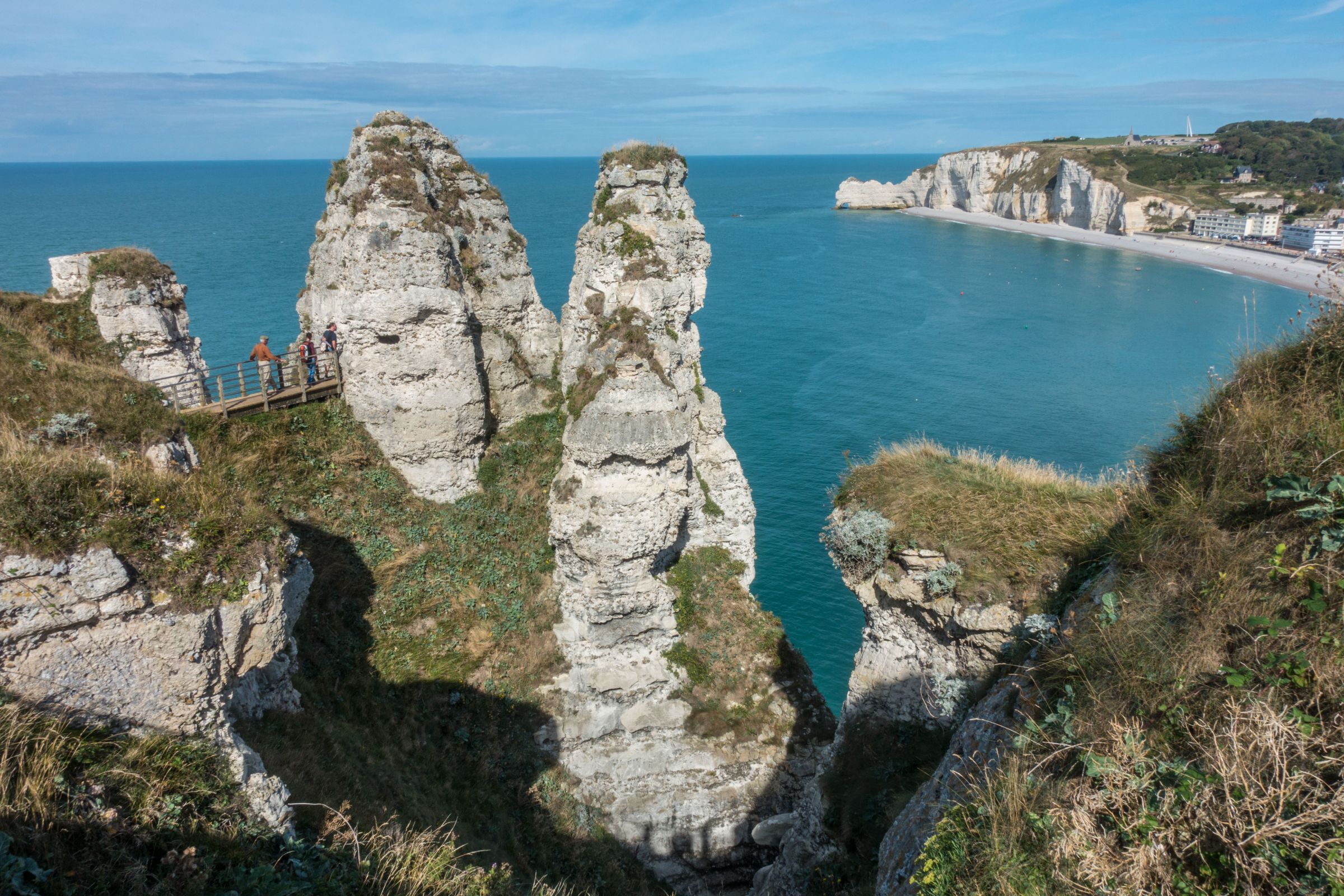
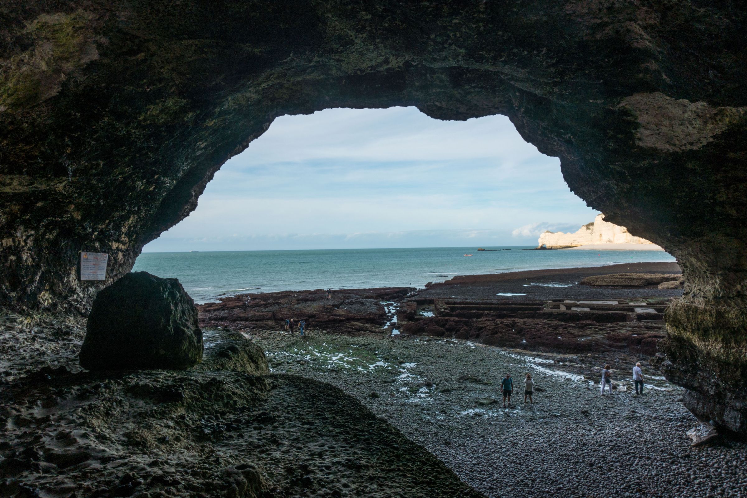
Natural cliff arches and stacks can be seen from the clifftops along the coastal trail if you don’t have any fear of heights.
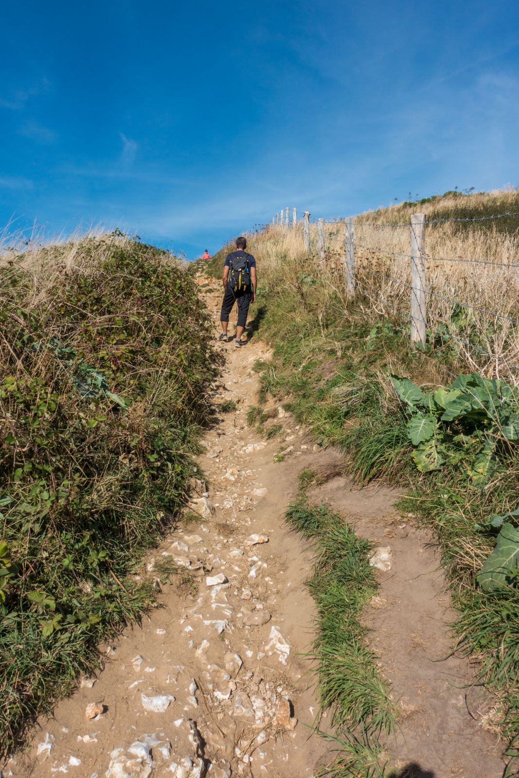
3 Hiking Trails
Three breathtaking hikes start in Etretat. We spent an entire day in this lovely town and along the cliffs, but this was much too short. We only could do two of the three different walking paths.
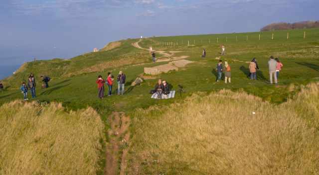
- The beautiful coastal walk to the different outlooks to the natural arches is a steep up and down hike. Enjoy the spectacular scenery on this circular trail. Hike until the lighthouse (Google Maps), then left and direction La Place. When you leave the village, the path leads through a forest direction Valaine. Before you enter the town, turn left direction the golf course. You can also shorten the walk and return the same way to enjoy the landscape again as we did. Trail length 12 km - duration between 3-4 hours
- his hike also leads along the coast but to the other side direction Yport. You can either start in Etretat or on the clifftop at Chapelle Notre-Dame-de-la-Garde. The chapel got destroyed in WWII and got rebuilt in 1950. Hike until the beach Plage De Vaucottes which takes 7 km - 2 hours one way. Hike the same way back.
- This is the most spectacular and less frequented walk. Climbing skills are needed several times. The hike can be done at low tide only. Walk along the pebbled beach but don't take any of the pebbles back home. They are natural protection during strong surf and storms. First, you pass by a bunker to get to a tunnel. From here, you need to climb down to the beach. Tip: Walk carefully along the rim until the end. That is much easier than using the rope and jumping down.
Now continue walking and climb down a ladder. Such a breathtaking scenery, but always have in mind when the tide is coming in. It's safe to hike here two hours before and one hour after low tide.
Packing List
- Carry plenty of water. There isn't any shop available along the trails and coast.
- A light snack or sandwich; the fresh air always makes me hungry.
- Windproof jacket; it is often very windy at the clifftop.
- Sunscreen and hat during summer if you plan to walk here for hours.
- Wear proper shoes for hiking on uneven terrain.
- Plenty of time for this jaw-dropping part of the Normandy!
History

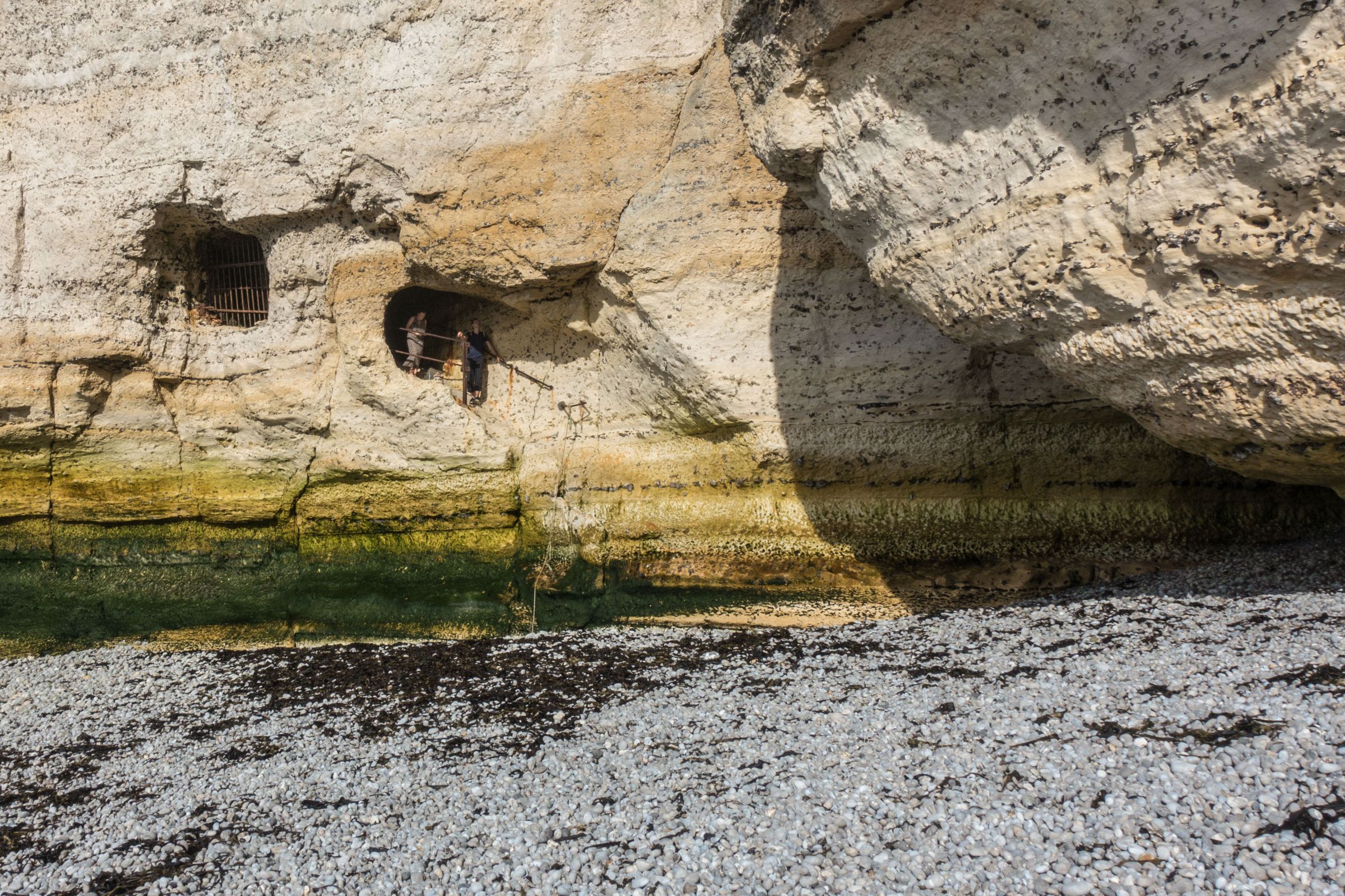
Signs and marks are remembering WWII. Remnants of the concrete bunkers between the cliffs can be seen. Some are only accessible during low tide. One of these bunkers in Etretat is located before the tunnel at “Ponte d’Aval”. 1.500 mines were buried along the beach. The bunkers were built, and the mines were buried to prevent the allied landing during the war. It’s hard to believe what happened here just 75 years ago.
Parking Etretat

Free parking at the village entrance Google Maps
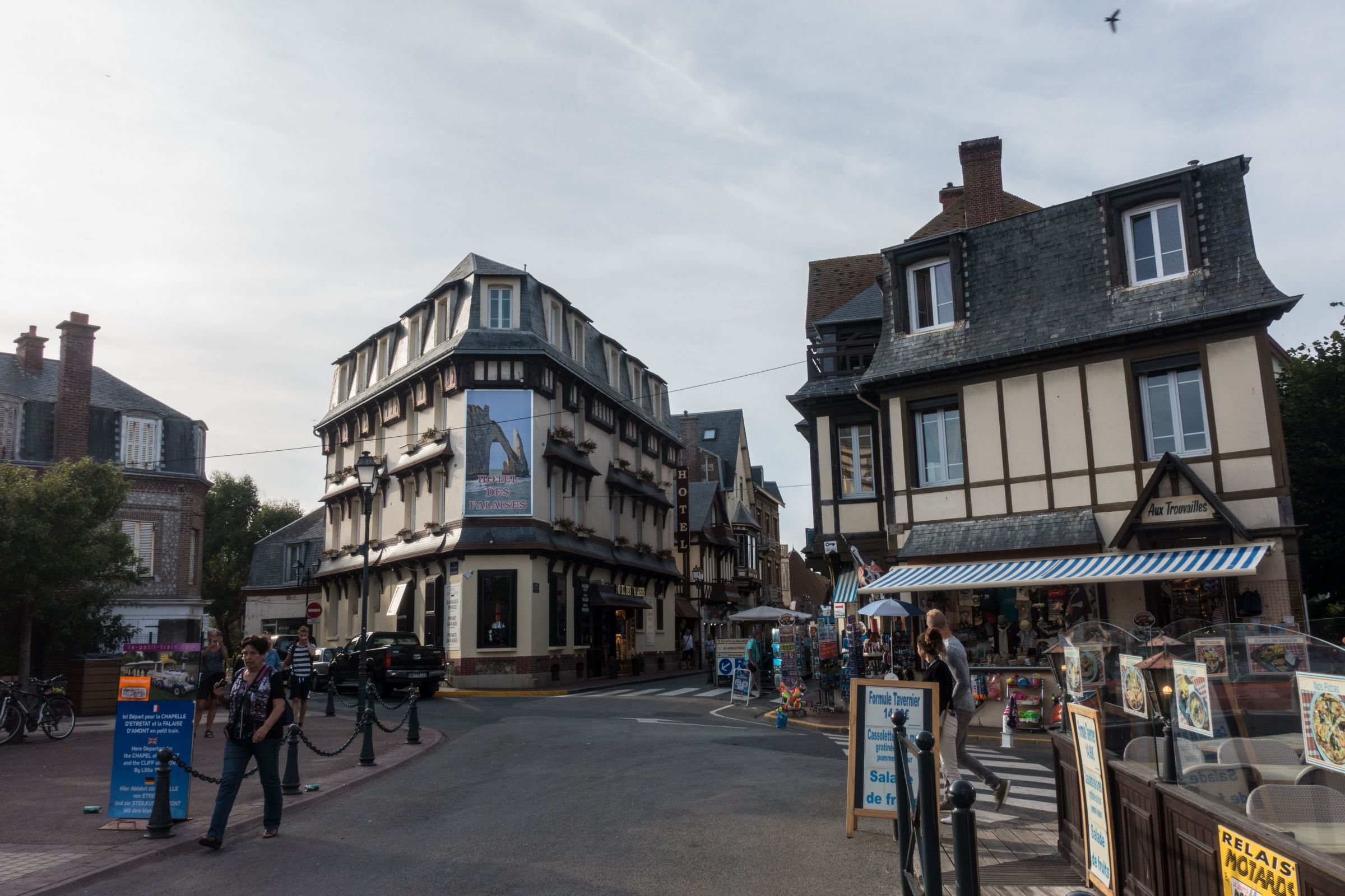
There are two huge parking areas in Etretat requesting a fee but fill up quickly. An additional parking area for free is located at the town entrance. It’s a 15 minutes walk to get to the promenade and beach in Etretat from the outside parking. You pass the house of Arsene Lupine by Guy de Maupassant (1850–1893) build in 1883, the information centre, and some nice Norman groceries and souvenir shops.

Parking Information Center Google Maps
Enjoy traditional Norman cuisine and the typical cidre. People with mobility issues can see the arches Falaise d'Aval and Falaise d'Amont from the promenade already.

Parking next to the Etretat beach Google Maps
If travelling by car, you can drive up to the top of the cliffs to chapel “Chappelle Notre-Dame de la Garde”. Parking for free is available. Enjoy the view of the beach and the cliffs from a distance.
If you have a day to spare book a kayak or speedboat tour to get another impressive perspective from the sea to the white cliffs.
Some of these outstanding pictures are provided by my friends Chris and Jens