
When Is the Best Time
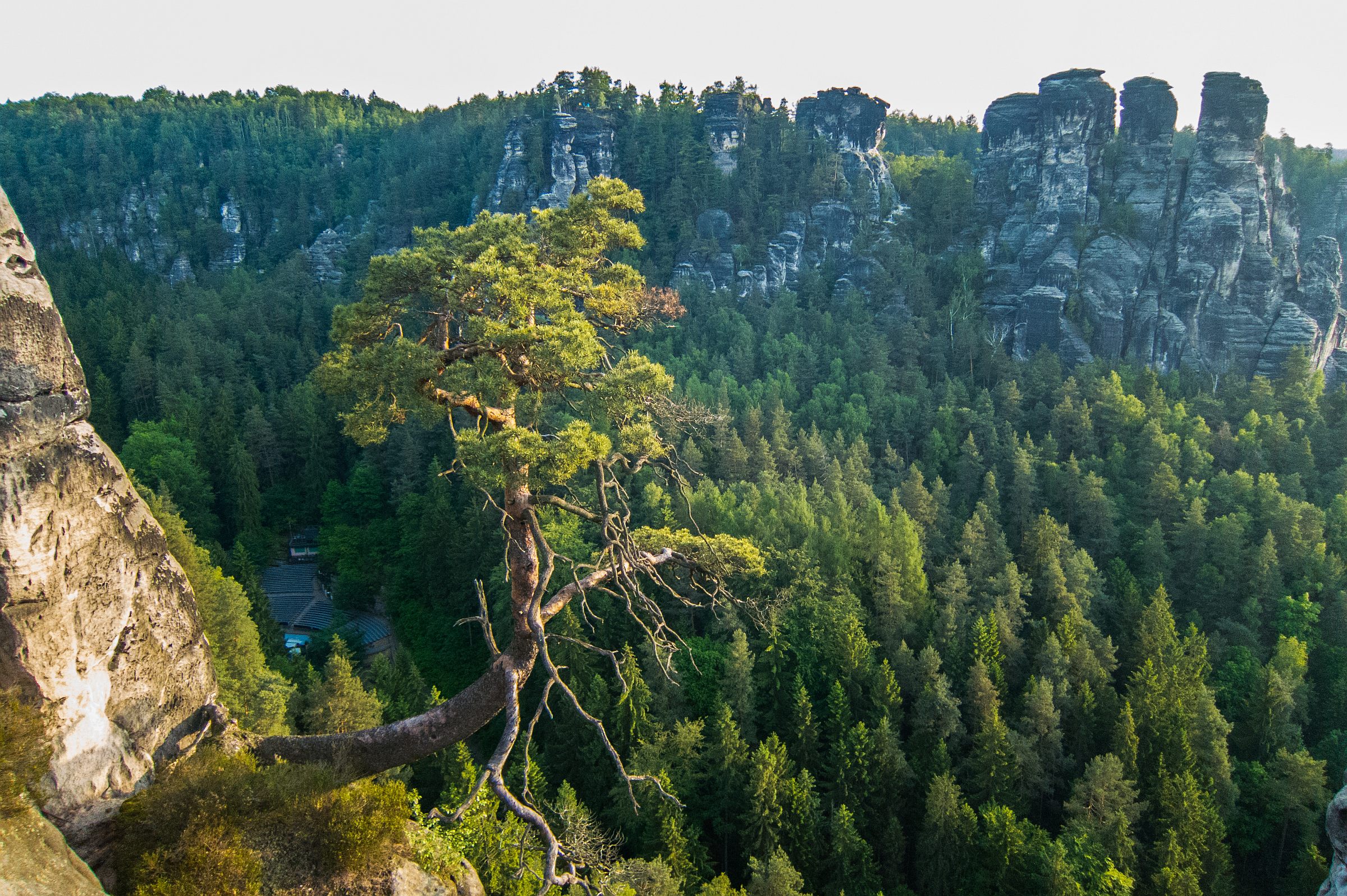
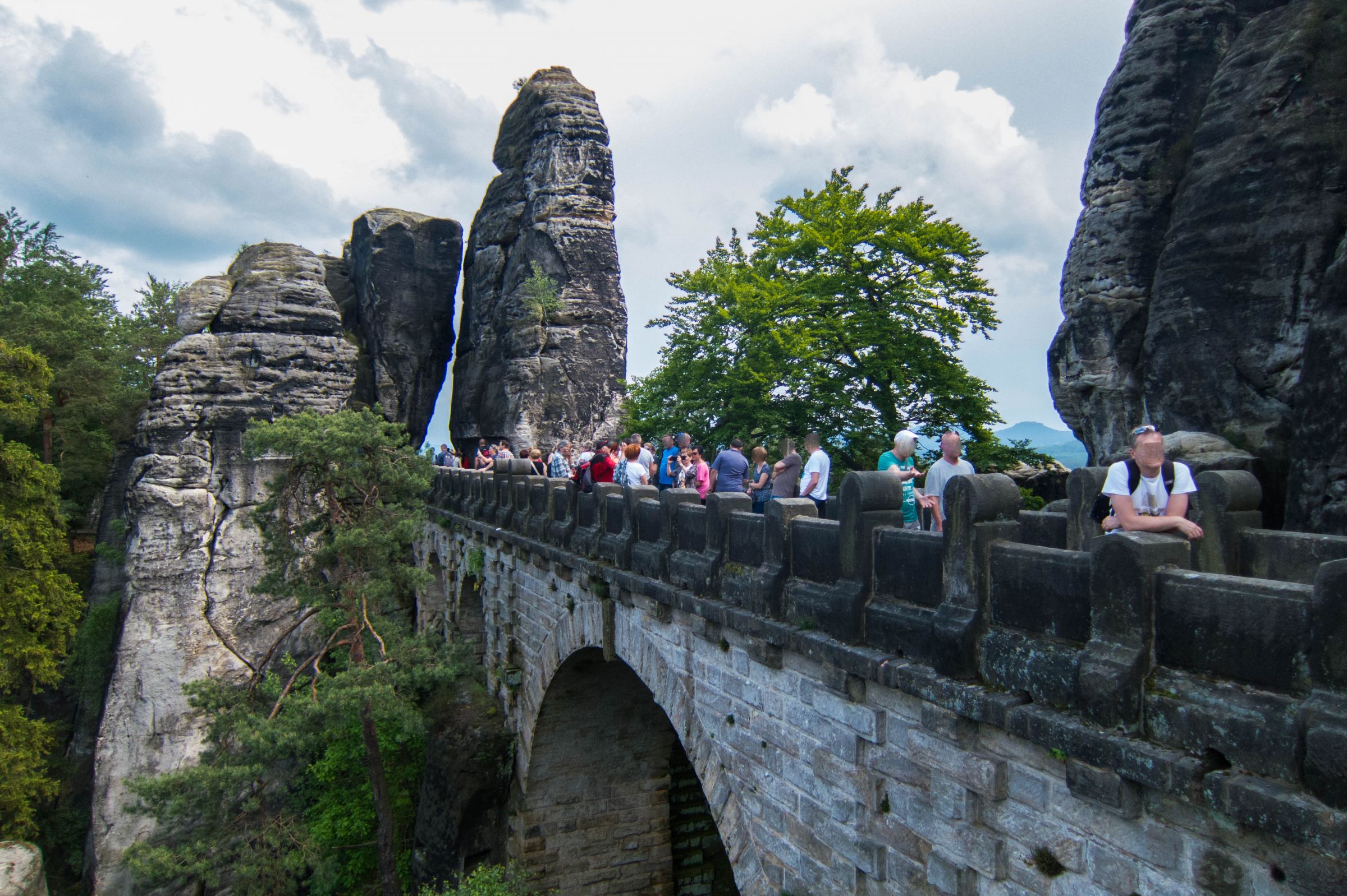
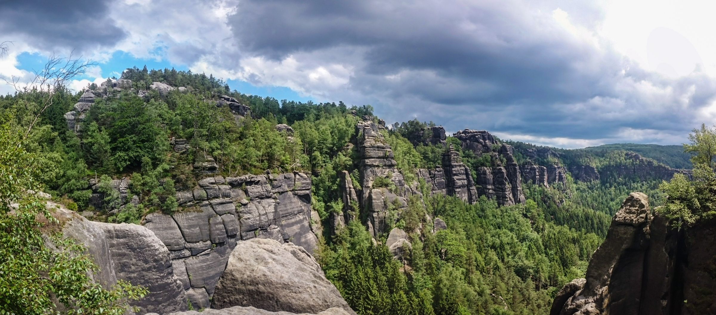
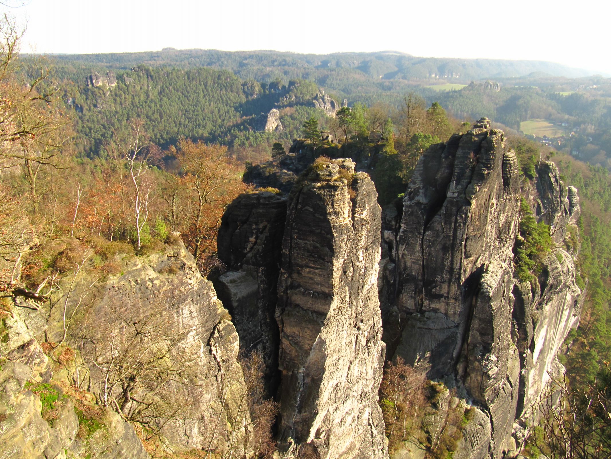
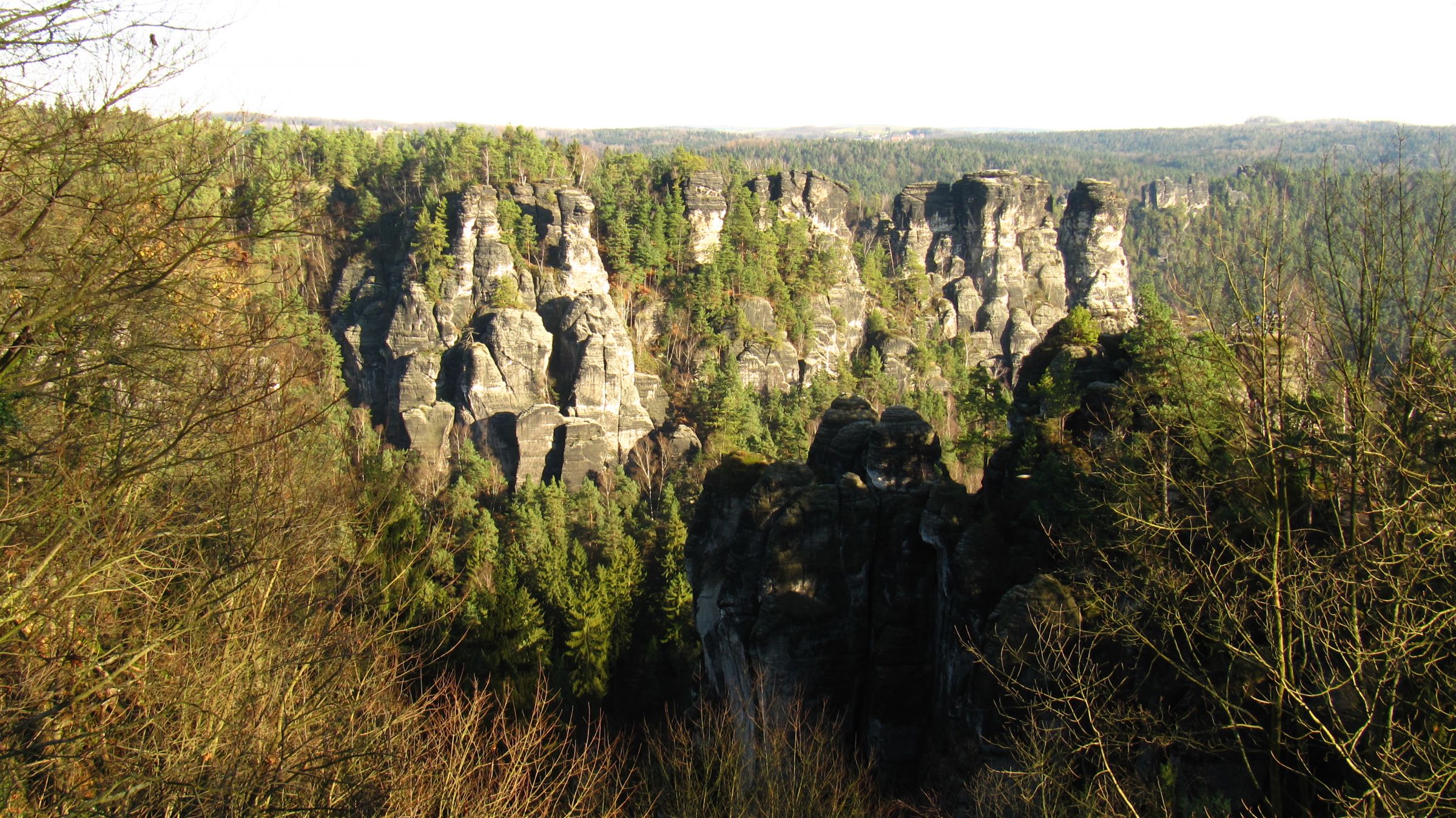
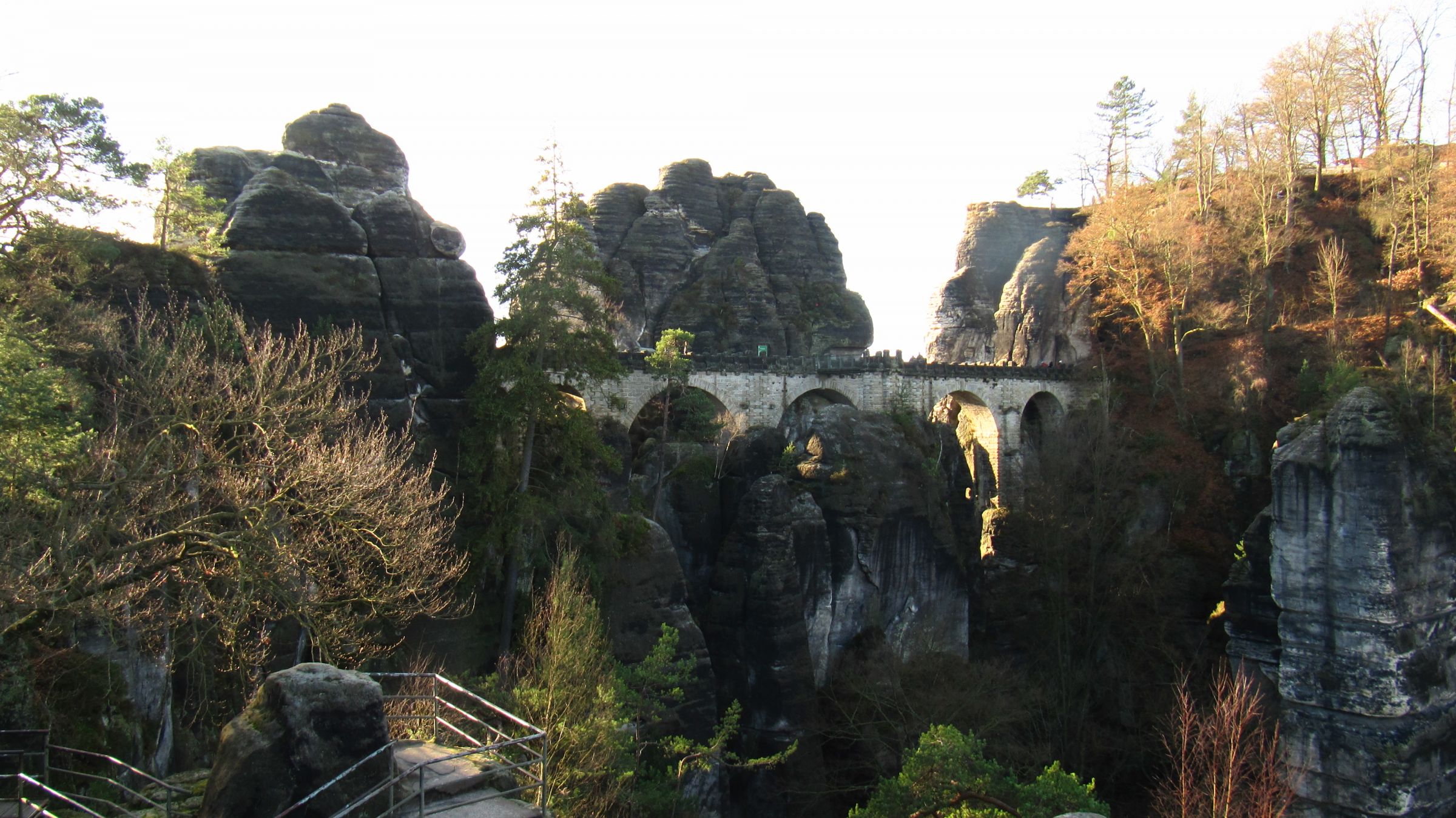
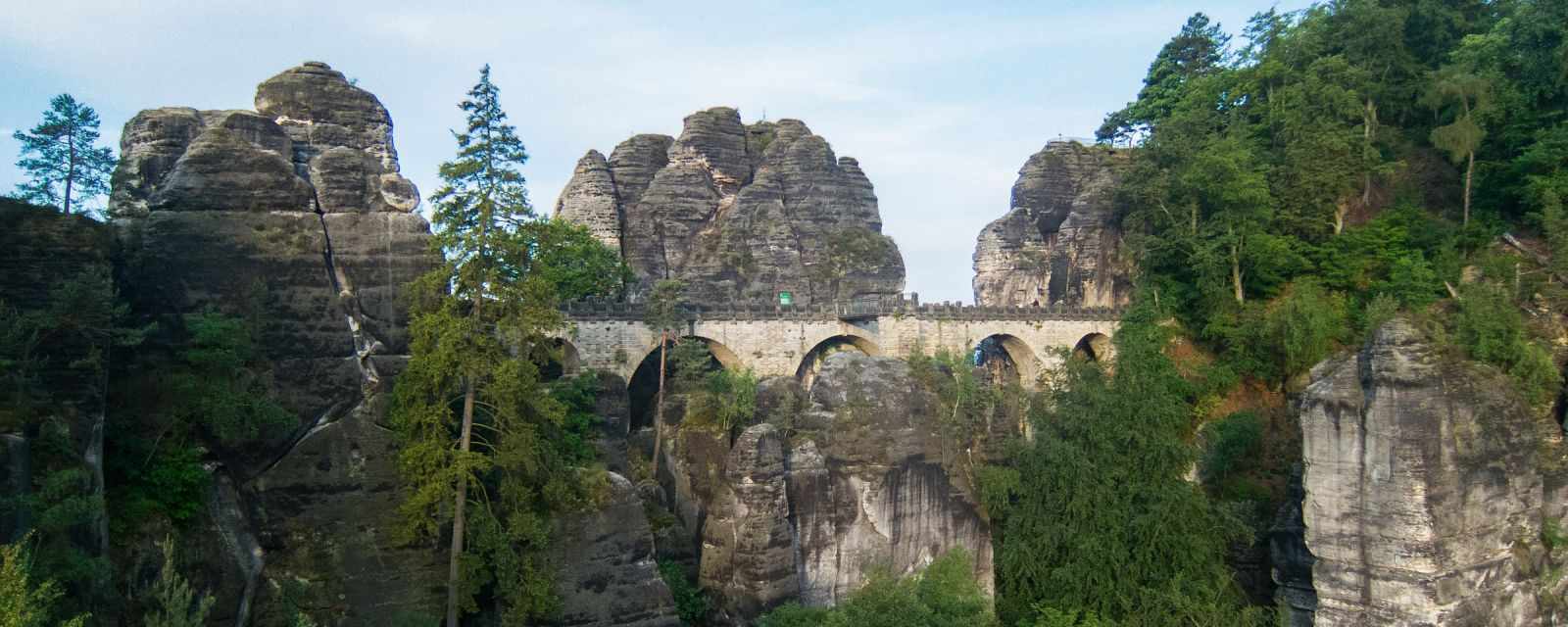
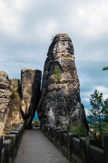
Located in Saxon Switzerland National Park are the famous Elbe Sandstone Mountains. Here you can visit breathtaking sights like the 194 m high Bastei Bridge, hike stunning trails and even climb gorgeous rock formations. The region got already developed for tourism at the end of the 18th century. Many visitors come here simply to visit the main attraction, the Bastei Bridge, and the remained ruins of the Neurathen Castle. We spent more than a week here because there is so much more to explore.
I wrote this guide for everyone: Sightseeing only visitors, as well as hikers, and climbers. I provide my personal accommodation tips as well as tips for cruise tours from Dresden. Read my complete guide below, including weather details and tips for the Bastei Bridge or jump directly to 9 Must-Do Sights and Hikes in Saxon Switzerland National Park with insider tips!
Avoiding the Crowds in Saxon Switzerland

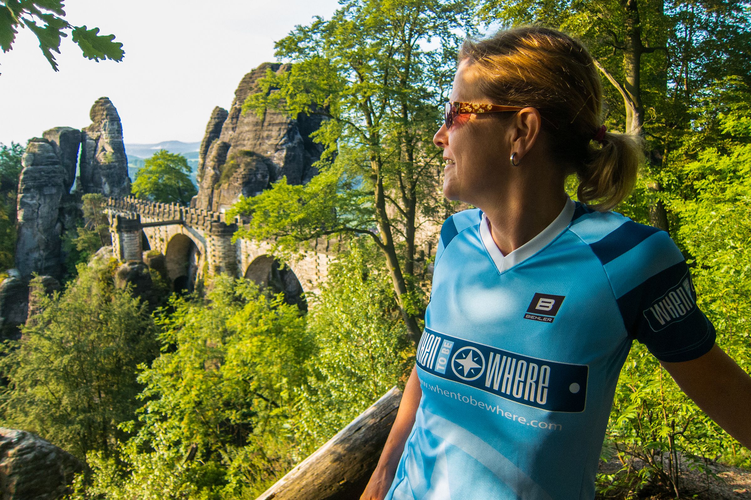
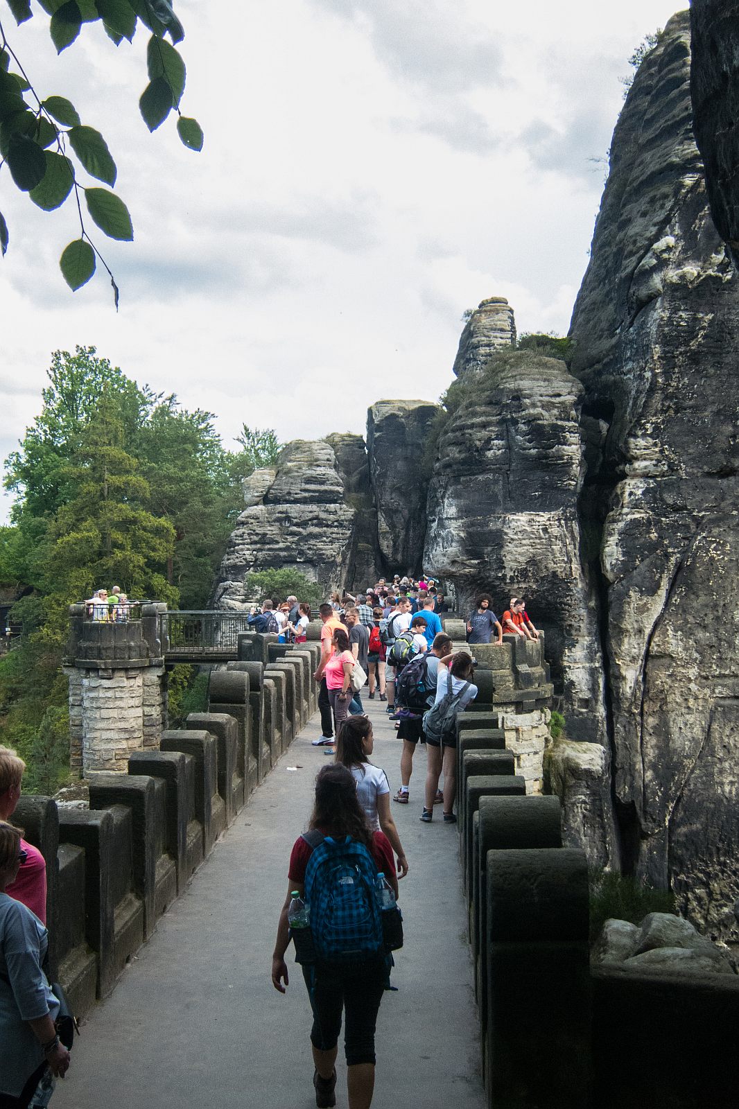
It is the most popular place in Saxon Switzerland, with around 1.5 million visitors each year. To enjoy this beautiful place, the Bastei, without crowds, you should visit this fascinating sight in spring, autumn or winter, either very early in the morning or late evening. We visited this magic sandstone bridge several times in May. We enjoyed most our visit at 6.30 on a Sunday morning. We shared this incredibly impressive Bastei Bridge and the surroundings with very few people. Avoid midday when the bridge and the castle ruin are overrun.
What is new since 2023
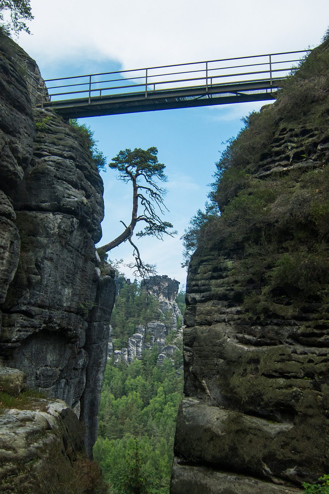
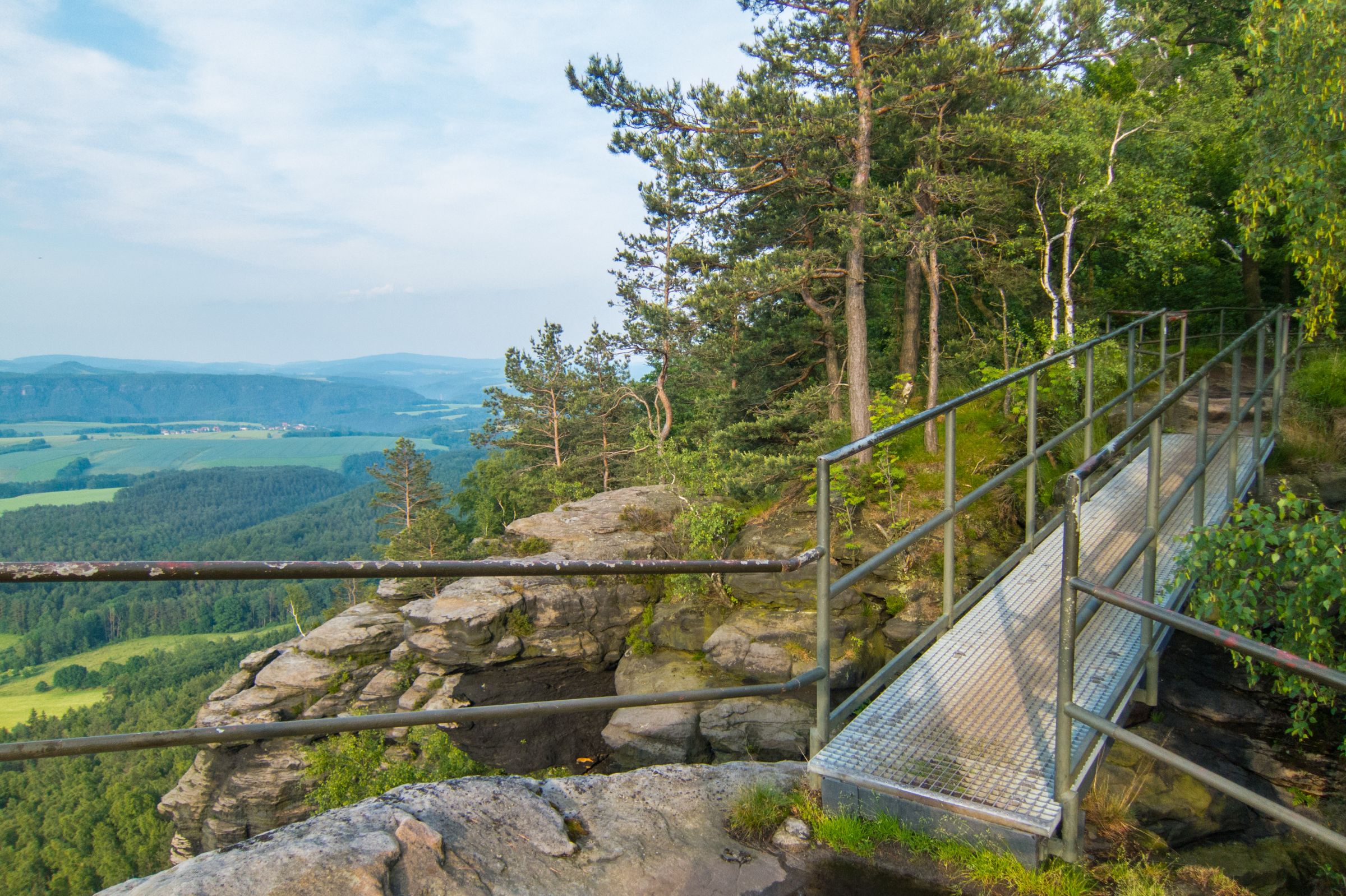
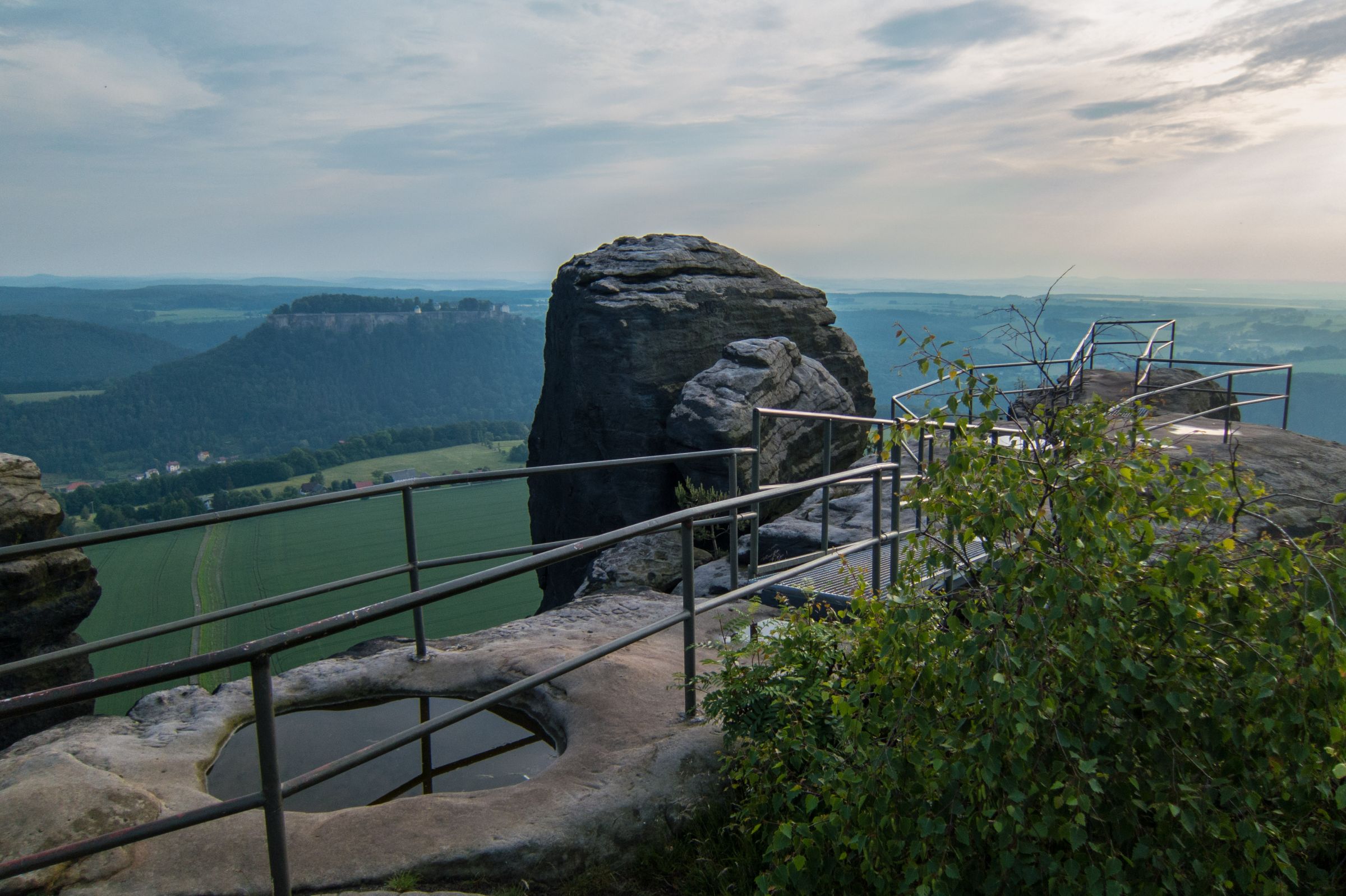
After more than six years, the viewing platform known as the "Balcony of Saxony" at the Bastei Rock in the Elbe Sandstone Mountains of Saxon, Switzerland, was reopened on Friday, February 3, 2023. Visitors can once again enjoy the famous Bastei view of the River Elbe.
The new floating platform is about 20 m long and up to 3.5 m wide. Paths for barrier-free access were also created, and a railing was installed.
The sandstone was porous from erosion, and the last ten metres had to be closed in 2016. After securing the rock, the new platform was placed above it. The construction is supported at the back of the rock and hangs freely in front at a low height so that it seems to float. The total cost is immense at 3 million euros.
Opening Hours Bastei and Fortress Königstein
- The reproduction of the Neurathen Castle is accessible 24/7. From 9 a.m. to 6 p.m., the entrance fee of 2 € has to be paid at a cash desk, and afterwards, you are asked to put the payment into a metal box. This is a fabulous opportunity to enjoy this magical place at sunrise or sunset with only a few people and photographers. If you like to watch the sunset or sunrise in the summertime, it is best to stay next to the Bastei in the Berghotel Bastei.

- The Fortress Königstein is utterly overrun nearly the entire day because of the many tour buses. The crowds start to thin out after 3 pm, and the last hour is the quietest of the day. Open from 9 am – closes at 6 pm from April to October and 5 pm from November to March. Last admission one hour before closure. Every weekend in Advent, the Historical Christmas Market is a highlight not to be missed in December. These weekends are pretty popular. Book your hotel in advance.

Tip for Photographers
To get the perfect shot of the Bastei Bridge, come here early morning. To experience the sunrise at the Bastei is a must but pretty early during summer. We chose the Berghotel Bastei next to the bridge and enjoyed our breakfast afterwards.
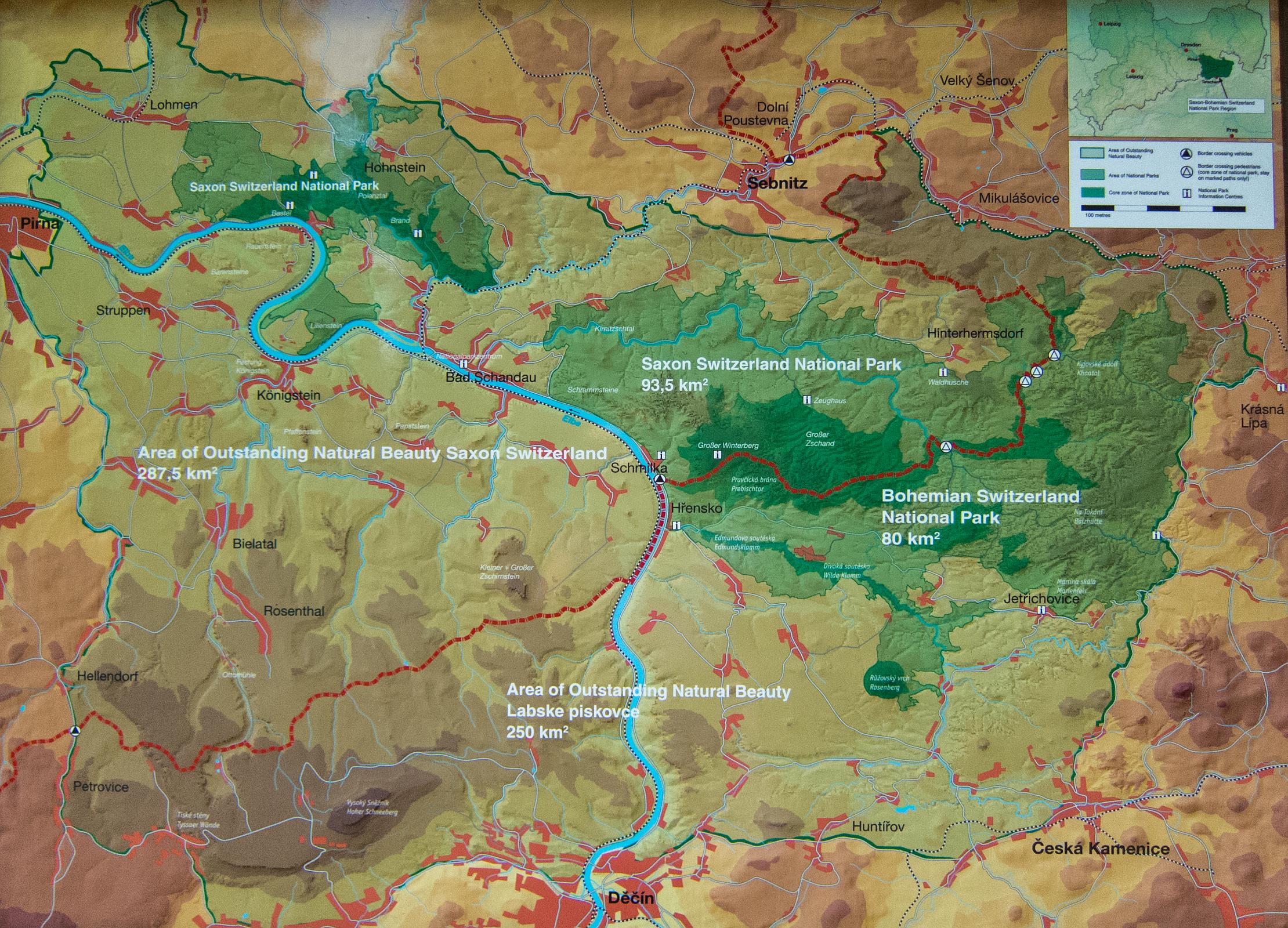
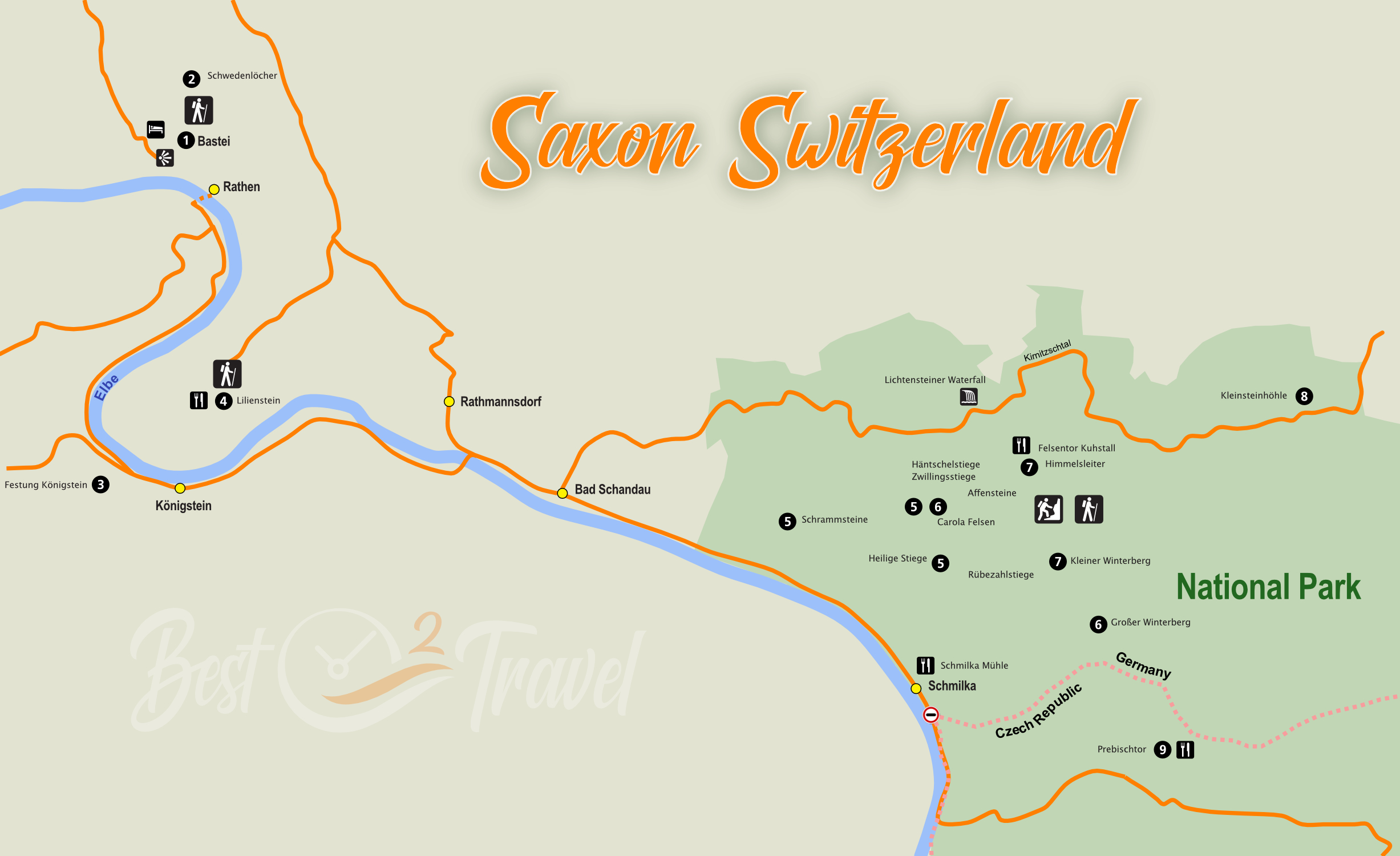
Hiking Map Saxon Switzerland
Weather and Hiking Conditions

Usually, the best time for hiking in Saxon Switzerland and the Bohemian Swiss are from April to October. Regarding the crowds, spring and autumn are the best seasons.
Trails are slippery when wet, especially the iron stairs and stone steps. Leave the mountains during thunderstorms, don't walk on the iron stairs. Winter is awesome when the hills are covered in snow, but the weather is more unpredictable. During summer, it's pleasantly warm, around 20°C in the daytime, but it can get hot while hiking without any shadow in the Elbe Sandstone Mountains.
Expect minus degrees day and night on top of the mountains during winter. It is several degrees warmer at the foot of the mountains. Rain (snow in winter) occurs throughout the year, occasionally heavy thunderstorms during summer. We experienced a thunderstorm and hail at the end of May.
Best Accommodations Nearby
- The Berghotel Bastei in the heart of the National Park and next to the famous Bastei Bridge is the best choice if you are limited in time. You couldn't wish for a better location. The balconies have spectacular views. The breakfast buffet offers a huge variety, and the panorama restaurant is perfect for bringing the day to a close with an excellent dinner. Lots of hikes can be done from here as well.

- Bad Schandau (Hotel List) is a small town ideally located in the middle of the National Park, close to all attractions and hiking trails Saxonian Switzerland offers. Check out the many hotels and get the best prices for Bad Schandau.
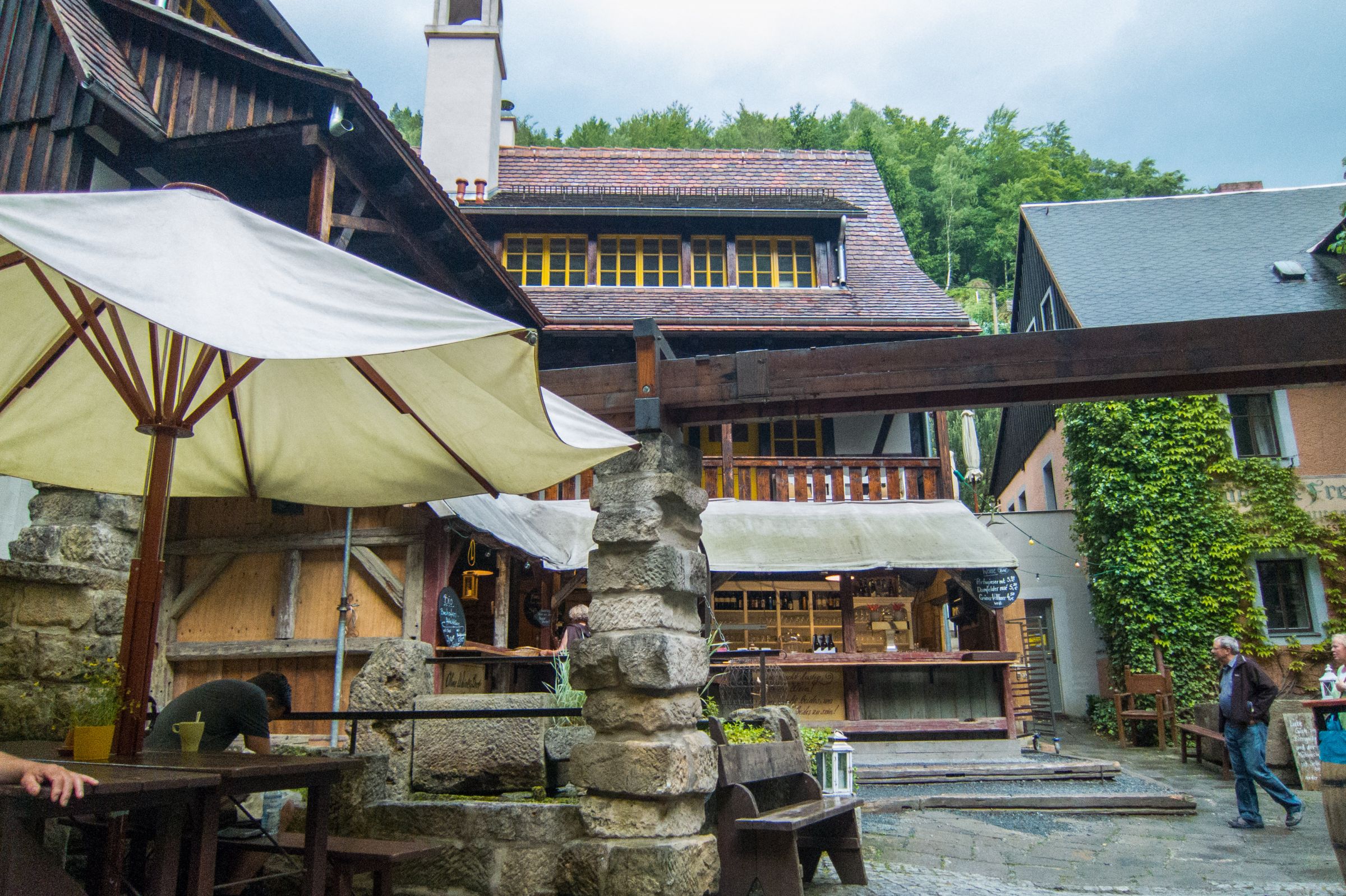
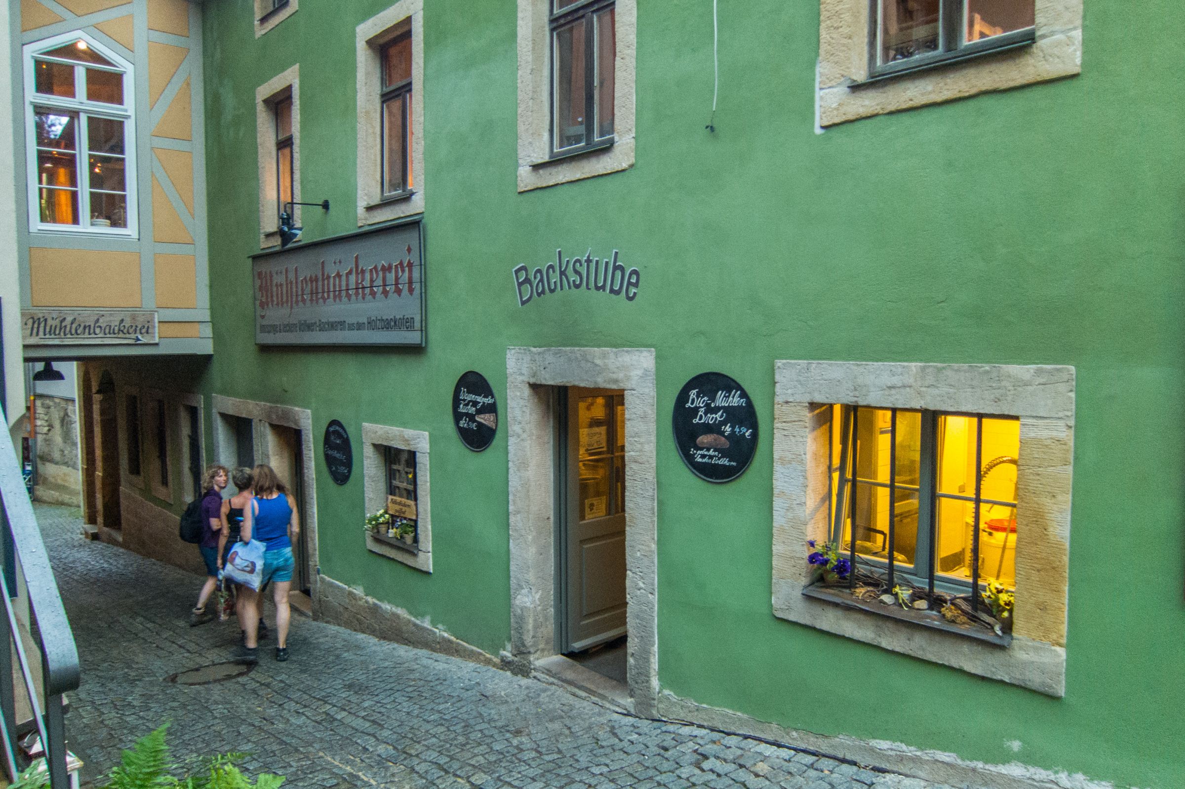
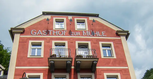
- We like the little village Schmilka with an exceptional organic bakery, the "Schmicksche Mühle", and the organic boutique brewery most. They also offer delicious food which you can enjoy in the beer garden of the old school "Zur Alten Schule". There are some excellent guest-houses in the area all close to the National Park.
Directly behind the hotel starts the "Painters Way", a gorgeous hike up to the most famous rocks. The bus for hikers departs 200 meters away. Schmilka is located next to the German-Czech border and one of our favourite hikes to the "Prebischtor". More about the different hiking trails in the description.
Getting to the Bastei from Dresden (Tips & Tours)
Click the image to see our favourite tours in Saxon Switzerland (not only from Dresden)
For those who are limited in time, you can either take a train from Dresden to Rathen or book a guided tour. The train (S-Bahn) from Dresden Central Station to Rathen operates at least twice each hour. From here you can take a ferry boat to cross the river Elbe. You can't miss the ferry; signs leading to the jetty. After the short ferry ride, it’s a steep trail along with many steps through the forest to the Bastei Bridge. However, consider that there is much more to explore than this picturesque and famous bridge. To discover this excellent hiking region, you can also book a guided trip from Dresden to the Elbe Sandstone Mountains.
Reading Recommendation
 |
If Saxon Switzerland piques your interest, I recommend this National Geographic book. It is genuinely captivating and has ignited my wanderlust, covering 460 European national parks. I would love to visit all of the parks it features, both familiar and new. The exploration was fascinating, and I learned so much. |
Best Tours from Dresden and Prague
If you travel to Dresden or Prague, don't miss this exceptional National Park. Free entrance to the park.
These are my recommended tours via GetYourGuide with 24 hours advance cancellation policy. Thx for booking via my website! With your support, I am able to provide all information first-hand. Tour prices are at no extra cost!
Best Months to Visit
Location and Tips

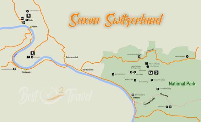
Saxon Switzerland, just an hour drive southeast of Dresden, the capital of Saxony. Saxon Switzerland is named after the region Saxony and Switzerland referring to their mountains. Bohemian Switzerland is located in the Czech Republic. It is a trans-border national park.
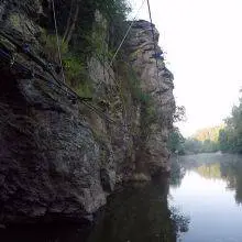
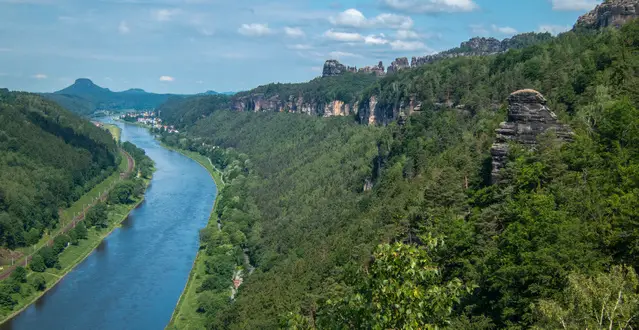
The river Elbe gave the Elbe Sandstone Mountains their shape; it carved the rocky landscape, deep valleys, and gorges millions of years ago. Make a boat cruise for sensational views, take a bike along the river, hike on one of the many well-maintained trails, or climb to the top of a rock. It’s an amazing destination, don't visit it in a rush. Continue reading to get all the insights and highlights of this beautiful piece of nature in Germany.

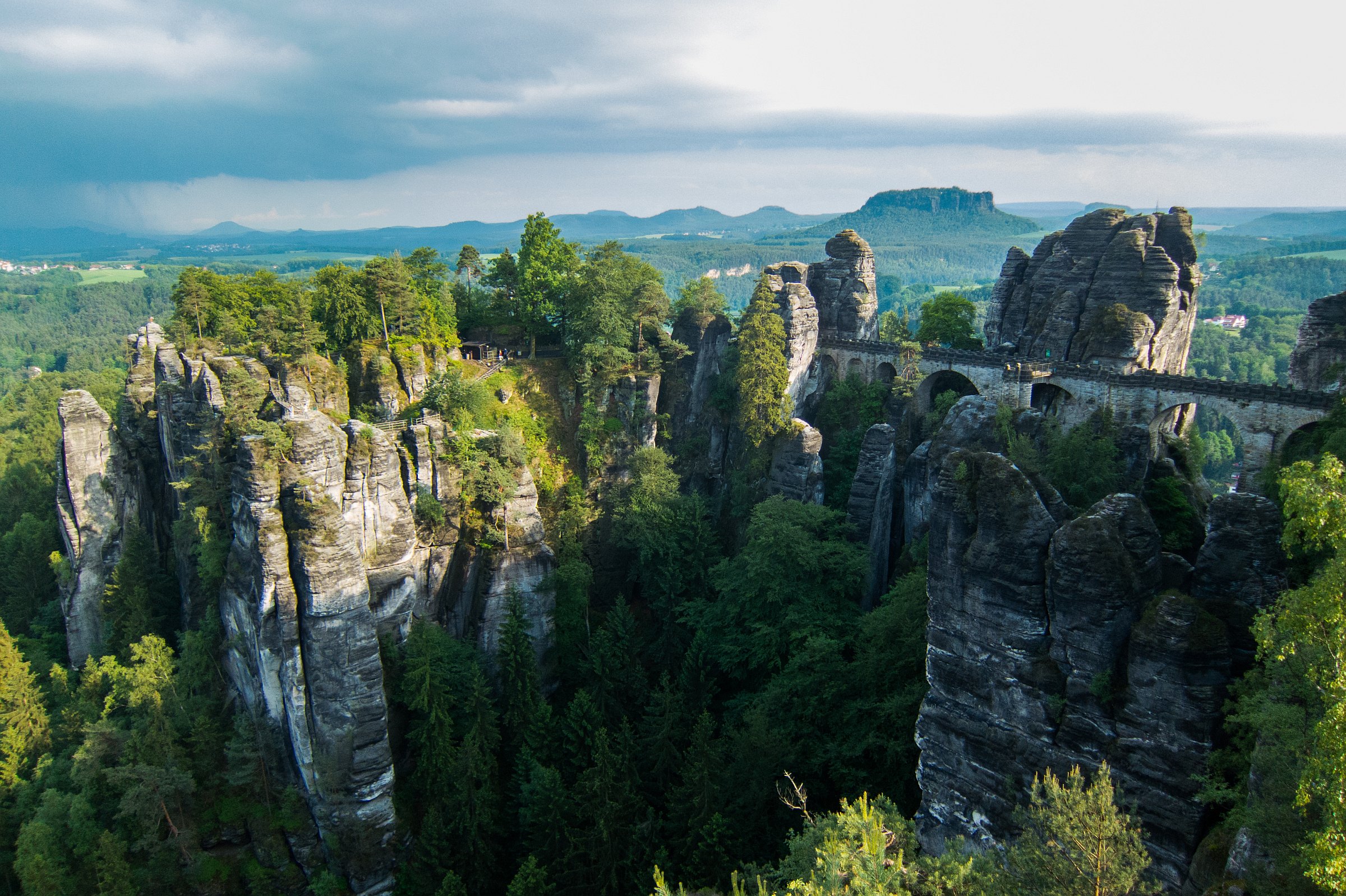
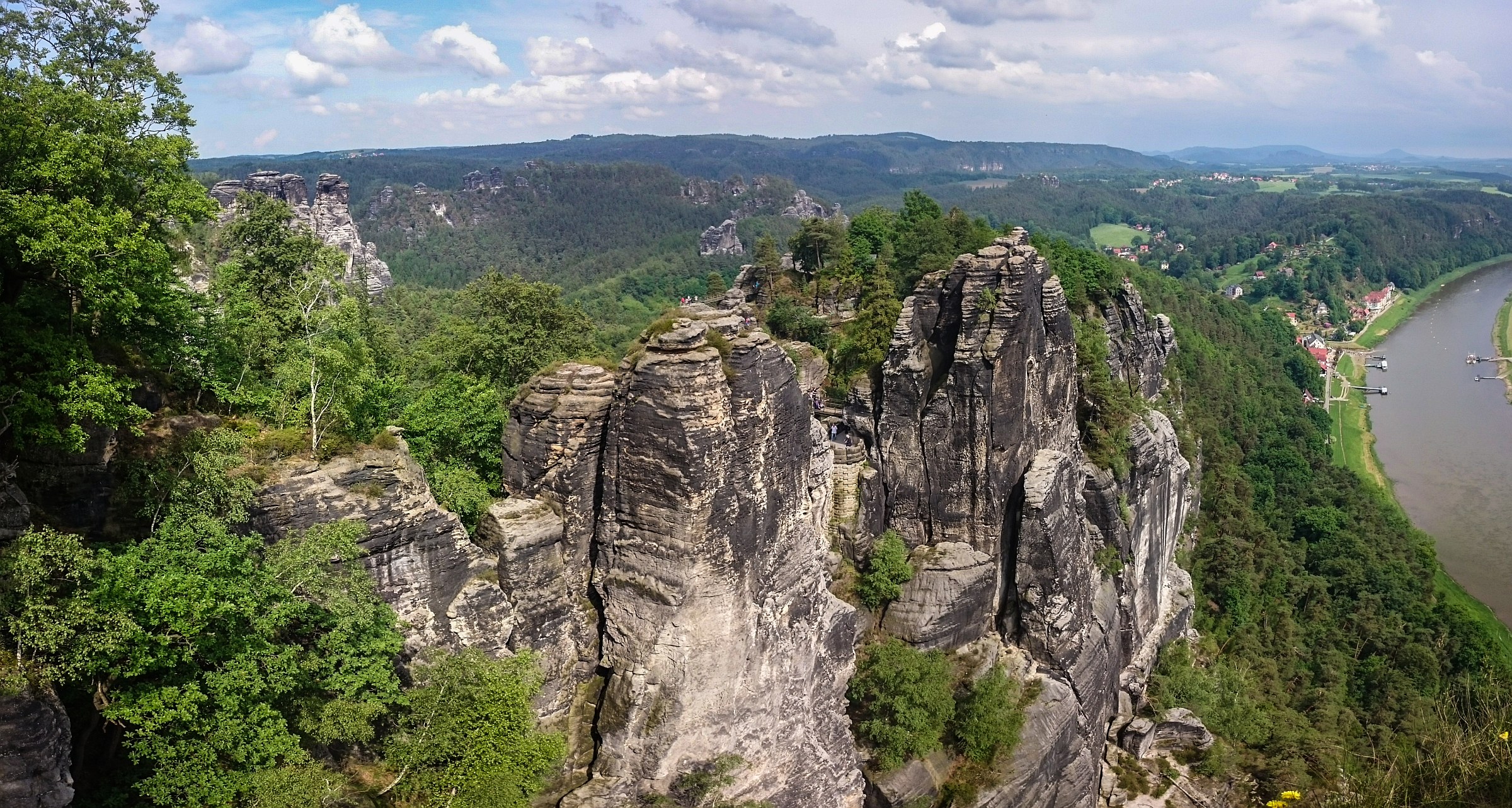
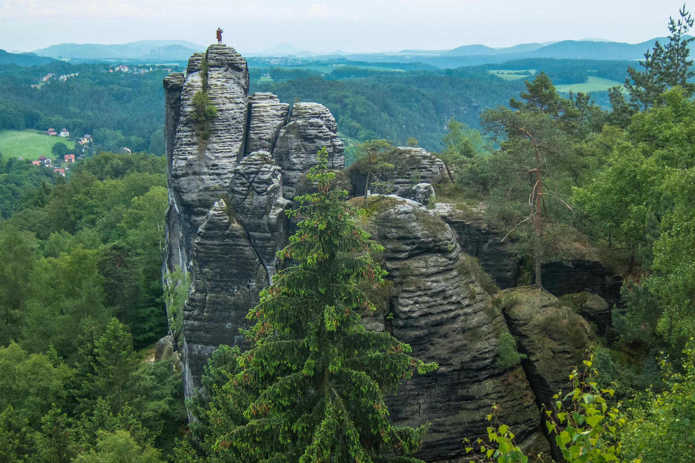
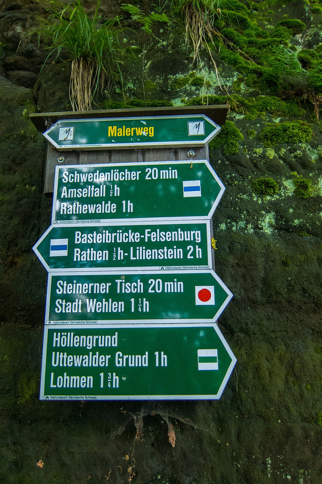
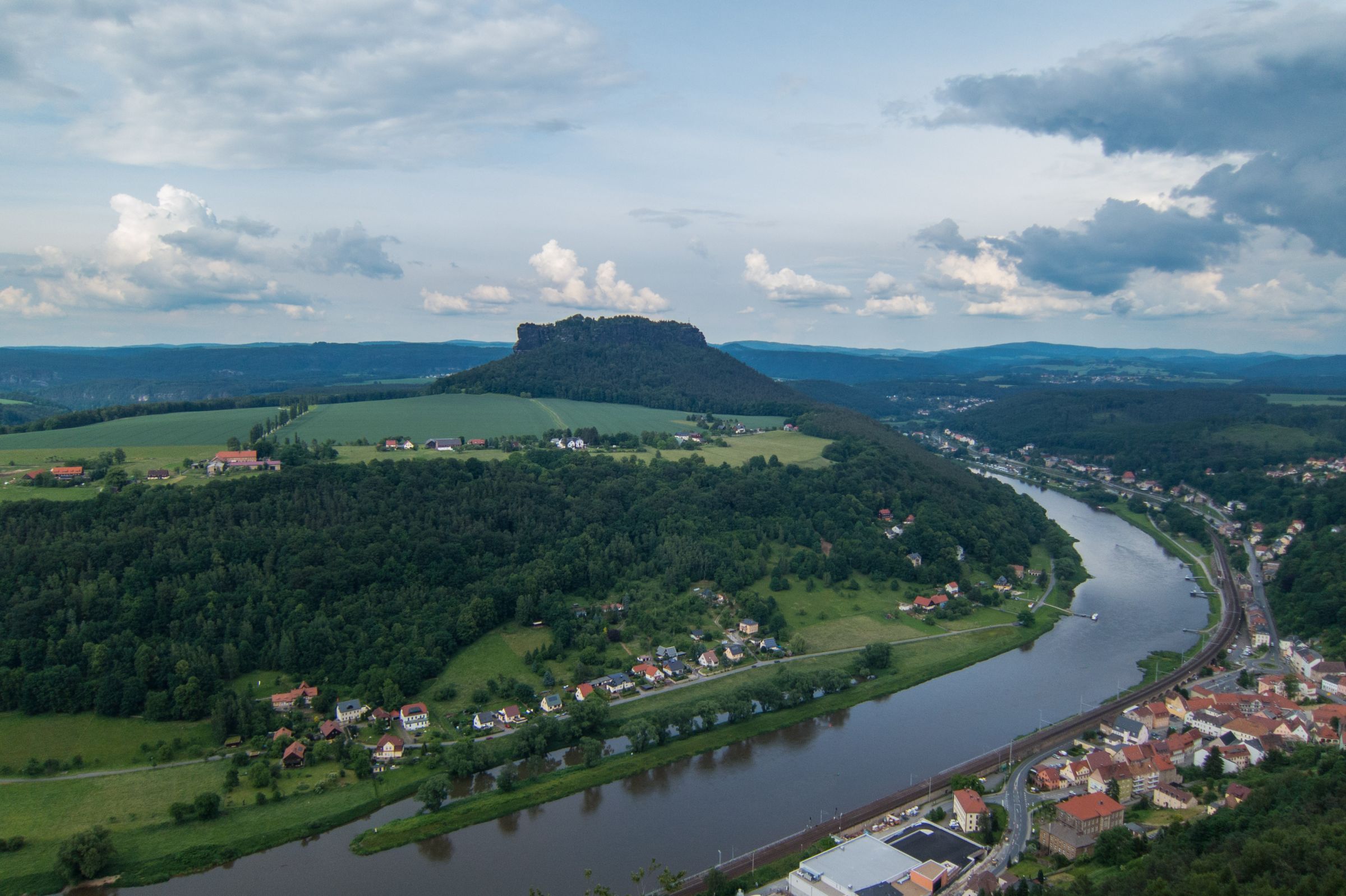
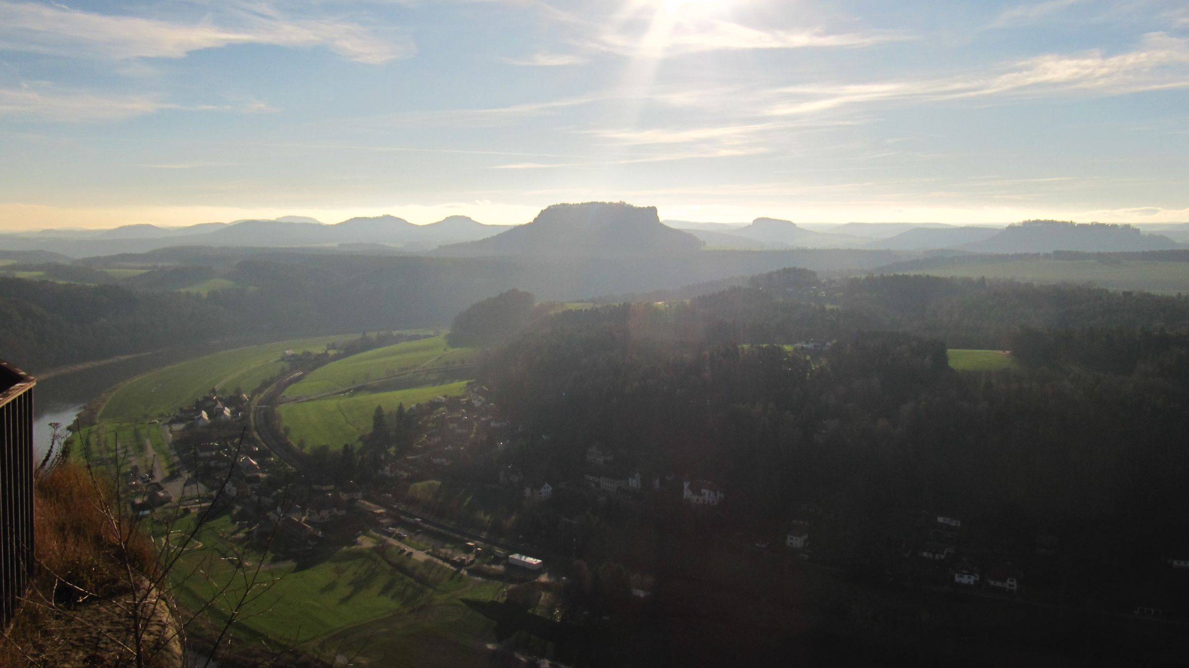
Several artists reached the Bastei on a trail the reason for the trail name; Painters Way or in German Malerweg. You might have seen a painting of the famous Casper David Friedrich from this magic place. Enjoy the spectacular views of Elbe, Rathen, Wehlen, the famous Lilienstein, a massive rock, and the Königstein Fortress.
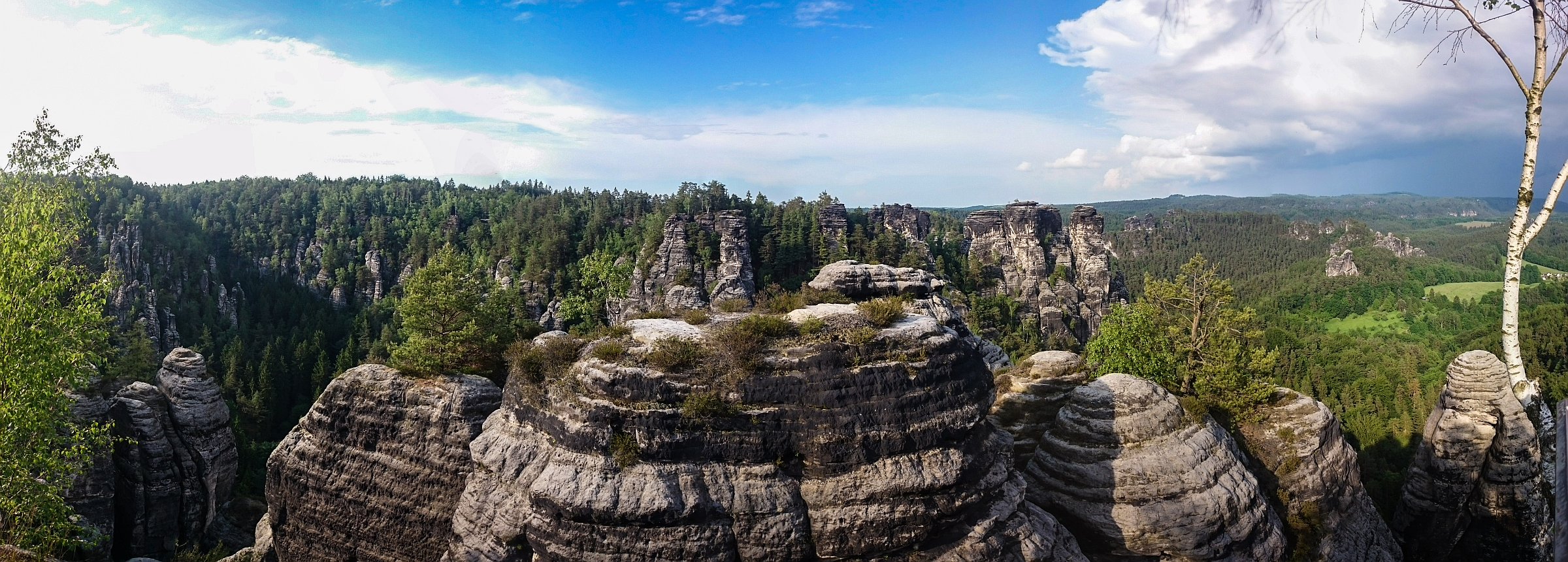
9 Sights and Hikes Not to Be Missed in Saxon Switzerland

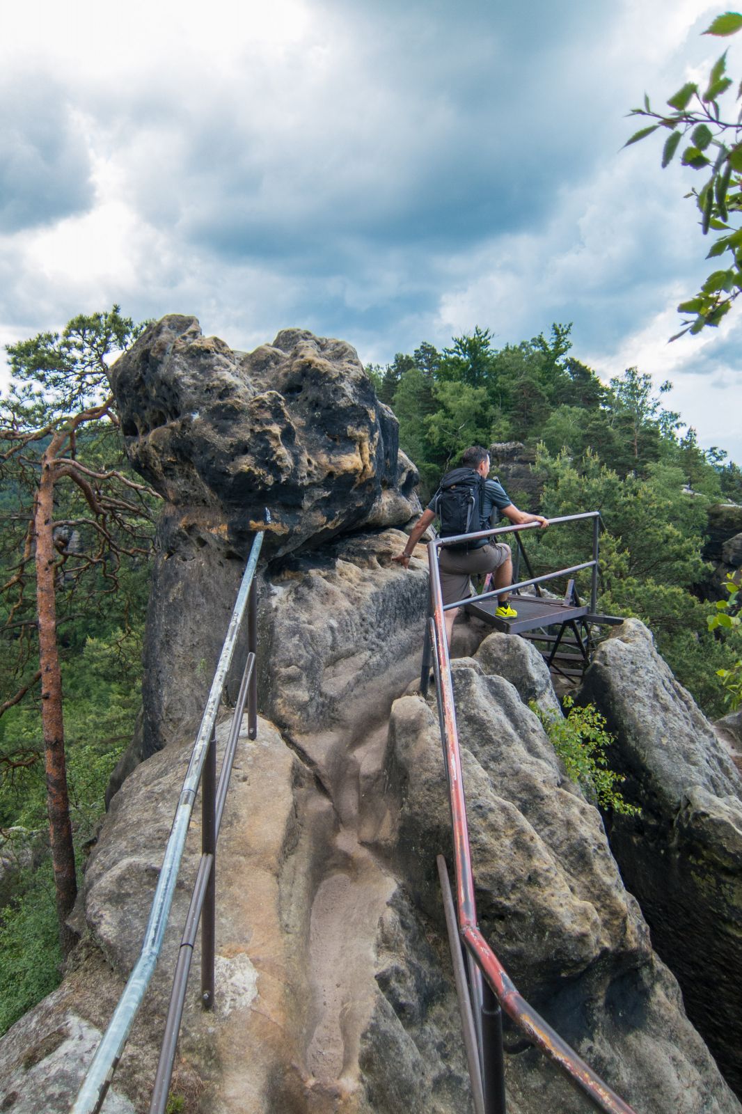
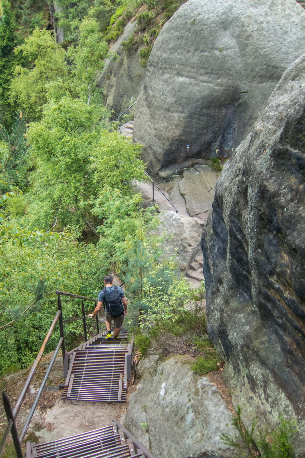
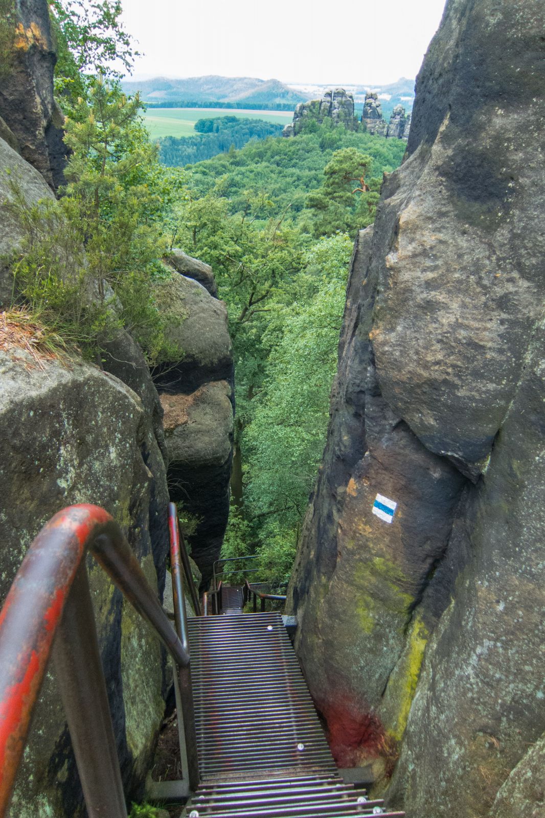
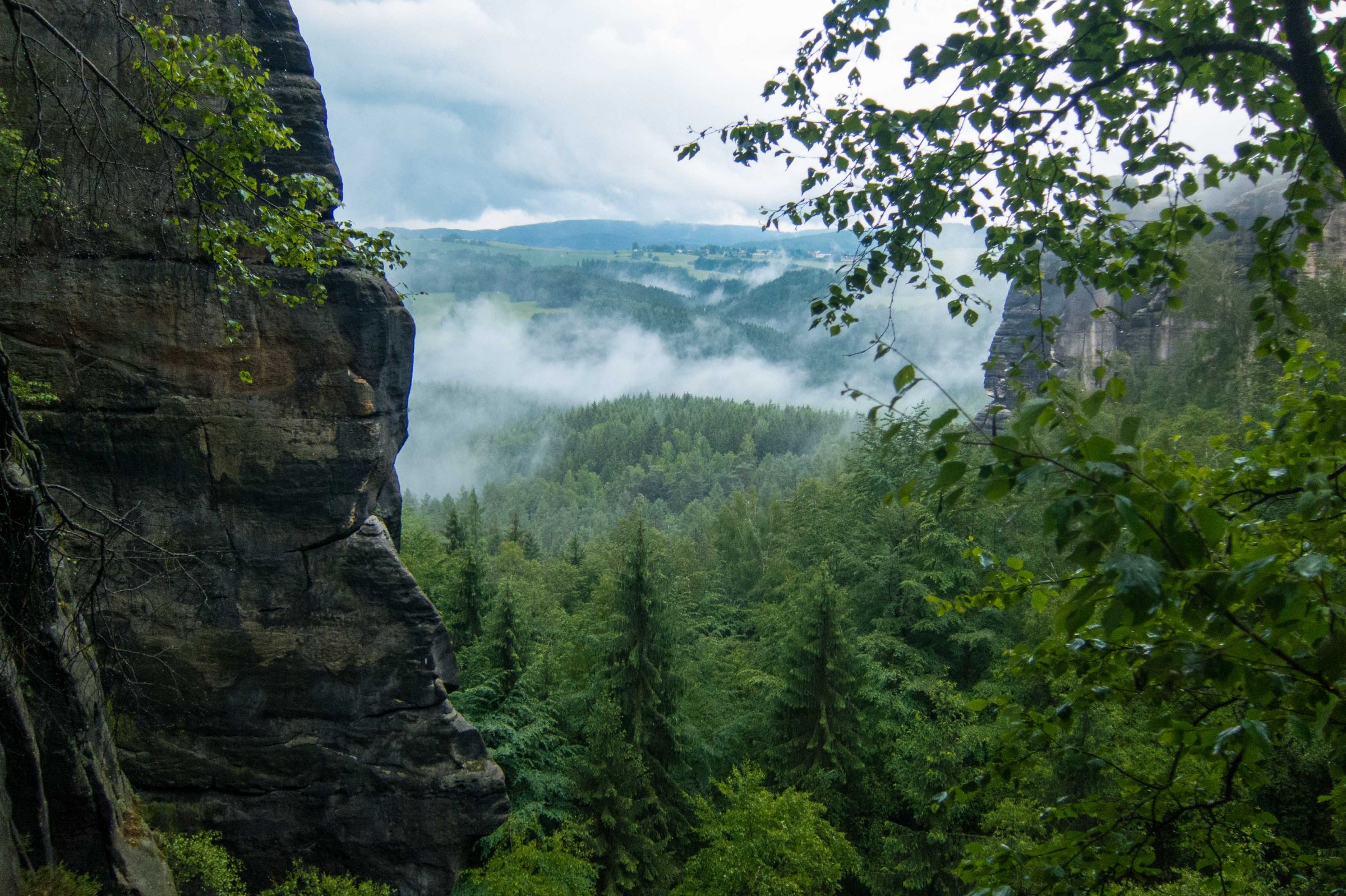
The hikes in the Elbe Sandstone Mountains are well marked. Usually, parking is available at the trailheads. Getting a parking space can be an issue at weekends, on bank holidays and during summer. Most of the trails have steep descents and ascents. The views from the top are always spectacular. We describe our highlights of this awesome hiking region, but of course, trails can be shortened or extended.
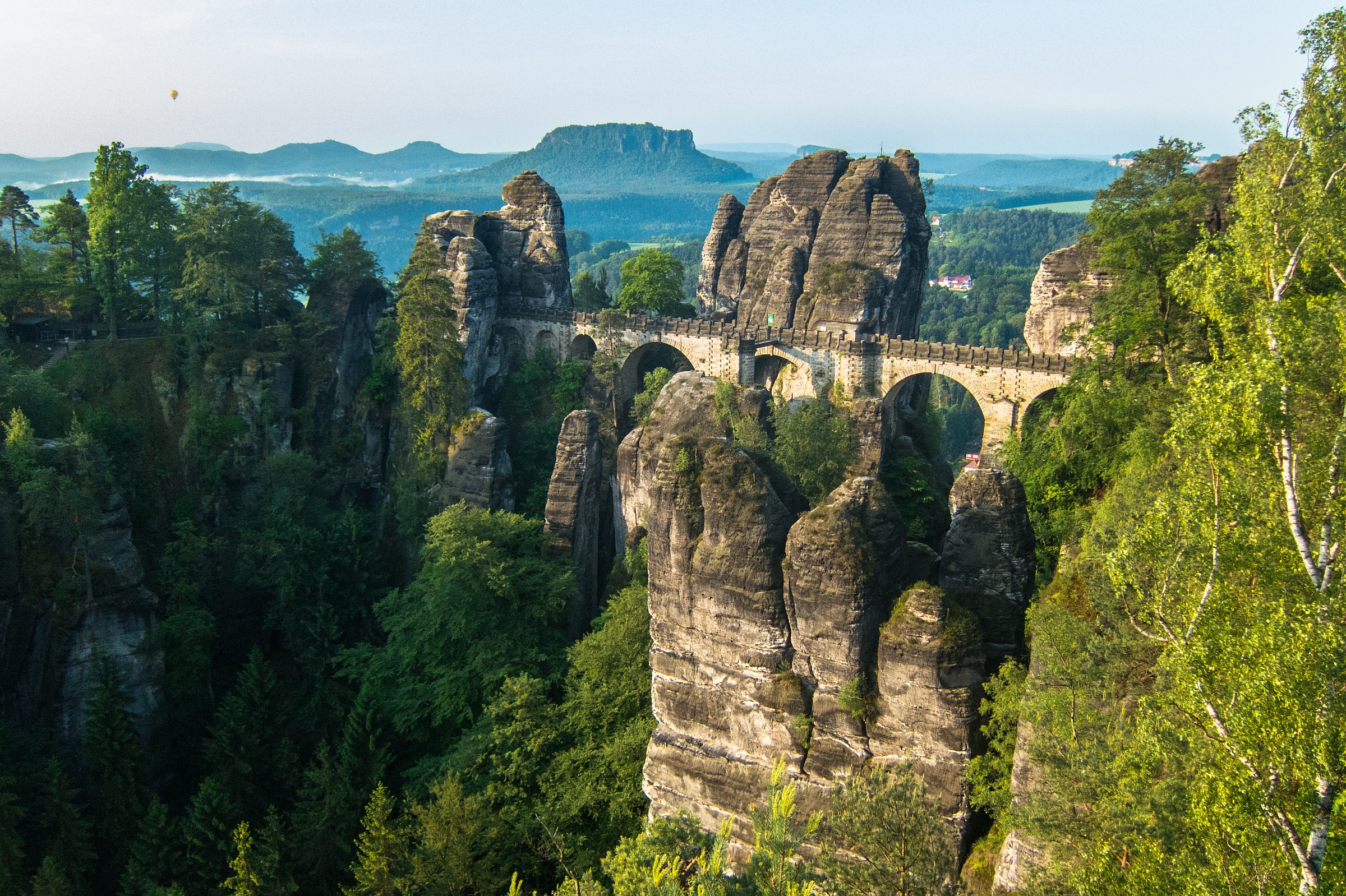
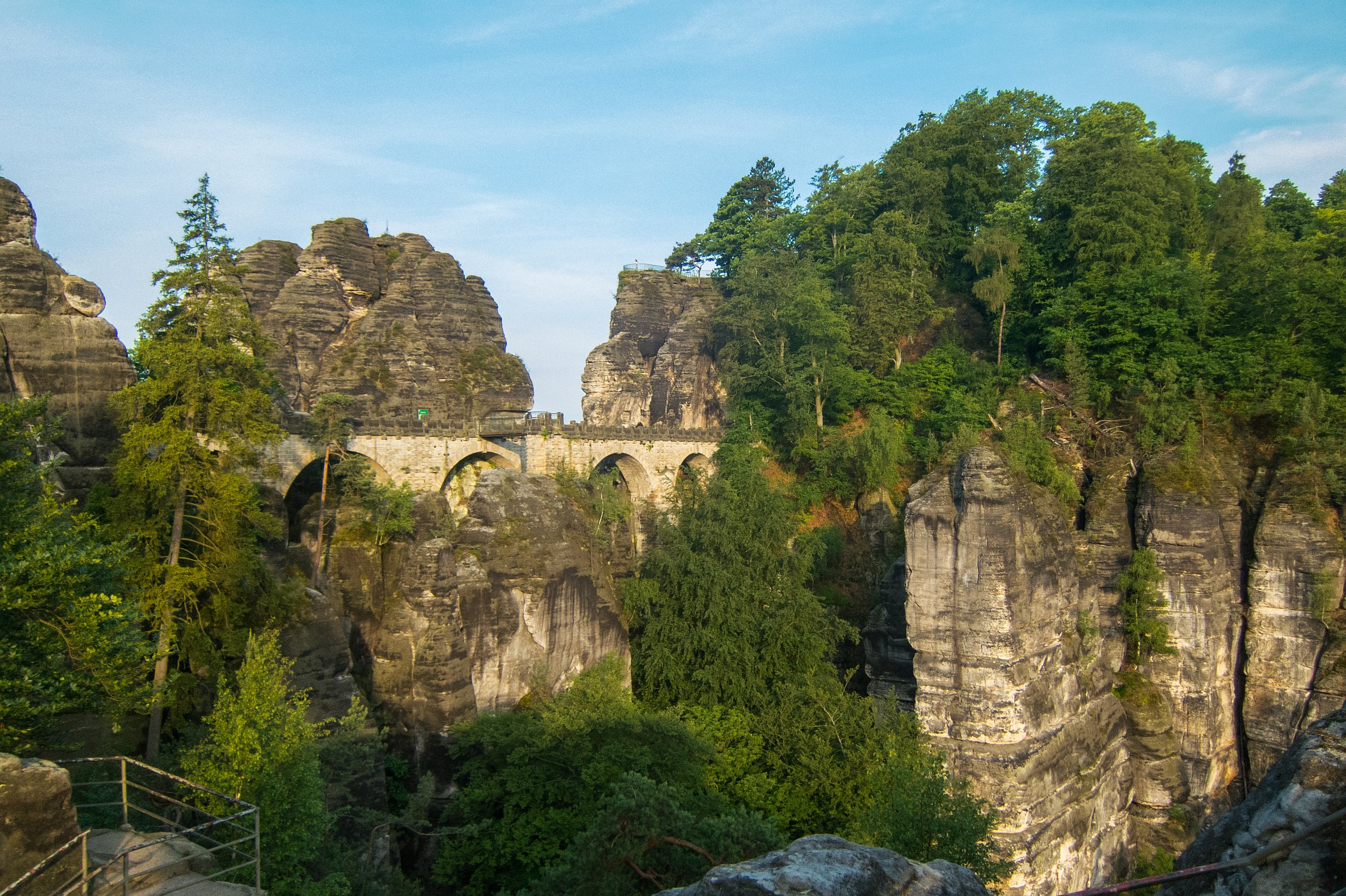
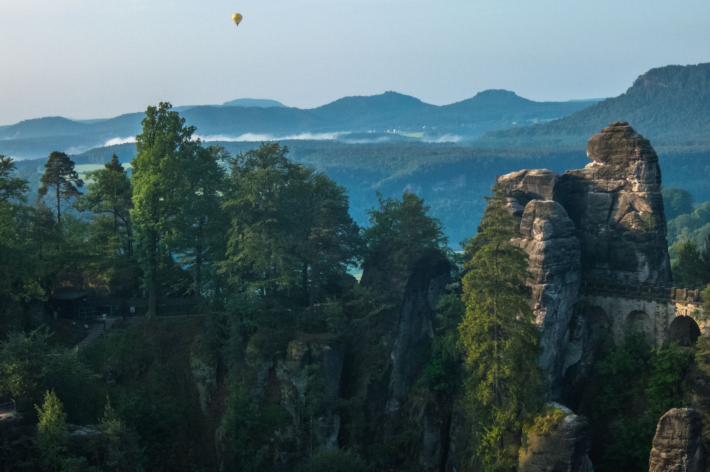
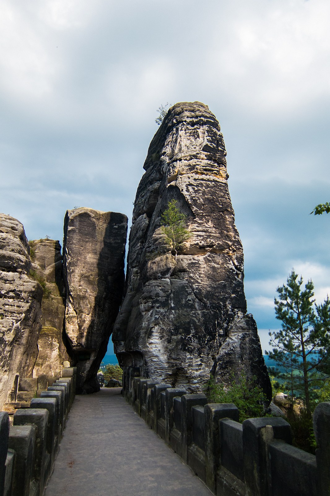
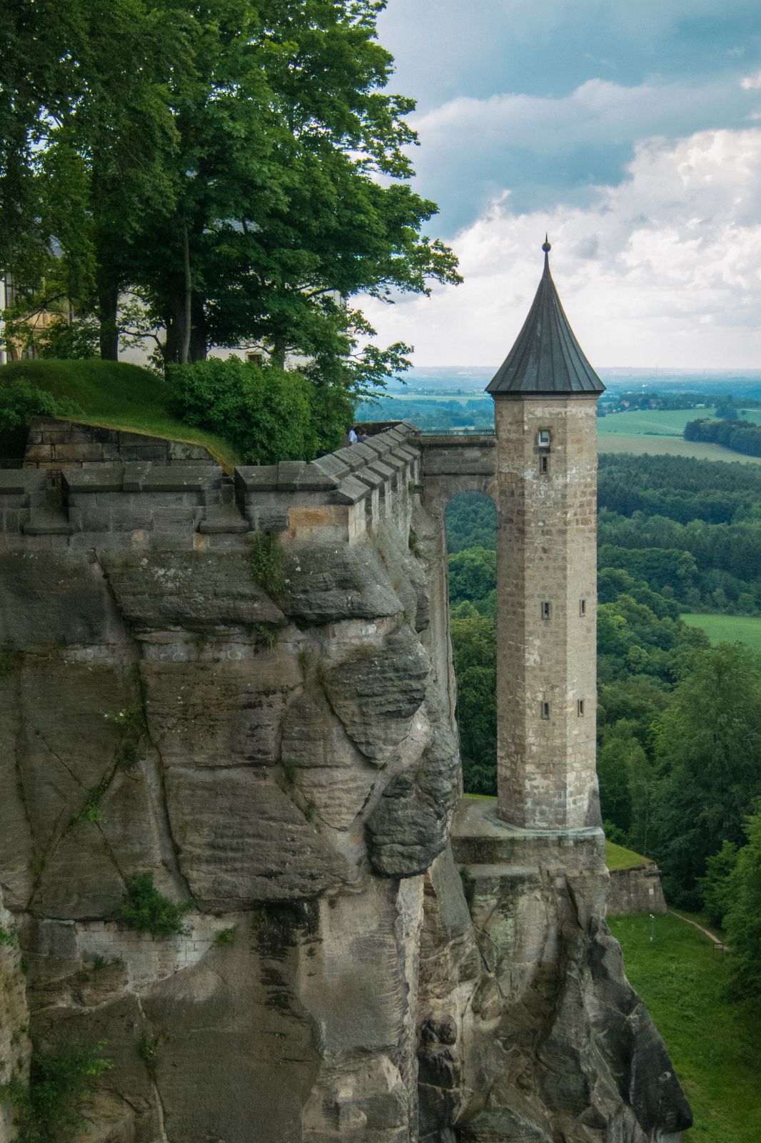
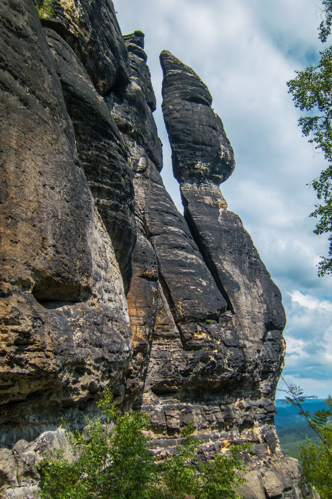
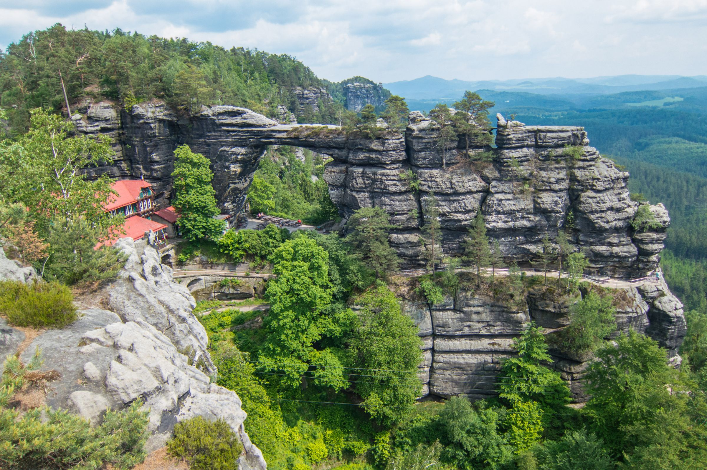
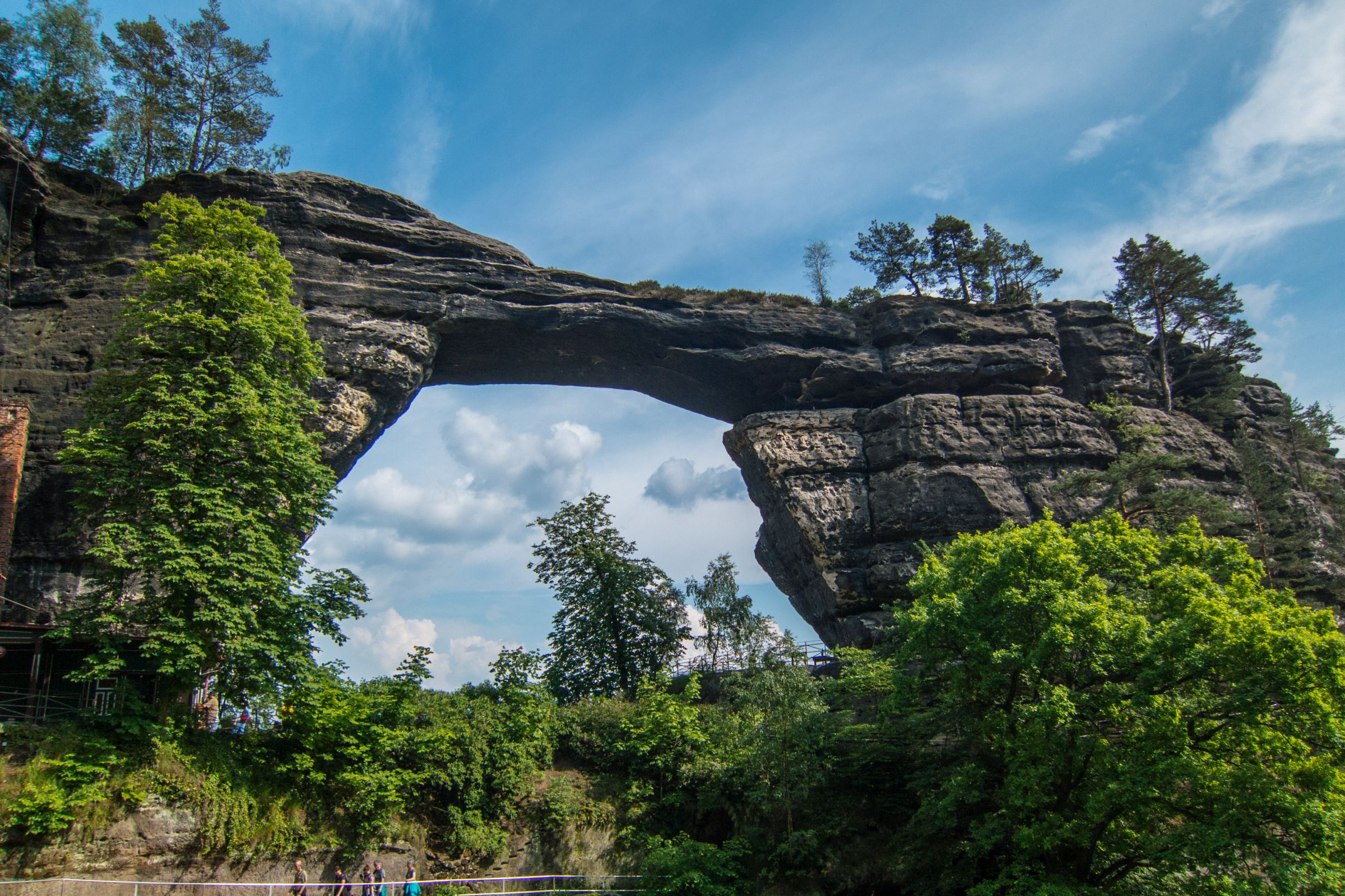
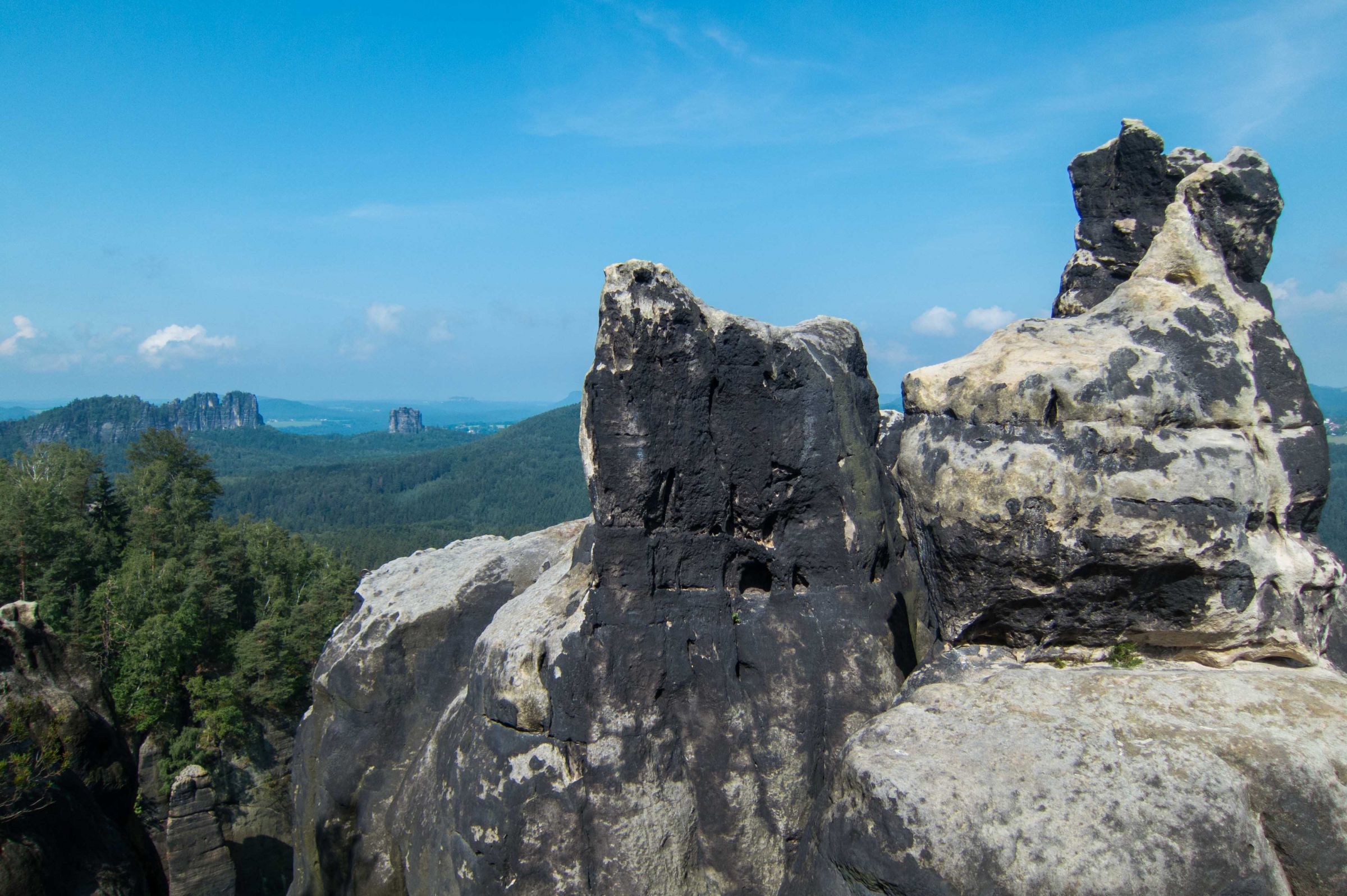
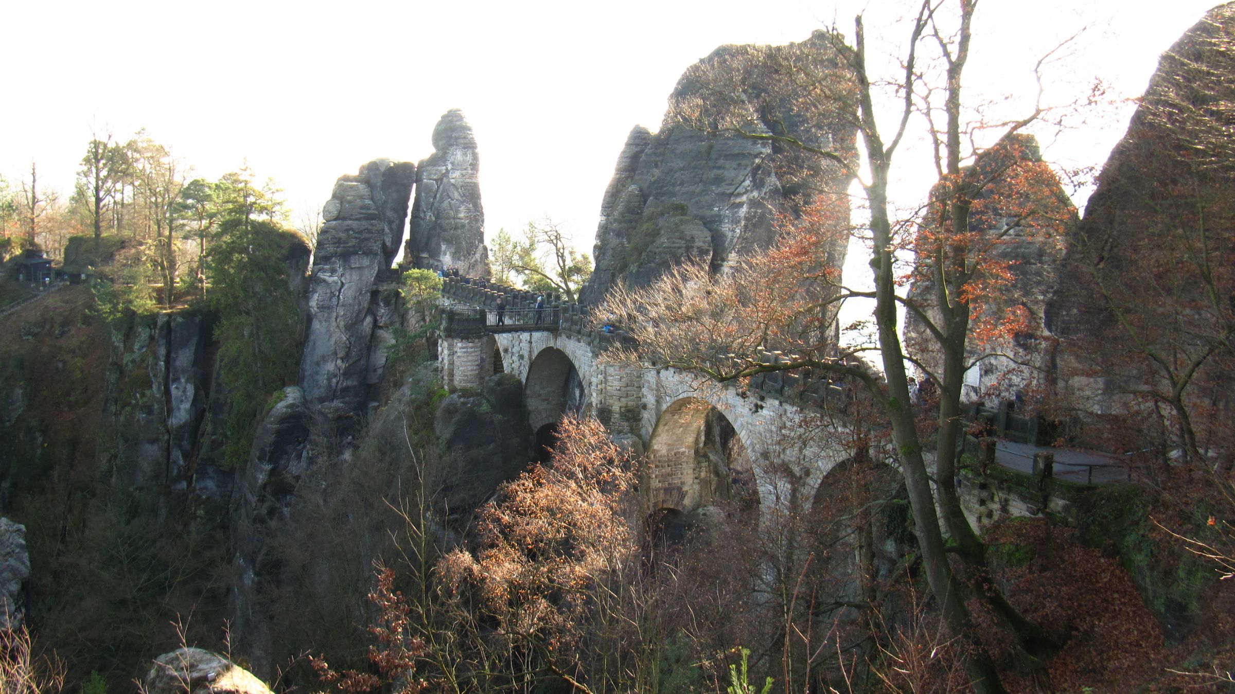
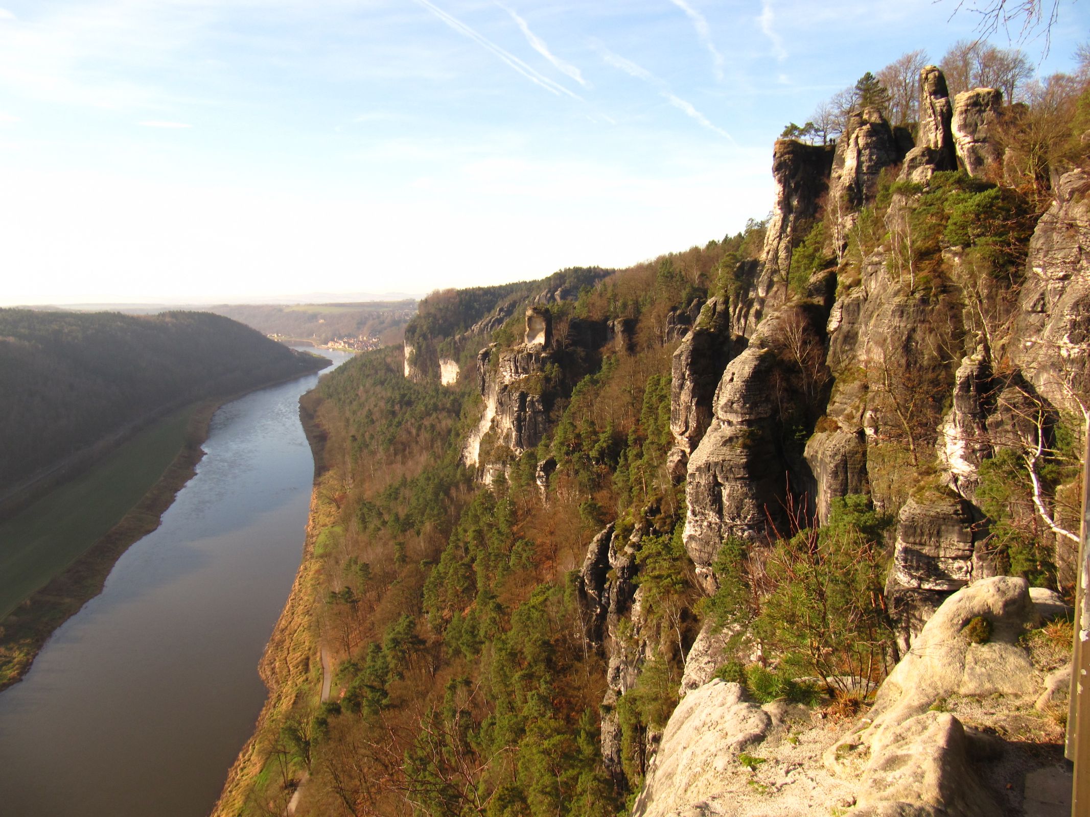
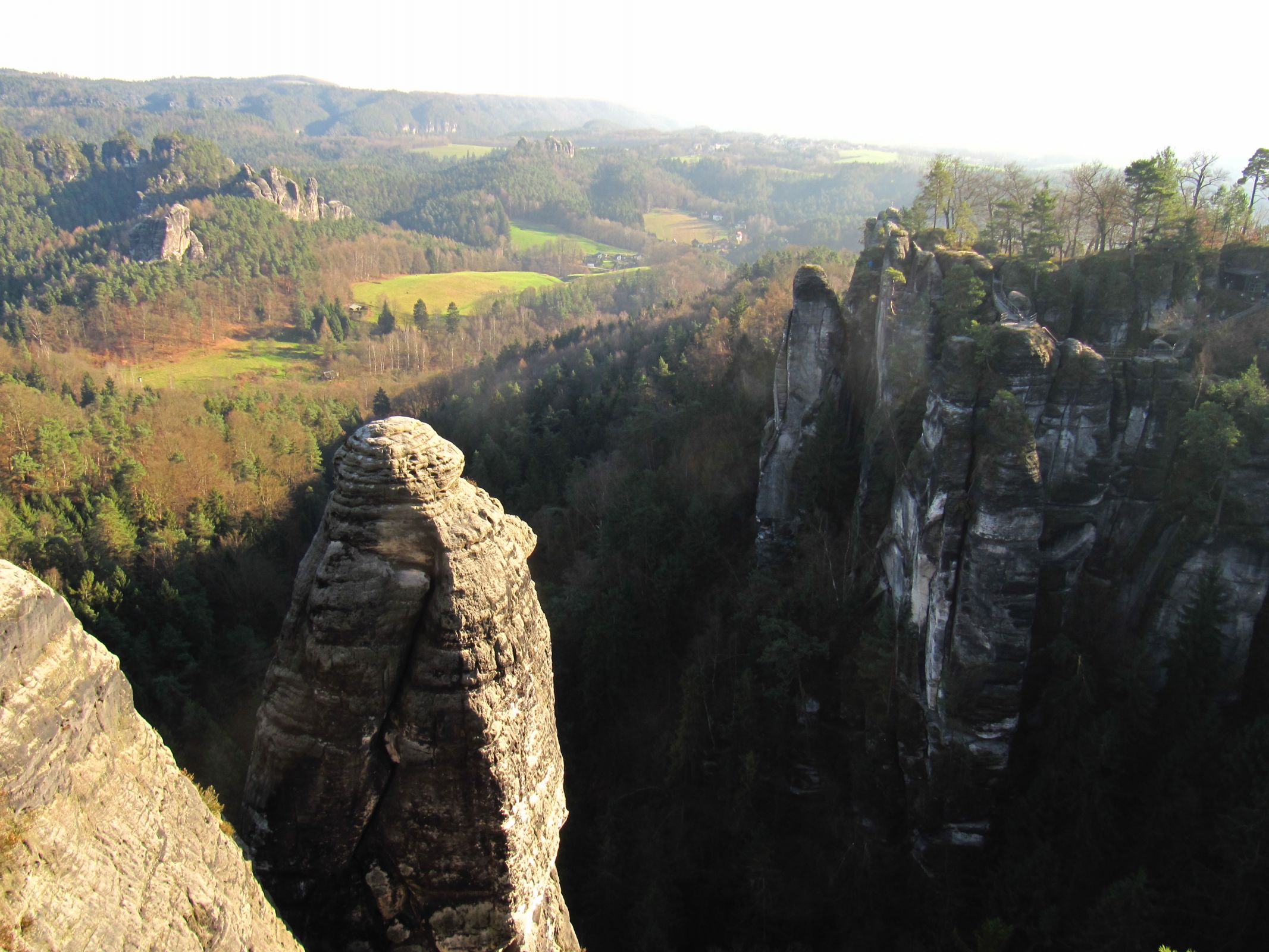
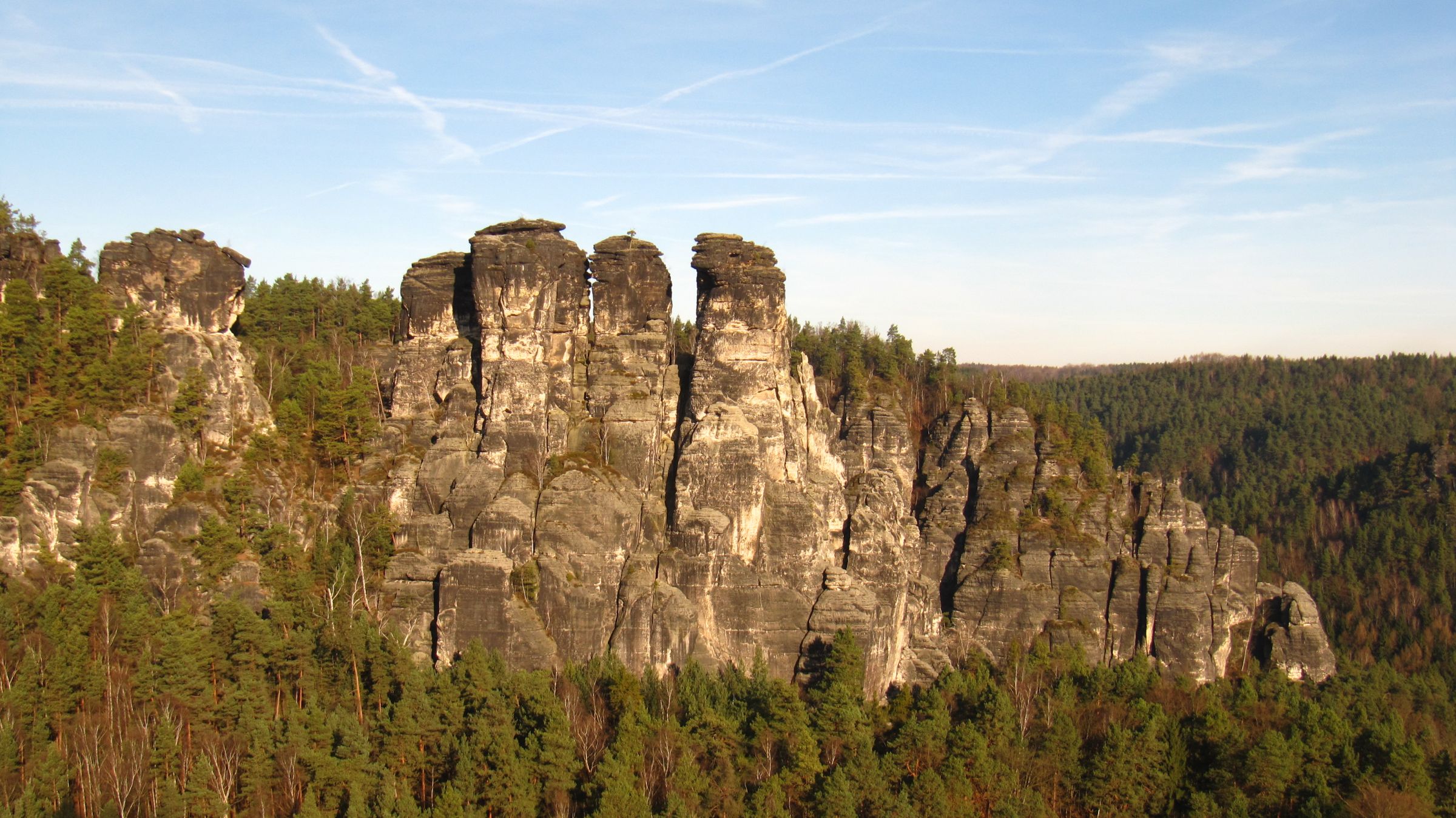
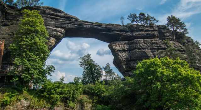
- The Bastei (Google Maps Location)

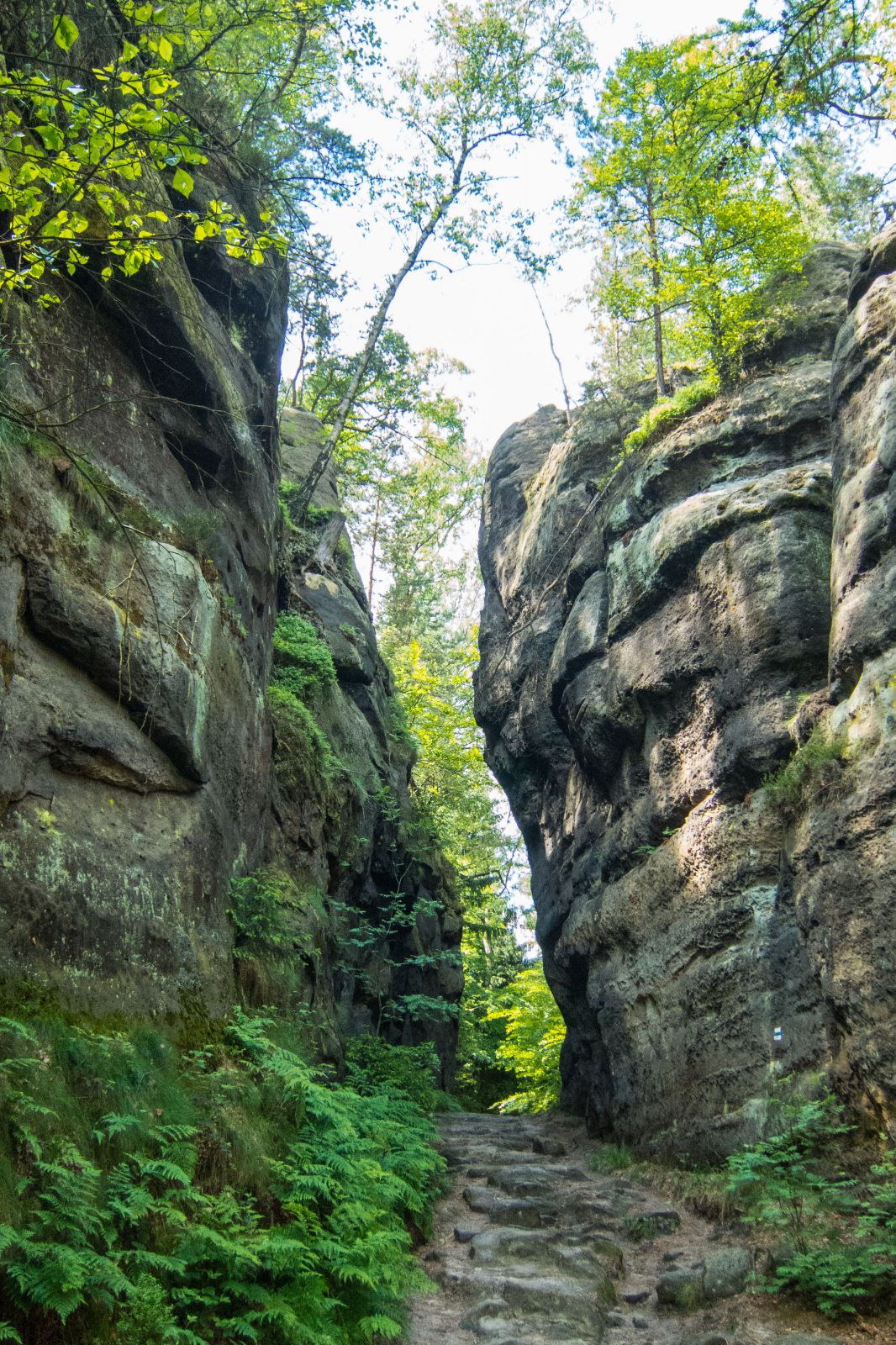
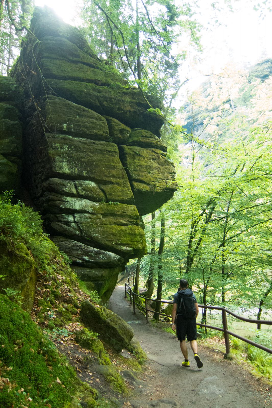
The rock formation is located 194 m above the Elbe and 305 meters above sea level. It is the most popular sight, with an estimated one million visitors each year. It was part of a defensive ring around Neurathen Castle. First mentioned in 1592. The region was explored and developed for tourism at the end of the 18th century. Many hiking trails were also developed in Germany and the Czech Republic, both part of the protected Bohemian Switzerland National Park. In the beginning, the Bastei was a wooden bridge that was later on replaced by sandstones. The bridge is 76.5 m long with seven arches. If you arrive early or late in the day, you can park your car nearby for a 3 € fee for three hours, the whole day 5,50 €. Limited parking close to the Bastei. The huge parking area is four kilometres away. You can either take a shuttle bus, do a boring walk next to the road, or take the bikes from the parking. - Swedish Holes - Schwedenlöcher (Google Maps Location)

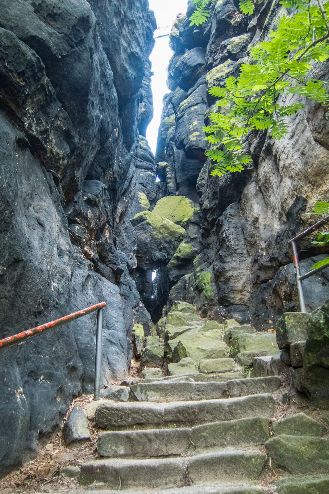
Update January 2022: The popular Schwedenlöcher are reopened for hiking. Path and stairs improvement are finished.
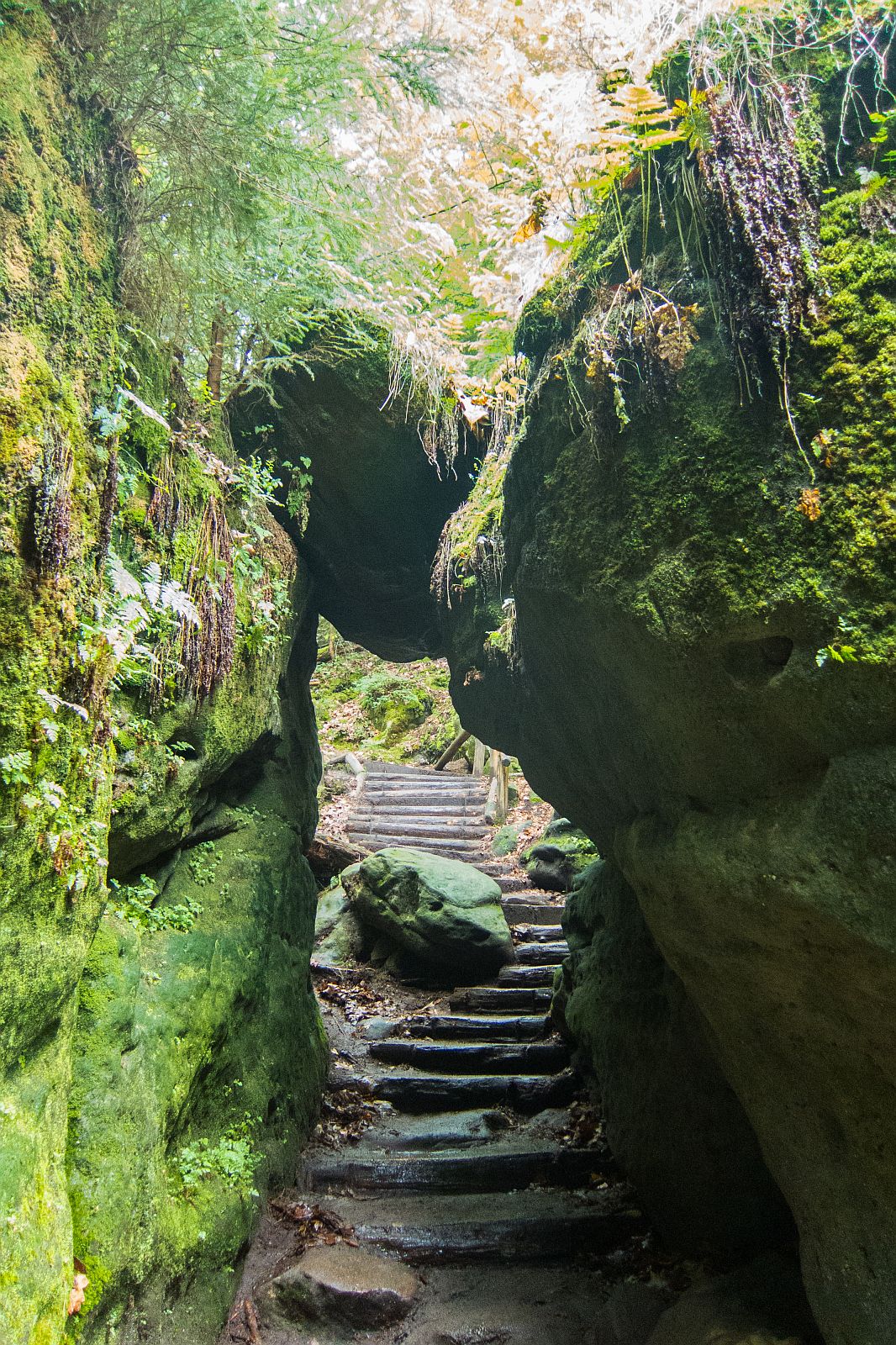
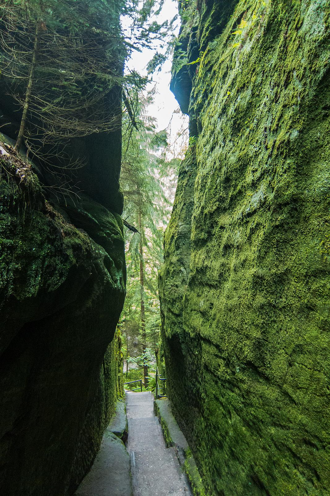
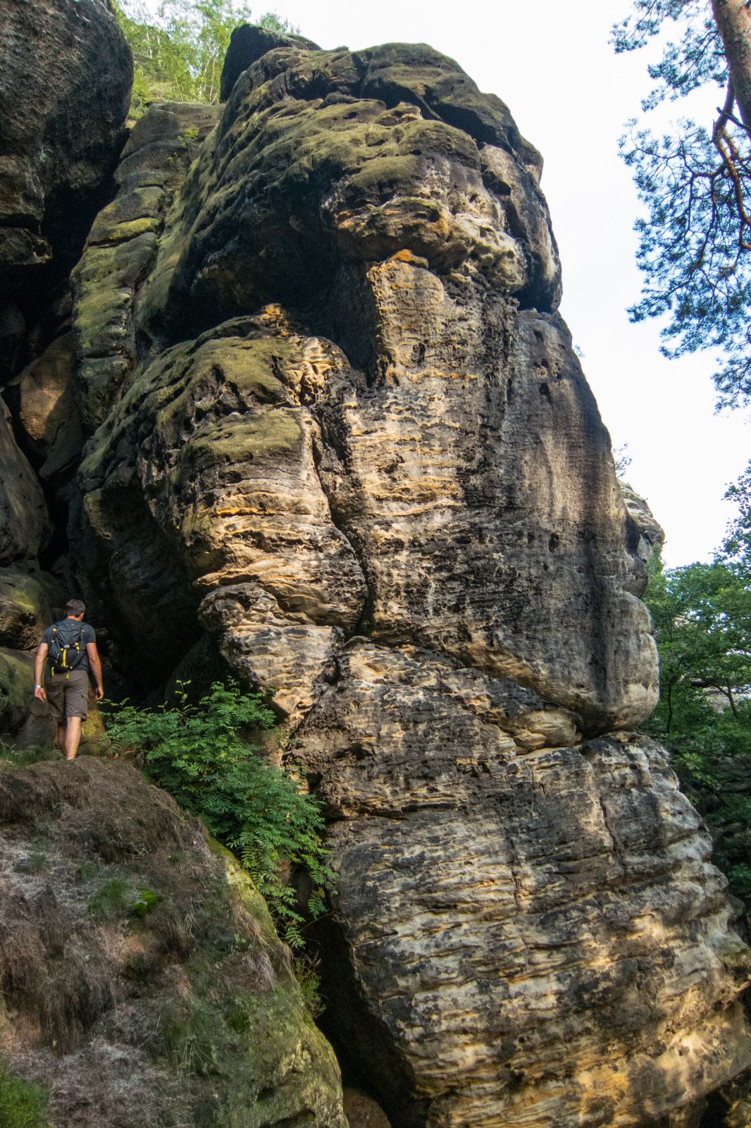
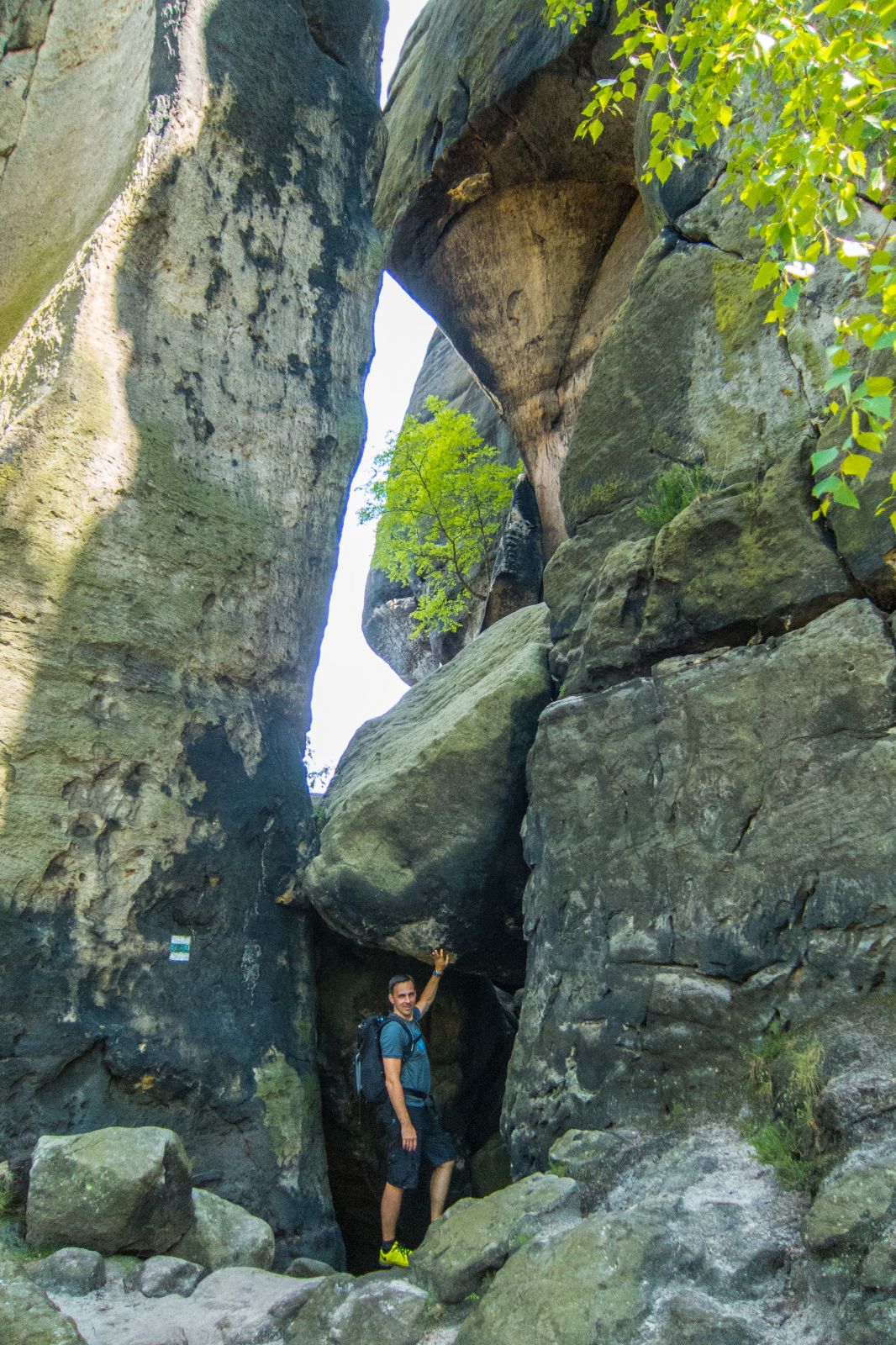
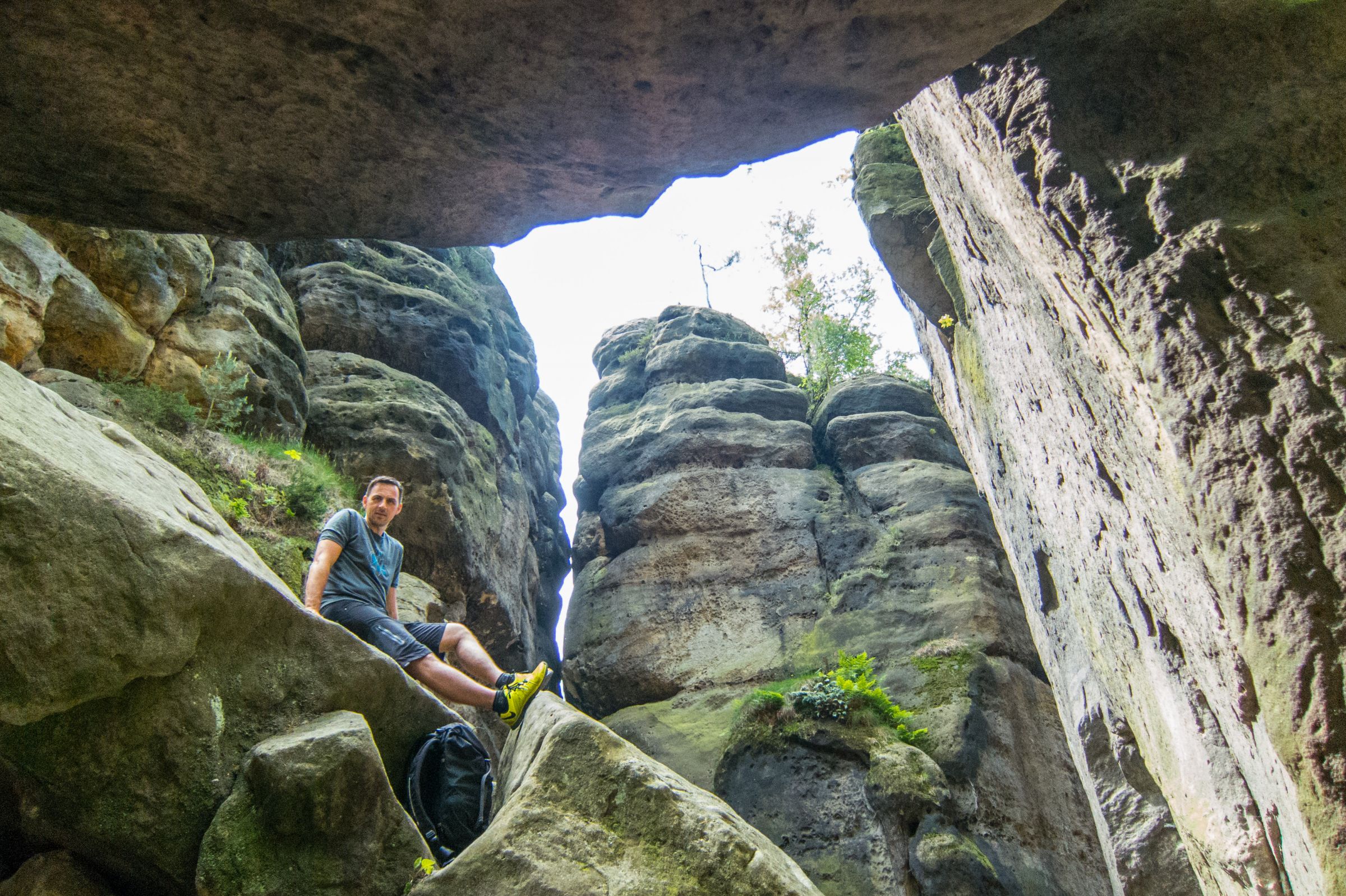
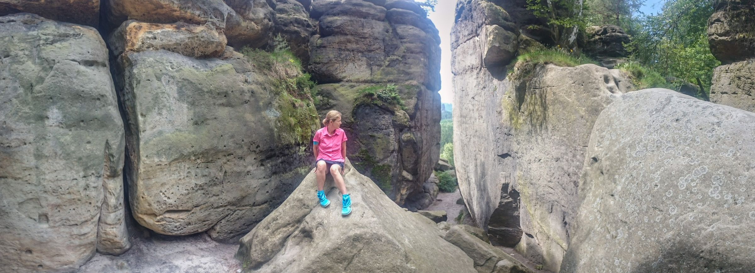
Another option to get to the famous Bastei is the trail from Rathewalde parking at the Amselfall through the Swedish Holes. It’s a steep and impressive trail up with roughly 700 steps. The picturesque trail leads through a narrow slot canyon. The history behind the name Swedish Holes; in the 30-year war, the residents found refuge here to escape the Swedish.
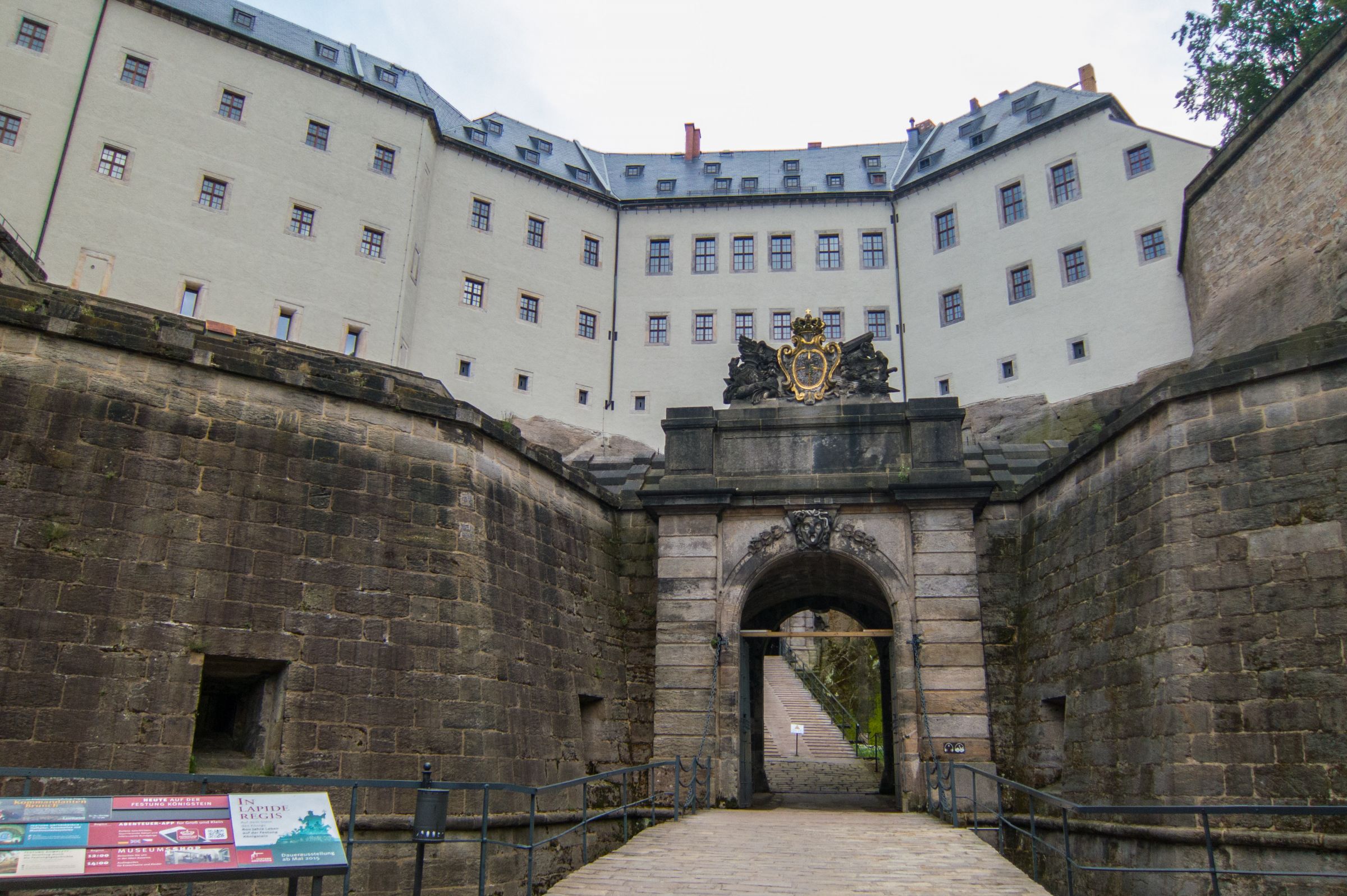
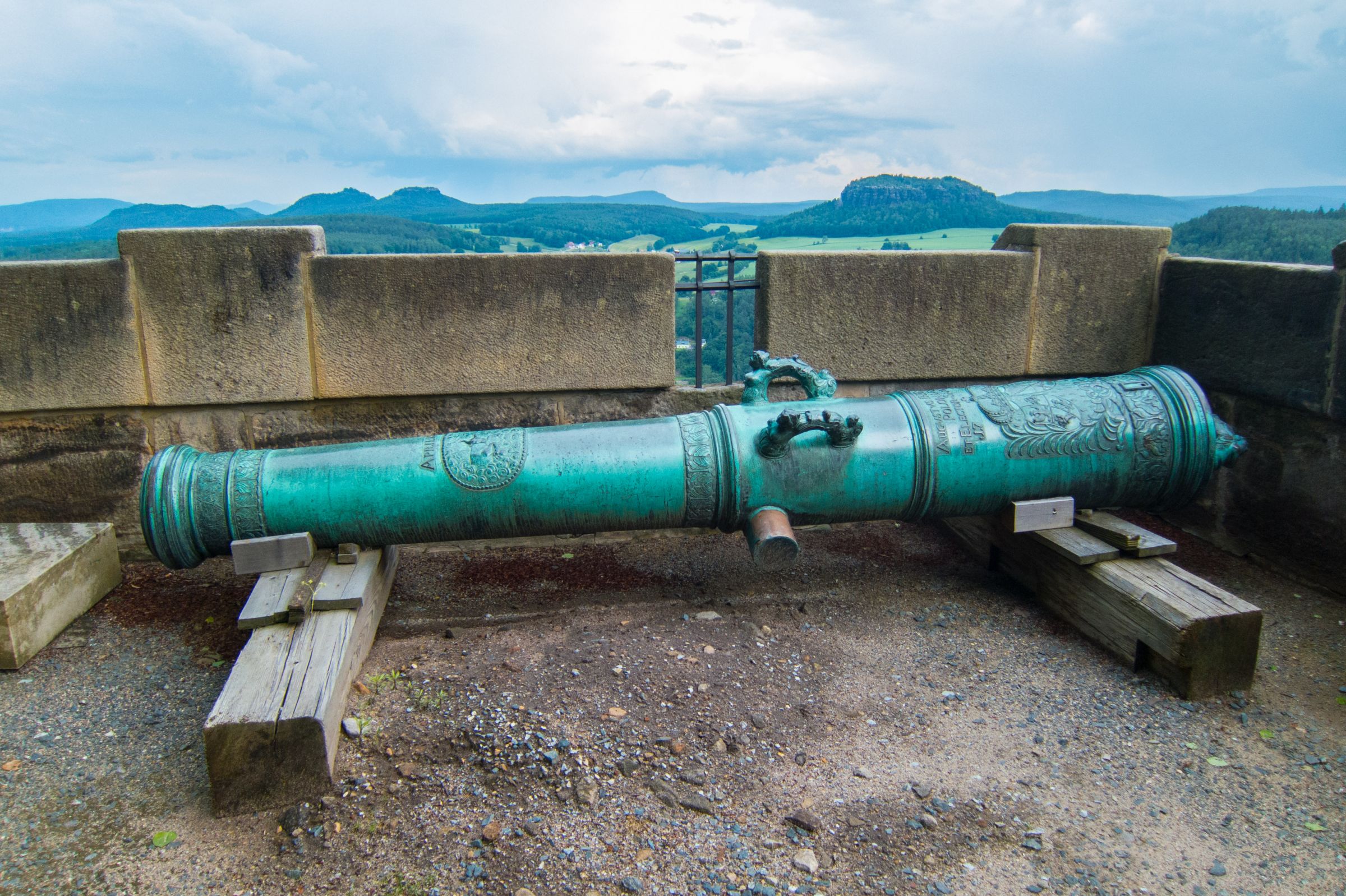
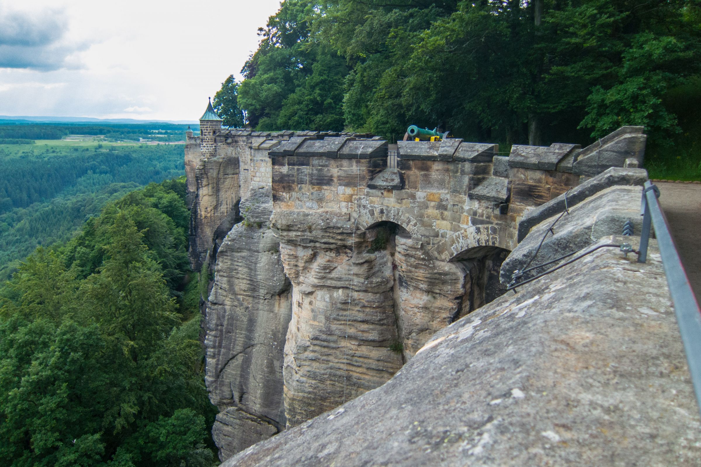
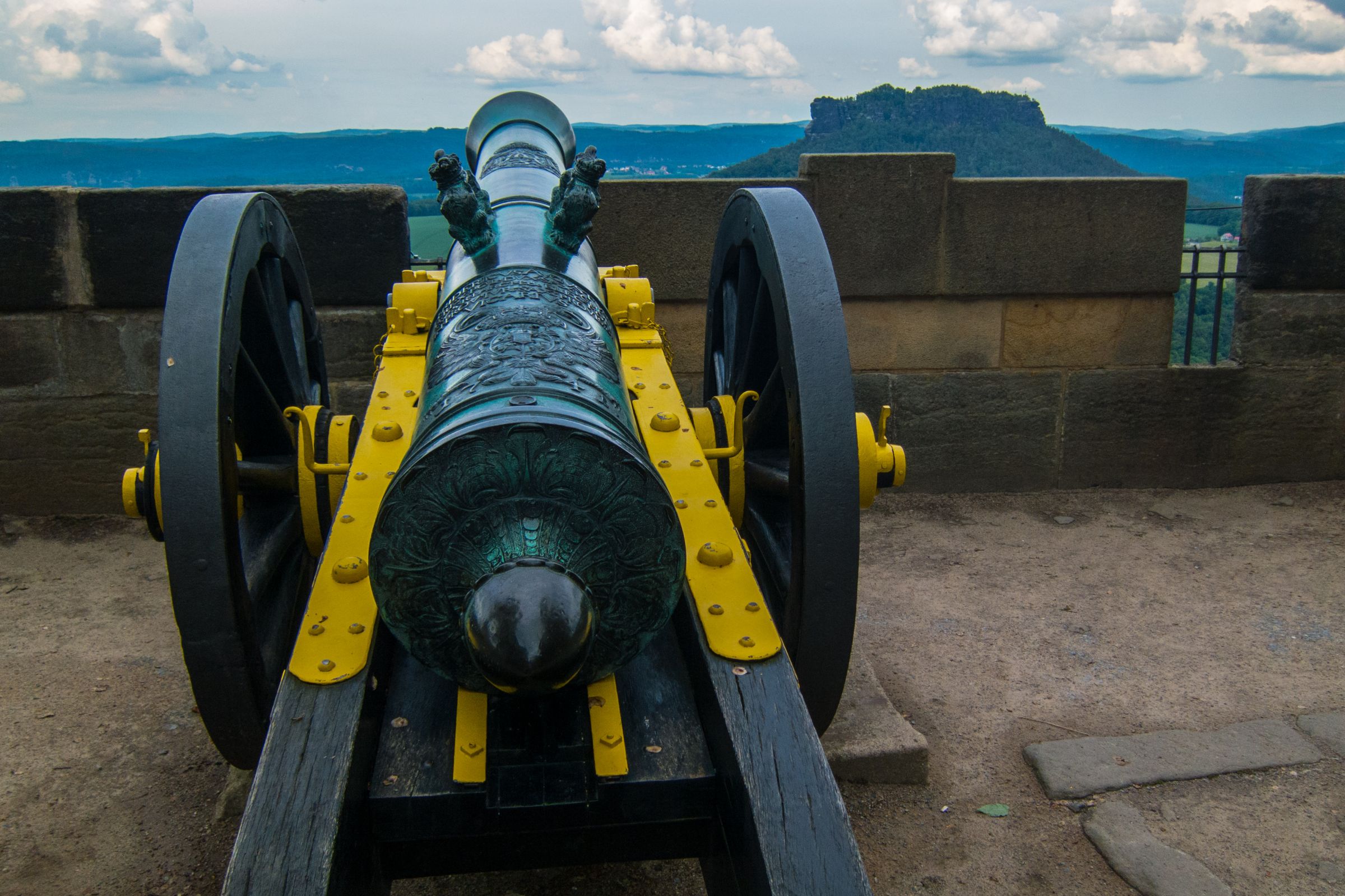
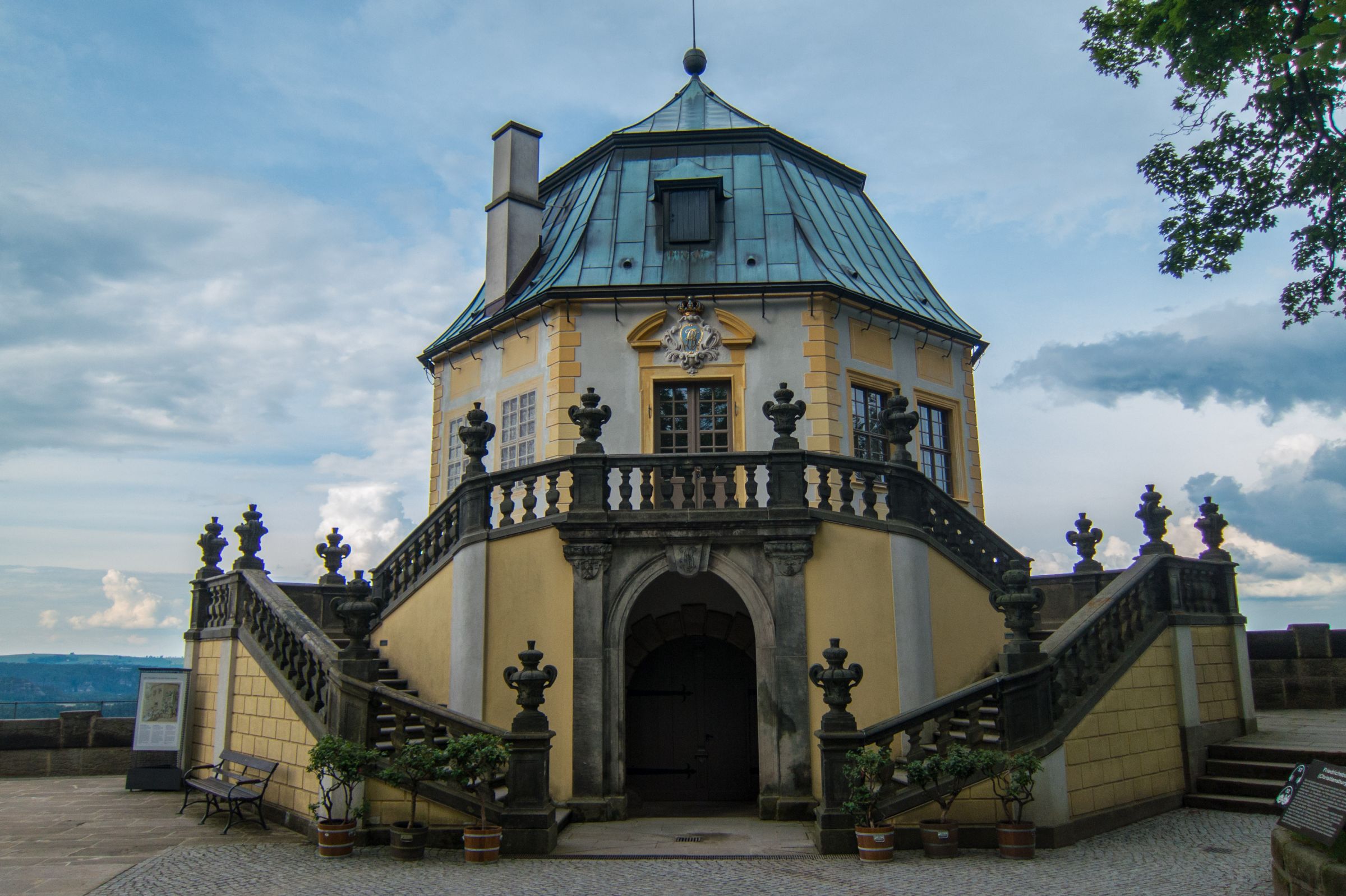
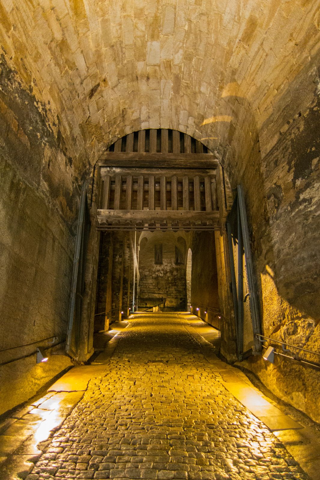
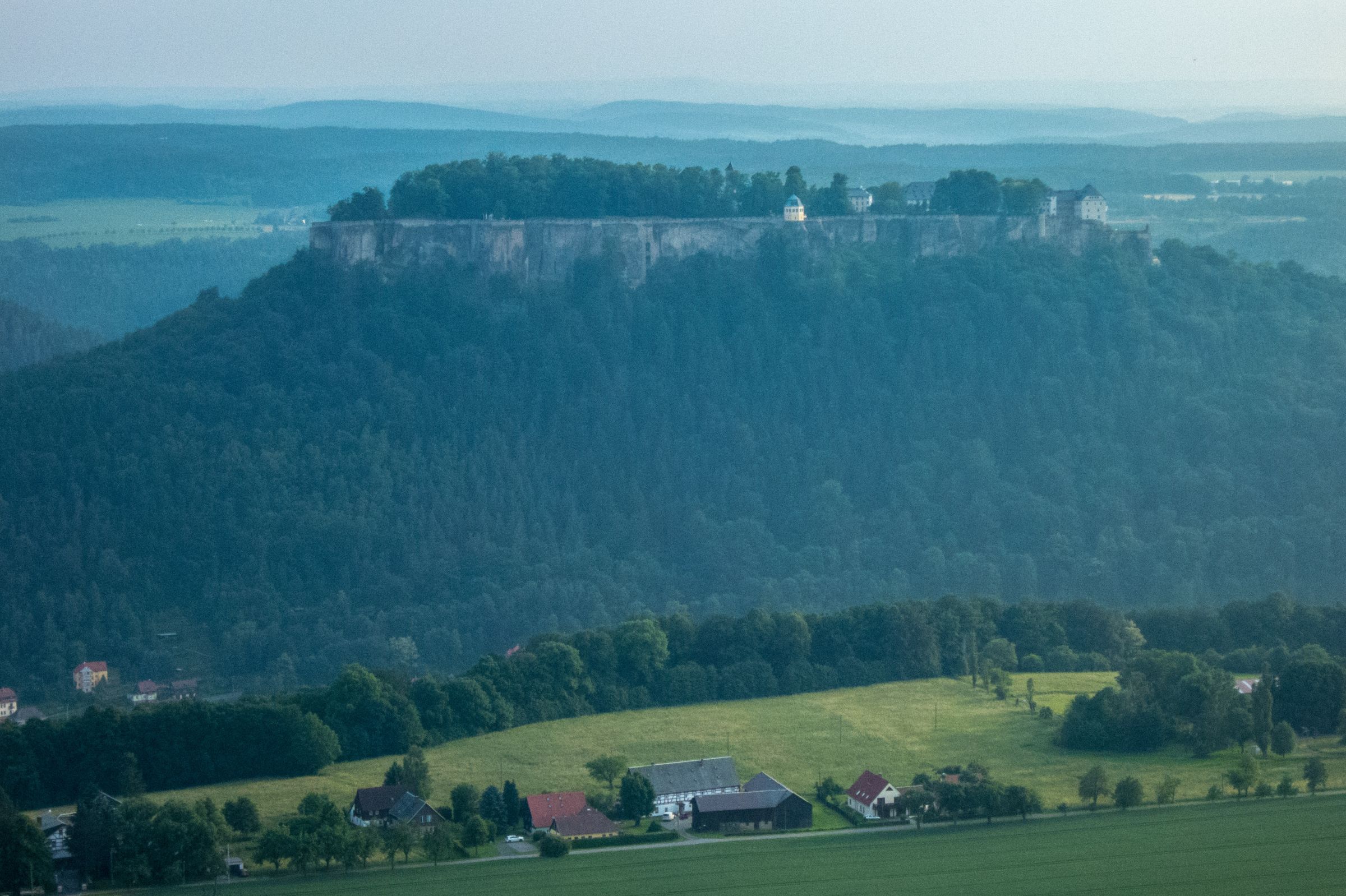
- Fortress Königstein (Google Maps Location)

It is located on the top of a table mountain. Schedule at least 2-3 hours to get a glimpse into the permanent exhibition. Open from 9 am – closure at 6 pm from April to October and 5 pm from November to March. The fortress was always used as a prison with up to 1000 prisoners since the 16th century. Parking in 800 m distance. Wheelchair accessibility due to an elevator up to the fortress. We walked in total of 5 km to and around the castle. It’s a 1.7 km walk around the walls of the fortress. There is a historic bakery, restaurant, and beer garden inside the castle. An audio guide for the exhibition and Königstein is available.
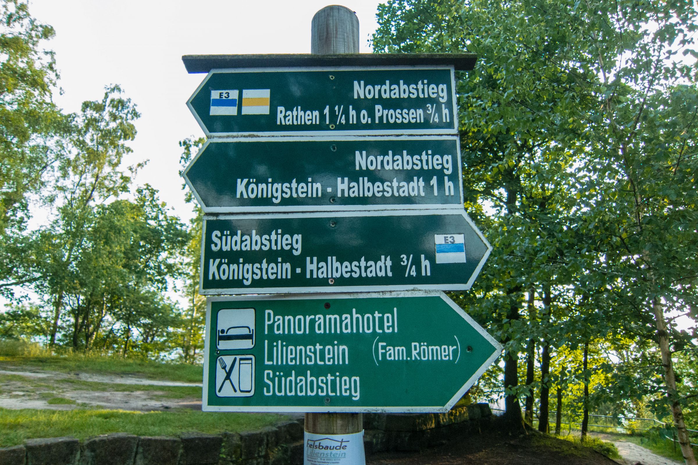
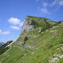
- To the top of the Lillie Rock / Lilienfels or -stein (Google Maps Location)

It’s another popular tourist attraction and famous for its awesome sunset. The hike can be done throughout the year. Several trails are leading to the top of the famous Lillie Rock. We’d chosen the steep south ascent. The south trail up to the top was already developed in 1708, the north much later in 1900. You get a spectacular view of Fortress Königsstein and river Elbe. On top of 415 m, elevation is a beer garden located offering beverages and a small menu. It has a long history of more than 100 years. The pub is open daily during the peak season, and I winter at weekends and bank holidays only. Like to celebrate New Year's Eve here? Make a reservation far in advance! Felsbaude Lilienstein in German only: Telephone: 035022 53 100 and E-Mail: [email protected]
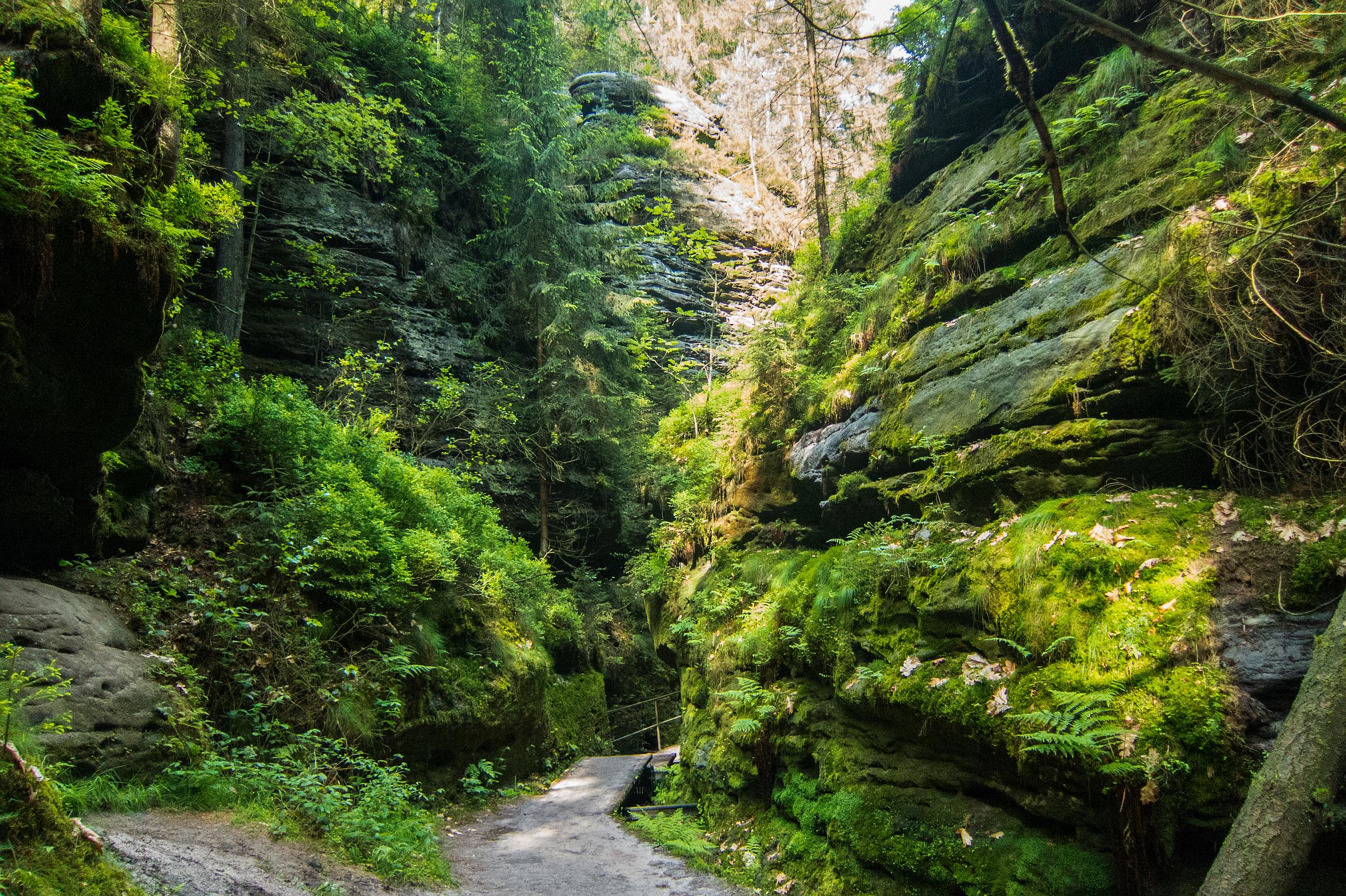
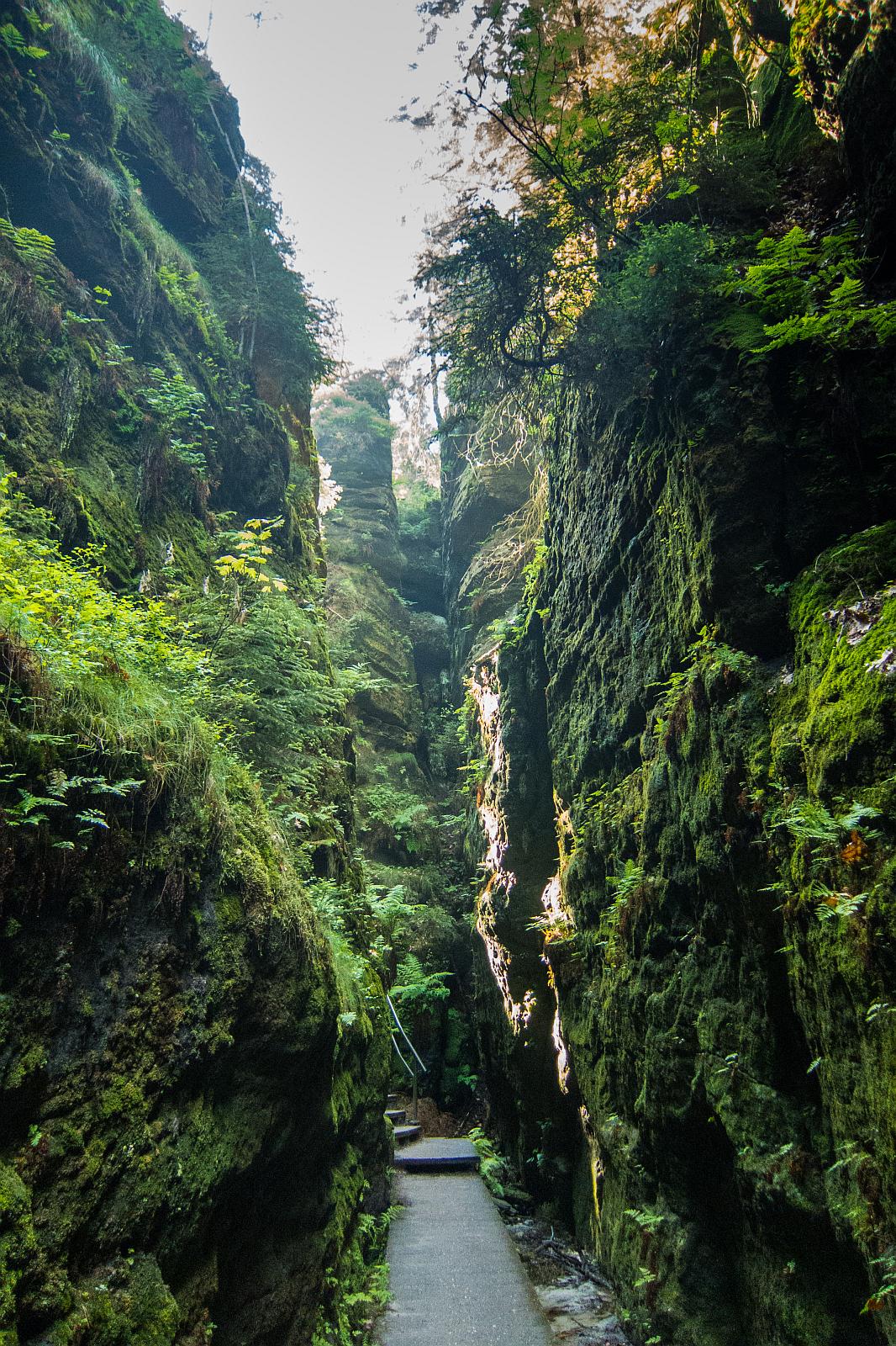
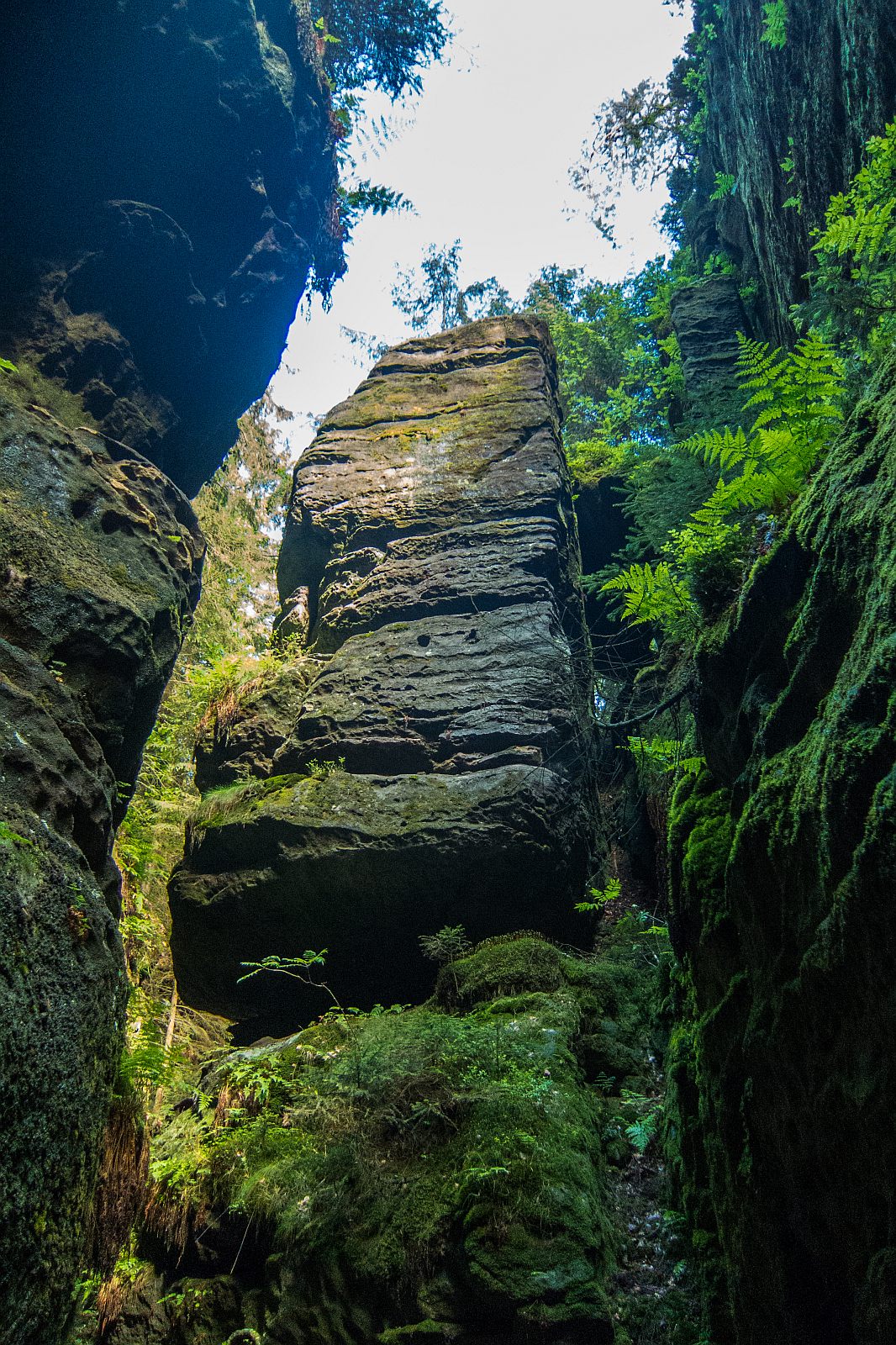
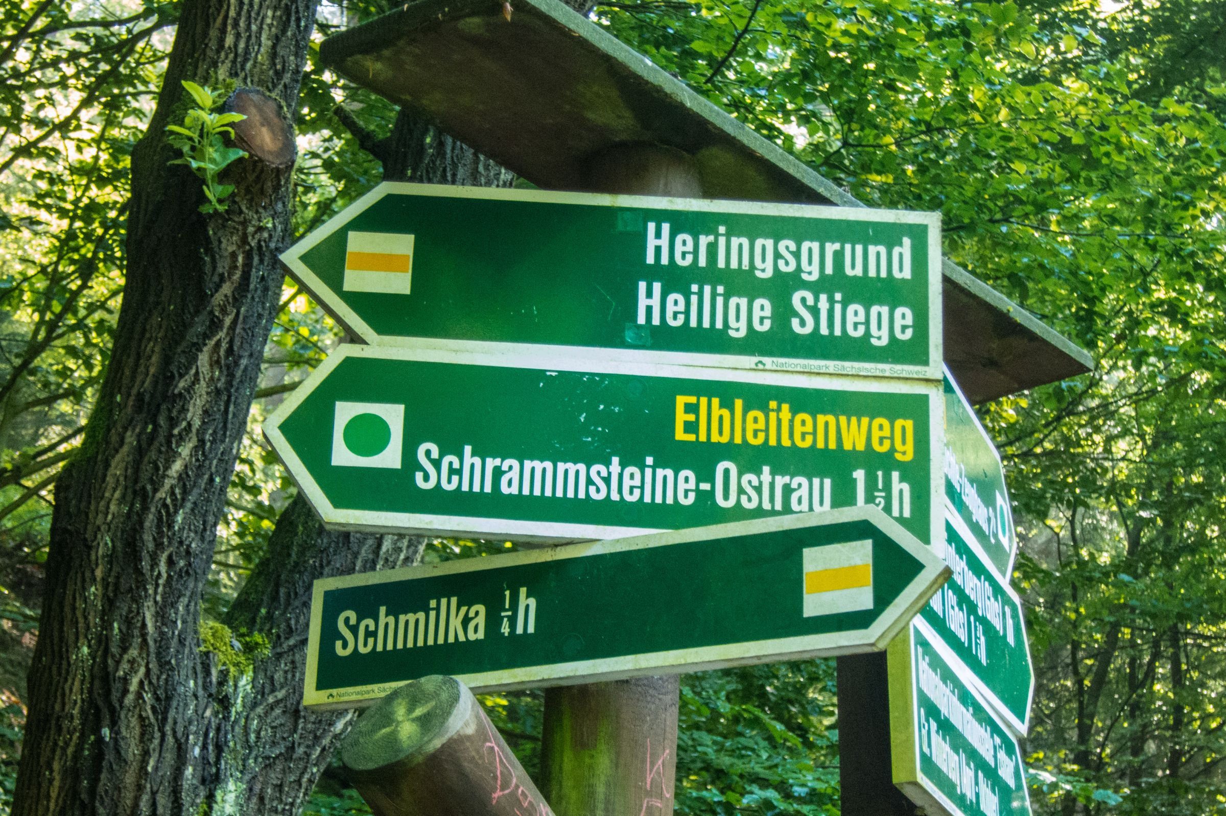
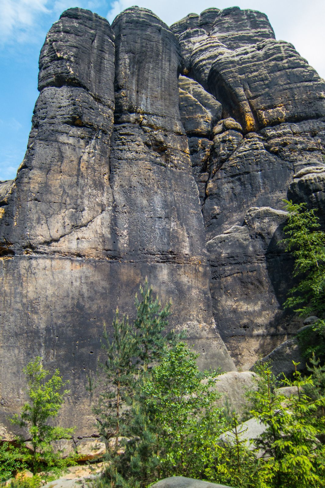
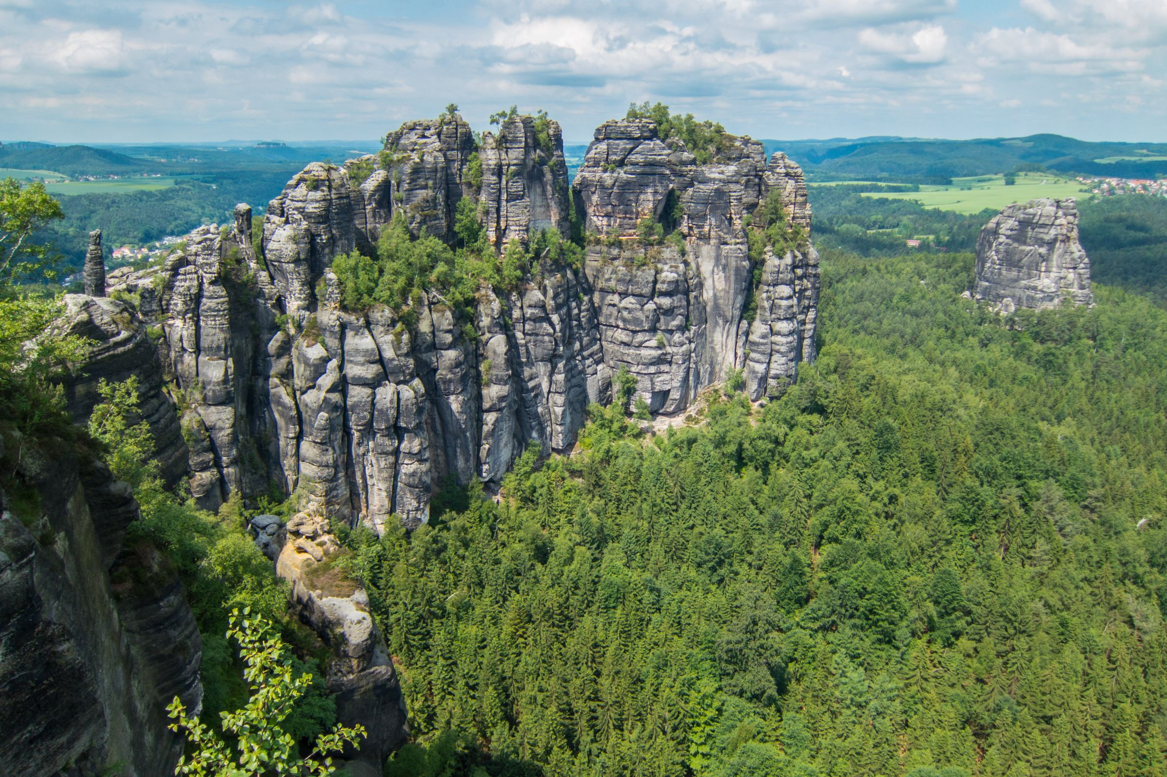
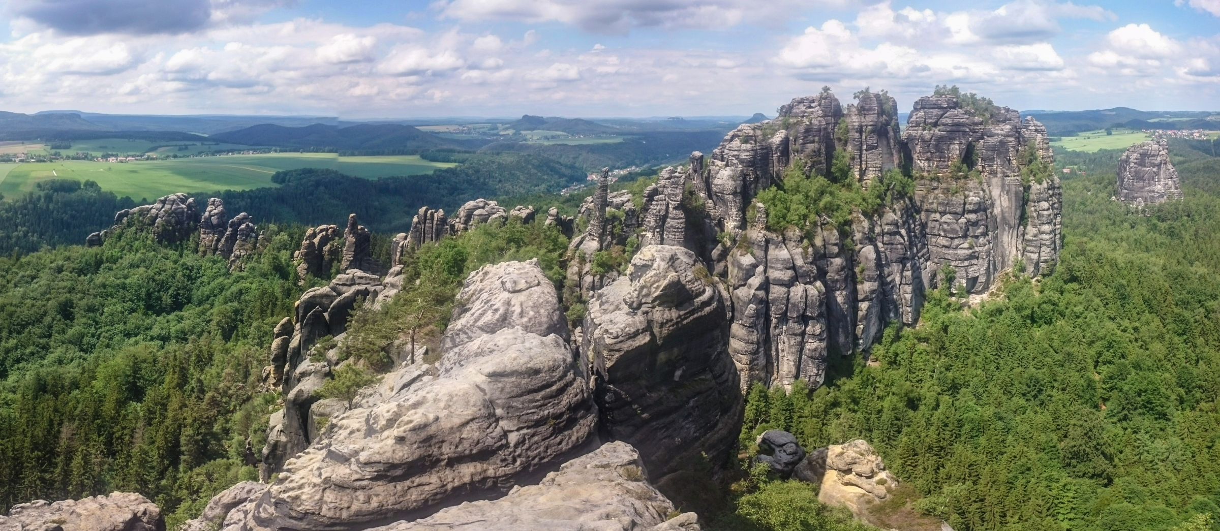
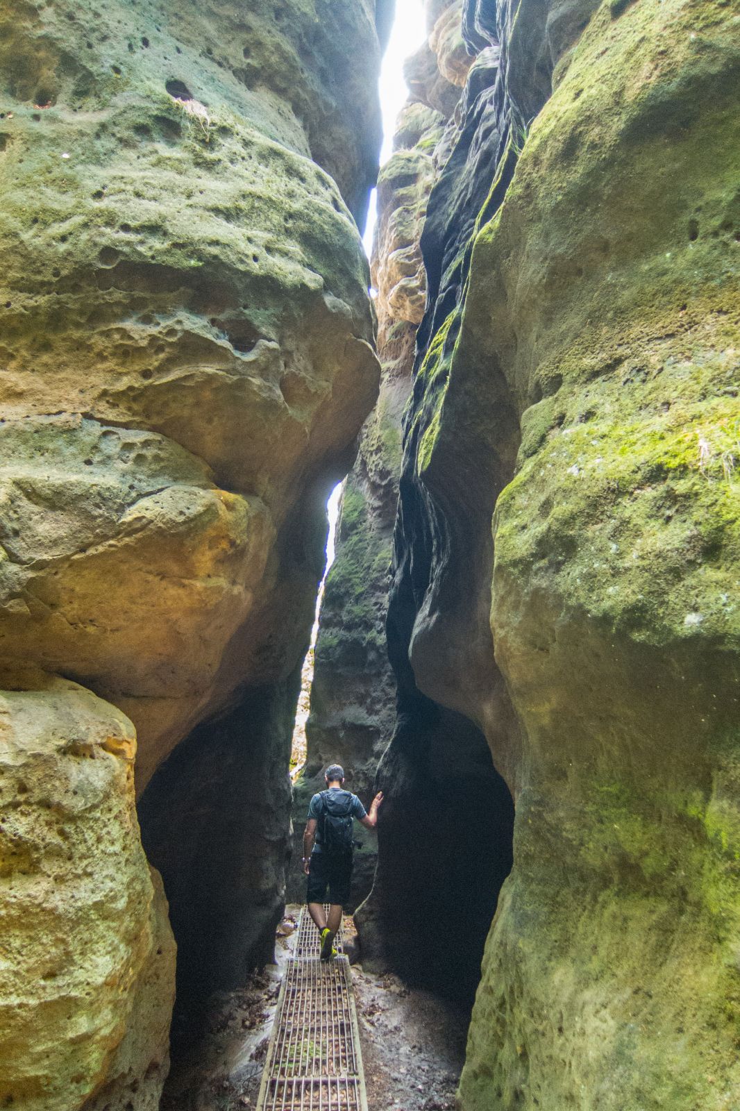
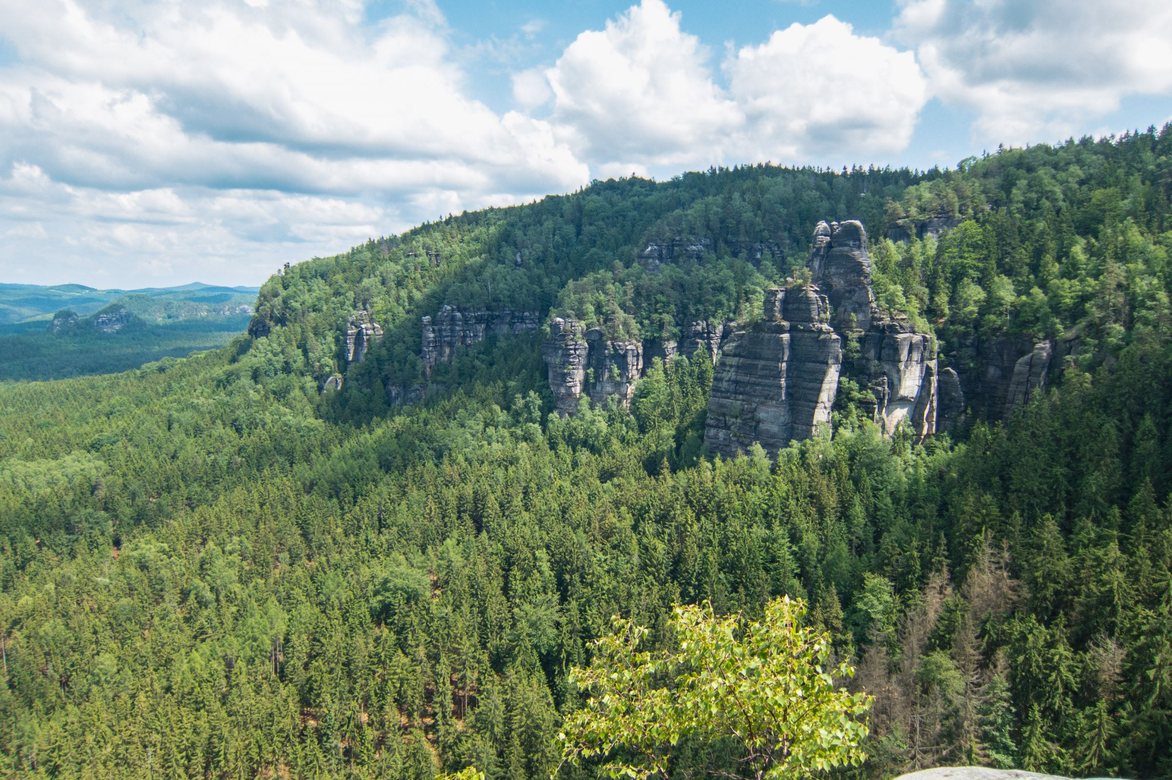
- Schmilka – Schrammsteine (Rocks) (Google Maps) – Heilige Stiege (Sacred Staircase) (Google Maps)

Schrammsteine Outlook
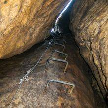
This 10 km trail is a Must-Do. The trailhead is in Schmilka. Get your picnic at the organic bakery and reward yourself after the hike in the beer garden. Walk the adventures trail counterclockwise along iron staircases and ladders. The view of the "Schrammsteine" is unforgettable. The path back to Schmilka along "Heilige Stiege" / Sacred Staircase is pretty steep, leading on several iron staircases back to Schmilka.
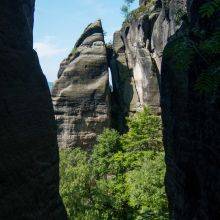
- Großer Winterberg – Kleiner Winterberg – Idagrotto - Carola Fels (Rock) (Google Maps) – Heilige Stiege (Sacred Staircase)
Idagrotto
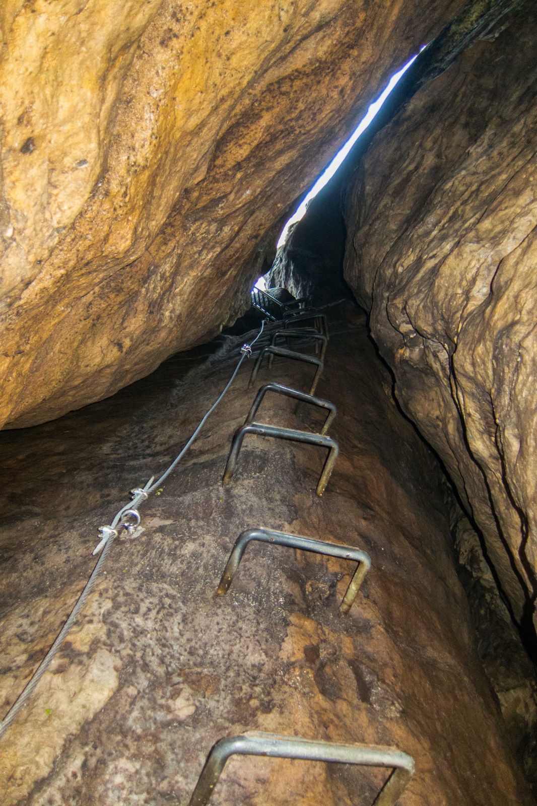
The trail starts in Schmilka, a district of Bad Schandau. First, stop at the organic bakery and reward yourself with a delicious meal afterwards in the beer garden. It’s a circular trail 10 km – 3 h with spectacular views. First, it’s a steep ascent on iron stairs and steps in between. Afterwards, you can choose between different trails. We hiked to both Winterberg mountains and the Idagrotto. It's an exposed path to get to the grotto.
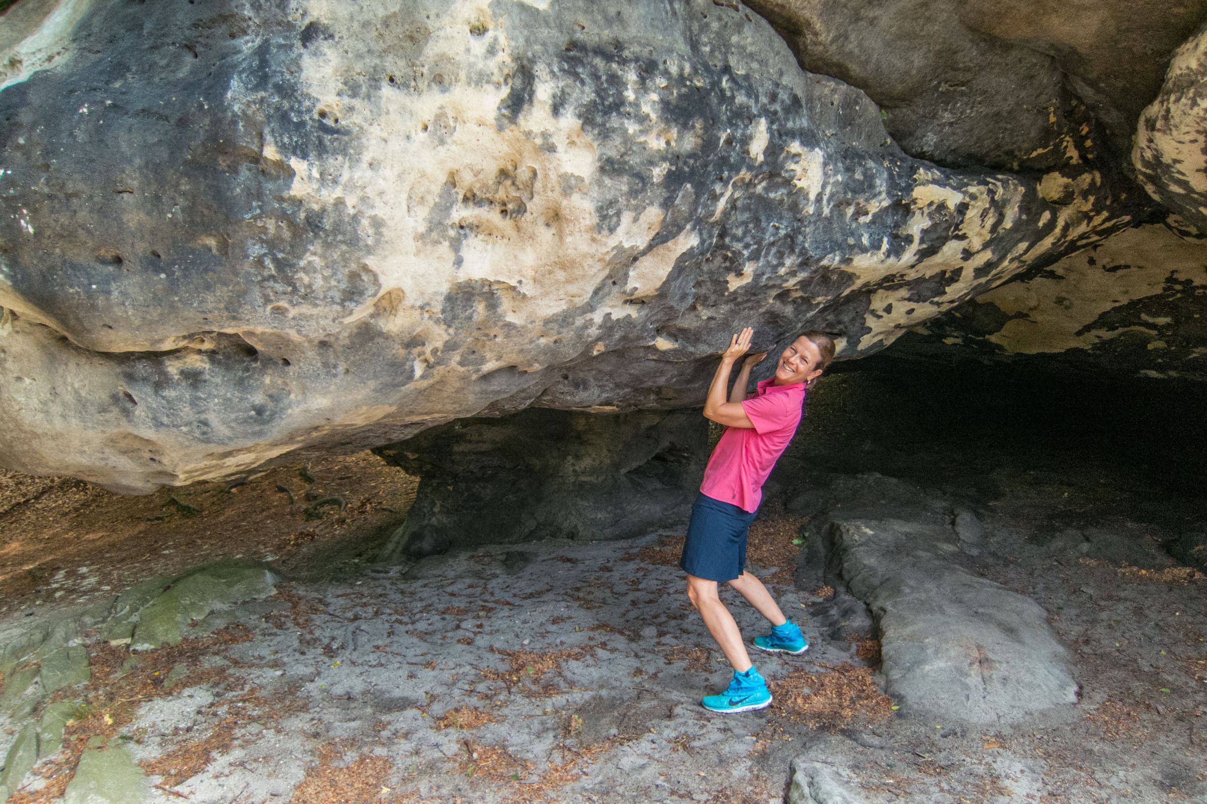
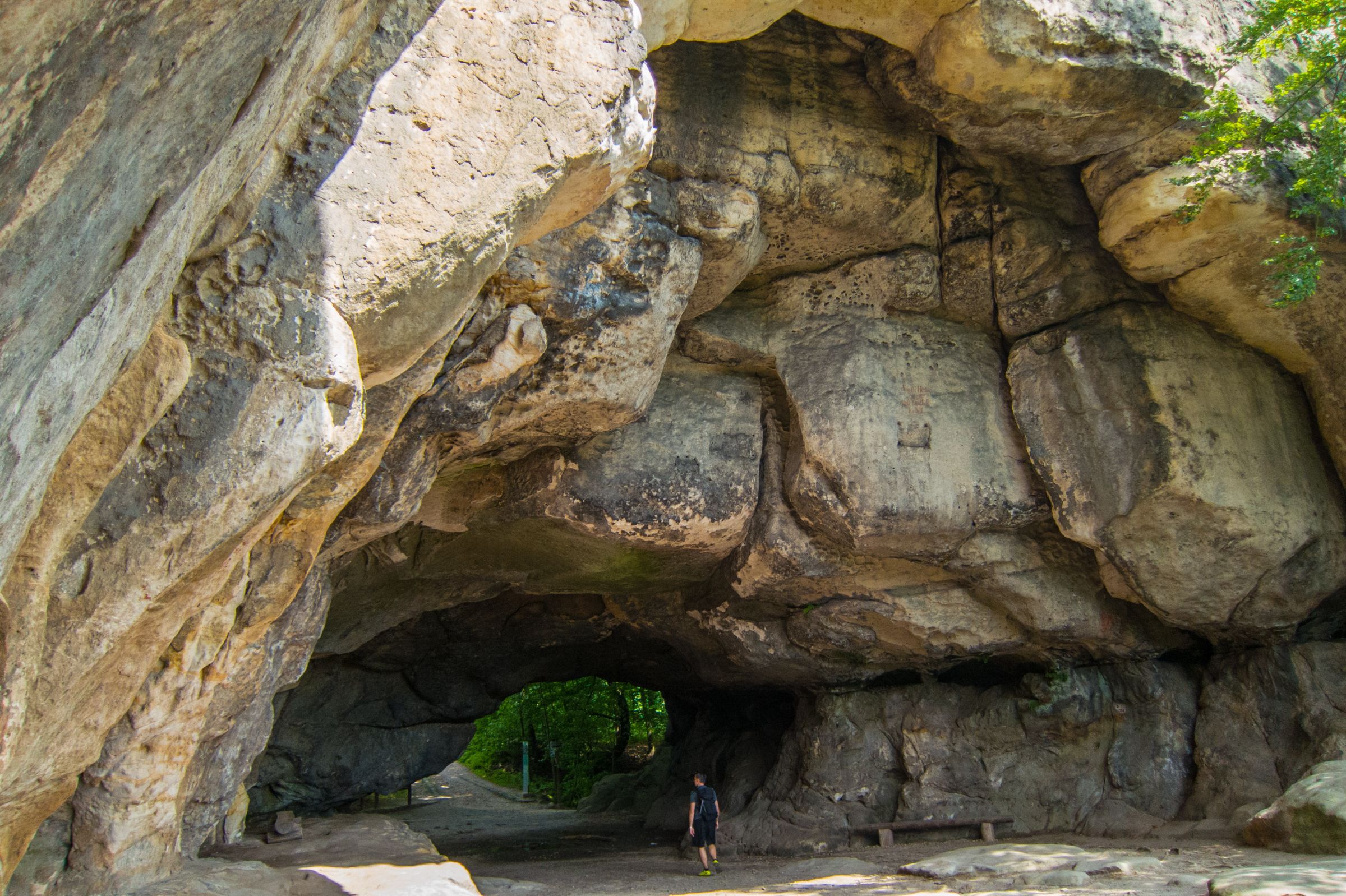
- Kuhstall ( Cow Shed) (Google Maps)– Himmelsleiter (Stairway to Heaven) (Google Maps)– Kleiner Winterberg – Idagrotto - Affensteine (Monkey Rocks)

Kuhstall - Cow Shed
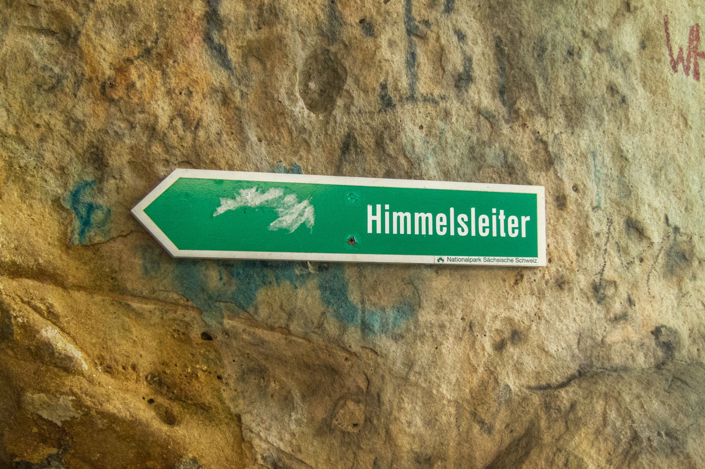
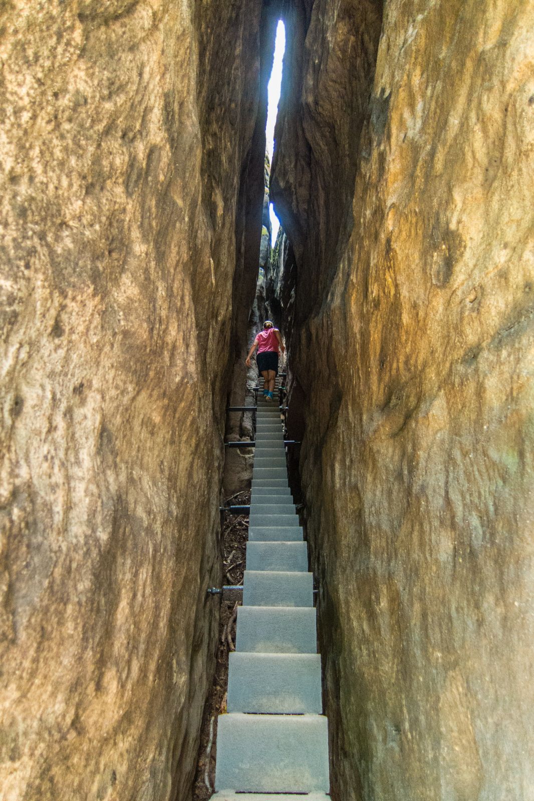
One of the Must-Do Hikes! The trailhead is located in the Kirnitzsch Valley next to the Lichtenhainer Waterfall. You can either park your car here or take the Kirnitzsch train, which leads through the entire valley. It's an awesome hiking trail roughly 10 km long, taking 4 hours. It takes less than an hour to get to the "Kuhstall"/ Cowshed, a large rock arch with a fantastic view, one of the must-sees on the Painters Way. The rock arch is 11 m high, 17 m wide, and 24 m deep. Next to it is a local hilltop pub dating back to 1824 with self-service offering delicious homemade meals. Impressive is the small steep ascent on an iron staircase called "Himmelsleiter" / Stairway to Heaven through a rock crevice. TIP: The pub does not accept credit cards - cash only!
Himmelsleiter - Stairway to Heaven
The next stop is the "Kleiner Winterberg" also with an amazing view. Spectacular is the narrow path that leads to the Idagrotto. The "Affensteine" or Monkey Rocks are popular for climbing.
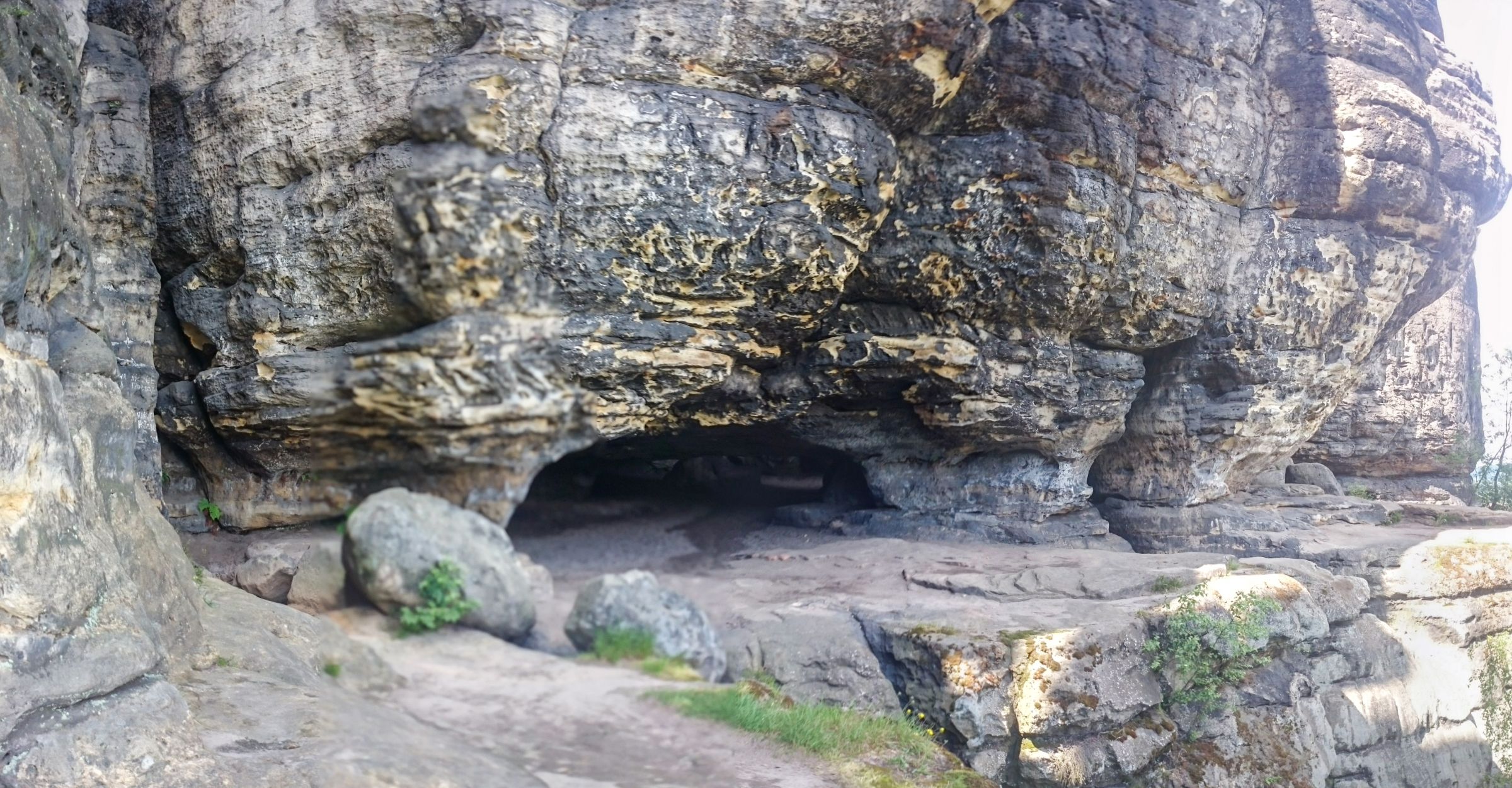
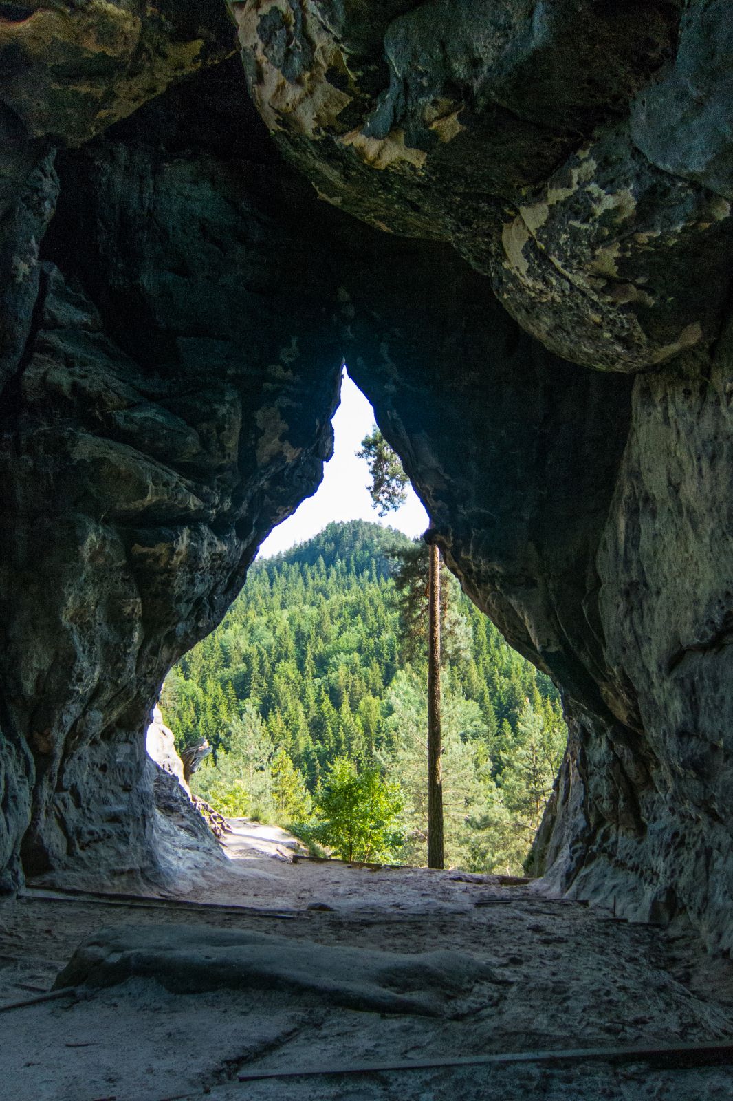
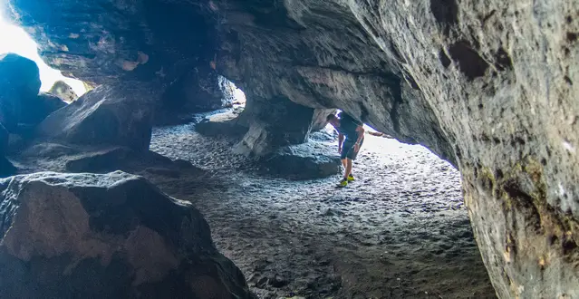
- Kleinsteinhöhle / Cave (Google Maps)

The "Kleinsteinhöhle", also located in the Kirnitzsch Valley, was painted by Ludwig Richter in 1820. It's a short trail to get here from the parking Helfrichs Wiesen at the Kirnitzschtalstrasse / Kirnitzsch Valley Road. The return walk may take half an hour.
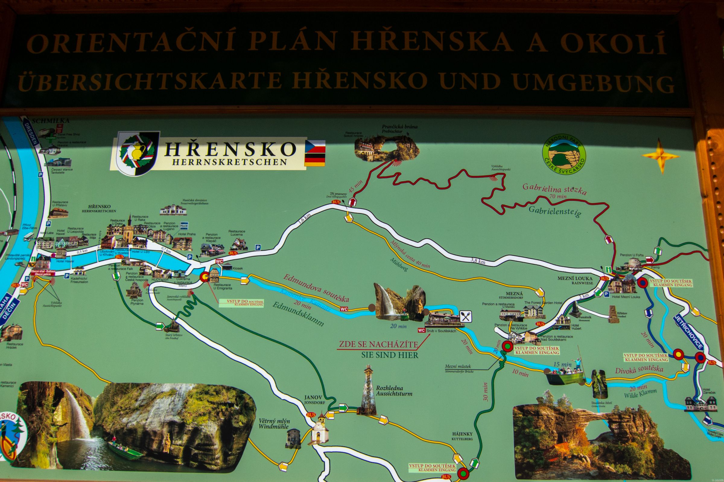
- Prebischtor – A transborder trail from Germany to the Czech Republic (Google Maps)

Edmunds Gorge – Wild Gorge – Mezhi Louka – Gabrielensteig - Prebischtor
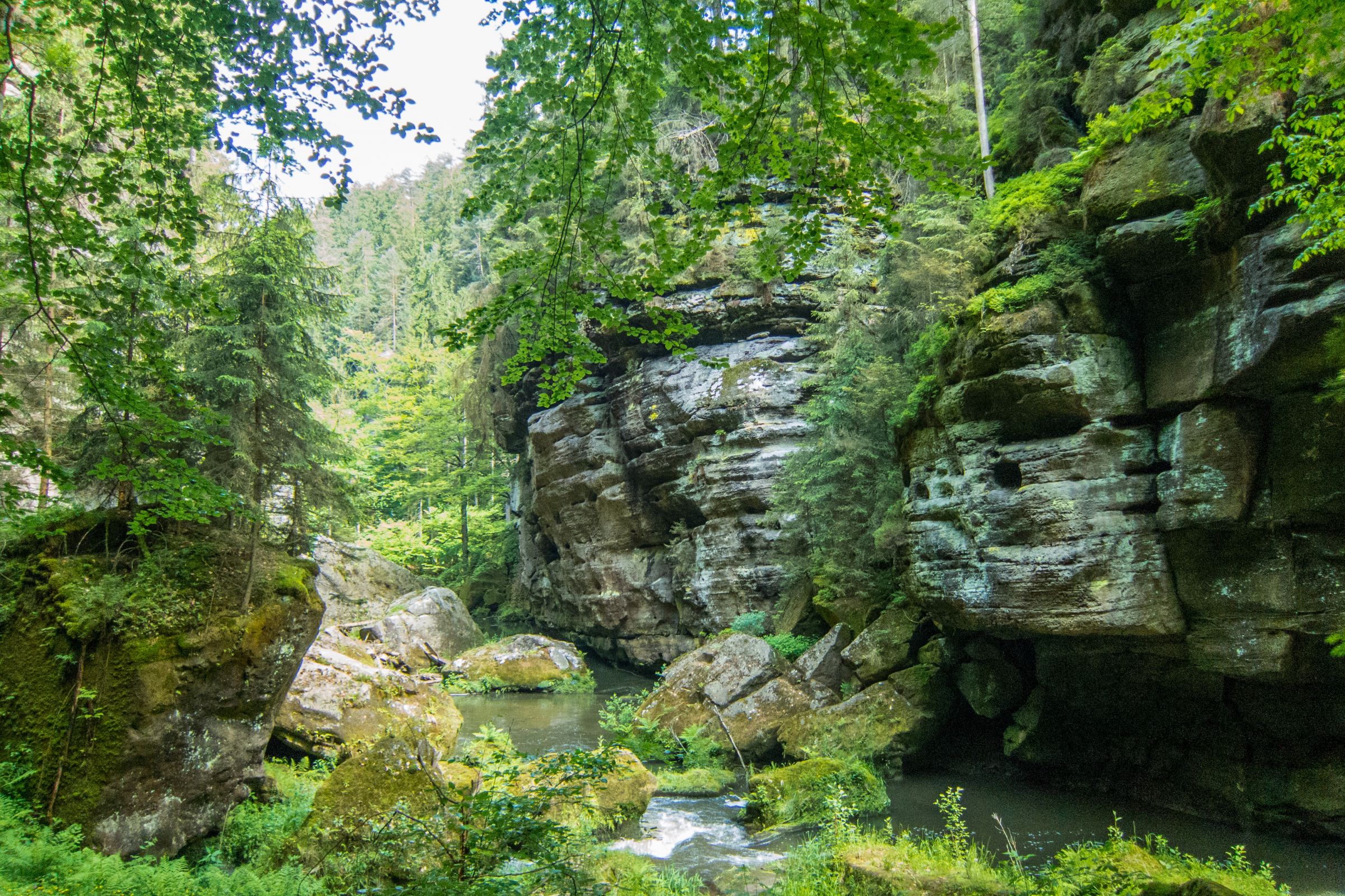
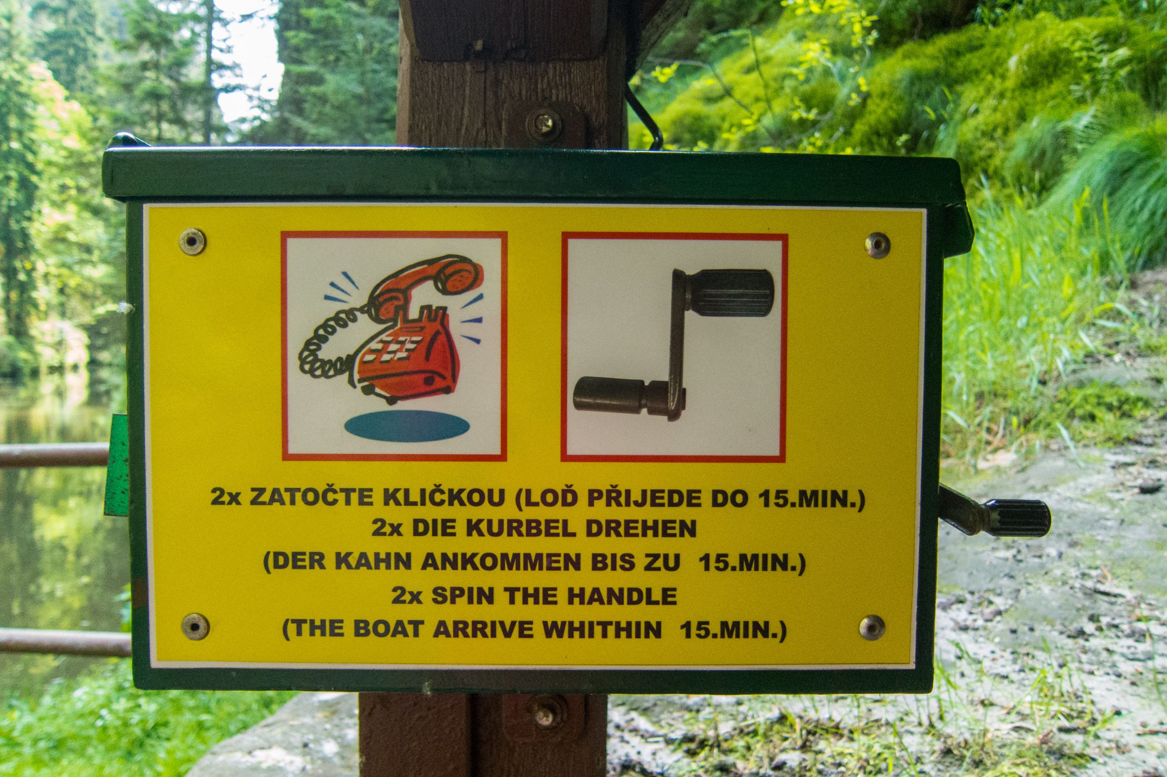
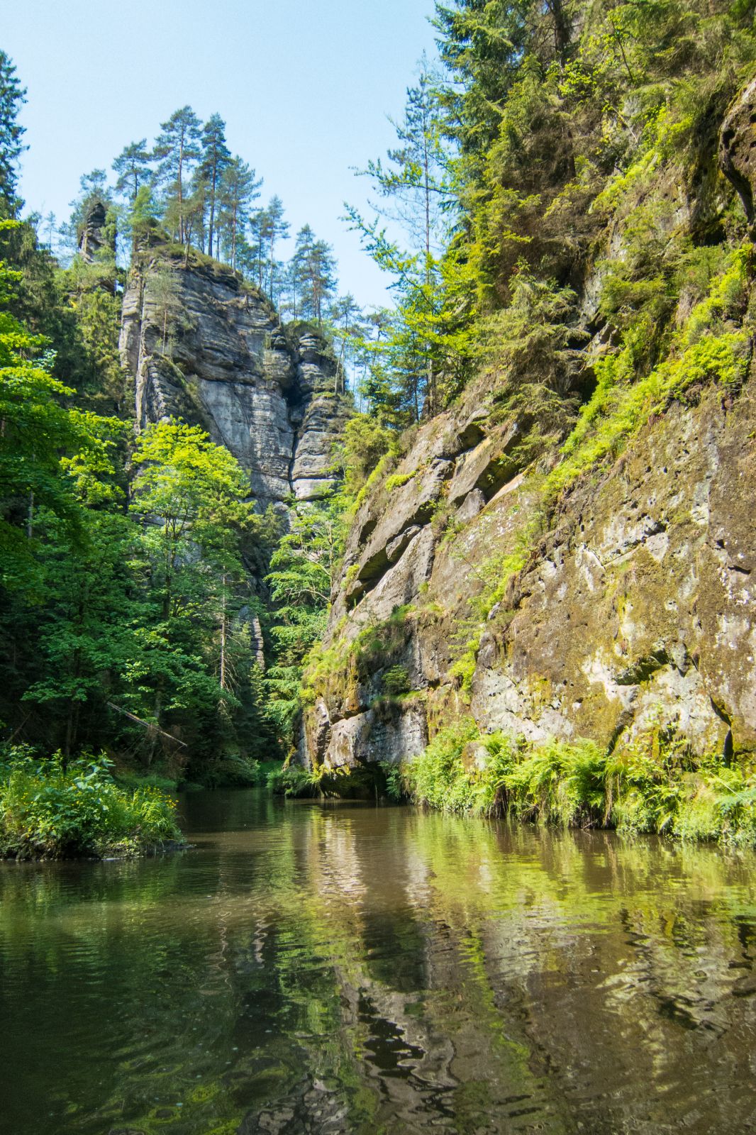
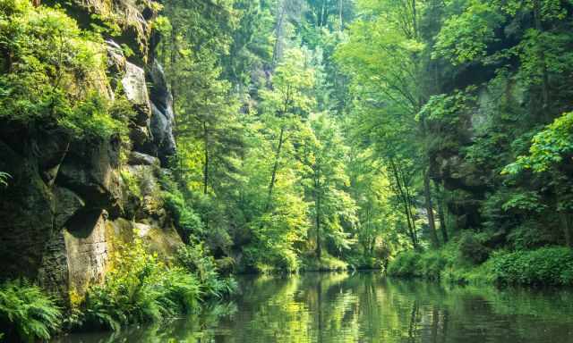
This day hike is roughly 18 km long and took us 6 hours. Hike the trail counterclockwise to get the perfect shot from the huge rock arch Prebischtor in the afternoon. The fascinating path combines hiking and taking a boat twice in the Edmundsklamm / Edmunds Gorge at the beginning and again in the Wilde Klamm / Wild Gorge. The ferry boats are offered from April to October from 10 am – 6 pm.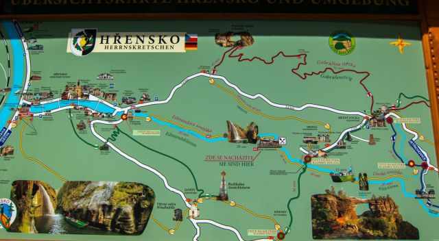
The Edmund’s Gorge trail is 1.8 km plus 950 m by boat long. The Wild Gorge is a 1 km path plus 500 m by boat. The incredible Prebischtor is a jewel of Bohemian Switzerland and the largest natural sandstone arch in Europe. It is 16 m high and 27 m wide. The walk to the top of the Prebischtor was closed and removed in 1982 to protect this natural wonder for future generations. After 250 years of people walking above the arch, there was already a 60 cm deep groove. The restaurant of the castle "Falkennest" Hawk's Nest was already opened in 1882 and offers affordable home-cooked meals nowadays with a spectacular view of the rock formation. The trailhead is in Hrensko/Hernskretschen. Limited parking for a small fee. The first part of the trail until Mezhi Louka is marked in blue, the second to the Prebischtor red. Picture Hiking Map
My Hiking Map Tip: I highly recommend buying a Saxon Switzerland hiking map. It is a labyrinth of hikes and climbing routes, all well-marked, but as an exception, our hiking app was insufficient, and most of the trails are not named.
The Painter’s Way – Multi-Day Hike

Painters, musicians, and poets got inspired by the Elbe Sandstone Mountains, like Caspar David Friedrich, William Turner or Antonin Dvorak. The Painters Trail is a 114 km long hike, split into eight stages. The path leads to the most spectacular parts of the National Park. It’s almost a circular trail leading on both sides of the river Elbe. Luggage transport from one accommodation to the next one is offered. You only need to carry your daypack. Get in contact with your host and ask them for assistance. Unfortunately, there isn’t any information provided in English. The attached link about the different stages and hosts is in German only. Accommodations Painters Way for each stage. Click on the map to choose the region you like to hike this famous trail. If requested, many of these places prepare a lunch package for you as well.
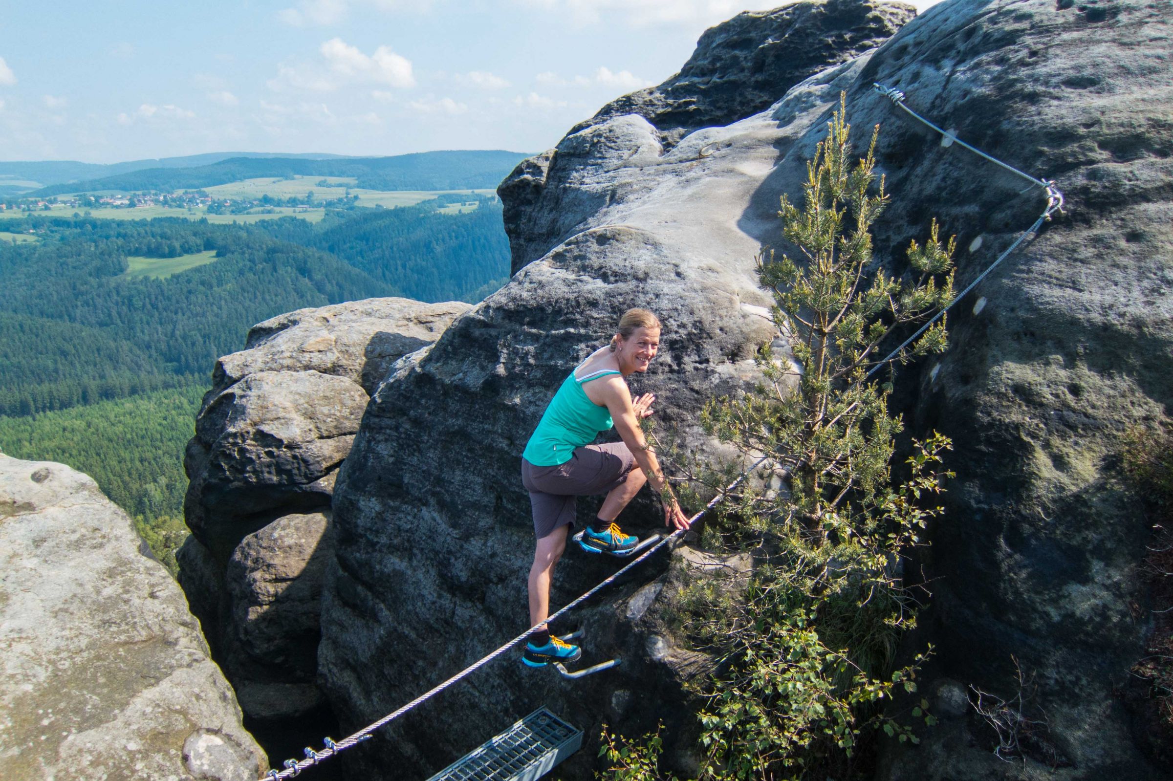
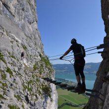
Via Ferratas

For those who like to climb a via ferrata there are several around usually called "Stiege" which can be combined with hiking. Initially, they were built to overcome the mountains, often transporting goods. That's also the reason for extremely long staircases with hundreds of steps. These two were our favourite ones:
- A combination of two different via ferrata: The "Zwillingsstiege" and "Häntschelstiege" plus spectacular views on the top.
- Rübezahlstiege; is one of the most difficult ones. Climbing experiences are helpful in mastering it.
Climbing - Where Free-Climbing Was Invented
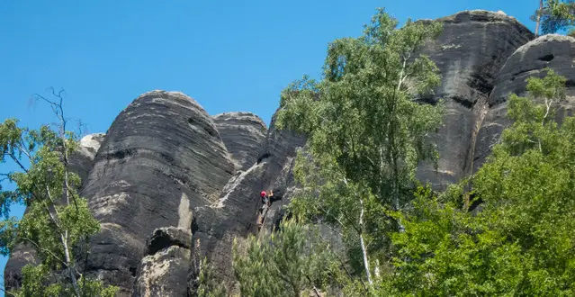
The Saxon Switzerland where free climbing was invented, and a unique technique is required. Climbing here is completely different, and the existing rules are essential:
- It’s only allowed to climb up on dry rocks. If there was rain before, you have to wait an entire day; if the stone is wet, it’s less stable and can break.
- Chalk is not allowed; it would destroy the sandstone over time.
- All kinds of metal for your protection while climbing is prohibited. Instead, you only use a special type of knot that has to be put in narrow cracks. Climbing lessons for this unique technique are offered.
Climbing School Lilienstein in German only; e-mail address: [email protected]
Public Transport

There are buses available the entire week. From April to October, there are additional buses at weekends and public holidays offered for the following locations; Pirna, Bahratal, Berggiesshübel, Koenigstein, Rosenthal, Bad Schandau, Hinterhermsdorf, and Sebnitz. These buses transport up to 20 bikes as well. A historic tram is operating in the Kirnitzsch Valley, giving you access to different trailheads.
Tourist Information Center Saxon Switzerland
The tourist information centre is located in the centre of Bad Schandau. They provide hiking brochures, bike hire, and outdoor gear hire; they even purchase tickets for public transport and much more. If you have any questions, get in contact with them or grab your maps after arrival.
Touristservice Bad Schandau
Markt 12 · 01814 Bad Schandau
[email protected]
Do you want to obtain the usage right for my images? Contact me, but I will take action against picture theft.