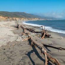
The Point Lobos State Natural Reserve is one of the most popular parks because of its natural beauty and location. With more than one million visitors annually, the park has already reached its limit, and the number of visitors is still increasing.
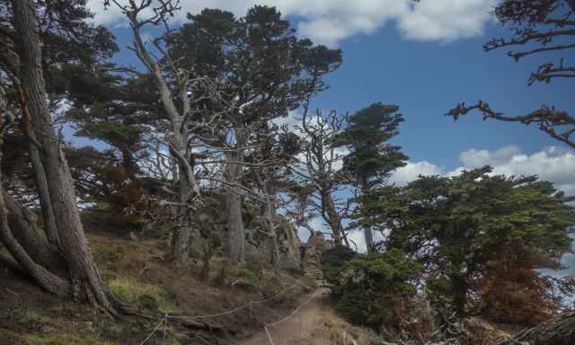
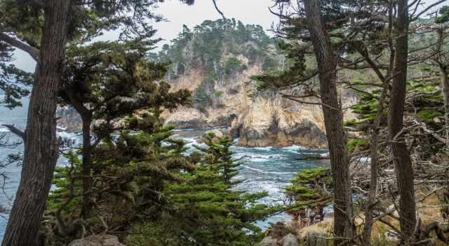
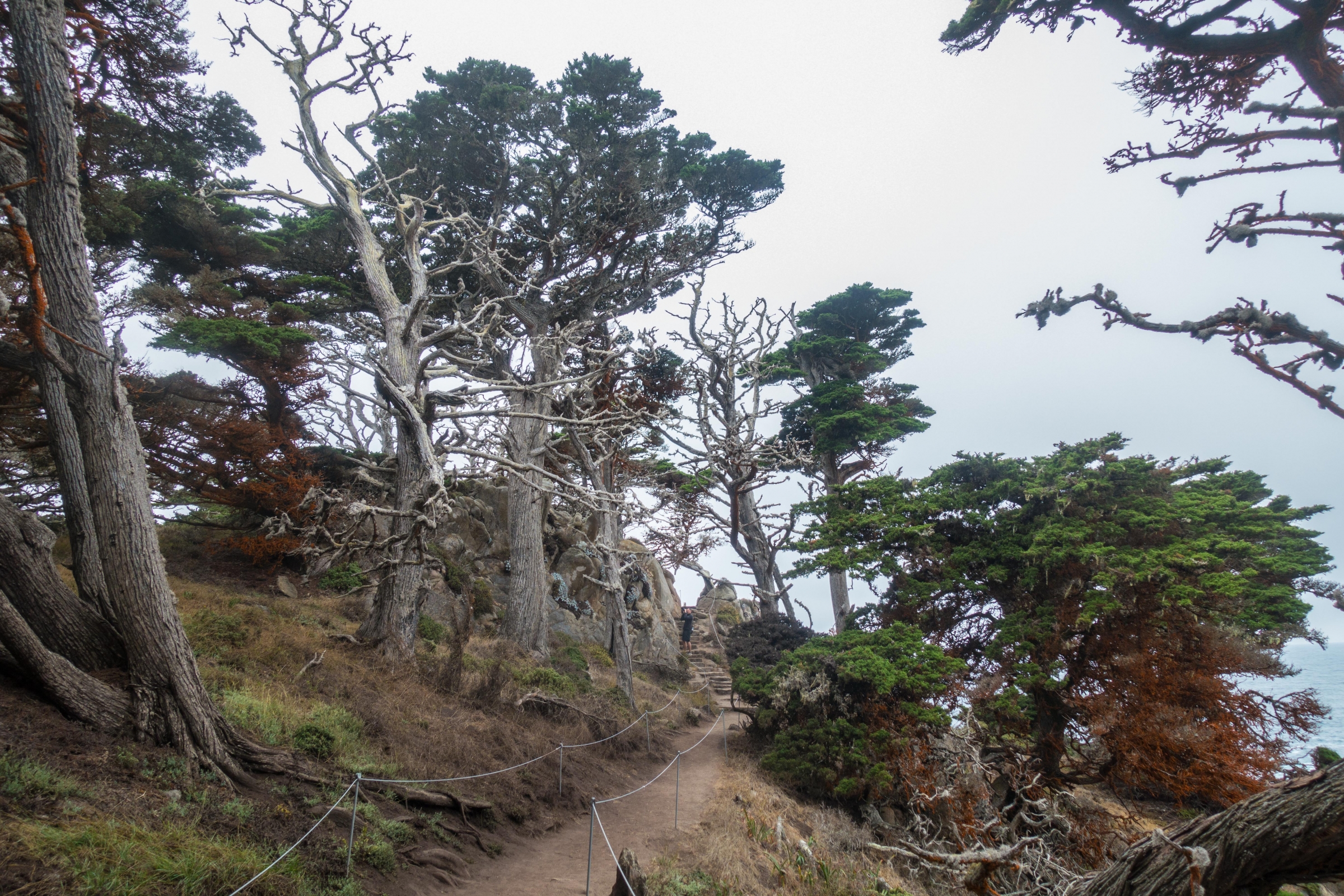
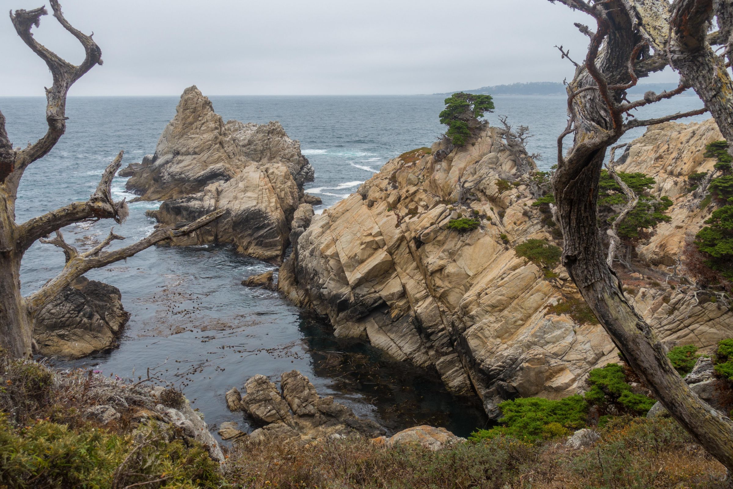
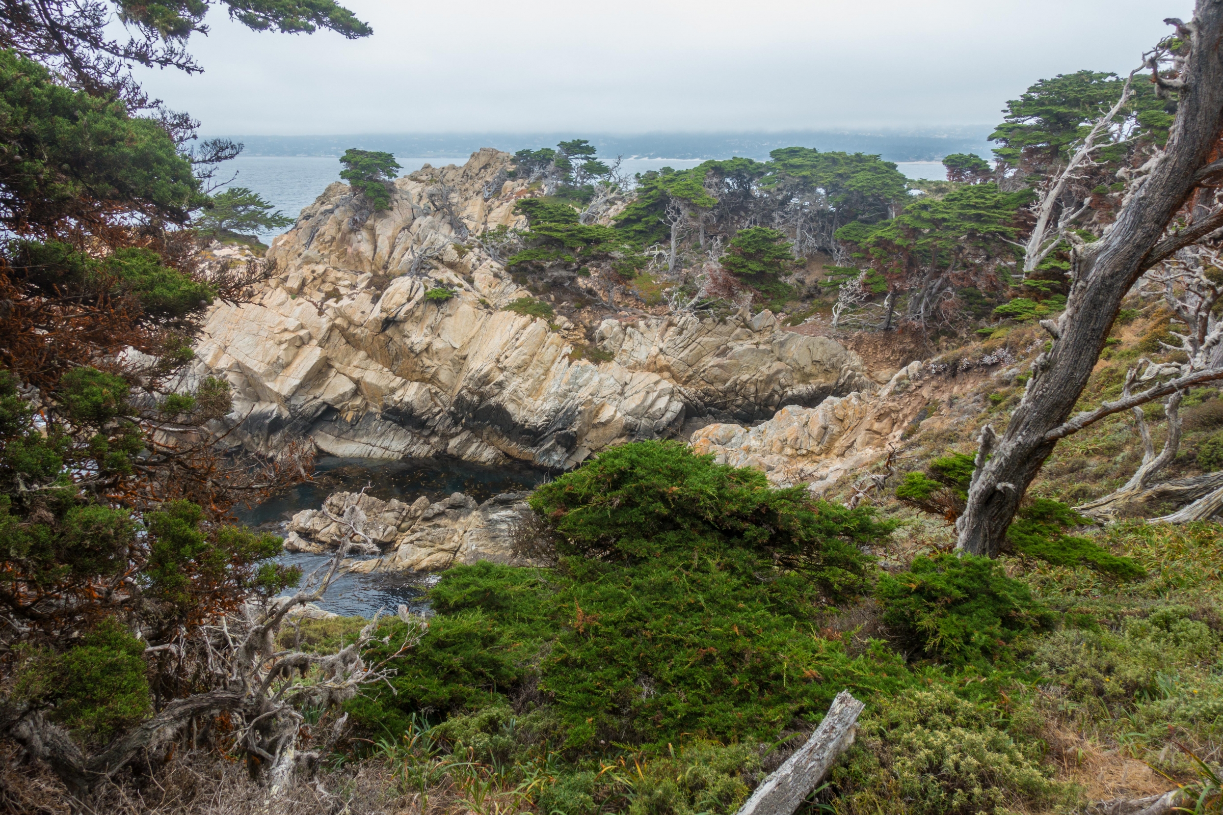
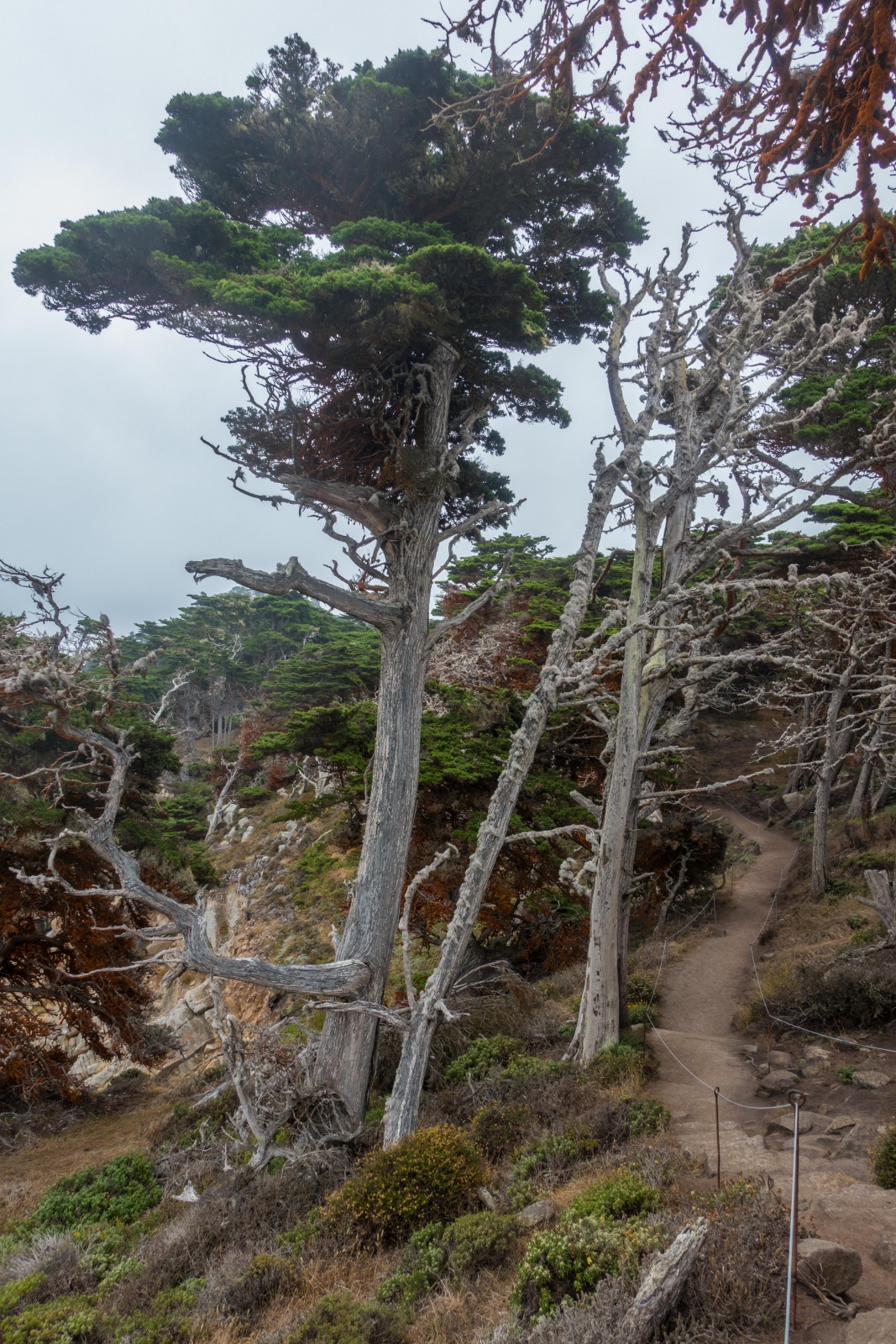
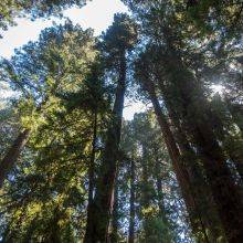
Allan Memorial and Cypress Grove Trail in Point Lobos - Monterey Cypress Forest
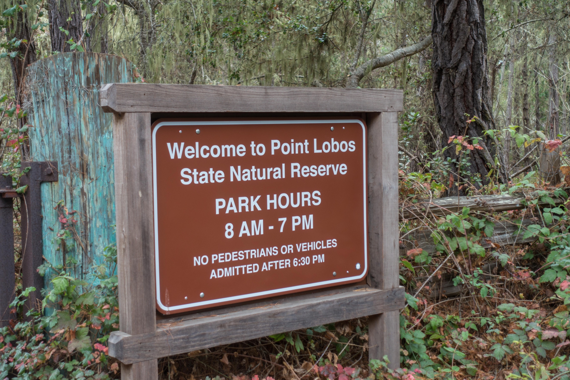
The park opens throughout the year at 8 a.m. but closes before sunset to protect the wildlife and to avoid disturbances (like deer, foxes, bobcats, and owls). Camping is not permitted.
The best time to visit Point Lobos regarding crowds and weather with clearer skies, pleasant temperatures are September and October, followed by April and May.
Crowds in Summer at Point Lobos
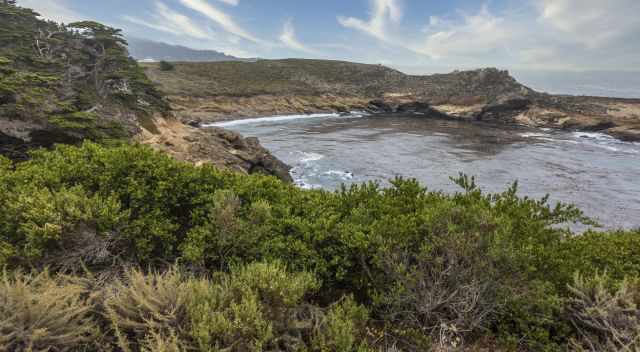
Point Lobos State Natural Reserve is one of the most popular coastal destinations in California, and summer brings the highest number of visitors. Its breathtaking scenery and easy access from Carmel along Highway 1 make it a year‑round highlight, but summer weekends—especially Sundays—are extremely busy. With only around 150 parking spaces inside the reserve, the lot often fills up shortly after opening.
To avoid long lines or having to park on the shoulder of Highway 1 and walk in, it’s best to arrive before 9 a.m. or visit later in the afternoon. Mid‑week visits are much quieter and far more enjoyable.
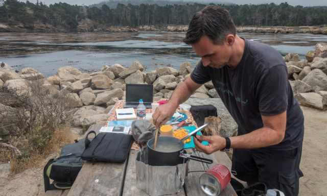
Bring a snack or meal to Point Lobos there isn't any cafe or shop.
There are no cafés or shops inside the reserve, so bring snacks or a packed lunch. Point Lobos is also a favorite destination for school groups and youth programs, especially in spring and summer, which can add to the crowds. However, once you start hiking, the reserve quickly becomes peaceful. Even on a busy Sunday during our visit, we found ourselves almost alone on the trails, surrounded only by cypress trees, ocean views, and wildlife.
Climate at Point Lobos
Dense fog typical for the summer season.
Point Lobos has a cool, moderate coastal climate influenced by the cold Pacific Ocean. Temperatures stay remarkably stable throughout the year, usually between 55–65°F (13–18°C). Spring is typically sunny and cool before the summer fog season begins. From June through August, dense fog often lingers until midday as warm coastal air condenses over the cold ocean water, which averages around 50°F (10°C).
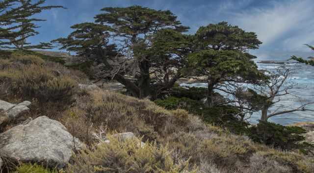
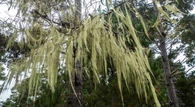
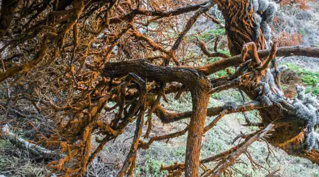
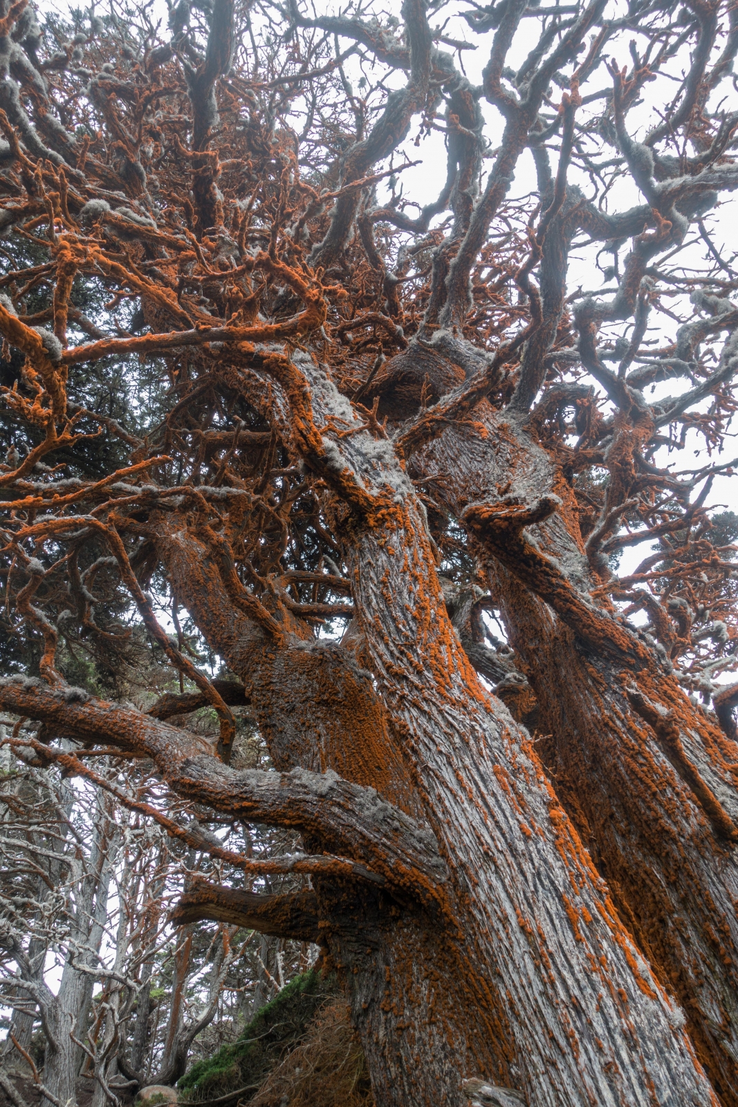
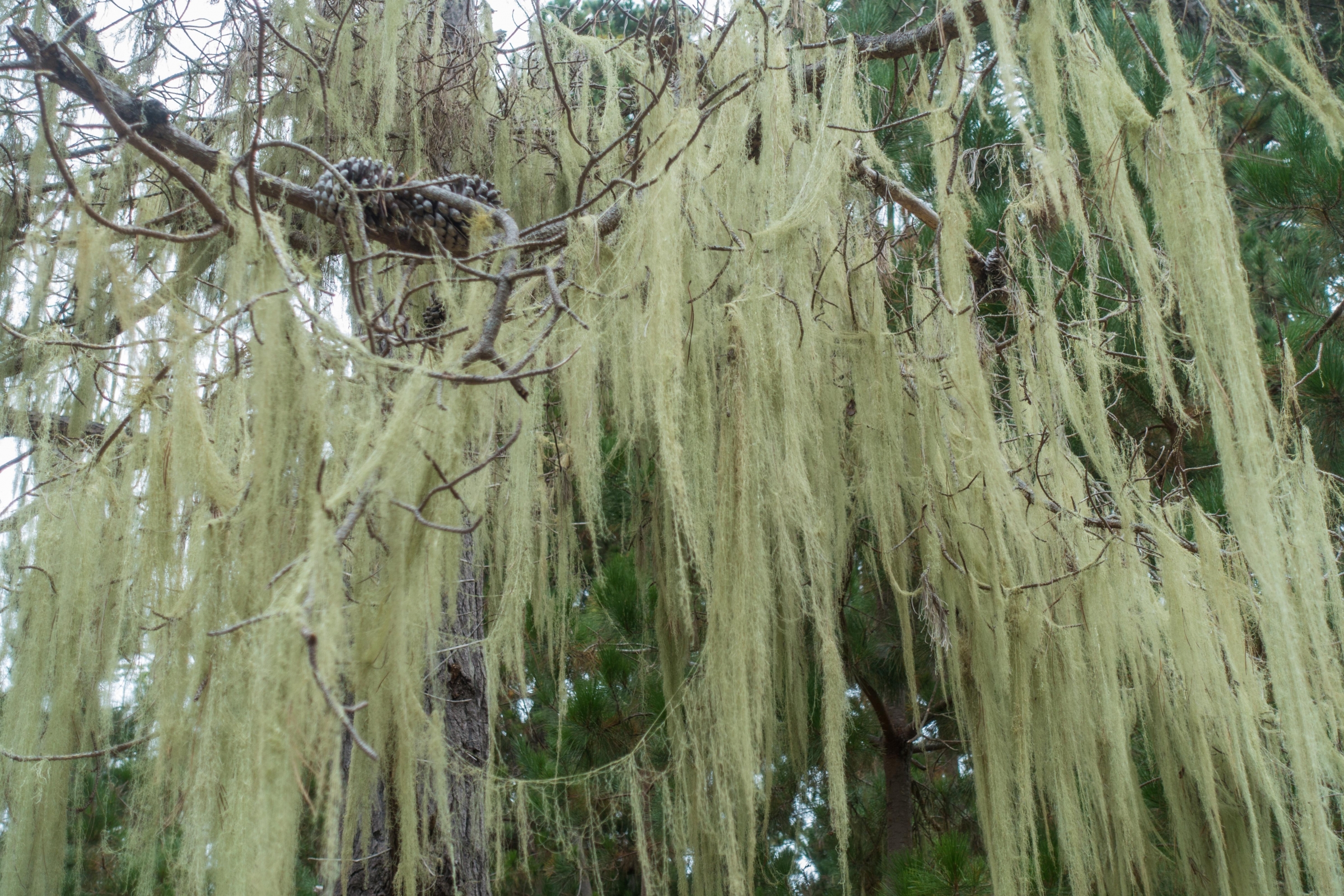
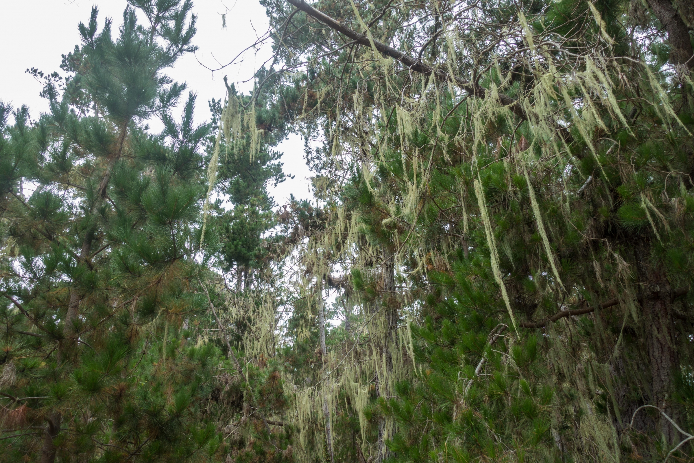
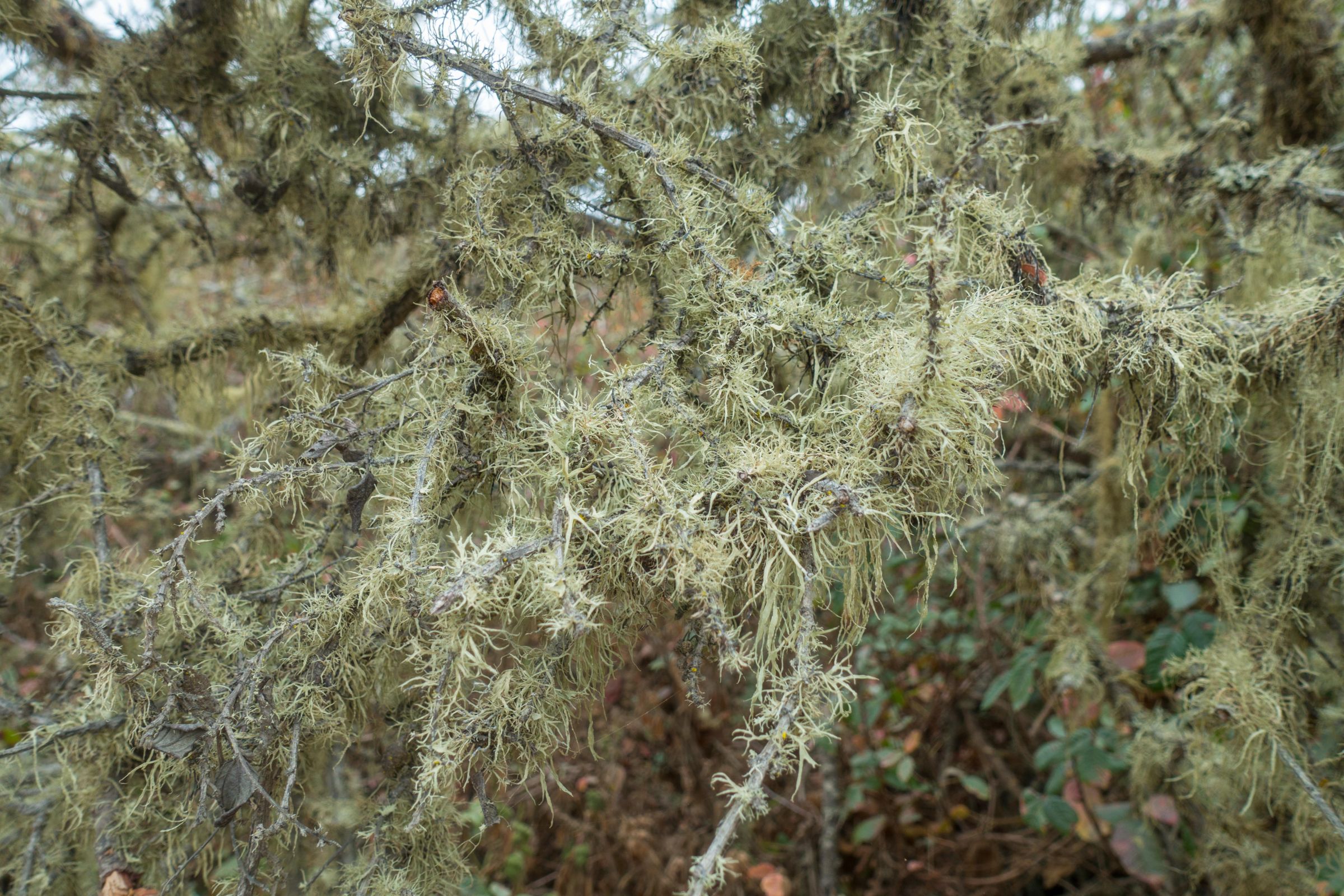
Pine Trees are full of lichen, the evidence for fog and rain.
The iconic Monterey cypress and pine trees are covered in lichen — a clear sign of the area’s high humidity and frequent fog. The sunniest months are September to November, offering clear skies and mild temperatures, although evenings can be chilly. From November to March, expect mist, light rain, and occasional winter storms.
6 Seasonal Highlights and Animals
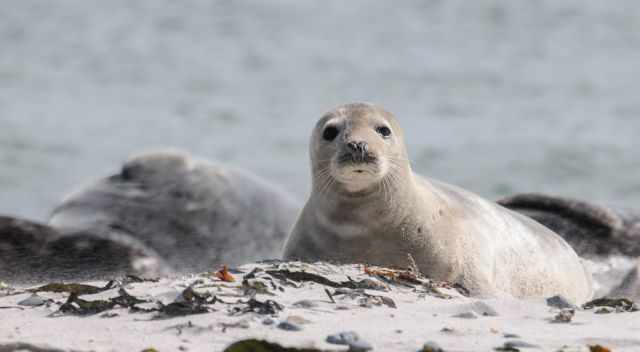
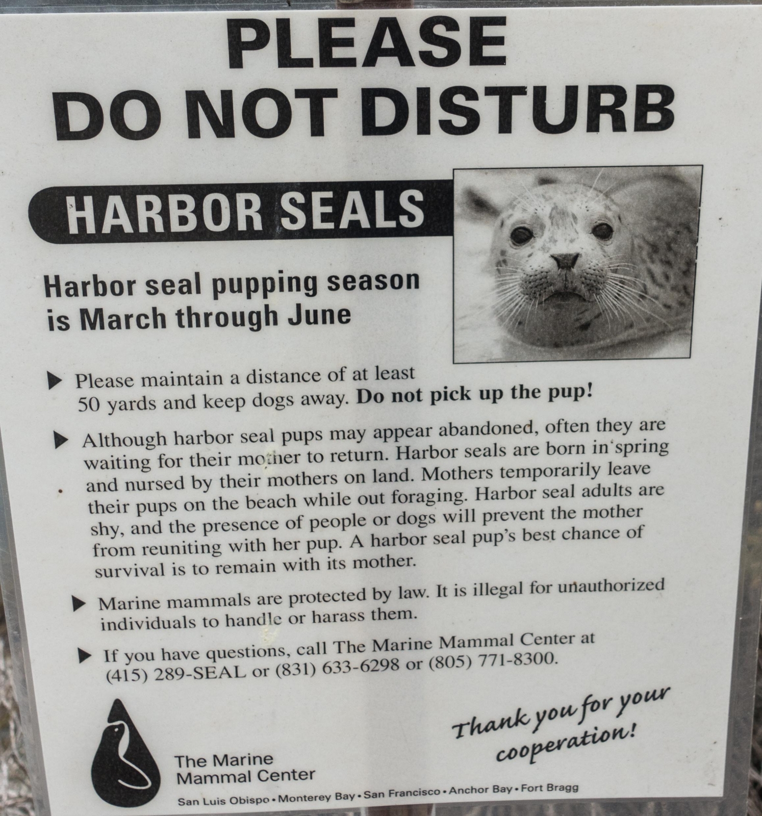
Harbor Seal Pupping Season
Picture by my friend Leif
From March until June, you may spot harbor seals giving birth to a puppy at China Cove. It’s amazing that the newborns start to swim just 20 minutes later. The best months to witness this spectacle are April and May. The cove and beach are closed for the public during this season.
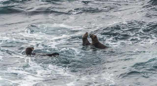
Southern Sea Otters
They may be spotted offshore in the kelp beds on calm days. On windy days they are more often found in protected coves like in my picture. They are living in waters with a temp between 35°F and 60°F / 1,5°C up to 15,5°C. This is important for their constant body temp of almost 100 °F / 37°C. They mate and give birth in the sea throughout the year with a peak of pupping from January to March, fewer from August to October.
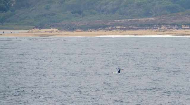
WhalesHumpback whale in the distanceThey can be spotted throughout the year. Perfect spots to observe whales are South Point and Sea Lion Point.
# Grey whales are most commonly seen from late December to January and again from March until early May.
# Humpbacks are frequently seen from March until December.
# Minke whales are sometimes spotted from January until April. They migrate in larger numbers, but due to their smaller seize often missed.
# Blue whales are sometimes spotted in summer.
# Orcas; three different species of orcas can be found. The transient orcas feed on mammals, therefore, frequently seen when gray whales migrate with their calves their preferred prey. They can also be spotted at other times of the year hunting seals, porpoise, and dolphins. The resident orcas feed on fish, especially salmon, and always stay in the same area. Nowadays, resident orcas from Puget Sound and the Strait of Juan de Fuca can be found around Monterey. The offshore orcas are mostly seen during winter feeding on squid, fish and even sharks.
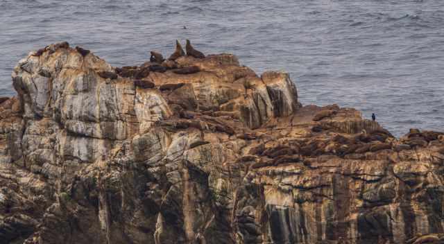
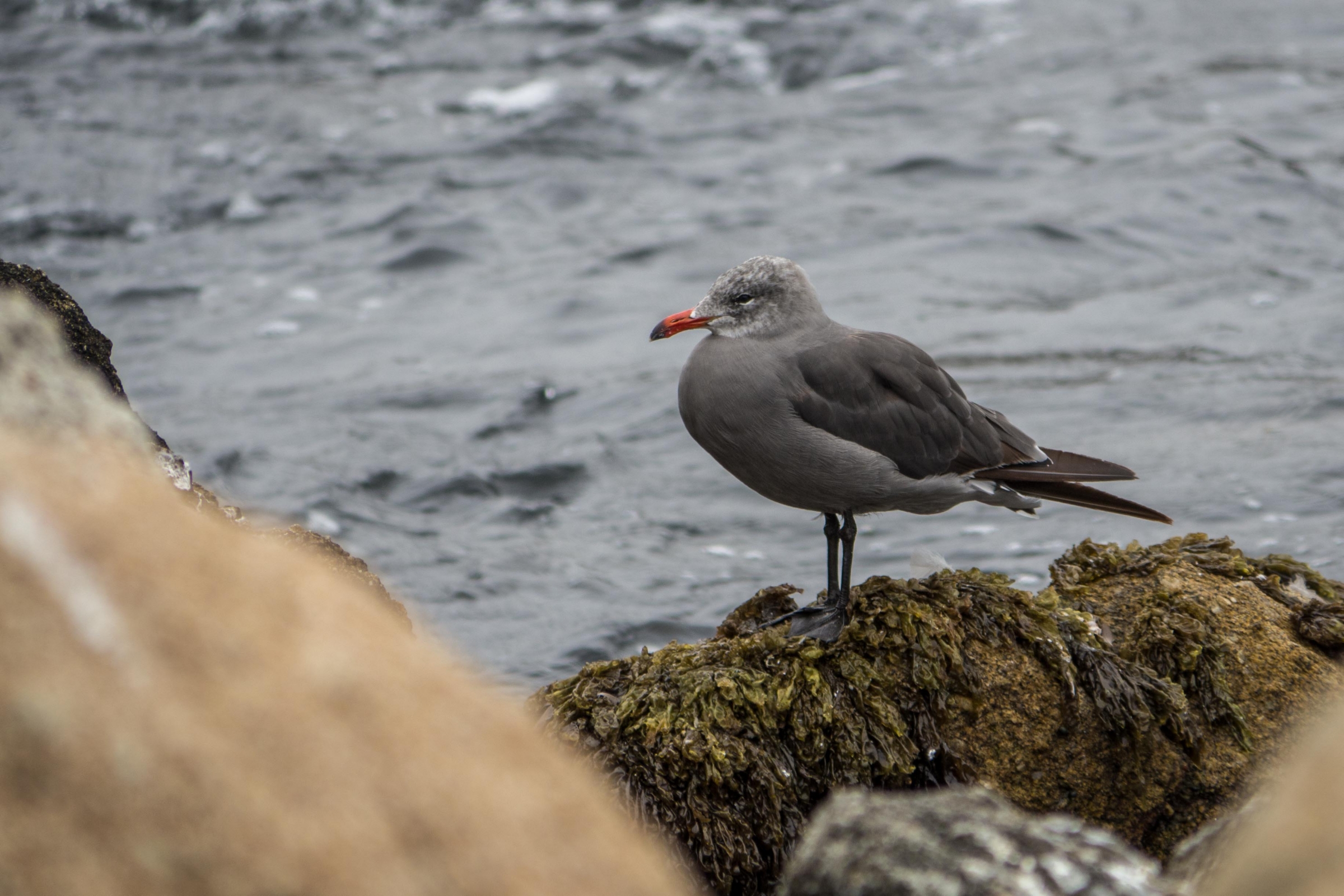
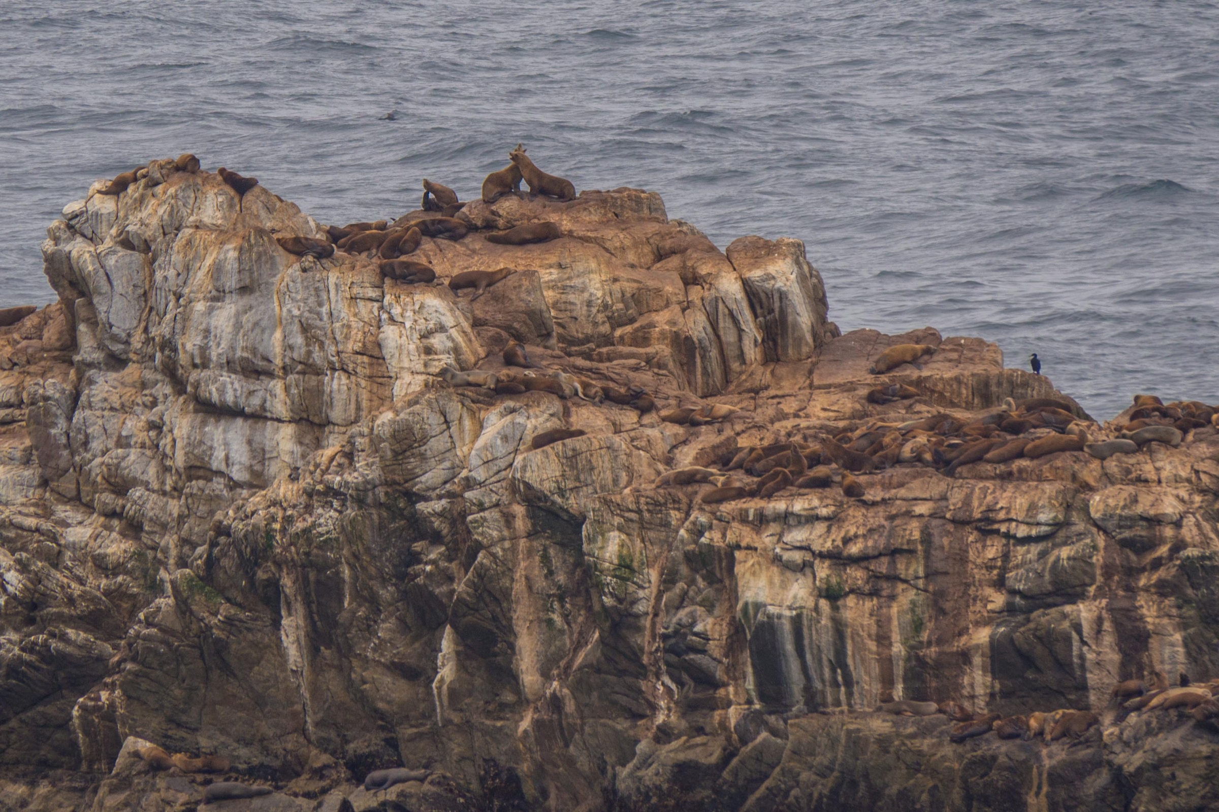
Sea Lions
The sea lions are resting along the shoreline of Point Lobos. Most common is the California sea lion at Point Lobos. You already hear them baking from far away. The reason for the name of the State Park Reserve. "Punta de Los Lobos Marinos" in Spanish means "The point of the sea wolves". The sea lion population is much smaller in late spring and summer due to migration to the south for mating. However, you spot them here throughout the year. Elephant seals are spotted occasionally.
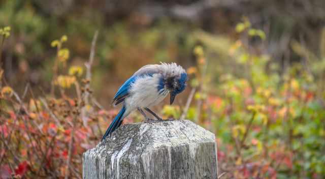
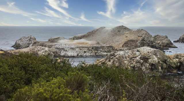
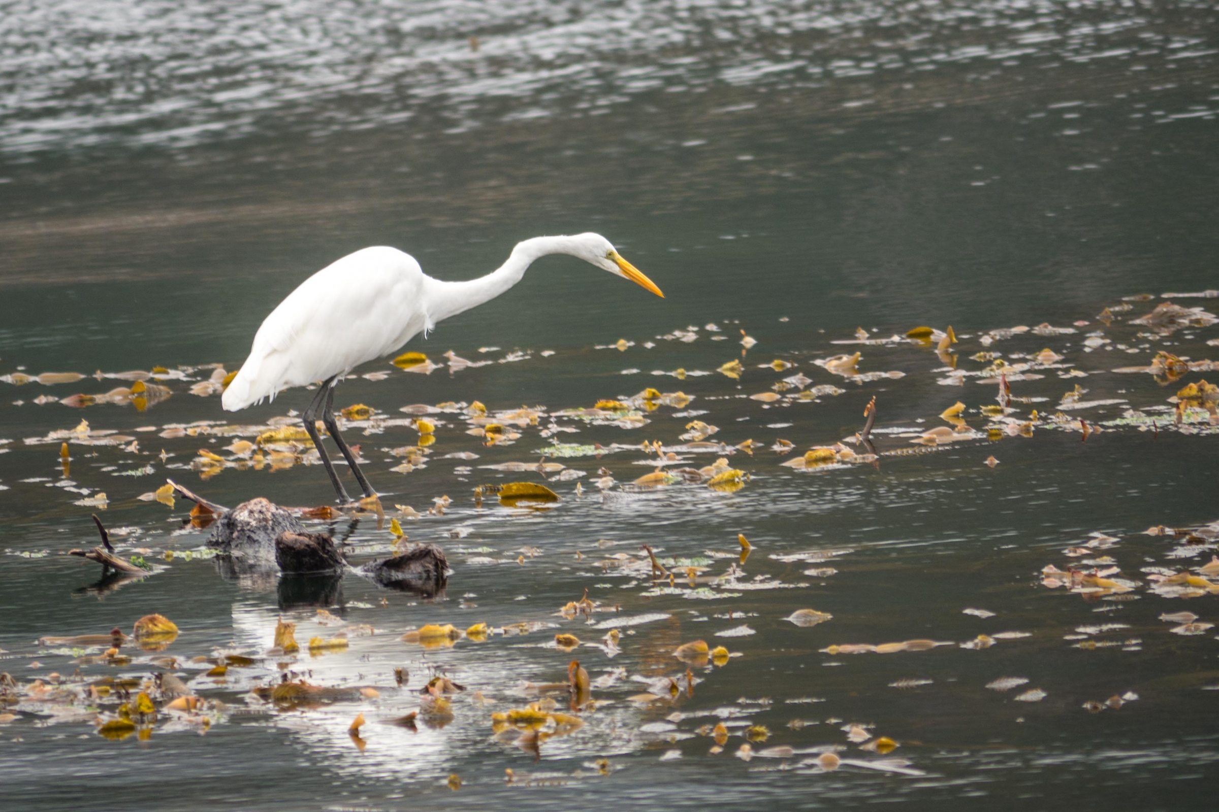
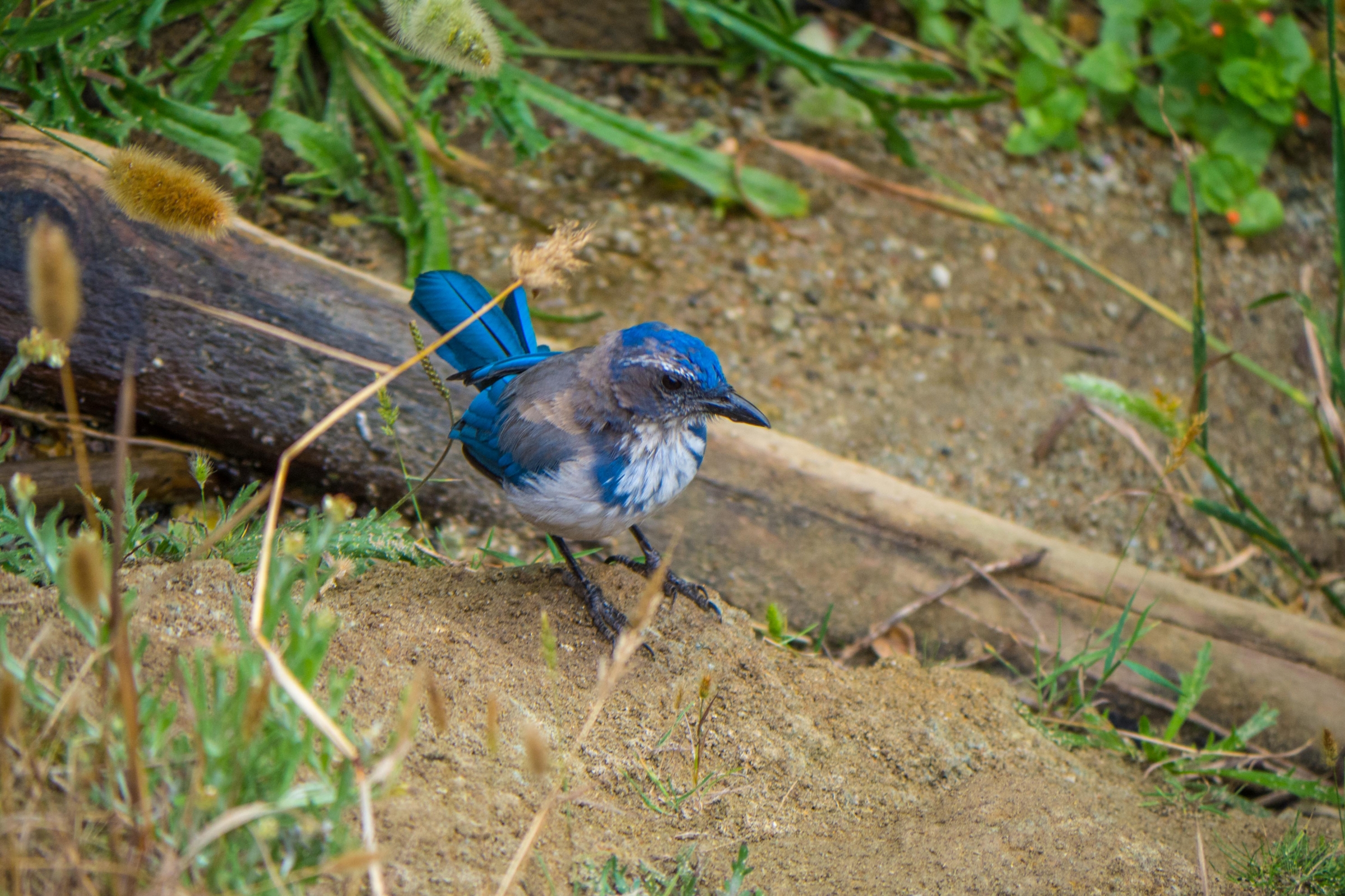
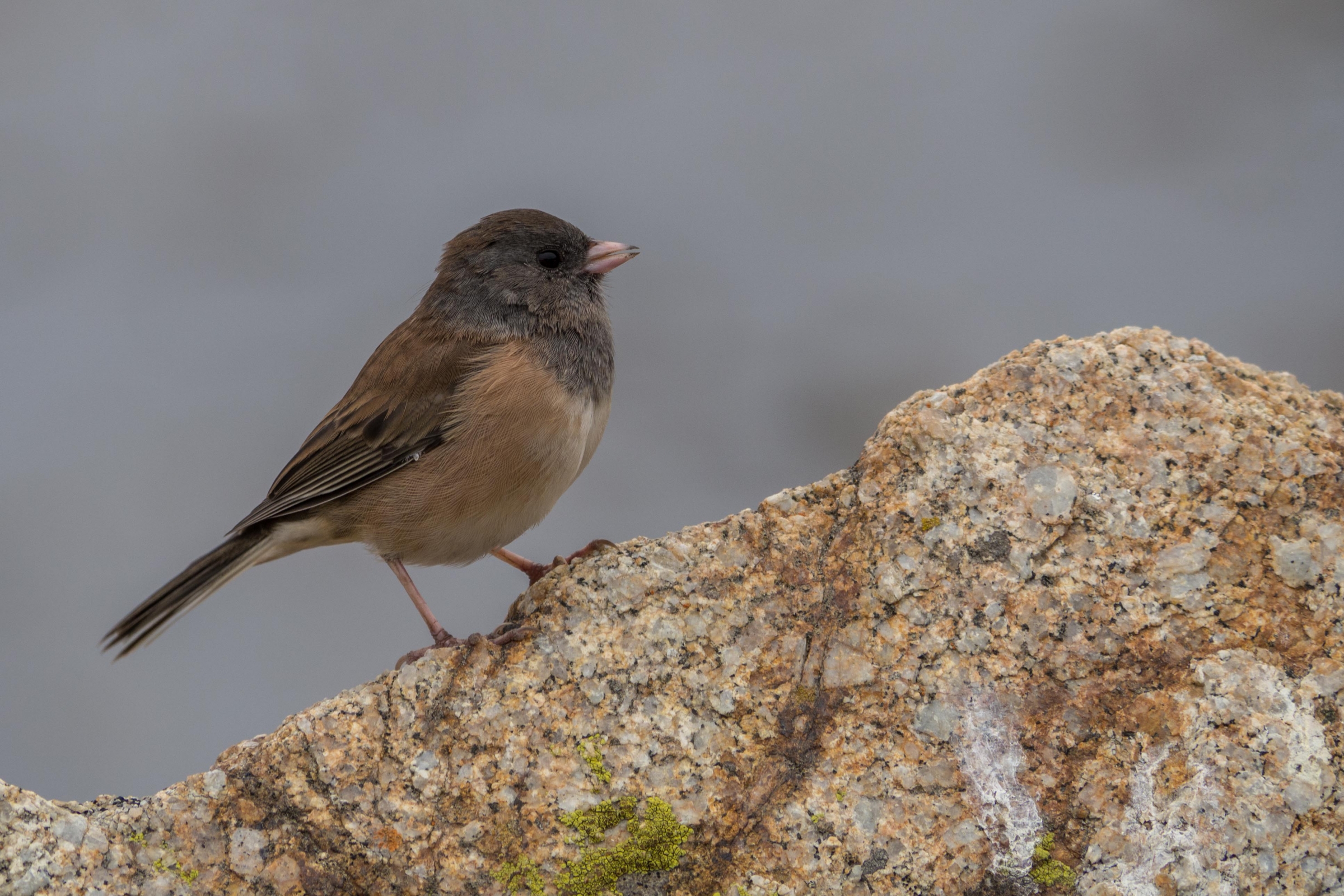
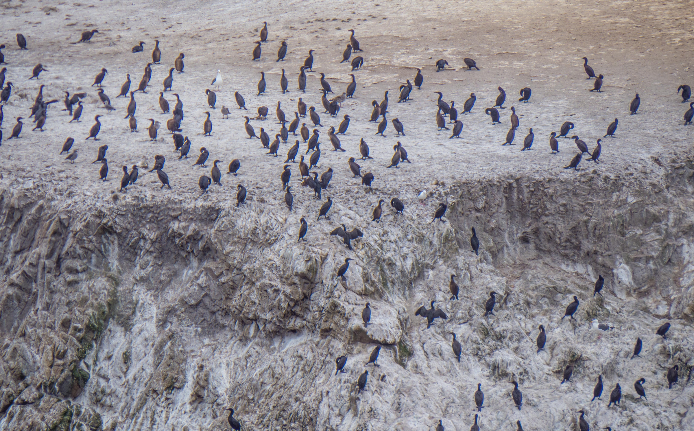
BirdingWestern Scrub-JaySpring and summer is the nesting season for seabirds on bird island. The bird island trail is great to spot lots of birds in the morning or late afternoon. Two cormorant species can be found year-round, nesting on rocks offshore from March to August. Overall there are three cormorant species that can be found here: Brandt's Cormorant, Double-crested Cormorant, and Pelagic Cormorant.
Depending on the wind it is a bit smelly when you reach Pelican Point but the view is excellent of hundreds of nesting birds. We spotted several birds like the scrub jay and dark-eyed junco along the loop trail.
Wildflowers
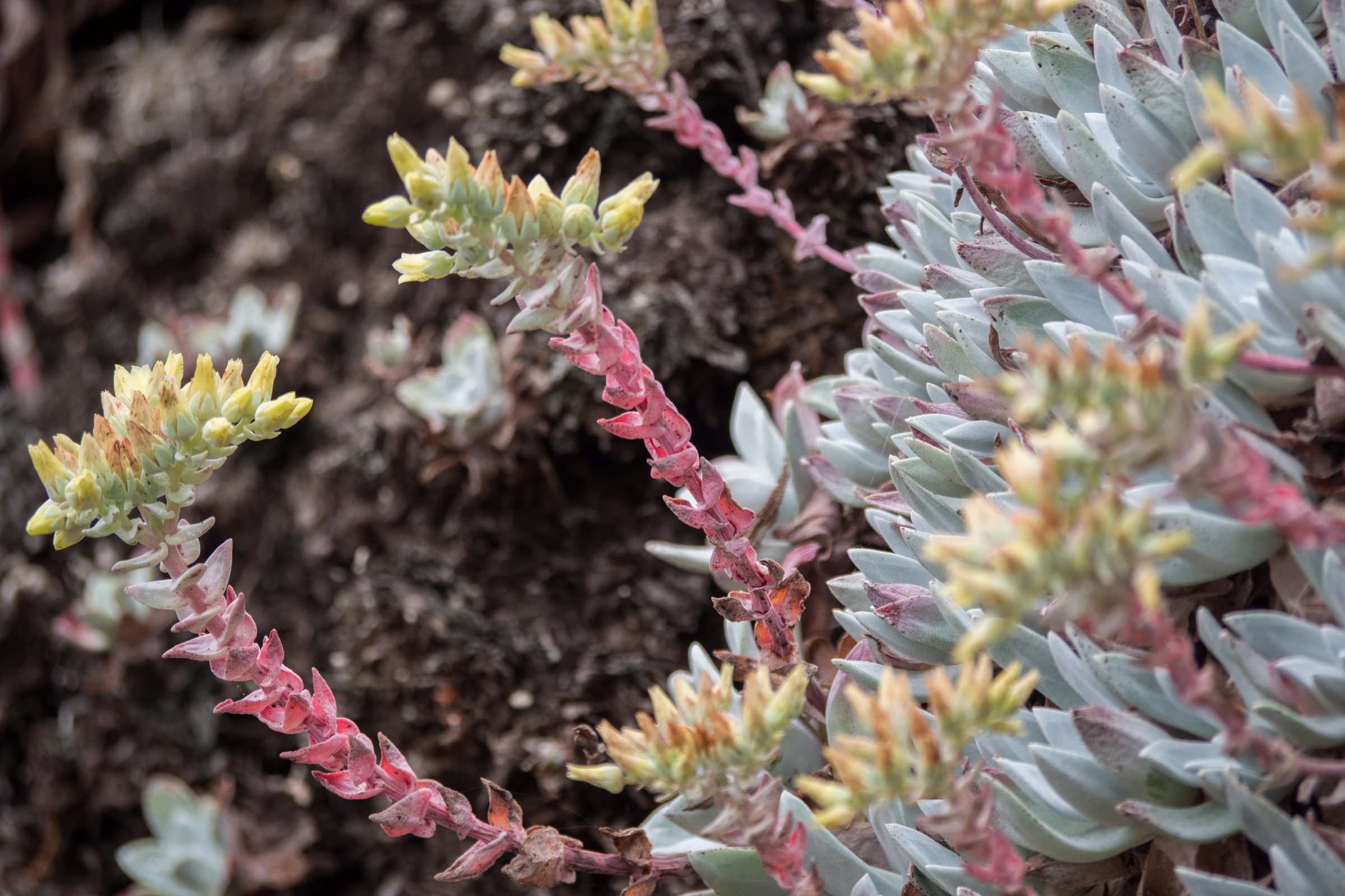
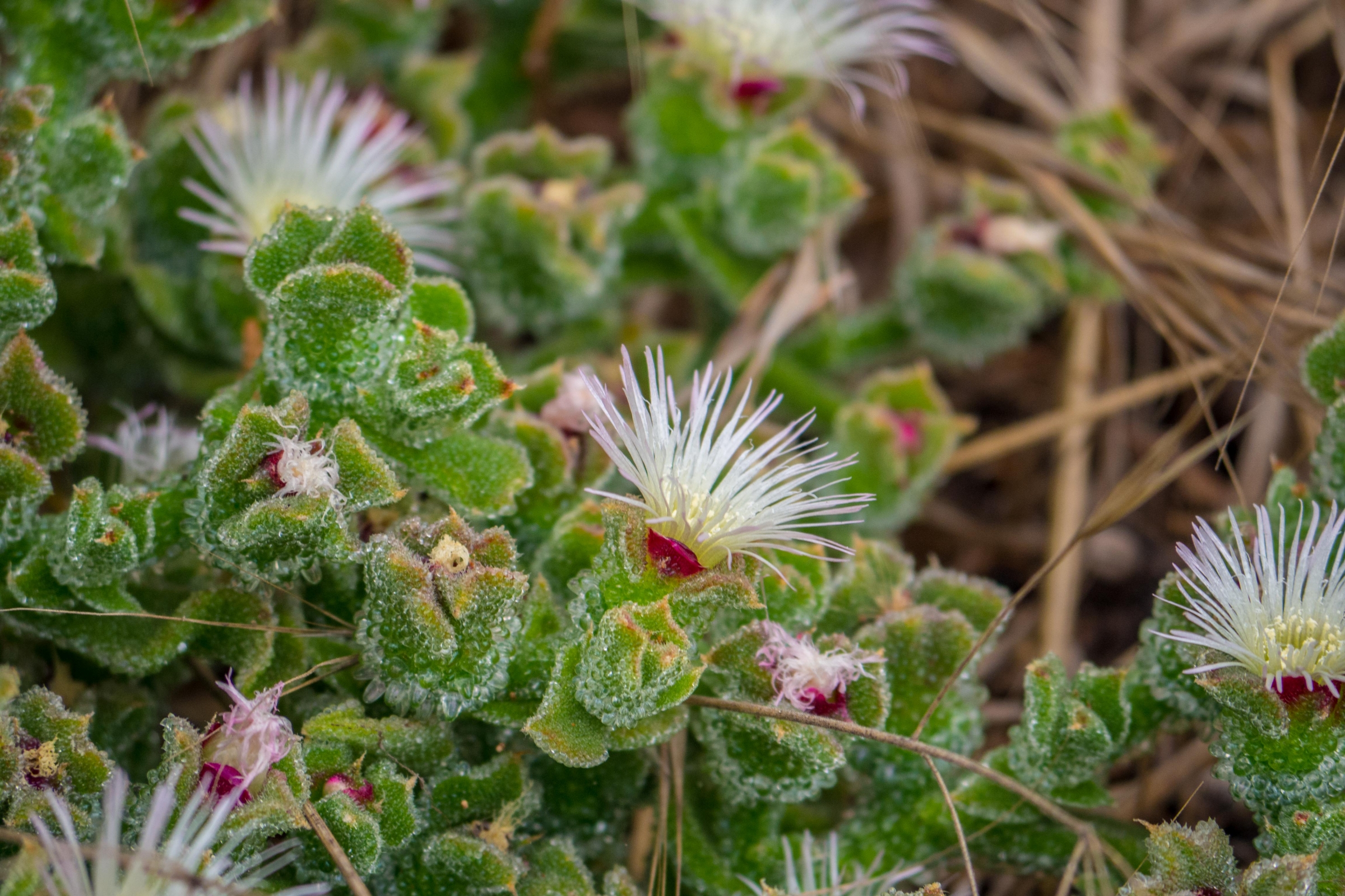
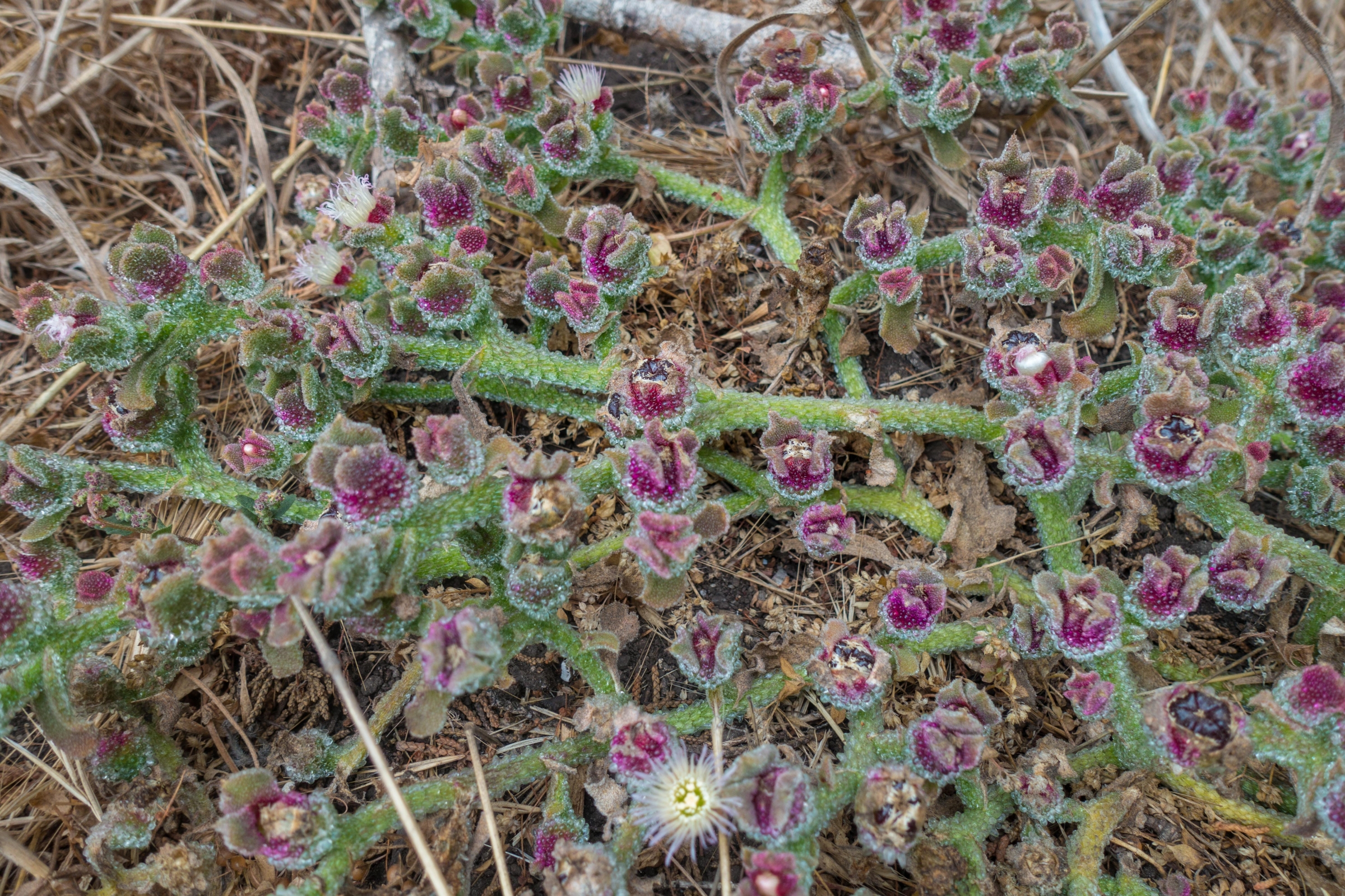
The wildflower season in spring is stunning when colourful flowers like California Poppies, Douglas Iris, lilac Ceanothus are spread on the ground. We also saw beautiful ground cover plants in bloom in September. Due to the higher humidity; the dense fog, the vegetation is colourful from spring to autumn. If you like to know more about the different common wildflowers follow the link.
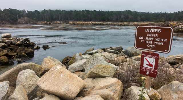
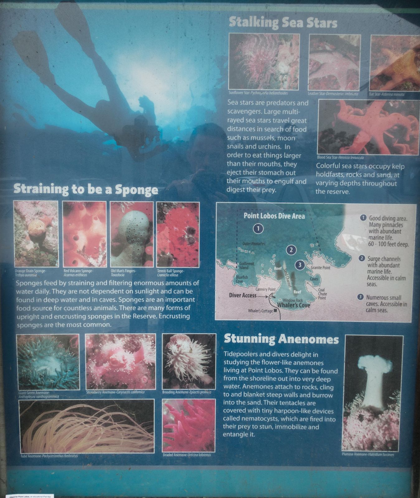
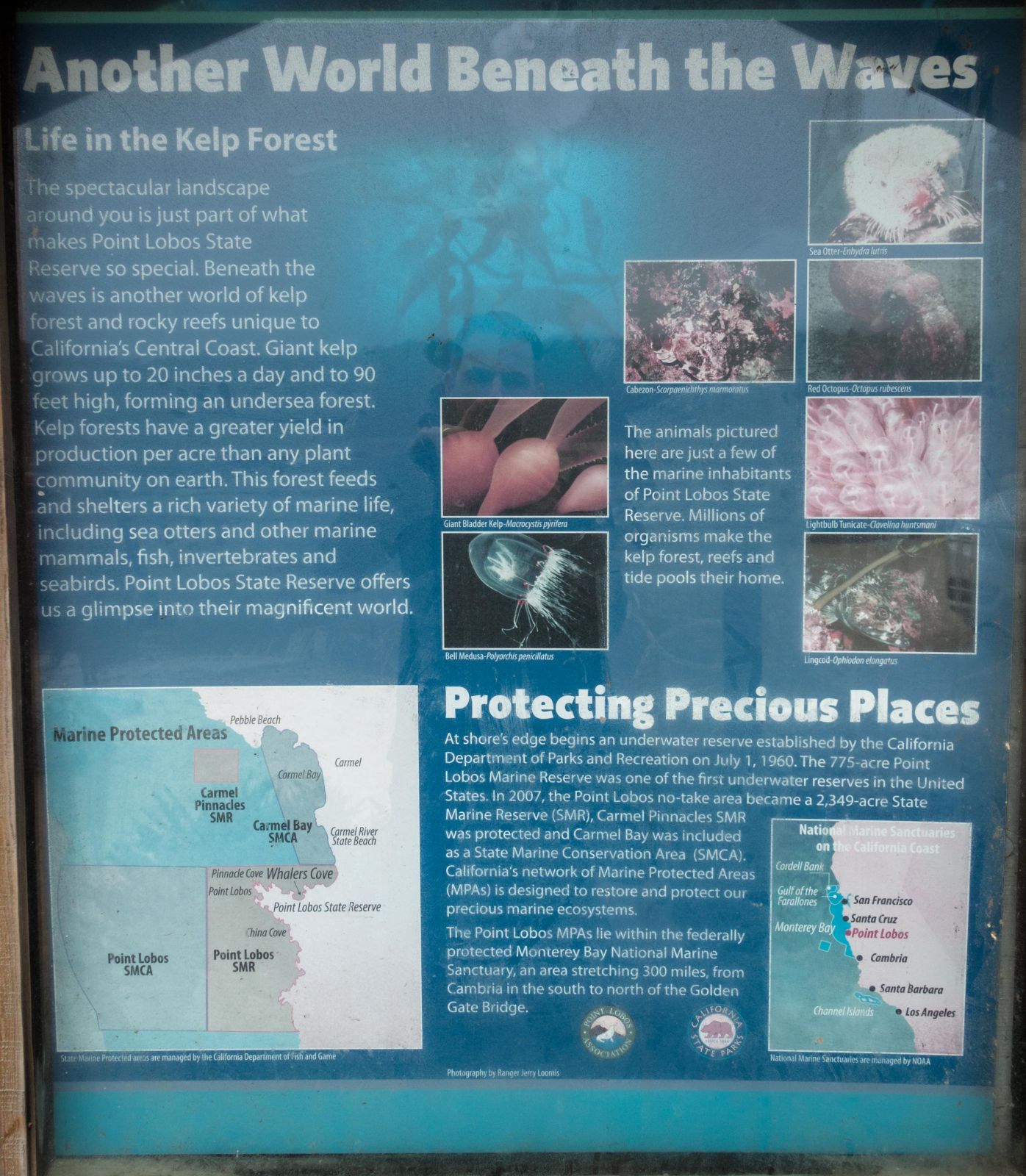
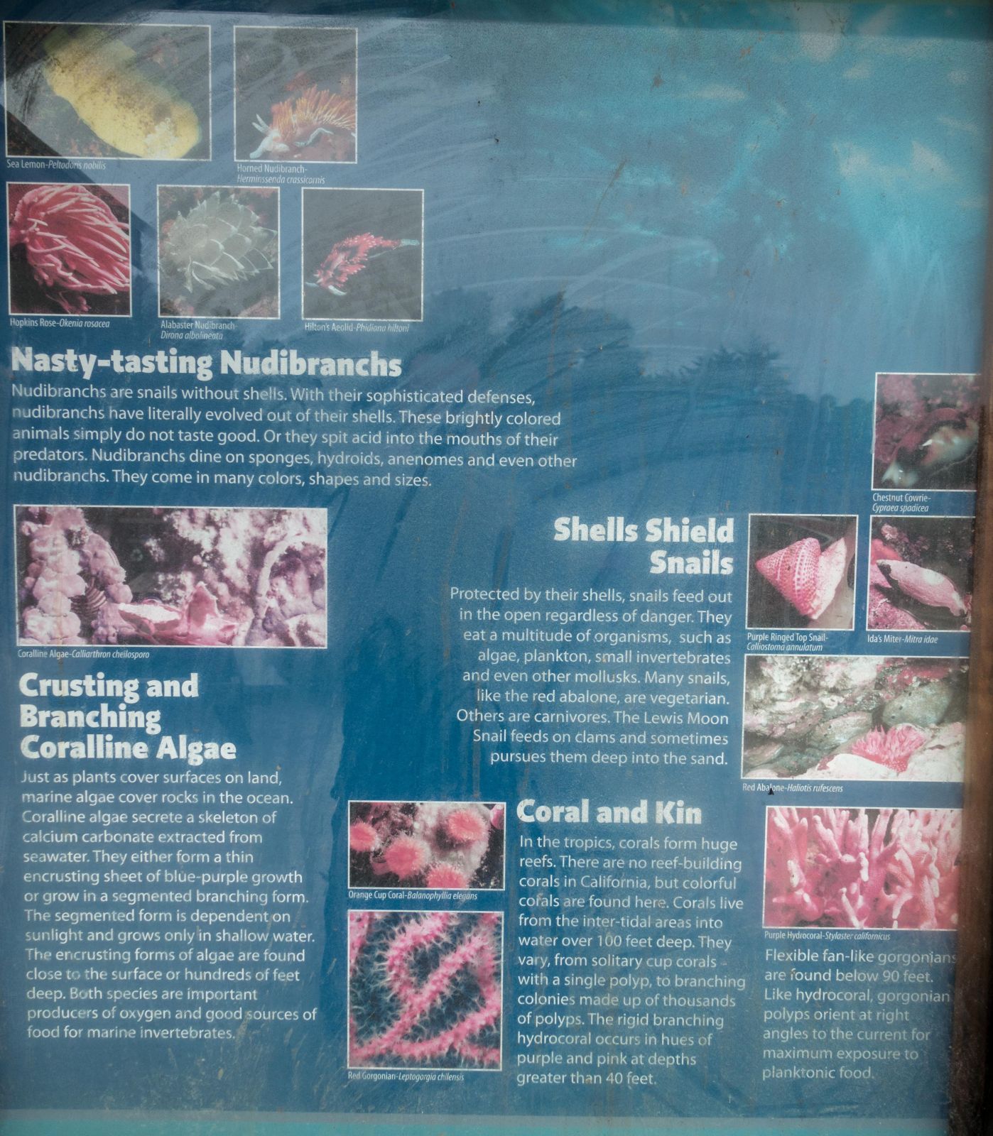
Diving
Access for divers only
Diving at Point Lobos is considered one of the most exceptional underwater experiences in California, but access is strictly regulated to protect the fragile marine environment. A permit is required, and reservations can be made up to two months in advance. Each day, only 15 dive teams—always in pairs—are allowed to enter the water at Whalers Cove and Bluefish Cove. The underwater world here is spectacular, with towering kelp forests reaching up to 70 feet, abundant marine life, and even a few sea caves that can be explored when the ocean is calm. Entry points are designated specifically for divers, ensuring both safety and conservation. Diving map and reservation system Point Lobos State Reserve
Parking at Point Lobos – What to Expect Today
Parking at Point Lobos State Natural Reserve is still very limited, with only around 150 spaces available inside the reserve. The lot often fills up shortly after opening, especially on weekends and during the peak months from spring through fall. Once full, rangers close the entrance until spaces become available again.
If the lot is closed, the only alternative is shoulder parking along Highway 1, which is permitted but not ideal. The walk to the entrance is long and exposed, and traffic can be heavy. A proposed additional parking lot north of Point Lobos was never built, and there is currently no shuttle service to the reserve.
Restrooms near the main parking area are very clean and well maintained. There are no campgrounds or accommodations inside the reserve, but Carmel and Monterey offer many excellent lodging options.
My Top Tip to Beat the Crowds
My most favourite park is Garrapata State Park, just a ten minutes drive - 5 miles south of Point Lobos. This park is as beautiful, with 19 stops along HW 1. Visitors are spread in the long-stretched coastal and inland park, and it rarely gets crowded. You easily get a parking space.
Point Lobos is a jewel among the State Parks for the whole family, with four accessible wheelchair trails. It is located just 3 miles south of Carmel and 90 miles south of San Francisco. The park offers stunning landscapes, pristine beaches, pine forest, Monterey cypress grove full of lichen and algae, birds, wildlife, marine life, several well-marked hiking trails, a great diving spot, and is rich in history.
I have to confess Point Lobos is a breathtaking place in California. The outstanding work of the foundation and its volunteers make this State Reserve even more popular. We got provided with lots of information and tips from the volunteers, even where to spot a whale during our visit.
It is very rare to experience such attentive and kind volunteers as we did at Point Lobos. It's a place that should not be missed on your visit along HW 1.
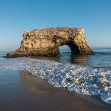
Beaches and Swimming Point Lobos
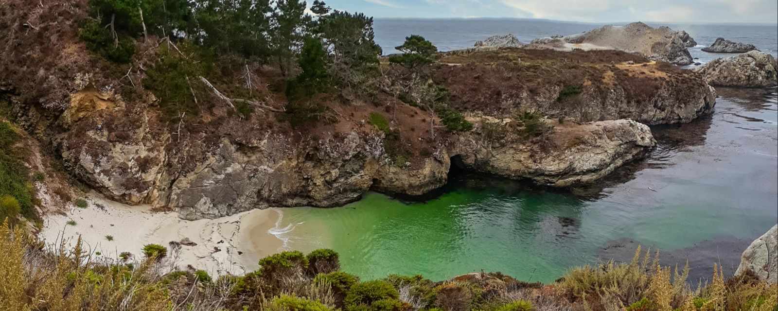
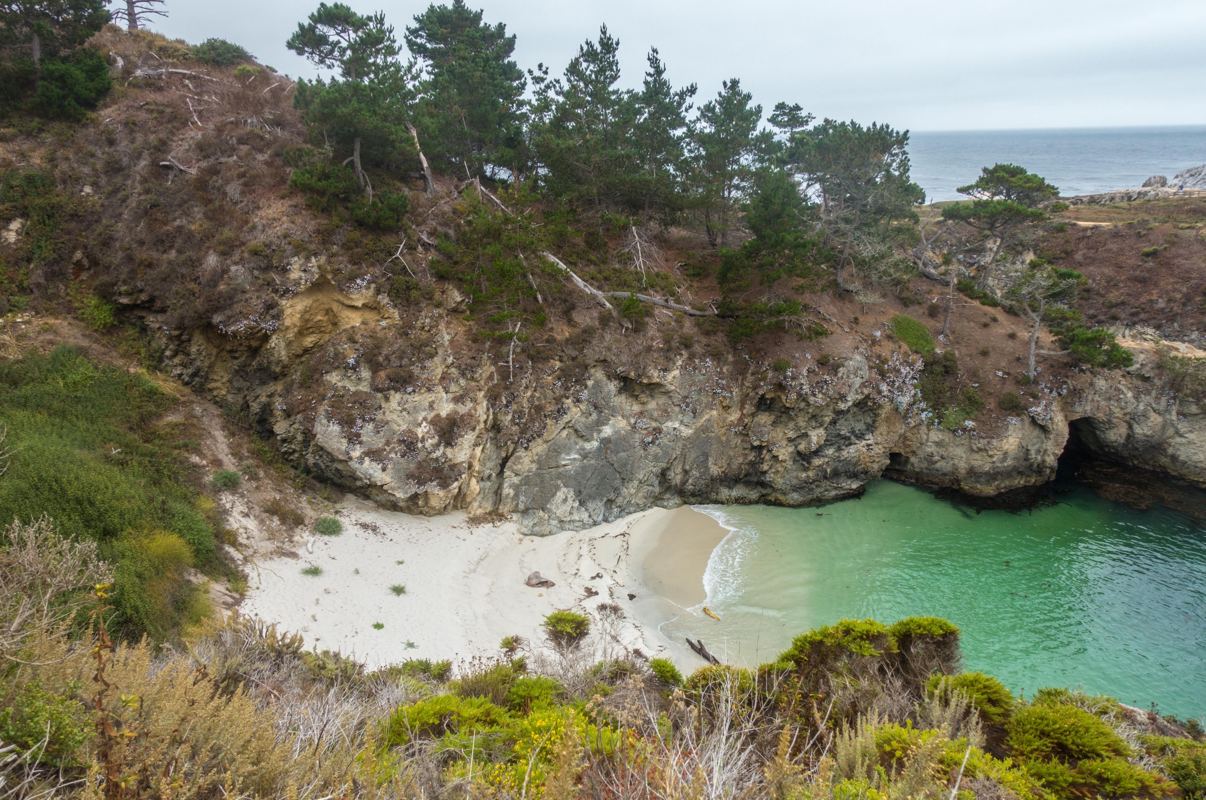
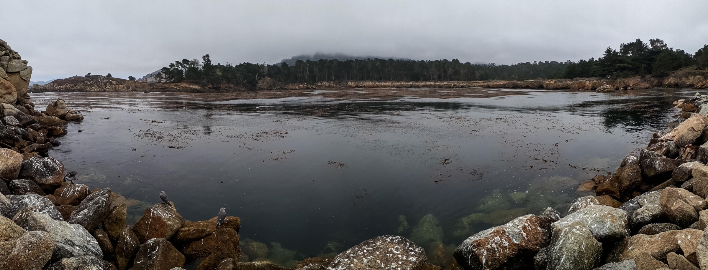
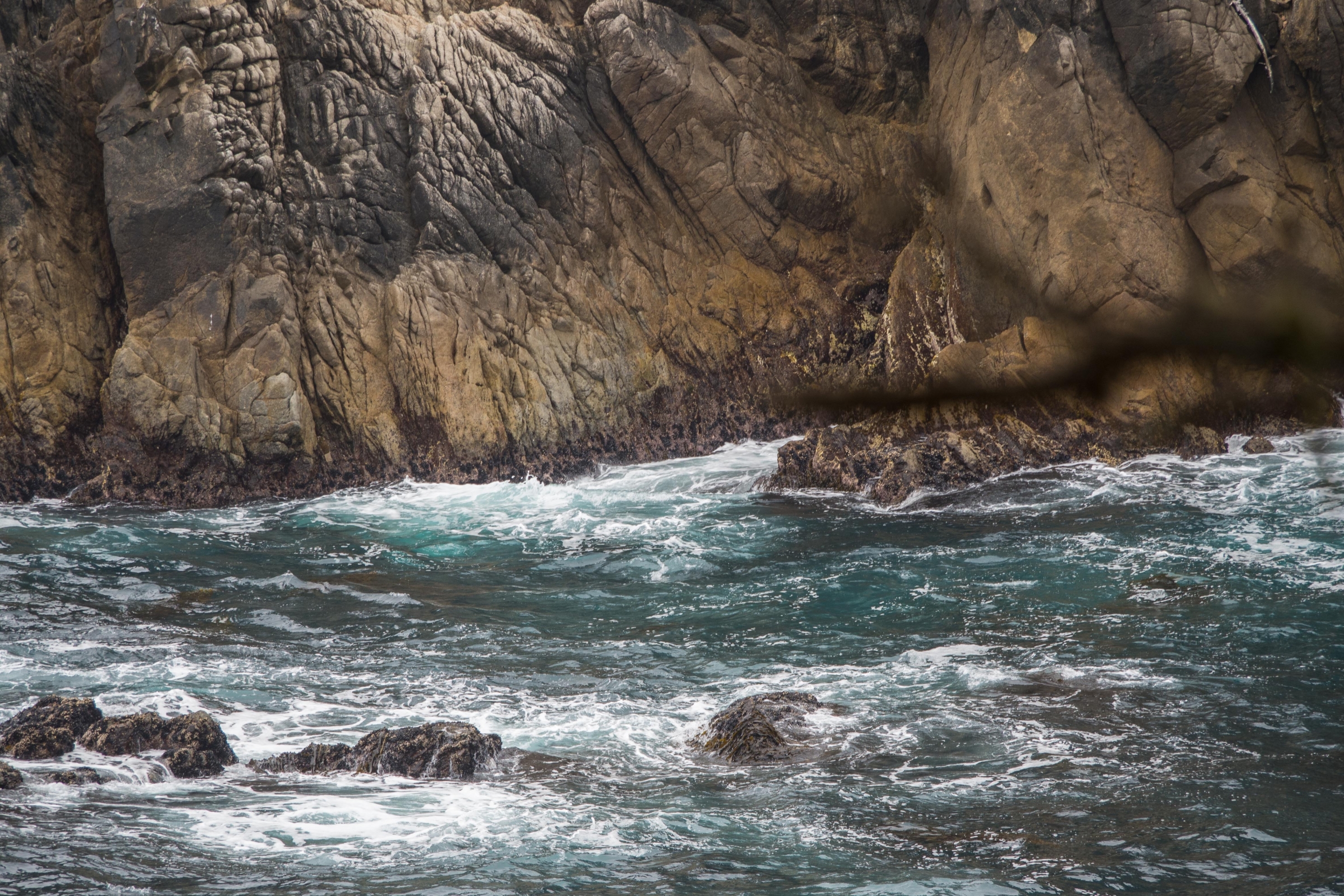
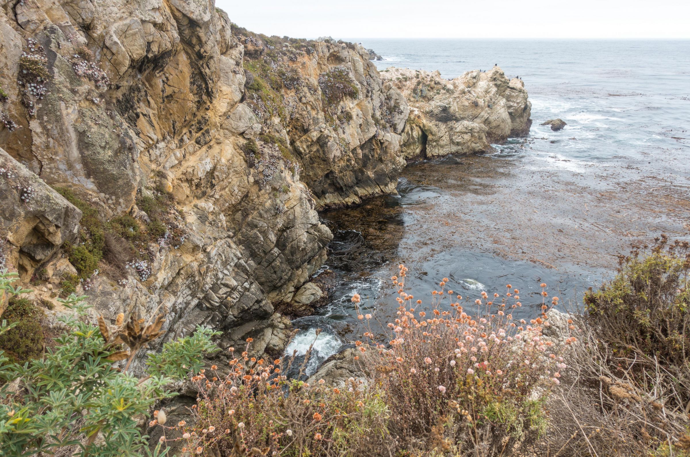
The three most beautiful beaches are situated in the south of Point Lobos. There is direct access on short trails. Swimming is not prohibited but keep in mind there are seals, sea lions, and the cold sea temp below 60°F - 16°C It rarely climbs above 60°F it only occurs in August and September.
Gibson Beach
It's a five-minute walk from the parking to the steep stairs leading down to the white sandy Gibson Beach. It is as breathtaking as Mc Way Falls and Beach, but here it is allowed to access the beach.
Hidden Beach
Also, a short walk from the parking at China Cove. Steps lead down to the small pebble beach.
Weston Beach
Get in awe of this awesome beach and its tide pools. The tide pools are accessible during low tide. Tide times The kiddos will love the tide pools with crabs, starfish, anemones, and small fish.
Where Does the Name Come From?
Spanish is widely spoken in the Bay Area, and Point Lobos means; “Punta de Los Lobos Marinos – Point of the Sea Wolves". The early Spanish Seafarers got reminded of wolves due to the barking noise of the sea lions. If hiking close to the rocks full of sea lions, you utterly understand why this name was given to this place.
History
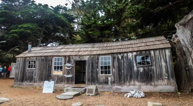
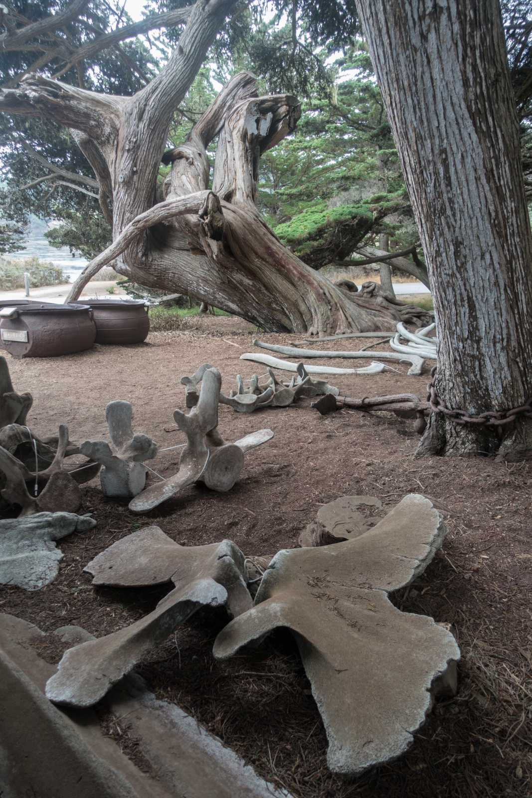
The wonderful whaling museum full of interesting information
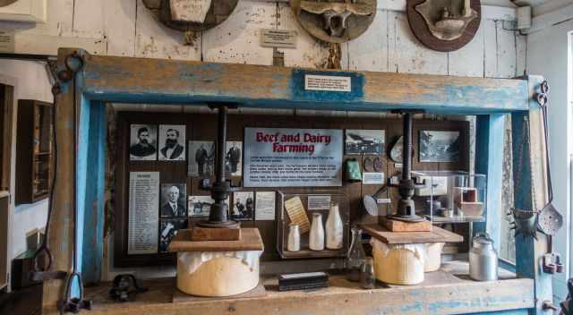
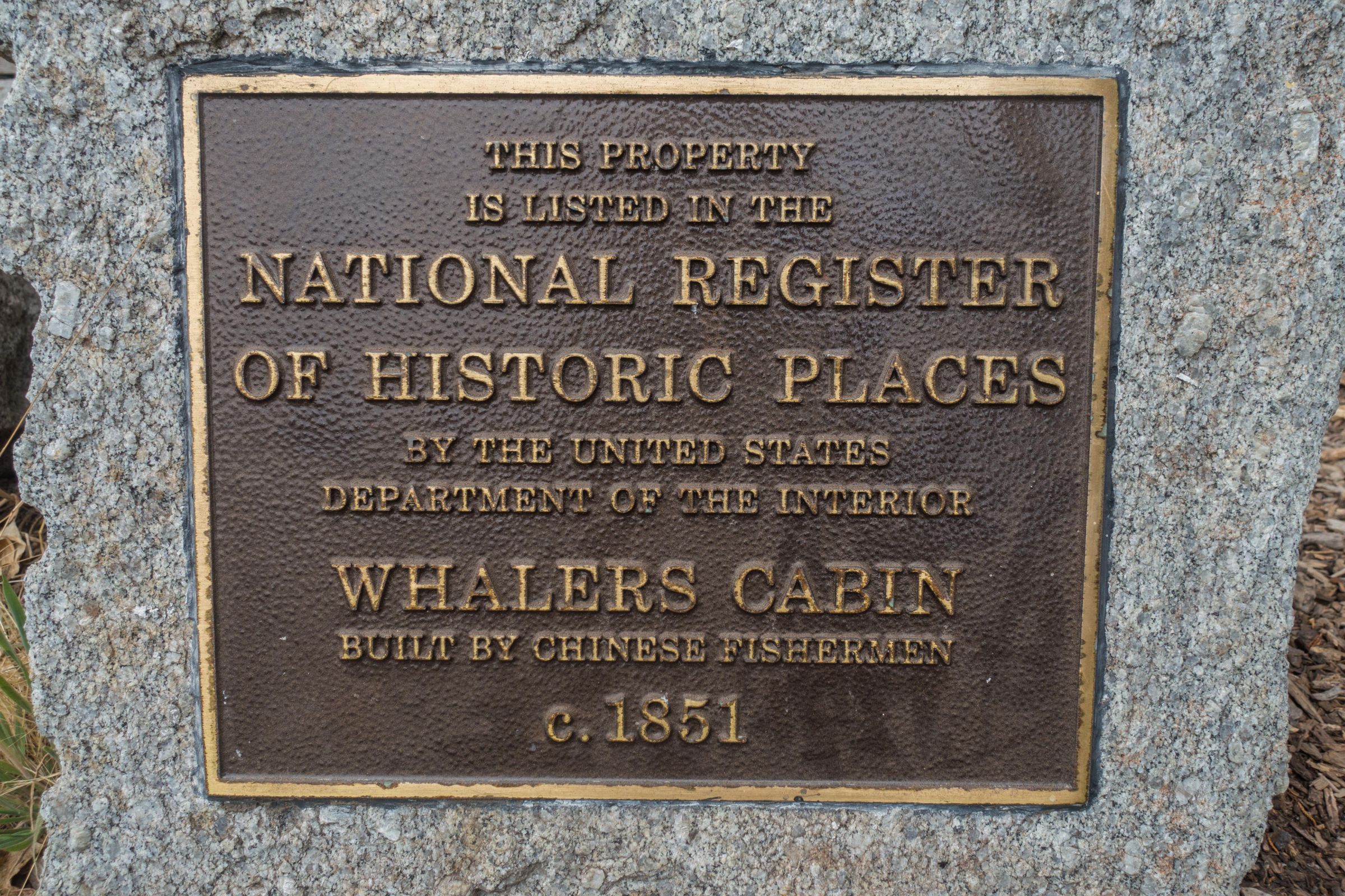
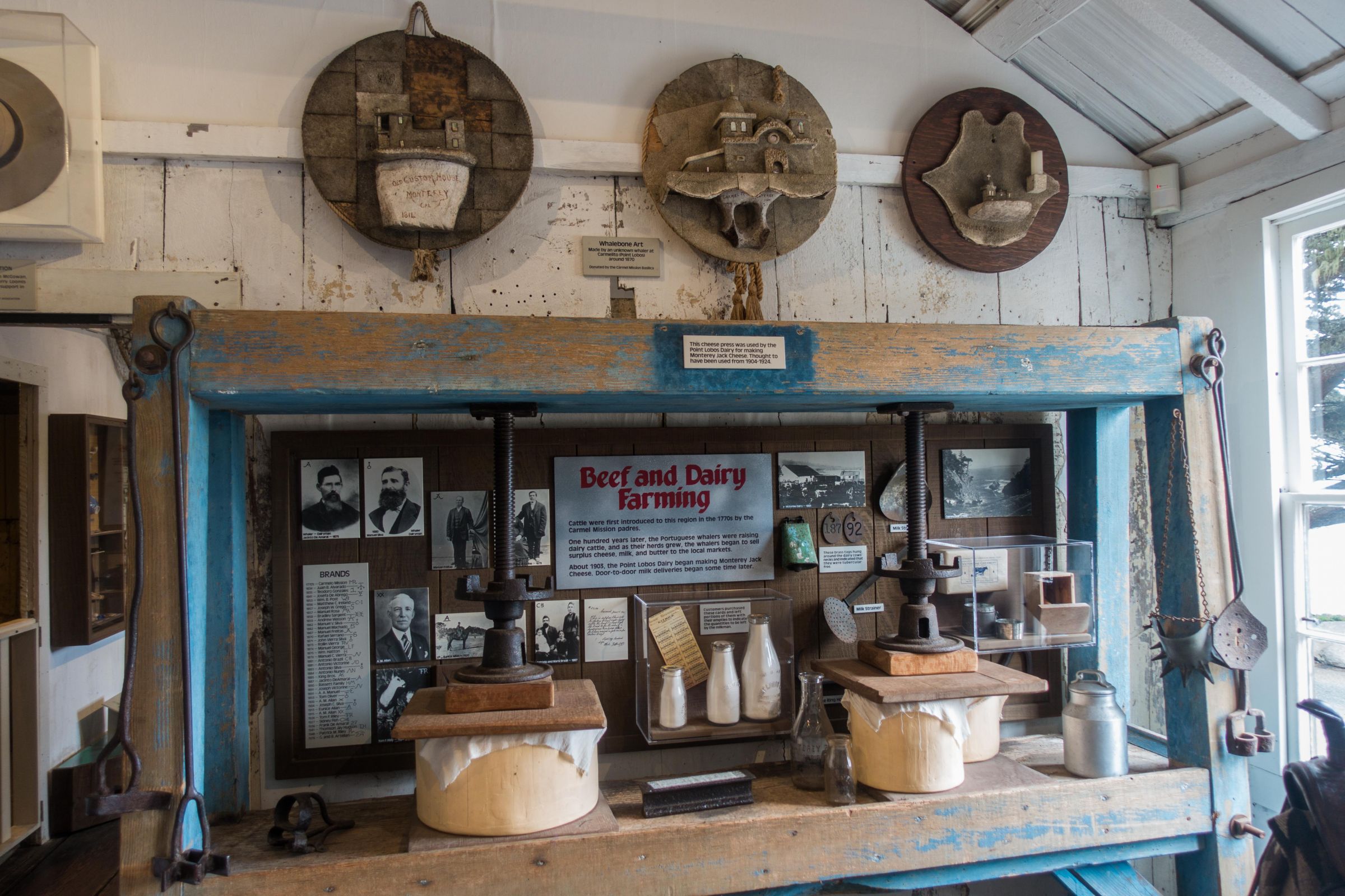
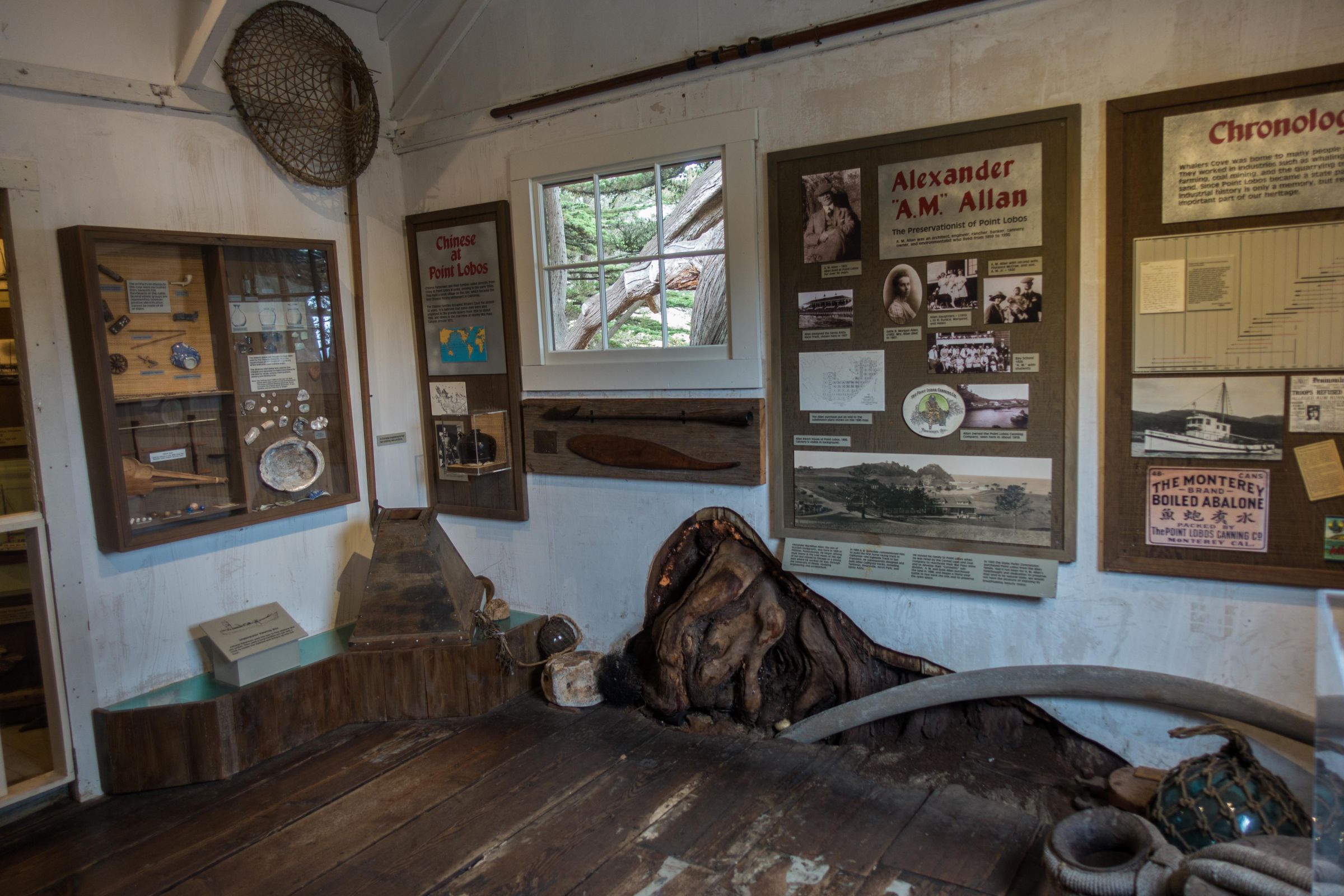
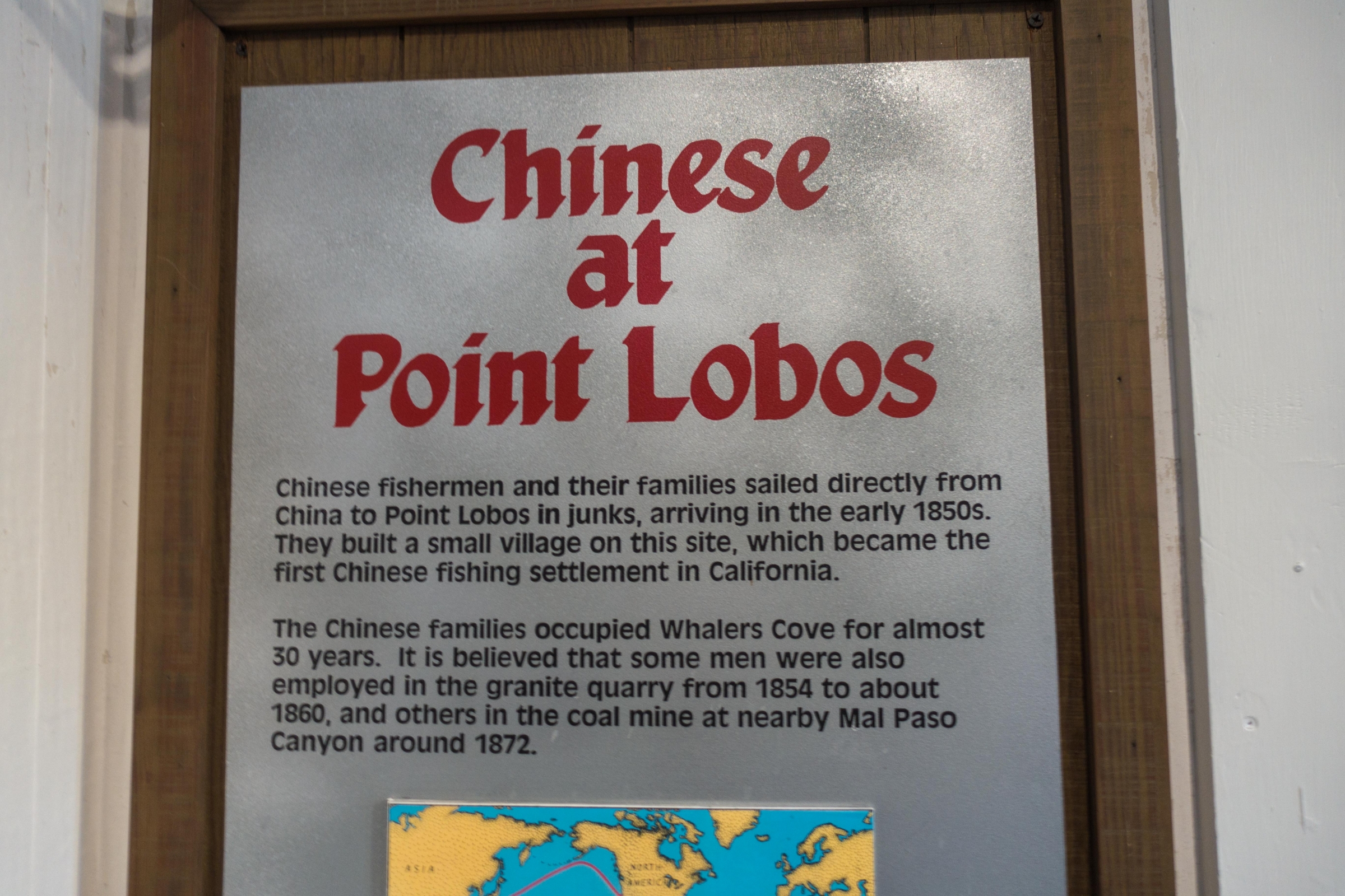
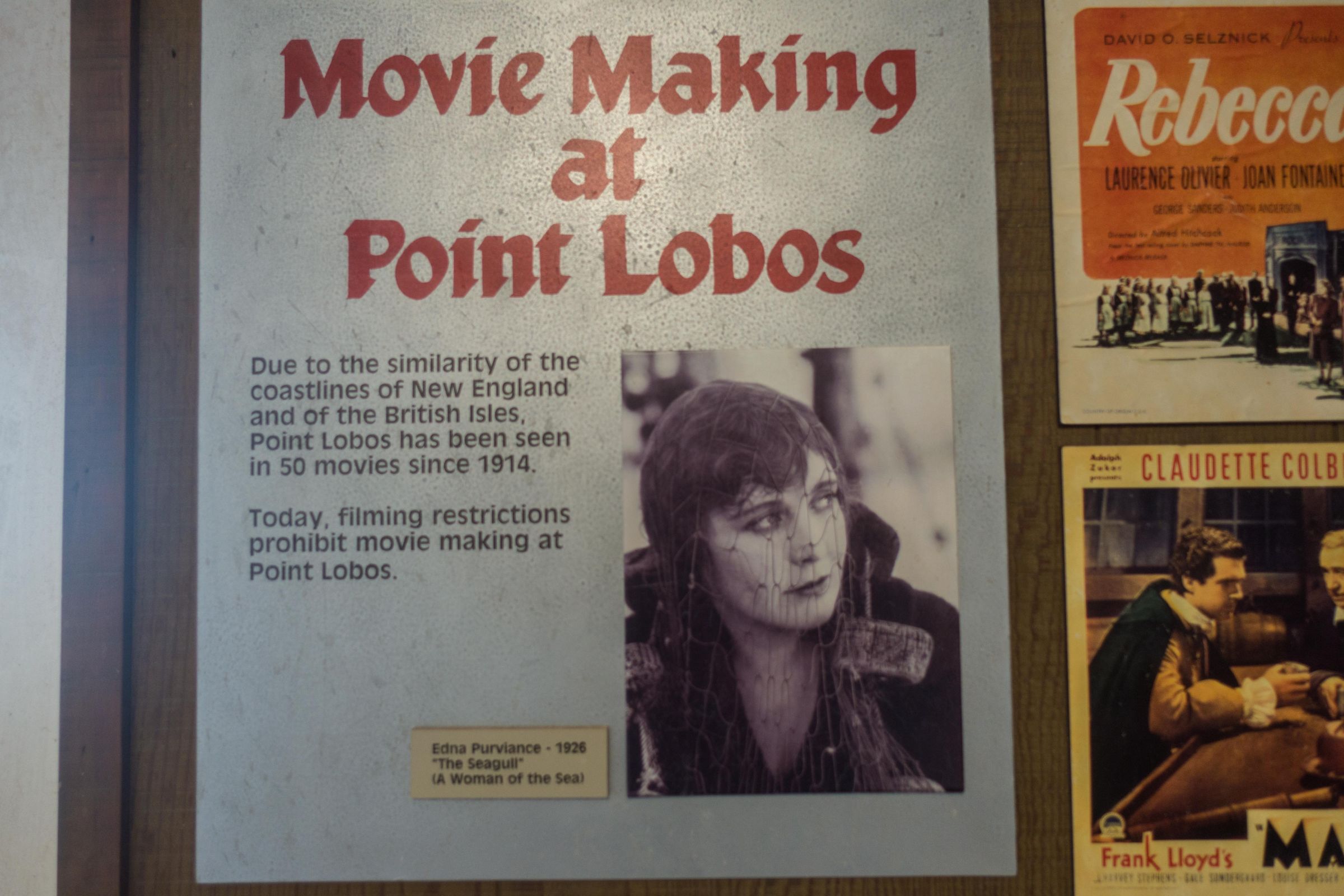
The Whaling Station Museum is rich in history with an exhibition about the different occupants in the last centuries. First of all were the indigenous people, followed by Chinese fishermen and Japanese Abalone Fishermen, and for a short time, the Portuguese Whalers came here. You may even get the impression that you’ve seen the house or area before because it is famous for 50 movies like Hitchcock’s Rebecca, Blind Date with Bruce Willis or Turner, and Hooch with Tom Hanks.
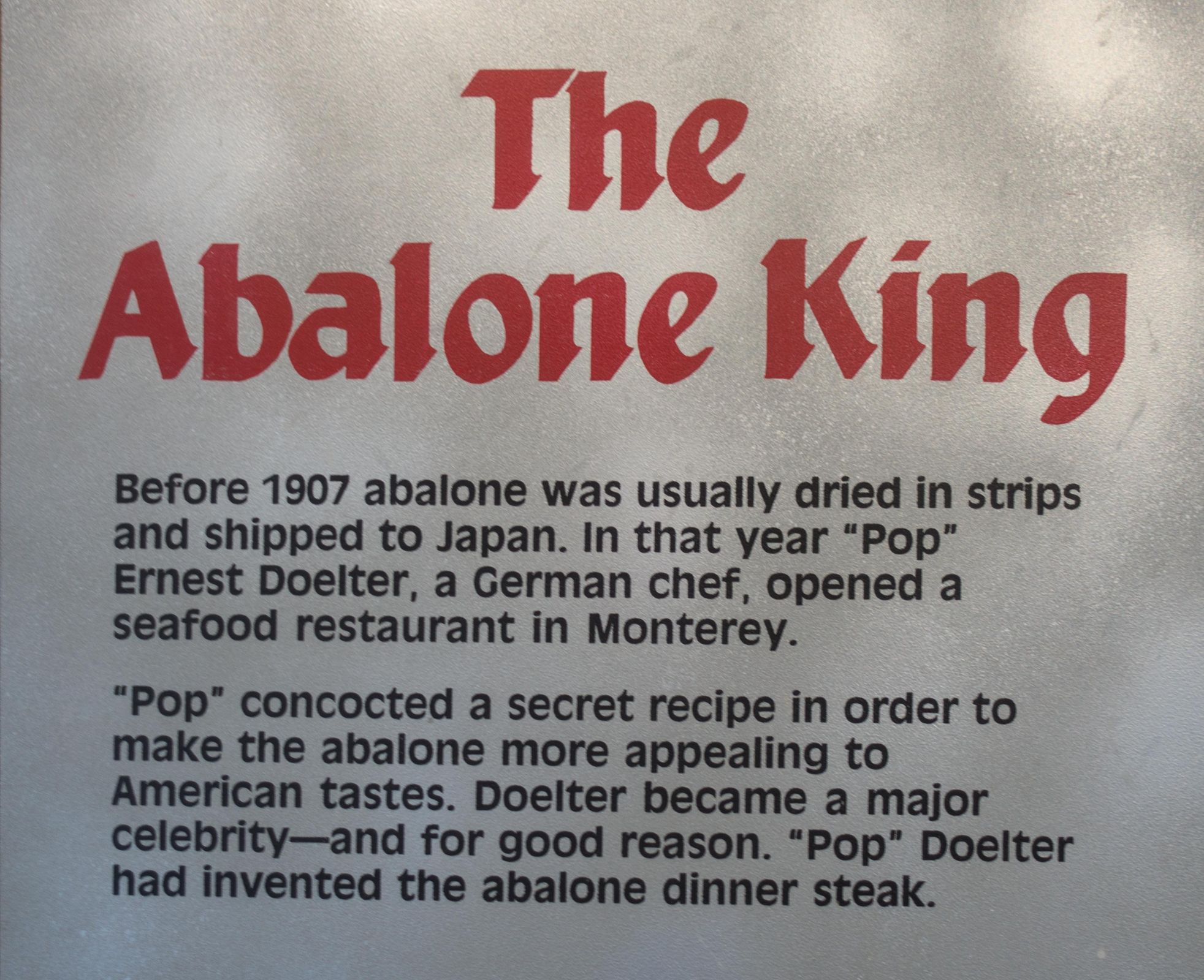
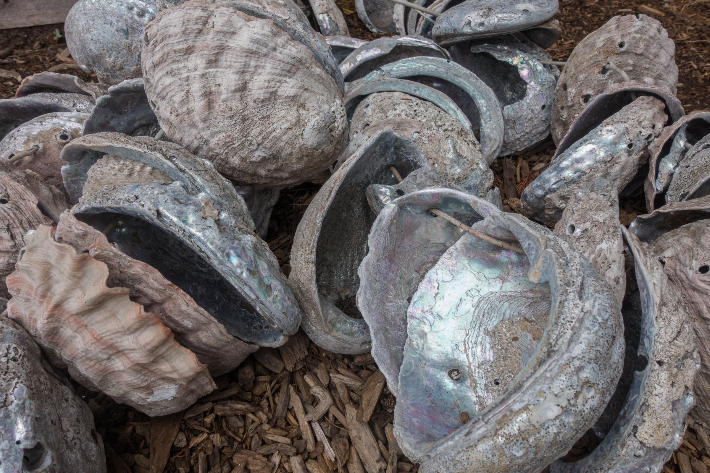
The museum is one of the Chinese fishermen houses built in the 1850s. Portuguese whalers were attracted by the annual grey whale migration in 1862, but already in 1880, the oil of the whales was substituted by the cheaper kerosene. The abalone fishery began in 1898. During WW II, the area was the headquarter of the US Army. In 1960 the waters at Point Lobos were declared as a marine reserve. In 2007 Point Lobos became utterly protected.
Packing List
Binocular to spot birds and whales
Camera
Bring beverages and food; there isn’t any café or restaurant inside the park, only three picnic areas; one at Whalers Cove parking area, at bird island parking area, and Piney Woods.
Windproof jacket and fleece pullover also during summer; the breeze is chilly and the fog persistent.
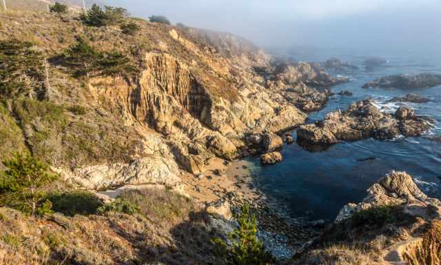
Hiking at Point Lobos
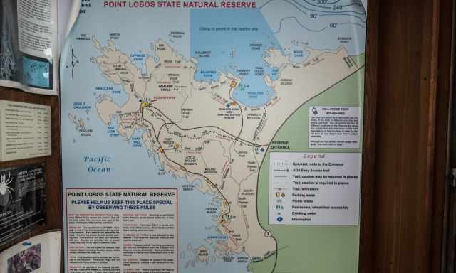
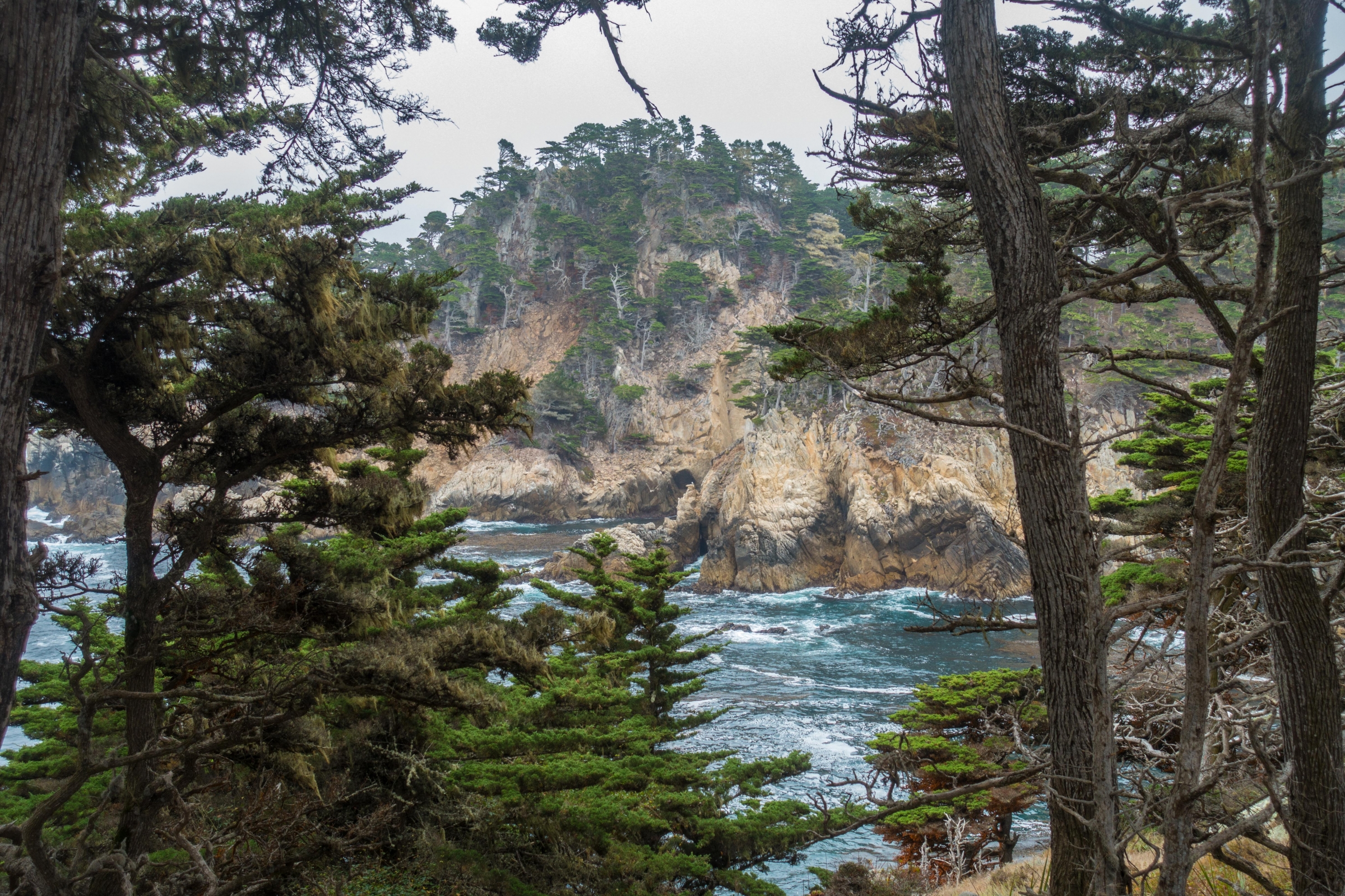
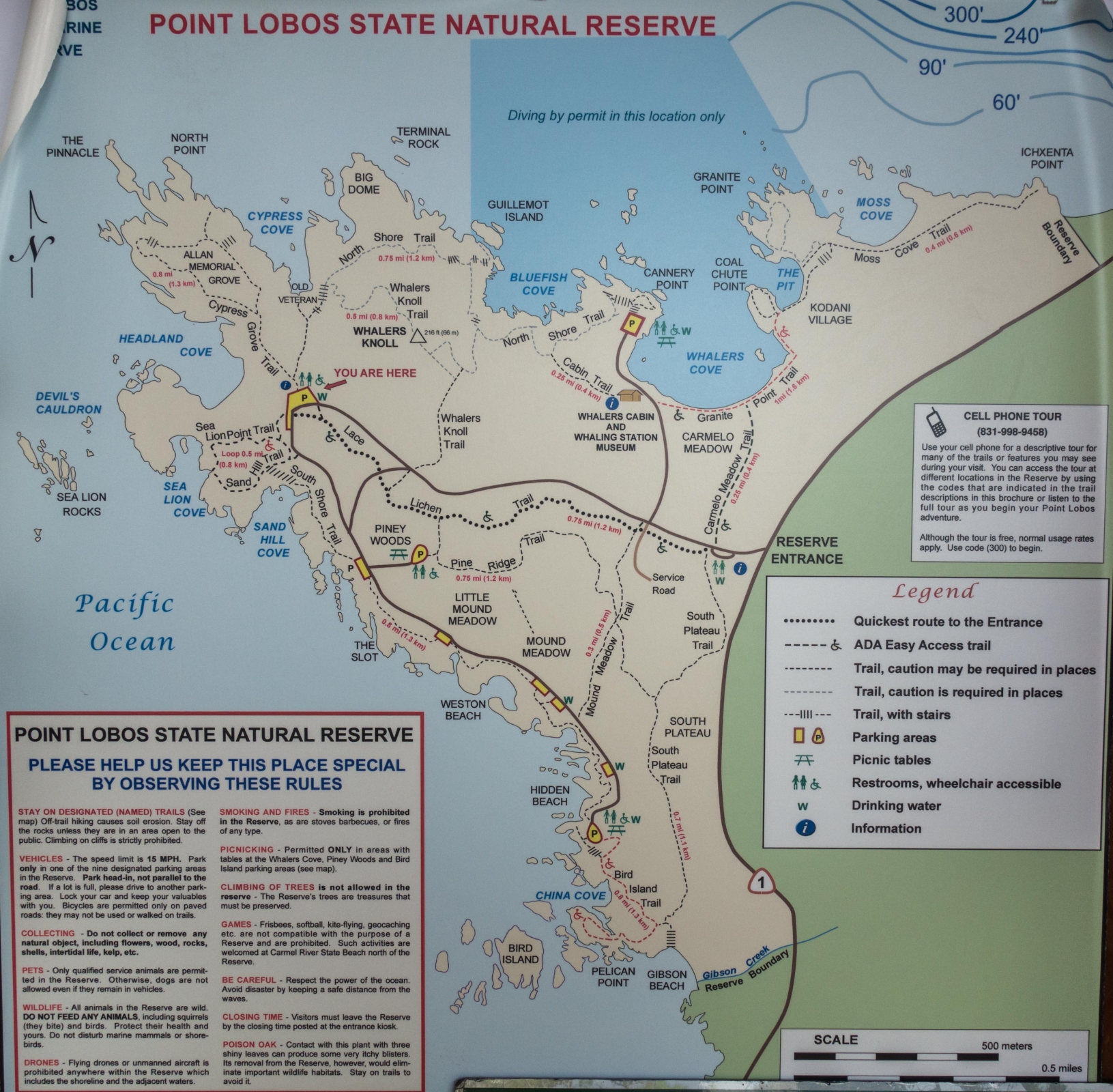
Point Lobos State Natural Reserve offers some of the most scenic coastal trails in California. The hikes are easy to moderate, well‑marked, and many are shorter than one mile, making them ideal for families and casual hikers. To experience the full beauty of the reserve, you can combine several trails into a 6.7‑mile (10.8‑km) loop that showcases the best viewpoints, wildlife areas, and dramatic coastline.
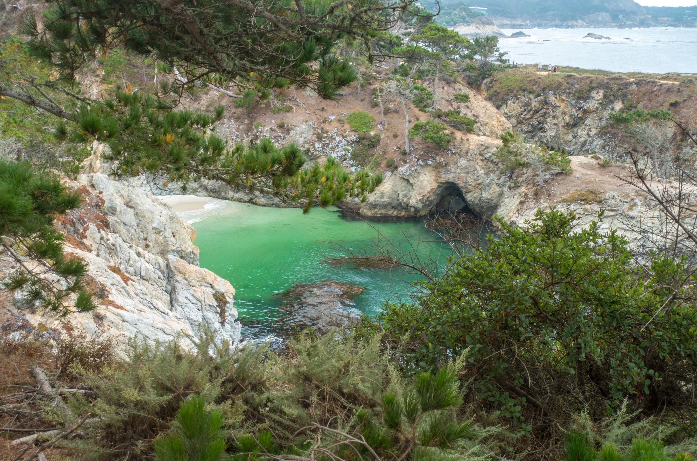
The loop traditionally begins at Whalers Cove, following the rugged North Shore Trail before connecting to the iconic Cypress Grove Trail and Sea Lion Point Trail. From here, the route continues onto the short Sand Hill Trail and then the longer South Shore Trail, which leads toward China Cove and its turquoise water. The scenery along the coastal cliffs is spectacular before the trail turns inland for the final stretch.
You can start this loop from any parking area, as all trails interconnect. The highest point in the reserve is Big Dome, rising to 260 feet (80 meters) and offering sweeping ocean views. With its diverse landscapes, wildlife, and dramatic shoreline, Point Lobos is a place where you can easily spend an entire day exploring.
Entrance Fee Tip
The entrance fee for Point Lobos State Natural Reserve is $10 per car. If you already paid the day‑use fee at another nearby California State Park on the same day, your receipt grants you free entry to Point Lobos. Parking outside the reserve along Highway 1 is also free, but you’ll need to walk in — and the distance can be quite long on busy days. Considering the beauty of the reserve and the convenience of parking inside, the entrance fee is absolutely worth it.
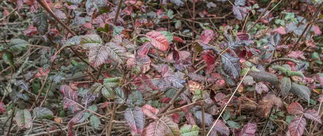
Poison oak is common throughout Point Lobos, often growing as groundcover or dense shrubs along the trails. The oily resin on its leaves, stems, and roots can cause an itchy rash that lasts for days — I speak from experience. Staying strictly on the marked trails is the best way to avoid contact.
Ticks are also present in grassy and wooded areas, so check your clothing and skin after hiking.
To protect the sensitive wildlife and fragile ecosystems, dogs are not permitted anywhere in the State Natural Reserve, including on trails and beaches.
Traveling Highway 101?
Here are more of my favorite stops along the route:
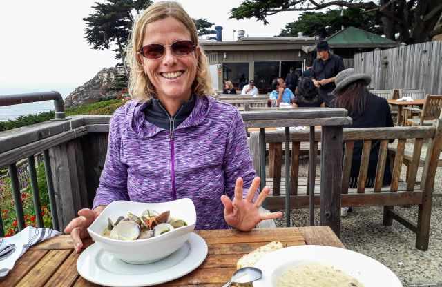
Rocky Point Restaurant, located about nine miles south of Point Lobos along the Cabrillo Highway, has long been known for its dramatic ocean views and excellent seafood. During our past visits, we loved the cliffside setting and the dog‑friendly outdoor terrace. As of 2026, the restaurant is temporarily closed, so it’s best to check Google Maps for the latest status before planning a stop.