
When Is the Best Time
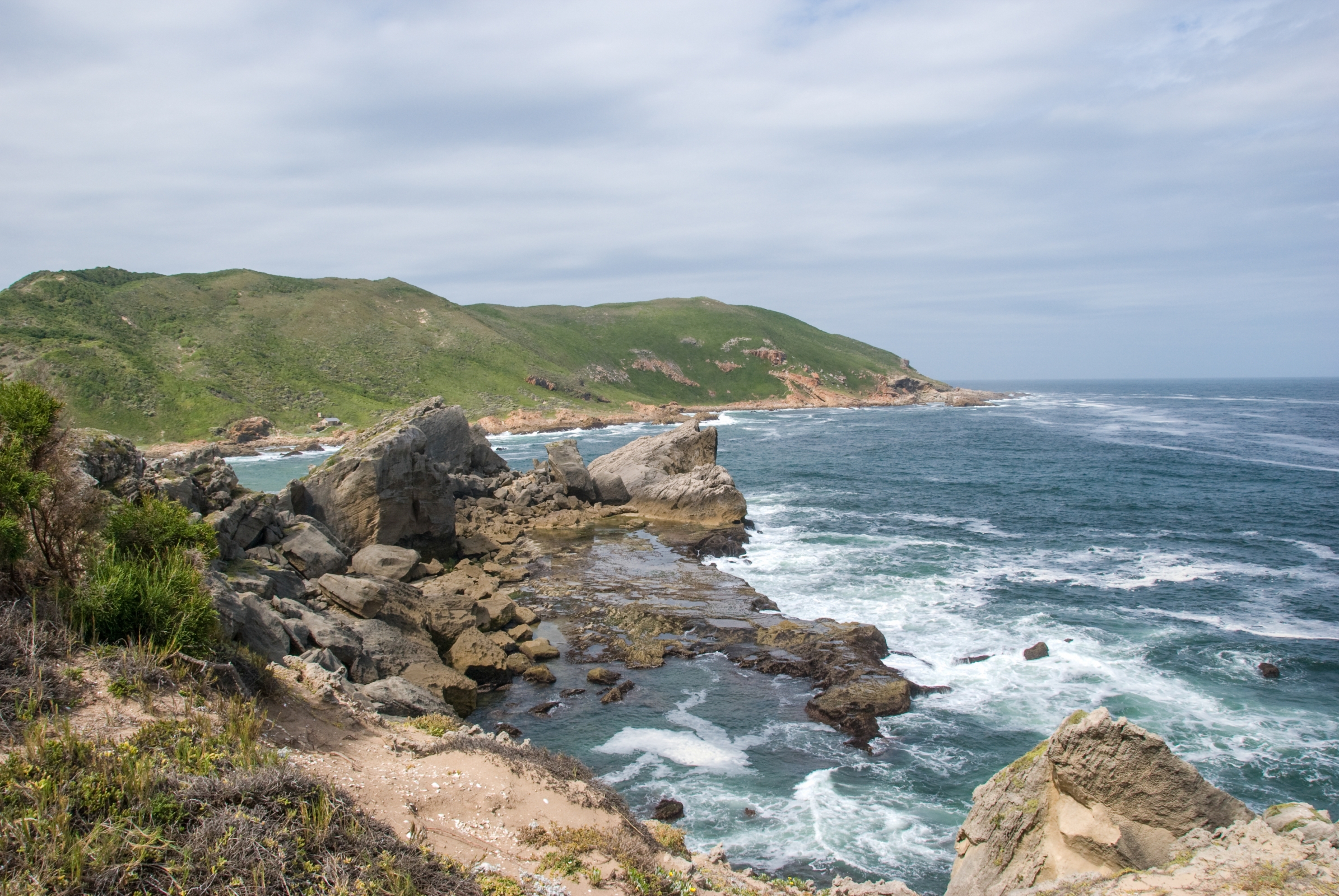
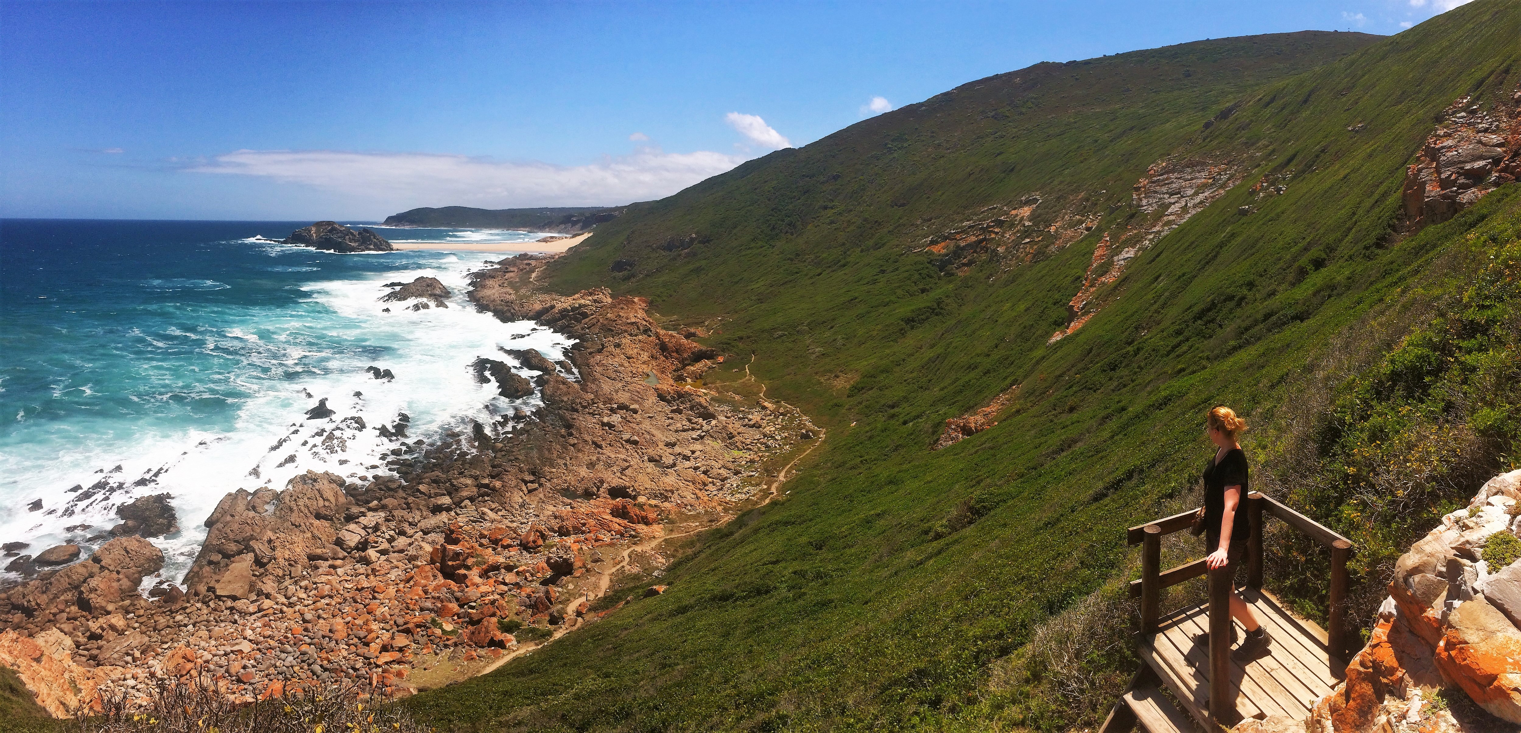
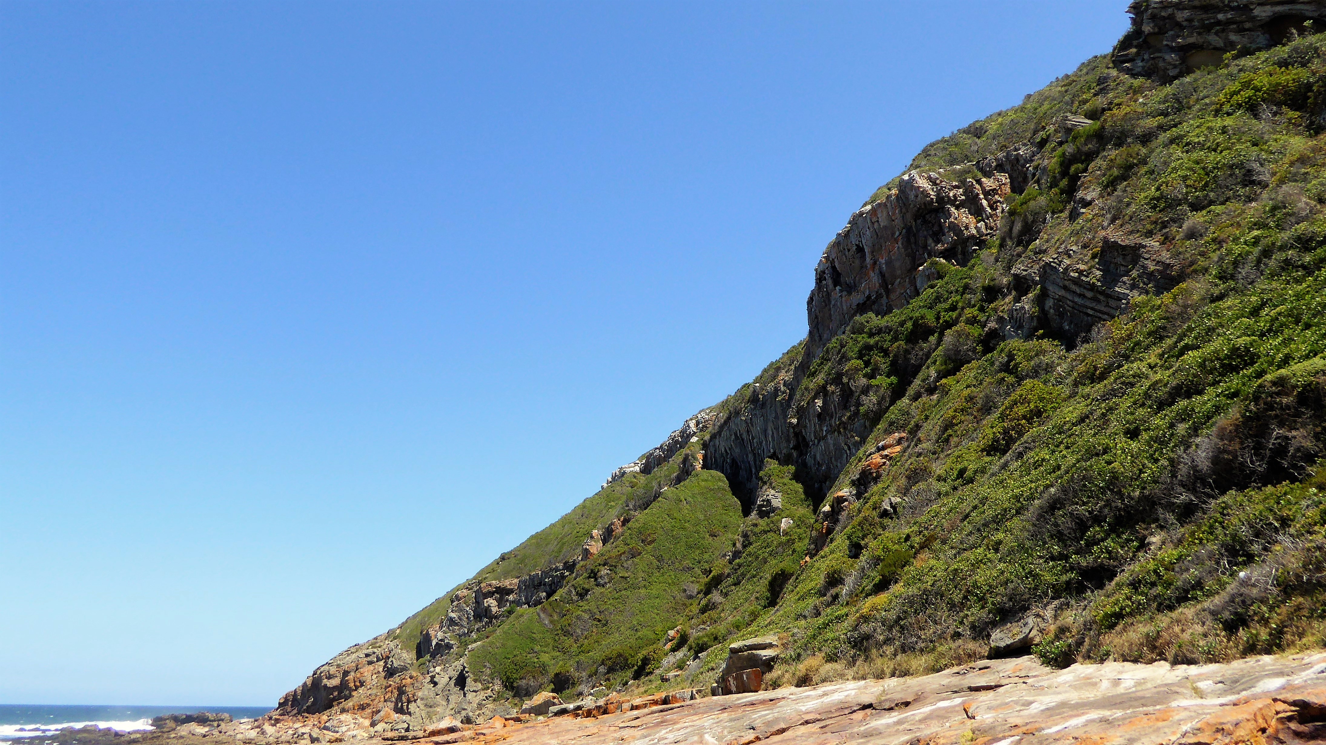
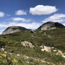
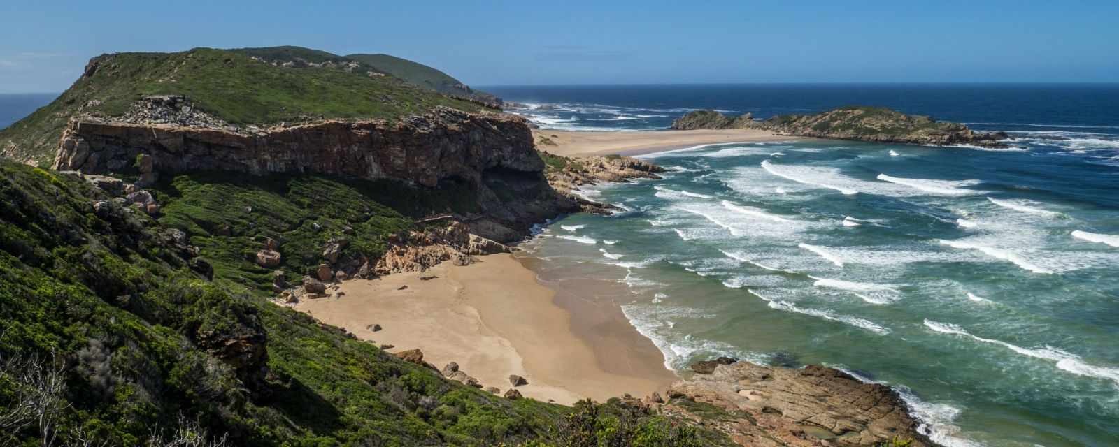
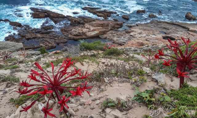
Robberg is a Nature and Marine Protected Area and a little gem along the Garden Route. We visited the Nature Reserve multiple times, and it was always different and outstanding. The scenic hiking trails inside the reserve provide a diverse landscape, sheer cliffs, an endless dune, and ocean life. Robberg is beautiful in all seasons, leaving you breathless at the end of the day.
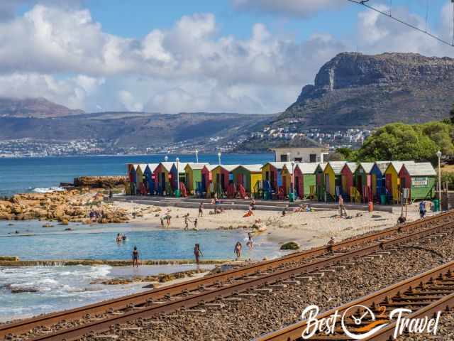
Robberg Nature Reserve is a short drive south of Plettenberg and a 6-hour, more than 500 km drive east of Cape Town.
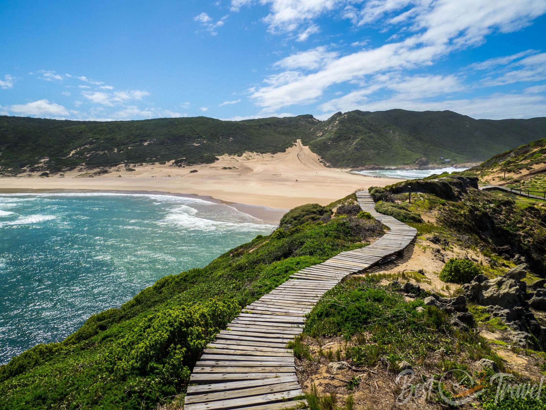
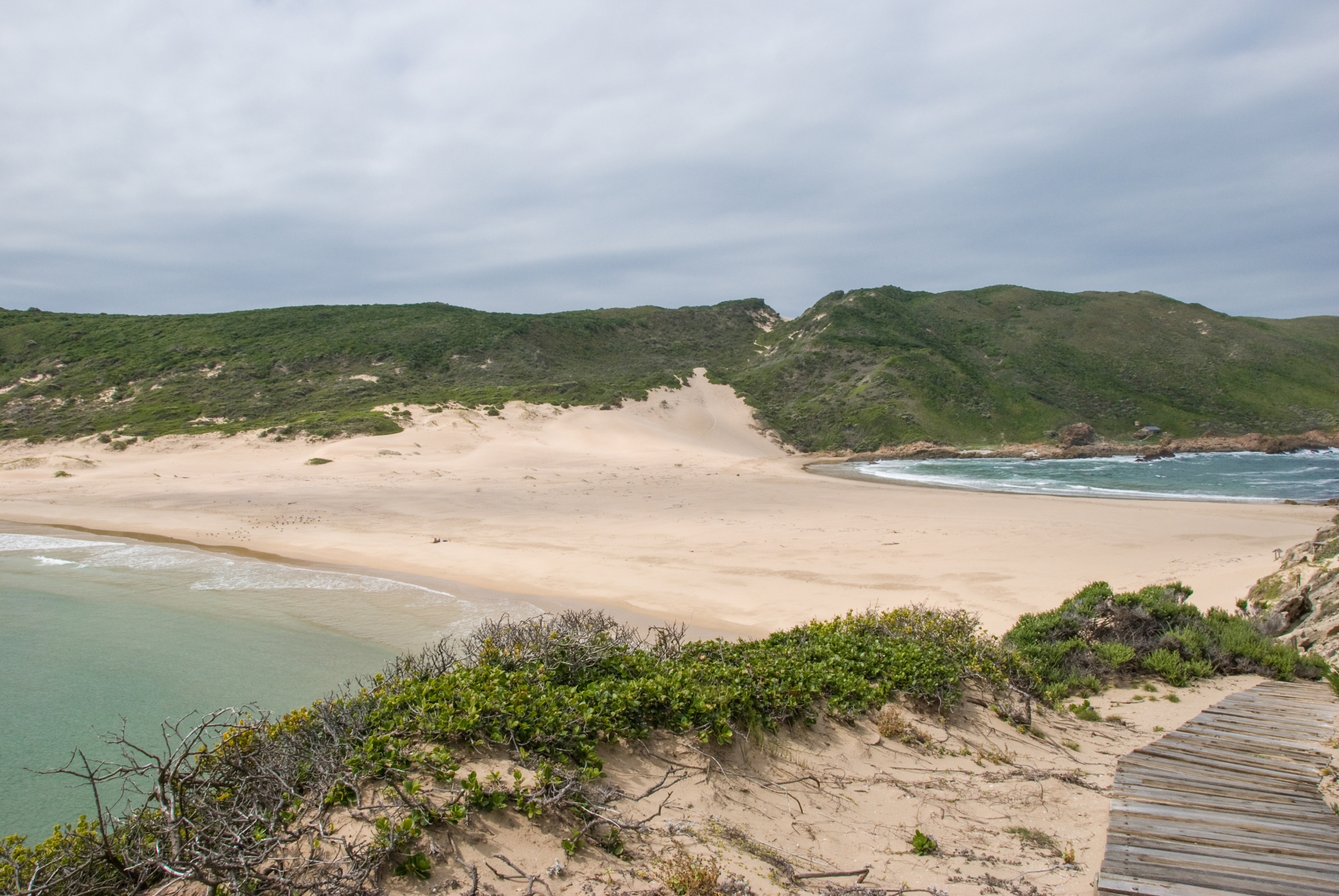
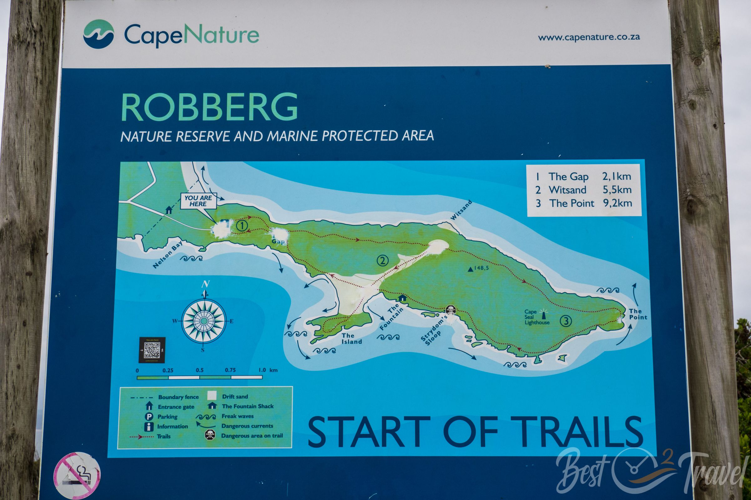
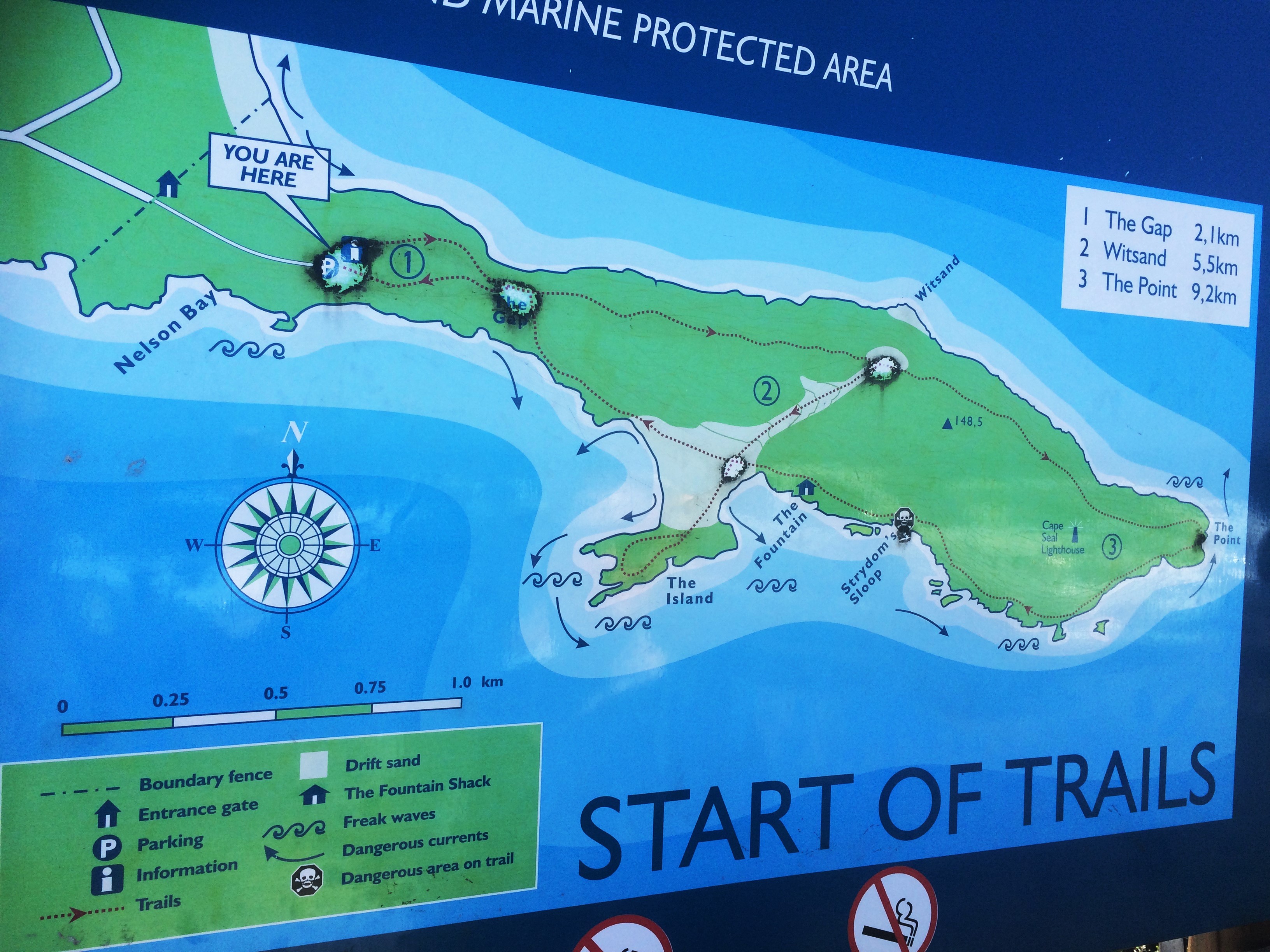
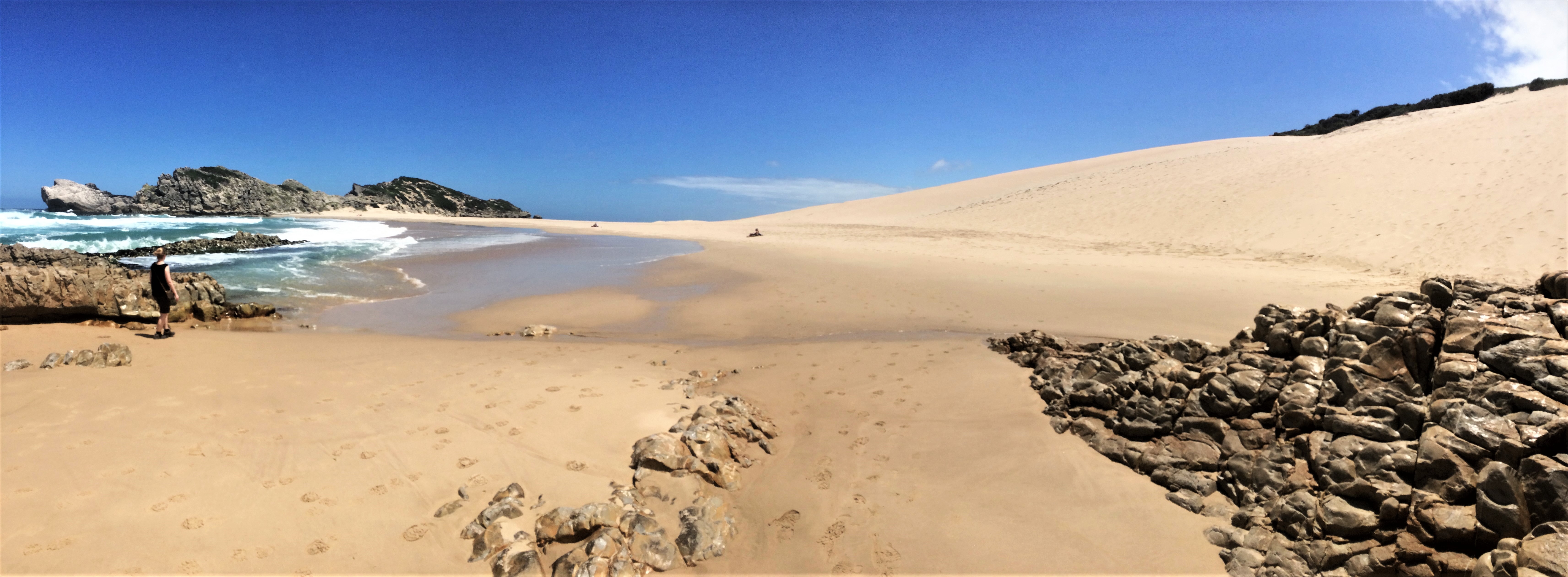
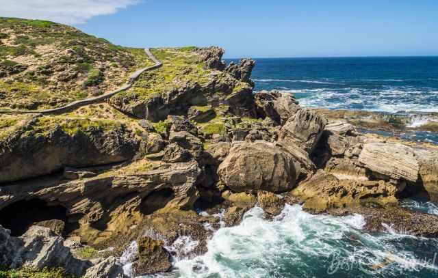
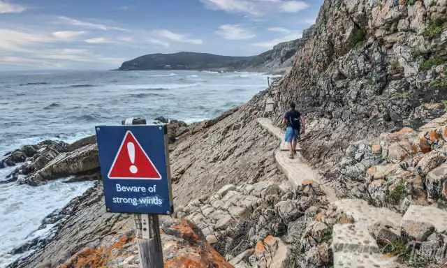
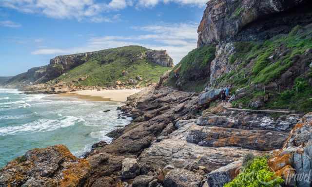
There are three hiking trails of different lengths and difficulties. My favourite one is to the tip of the peninsula. This circular trail is 9.2 km long and takes roughly 4 hours because of the epic views, fascinating coastline, and nature.
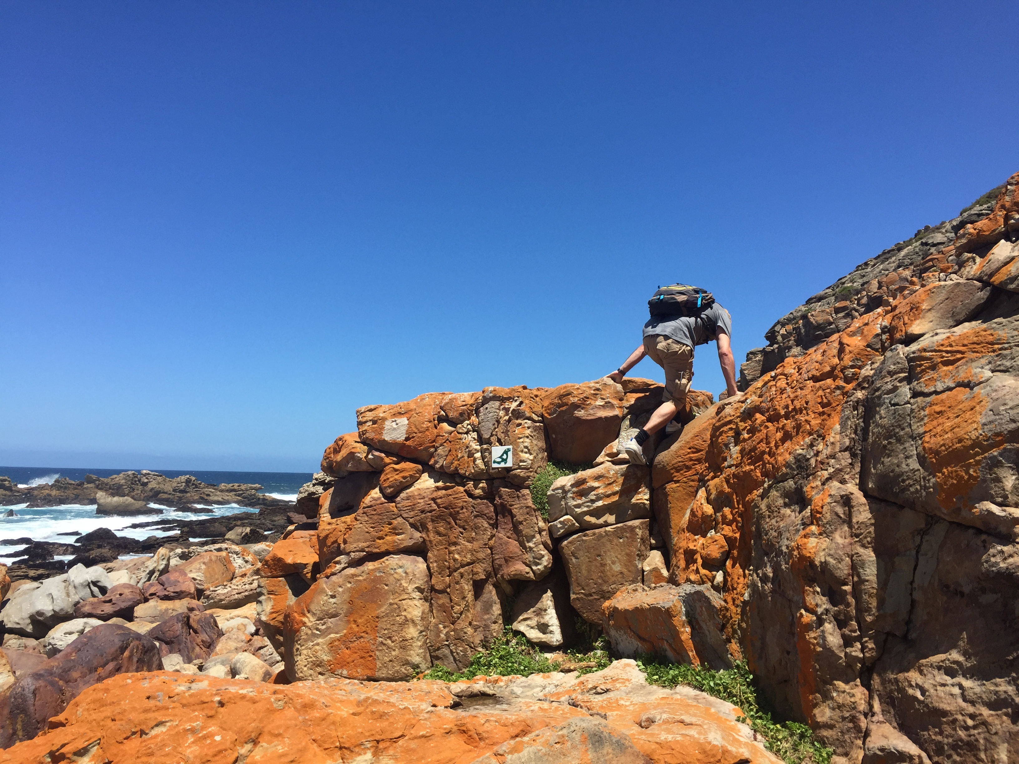
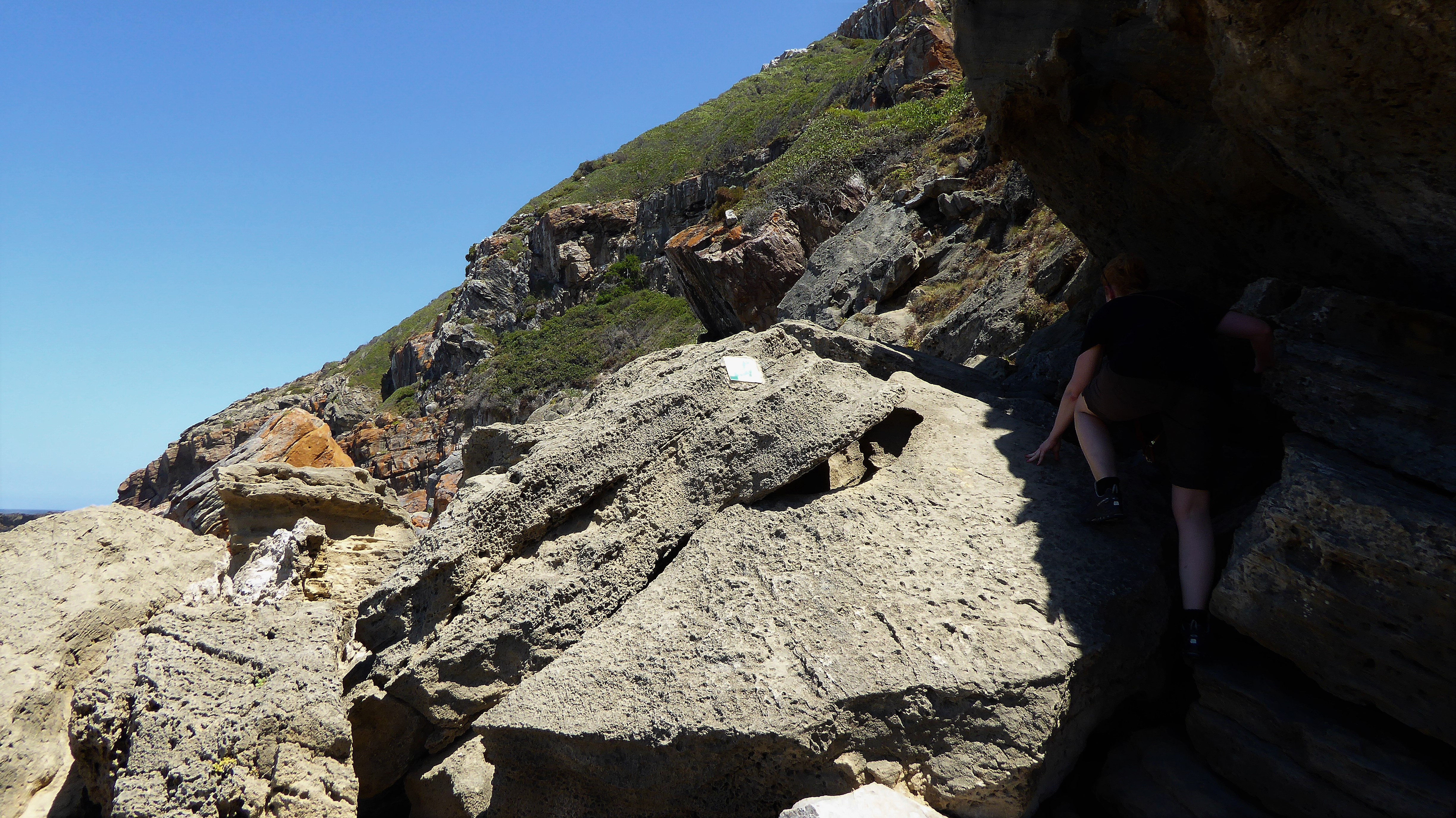
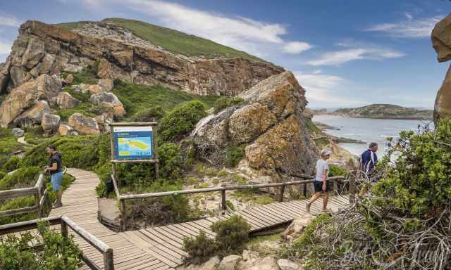
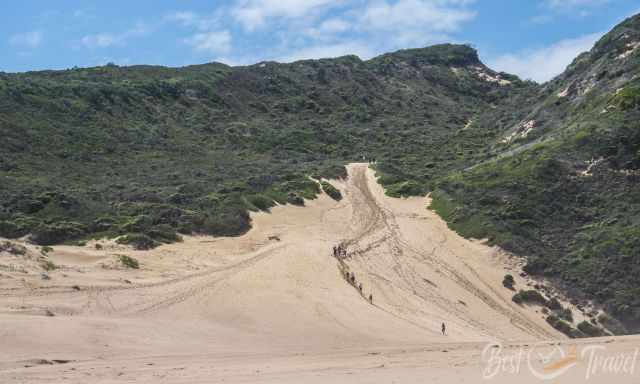
It is such a picturesque park that you can spend an entire day here without boredom. The trail descends at the end of the peninsula, and you get close to the sea. This part is easier and safer to pass during low tide, the same for a narrow and exposed section of this trail (see the picture below in the trail description). Carry a picnic and have a break here. Tide times
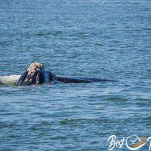
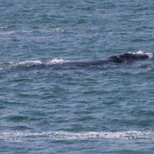
You may spot migrating whales from May to November along the coast.
Weather
Plettenberg Bay is an excellent destination throughout the year. Due to the location between the Atlantic and the Indian Oceans, Robberg experiences a mild climate, not too hot in summer and pleasant in winter. Summer highs are around 28°C, but nights are comfortable below 20°C.
The winter is the "coldest" and driest time, with day temperatures at around 22°C. Nights are chilly in the wintertime, below 10°C. Generally, there is low rainfall in the Plettenberg area, with most precipitation in the hottest months, from November until March. Plettenberg is a sunny region with more than 300 hours of sunshine monthly in summer.
Parking Robberg
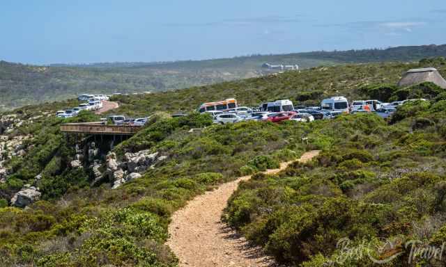
Limited parking can be an issue during sunny weekends. If you plan to visit Robberg at the weekend, come either early or late in the day. Parking Location Google Maps
Opening Hours - Gate Times
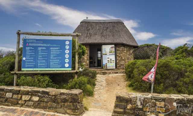
- 1. October until 30. April from 7 am to 8 pm
- 1. May until 30. September from 8 am to 6 pm
Entrance Fee
A conservation fee of R60 for adults and R30 for children is requested. The gate is not closed after opening hours, so you can stay inside the reserve as long as you want.
3 Hiking Trails in Robberg
We have done the longest hike to "The Point" many times, but we also came here with our takeaway dinner and enjoyed the fantastic scenery and breeze. Lots of residents meet up here in the evening during the weekends.
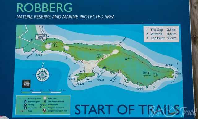
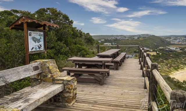
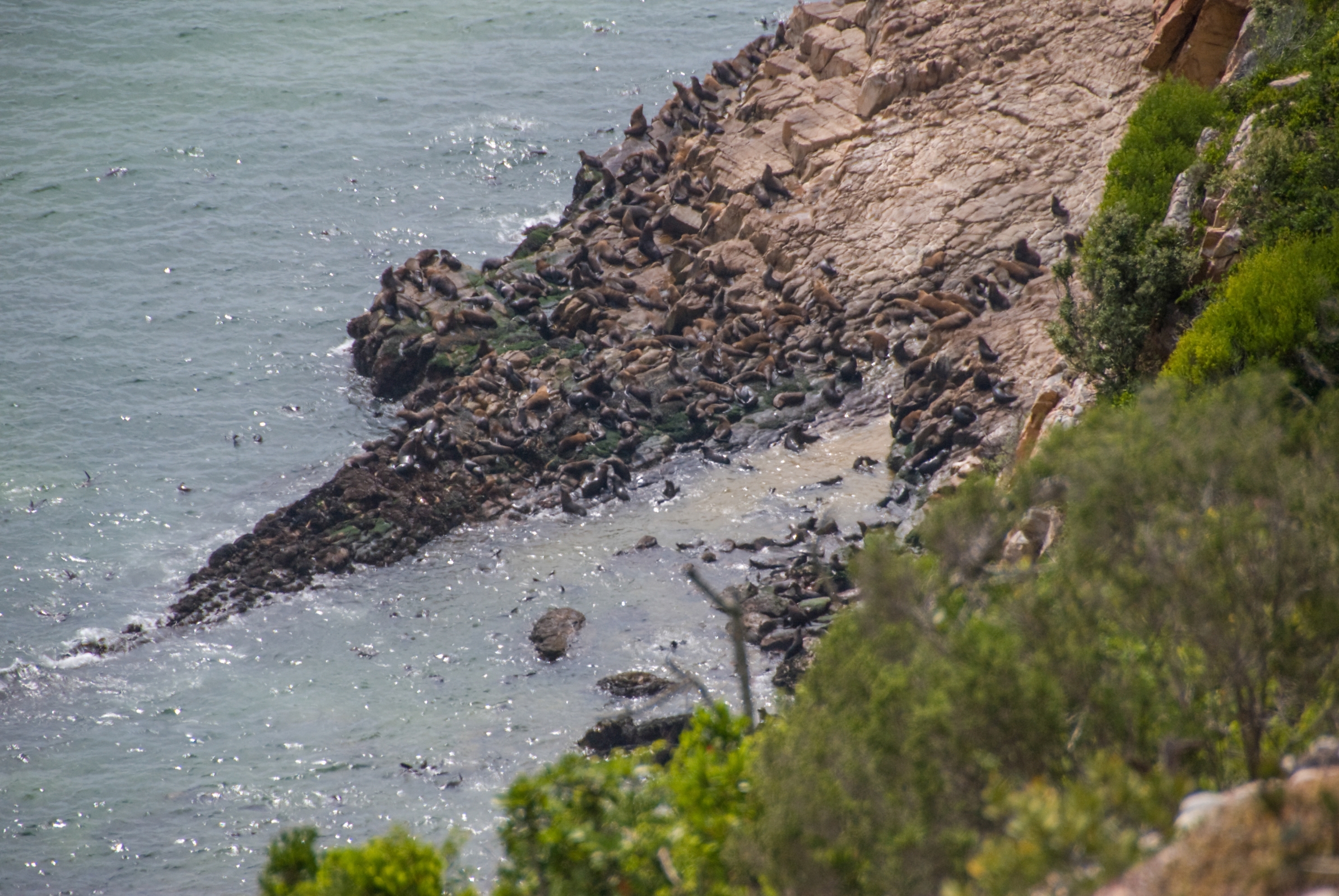
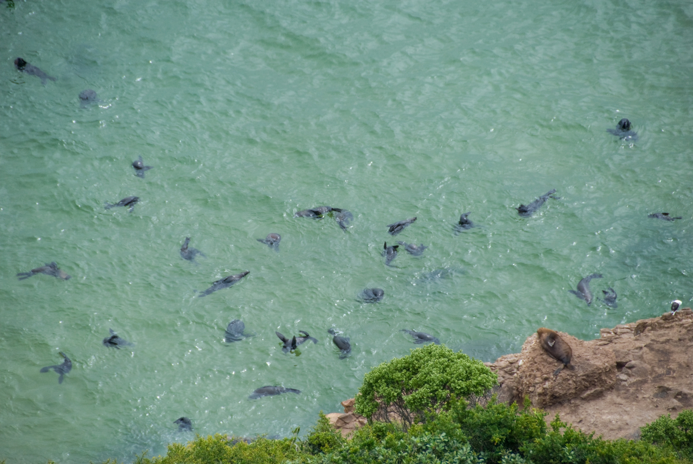
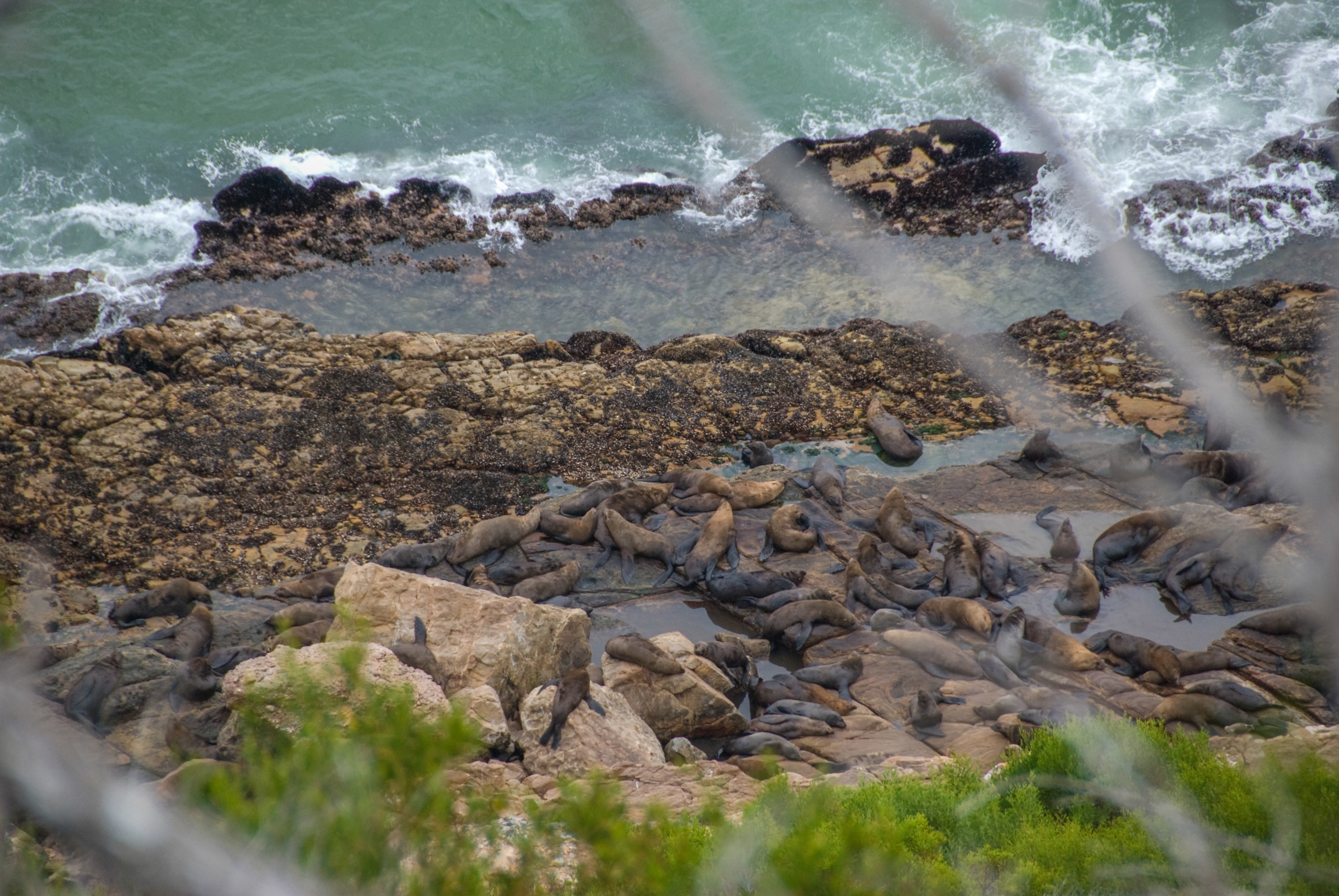
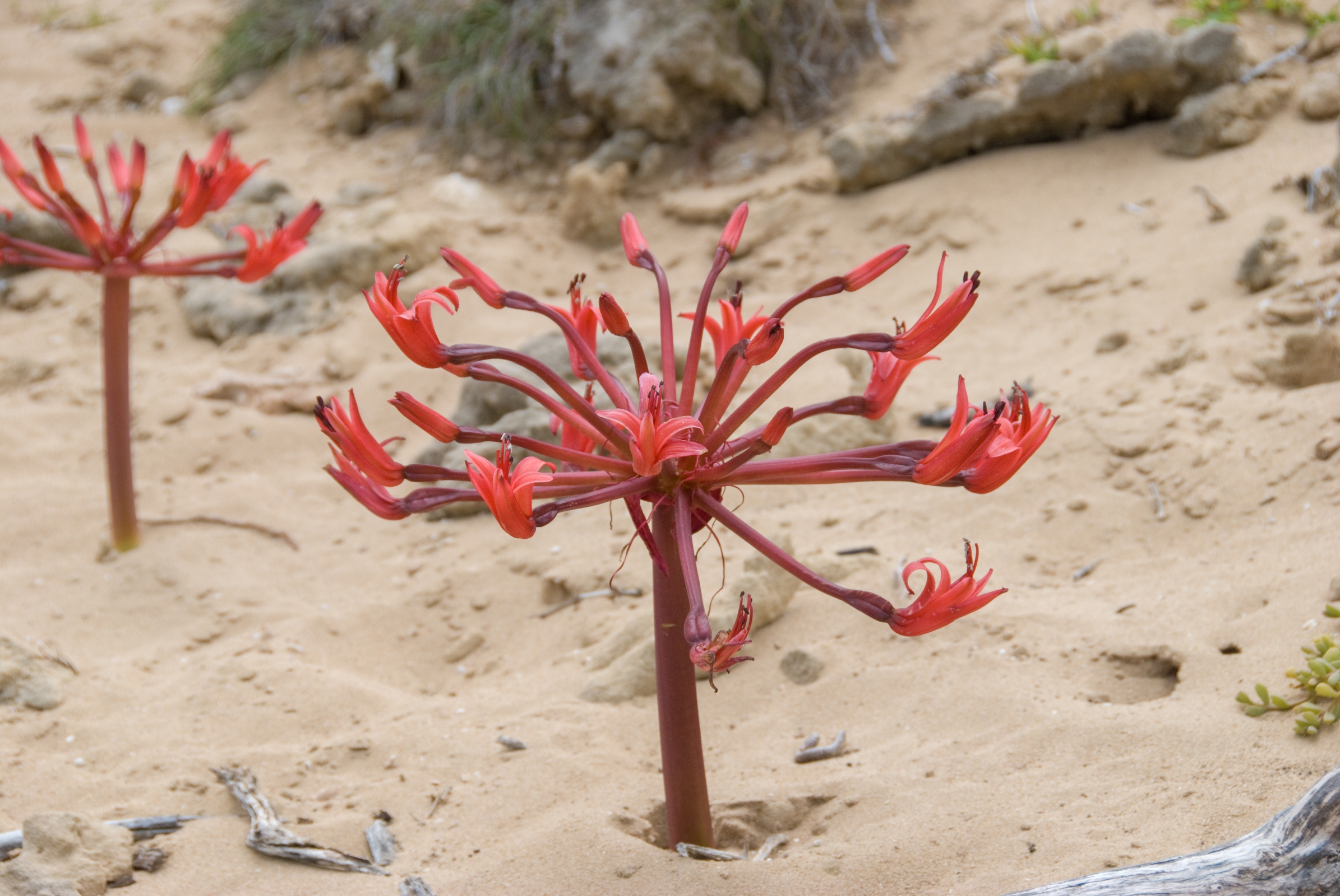
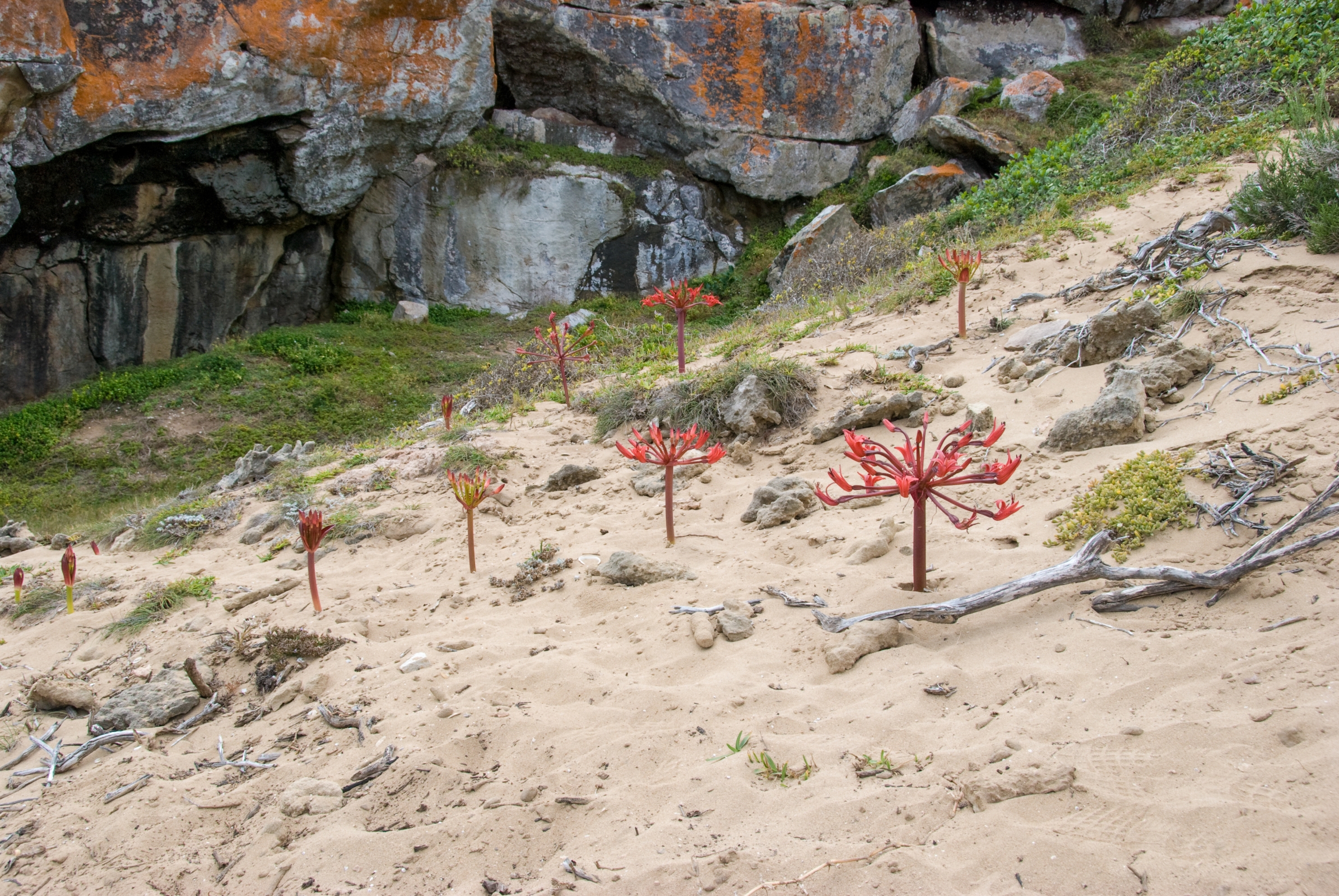
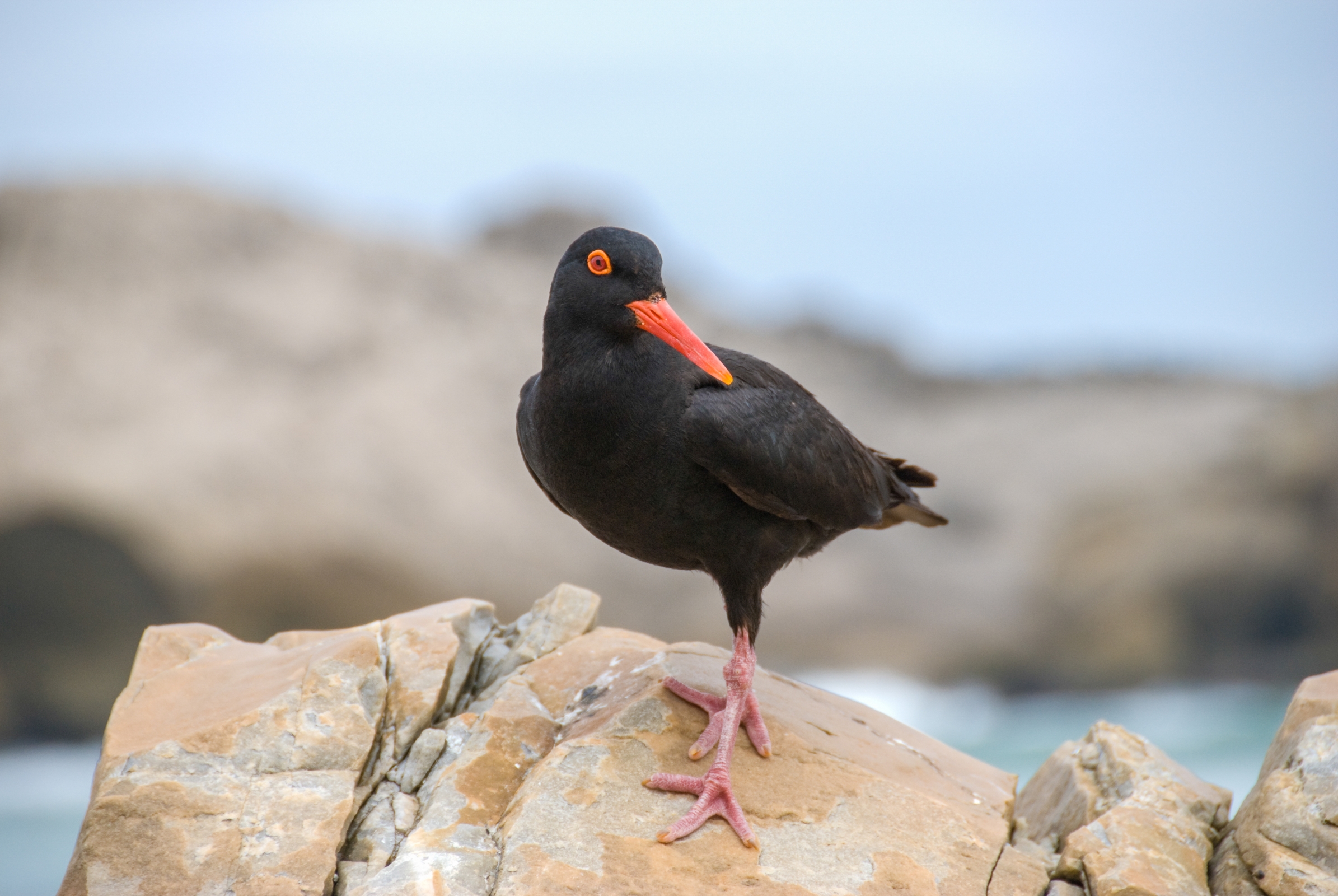
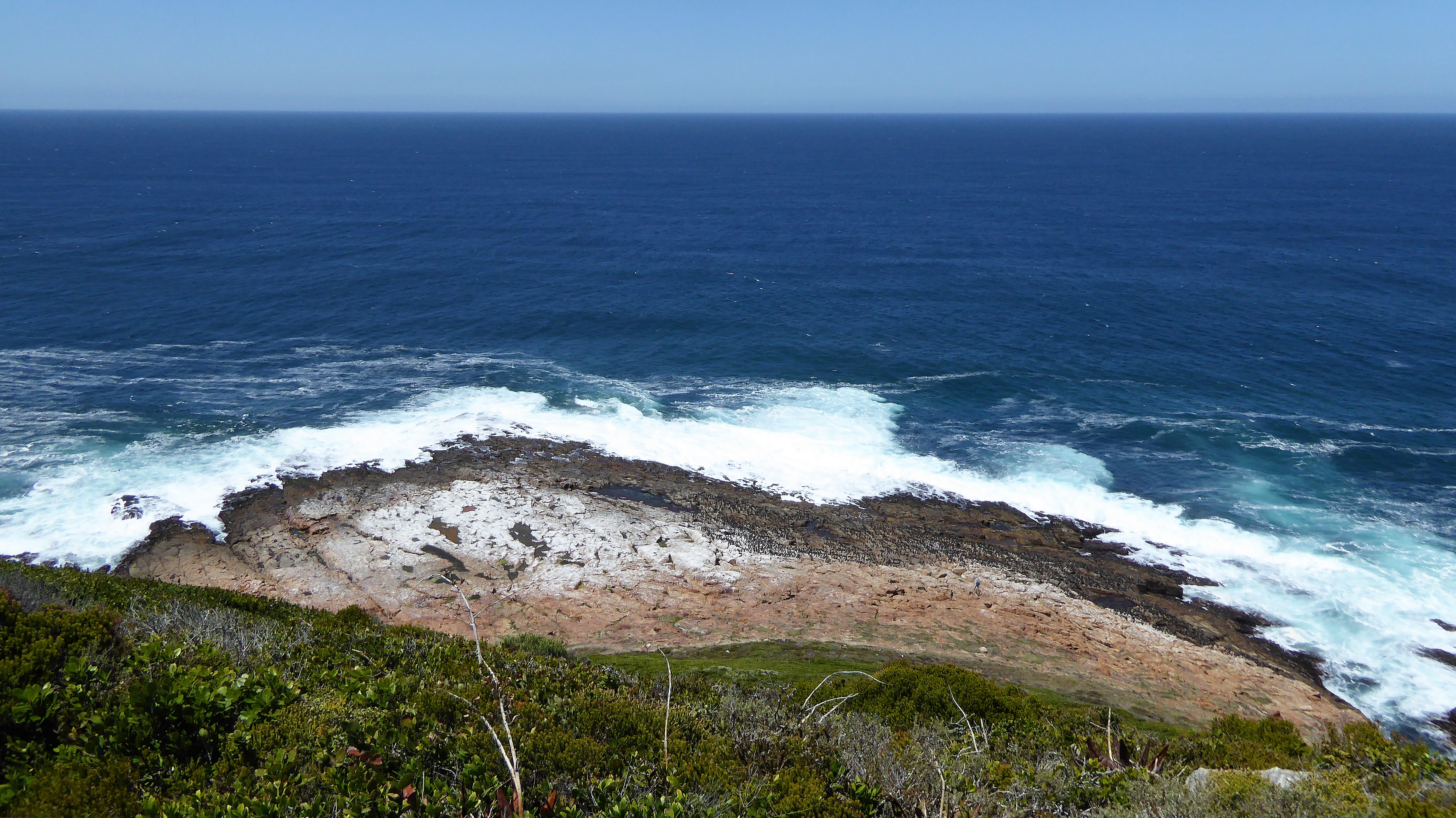
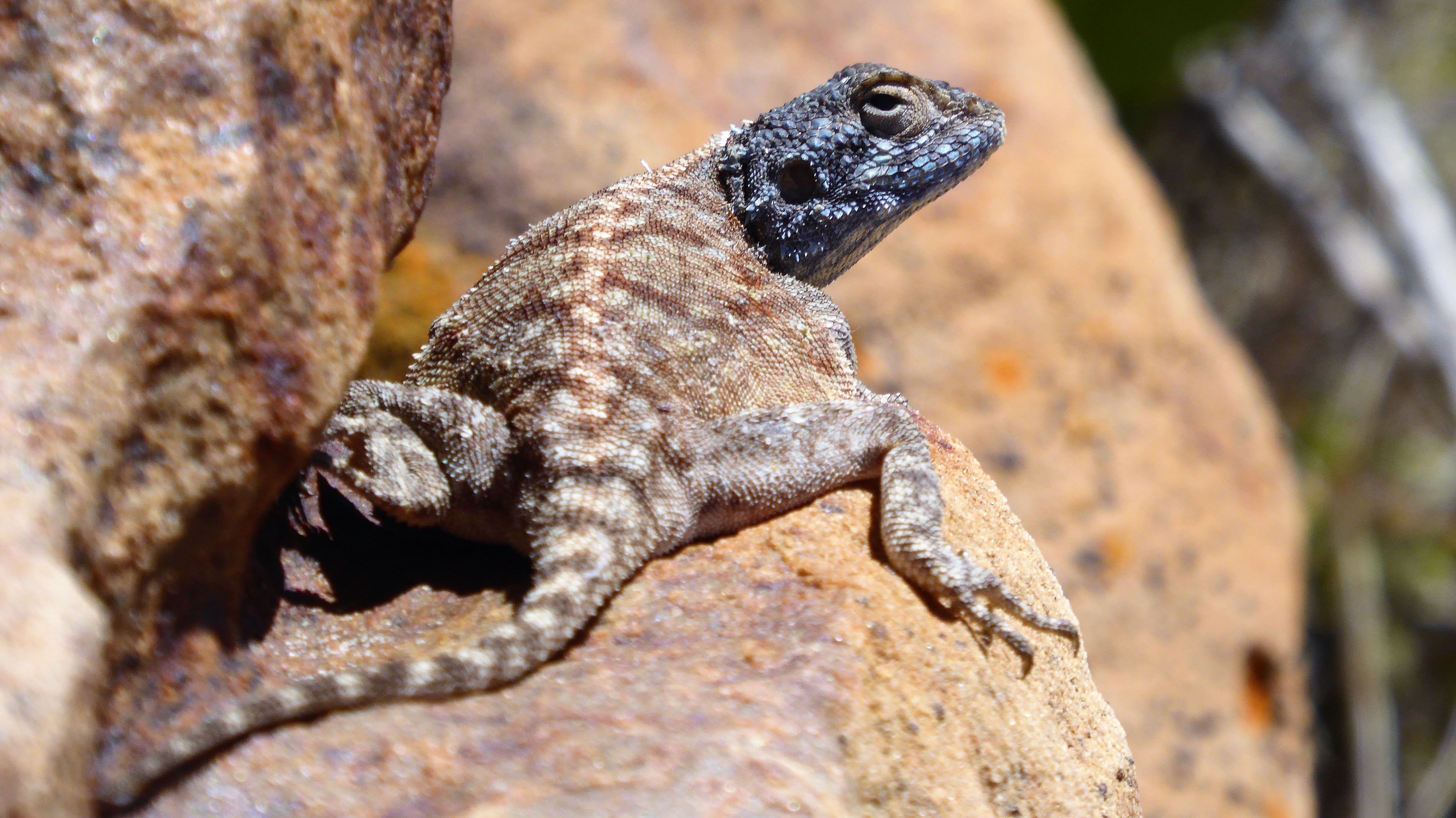
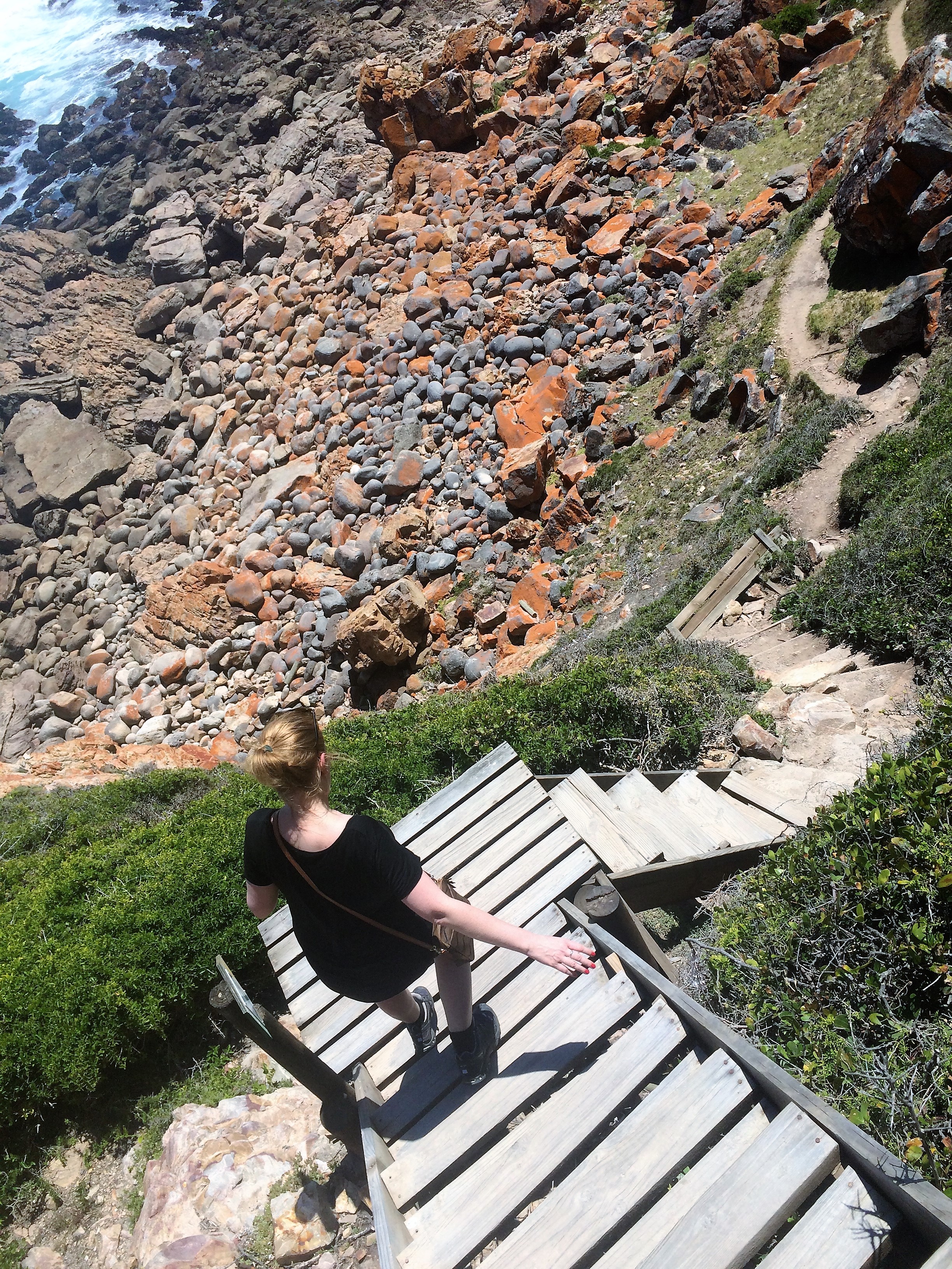
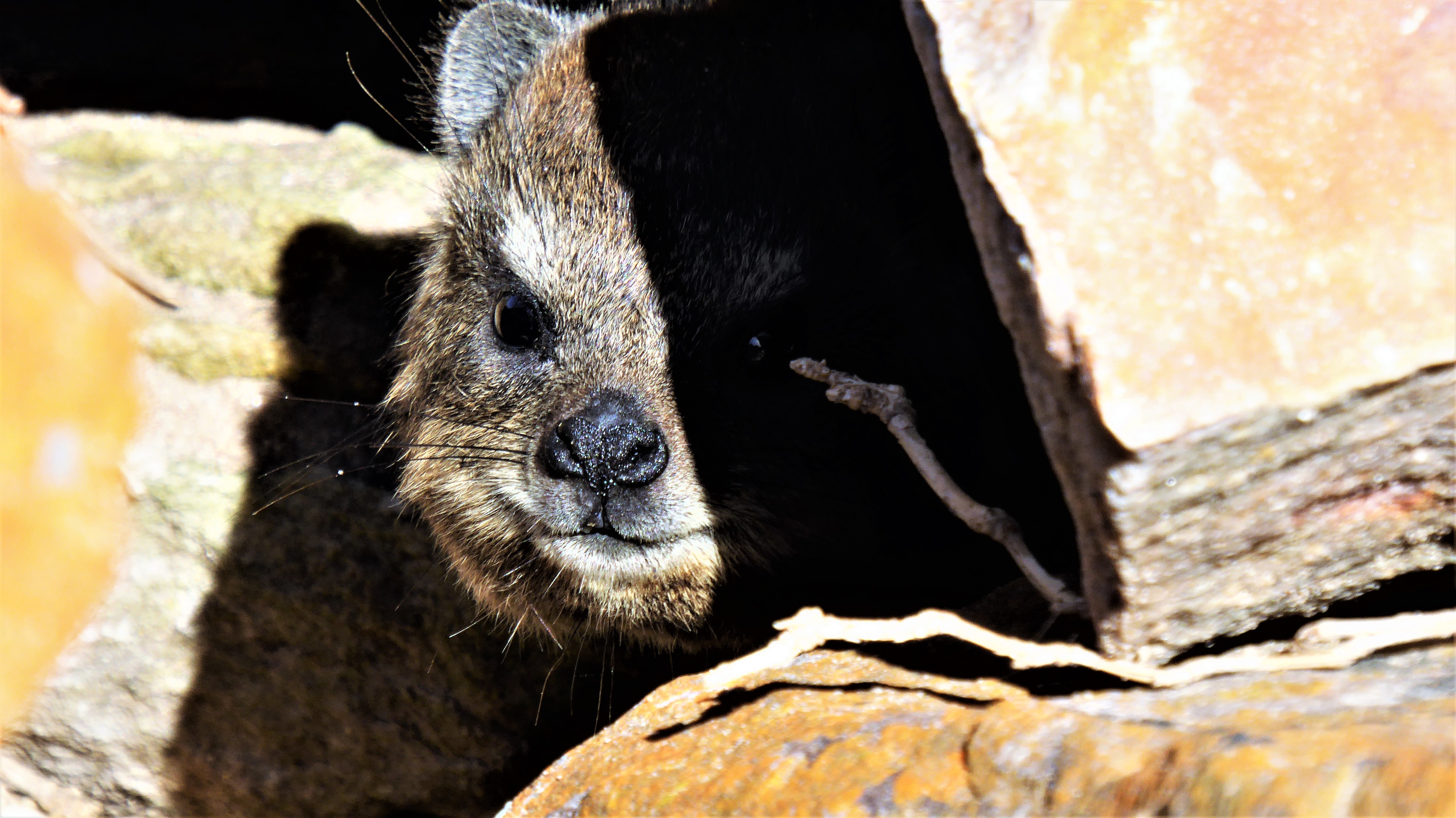
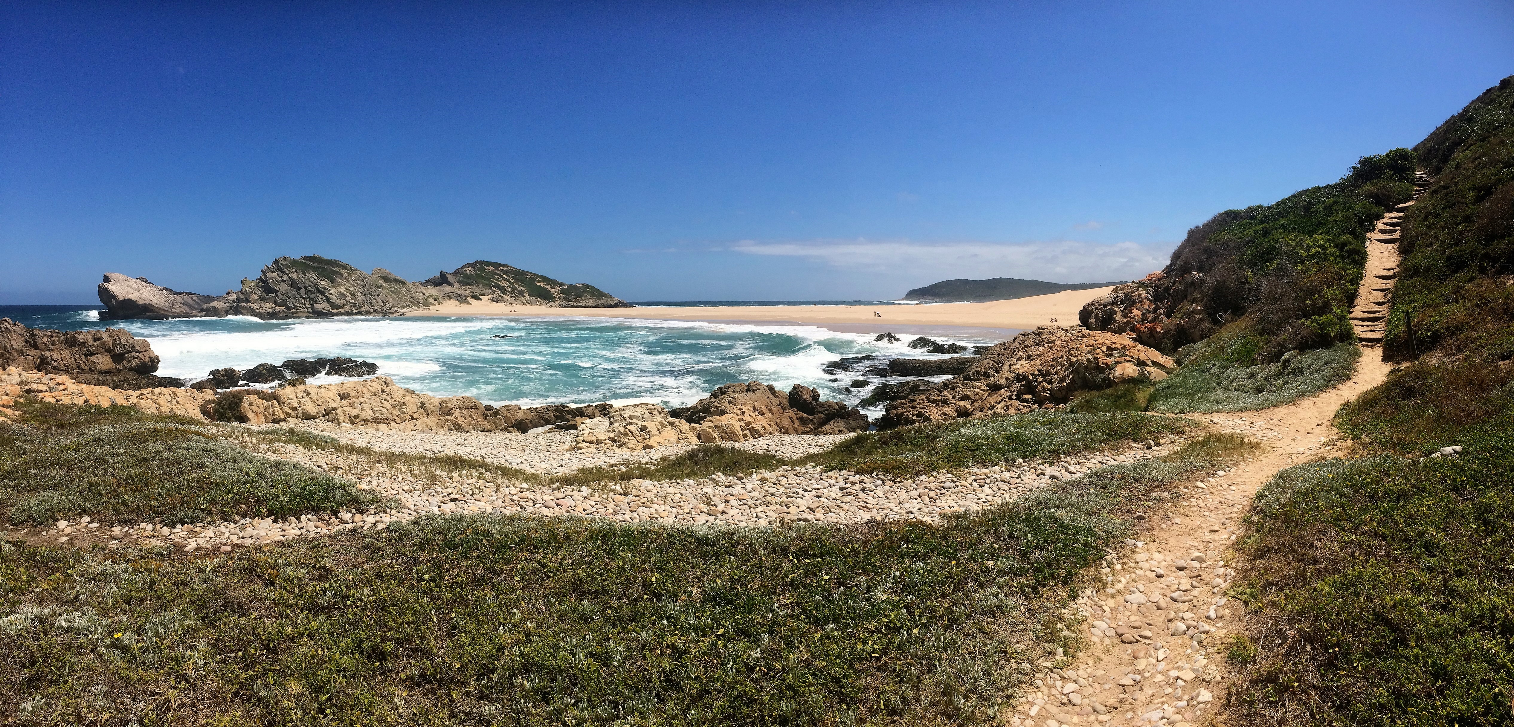
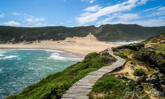
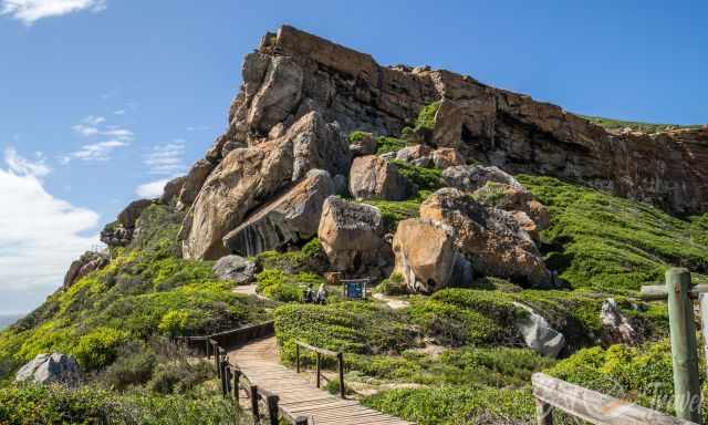
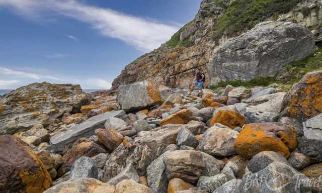
Three different hikes lead through this stunning Nature Reserve, starting from the car park. The path is narrow and steep in some parts. Always had an eye for the ocean and spotted bottlenose dolphins, humpback whales and Cape fur seals. Boardwalks were installed to keep visitors out of the nesting kelp gulls. Please stay on the trail; otherwise, you may disturb the birds or destroy a nest. Therefore, dogs are not allowed inside of the reserve to protect all wildlife like the blue duiker, the smallest antelope that occurs here.
1 The Gap
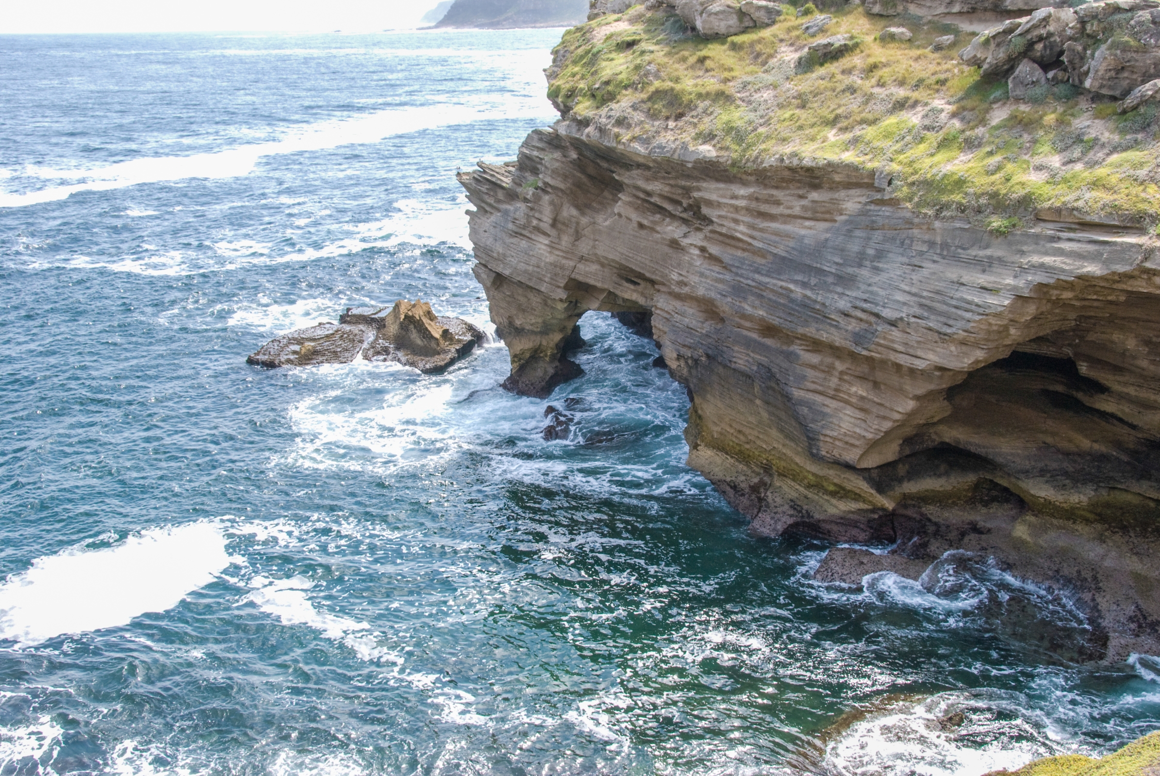
The shortest track is 2.1 km, leading to the Gap. Already along this trail, we spotted and smelled Cape fur seals. There is a vast colony, which we saw from the clifftop.
2 Witsand
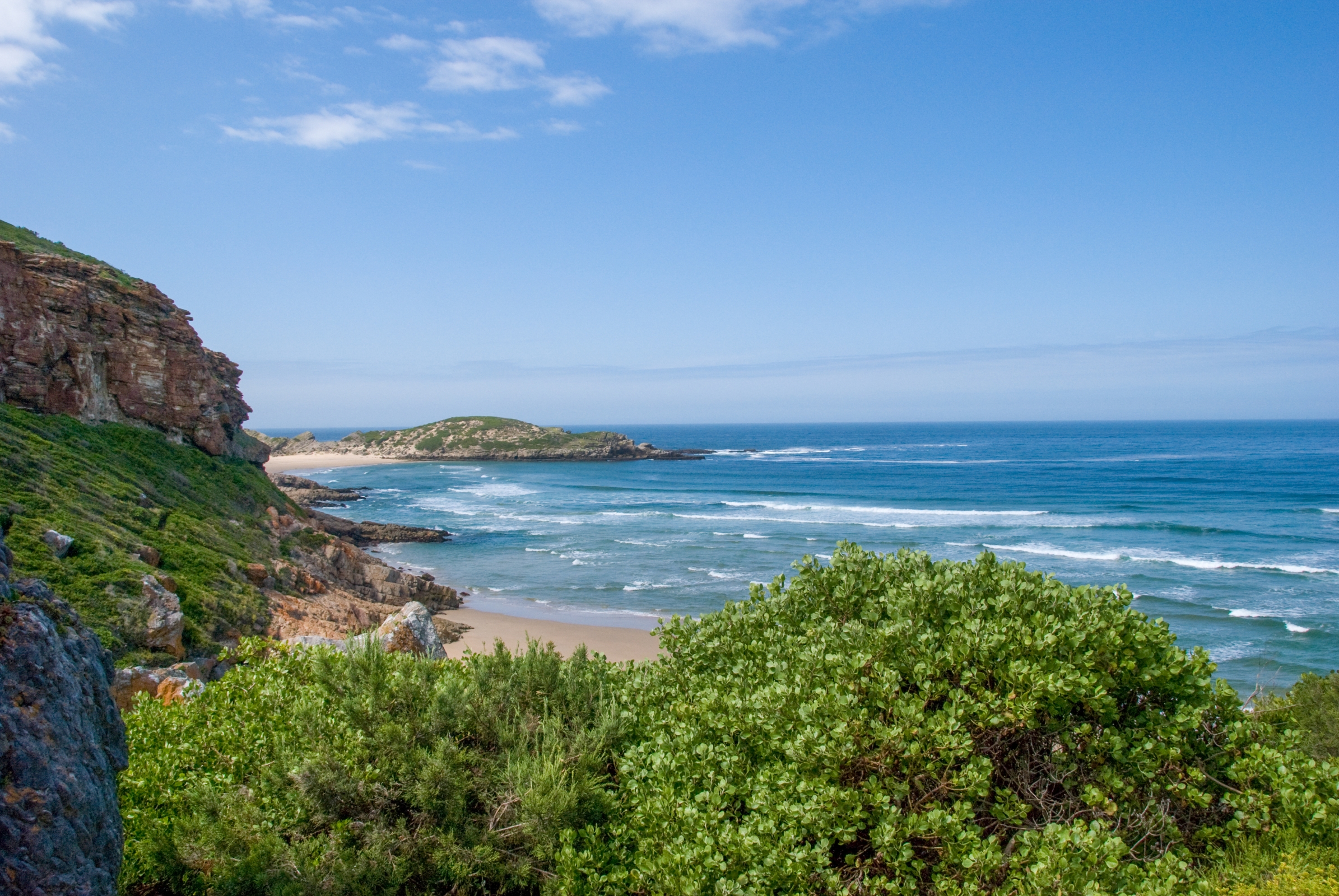
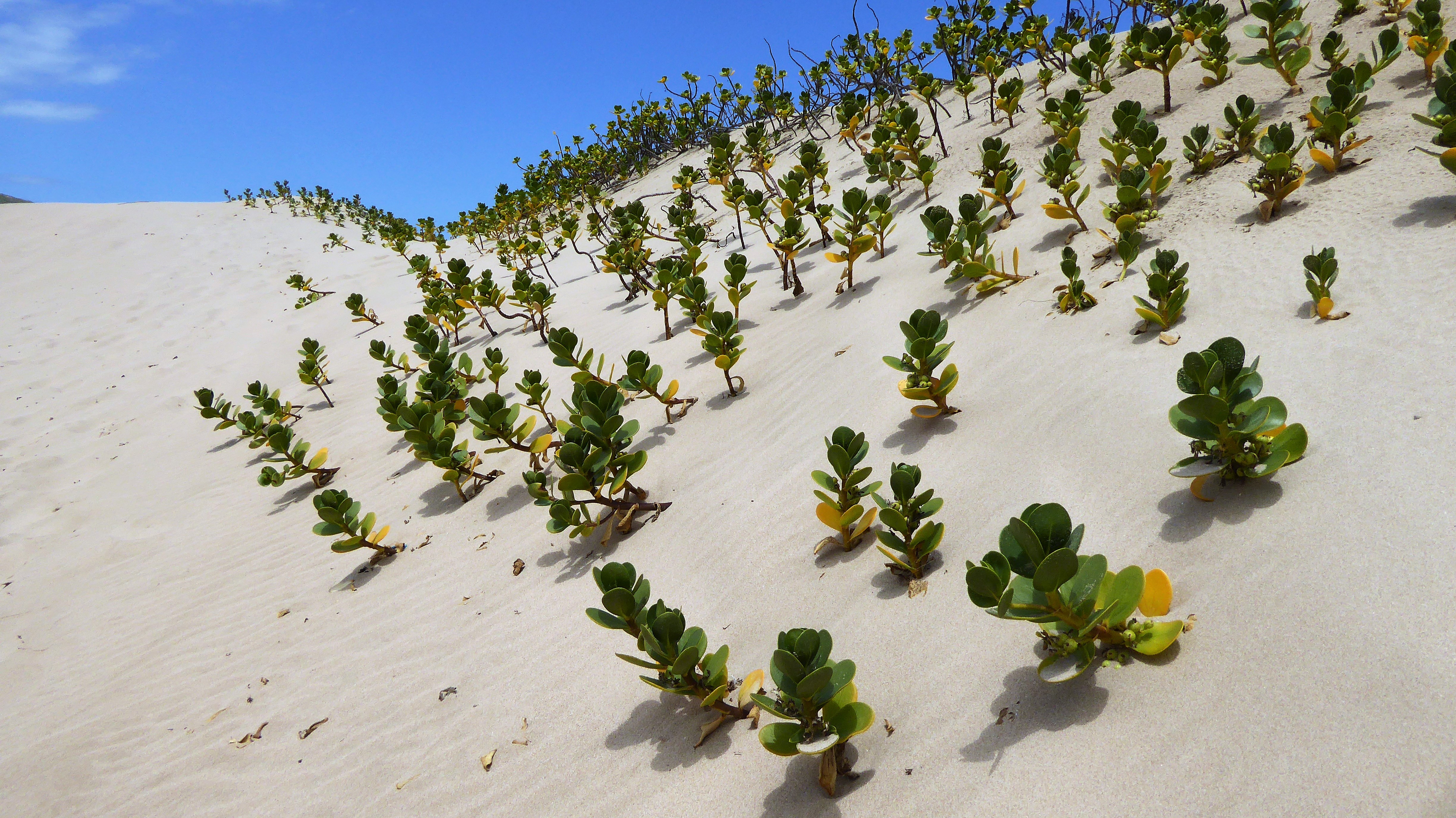
The second trail, the Witsand Circuit, continues until the Witsand Dune and the Island or "Die Eiland". Before Witsand, we already smelled and heard the seals barking, and hundreds of them were lying on the rocks. The Island offers breathtaking views; we sat down on the bench and enjoyed this magical place. Mother Nature at its best. This trail is 5.5 km long and shouldn't be missed. The Witsand trail does not include "Die Eiland" but is worth a detour of roughly 500 meters.
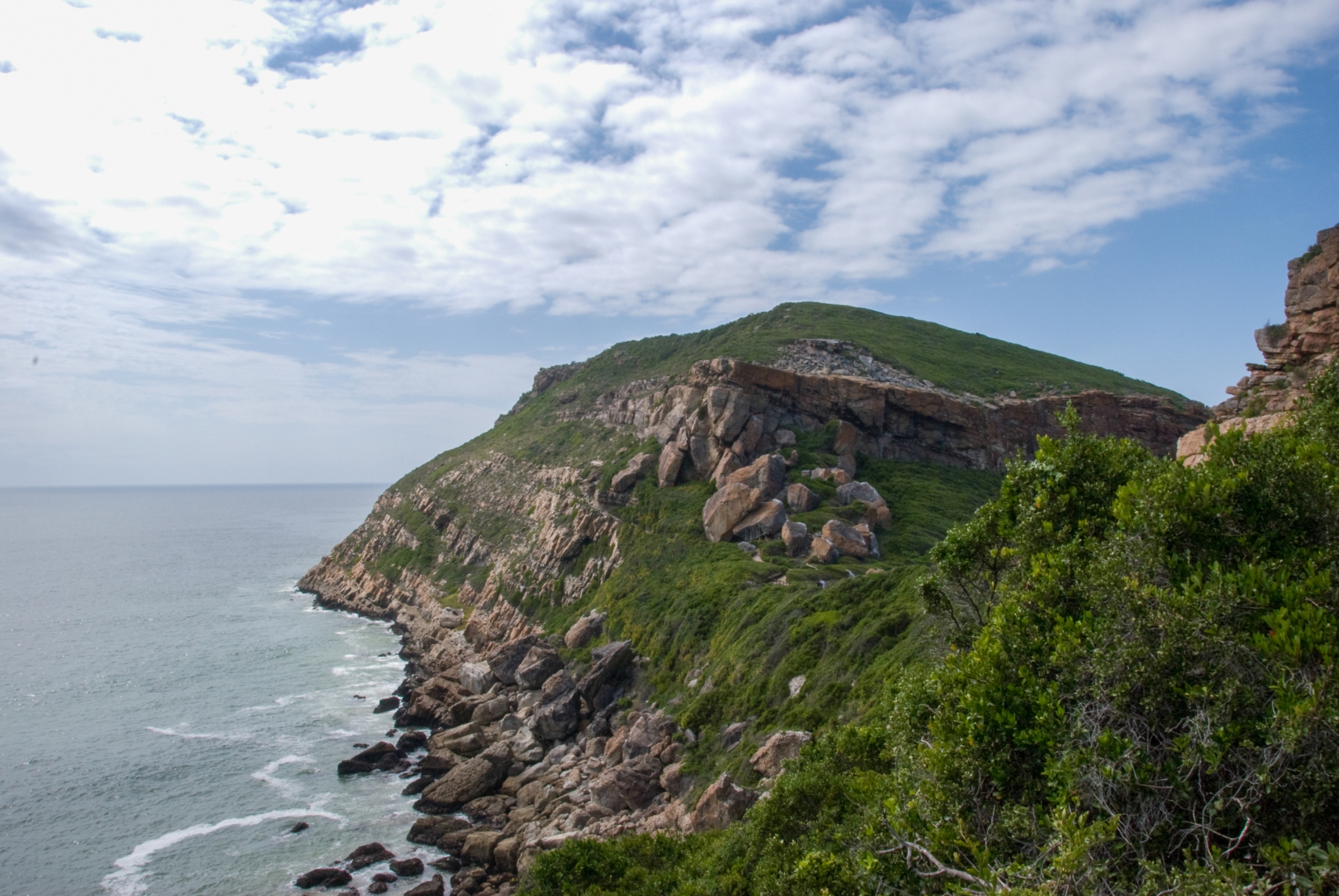
3 The Point
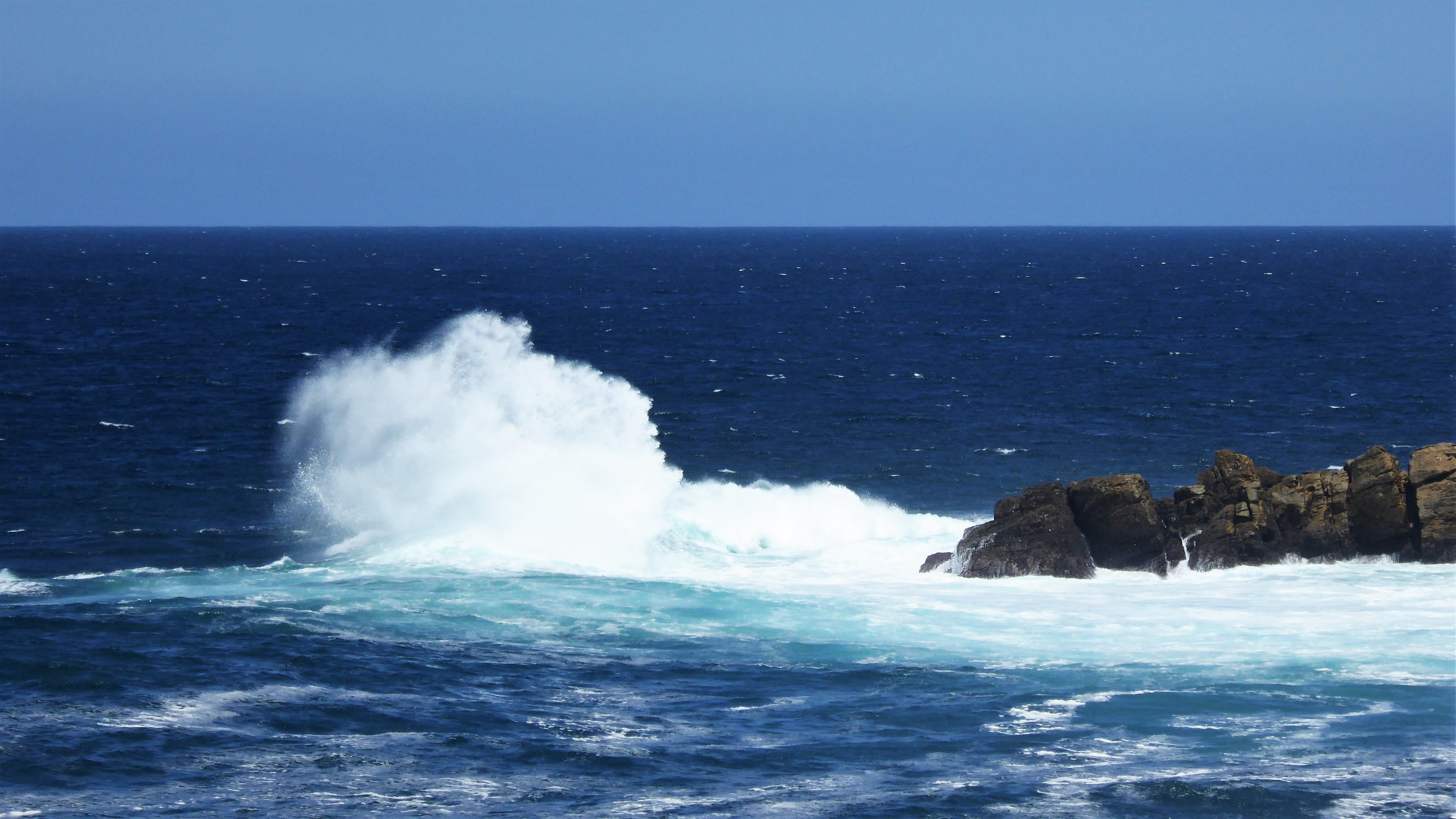
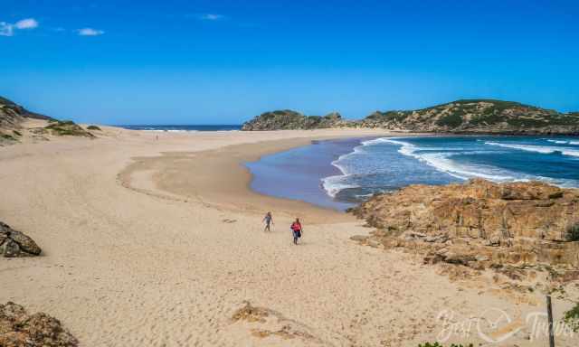
The longest track leads along the entire peninsula to "The Point". This 9.2 km trail is a little strenuous, gaining an elevation of almost 400 m. Walking clockwise is recommended not to bump into other hikers on the narrow path. Along the shore, we spotted a big Cape fur seal colony. From May/June until early November, you may also spot whales. If you do the hike in summer, don't forget your swimsuit for a bath at Tombolo Beach. I only recommend a dip close to the shore but not swimming due to strong currents.
Packing List
- Wind jacket; the exposed trails experience lots of wind.
- Plenty of water, especially in the summer. You can't buy anything in the reserve.
- Also, carry a picnic, sandwich or snack and enjoy the awe-inspiring nature.
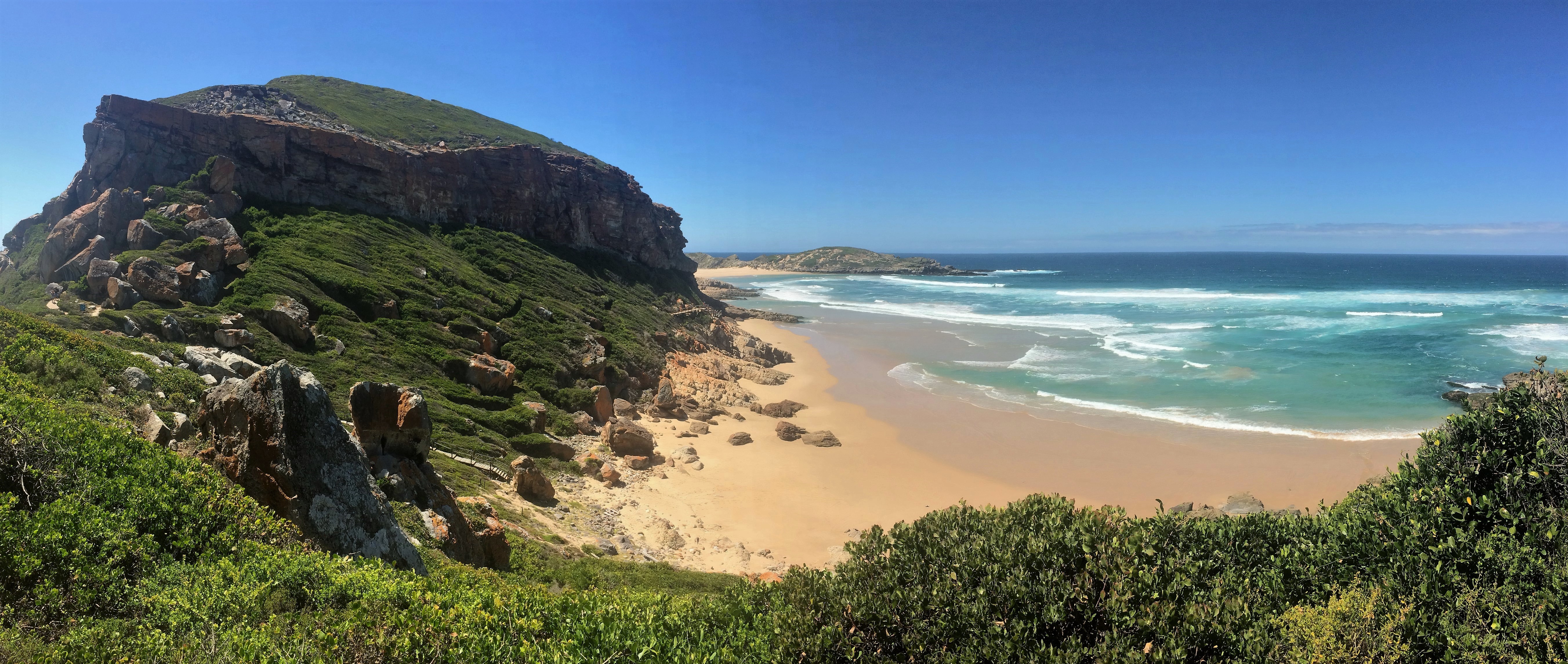
- Bath clothes and a towel in summer. Check out the map; number 18 Island's Beach is one of the most beautiful beaches.
- Sunscreen and a hat are essential. The African sun is intense, and there isn't any shelter provided.
Map Tip
- Download the leaflet for your trip to Robberg Nature Reserve.
Where to Stay Nearby
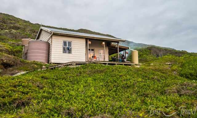
No camping inside the reserve. There is one overnight hut, "The Fountain Shack" sometimes called Point Shack, which can accommodate eight people. Book the hut far in advance; it is popular with residents, especially on weekends and bank holidays.
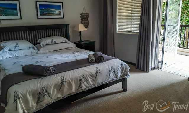
We never got the hut booked in time, so we always stayed in one of the lovely guesthouses in Plettenberg Bay. It is just an eight km drive to the entrance of Robberg. Guesthouses Plettenberg Bay Thanks for booking via my website. With your support, I am able to provide all content for free.
Don't miss out on my first-timer's guide and learn all about the 12 Essential Insights for Your Vacation in South Africa.
Best Months to Visit
Location and Tips

Robberg Nature Reserve is a fantastic place not only for hikers. Already, the first viewpoint at the entrance gate is mindblowing; mother nature at its best. Have a picnic here and enjoy the breathtaking scenery.