
When Is the Best Time
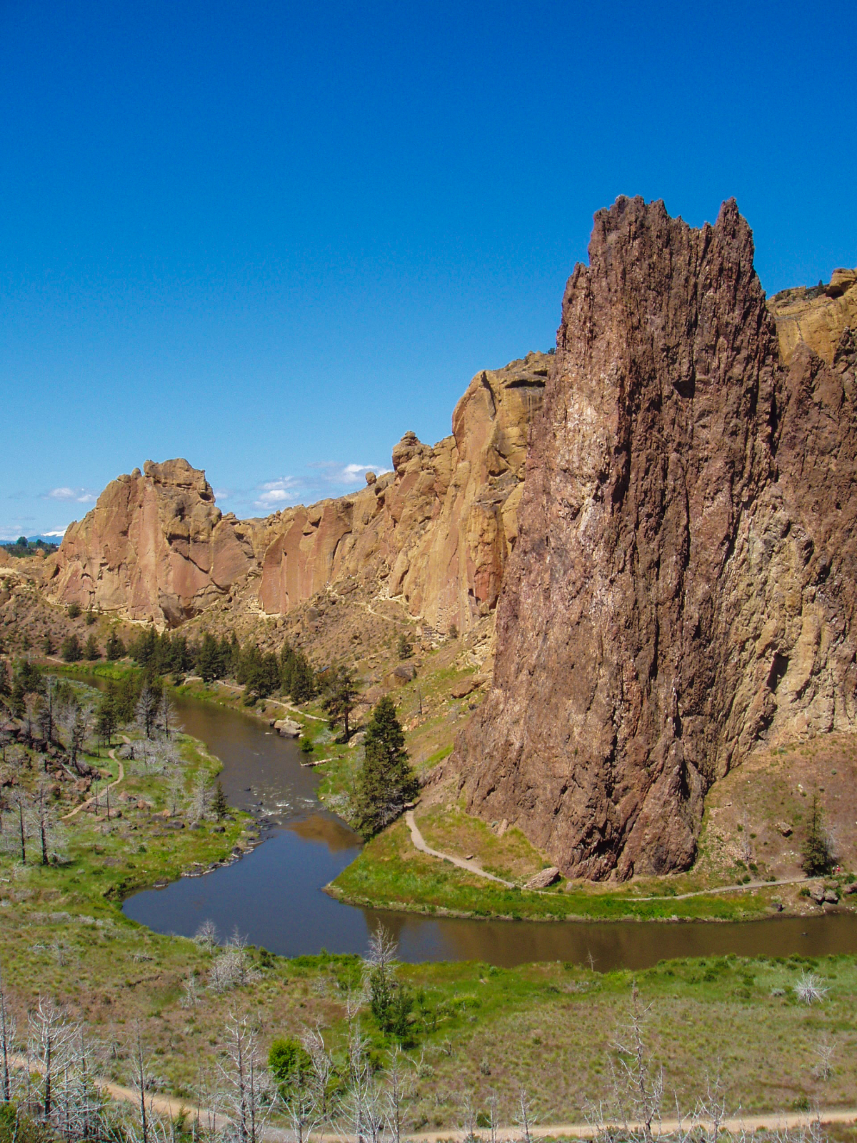
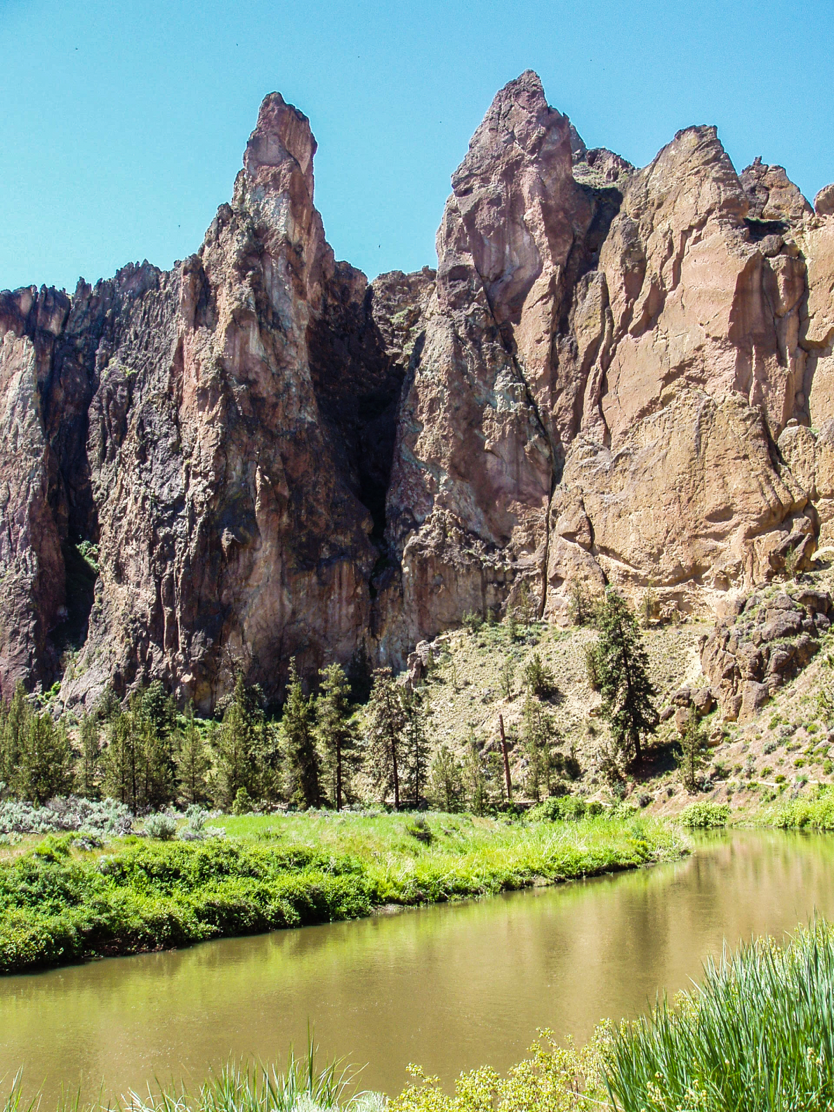
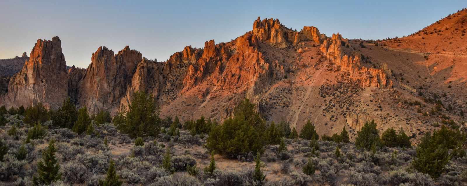
Smith Rock State Park is one of Oregon’s most iconic outdoor destinations, known for its dramatic cliffs, deep canyons, and world‑class climbing routes. Located in the high desert at 2,800 ft (850 m), the park has a microclimate and a volcanic history dating back more than 30 million years. Weathering continues to shape the rock walls, creating a constantly changing landscape.
Visiting Smith Rock State Park
Smith Rock lies 9 miles north of Redmond. In summer, temperatures rise quickly inside the canyon, so an early start around 7 a.m. is ideal. The steep walls trap heat, making late spring and summer hikes surprisingly hot.
Rattlesnakes occur in the park, especially on warm days when they sun themselves on open sections of the trail. Stay alert, watch your step, and give wildlife plenty of space.
Bald eagles and falcons nest in the area, and seasonal closures protect their nesting sites. Always check for updates before hiking or climbing.
Best Time to Visit Smith Rock
The best time to visit Smith Rock State Park is spring and fall, when temperatures are mild and the canyon is comfortable for hiking and climbing.
March–May (Spring) — Ideal temperatures, blooming wildflowers, and increasing rattlesnake activity on warm days. Some climbing routes may be closed due to nesting falcons or eagles.
September–October (Fall) — The most pleasant weather of the year with clear views, stable conditions, and fewer crowds than summer.
June–August (Summer) — Very hot inside the canyon by late morning. Start early to avoid heat. Rattlesnakes are more active, and parking fills quickly.
November–February (Winter) — Quiet and peaceful with cold nights and occasional snow. Trails can be icy in shaded areas.
Overall best months:
Best Hikes at Smith Rock
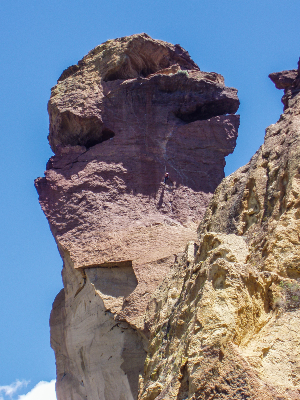
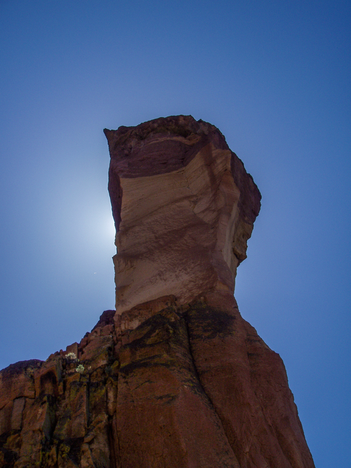
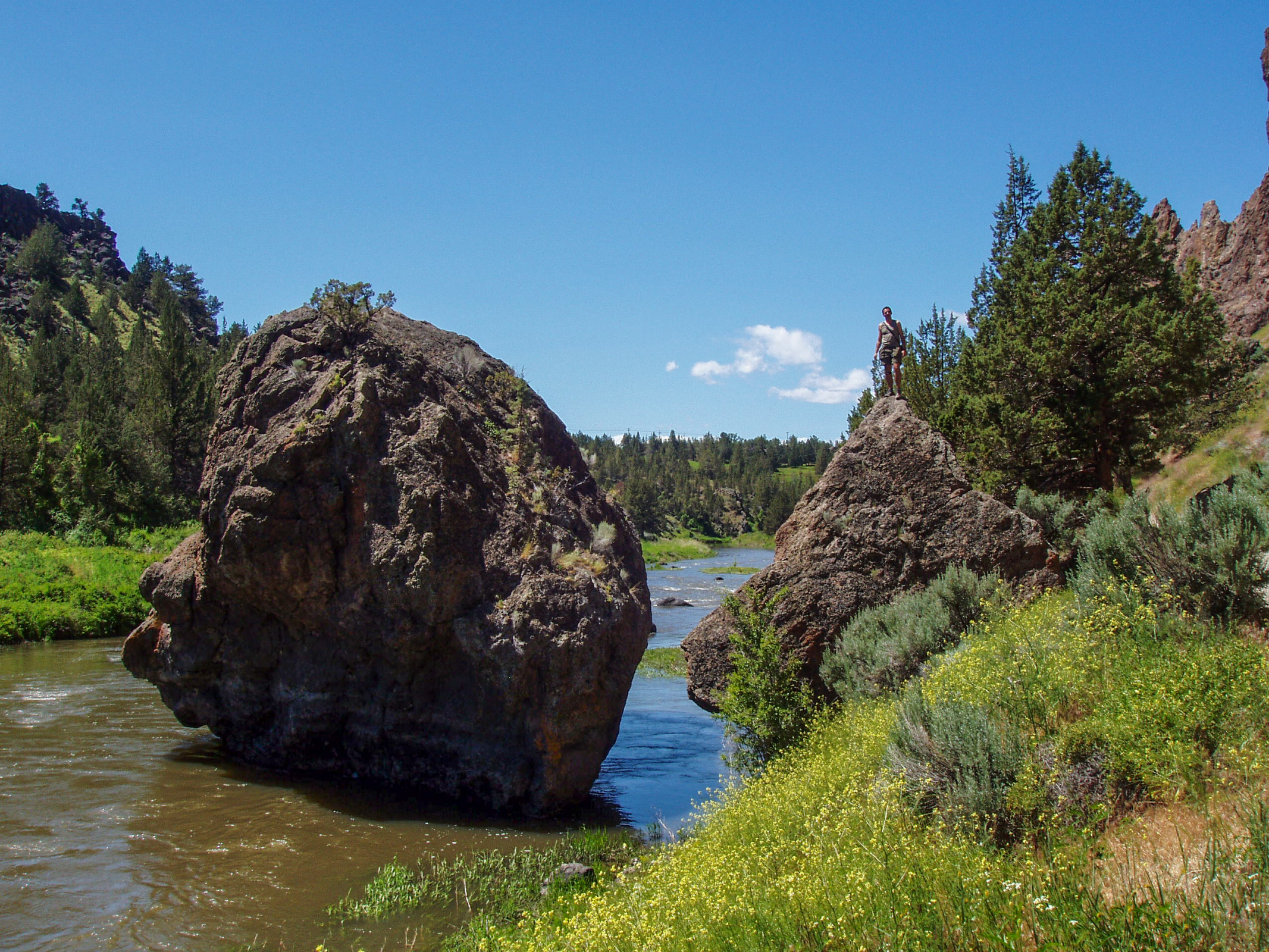
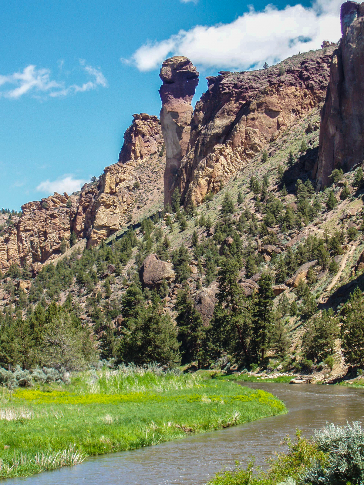
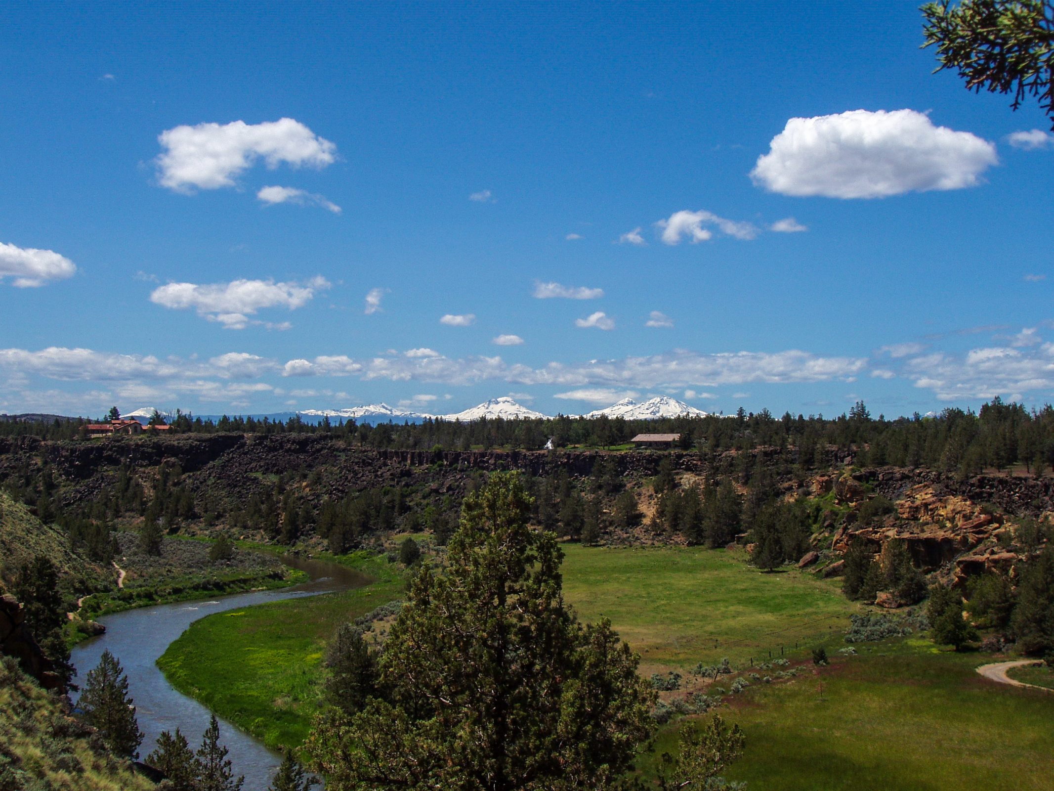
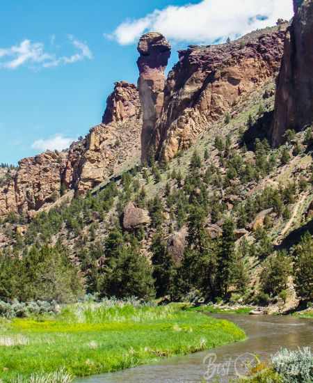
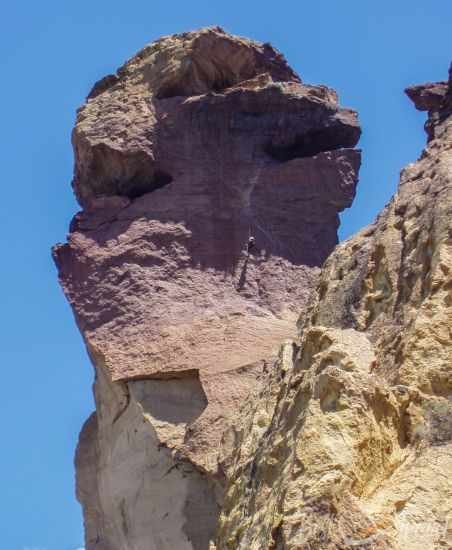
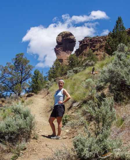
The most popular route is the Misery Ridge Loop Trail (3.7 miles). It climbs steeply to panoramic views over the Crooked River and the surrounding cliffs. The loop ends near the base of the iconic Monkey Face rock formation.
Other scenic trails include the River Trail, Canyon Trail, and Summit Trail — all well‑marked and offering different perspectives of the canyon. Smith Rock Park Map
Scenic Viewpoints
Smith Rock features several natural viewpoints along its trails:
- Misery Ridge Summit — the best panoramic view in the park
- Monkey Face Viewpoint — one of the most photographed formations
- River Trail viewpoints — canyon walls, river bends, and reflections
These viewpoints appear naturally along your hike and require no detours.
Camping at Smith Rock
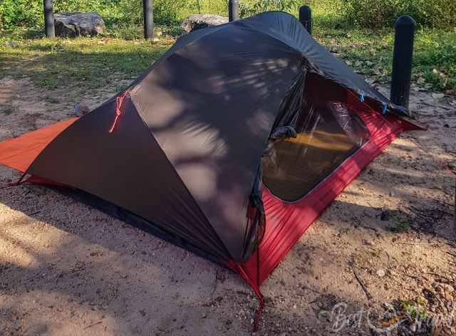
The Bivouac Campground is the best option for early access to the trails. It is a walk‑in, tent‑only campground with basic facilities.
Important size limit: Vehicles over 20 feet (6 meters) are not allowed to stay overnight at the Bivouac area. This includes RVs, motorhomes, and larger campervans. Parking is permitted during the day, but no overnight stays for oversized vehicles.
If you travel with a larger motorhome, the best alternatives are campgrounds in Redmond, Terrebonne, or Crooked River Ranch.
Climbing & Wildlife
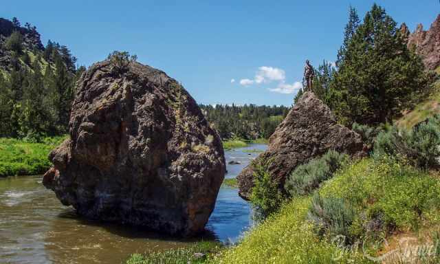
Smith Rock is one of the top climbing destinations in the United States, with nearly 2,000 routes. Watching climbers from the trails is impressive, especially around Monkey Face.
Falcons and bald eagles nest in the park. If a nest is active, climbing routes and sometimes trails are temporarily closed. These closures are strictly enforced to protect the birds.
Tips for Your Visit
- Start early, especially in summer
- Bring plenty of water — the canyon heats up fast
- Wear sturdy shoes for steep and rocky sections
- Watch for rattlesnakes on warm days
- Check for wildlife and nesting closures
- Parking fills quickly on weekends
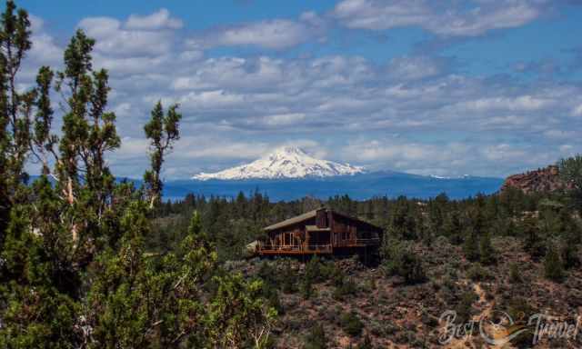
Where to Stay Near Smith Rock
The closest town to Smith Rock State Park is Redmond, just 9 miles south of the park. It’s the best base if you want short driving times, early trail access, and a good selection of restaurants and stores.
Redmond offers a mix of hotels, motels, and vacation rentals. If you prefer a quieter setting, Terrebonne also has a few small lodges and rentals just minutes from the park.
Best Months to Visit
Location and Tips

Smith Rock State Park is situated 9 miles north of Redmond. If you wish to visit the park in the peak season in summer, I recommend either camping in Smith Rock or staying nearby to access the park in the early morning at 7 am.
The banner picture was taken at sunset by Patrick Bösiger.