
When Is the Best Time
Tongariro Crossing a Must-Do on the North Island of NZ. Enjoy the awe-inspiring hike the entire year. To master the once-in-a-lifetime hike - Consider three simple rules: Read on for my insights to hike in your right season, be prepared for the elements throughout the year, and arrange your bus shuttle in advance.
Weather and Hiking Season
The best time for Tongariro, with more stable weather, for this inspiring hike is from November to April. In March, April, and November, crowds are bearable.
Summer is the busiest time, with up to 3.500 hikers each day. Winter can also be fantastic, but snow hiking experiences or a guide are essential. Take this seriously a fatal accident occurred here in August 2022.
 |
To plan your trip or explore the Islands, we recommend the guidebook from Fodor’s. It is packed with maps, carefully curated recommendations and everything else you need to simplify your trip-planning process and make the most of your time onsite. |
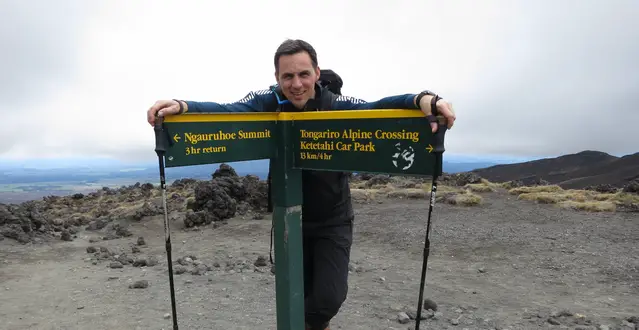
Limited Access Planned
Do you wish to hike the incredible Tongariro Crossing? This unique adventure is still permit-free, but it is getting busier continuously, and plans are discussed to limit the number of people who can access the park.
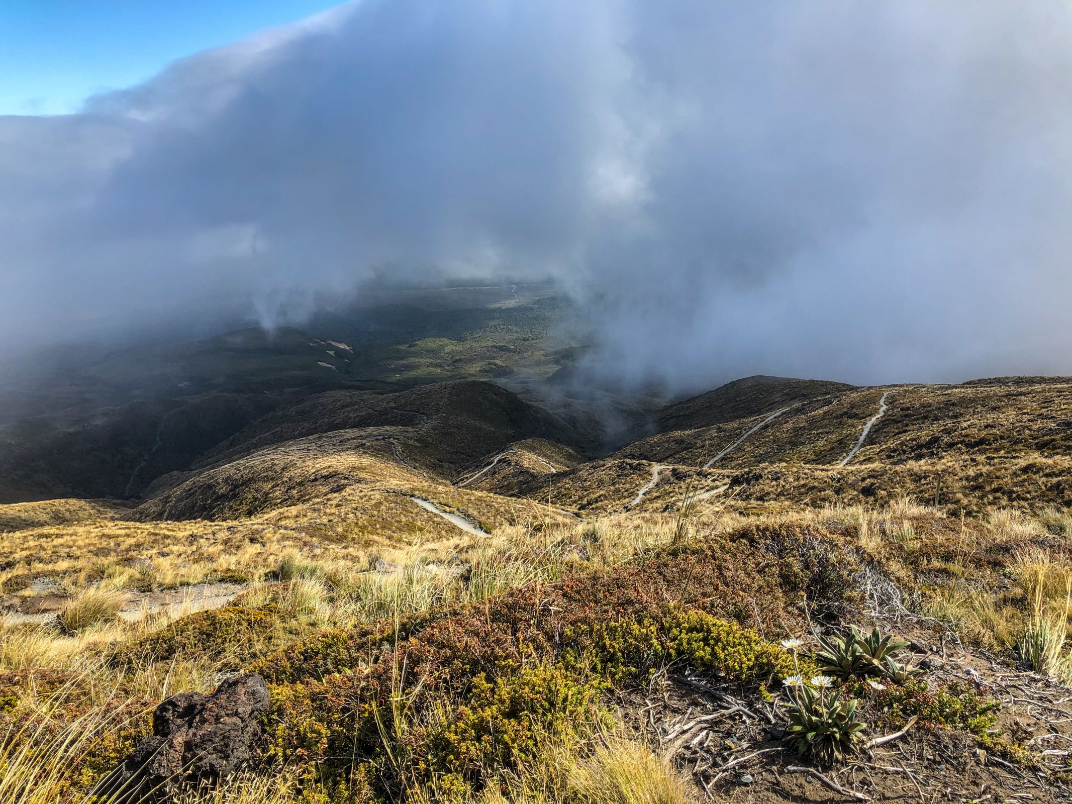
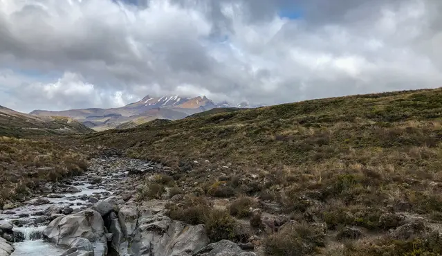
The official hiking season starts in late October and lasts until the end of April. Nevertheless, the weather at the Tongariro Crossing can change quickly. Be prepared for four seasons in one day on this Alpine Track. The trail is closed in very poor weather conditions. Rain occurs throughout the year, with its peak from May to September.
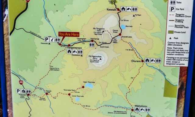
The hike starts at an elevation of 1.100 meters and climbs up 800 meters to 1.900 m height. Temperature differences of ten degrees and more are not uncommon—the west part of Tongariro experiences more clouds. You may start with an overcast sky, and it improves during the walk after the red crater. You can walk the entire trail on your own during the hiking season. I highly recommend booking your shuttle ticket in advance at no extra cost. Hiking Map by Locus App
Spring (September-November)
The official DOC hiking season starts in late October, although snow and ice can occur until November. Temps can drop below zero quickly, even during the day. For September and October, be prepared for winter conditions. Mountaineering skills are essential for these months. In November, morning temps at the Mangatepopo trailhead are, on average, below 10°C. The Red Crater's highest point experiences a maximum of 10°C during the day and minus at night. Nevertheless, it’s incredible to hike here with fewer people.
Summer (December-February)
The best months with the most stable weather for hiking are during summer, from December to February. It is the driest time of the year but also the busiest months. It’s frequently crowded on the track, with up to 3000 hikers daily. In summer, the mean daily temperature is around 20°C, which can drop to 10 °C, but it can also be hot at 30°C. It’s much colder at the Red Crater, averaging around 12°C during the day. Everything is possible in the summer, be prepared for intense sun, rain, and cold, strong wind.
Autumn (March-May)
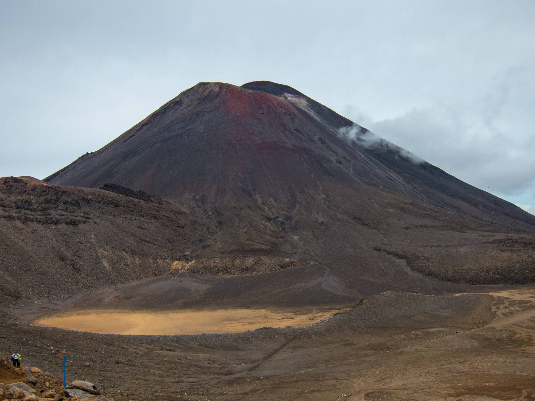
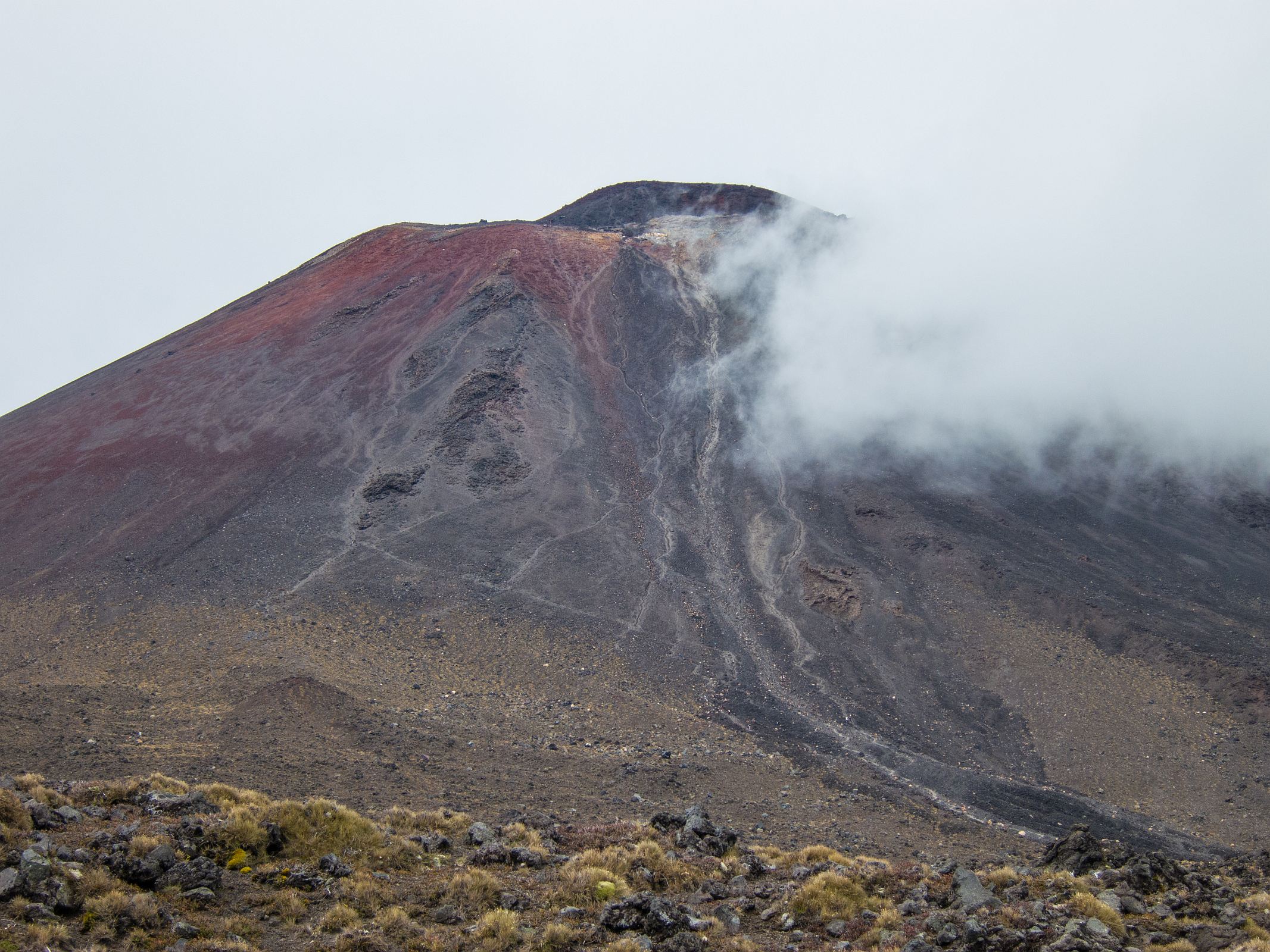
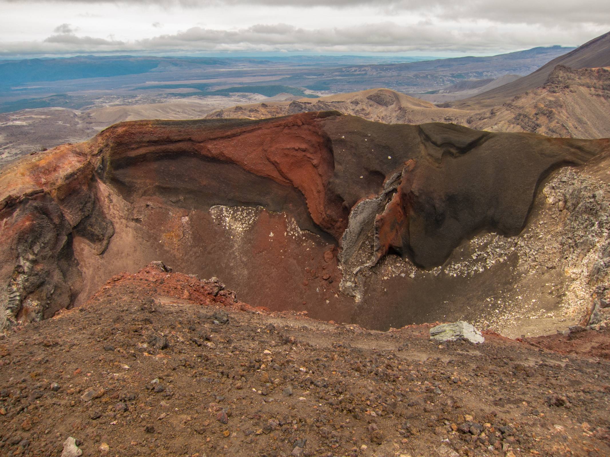
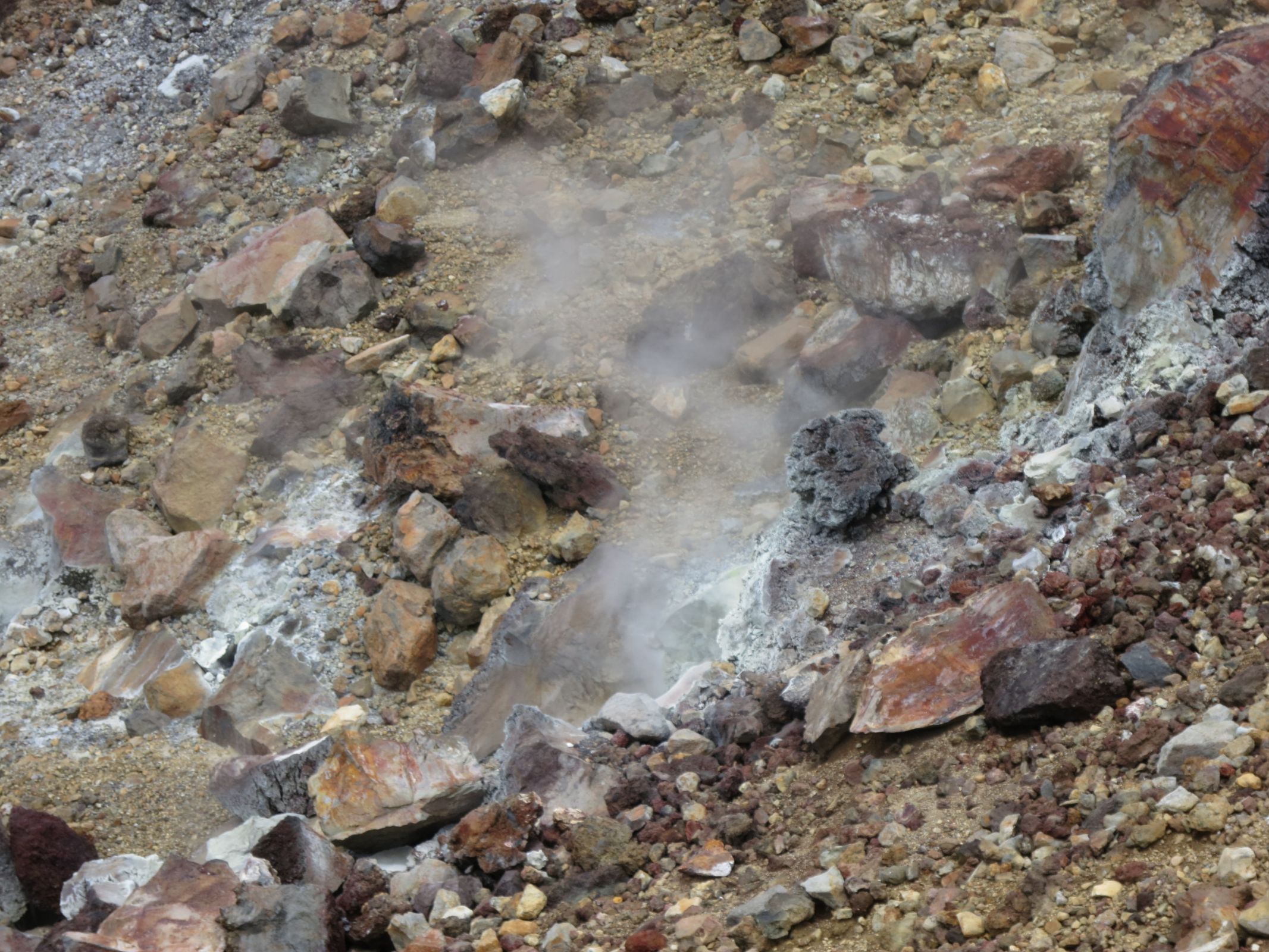
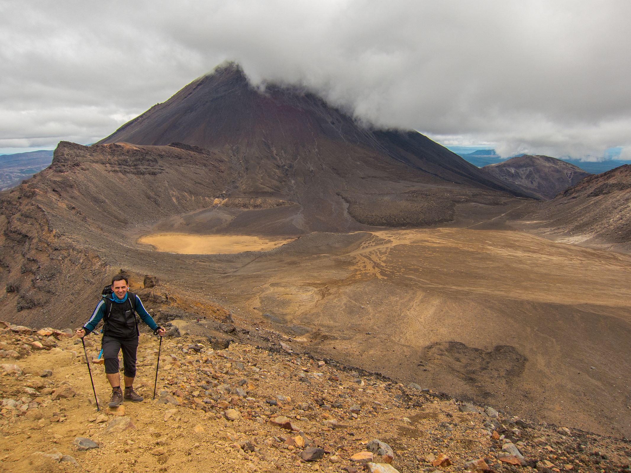
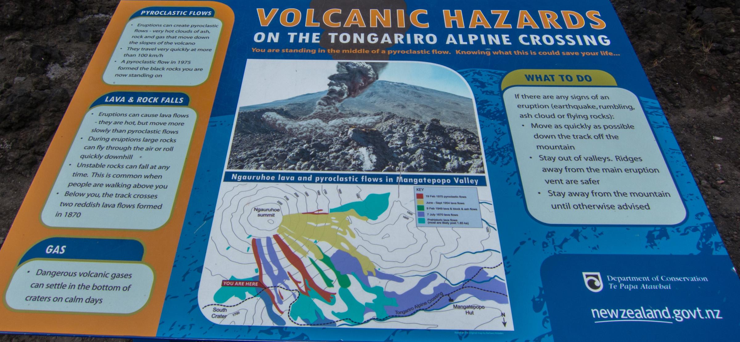
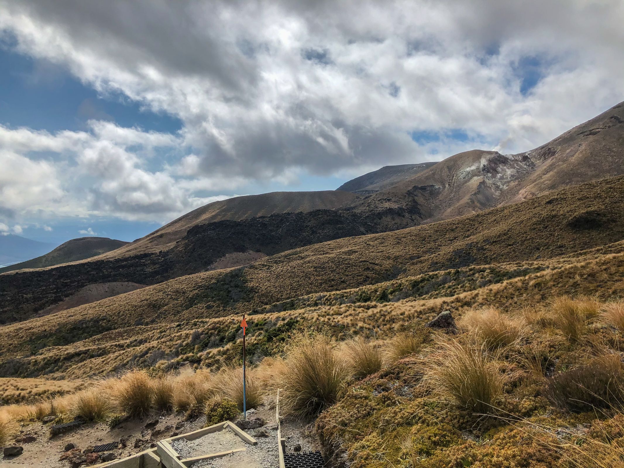
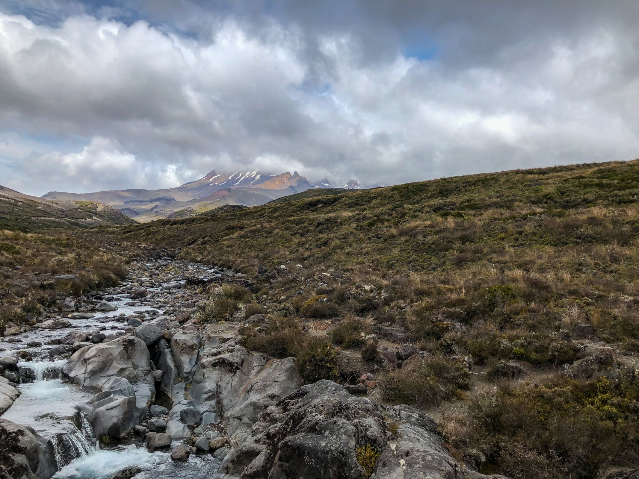
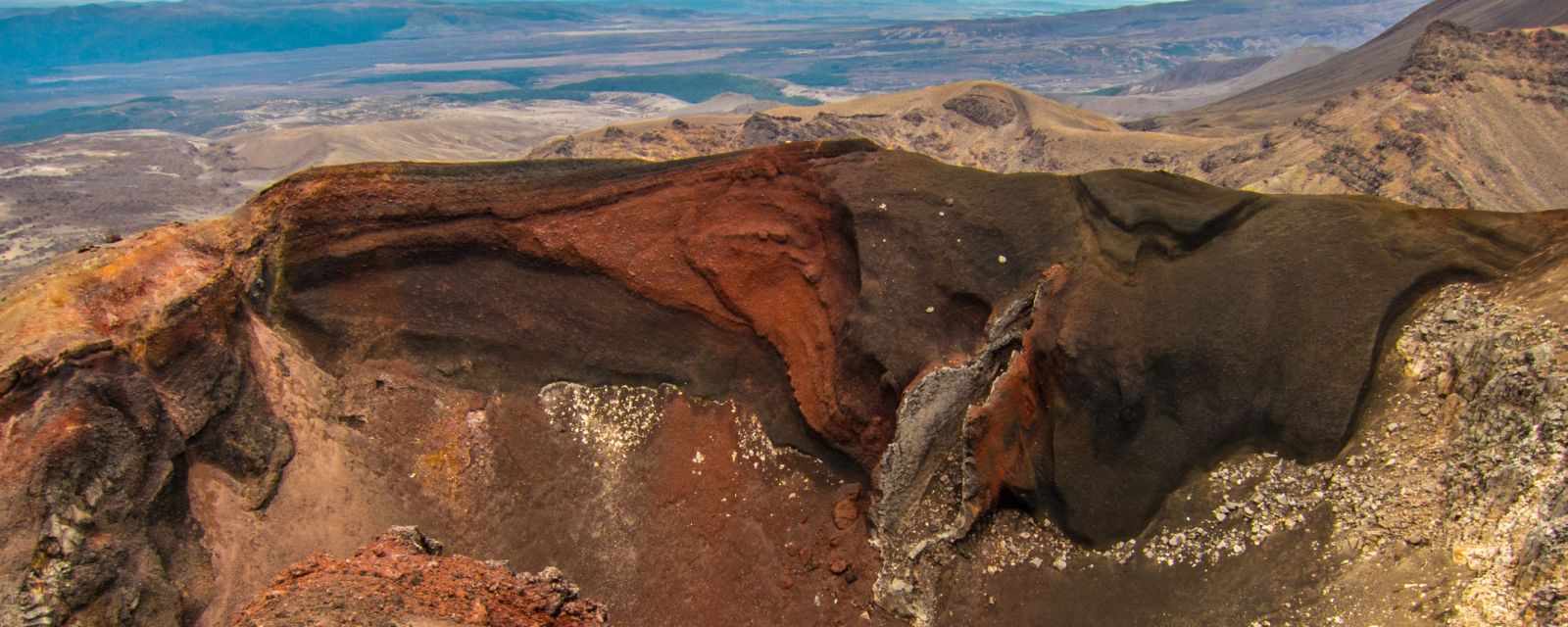
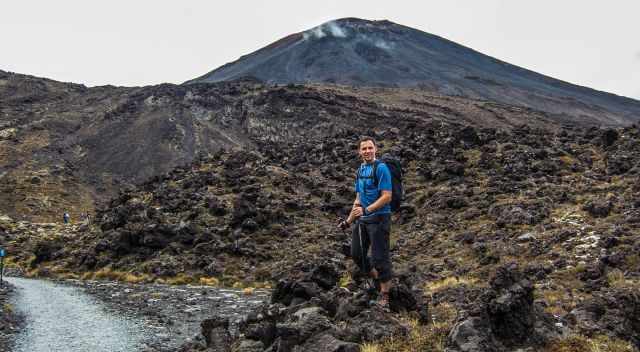
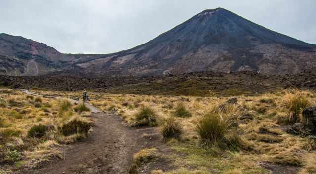
Mount Ngauruhoe is an active Stratovolcano; its last eruption was in 1977
The official DOC hiking season ends in late April. Increasing rainfall from May onwards. March and April are still pleasant for this remarkable hike and less busy except for the Easter holidays. However, expect one-digit temps – maximum 10°C until you get to Ketehahi, the trail's end. Temps can climb up to 15°C, but that’s an exception.
Winter (June-August)
Expect snow in June and July and at higher altitudes until spring. Snow hiking skills are essential; better take a guide. Please, take the winter seriously; this August 2022, someone died on this track. Winter is the wettest time of the year with more extreme weather. If you want to hike the track during the coldest time of the year, consider wearing different layers, and carrying extra clothes, crampons, and an ice axe. Monitor the forecast, spend a couple of days around Tongariro, and you may get rewarded with a blue sky and spectacular views. However, remember it is an alpine terrain hike, not an easy walk. Snow and hail storms can occur, making the orientation difficult. Better book a guided hike which is mentioned below in my tour recommendations. During winter, skiing around Mount Ruapehu is common. There are two ski fields; Whakapapa and Turoa. Also, this is an incredible experience here.
Check the weather forecast for the Tongariro Alpine Crossing first!
Crowds
Tongariro Crossing is known to be one of the most spectacular hikes in the world. Expect at least 600 hikers each day and 3.500 during the summer. The number of visitors is increasing by more than 15 % each year, becoming overcrowded. Now it is discussed if a permit is required in the future. If the trails are widened, the experience and beauty get lost. The situation improves a little in November and March/April. Since October 2017, booking a shuttle for around $40 pp has been mandatory. The tiny car park was always full.
The Best Tours

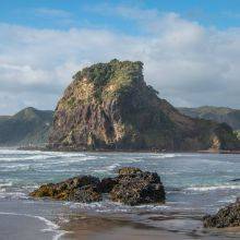
The thrilling Huka Falls from the bridge - Huka Falls Tour
When staying in Taupo, don’t miss the turquoise-blue Huka Falls and the awesome jet boat trip. They pick you up from Taupo via shuttle. Another excellent tour is the Hobbiton Tour, and it's a must-do for every Lord of the Rings fan!! The Hobbiton Village is located in Matamata before Rotorua.
These are my recommended tours via GetYourGuide with 24 hours advance cancellation policy. Thx for booking via my website! With your support, I am able to provide all information first-hand. Tour prices are at no extra cost!
Accommodations Tips | Close to the Tongariro Crossing

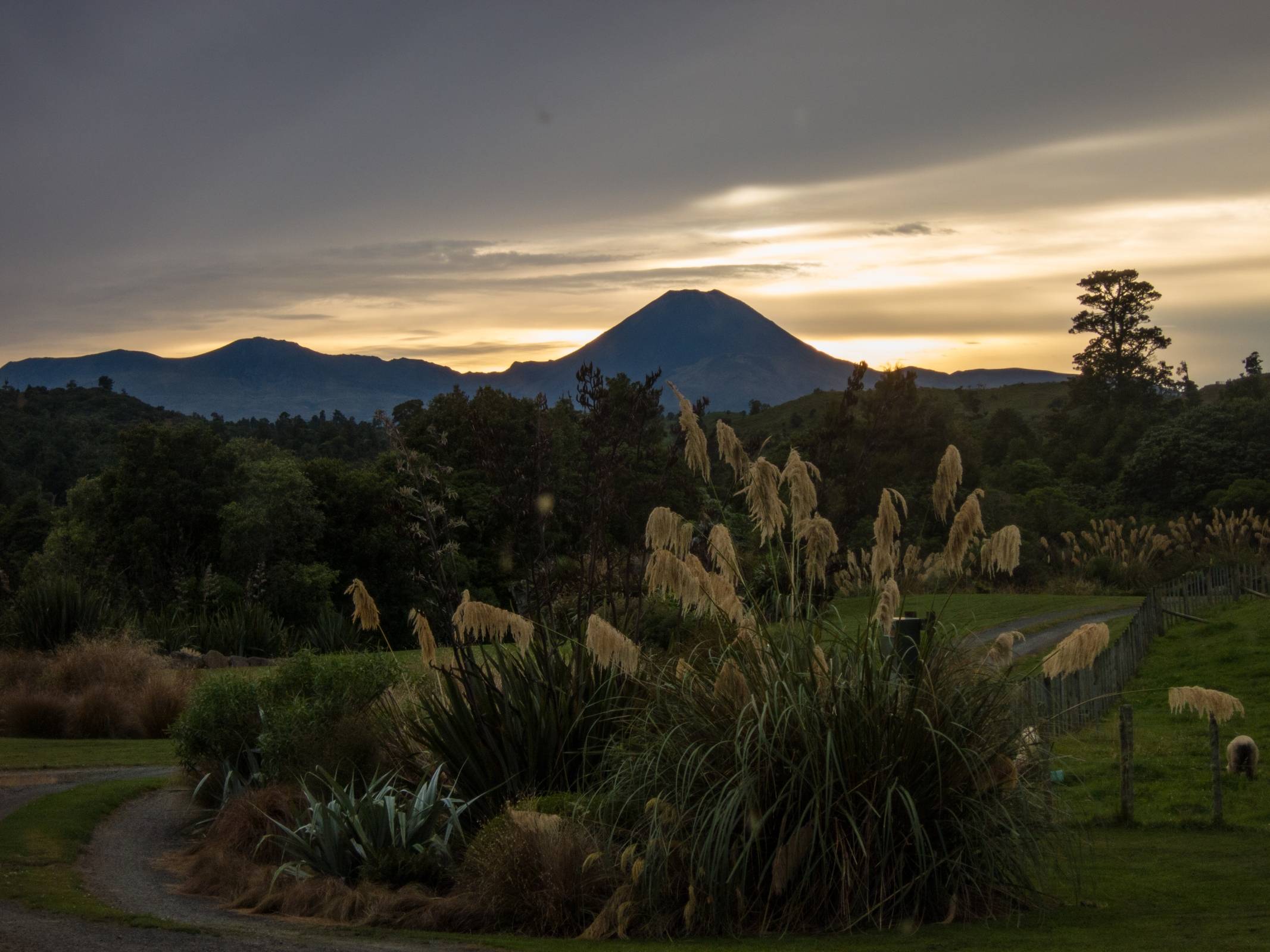
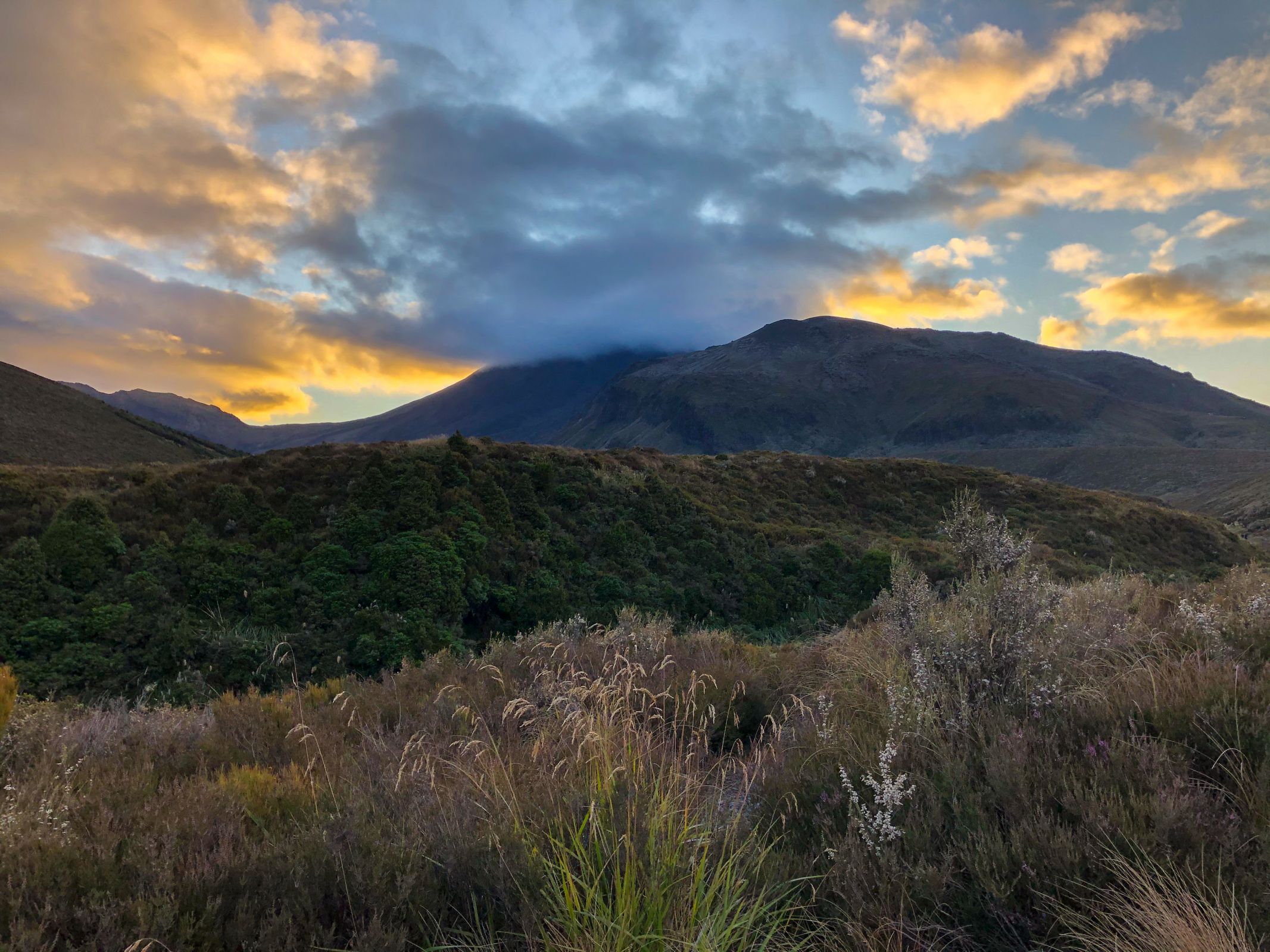
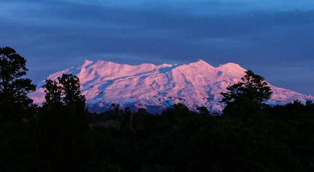
The view from our accommodation to Mount Ngauruhoe
Most visitors stay around the National Park, which is the most convenient way to visit. Keep in mind there is more demand than availability and some hotels have a poor rating. I highly recommend booking your room far in advance. It is possible to get here on a day trip from Lake Taupo, which takes less than 1.5 hours one way. From Auckland, it takes at least 4 hours to get to the National Park.
- If you want to feel at home, the lovely Mountain Heights Lodge is the right choice for you.
- Perfectly located right inside the park with a spectacular view is the Chateau Tongariro Hotel.
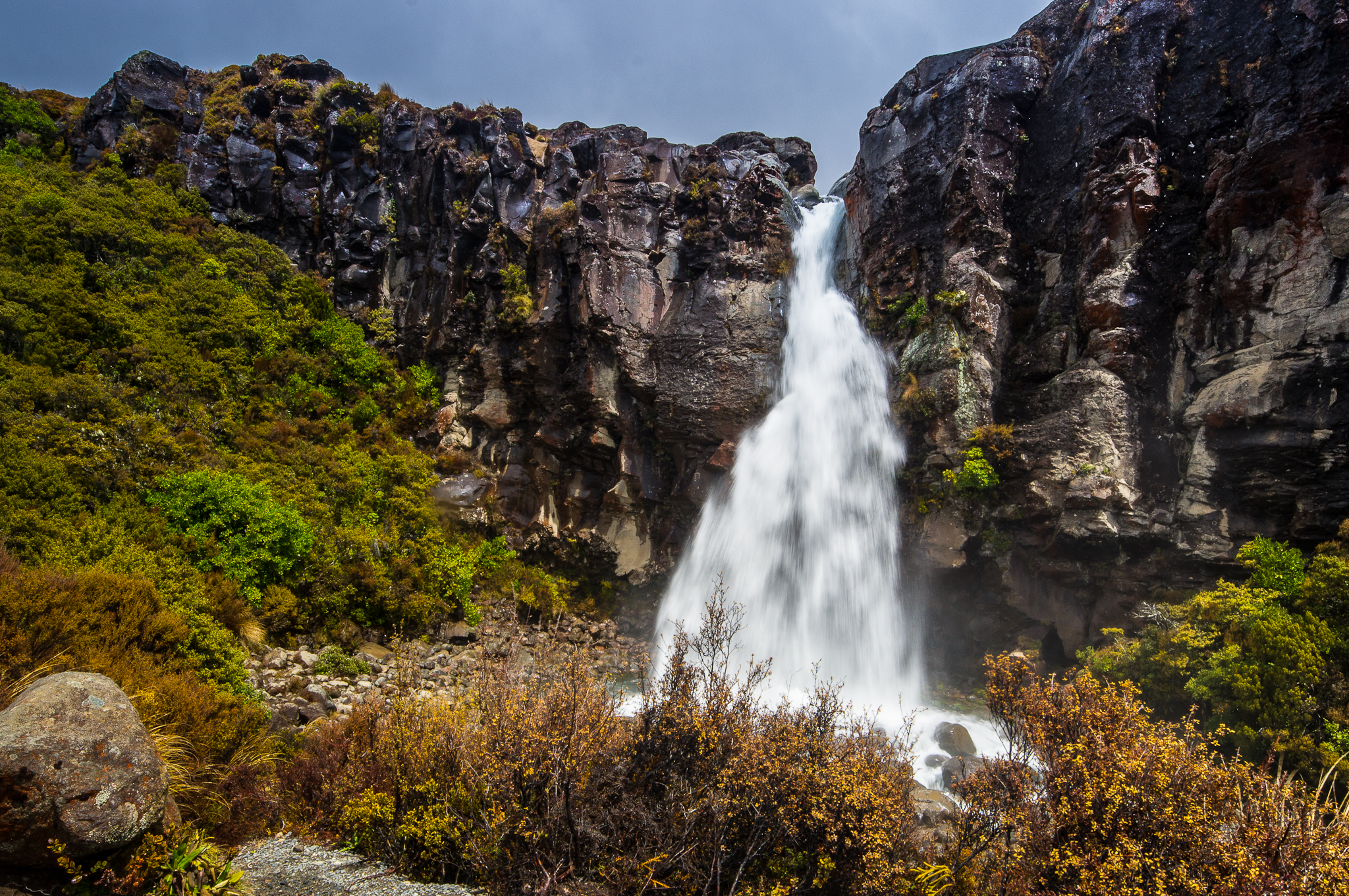
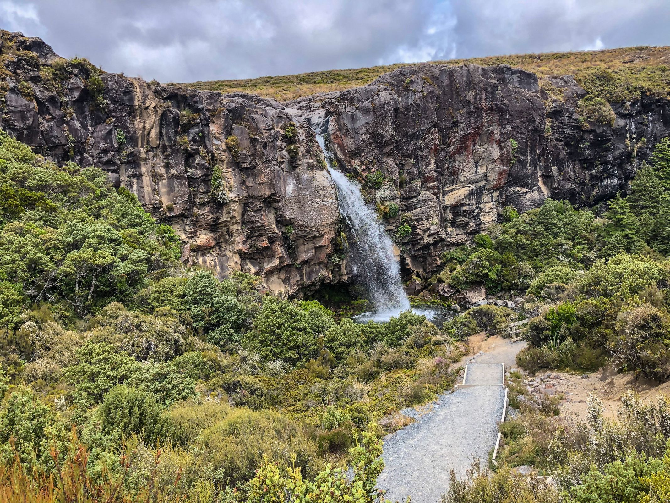
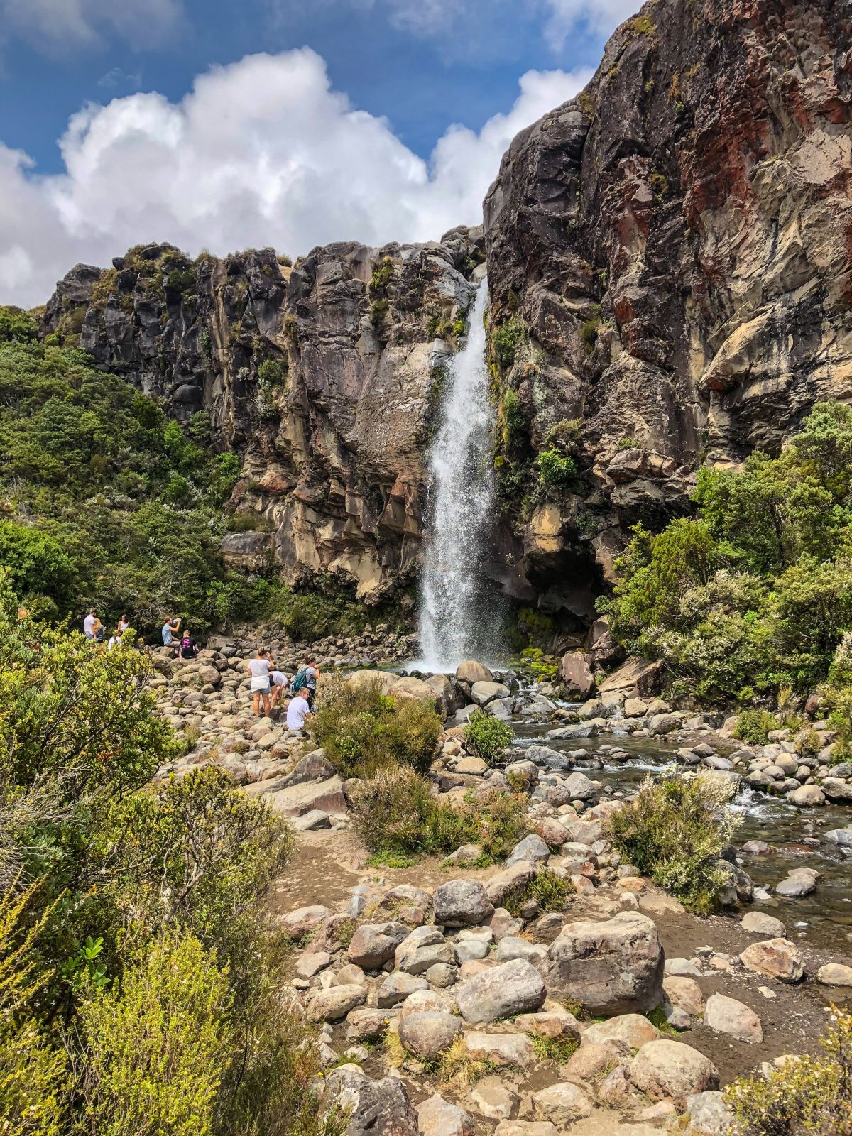
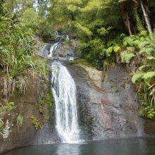
From here it is just a 3 km walk to the Taranaki Falls. Even during rain, you can get to this beautiful waterfall which is along the Northern Circuit; one of the Great Walks of NZ. The return hike takes a maximum of 2 hours.
Taranaki Falls in the Tongariro National Park along the Northern Circuit
- Low Budget, good location, and clean is the Tongariro Holiday Park.
- For backpackers, an excellent choice is the National Park Backpackers. A shuttle to the Tongariro Crossing departs in the morning from 6 to 10 am every hour and back from 1.30 to 5.30 pm.
Best Months to Visit
Location and Tips

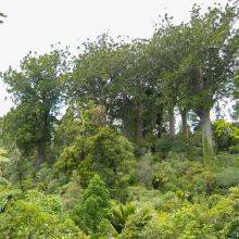
Tongariro is the oldest National Park in New Zealand, declared in 1887, and its dual World Heritage status is second to none. Three mighty active volcanoes, Tongariro, Ngauruhoe, and Ruapehu, are part of the National Park. Mount Ruapehu is the North Island highest peak with 2.797 m.
The last eruptions of Mount Tongariro were in August and November 2012. Experience the dramatic volcanic landscape either in one day on the Tongariro Crossing or enjoy the whole World Heritage Side and follow the Northern Circuit in 3 to 4 days.
Tongariro Hike | Details and Facts
- The trail is 19.4 km long and takes roughly 6 to 7 hours, but you can walk the trail easily in 5 hours with a high fitness level. However, enjoy the remarkable volcanic landscape. There isn't any National Park fee requested just for the bus shuttle.
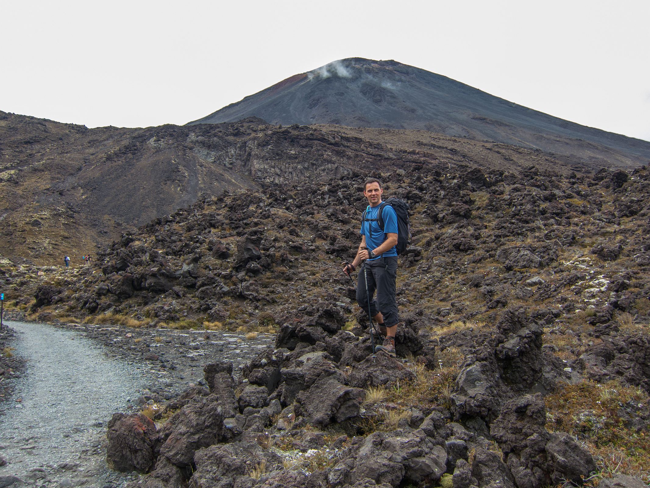
- If you want to climb to the top of Mt Ngauruhoe, famous for being the “Heart of Mordor” from Lord of the Rings, add 2-3 hours. However, the peaks and alpine lakes are sacred to the local Maori. They ask that peaks are not climbed, and lakes are not touched. We decided not to climb to the top to respect the wish of the Maori.
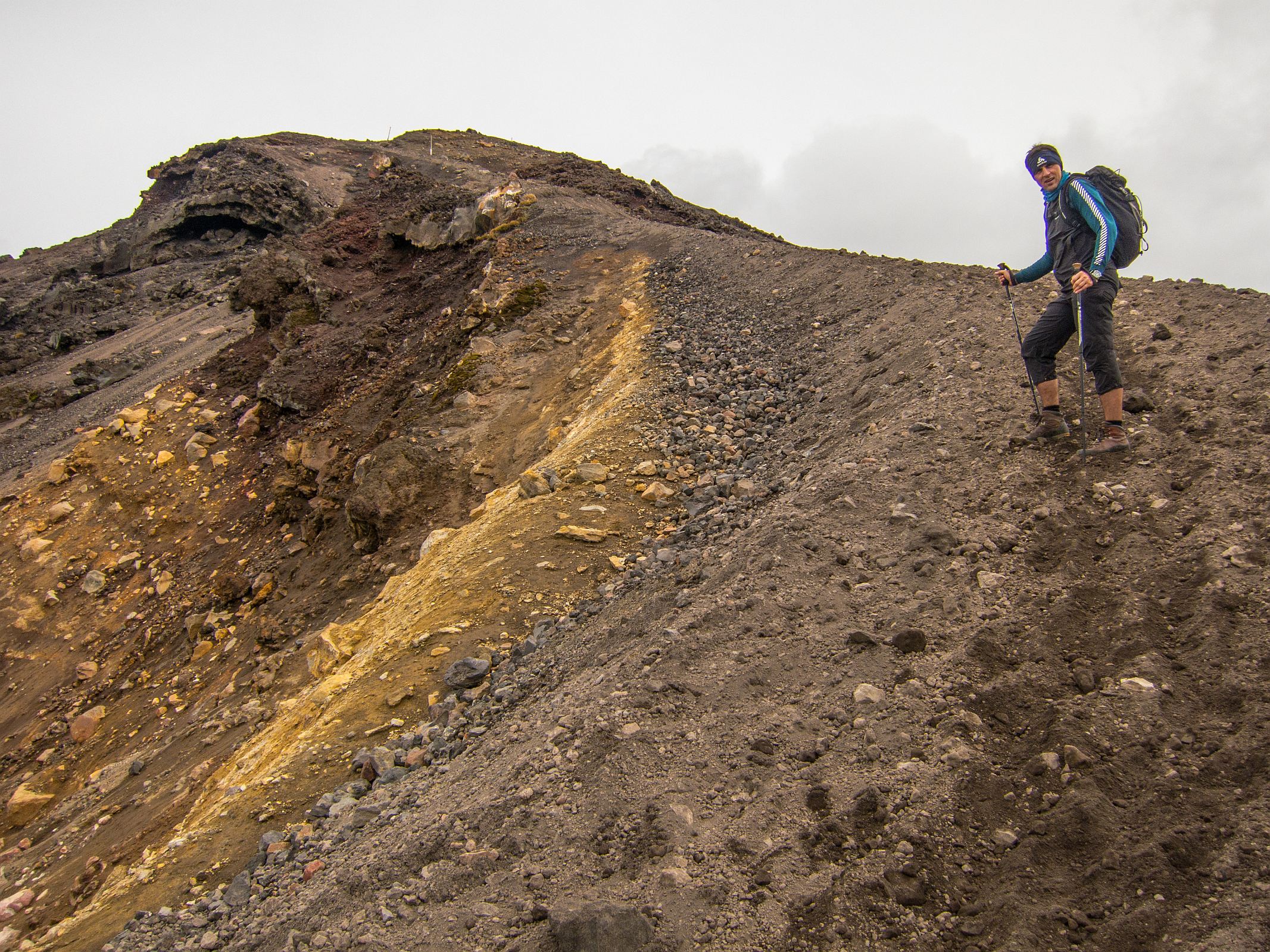
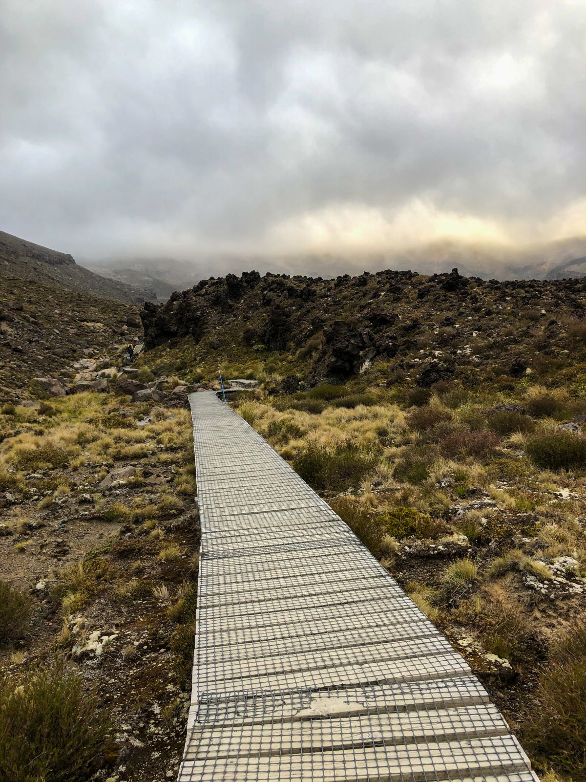
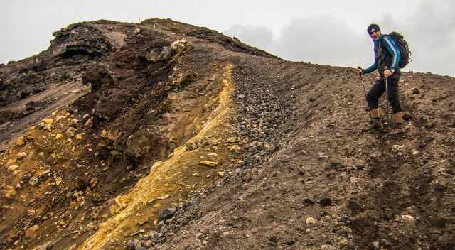
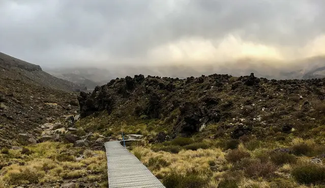
- The trail is well marked with signs and poles; nevertheless, it's hard to spot them in fog. The track is well prepared, and in some sections, you hike on boardwalks to protect the flowers and plants.
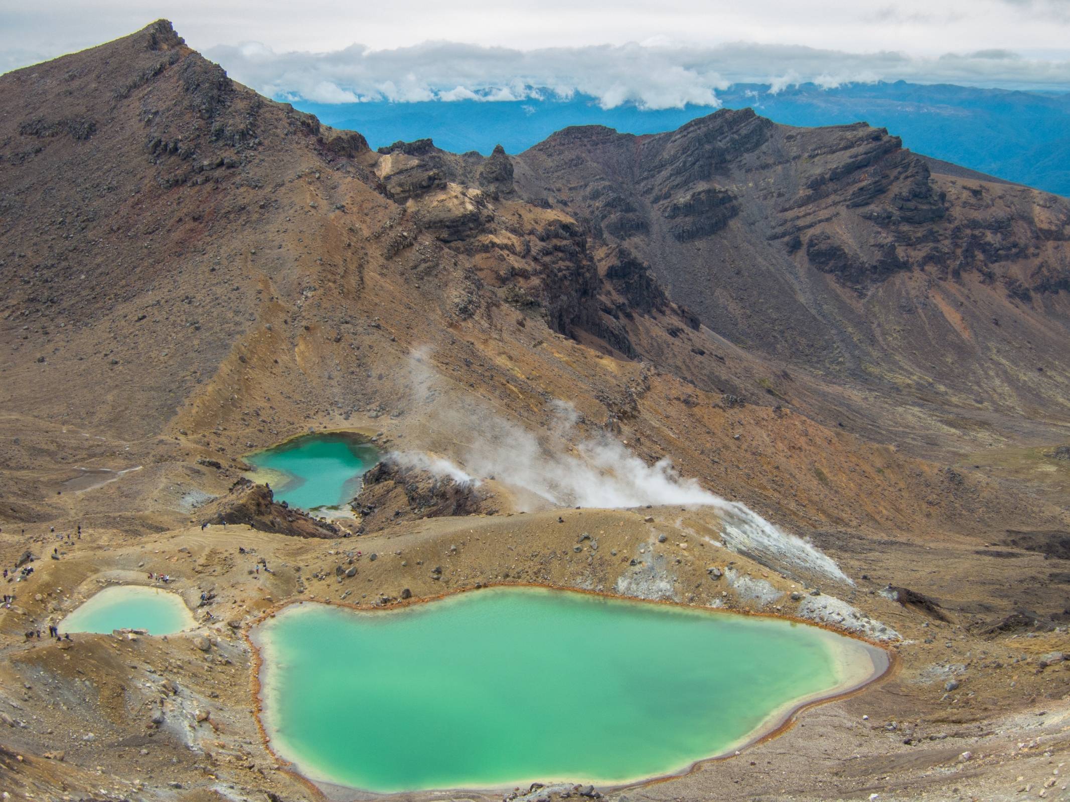
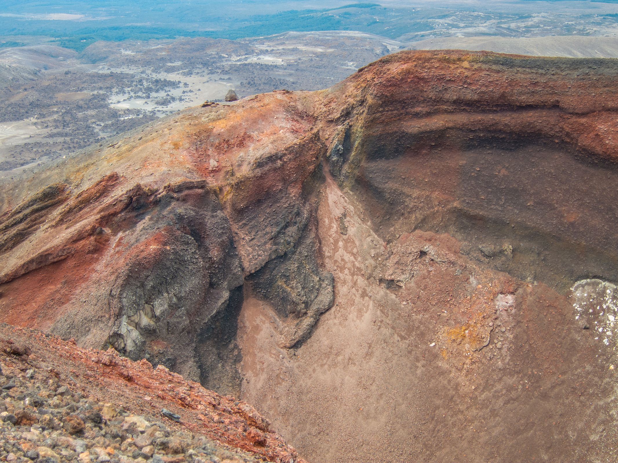
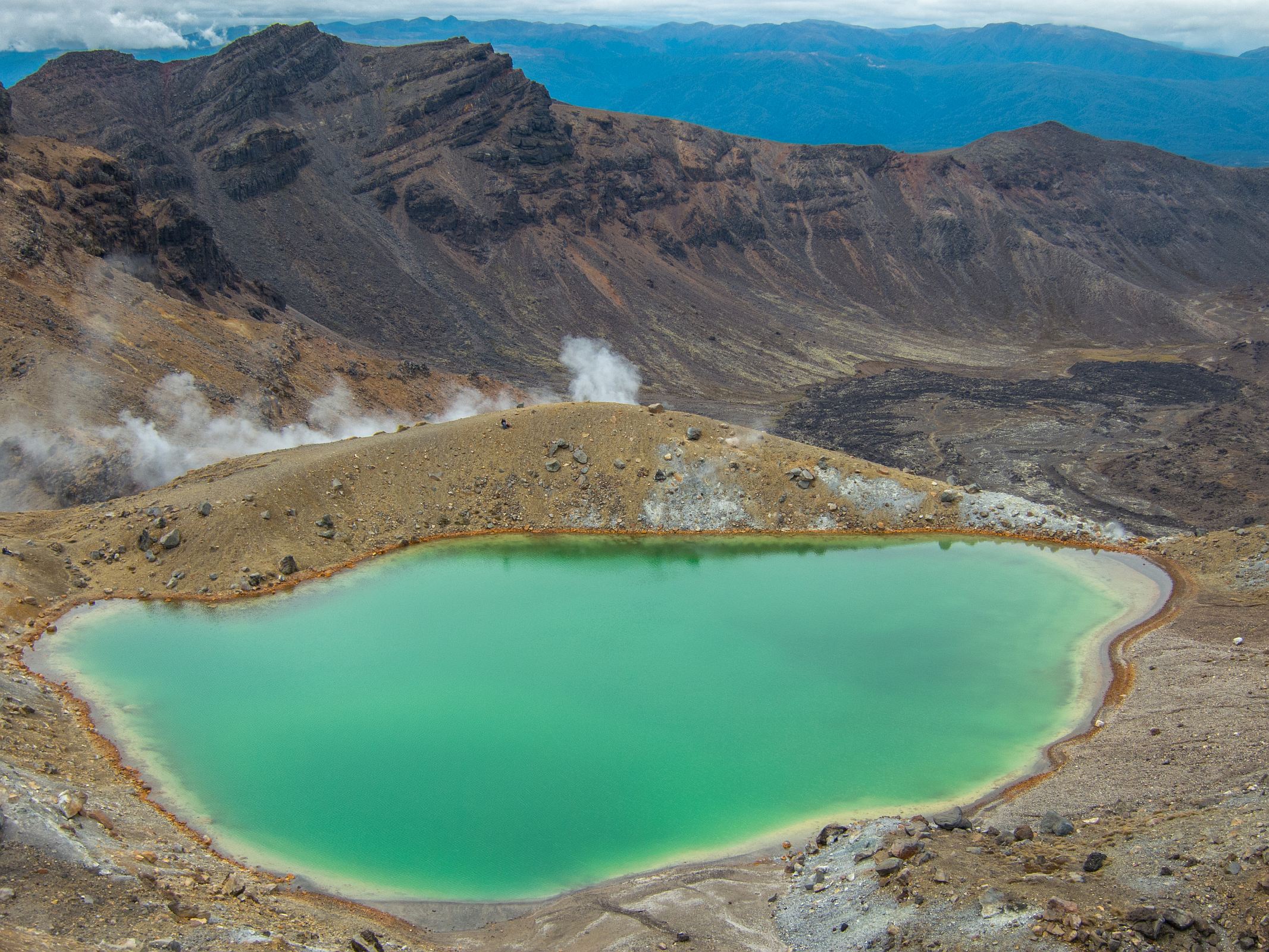
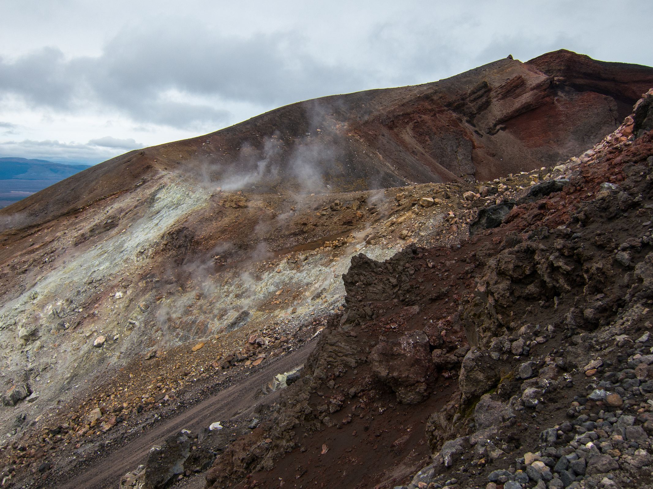
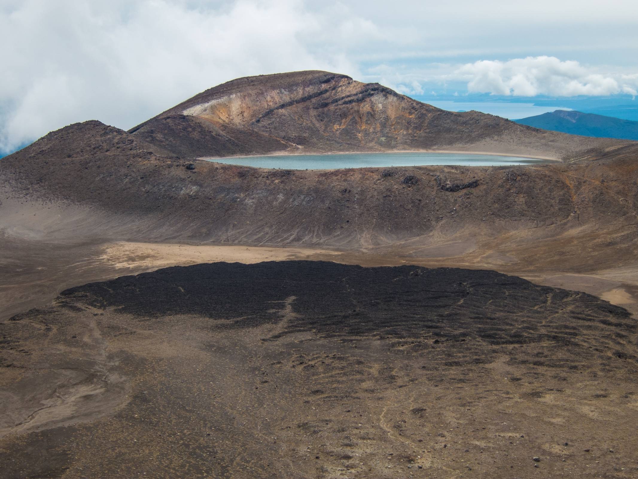
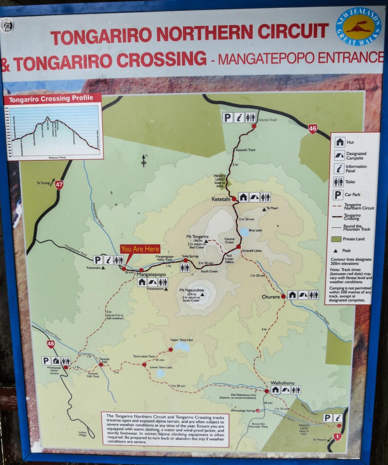
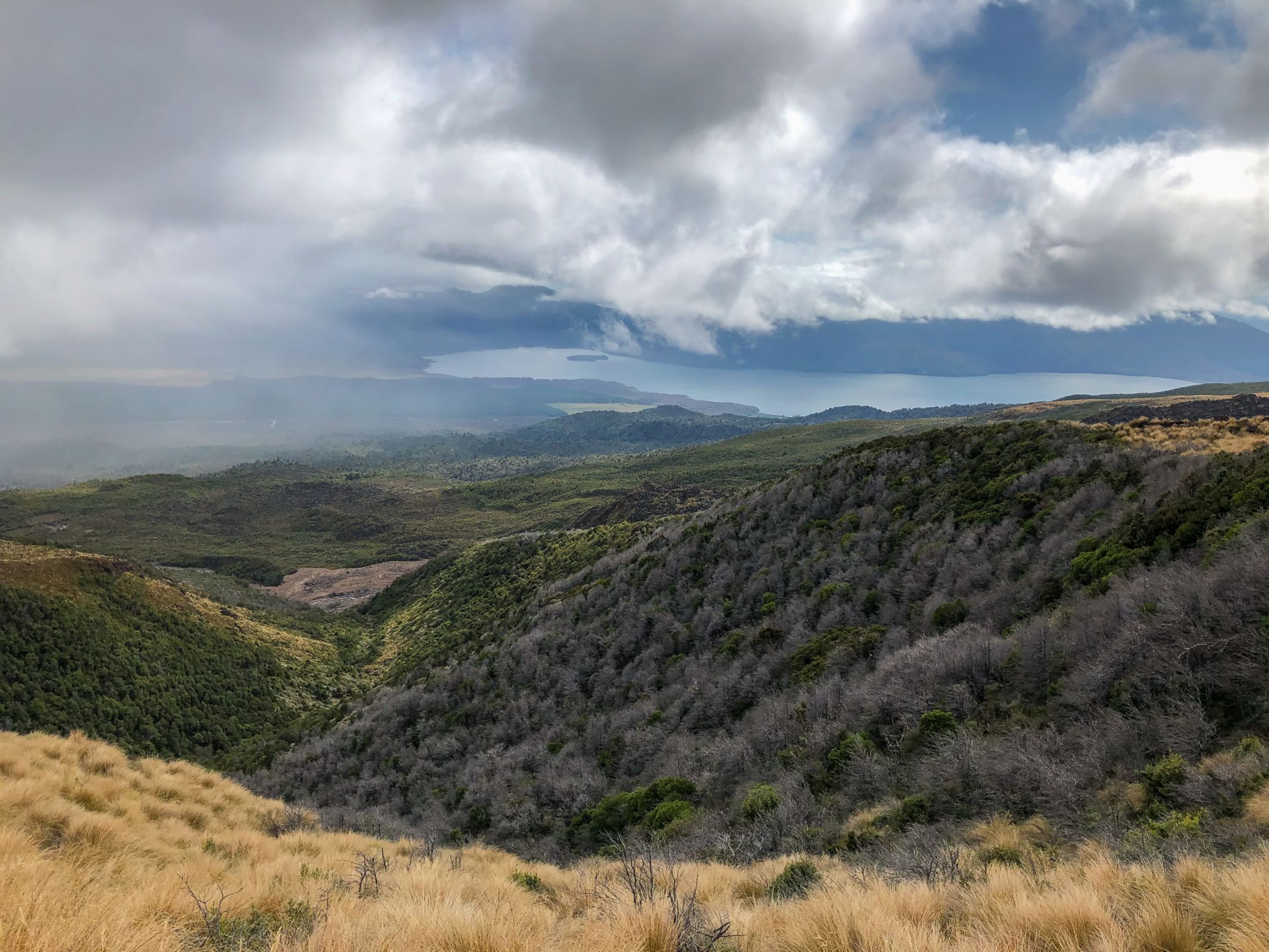
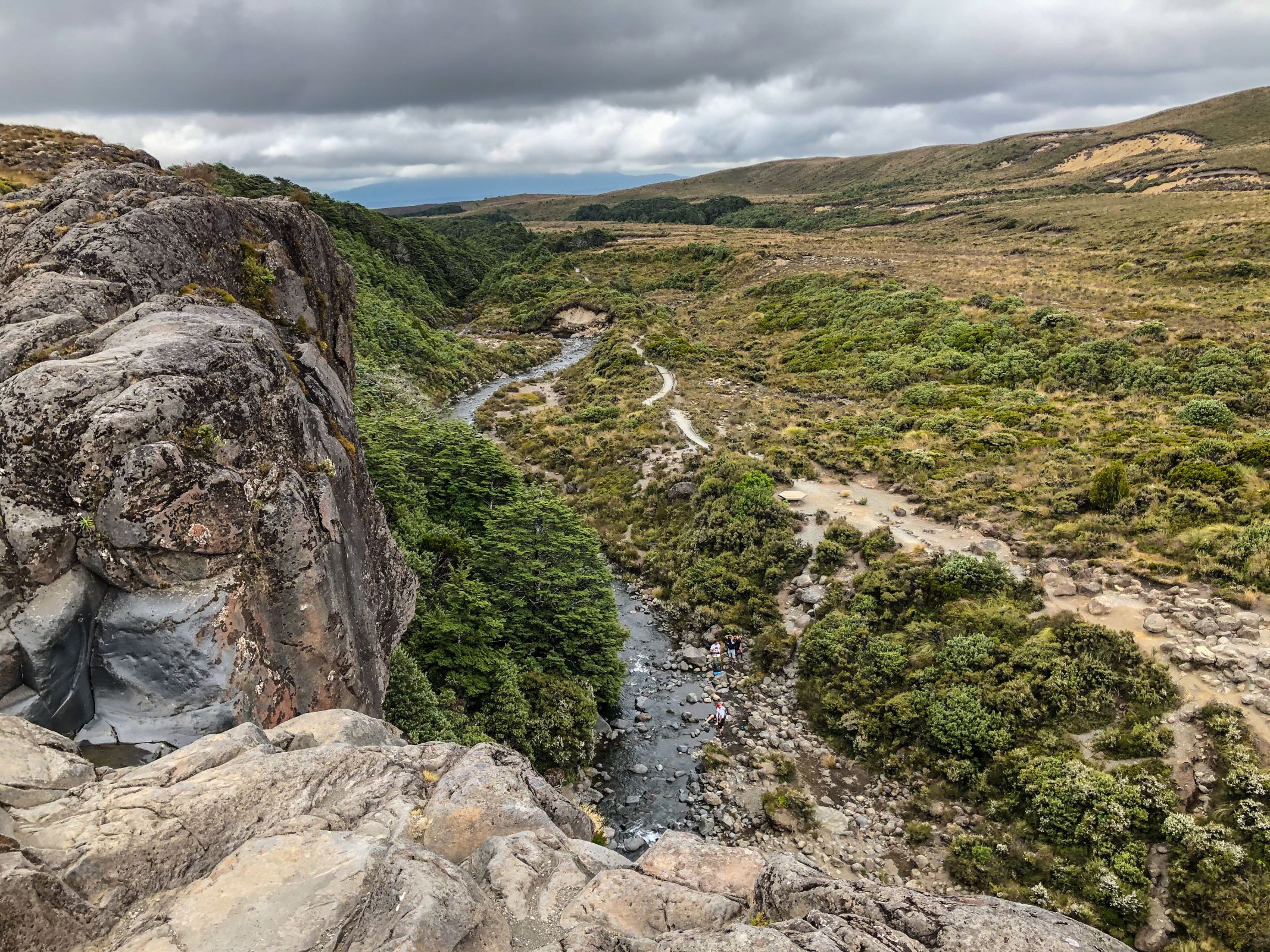
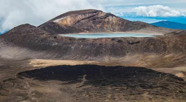
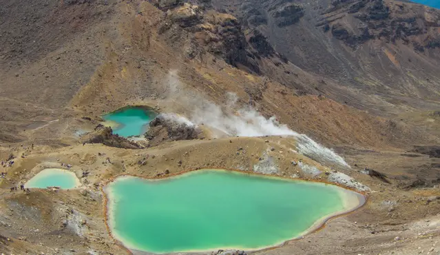
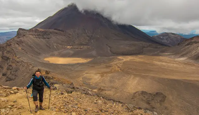
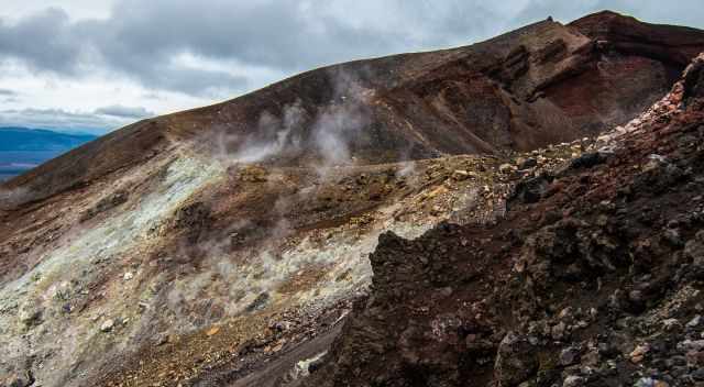
- It's fascinating to walk through this moon-like landscape. You start at the Mangatepopo road. First, you climb all the way up for 800 meters to the south crater and continue to the red crater—the highest point of the hike at 1.886 m elevation. The walk then descends to the picturesque green Emerald Lakes. Now it climbs up a little again to the Blue Lake. From now on, it only descends zigzagging for more than 1000 meters. The last section leads to the beautiful forest until you get to Ketetahi car park and shelter the track's end. Your shuttle bus will pick you up here.
Tongariro Northern Circuit
The Tongariro Crossing is a breathtaking hike, but the Northern Circuit is even better to experience this exceptional volcanic area. It is one of the Great Walks of New Zealand for backcountry hiking. It extends the Tongariro Crossing into a multi-day loop of 45 km and takes 3 to 4 days. Advanced booking during the peak season is essential. Outside the season, it is first-come, first-served. The track can be walked in either direction. During the Great Walks hiking season, is a high demand for overnight stays in the three different huts.
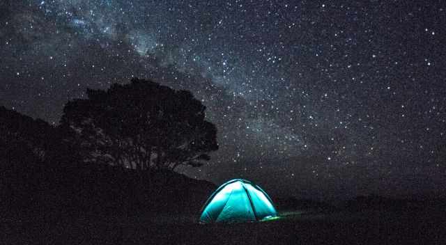
Book your bunk in advance or try to get one of the seven campsites. While camping, you can use the hut facilities, which is prohibited on other great walks. The fees for the hut and camping are higher in the hiking season. The reason; for the rest of the year facilities are reduced. There is only a limited water supply, no gas for cooking, no ranger is available, and even emergency radio facilities are not provided.
This track traverses exposed and open alpine terrain. Severe weather conditions can occur throughout the year! Warm clothing and different layers are essential. If you are not experienced, book a guided tour! More information about the booking process and fees
Gear List | My Tips
Good preparation is essential for this breathtaking hike. Always expect all seasons in one day, even on a perfectly forecasted day. It's an alpine hike at a higher elevation.
- Sunglasses and hat
- Wind- and rainproof jacket
- Fleece or wool layer
- Hat and gloves even in the summer
- Hiking poles are well needed for the steep ascent and descent
- Bring plenty of food and water
- Wear proper shoes for the hike; however, good trainers work as well
- Crampons and ice axe during winter
Good to Know - Facilities Along the Hike
Nowadays, facilities are along the entire trail every 1 - 1.5 hours.
- In the beginning - Mangatepopo parking
- Mangatepopo camping and hut
- Soda Springs
- South Crater
- Blue Lake
- Ketehahi hut and camping
- Ketehahi Road
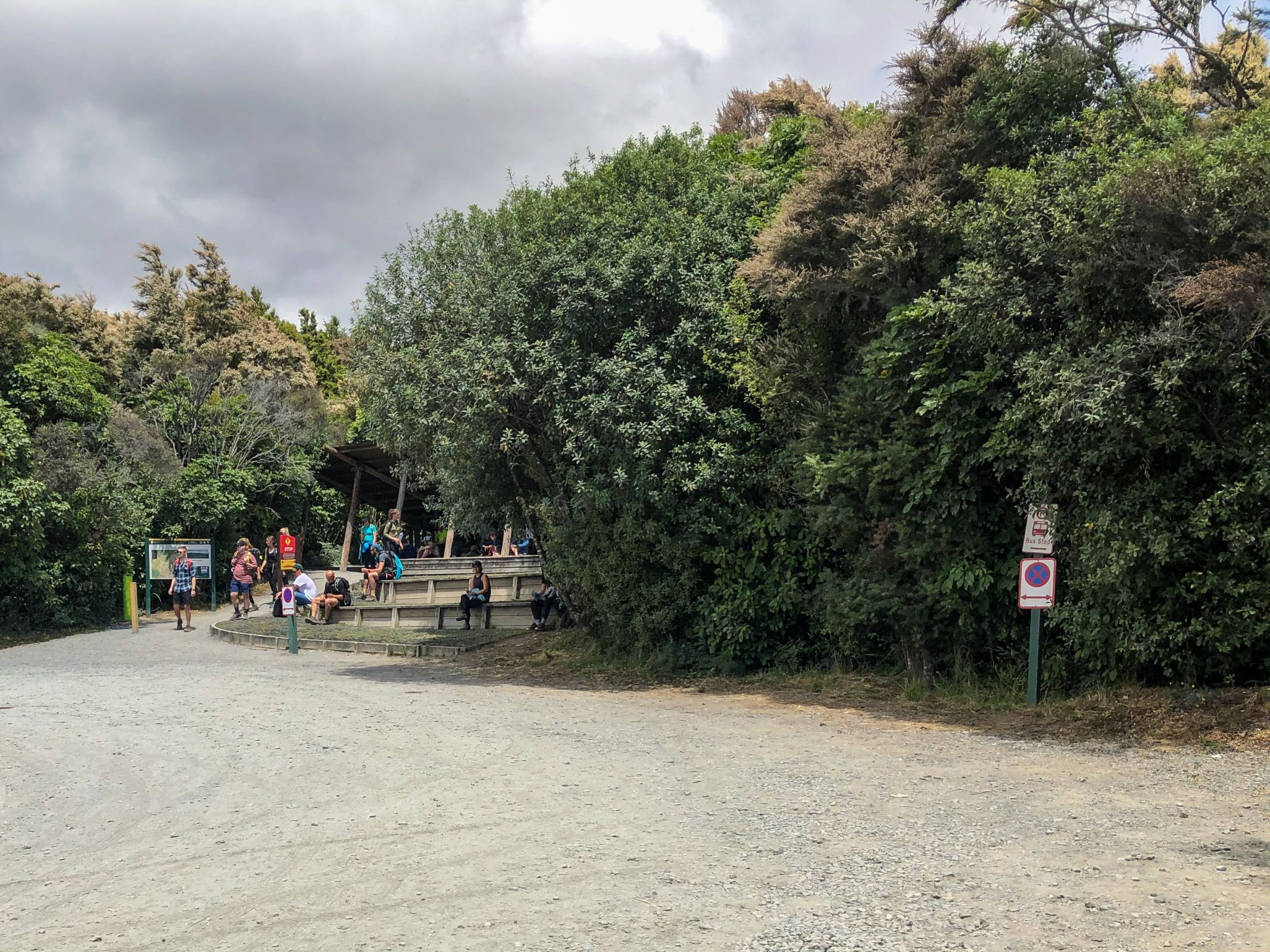
Parking Restrictions - Shuttle Bus

Hikers waiting at Ketetahi Parking for the shuttle bus
The maximum time for parking at the end of the Mangatepopo road is 4 hours. If you plan to hike the Tongariro Crossing or the Northern Circuit, you have to arrange a shuttle to drop you off and pick you up. This is a new rule since the end of October 2017. A bus shuttle is offered in the morning, roughly from 6-10 am and back from 1.30-5.30 pm every hour from all villages around Tongariro. The price for the roundtrip is roughly $40 pp. Tongariro became too popular. There is not enough space in the car parks for this high number of cars and campers.