
When Is the Best Time
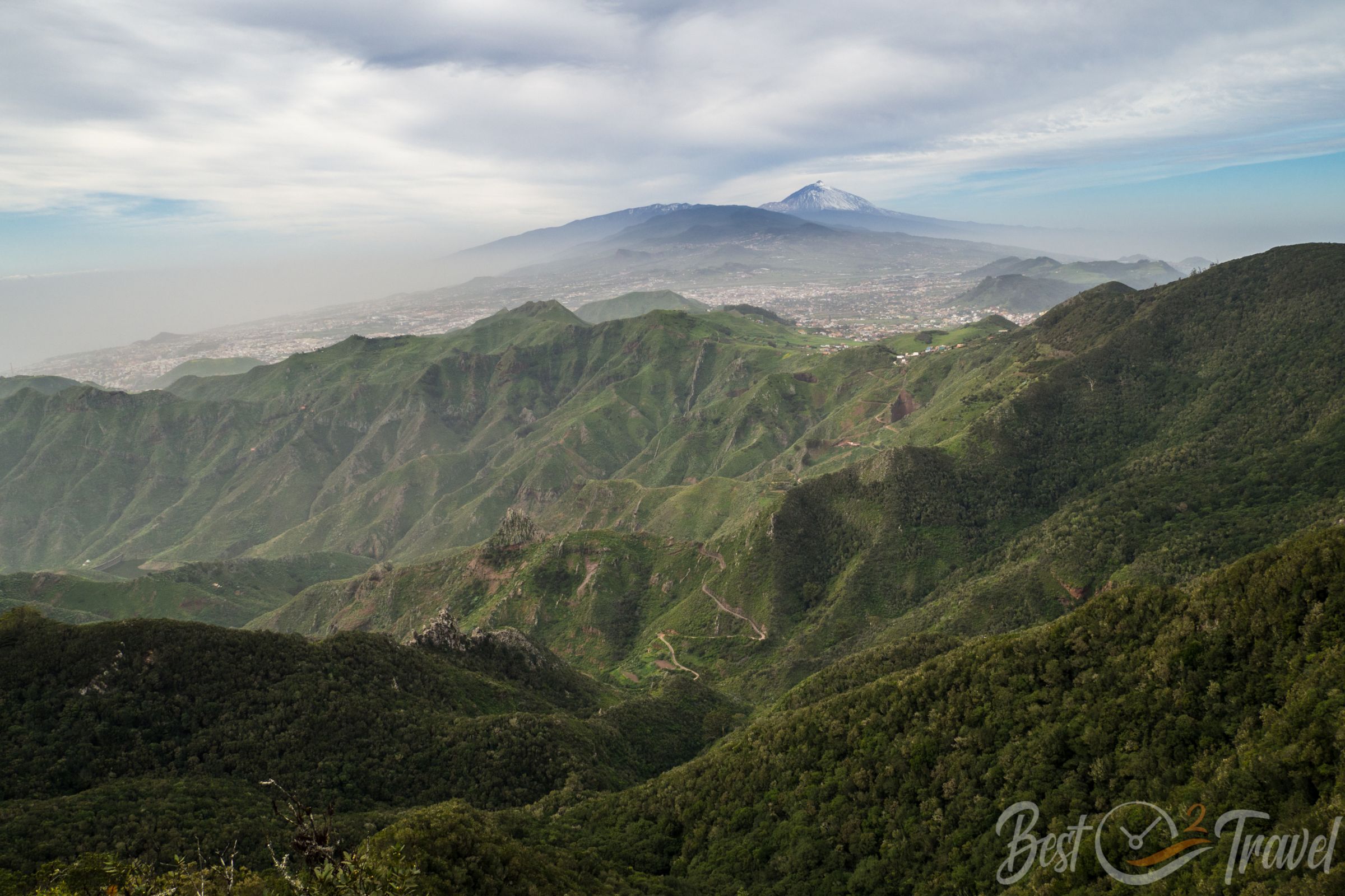
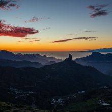
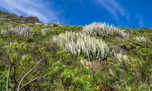
Anaga is a magnificent part of Tenerife, a hiker’s paradise in lush vegetation you won’t expect if you have visited the dry south before. What makes Anaga unique is the type of forest which occurs here. The inhabitants have a huge understanding of their environment; they do not lumber the valuable forests which develop clouds.
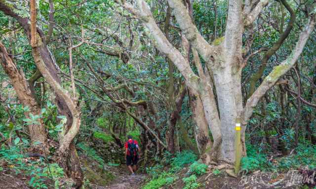
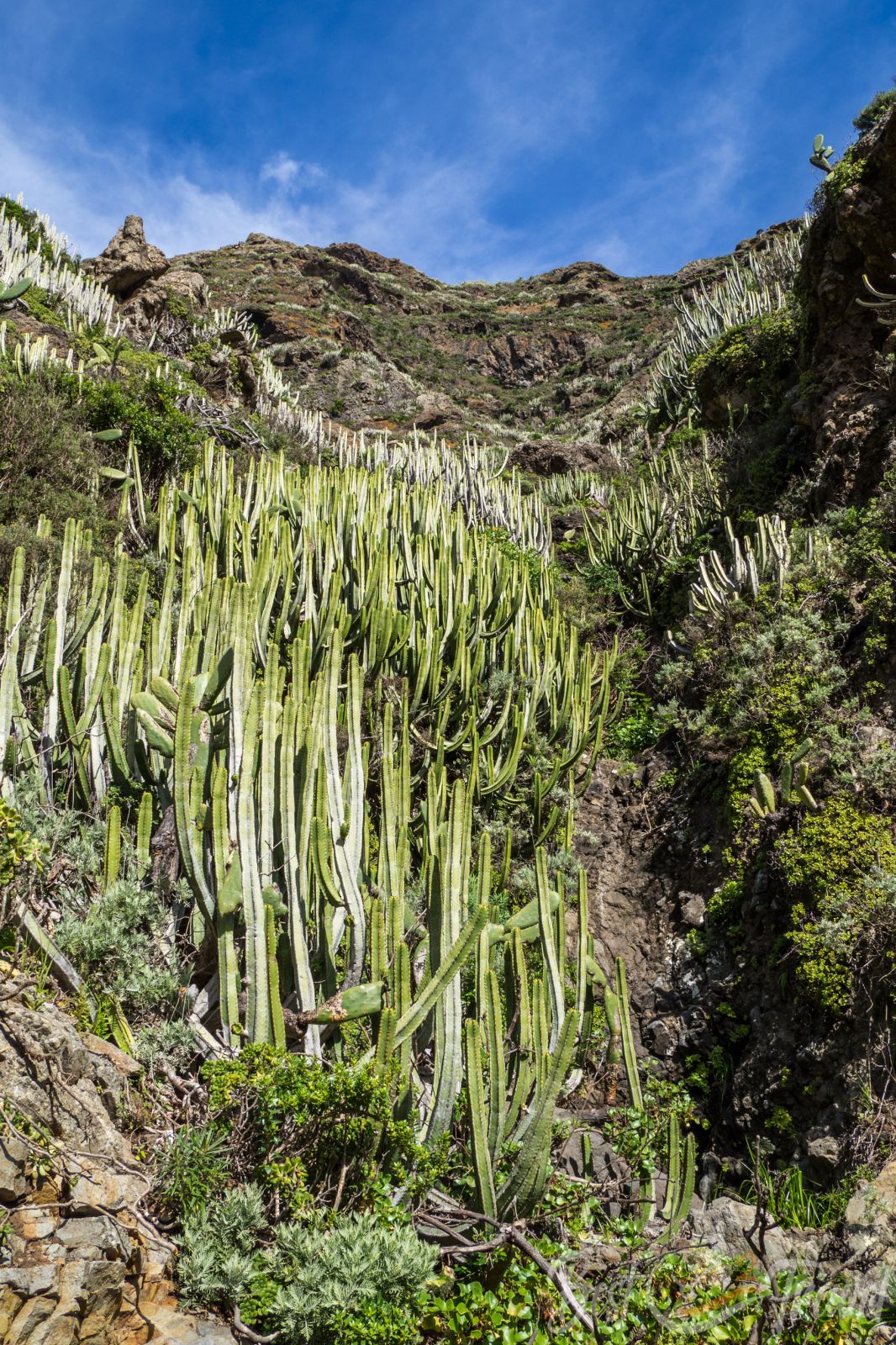
These primary forests with laurisilva, savin juniper and other plants are endemic to the Canaries, Azores, and Madeira.
You can easily hike in the Anaga Park for weeks, but usually, the vacation lasts for one or two weeks only. I would like to introduce you to the three most beautiful hikes in the Anaga Rural Park. Anaga became a UNESCO Biosphere Reserve in 2015 because of its biodiversity in flora and fauna.
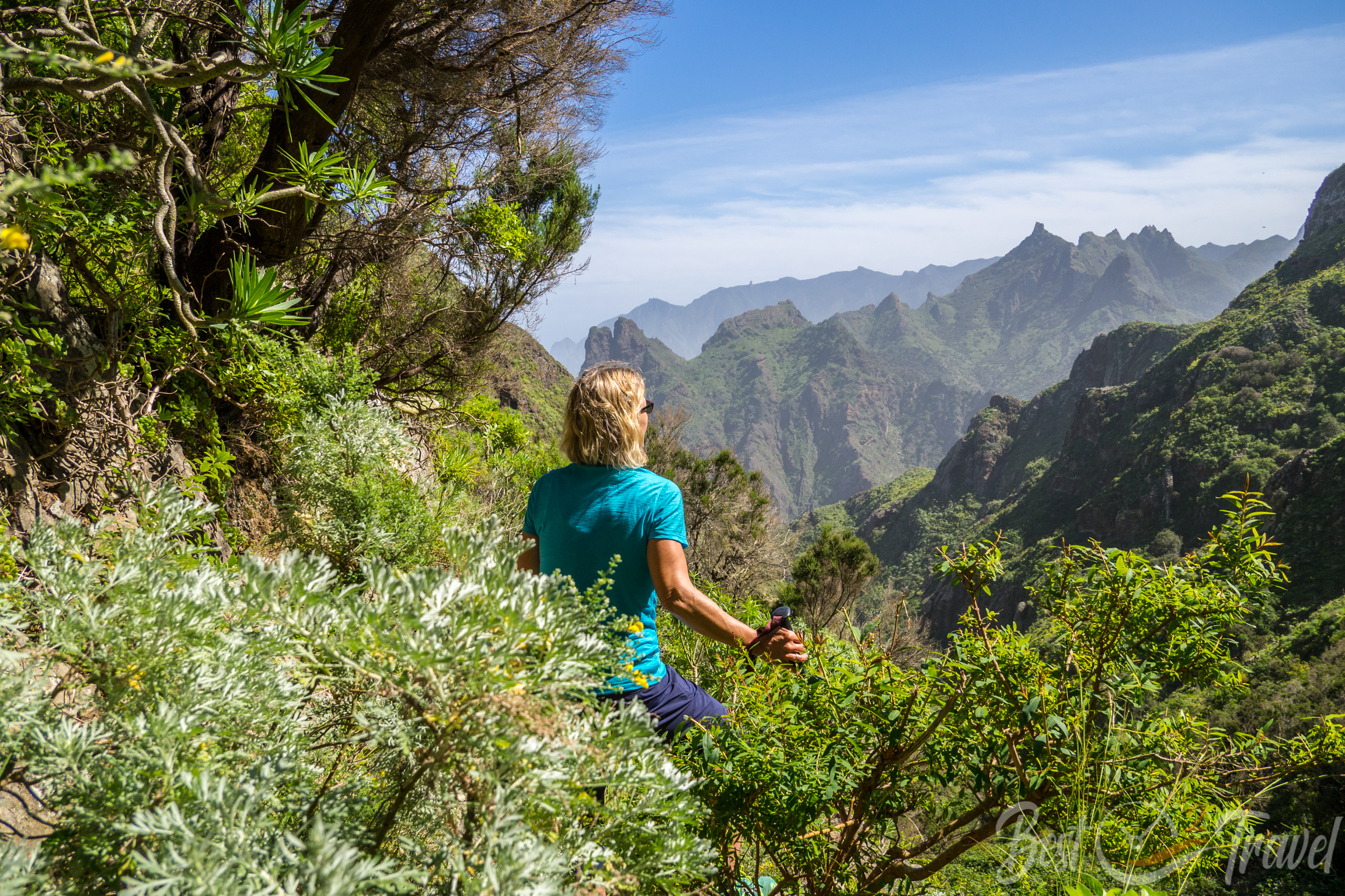
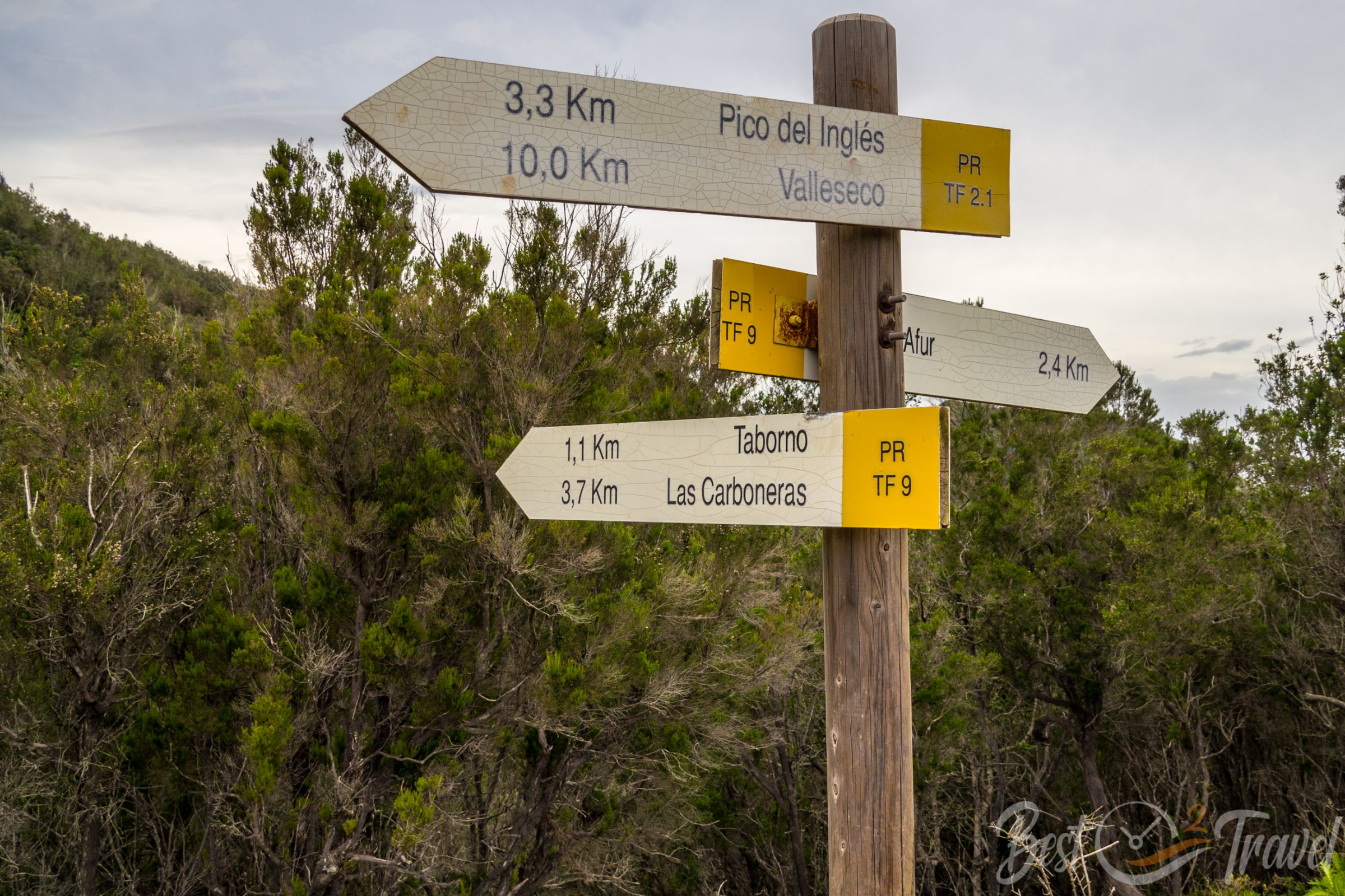
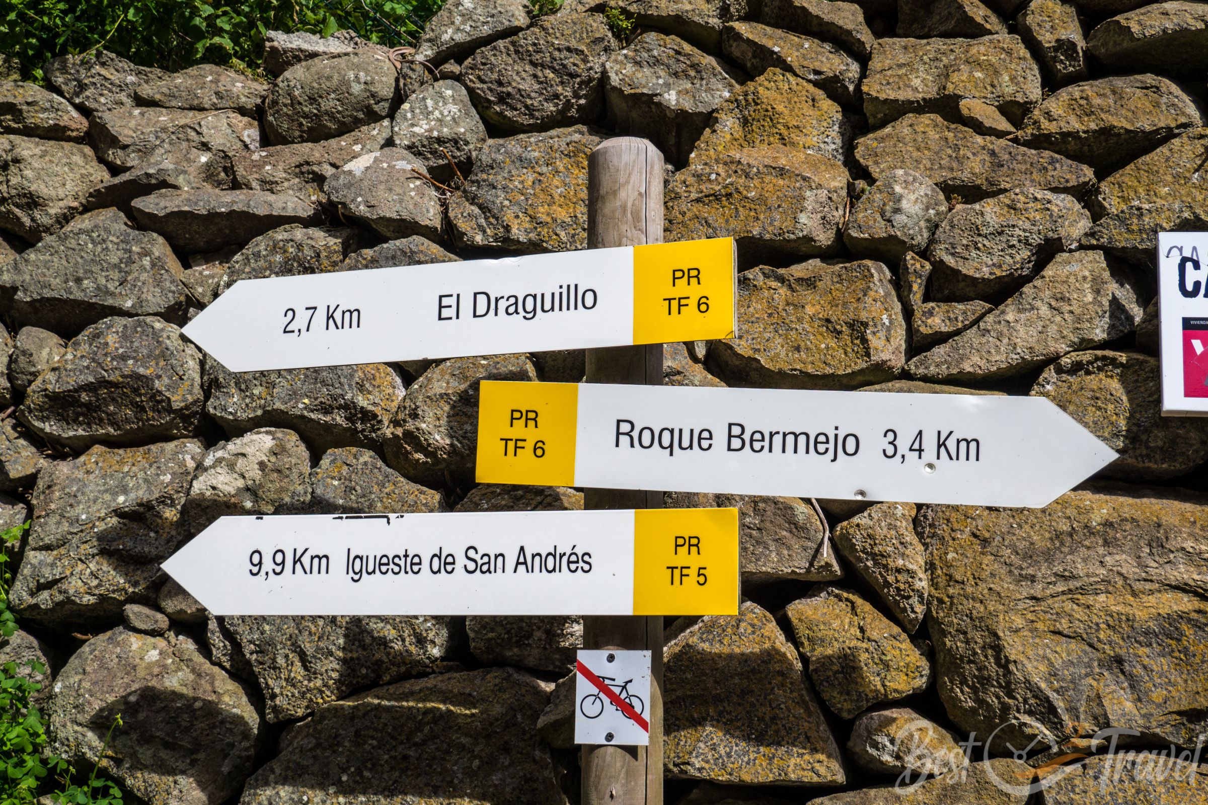
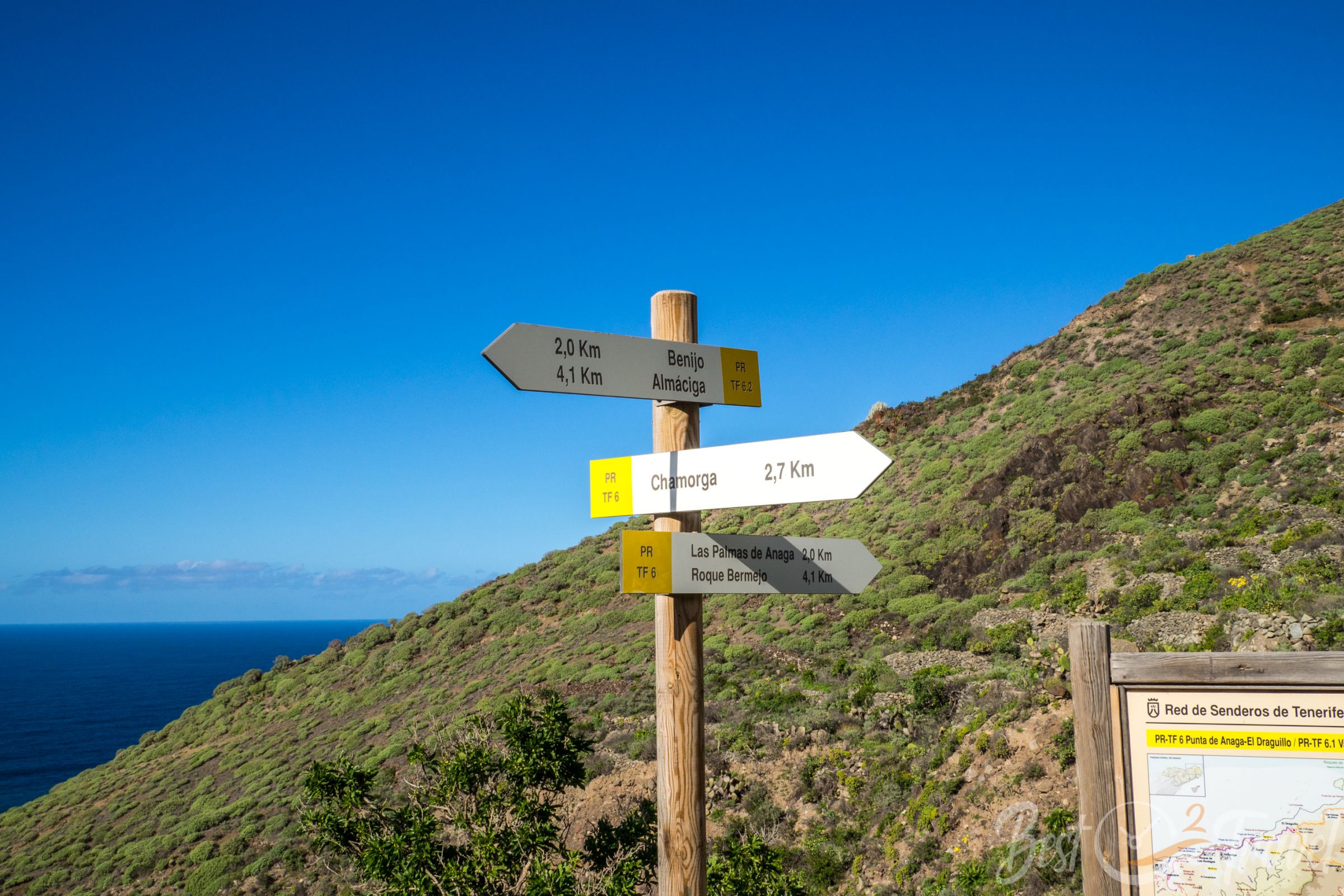
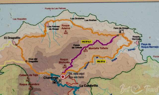
1 Chamorga – Roque Bermejo – El Draguillo PR TF 6
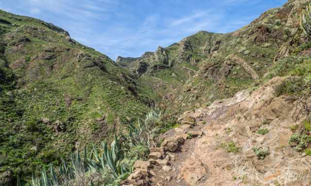
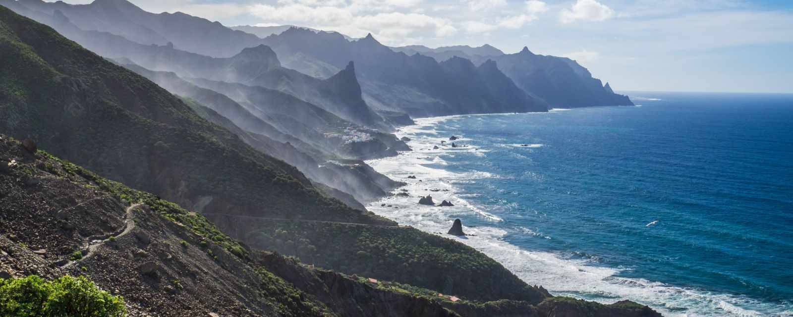
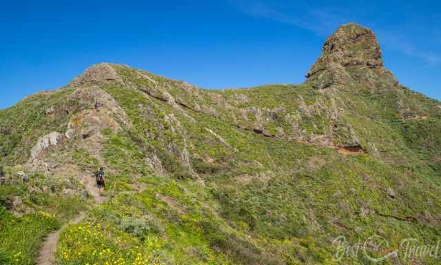
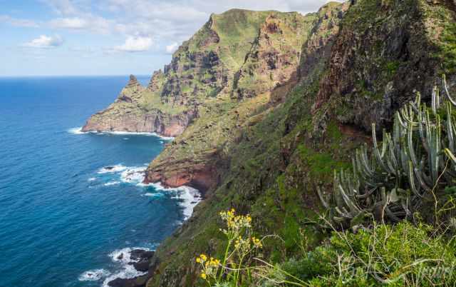
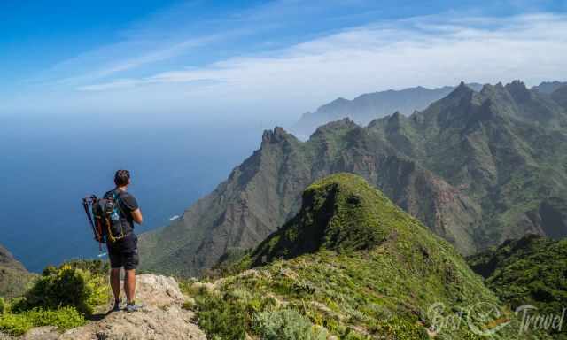
For me, the most picturesque trail of all in the Anaga Massif on the eastern tip of Tenerife. I am always fascinated by the beauty on this trail. If you are limited in time, this hike is my top recommendation! It is a circular trail that starts in Chamorga, the biggest village in the northeast and a dead-end road. Locus Map Hiking Route
Distance: 13 km
Elevation: 815 m
Duration: 5-6 hours
Difficulty: Moderate
Parking Trailhead Google Maps
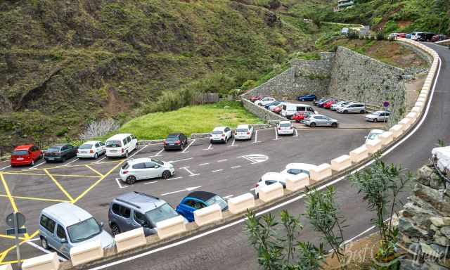
Because of the narrow roads, we parked at the entrance of the village.
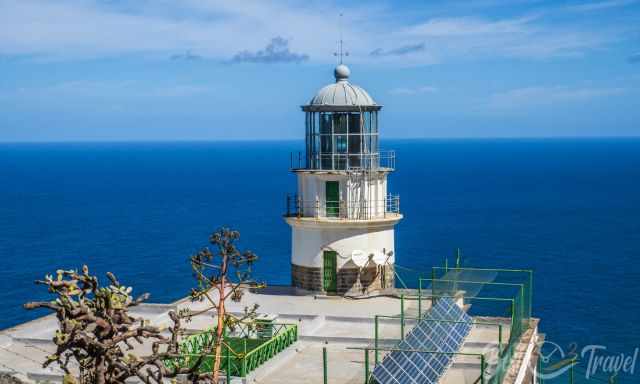
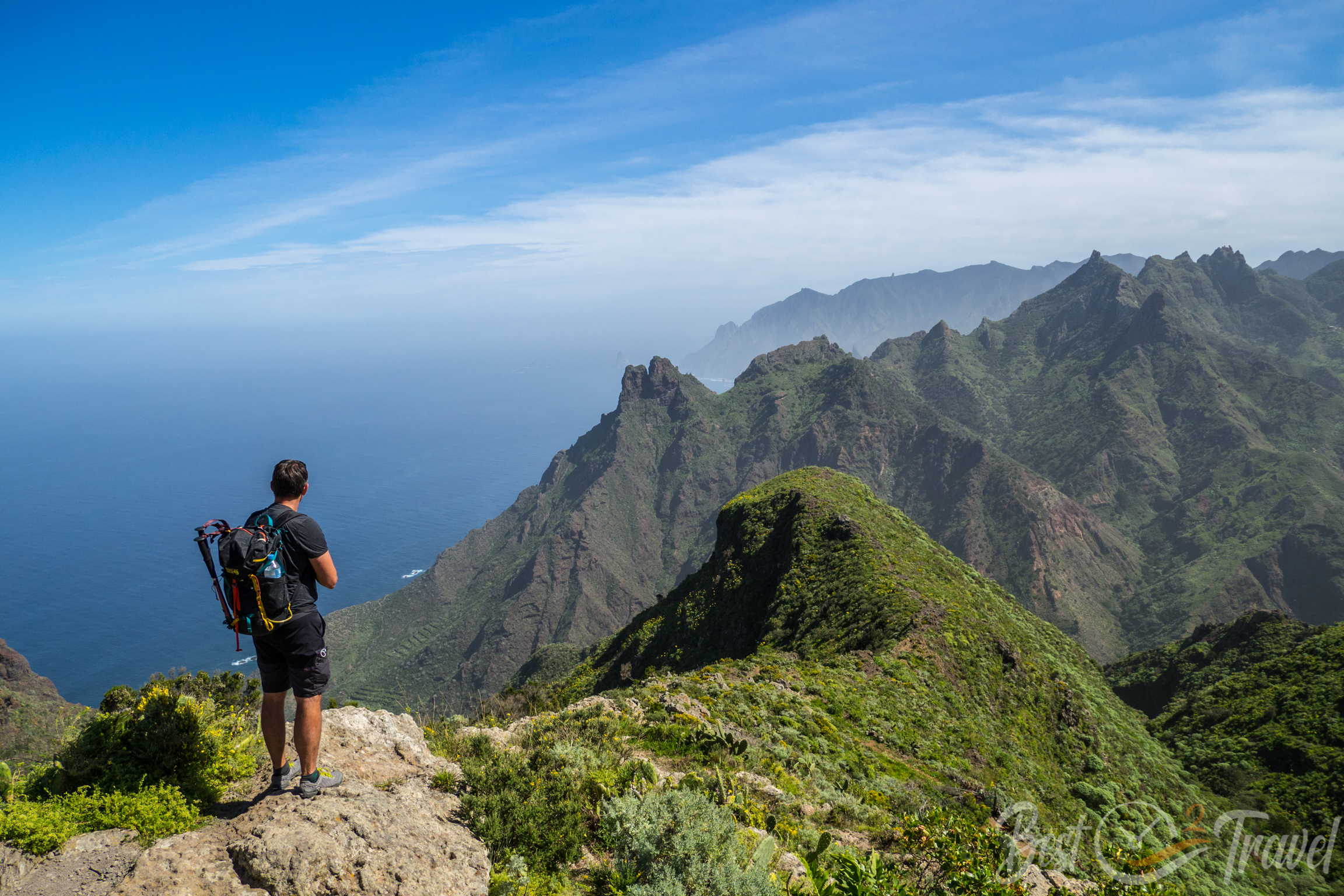
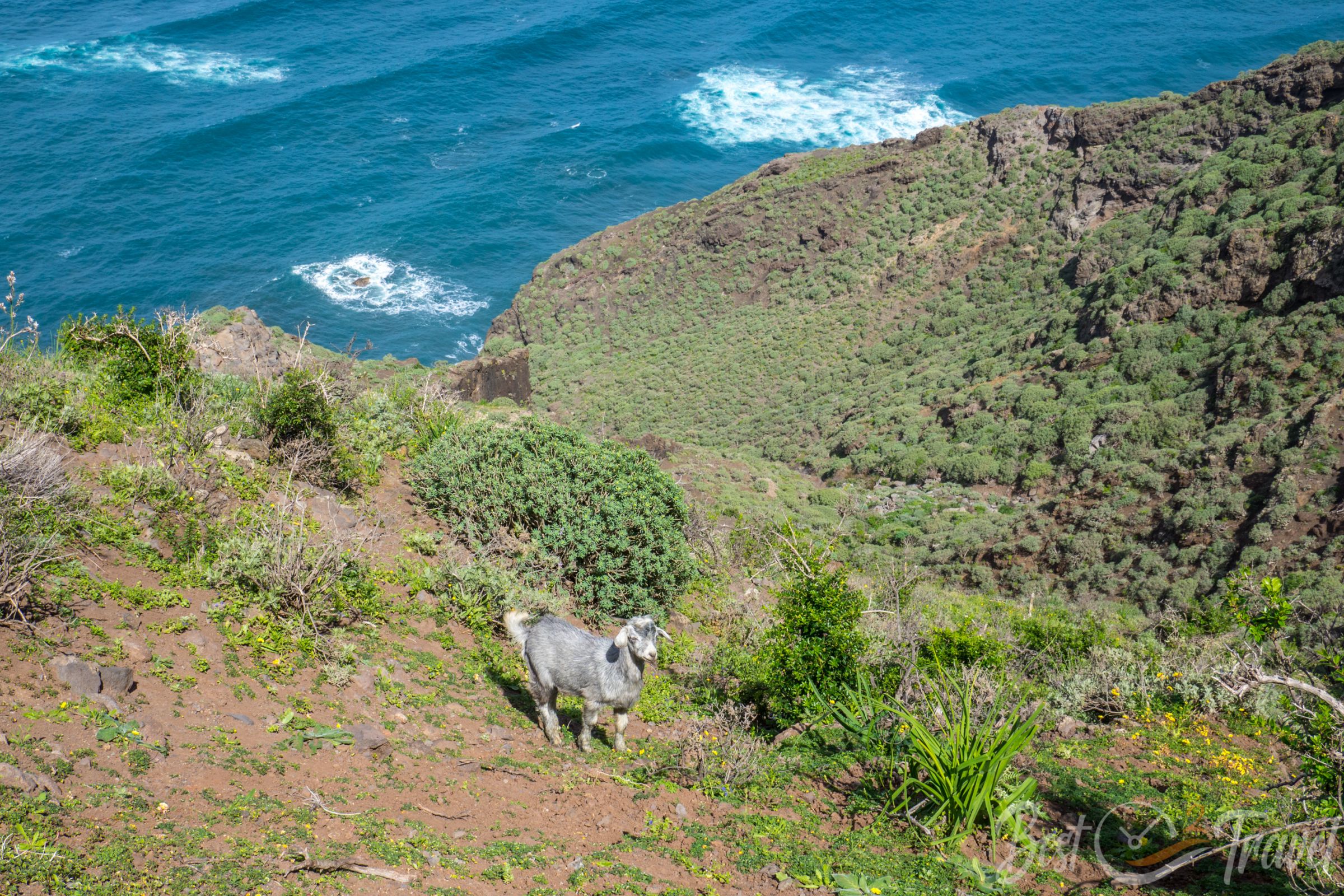
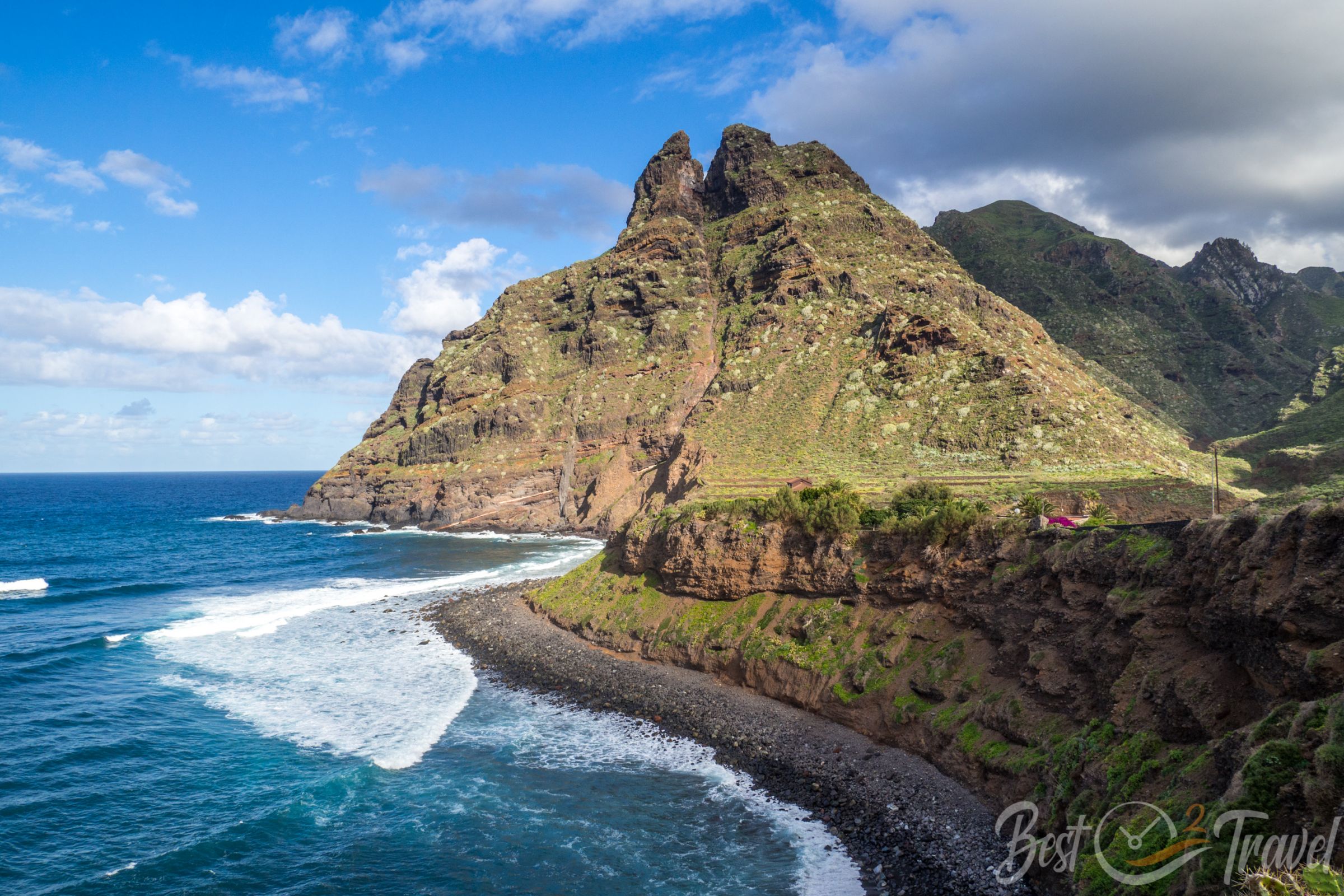
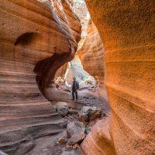
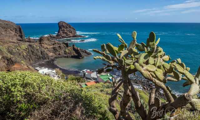
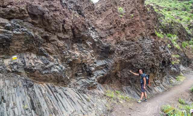
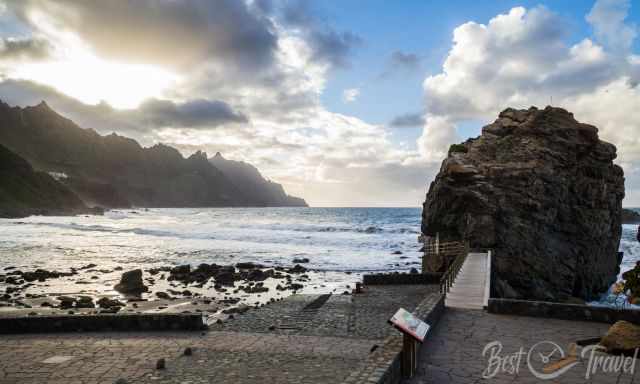
Descending through a canyon parallel to a stream to the lovely small village of Roque Bermejo located at sea. The trail continues along this stunning coast, passing by the Faro de Anaga, which is not open to the public at 247 m above sea level.
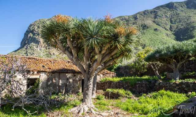
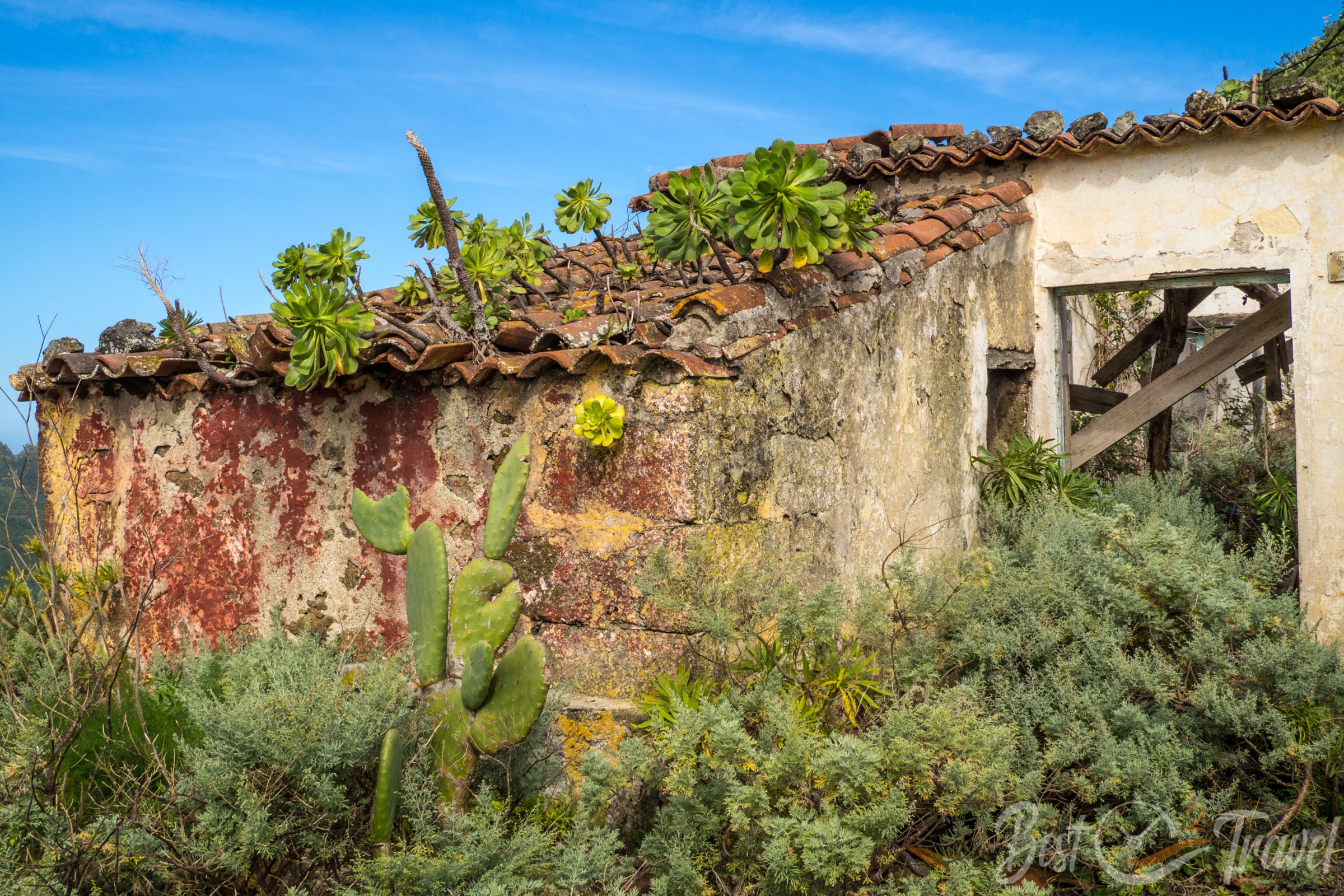
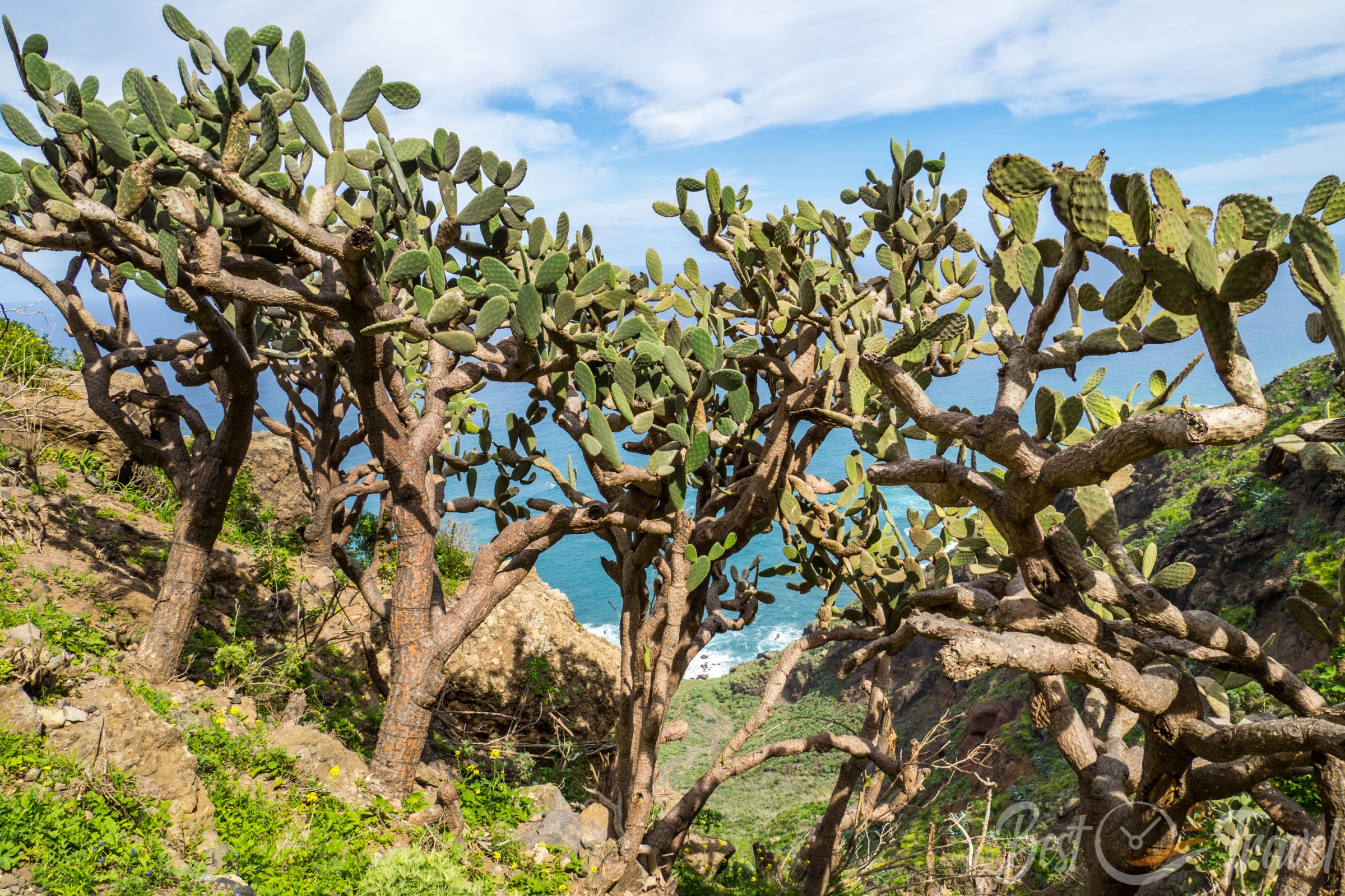
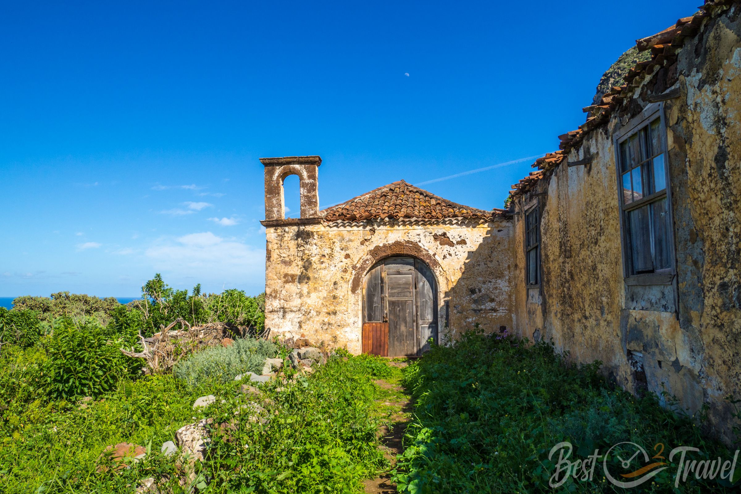
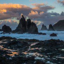
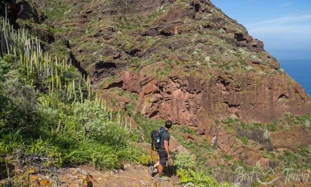
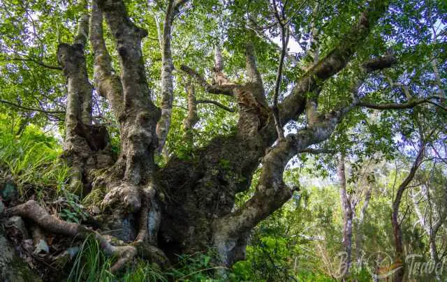
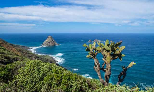
It is an exposed trail, narrow in some parts and offers breathtaking coast views. Another stellar picture stop is a remote village, Las Palmas de Anaga, a natural heritage site since 2014. The inner courtyard of this old hacienda gets retaken by nature and two dragon trees. The former fields are transmitted into a forest of prickly pears.
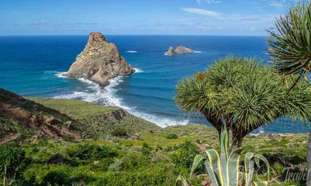
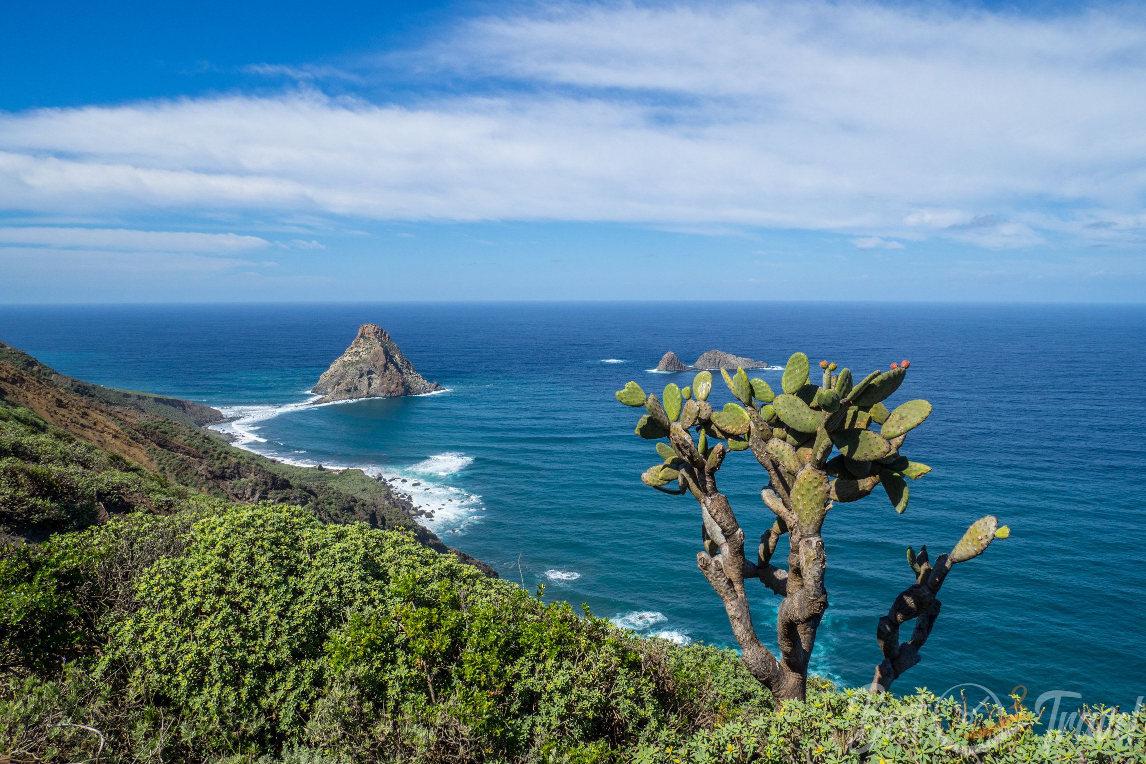
We continued on the coastal trail, and soon after, we reached some bigger rocks near the shore. Roque de Anaga and the second one 800 m away are nature-protected areas, and access to these rocks is prohibited. They are the remnants of eroded volcanic vents and are inhabited by sea birds now.
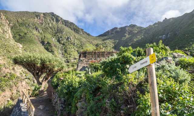
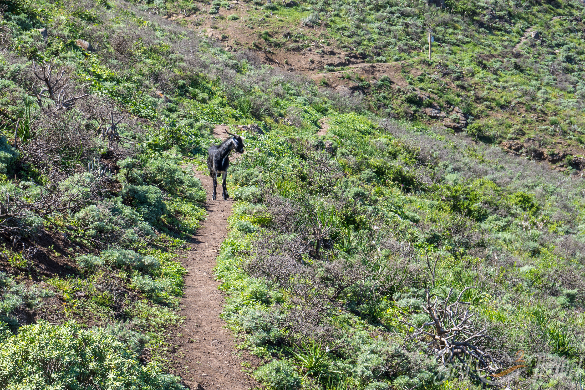
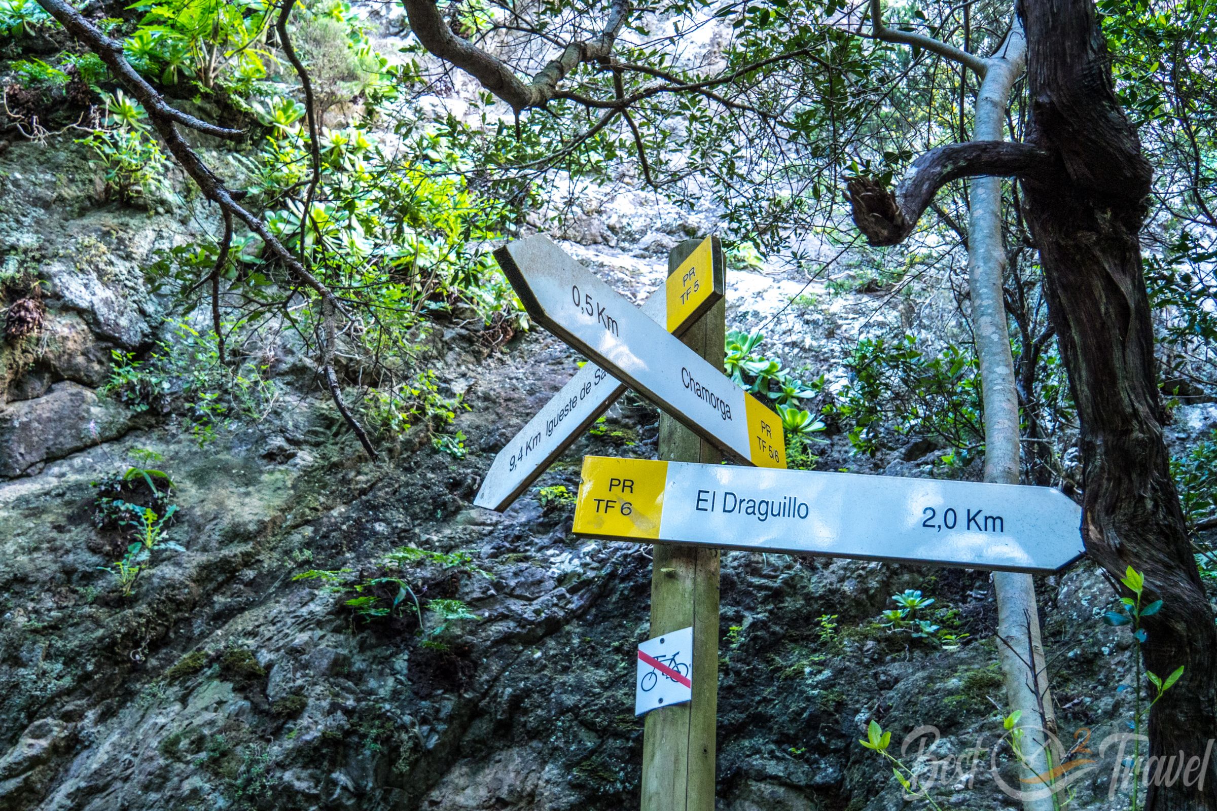
The trail ascents at a dragon tree to the left in the village of El Draguillo. This small village officially has three residents, but many hikers pass by. It is a steep path leading through a thick cloud forest back to Chamorga.
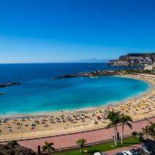
An alternative is to continue from El Draguillo along the coast for 2 km to the exceptional Benijo Beach and then back to Chamorga – add another 4 km.
2 Afur – Tamadite – Taganana PR TF 8 or
The circular trail from Afur to Playa Tamadite and Taganana is one of the most popular trails, which we have already hiked several times. Locus Map Hiking Route
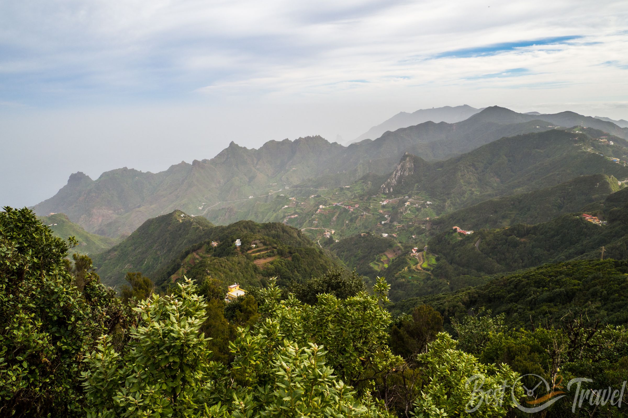
You can start the hike either in Afur or in Taganana. The slopes around Taganana have been traditionally used to grow grapes for viticulture in the 17th and 18th centuries.
Anaga is wetter than the rest of Tenerife but experiences lots of sunshine, too. The wine from Taganana was traded from Almaciga.
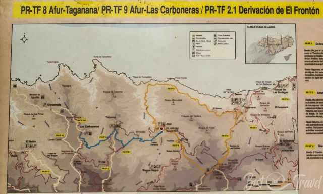
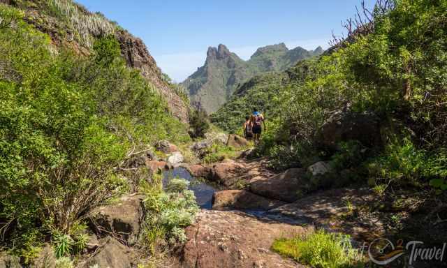
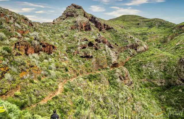
Roque Taborno - Playa Tamadite – Afur - part of PR TF 8
Therefore, we tried another route, a hidden gem in the Anaga Rural Park, which was even more spectacular than Masca. Locus Map Hiking Map
We started the round trail at Taborno village, toward Roque de Taborno. The village is located 589 m above sea level, and the view of the Anaga Mountain Range and Roque de Taborno is already worth coming here. Because of the narrow roads, we parked the rental car at the village entrance. Google Maps
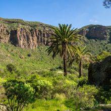
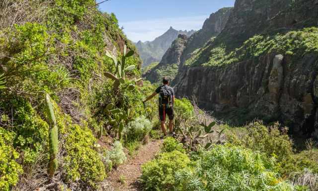
The pristine forest around Taborno and the Barranco de Palos Hincados vegetation are breathtaking, fantastic, and wild. This ravine can easily compete with Masca’s beauty, but beside us, just a group of young residents hiked this steep track down.
When we reached Playa de Tamadite, it wasn’t longer peaceful and tranquil; however, the walking path was incredible. From Tamadite, we hiked a while on PR TF 8 along the coast direction of Taganana, looking for a spot for our lunch.
Afterwards, we returned to where the trail forks to climb up to Afur on PR TF8. This trail is well maintained and wide because it is much more used.
| PR TF 8 from Afur | From Taborno | |
| Distance | 14 km | 10 km |
| Elevation | 800 m | 600 m |
| Duration Difficulty |
5 h Challenging |
4 h Moderate |
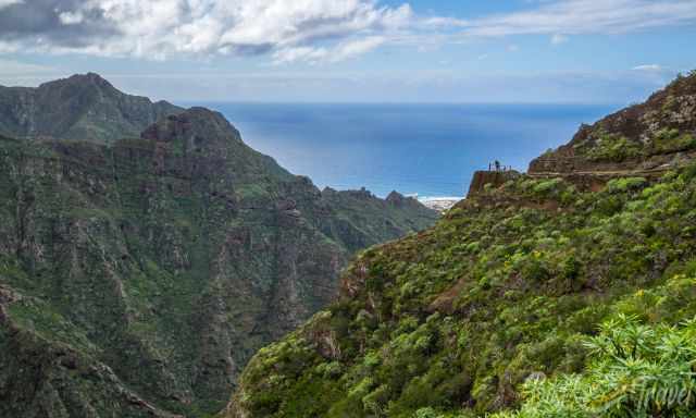
3 La Punta del Hidalgo to Chinamada or Cruz del Carmen PR-TF 10
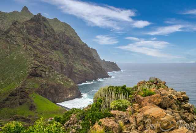
It is a fantastic hike, beginning along the wild and rugged coastline of Anaga and later through the canyon. Locus Pro Hiking Trail
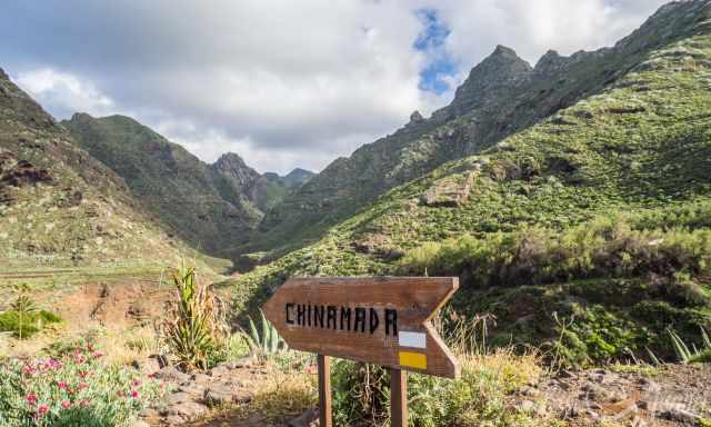
From Punta del Hidalgo, a steep and, in some parts, exposed hiking track leads through the canyon (Barranco del Rio) to Chinamada.
The walking path is mostly wide and sun-exposed, offering magnificent views of the sheer dropping cliffs, the rugged coastline of Anaga and the sea. ‘The trail is well marked with a yellow and white sign.
You can walk to Chinamada, take an excellent home-style lunch in the “Restaurante La Cueva” and continue to Cruz del Carmen or walk the same way back. Another alternative is the bus line 105 back to Punta Hidalgo. The restaurant offers one of the best mojos I have ever eaten called “polvito”. It is definitely worth planning a break here.
Distance: 5.3 km one way / 9.7 km
Elevation Gain: 600 m
Duration: 2 hours one way
Difficulty: Moderate
Parking Trailhead: There isn’t any real trailhead parking – just onside road parking. Google Maps
Weather Anaga Rural Park
There is a saying, “Where there is rainforest, there is rain”, and so true, but this makes the difference in providing a unique landscape in the Parque Rural de Anaga. The cloud forest provides rain which made life possible in the mountains, and the fertile slopes were used for agriculture and in Taganana for viniculture in the 17th and 18th centuries.
You can hike in the Anaga Rural Park throughout the year. Summer can be hot, reaching almost 30°C, but it is the driest time. The winter is notorious for frequent showers and overcast days. It is the wettest season with the most precipitation in November, with day temps ranging from 10°C during rain to 20°C if it is sunny.
The best time for hiking in the Anaga mountains and along the Anaga coast is in spring and autumn, from March until June and September and October. October is still a great month, but expect increasing rainfall.
However, we visited Tenerife and Anaga multiple times in the winter and checked the weather forecast daily to pick out the best days for Anaga. Therefore, we always had an awesome time, with pleasant daytime temperatures and a blue sky for hiking. Weather forecast
These are my recommended tours via GetYourGuide. Thx for booking via my website! With your support, I am able to provide all information first-hand. Tour prices are at no extra cost!
Best Months to Visit
Location and Tips

Anaga, in the east of Tenerife, is a terrific area during all seasons, providing shade or a breeze along the coastal hikes. I will give you all the information for the three most picturesque trails: the exact location, the distance, difficulty and the duration, plus plenty of pictures to get an idea of the beauty. I highly recommend hiking at least one of these magnificent tracks.
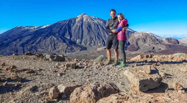
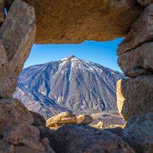
Do you like to get the best view of Teide on a moderate hike? Check out my detailed Teide Guide and enjoy one of the best views you can get in Tenerife.
Do you want to obtain the usage right for my images? Contact me, but I will take action against picture theft.