
When Is the Best Time
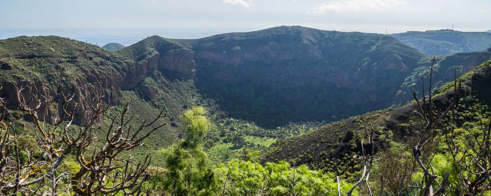
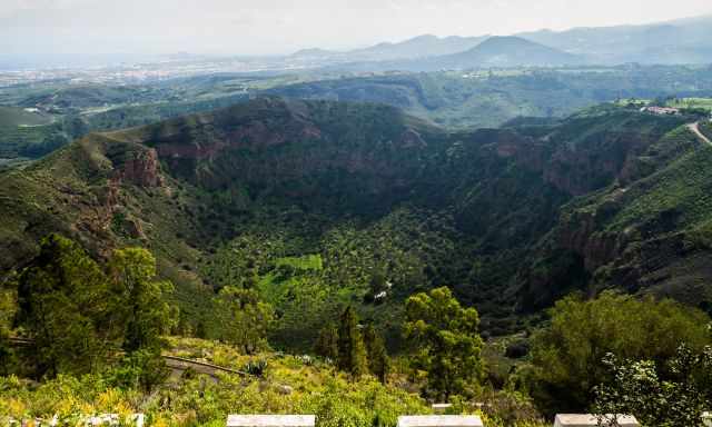
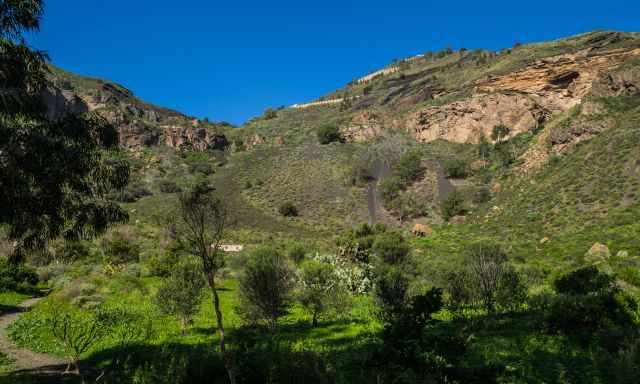
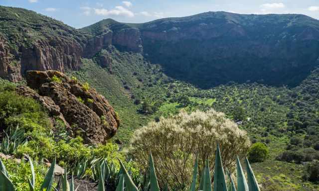
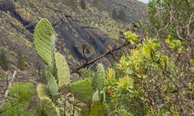
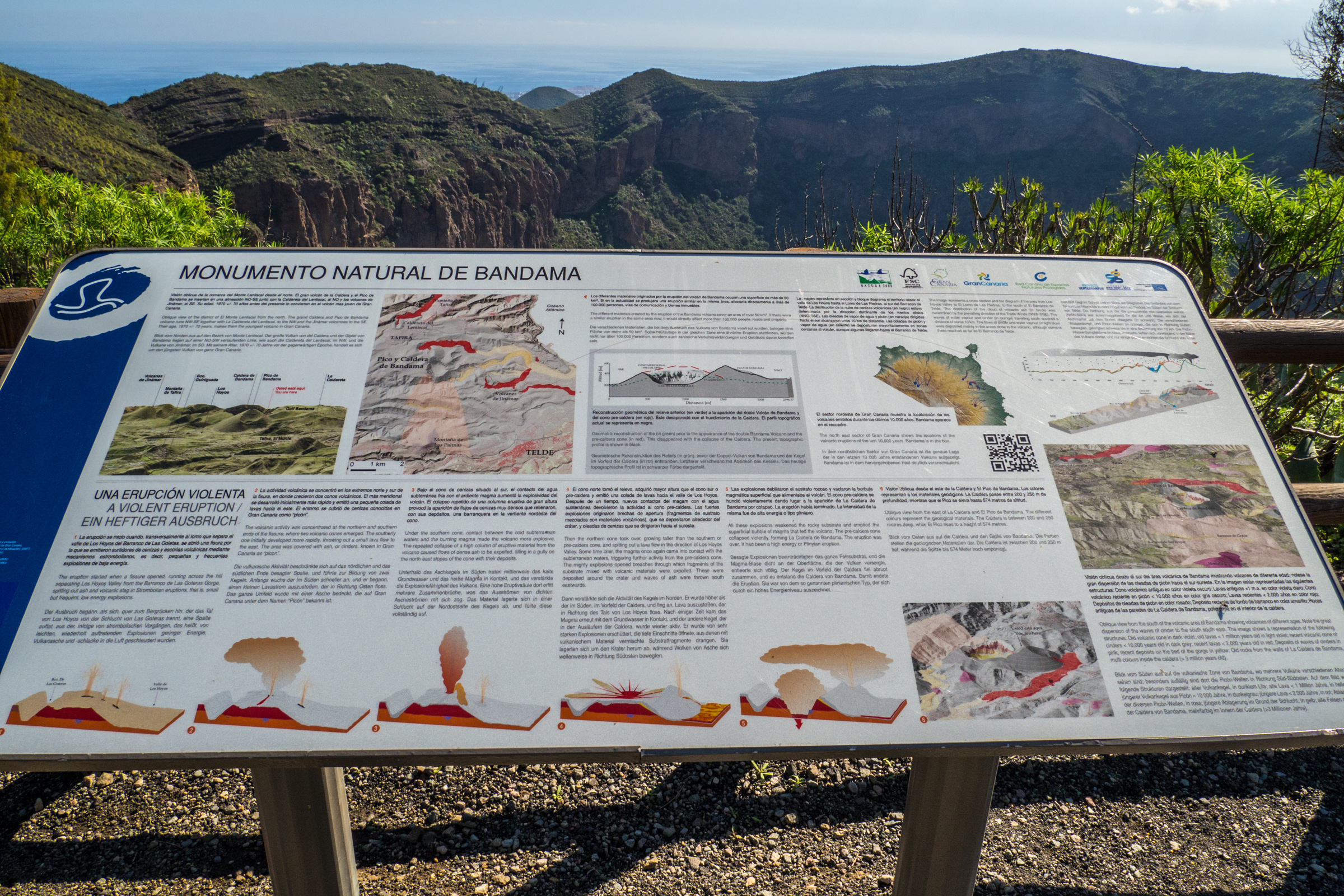
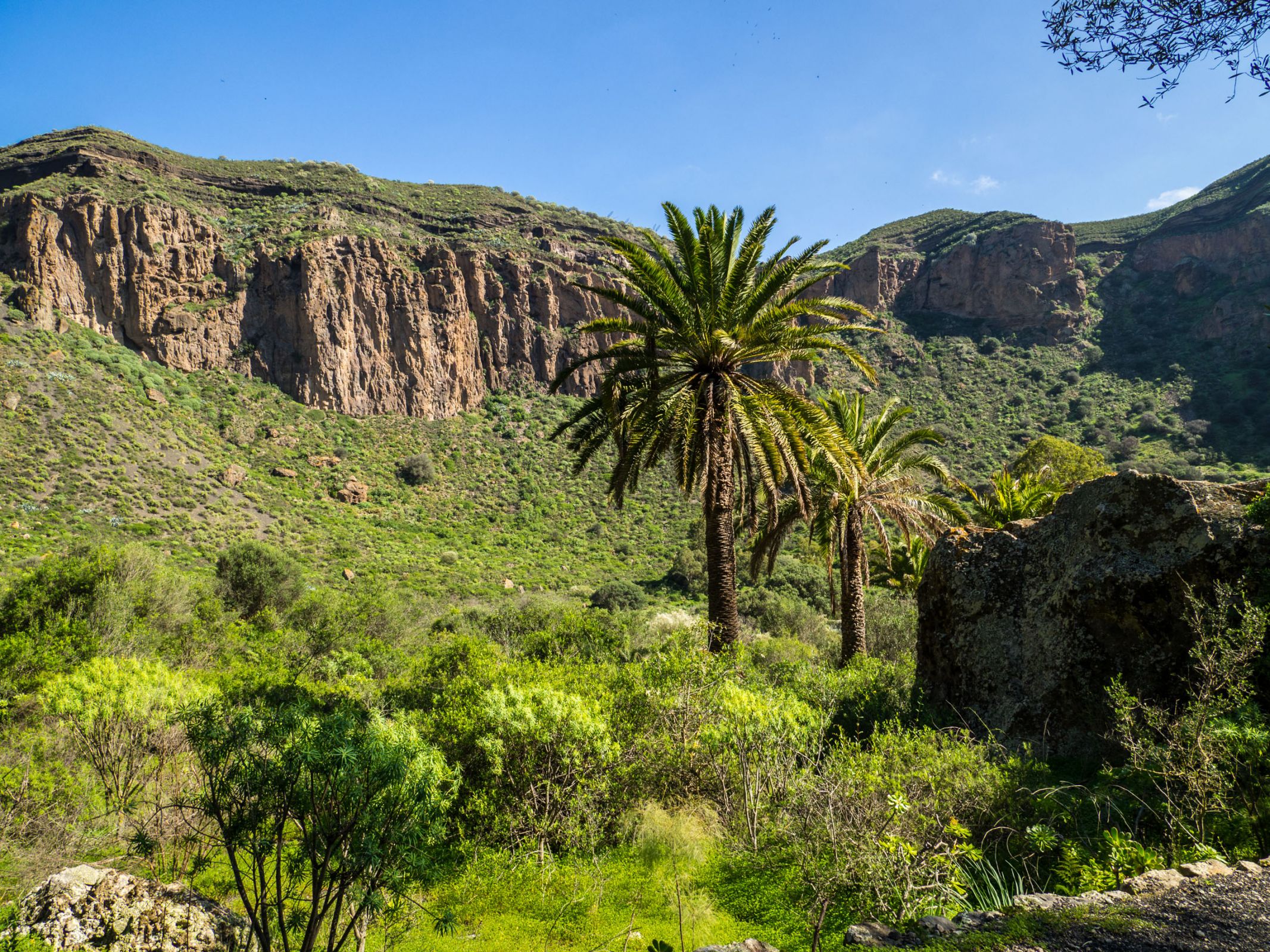
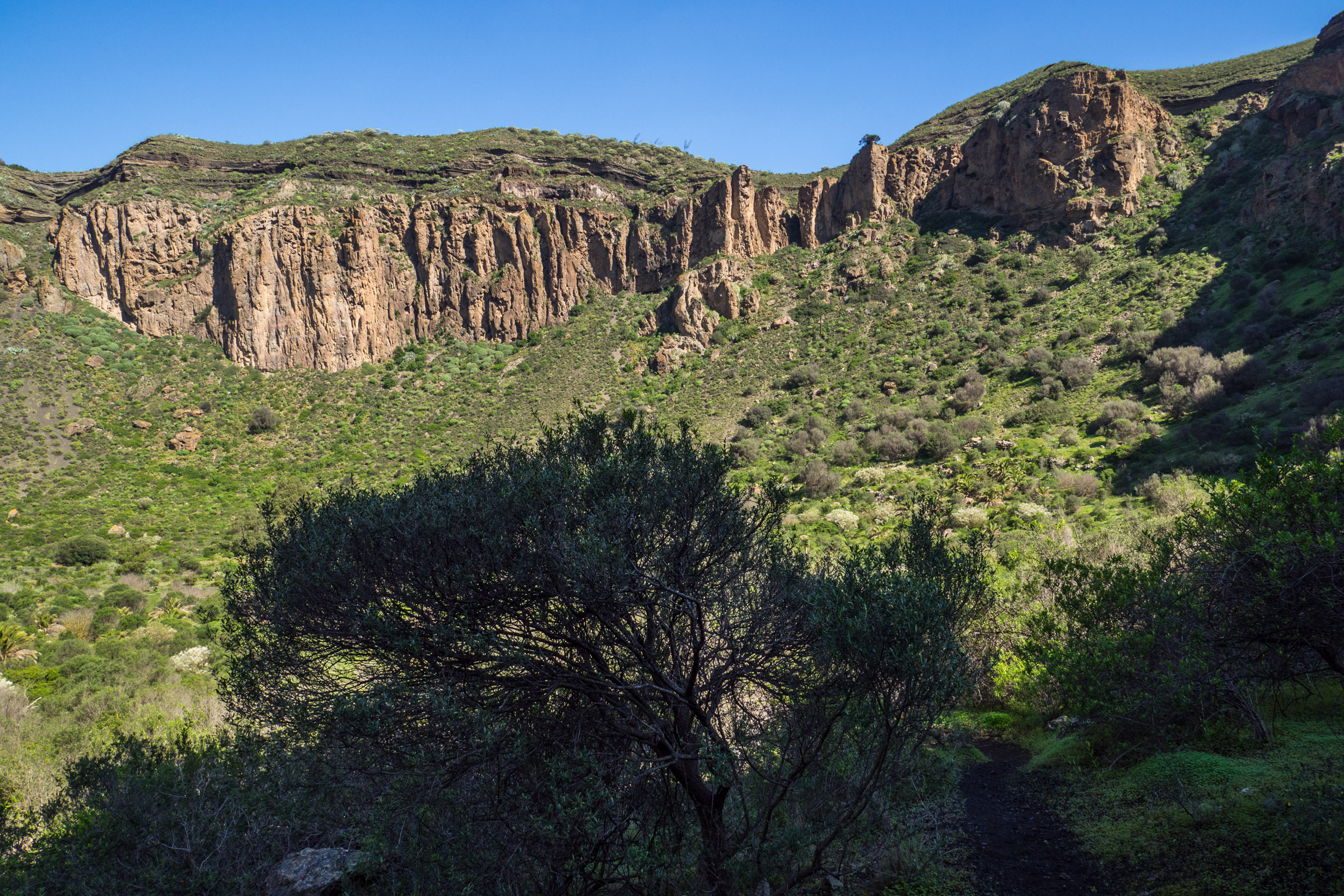
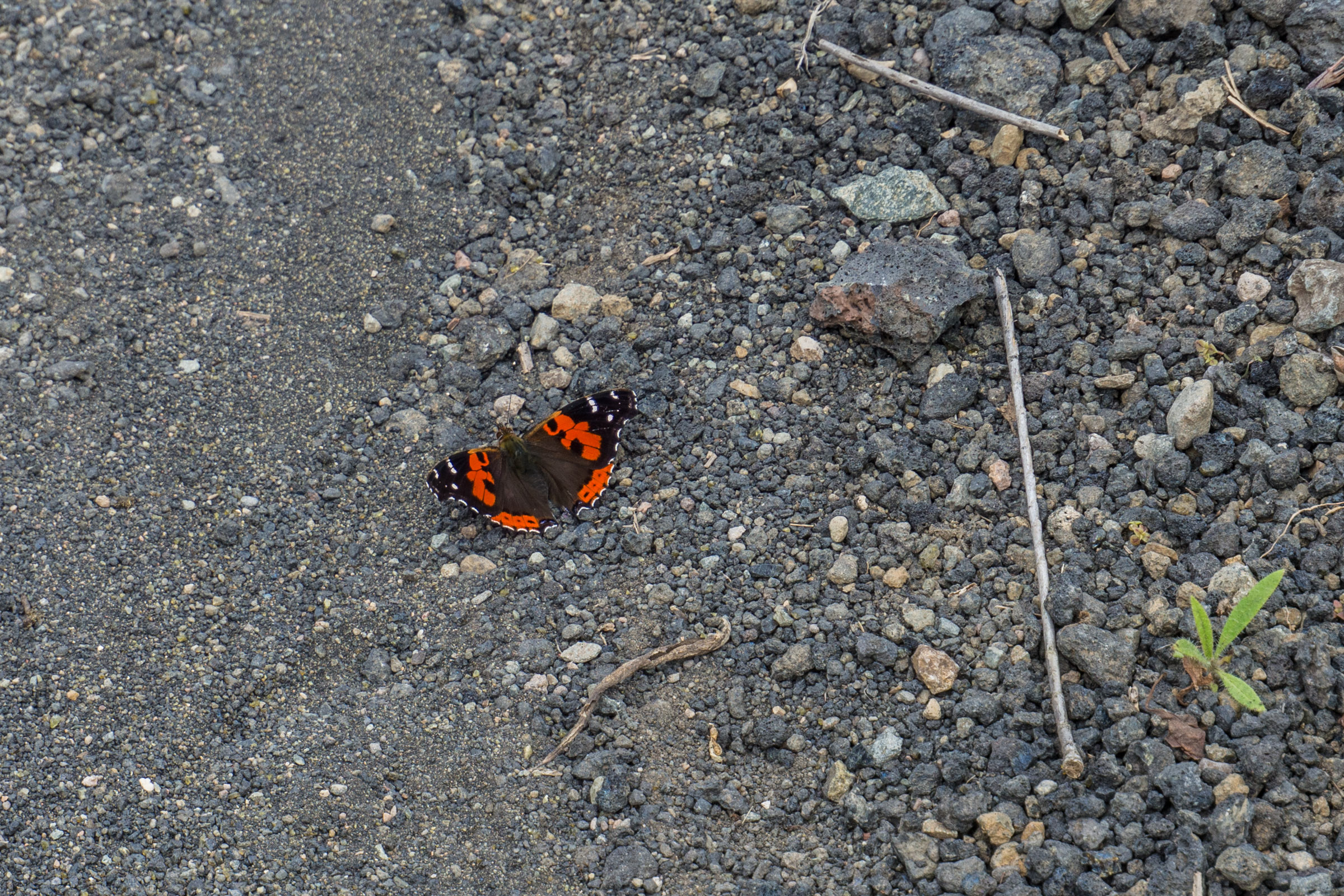
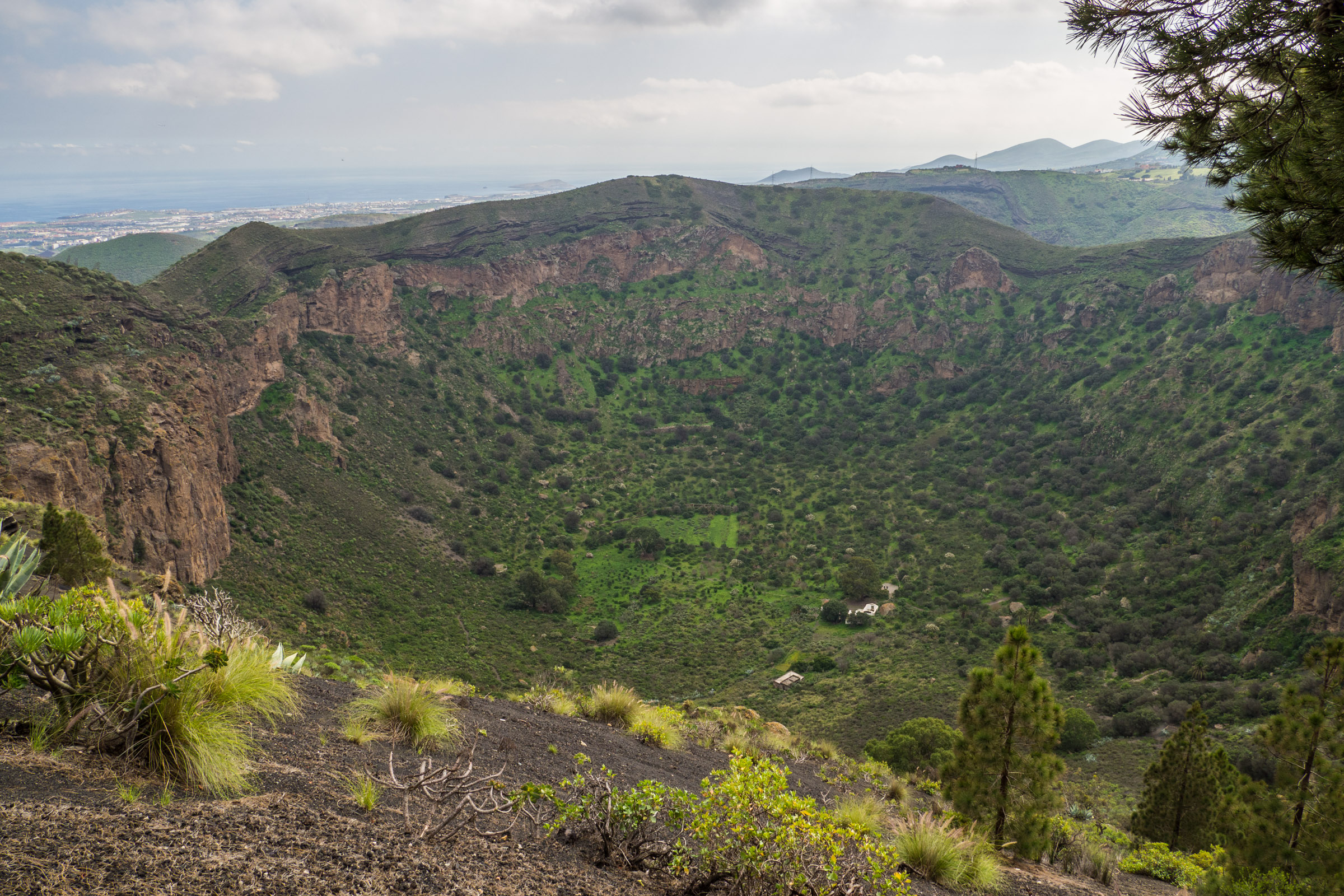
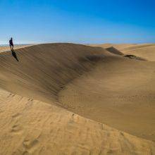
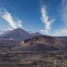
The Caldera de Bandama is a striking reminder of Mother Nature’s power. The crater drops 200–250 m and spans almost 1000 m, with derelict farmhouses still visible at the bottom. This hike feels like a walk into the island’s volcanic past, surrounded by beautiful flora along the trail and inside the crater. Pictures never capture how impressive this place truly is.
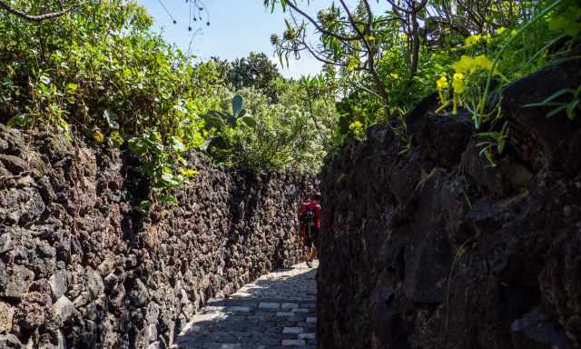
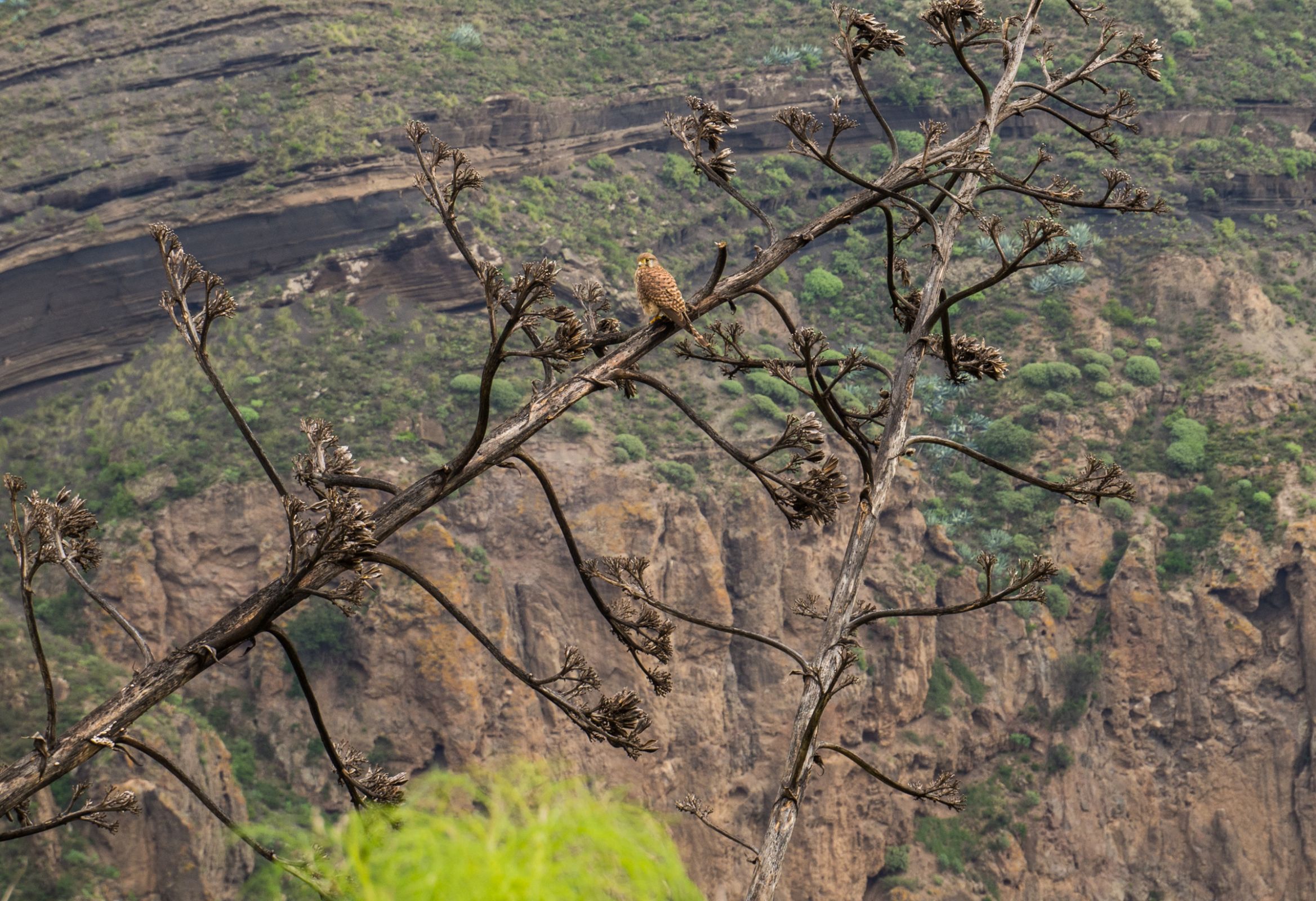
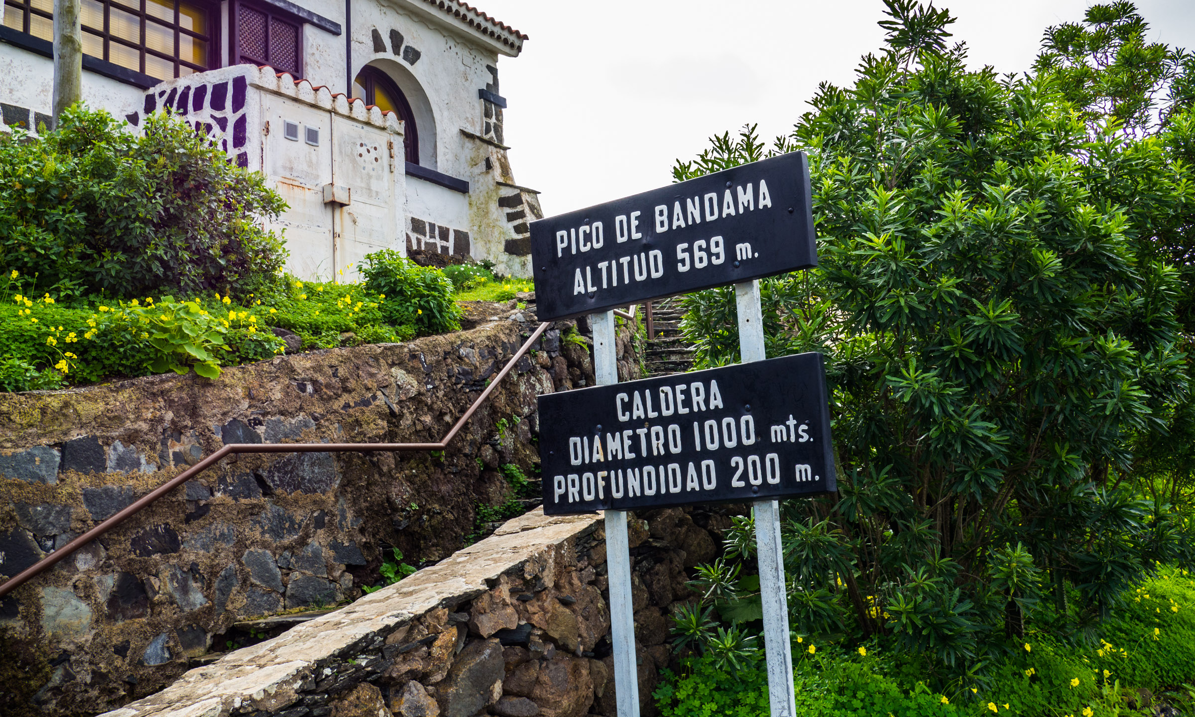
After the entrance gate, a cobbled path leads down into the caldera. Bandama crater and the 569 m high Pico de Bandama were formed during the last major eruptions around 2000 years ago — the most recent volcanic activity recorded on Gran Canaria. Life was wiped out at first, but the fertile soil allowed new plants to return. One endemic species grows only here: Dama de Bandama (Parolinia grabiuscula).
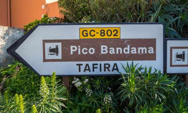
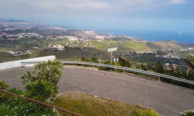
The crater is easy to reach, just a 20‑minute drive south of Las Palmas. It is one of the most exciting sights on Gran Canaria and a Must‑Visit location where you can spend 2–3 hours. Caldera de Bandama is protected as a National Monument and lies between the municipalities of Telde, Santa Brígida, and Las Palmas.
Tour Option Without a Rental Car
If you don’t have a rental car, this guided day tour by GetYourGiude is an excellent way to visit the Caldera de Bandama. It includes transport, food and wine, and takes you straight to the volcanic highlights of Gran Canaria. A comfortable and well‑organised option to explore the crater and its surroundings.
Opening Hours Bandama
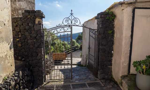
- Caldera de Bandama Crater Walk: 8 am – 5 pm, secured by a gate.
- Pico de Bandama is open 24 hours. It is a great spot to watch the sunrise.
Weather at Caldera de Bandama
The Caldera de Bandama has its own microclimate. The black basalt ash heats up quickly, making the crater several degrees warmer than the rim. Even in winter, temperatures inside can reach around 25°C on sunny days. There is no wind and no shade, so bring water and avoid midday heat.
The best time for this hike is in the morning, when temperatures are lower and parking is easier. Choose a sunny, clear day for the most spectacular views into the crater. Keep in mind that hiking trails, roads and restaurants are busier on weekends.
For more details about the island’s climate, see my article Gran Canaria - Best Time.
Parking Caldera de Bandama and Public Transport
- There are small parking lots only. It may be challenging to find a space if you arrive during midday. We parked our car here next to the Bandama signs (Google Maps location)
- The parking on the peak “Pico de Bandama” (Google Maps location) is much bigger, and you can start from here, too.
- Next to the crater is a golf course, but parking for members only.
- You can also get here by bus from Las Palmas, number 311.
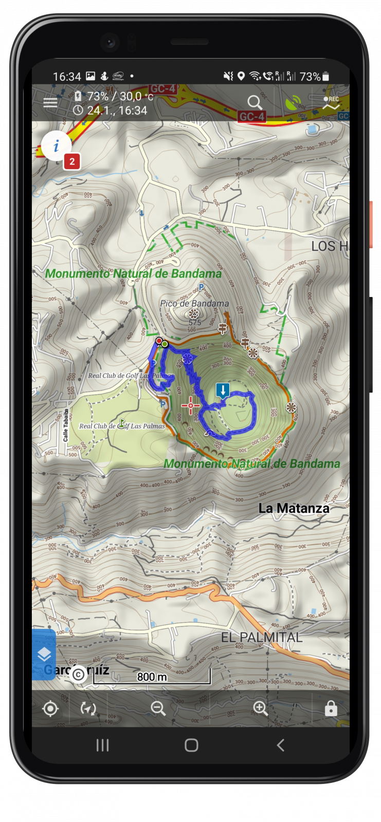
Hiking Trail Description
- Trail Length: 4 km
- Elevation Gain: 370 m
- Walking Duration: Maximum 2 hours
- Difficulty: Moderate
- Hiking Map Picture
- Hiking Map Link by Locus Pro
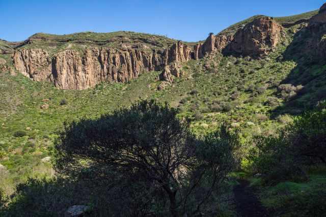
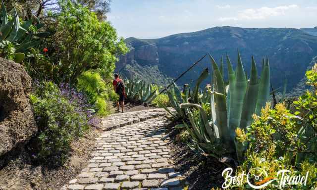
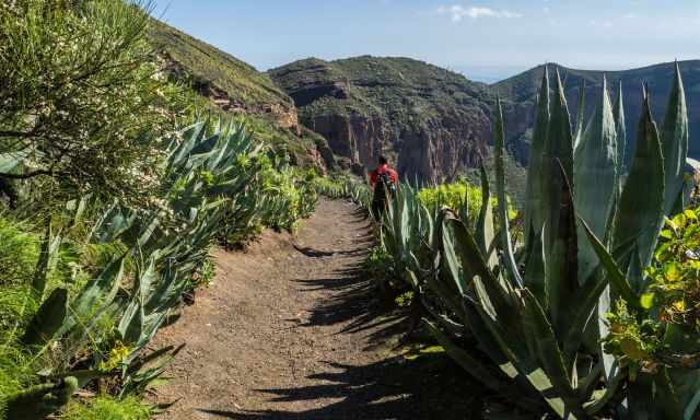
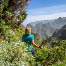
The hike into the Caldera de Bandama starts on a narrow cobbled path after the entrance gate and leads down to the crater rim. Inside the caldera it becomes noticeably hotter, even in winter, so bring water and a small snack. The trail soon changes from cobblestones to a dusty volcanic gravel track that can be slippery.
Along the descent you pass lush vegetation, flowers and wide views into the crater. After 15–20 minutes you reach a viewing platform overlooking the entire caldera and the old white farmhouses. At the bottom, follow the signposted circular route past farmhouses, caves and the endemic Dama de Bandama shrub.
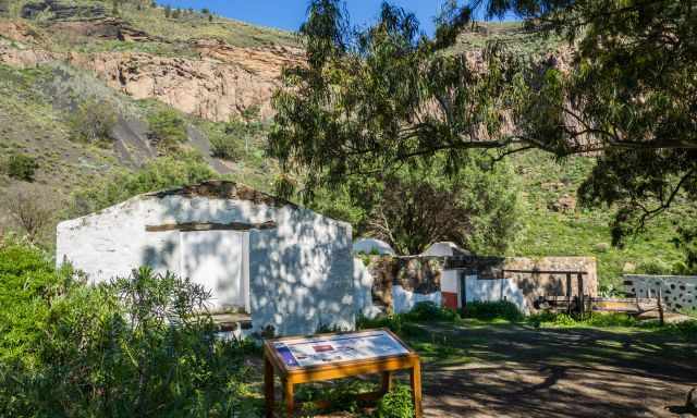
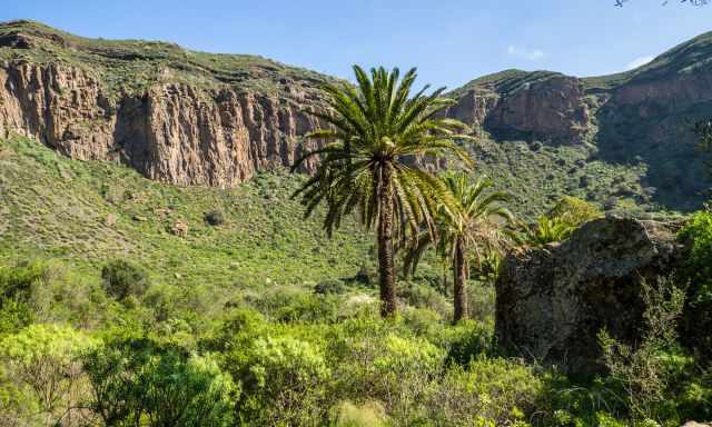
The palm trees inside the crater with the towering walls behind them are one of the most surreal sights. You return on the same path back to the rim.
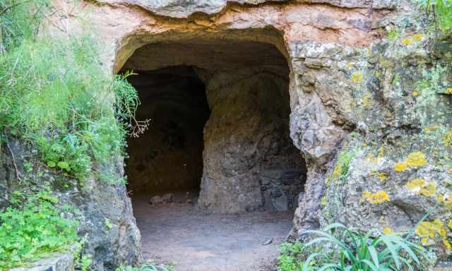
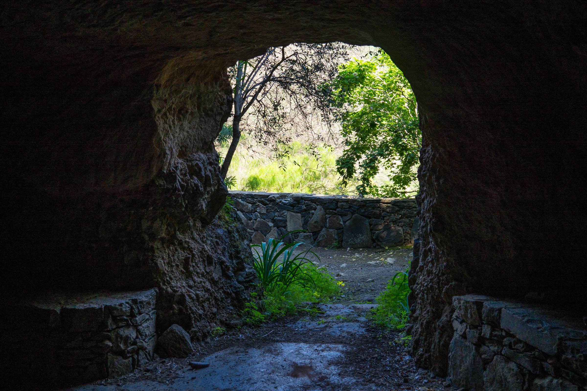
We followed different paths and explored numerous caves which looked like they were inhabited in former times. You get back out of the crater on the same route, but it'll take longer to walk out.
- half an hour down - half an hour inside the canyon - roughly 45 minutes to get out and back to the crater rim
Tip: Proper shoes recommended; no shade inside the crater. Carry plenty of water even in the winter! We visited Caldera Bandama in February and it was scorching at the bottom.
An easy alternative is the Caldera Rim Trail, a 3.5 km gravel loop on gravel terrain around the crater with spectacular views into the caldera.
- Elevation Gain: ~280 m
- Duration: 1–1.5 hours
- Hiking Map Locus Pro
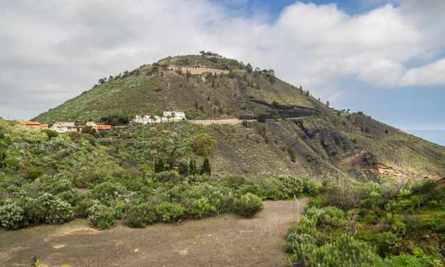
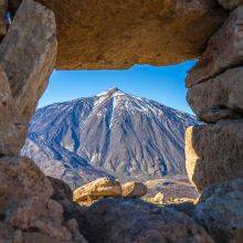
Pico de Bandama
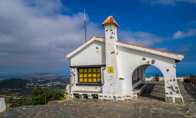
The peak is situated 569 m above sea level, offering a spectacular 360° degrees view of the Caldera de Bandama and the surroundings. If you are not able to hike into or around the crater, enjoy at least the breathtaking view from this viewpoint. Parking is available around the entire lookout.
The Characteristics of the Volcanic Landscape
The crater has its own microclimate for two reasons. The caldera heats up from small black porous pebbles, which are basalt ash that stores the heat of the sun but also the humidity from the cooling night. These small pebbles are well-known for viticulture, a common practice in the Canary Islands and Pico, Azores. These typical pebbles are called “picon” by the Canarians binding, the humidity, which is essential for the roots of the wine and other plants often endemic to this specific type of soil.
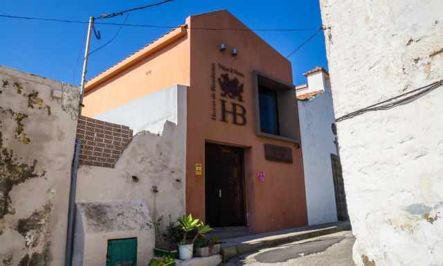
You can try such caldera wine in the “Bodega Hoyos de Bandama” next to the entrance of the volcanic crater. Opening hours are only from 12-3 pm from Thursday to Sunday.
My Top Accommodation Tip
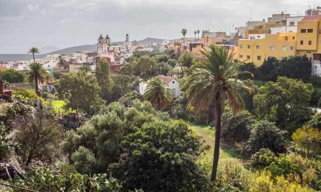
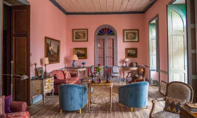
With its narrow alleys, the lovely town of Ingenio was the perfect place for our stay. Ingenio is rich in history and for those who seek serenity. We had probably chosen one of the best B&Bs ever. It is run by a Dutch couple, Arold and Alienka, who walk the extra mile for their guests.
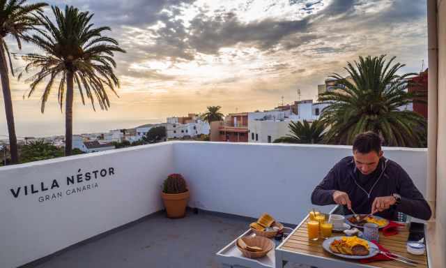
He was a chef in a restaurant before, and so is the breakfast, excellent and delicious served on the rooftop terrace, perfect for a good start.
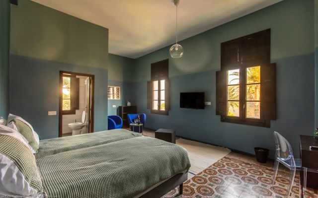
The spacious rooms in Villa Nestor are wonderful for relaxing with an incredible view of the small and quiet town of Ingenio. If you prefer a more personal stay in an old, charming but newly renovated house, this is the best place for your vacation. Alienka has many stories to tell about each room. Ours was a dancehall in former times, and it was like I could feel the good vibes.
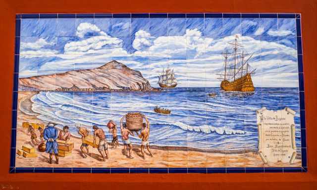
In the 15th century, sugar cane was harvested here. Mineral deposits from South America were reloaded. This painting tells the story of the cruel conditions the slaves and Canarians had to bear.
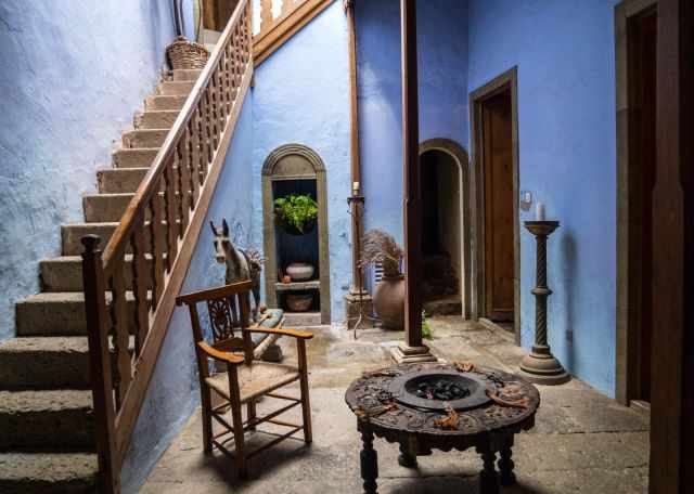
I was fortunate to visit the house of Christophe Gollut in Ingenio, which is usually not open to the public. Actually, these are three houses in one, bought and designed by Christophe 40 years ago.
Movies and photo-shootings were held here in former times.
These are my recommended tours via GetYourGuide with an excellent cancellation policy. Thx for booking via my website! With your support, I am able to provide all the information first-hand. Tour prices are at no extra cost!
Best Months to Visit
Location and Tips

Caldera de Bandama is protected as a National Monument, and the evidence for the last eruptions by active volcanoes was already 2000 years ago. It is located between the municipalities of Telde, Santa Brigida, and Las Palmas.
Do you want to obtain the usage right for my images? Contact me, but I will take action against picture theft.


