
When Is the Best Time
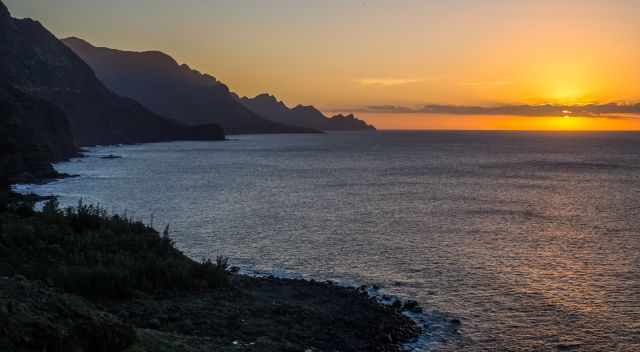
Watching the sunset is always a memorable experience. Gran Canaria has some world-class spots for breathtaking sunsets in a beautiful landscape. Gran Canaria is a fantastic destination throughout the year, though summer and Christmas are the busiest and most expensive times.
Soak in the beauty of this outstanding island and the colourful masterpieces at my five favourite sunset places in Gran Canaria.
2 Tips for Watching the Sunset
- Try to arrive at least 20 minutes better, half an hour before sunset, to find parking and the best spot for watching the breathtaking sunset. Don’t leave too early after sundown; watch the changing sky, twilight, and even more intense colours.
- We always stay roughly 20 minutes longer to enjoy the jaw-dropping twilight scenery. Sunrise sunset times Gran Canaria
5 Best Sunset Spots
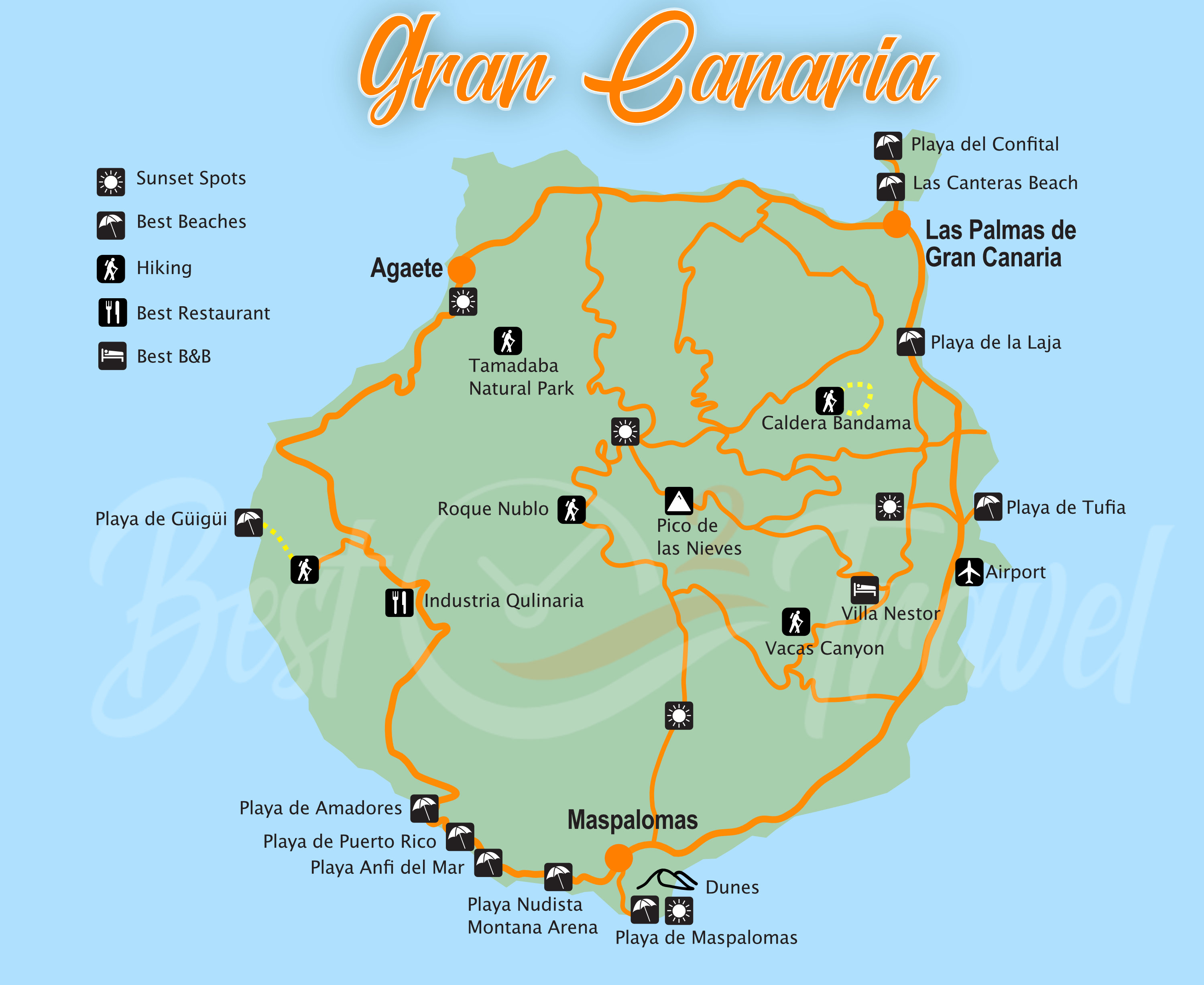
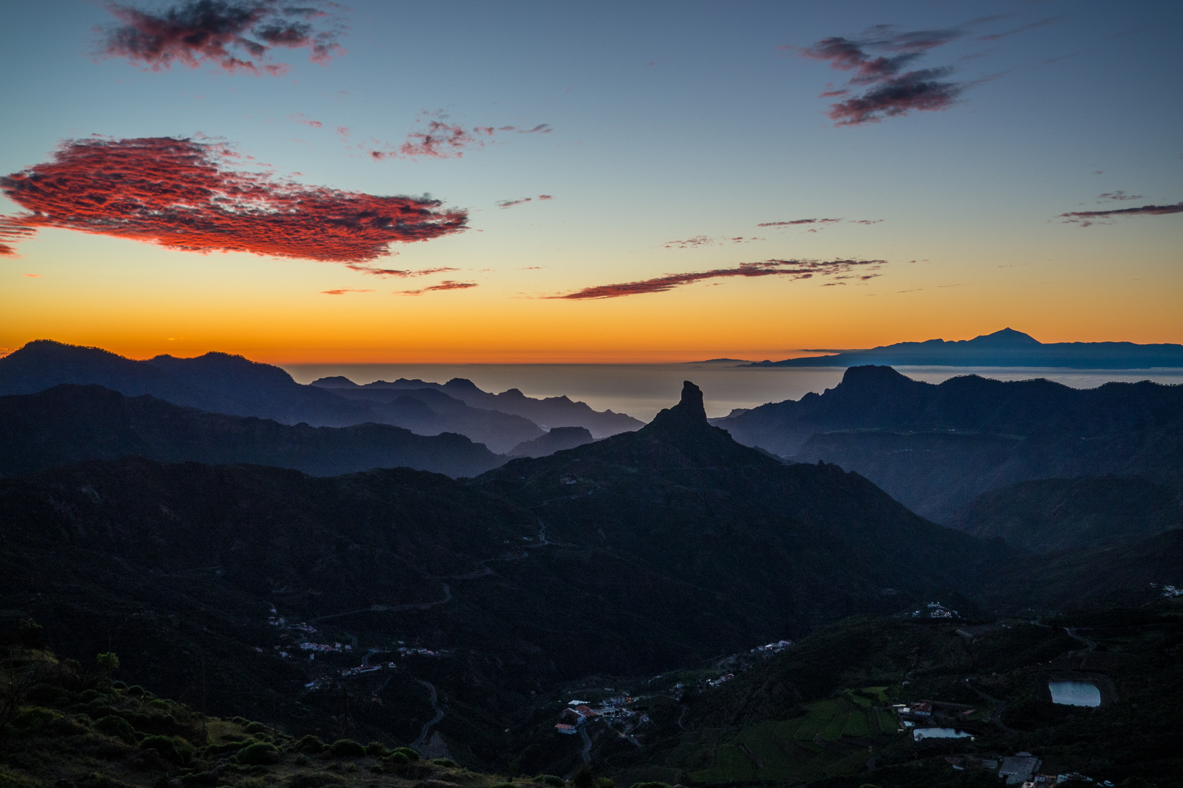
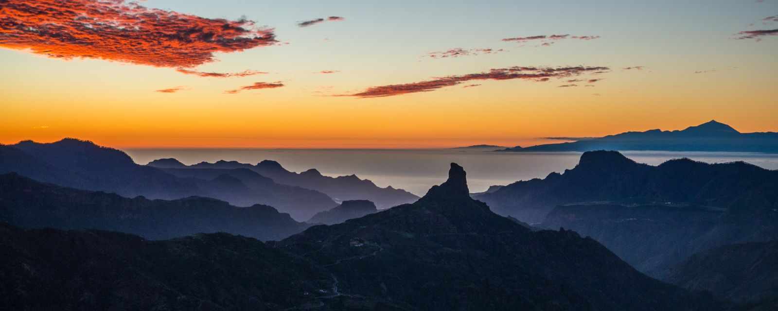
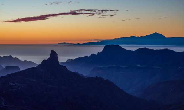
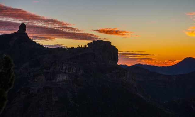
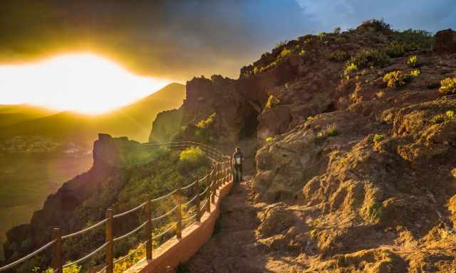
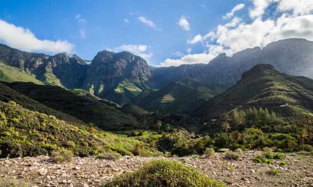
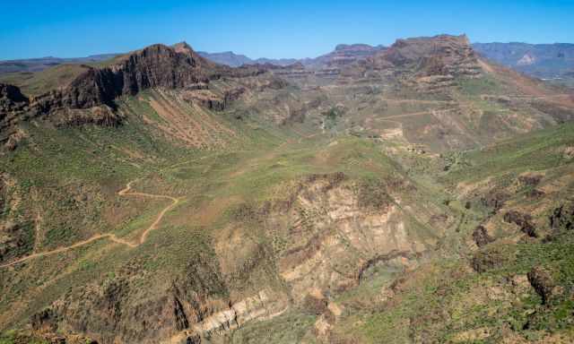
1 Mirador de Degollada Becerra - Centre Google Maps
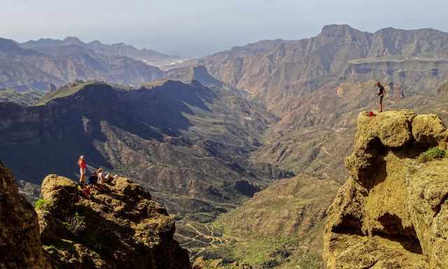
Watching the sunset from high elevation to the mountains until Tenerife and Teide was my favourite place of all. The are several outlooks – mirador – for this spectacular experience like Mirador Cruz de Tejeda.
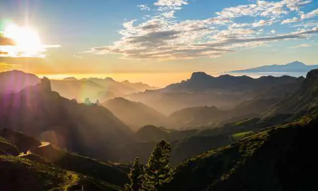
They all have limited parking only, therefore, arrive at least half an hour before. The viewpoint Mirador de Degollada Becerra is located at a high elevation of 1.500 meters above sea level. Bring a warm jacket or fleece pullover also long trousers.
Temperatures drop significantly when the sun sets. If you can't visit this viewpoint for the sunset, then make a stop here during the day. Soak in this majestic landscape the best mirador - the best lookout of all in Gran Canaria.
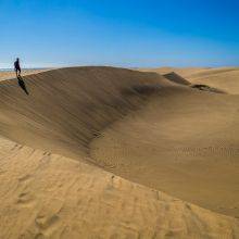
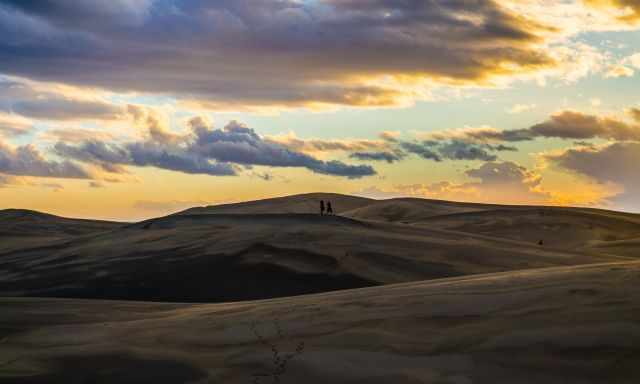
2 Maspalomas Dunes - South Google Maps
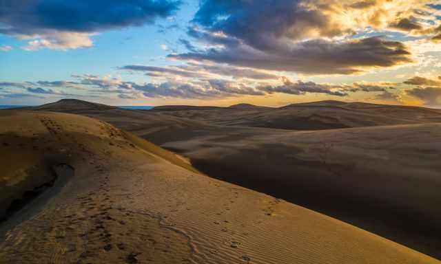
The dunes are one of the must-sees, and explore sights with a desert vibe you won’t expect on the Canary Islands. The Maspalomas Dunes are exceptional throughout the day and famous for memorable sunsets.
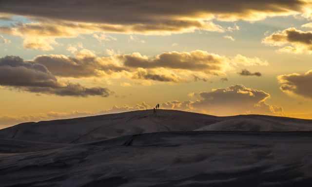
Parking can be an issue in the evening, so arrive earlier and hike through the dunes before. The dunes are famous for watching the sunset; however, if you don't mind walking, you may find beautiful places for your own. I
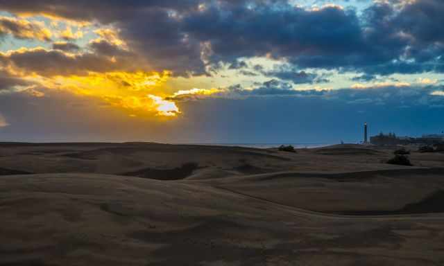
It is frequently windy here, so bring a jacket for watching the sunset. If you wish to know more about the unique dunes, read my complete Maspalomas Dunes Guide.
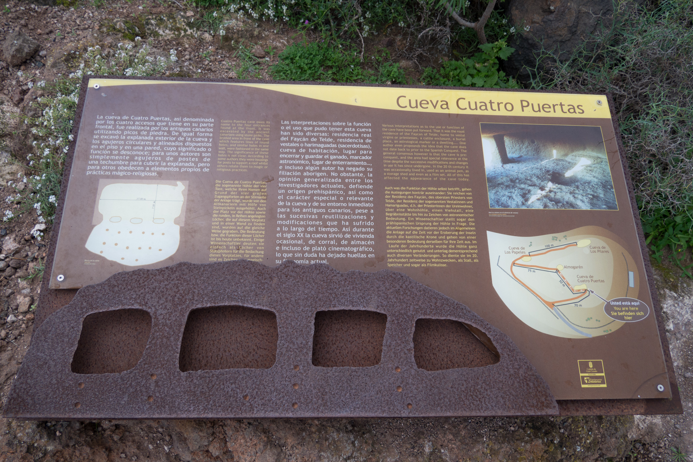
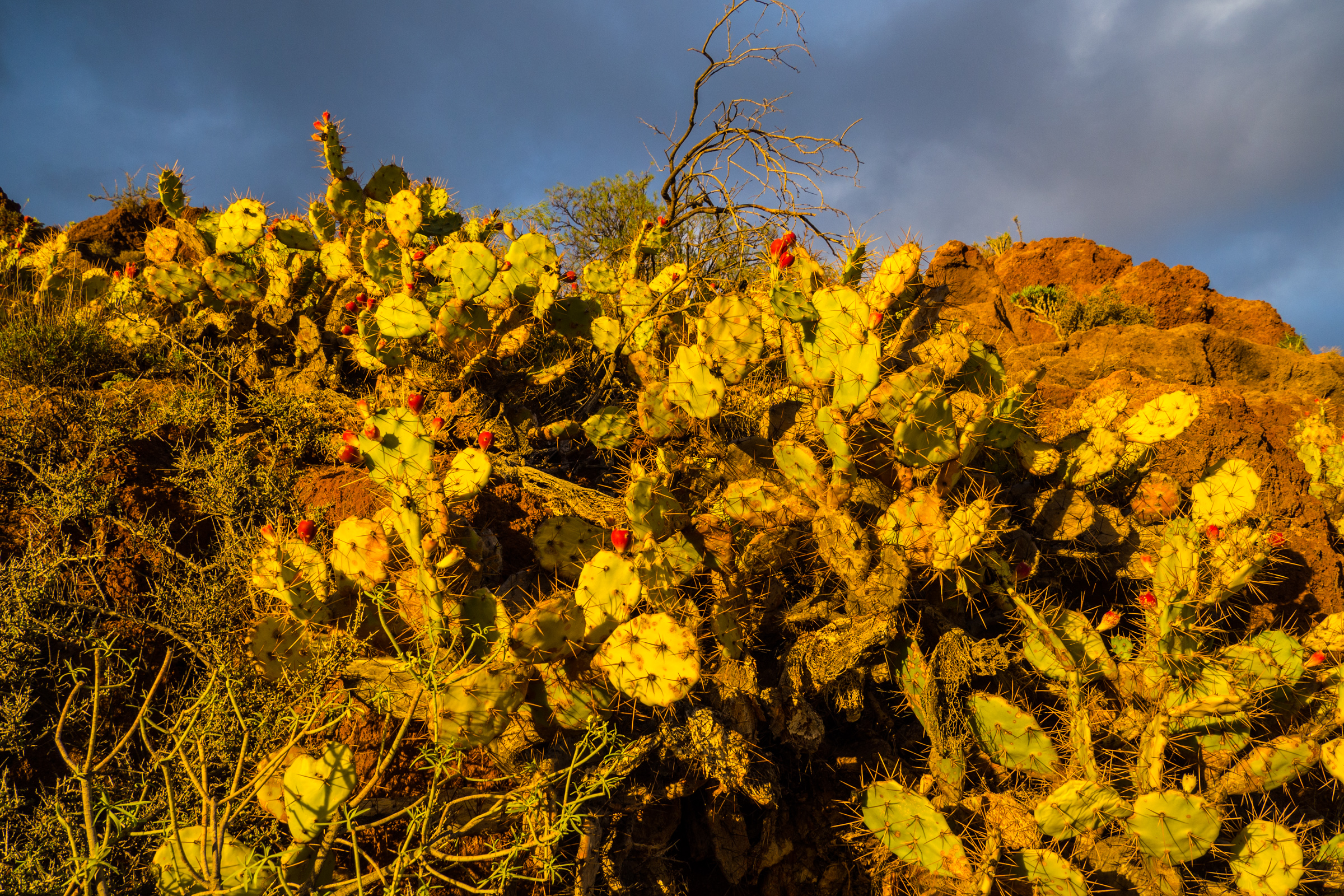
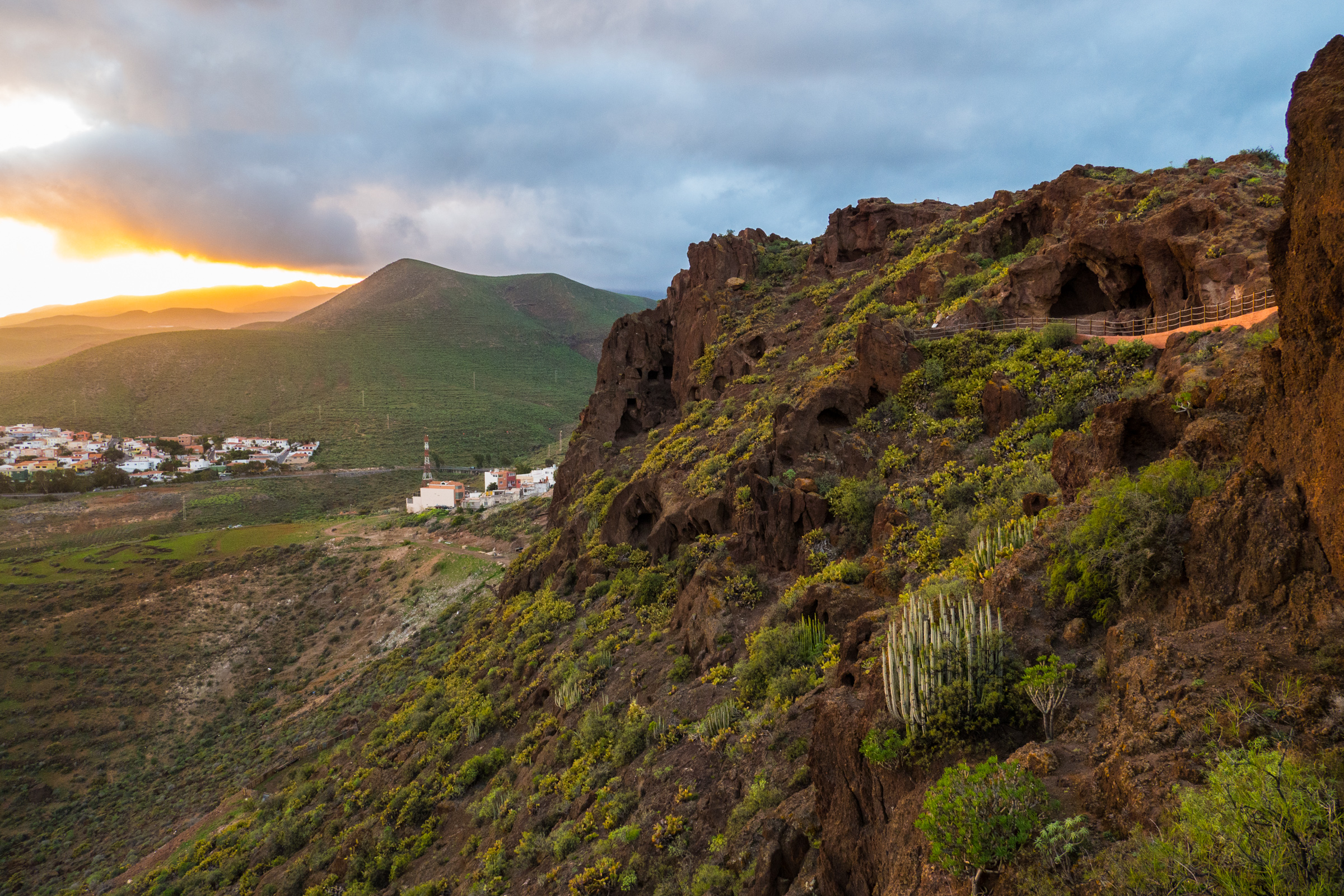
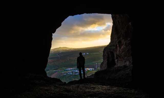
3 Cueva de Cuatro Puertas - East Google Maps
Do you wish to watch a more secluded sunset with fewer people? Sitting on a rock in thrilling scenery and enjoying a sundowner? Then the caves "Cueva de Cuatro Puertas" in the east close to the airport may be your spot.
Although it is a short walk, only proper shoes are recommended for the rocky trail. The caves are exposed, and it is frequently windy here, and when the sun sets, it gets cold here.
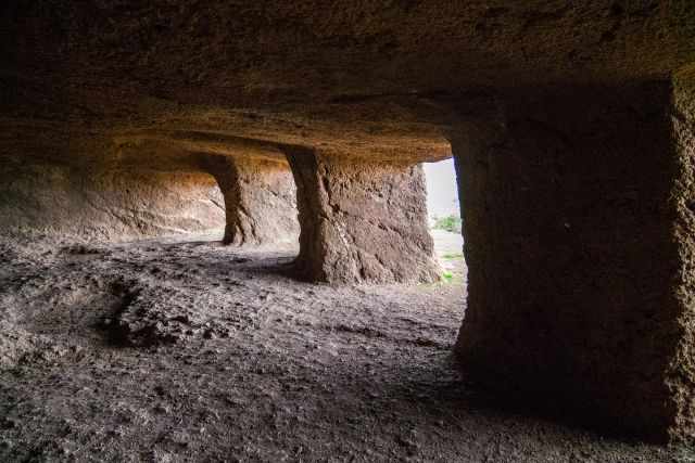
The caves are of archaeological importance, dug by the native Canarians more than 500 years ago. They are located on the Montana Bermeja, which means the reddish-brown hill, a cultural heritage site since 1972. These caves were housing areas, cattle sheds, and granaries. Cuevas de Cuatro Puertas means the caves of the four portals. It is presumed this cave, in particular, was a cattle shed.
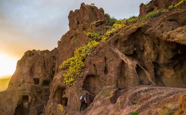
The bigger caves, the Cueva de Los Pilares - Cave of the Pillars, were housing areas. There are various interpretations for these caves, but one thing is certain: They are an exceptional place to escape the hustle and bustle and have an amazing sunset.
 |
The Gran Canaria Tour & Trail Super-Durable Map is the perfect companion for your next adventure. With a 50k scale, this map is designed to be the best in its class. It is water-proof and tear-proof, so you can simply wipe it clean with a damp cloth if it gets dirty. The map is backed up with a 2-year guarantee covering adventurous use. The 20 metre and 100 metre contours combined with altitude shading bring these impressive landscapes to life. All of the legendary Tour & Trail attention to detail is included so that you will find those petrol stations, mirador viewpoints with parking, refreshment stops with parking and accurate road numbering that are so essential when adventuring by hire car. |
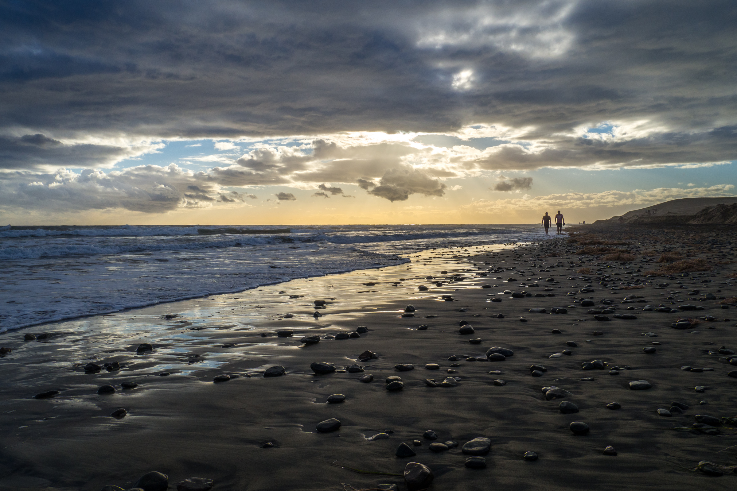
4 Playa de Guayedra - West Google Maps
It is a quiet and charming beach remotely located close to Agaete in the western part of Gran Canaria. Actually, it is more or less a nude beach. Due to the surf and the strong currents, I can't recommend swimming here. Lifeguards do not patrol the lovely beach.
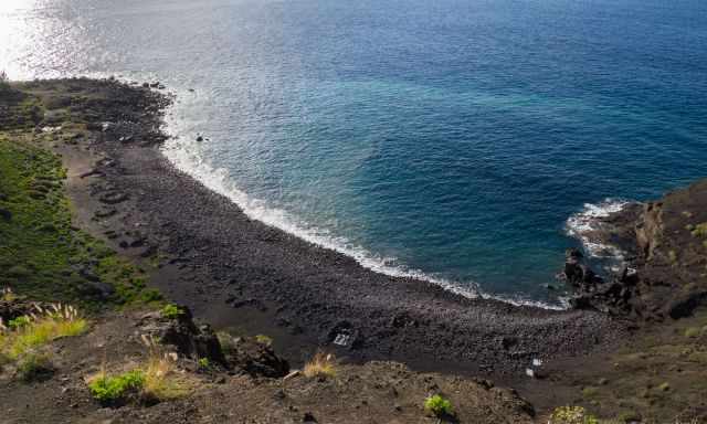
During low tide, a wonderful black sand beach appears. At high tide it more of a rocky beach but there are plenty of places to sit or lay down. Very limited parking and a 20 minutes - 1.2 km walk are required - Trailhead Google Maps . We parked our car at the road GC 200 shortly before Agaete Google Maps.
There is a closer parking just 5 minutes walk, but the road is slightly scary to get down with your rental car. There aren’t any facilities, no water or food available.
Take everything you need before you walk to the beach. We spent the afternoon at the beach and watched the sunset from the higher clifftop.
Towering mountains and cliffs offer jaw-dropping scenery at sunset, and best of all, we had the place for ourselves.
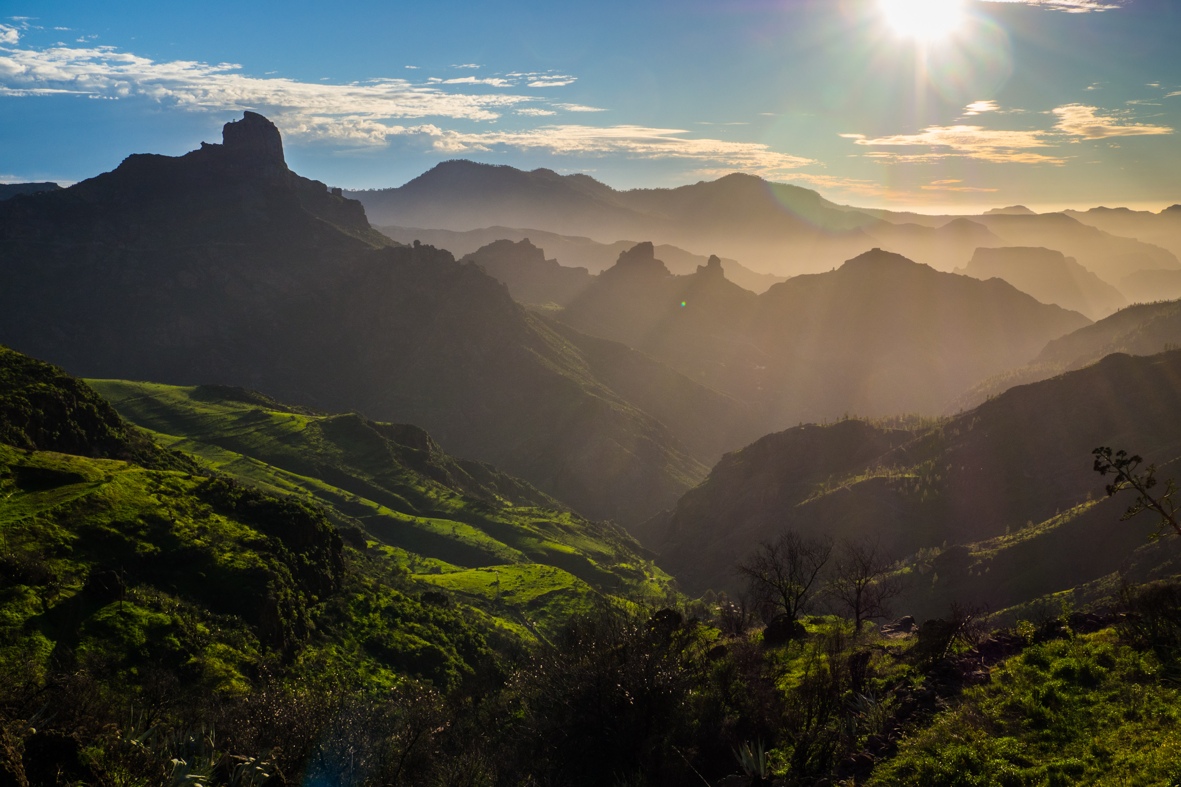
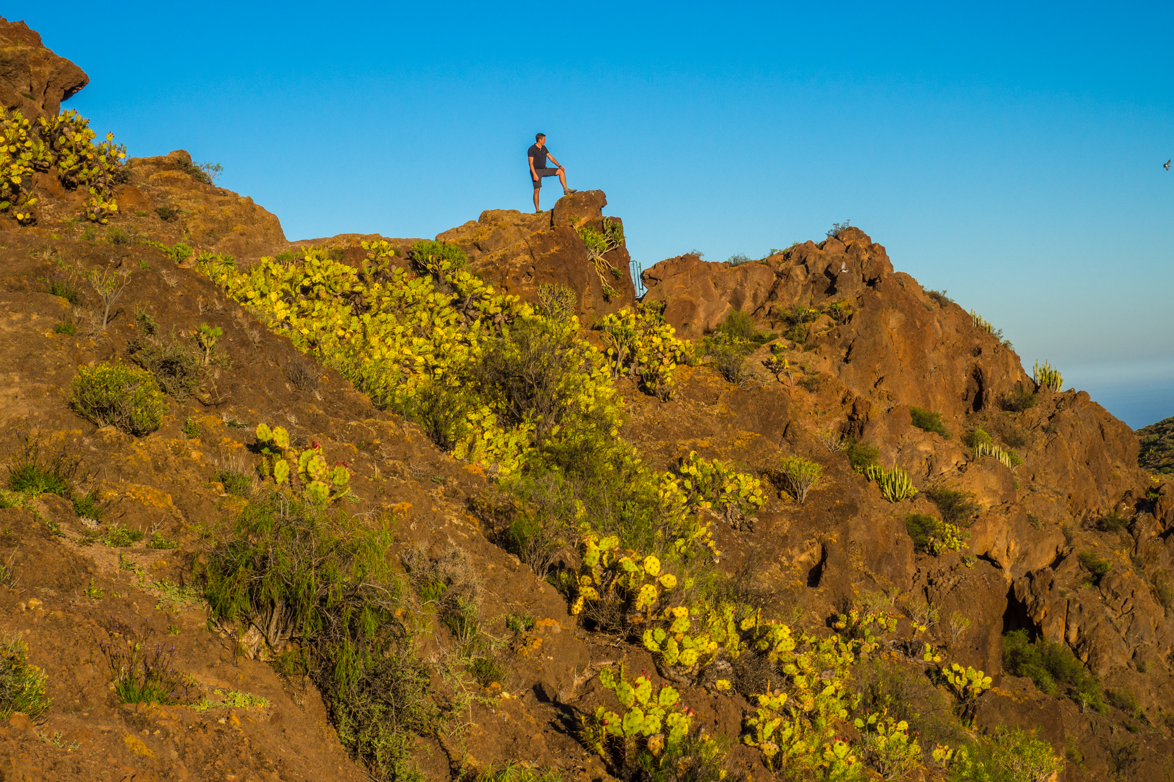
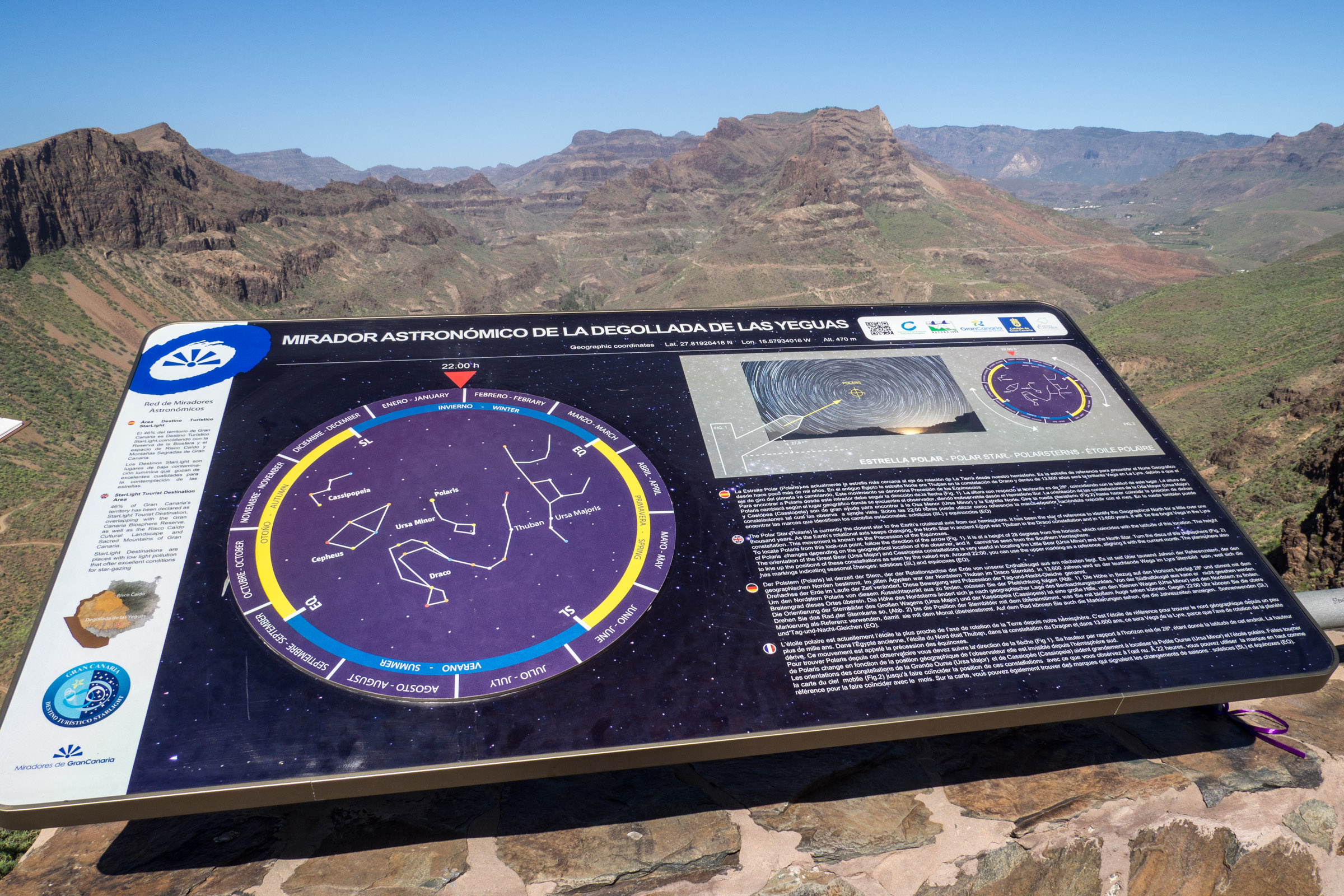
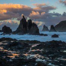
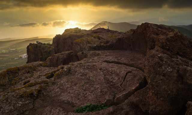
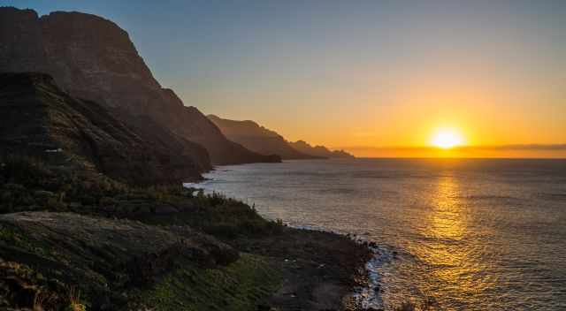
5 Mirador Astronómico de la Degollada de las Yeguas Google Maps
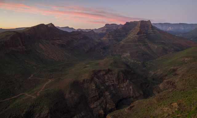
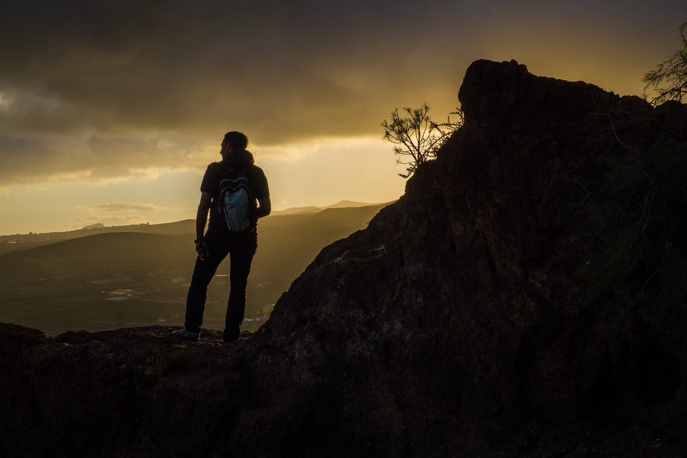
This lookout is just a 10 km drive north of Maspalomas on the GC 60. We stopped here completely by chance, coming from Roque Nublo. It was a one-hour drive - 30 km on narrow winding roads, and I became carsick. Rest was needed, and it was an excellent view on our drive back to our rental house on the coast.
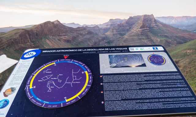
We were in awe of these magnificent views. Plan some time for this fascinating viewpoint and arrive before sunset. Read the introductions and details for stargazing in the night, watch the sunset, and then the outstanding night sky without light pollution. Try to find the polar star "Polaris", and you can easily find the Ursa Major and the Ursa Minor. It is all very well explained with information boards.
It is a semi-desert-like vegetation, and even in the winter, it is hot during the day. A hiking trail leads through the canyon "Barranco de Fataga," which you can see from the lookout and my sunset picture.
The most breathtaking sunset spots are spread around Gran Canaria. Of course, there are more places to watch the sunset. I like how the twilight and the landscape merge into a colourful piece of art.
If you wish to know the best time - the best beaches - and the best hikes, check out my additional articles.
My Top Accommodation Tip
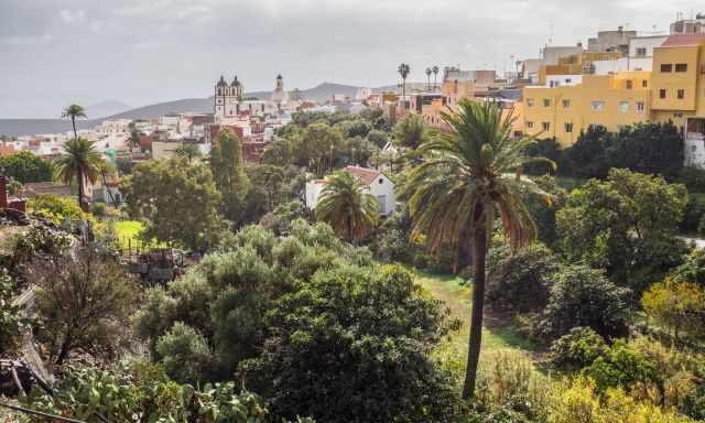
With its narrow alleys, the lovely town of Ingenio was the perfect place for our stay. Ingenio is rich in history and for those who seek serenity. We had probably chosen one of the best B&Bs ever. It is run by a Dutch couple, Arold and Alienka, who walk the extra mile for their guests.
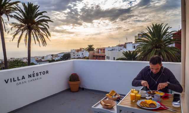
He was a chef in a restaurant before, and so is the breakfast, excellent and delicious served on the rooftop terrace, perfect for a good start.
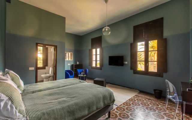
The spacious rooms in Villa Nestor are wonderful for relaxing with an incredible view of the small and quiet town of Ingenio. If you prefer a more personal stay in an old, charming but newly renovated house, this is the best place for your vacation. Alienka has many stories to tell about each room. Ours was a dancehall in former times, and it was like I could feel the good vibes.
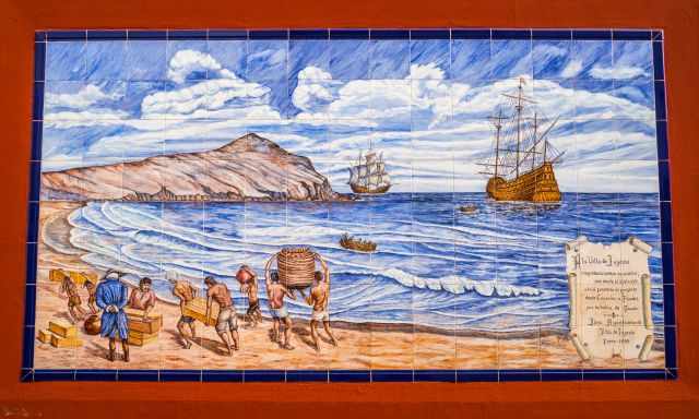
In the 15th century, sugar cane was harvested here. Mineral deposits from South America were reloaded. This painting tells the story of the cruel conditions the slaves and Canarians had to bear.
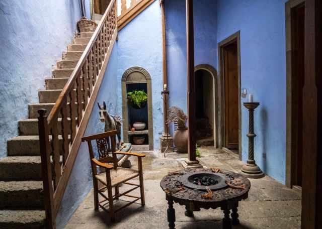
I was fortunate to visit the house of Christophe Gollut in Ingenio, which is usually not open to the public. Actually, these are three houses in one, bought and designed by Christophe 40 years ago.

Movies and photo-shootings were held here in former times.
A Hiking Paradise with Diverse Landscapes
 |
If you are looking for a sunny and beachy destination that also offers a variety of hiking trails, look no further than Gran Canary. This island is a miniature continent with stunning scenery, from dunes and valleys to cliffs and volcanoes. You can explore the ancient paths that connect the mountain villages with the coast, or challenge yourself with some dramatic walks on the high ridges and rock formations. This guide will provide you with 50 detailed and well-mapped tours for all levels of hikers, as well as colourful photos and useful information. Don't miss this opportunity to discover the hidden gems of Gran Canary! |
Hotel Recommendation in the Heart of Gran Canaria
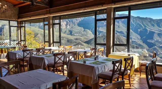
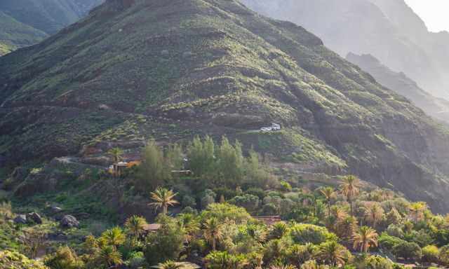
We spent an entire month in the south close to the sea. My brother instead had chosen a hotel in the heart of Gran Canaria. He mentioned it was perfect for watching outstanding sunrises and sunsets and also in proximity to Roque Nublo and Pico de la Nieves. Some of the best hiking trails of Gran Canaria are situated here. Hotels in San Bartolomé de Tirajana via booking.com
I recommend staying a couple of days in the heart of Gran Canaria and the rest of the time at the sea which is time-saving. It is at least an hour drive on narrow winding roads to get to the mountainous area.
Best Months to Visit
Location and Tips

Gran Canaria is located southeast of Tenerife, the third biggest Canary Island after Tenerife and Fuerteventura.
Gran Canaria is famous for its outstanding white sandy beaches in the south and a pleasant climate even in the winter. We spent an entire month on Gran Canaria and fell in love with the island and the sunsets.
These are my recommended tours via GetYourGuide with a great cancellation policy. Thx for booking via my website! With your support, I am able to provide all the information first-hand. Tour prices are at no extra cost!
Do you want to obtain the usage right for my images? Contact me, but I will take action against picture theft.