
When Is the Best Time
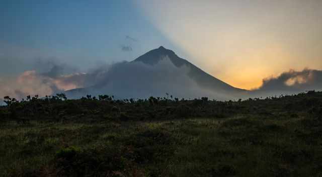
Hiking to the summit of Pico, the highest mountain in Portugal with 2351 m/ 7713 feet, was on top of our bucket list for the Azores. Our wish was to climb in good weather. We spent eight days in Pico. We monitored the weather forecast for the best possible weather for this once-in-a-lifetime hike to the top of this volcano. Weather Forecast Pico Summit
To climb Pico, you have to apply for a permit. It is a popular climb throughout the year. The number of hikers is limited to 120 daily. You can either book your permit online, which I recommend or ask for availability in the mountain hut for your desired day. Before you follow the link to apply for the permit, read all my tips to master this challenging hike and the different prices for three different levels! Permit Reservation Online (Before you follow the link, check out my 13 tips to pack your backpack and my Table of Contents below!)
The best time to hike Pico regarding crowds and weather is May, June, late September, or early October. July and August are great for hiking, but it is pretty busy, and reservations have to be made in advance.
From the beginning of May until the end of September, you can hike to the peak 24 hours a day. Many hikers start in the middle of the night in pitch darkness to watch the famous sunrise from the top of Pico.
My Tip: Start in the early afternoon, watch the sunset, camp in the crater, and watch the sunrise, too. This is a far better experience. There are 32 spaces available for camping. Don’t expect any facilities up there; therefore, please carry all your trash back. Be prepared if you wish to do so. It is cold and windy up there at night. Guided tours are offered, providing all the needed equipment. The camping fee is 10 €
Here is my Table of Contents, and don't miss out on my 13 tips and packing list to master this track.
Opening Hours Pico Hike and Mountain Hut
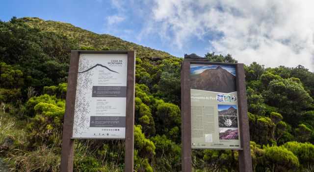
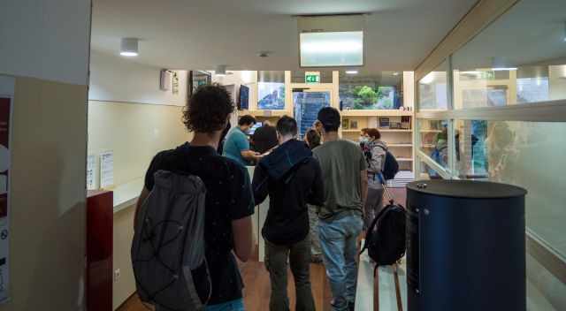
Before you start hiking, it is mandatory to register in the mountain hut. The guys in the house are amazing and attentive, providing all essential information. Only in very poor weather conditions, and on December 24, the hut is closed. The Nature Park employees let you start the hike if you have seven hours of daylight available. This is the estimated duration of the trek to the summit and back.
- Main Season: 1. May until 30. September open 24 hours daily
- Shoulder Season: April and October open from 8 am to 8 pm
- Low Season in the winter: 8 am to 6 pm
Don't miss out on:
- all my Azores Islands Guides
- and our Ultimate Azores Guide - 19 Must-Visit Places on YouTube
We are real travellers; we took all these pictures and footage. I provide honest content from our own experience, not generated by AI!
Is Pico Volcano Active?
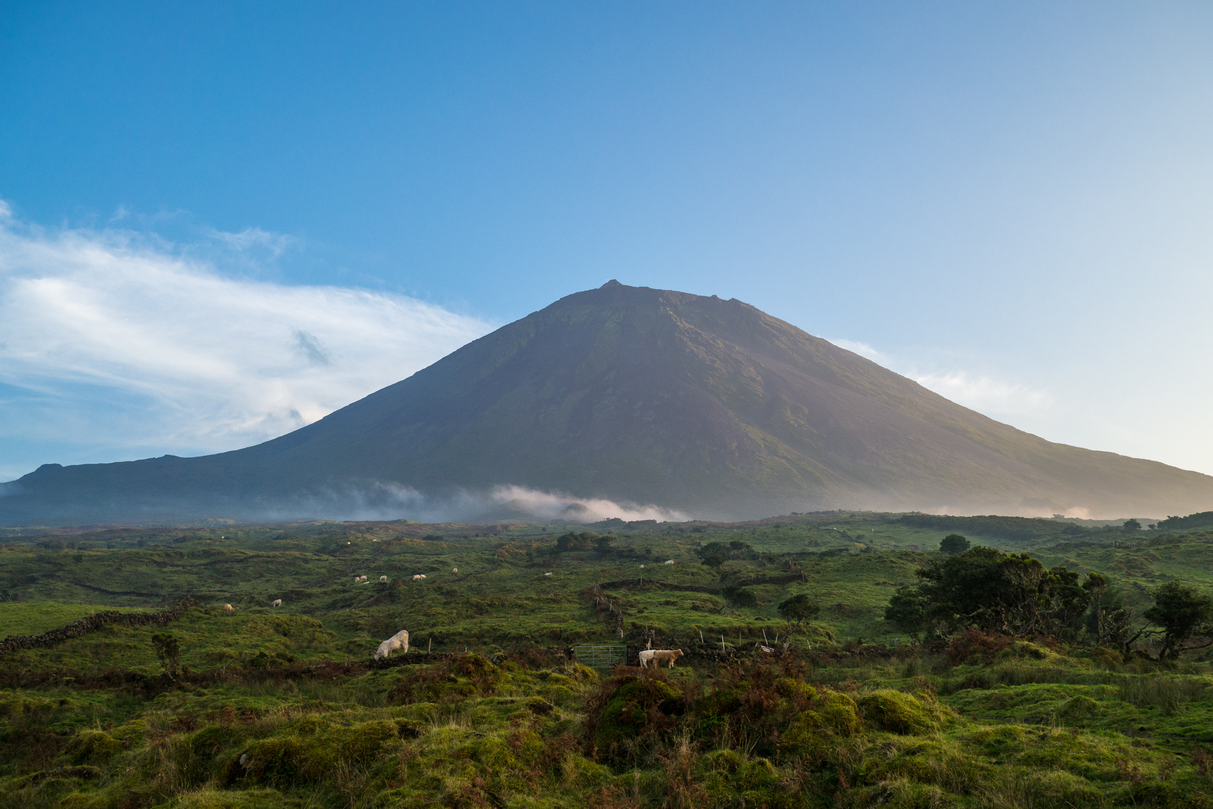
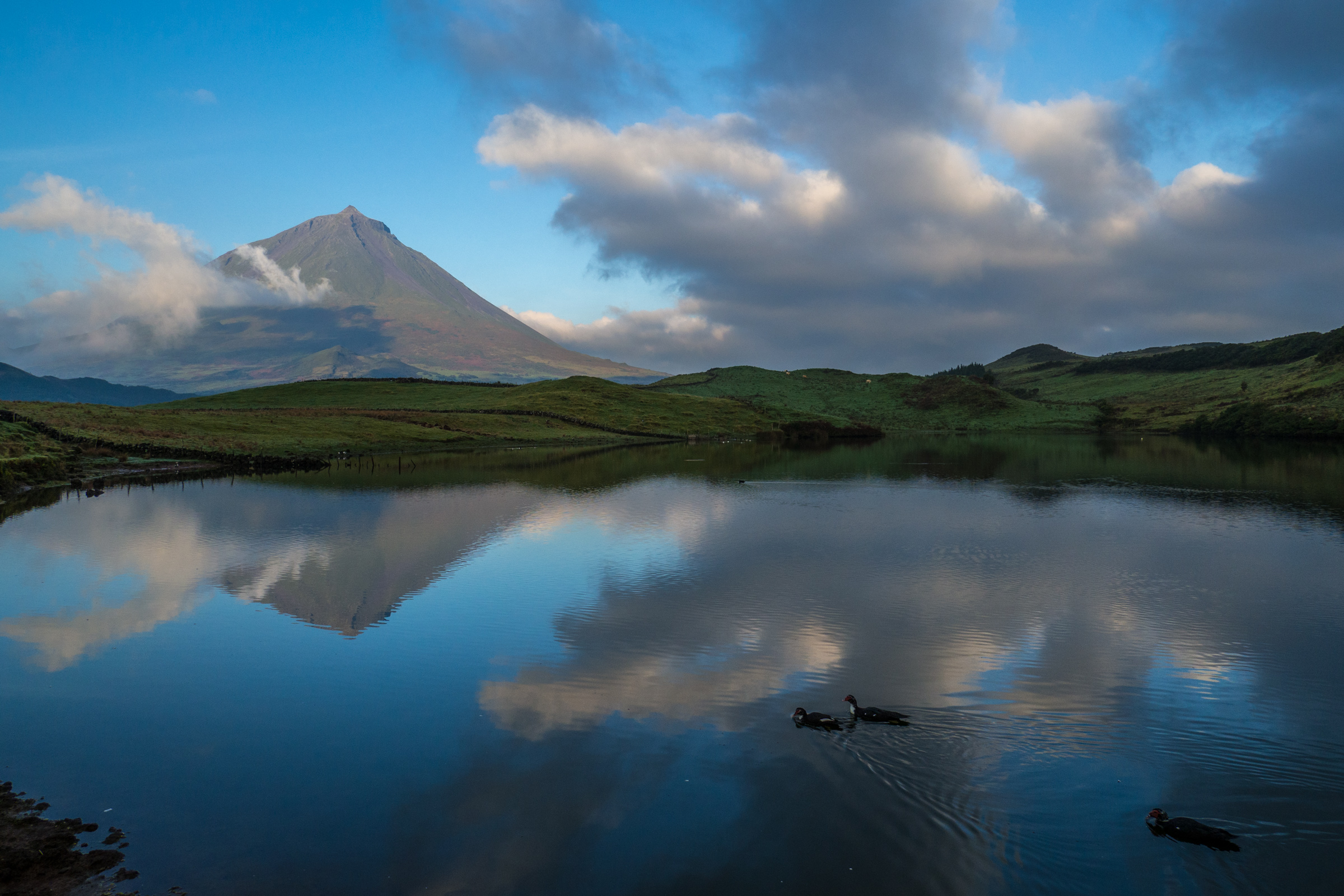
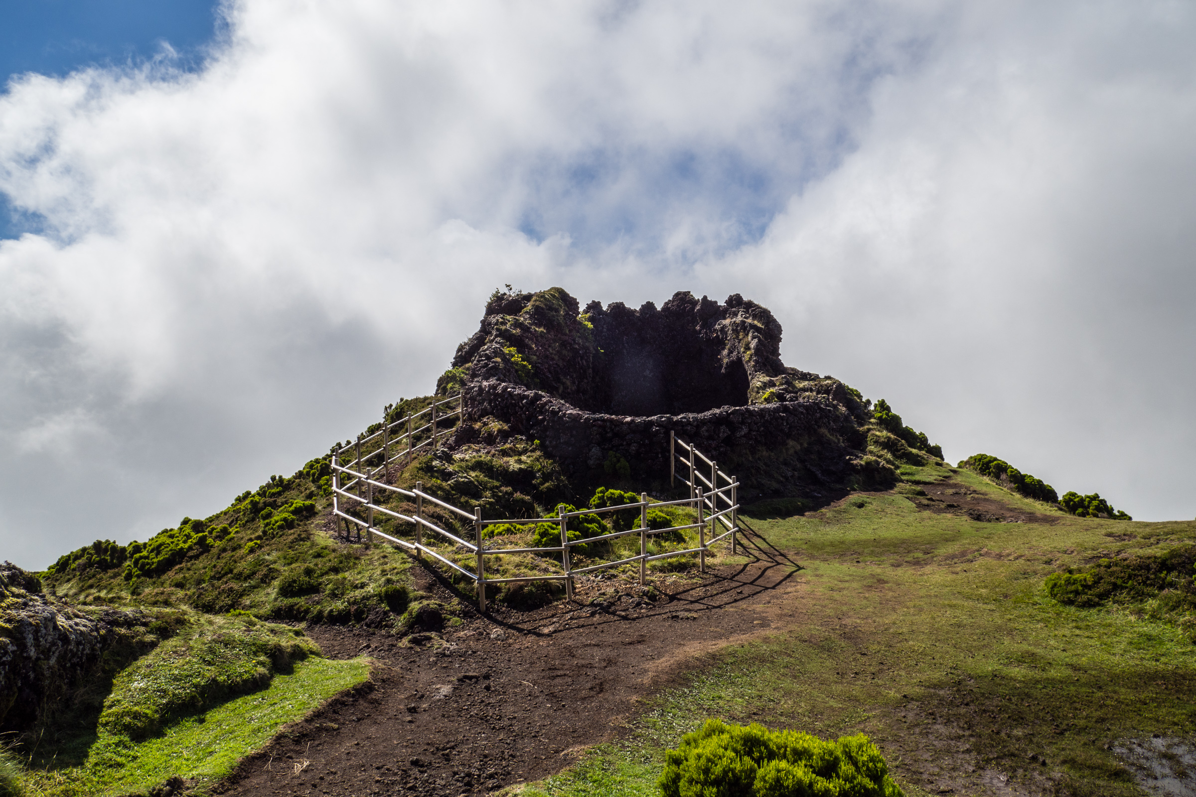
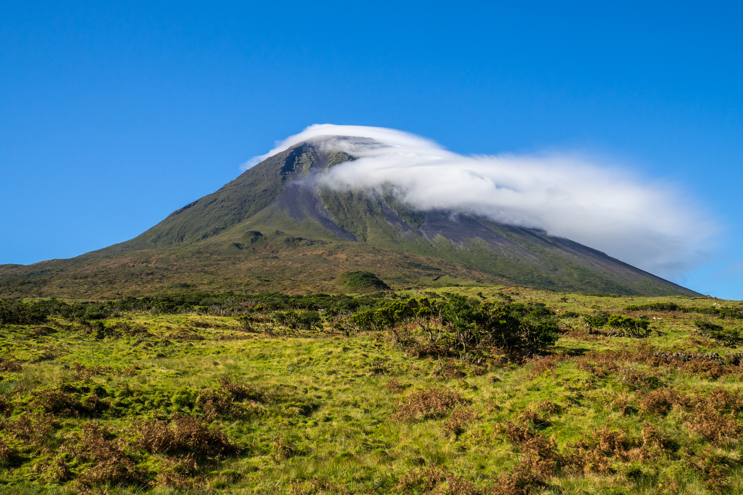
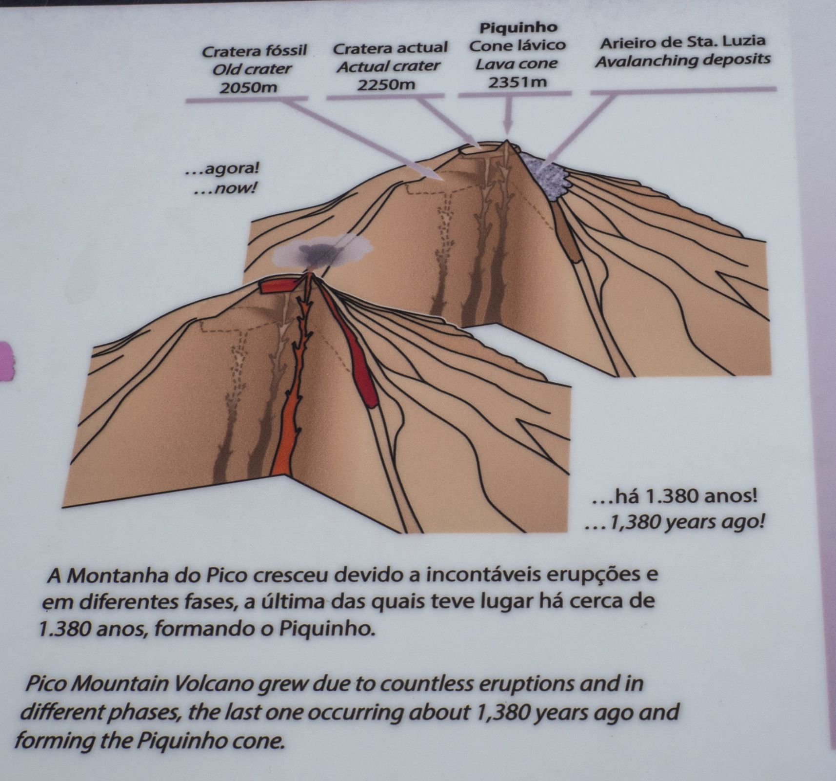
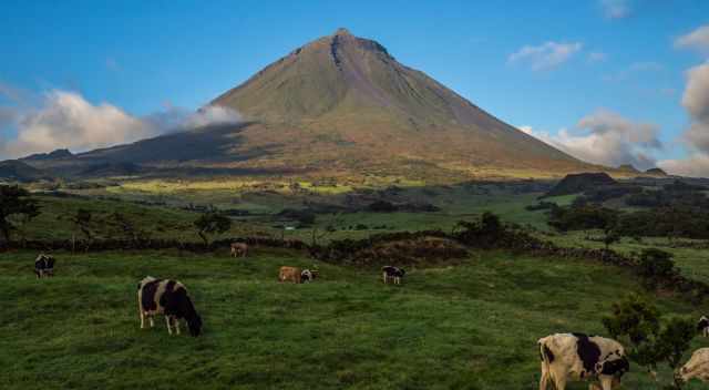
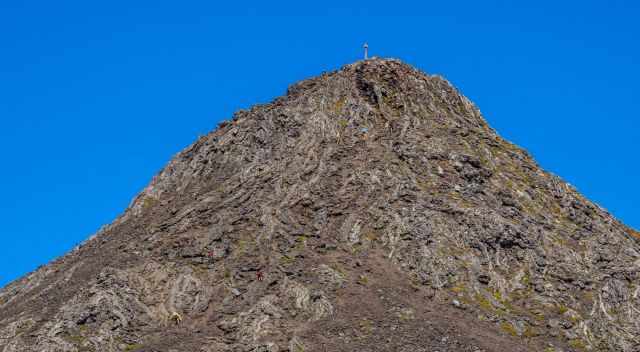
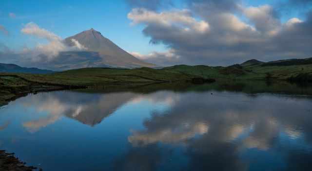
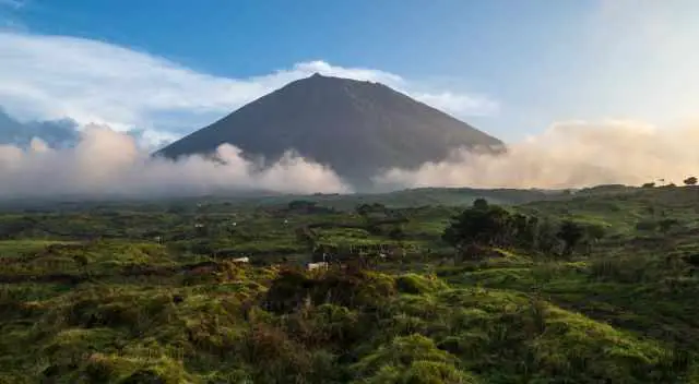
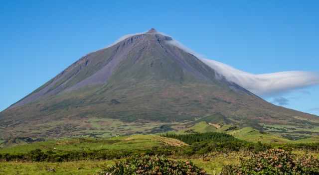
No. Pico Mountain is a dormant stratovolcano. This means the volcano is inactive, but likely, Pico will erupt again. The last eruptions were in 1718 and 1720. Pico is 2351 m high above sea level and even 3500 m from the seabed. Countless eruptions let the volcano grow, estimated 240.000 years ago, in three phases. In the end, the “Piquinho Cone” was formed.
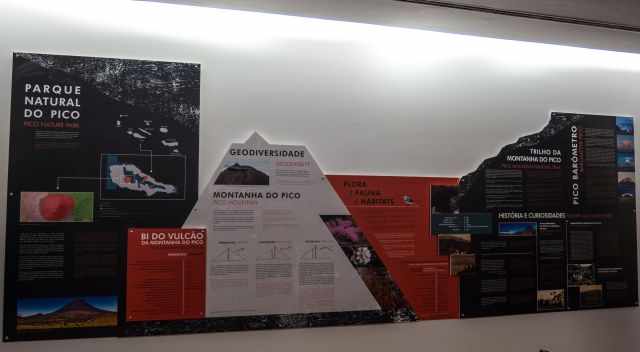
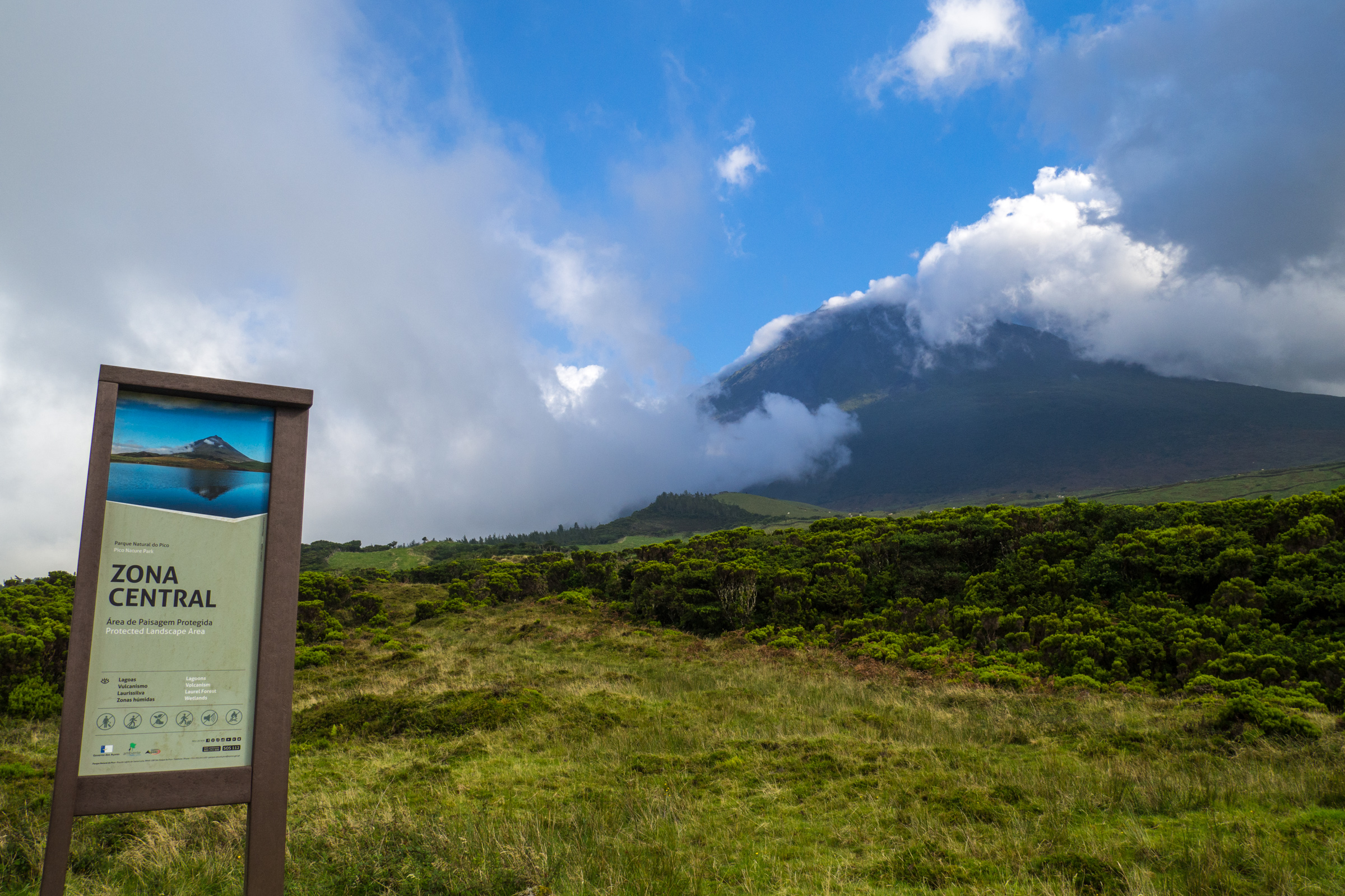
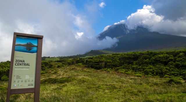
Mount Pico is located in the Pico Nature Park, the largest park in the Azores. About 35% of the entire Pico Island has been a protected zone since 1972. The volcano is the third highest in the Atlantic Ocean. The highest is Teide (3.718 m) in Tenerife, and Fogo (2.829 m) is the second in Cape Verde.
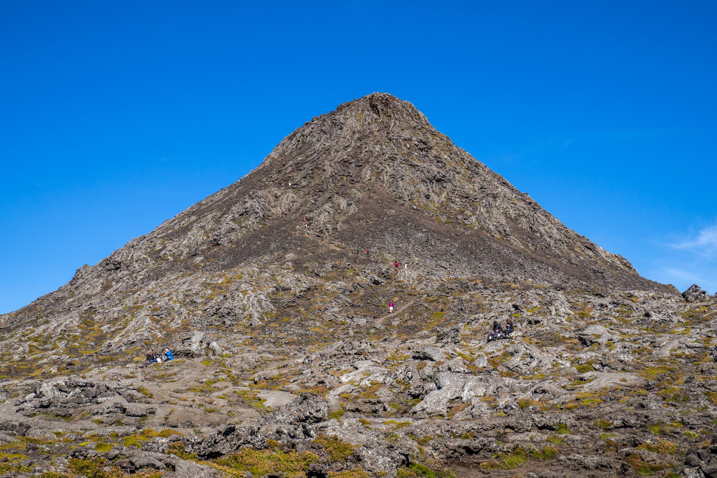
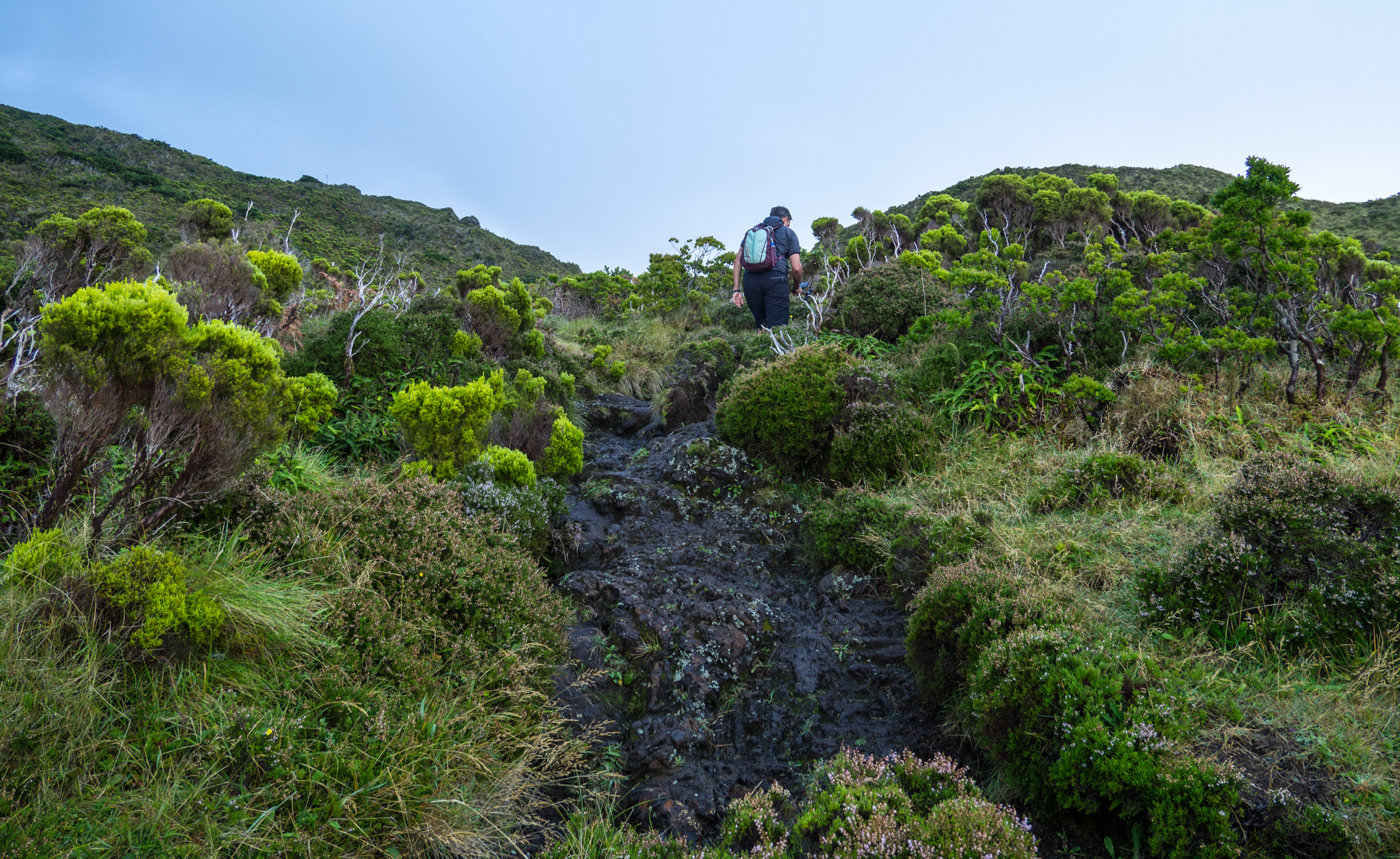
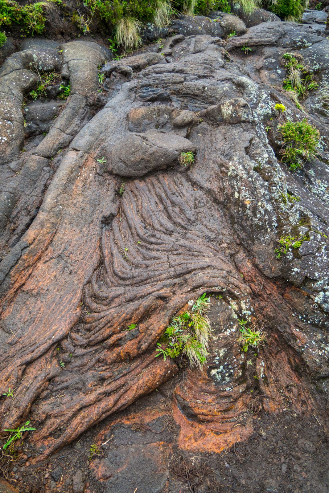
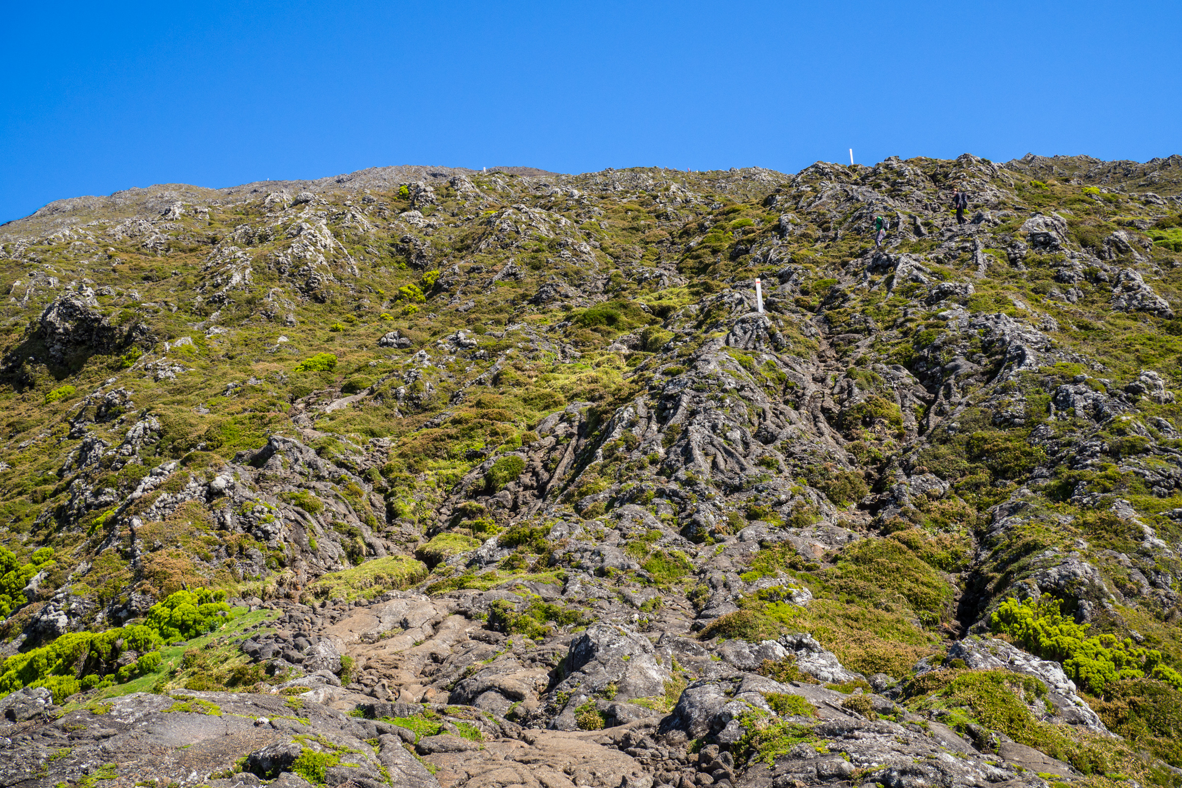
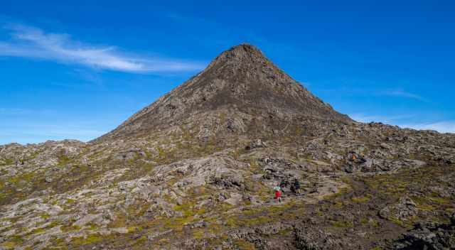
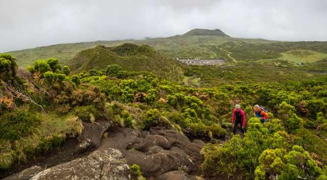
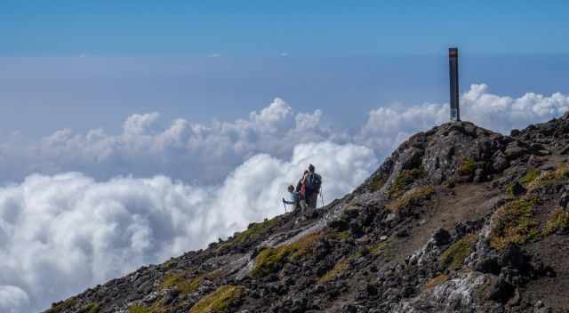
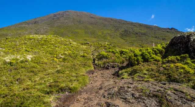
The hiking trail, although the climb is a much better description, is 7.6 km/ 4.75 miles long and takes 6-8 hours, depending on your fitness level. There isn’t any real hiking path. You follow the 47 makers to get to the summit of Pico. It is more climbing up with hands and feet instead of hiking.
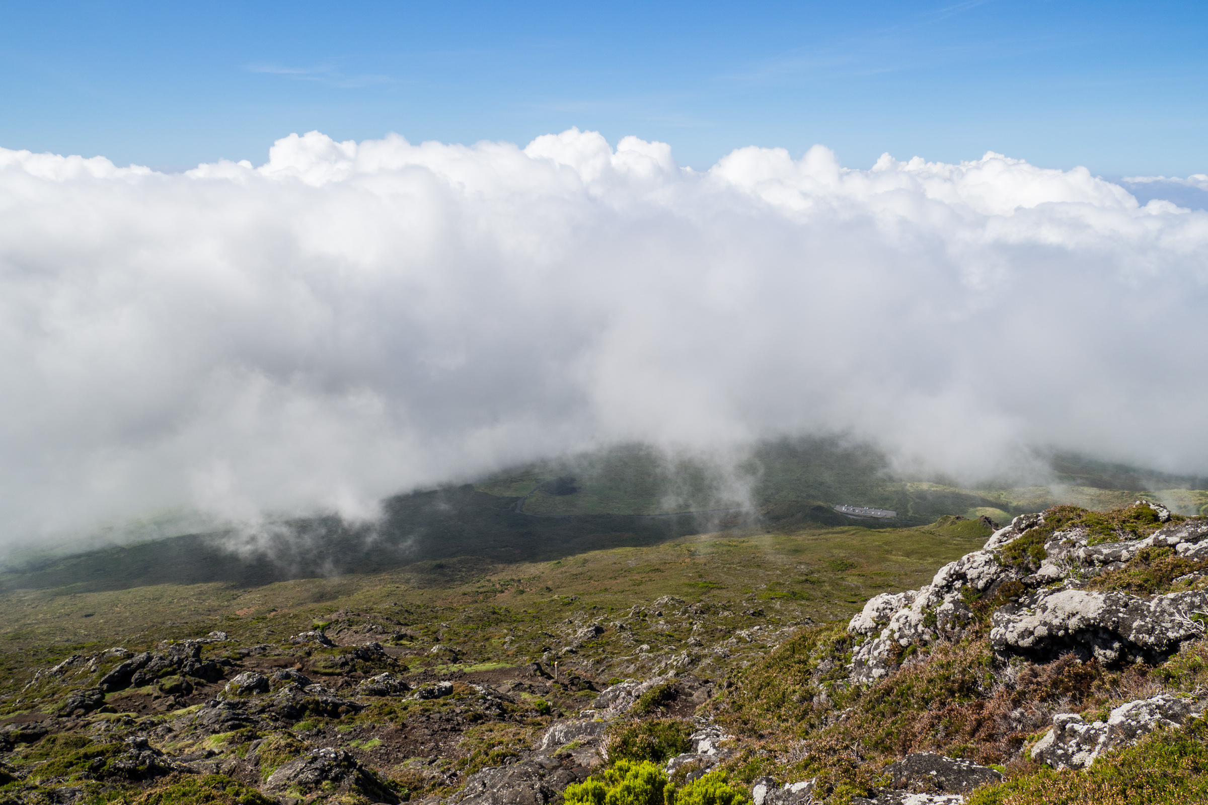
During fog and rain, which frequently occur, it isn't easy to spot the markers. The mountain hut is located at 1.230 m elevation, the crater is 2.250 m high, and the cone is 2.351 m. Due to an elevation gain of 1.121 m, the entire trail is steep.
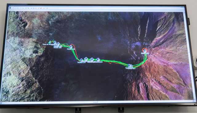
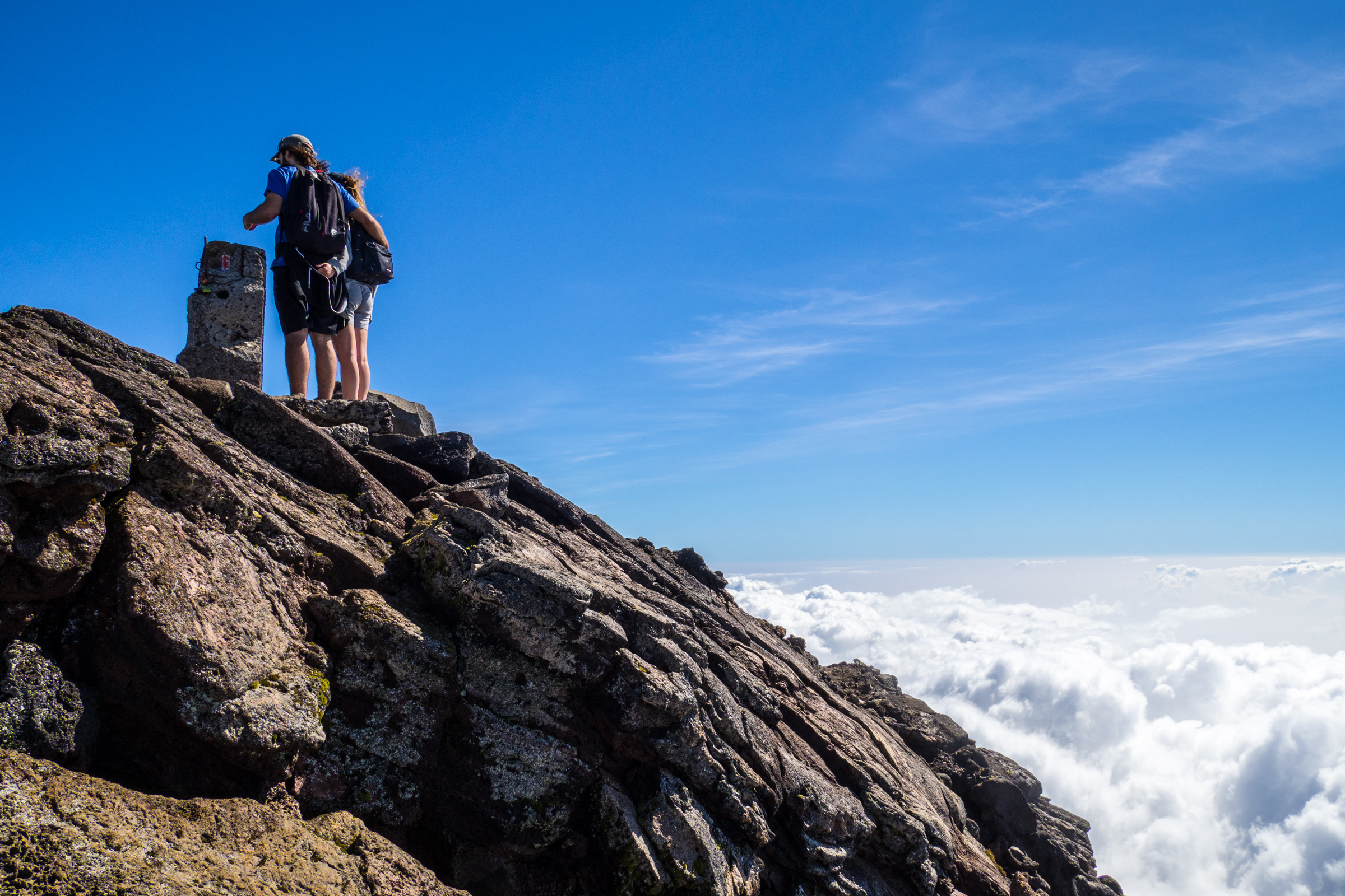
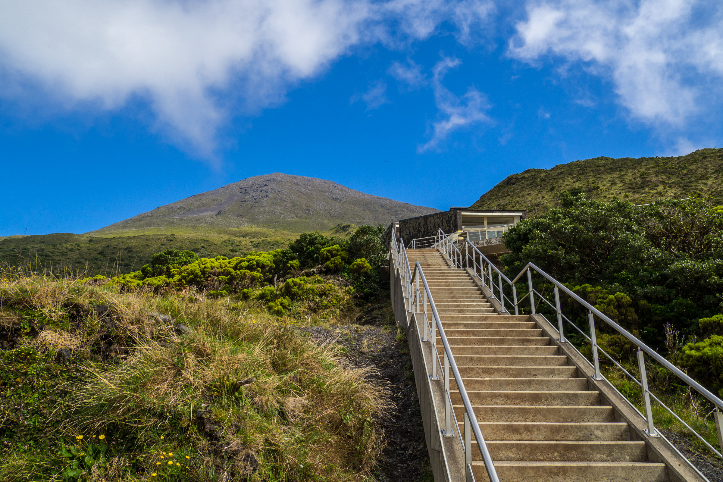
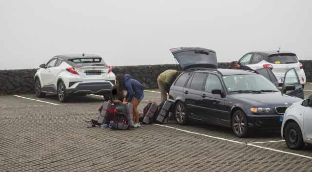
There is a huge parking lot in front of the mountain hut. The procedure is quickly done. The guys at the hut are super attentive and efficient in letting you go on this bucket list hike. After showing your online booking, you get a GPS tracker provided. They monitor all hikers throughout the day. It is mandatory to carry it safely in your bag. In any case of an emergency, you can contact them. A rescue is included in the permit fee.
Permit Fee Pico
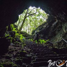
- Hiking until marker 2 to the cave is 5 Euro, no advanced booking is necessary - hiking duration is one-way maximum of half an hour.
- Climbing until the caldera of Pico to markers 45 and 46, the fee is 15 Euro. The climbing duration one way is 2.5-3.5 hours.
- Climbing to the summit, the cone from marker 47, the fee is 25 Euro. The climbing duration for this additional part is 15 minutes. It looks more difficult than it is.
Hiking Trail Details
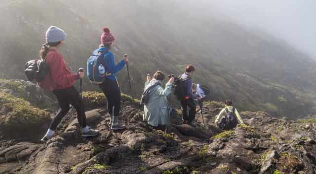
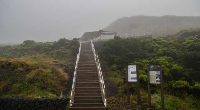
A staircase leads to the hiking path when you leave the mountain hut. The first part of the hike until the cave and marker two is easy to identify. From now on, the markers are closer because there isn’t any indicated path. Look how it best suits you to climb and hike to the next marker in front of you. It is a rugged and exposed path walking on loose volcanic rocks. Hiking this dark trail to watch the sunrise from the top is challenging, and a powerful torch is essential.
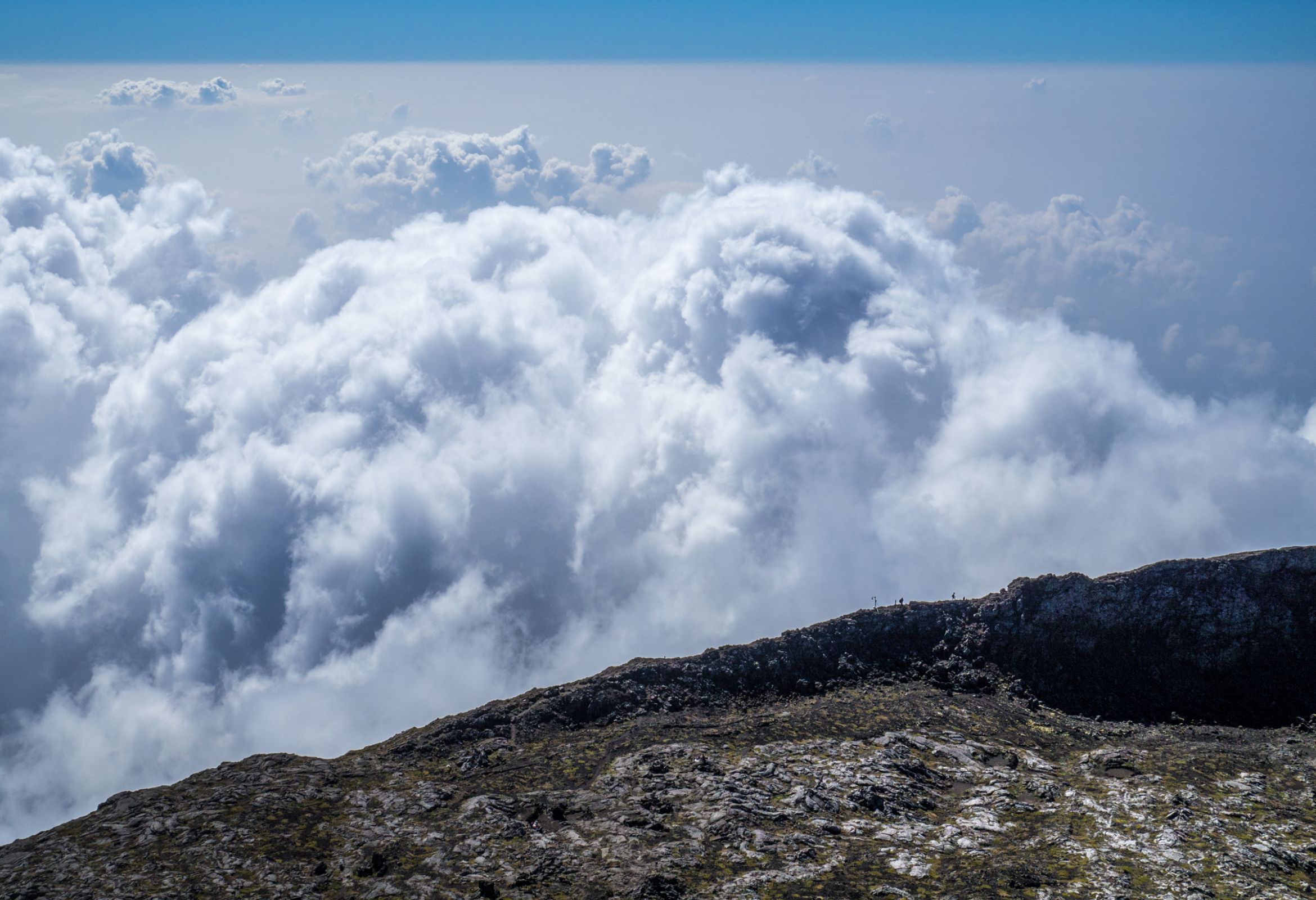
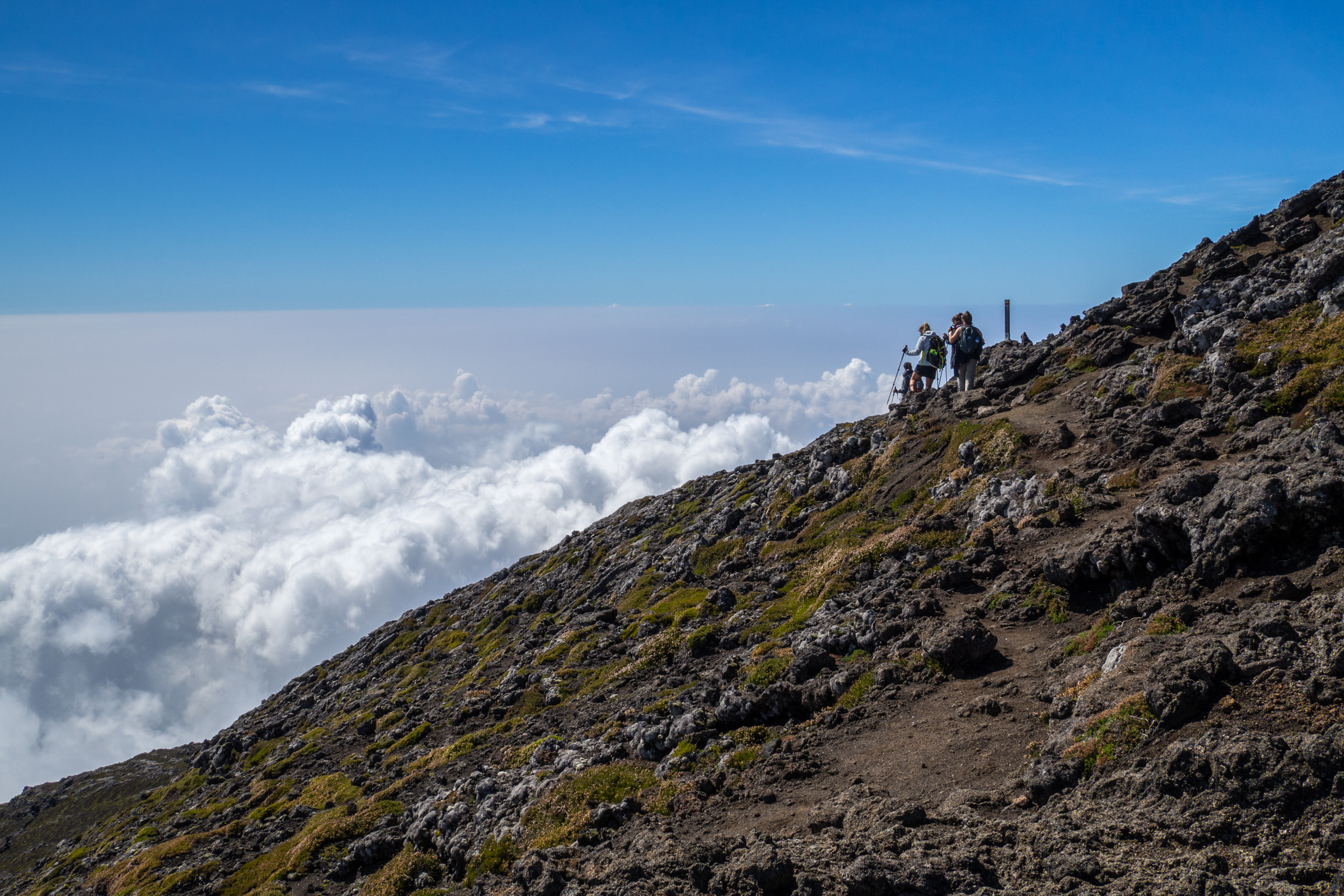
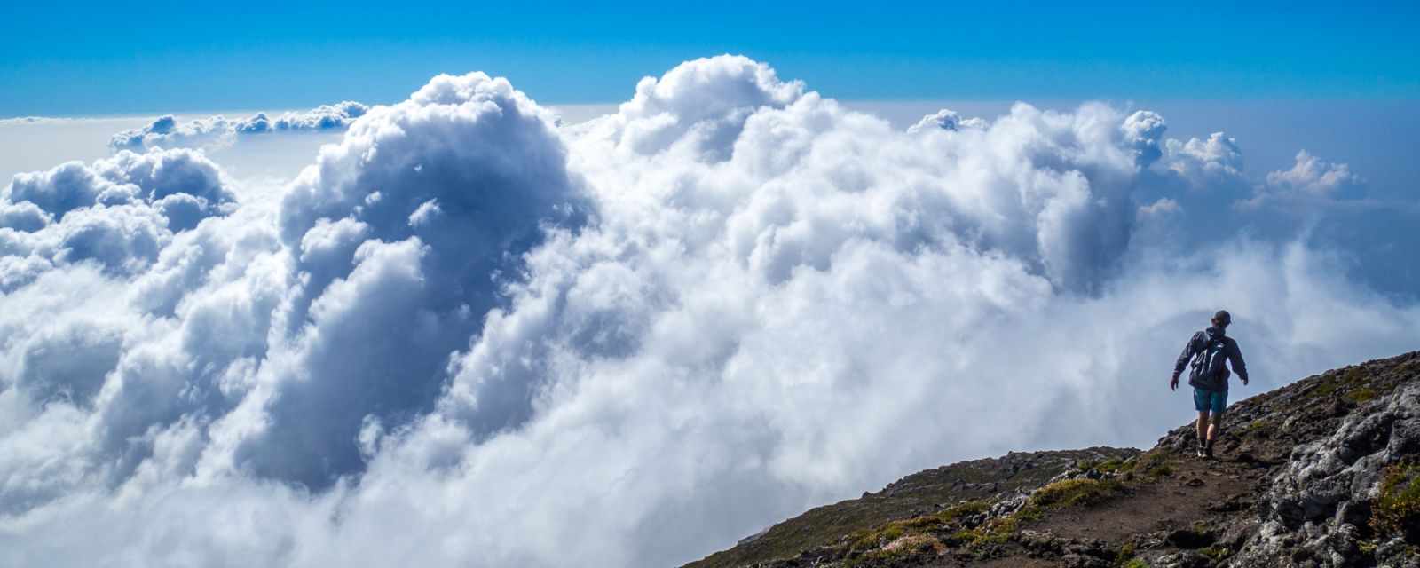
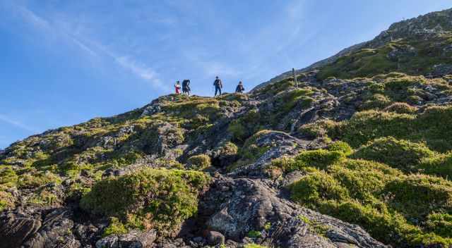
You frequently start the climb in clouds, dense fog, and occasionally in the rain. Therefore, be prepared and check out my packing list at the end of this article. Often, the clouds disappear somehow after marker 20 and higher, offering breathtaking views above the clouds. Also, we started the hike in the clouds at 9 am. We arrived at 8.30 am and lined up. The two guys in the hut are fantastic and patient, giving all introductions in Portuguese and English. The majority of the hikers are tourists.
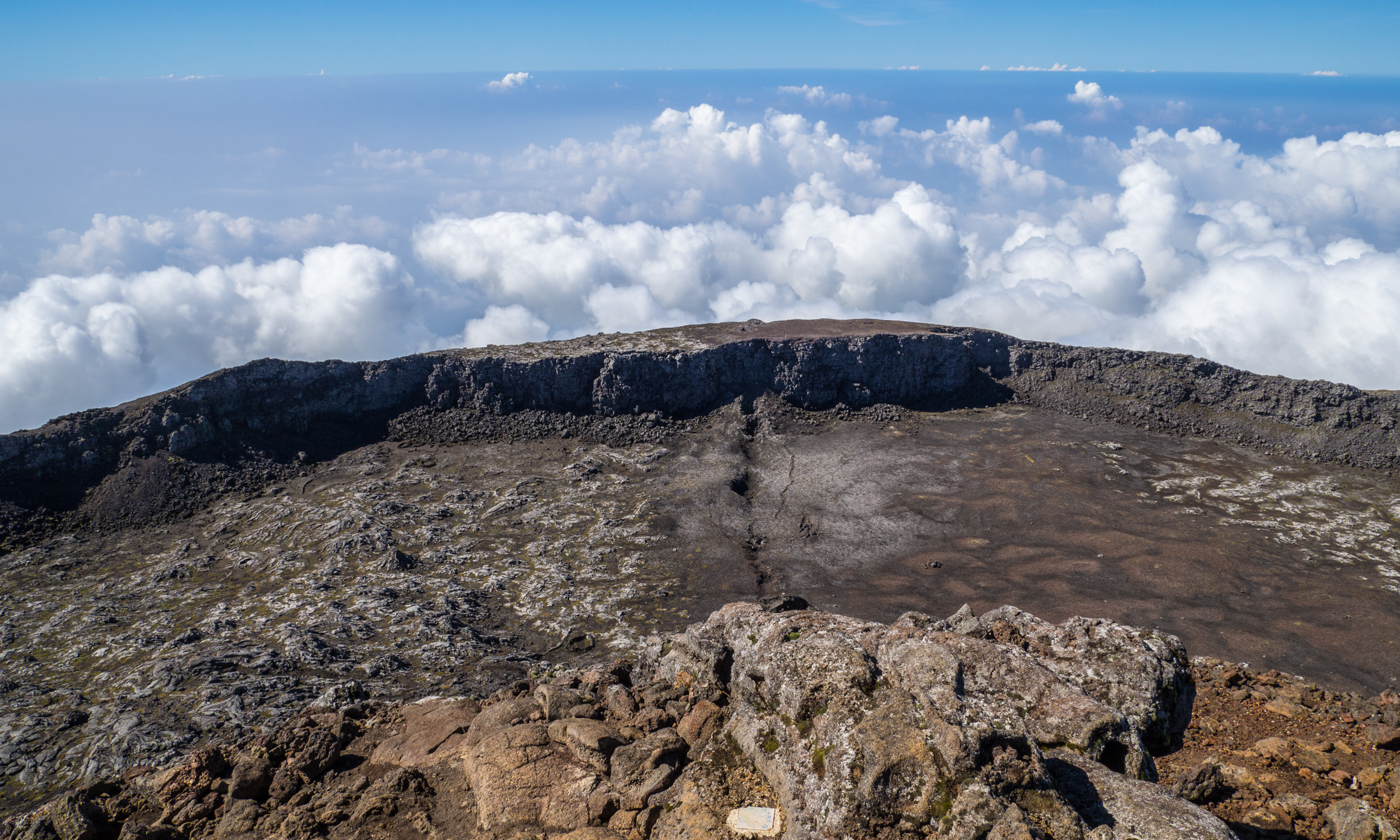
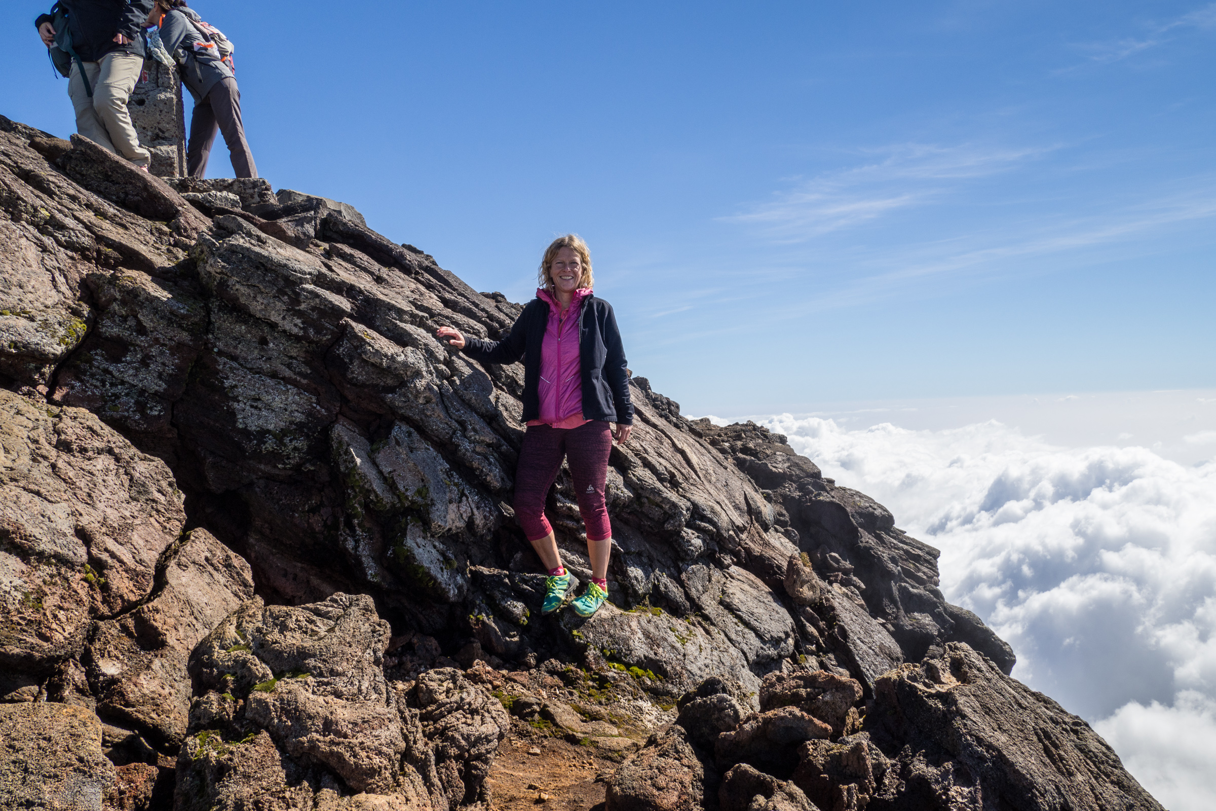
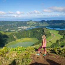
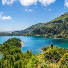
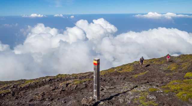
Climbing up worked very well for us, and we overpassed many hikers. However, we quickly stopped and drank water after every second or third marker. We reached the crater much faster than expected already after 2.5 hours. The scenery in front of us was mind-blowing, with the massive cone at the other end of the crater.
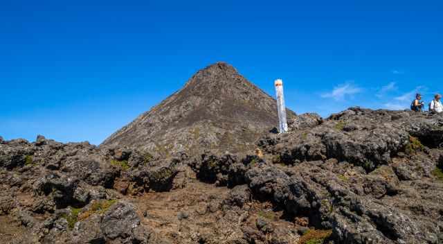
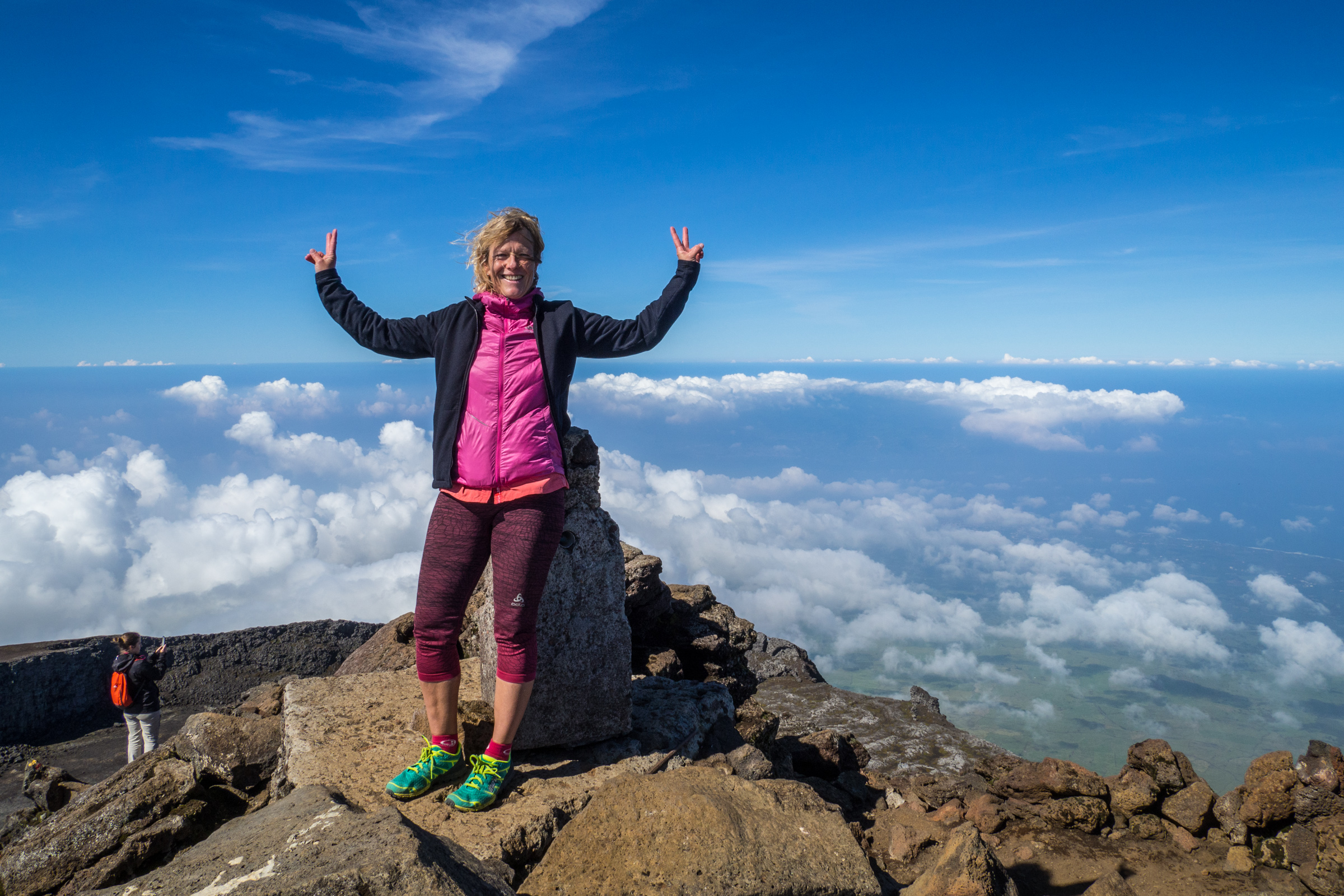
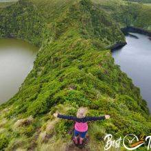
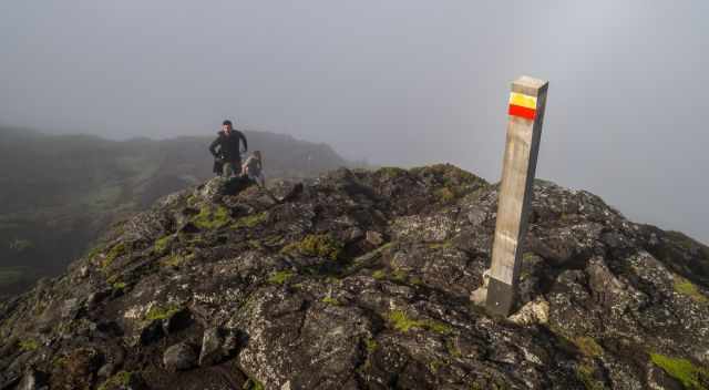
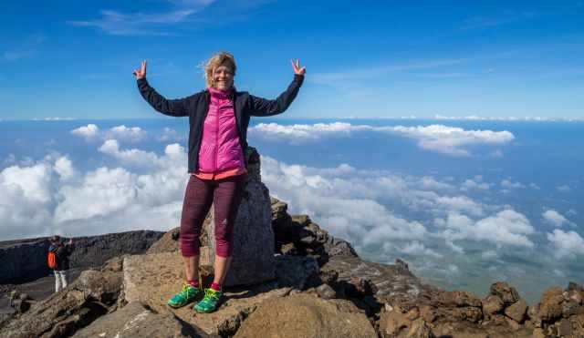
The crater is a maximum of 26 m deep. We immediately continued hiking through the crater to the last marker, 47. It took us another 15 minutes until we reached the top of Pico. It was a bit busy when we reached the summit, so we waited until these hikers left. Being above the clouds and getting some views down to Pico Island was incredible.
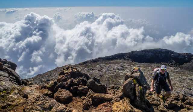
Because of the clouds, it is rare to see the other islands, Faial and Sao Jorge, from the top. However, it is a once-in-a-lifetime experience hiking and climbing Pico. Although I have climbed many mountains, this is definitely one of my top ten mountains so far. Due to the steep ascent, the descent was more challenging, IMO. Wear proper shoes, and if you are not used to hiking in the mountains, bring hiking poles for this rugged, steep trail.
Fortunately, we hiked the entire trail back in the sunshine with excellent views of the surroundings. Nevertheless, we still made short stops every second or third maker to drink water. When we returned, we gave the guys in the mountain hut the tracker back. If the GPS tracker gets lost, the fee is 300 Euros.
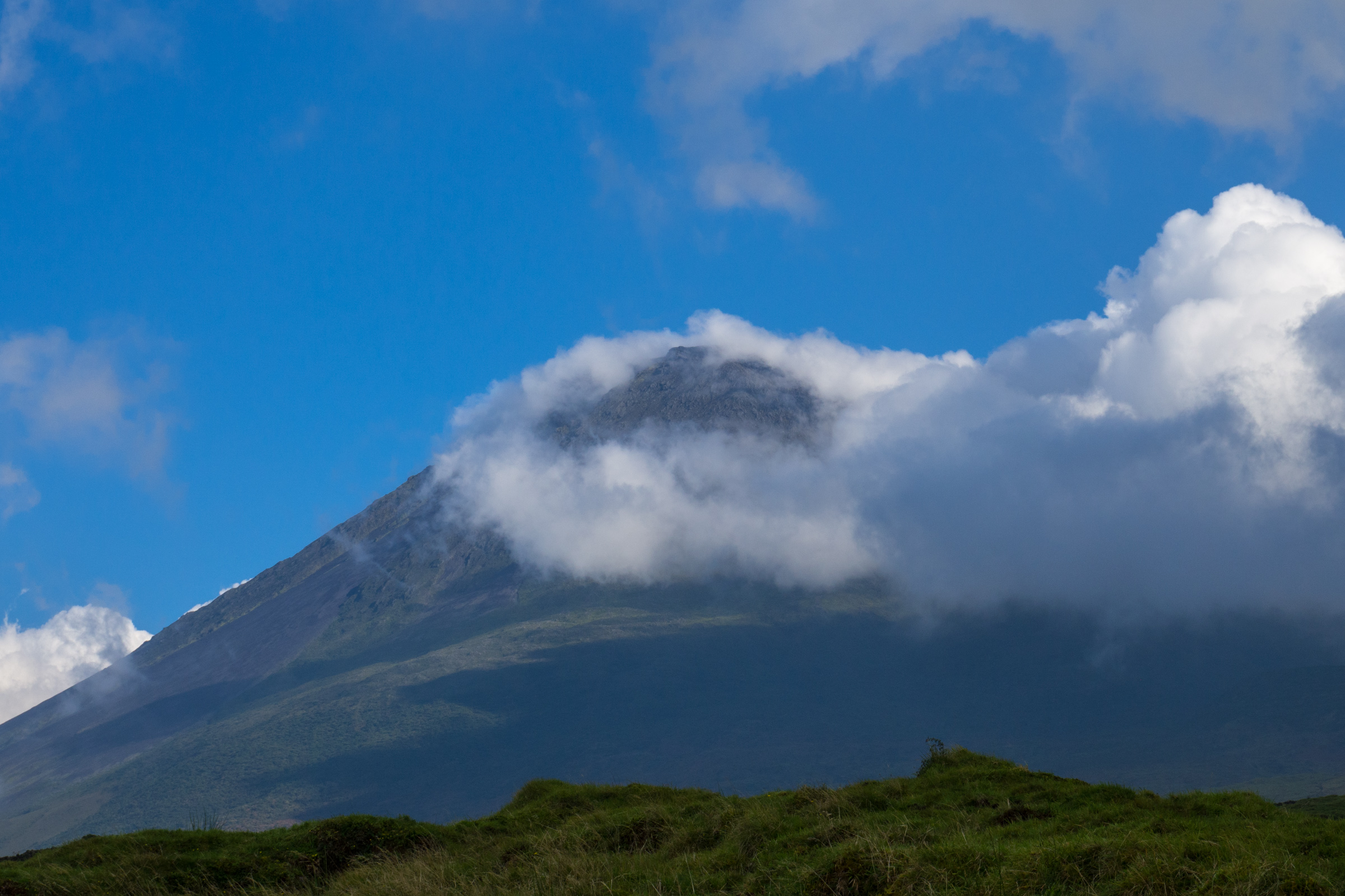
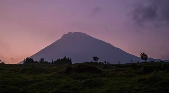
We were in awe when we stretched our legs at the car, looking back to Pico, who shortly after was covered in clouds again. What a spectacular hike here on Pico Island.
Packing List – 13 Tips
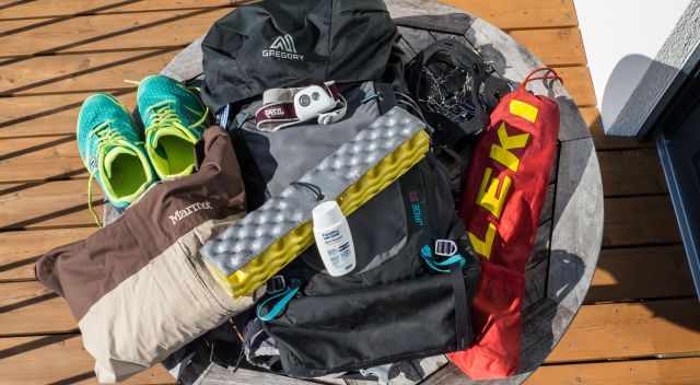
- Monitor the weather forecast. Expect a significant temperature difference of 10°C between the mountain hut and the crater caused by fog, strong wind, and rain. Weather Forecast Pico Summit
- Make your reservation online to secure a space Permit Reservation Pico
- If severe weather turns up, please return.
- Put the GPS Tracker in a safe and dry place in your backpack. If it is damaged, they charge you a fee of 300 €.
- Due to the unstable weather, carry a wind and rainproof jacket.
- If the sun comes out, you quickly get sunburned. A hat and sunscreen are also essential. I use my special SPF 50+ sunscreen for exposed areas like my arms and face. I have never gotten sunburnt since I started using this cream.
- Carry plenty of water, at least 3 litres for each hiker, and take a gulp now and then. Do you think 3 l is not enough? I agree, but most people carried less water. Drinking plenty of water is the key to such hikes. We sweat a lot on this demanding path but did it easily. Throughout the hike, I always put electrolytes into my water bottle for new energy.
- Eat high-energy food and snacks like nuts, take a proper break at the crater, and recharge your battery. You’ll need total concentration on the steep descent.
- For a comfortable break, I always carry a lightweight cushion, which is helpful for the sharp stones inside the crater and in poor weather.
- In case of an emergency, I always carry my Petzl headlamp with me. A powerful torch plus replacement is essential if you plan to climb in darkness.
- Wear proper hiking shoes with grip, not only trainers. We saw the ambulance leaving the mountain hut several times during our vacation on Pico Island. One guy injured his knee. A woman fell onto the rocks and hit her head. My Inov trail shoes were perfect for all the hikes in the Azores.
- I recommend hiking poles for the steep path, which is slippery in some parts, although I rarely need them. A third of the climbers used them up and down.
- In winter, crampons are a Must due to snow and icy conditions.
Also, check out My 10 Essential in My Backpack.
Weather and Crowds on Pico
It is said you experience four seasons in one day in the Azores, and this is true. The weather at Pico in high elevation is even more unstable. The reason we hiked to the top on our last day in Pico Island with the best weather forecast you can wish on this hike. The mentioned low temperatures are for the Pico summit.
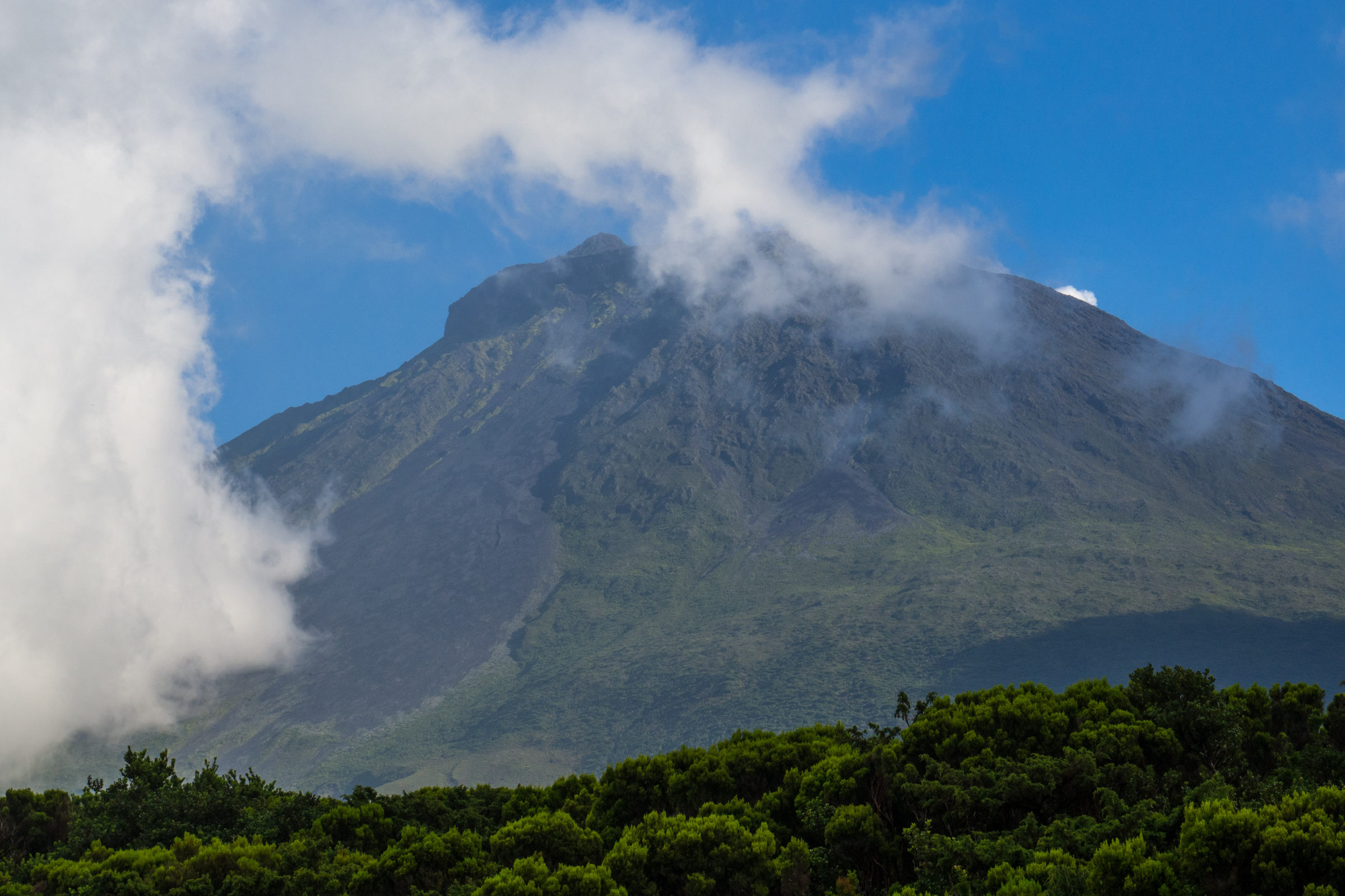
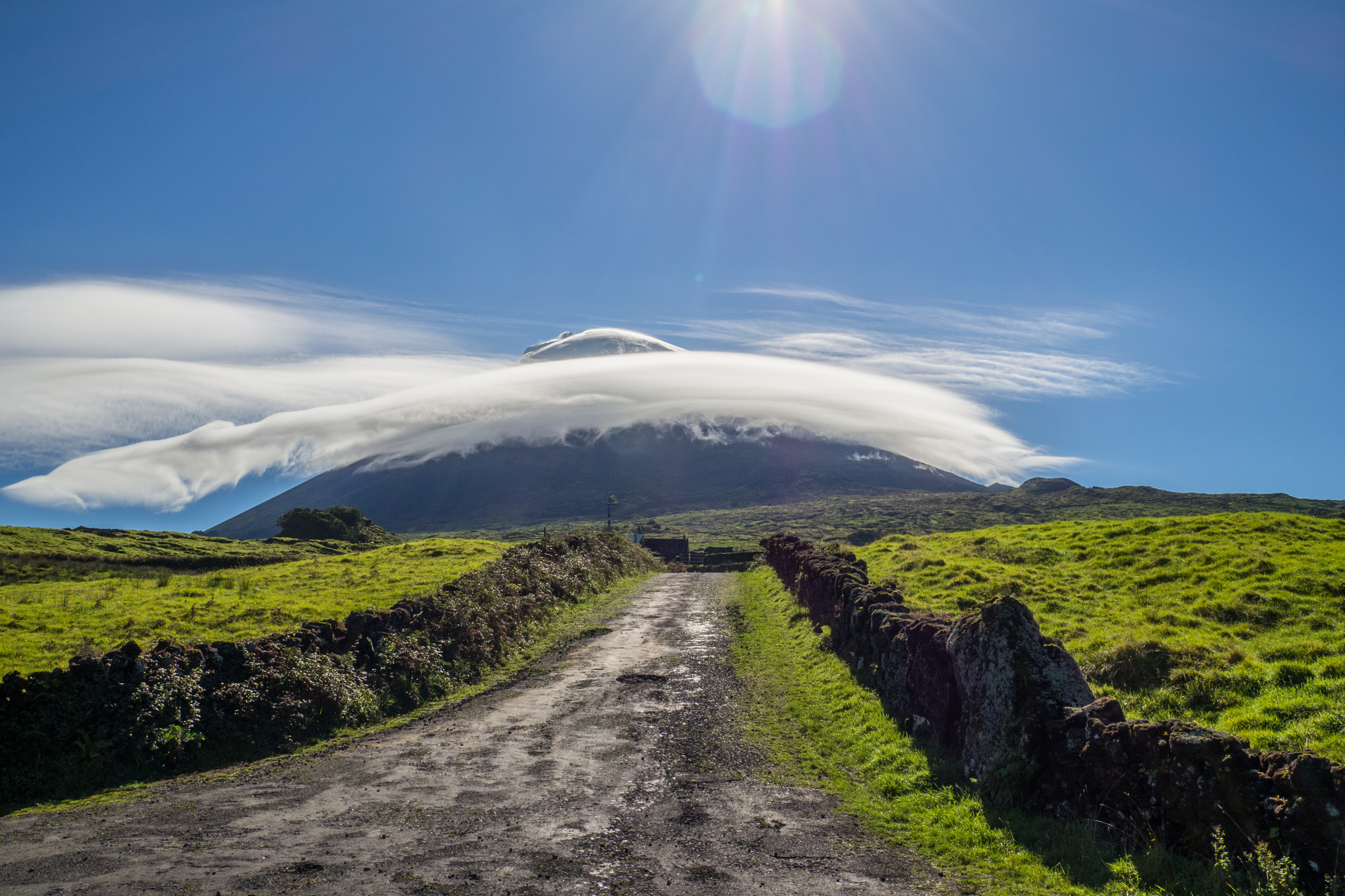
Pico Mountain determines the weather developing orographic clouds called by the residents “hats”. This explanation dates back to the first settlers. The shape of the clouds indicates the upcoming weather. The settlers had known if the weather was stable for fishing or if a storm was coming up. There is usually a significant temperature difference of 10°C or 18°F and more between the mountain hut and the crater caused by fog, strong wind, and rain. The wind is heavy and cold even during our hike in excellent weather.
Spring (April-May)
The hiking season starts on Pico. Decreasing rainfall in April though May to September, is the driest time of the year. The temperatures on the peak of Pico's range, on average between 4-8°C/ 39-46°F during the day and nights, are freezing. The sky is frequently overcast or partly cloudy. Depending on rain and fog, spotting the next trail marker isn't easy.
Summer (June-September)
Summer is the busiest time of the year. Lots of the 120 spaces are booked by tour operators. You may be forced to book your reservation early. If a hiker doesn’t show up for the reserved time, they give the permit to waiting climbers. The weather is relatively stable. It is the driest and warmest time of the year, perfect for camping on Pico. May night temps are still freezing from June to September, ranging from 3-7°C/ 37-45°F.
Day temps are around 10°C/50°F, but it feels warmer in the sun without wind but chilly when strong winds occur. From July to September, the chance for a clear blue sky is the highest.
Fall (October)
Increasing rainfall especially from mid-October onwards. Temps are still pleasant for this time of the year, around 8°C/46°F during the day and 4°C/39°F at night. However, it is an uncomfortable hike in the rain with poor visibility, but partly cloudy or sunny days exist as well. Everything is possible on Pico and in the Azores.
Winter (November-March)
The Azores do not experience a real winter but the summit of Pico Mountain. Snow and ice occur on Pico. Crampons, gloves, and full winter equipment is needed. The temperatures are low, and nights are freezing. It looks spectacular to watch Pico covered in snow. Nevertheless, mountainous experiences are essential for safety reasons. The Azores are less busy than in summer. If you wish to hike to the peak of Pico, you either have to be experienced or think about a guided tour with equipment.
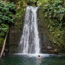
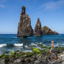
19 Best Places in the Azores
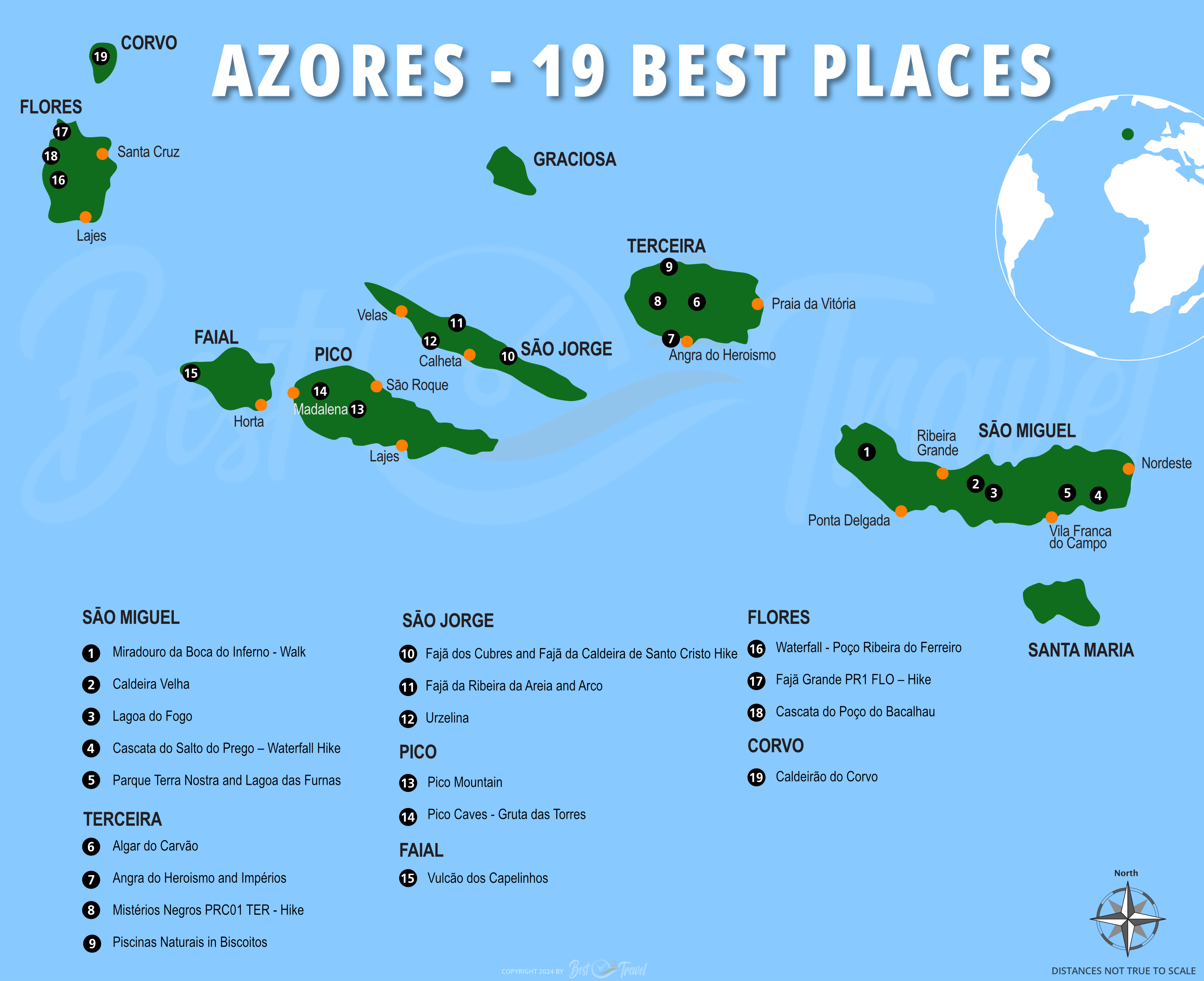
Don't miss out on my 9 Azores Guides; hikes, waterfalls, things to see and do, the best time, and my personal tips.
Best Months to Visit
Location and Tips

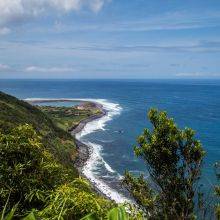
Pico Island is the second-largest island located in the central group of the Azores. Pico is the youngest island of the nine outstanding islands, about 300.000 years old.
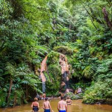
My Natural Pool and Restaurant Tip for Pico Island
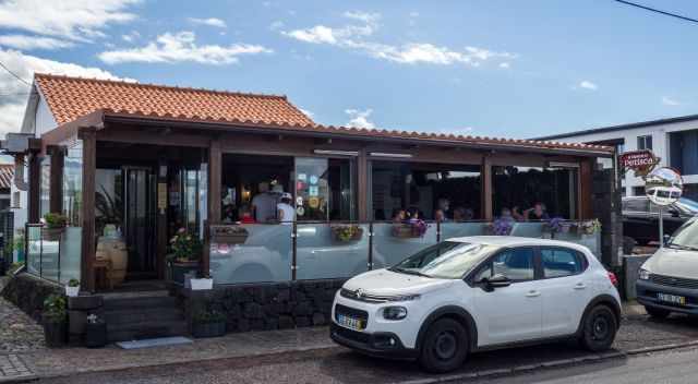
After such a hike, we love to spoil ourselves. We first went to a natural pool and bar and afterwards to one of the best restaurants we've ever been to in Portugal. The majority of my family lives in Portugal, and we went to many excellent restaurants, but the Tasca O Petisca is exceptional. If you visit Pico Island and Madalena, don't miss out on this typical Tasca.
Tasca O Petisca - A Tasca is a traditional Portuguese restaurant serving home-style food for reasonable prices. Usually, you meet more locals than tourists in a Tasca.
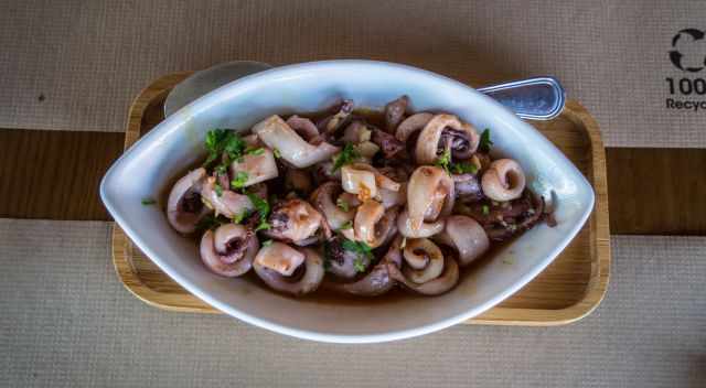
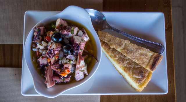
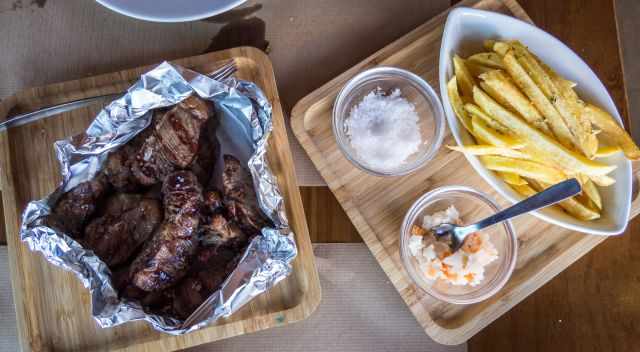
It is a popular restaurant, and all tables are already full 15 minutes after opening and for a good reason. The taste and seafood quality are mind-blowing. They offer a buffet and menu for lunch reasonable priced. The staff is super attentive and friendly. If you wish to get a table, be punctual shortly before noon for lunch or 6.30 pm for dinner. I highly recommend the tapas to try as much as possible.
My restaurant recommendation is not a paid ad; it is simply my recommendation for their outstanding food quality and taste. This restaurant is one of the Must-Visit places on Pico Island. (Google Maps Location)
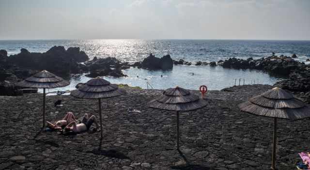
This natural pool; "Piscinas naturais da Criação Velha" is not well known, and a car is needed to get there. It is rarely bustling. We went swimming there several times and enjoyed a "Vivere Vinum" from the tap. This natural pool was our favourite for swimming in Pico. Piscina Natural and bar Google Maps Location
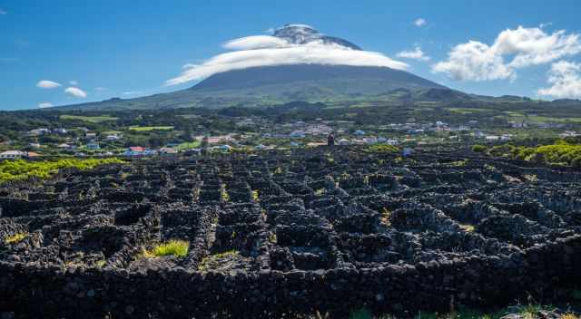
Pico is famous for its wine cultivation method, like in Lanzarote.
Who Are We
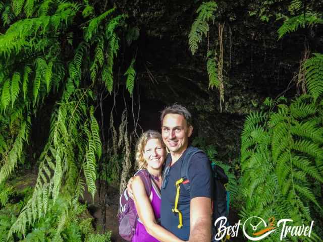
I am passionate about sharing some of the most beautiful places in the world with you, but I still can't live from my work, and we have regular jobs, too.
It is a tough business nowadays because fake travel websites rewrite content with AI without effort and expense. Want to know more about these schemes, picture theft, and how to unmask them? Check out "The Truth About Fake Travel Websites and Picture Theft"
Do you like my Pico Mountain Hiking Guide and Tips? Please share it with your friends and on social media, subscribe to our YouTube Channel. That is what already helped me a lot!
Do You Like to Support Me - It's easy; use the Paypal Button below 😍