
When Is the Best Time
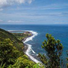
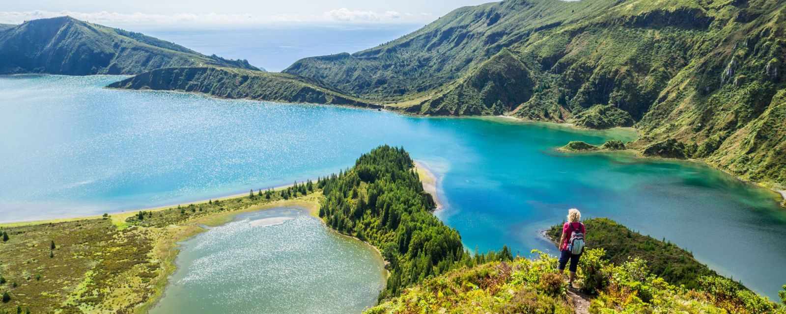
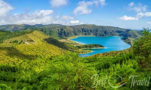
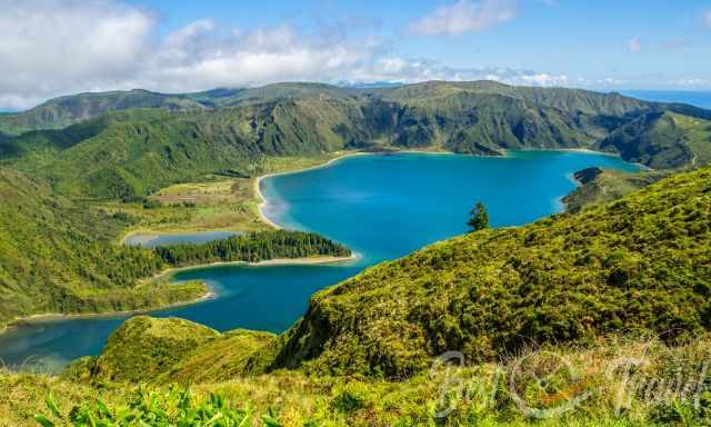
Fogo Lake is located in the centre of Sao Miguel, half an hour's drive east of Ponta Delgada. This crater lake is one of the Must-Visit-Sights with its emerald colour and part of an active volcano not extinct as usually mentioned. The magma chamber is located a few kilometres below Lagoa do Fogo.
The summit caldera of the active Volcano Fogo has an average diameter of 2.8 km and is a maximum of 400 m deep. Inside the caldera is Fogo Lake, with a depth of 30 meters. More details about how the lake was created in my volcanic history part.
Already the drive up to Fogo Lake in roughly 950 m/ 3.120 feet elevations is spectacular. If you plan to drive to Lagoa do Fogo, which means “Fire Lake”, you probably like to hike down to the lake but check the weather forecast and the webcam first. More below
How to Get to Lagoa do Fogo?
You can reach Lagoa do Fago either by rental car, taxi or book a guided tour. The public transport is insufficient to get to the Must-See places in the Azores. I highly recommend stopping here or even climbing down to the magnificent Fogo Lake.
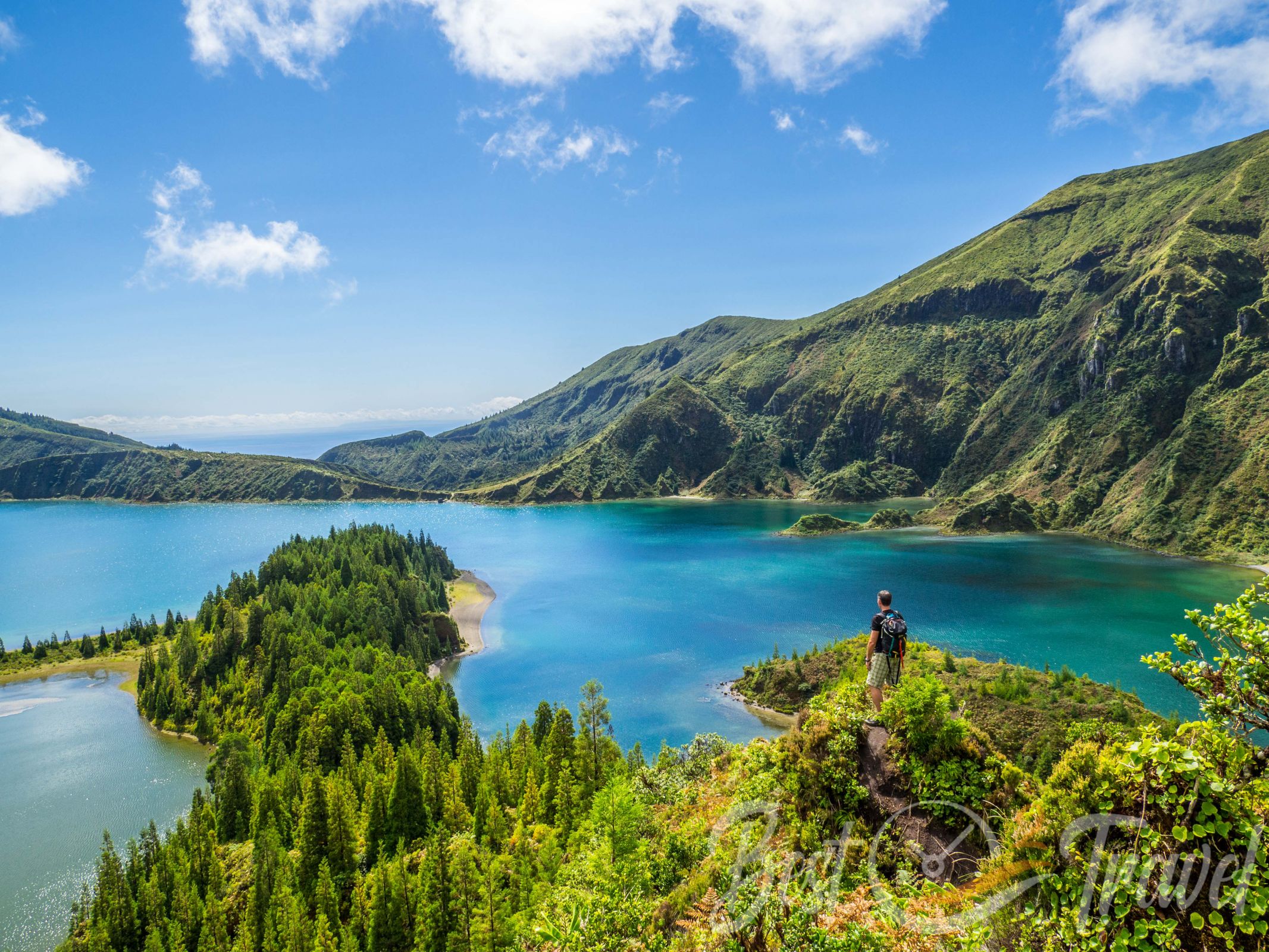
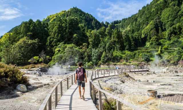
The hike down to Fogo Lake, offering breathtaking views, was one of our highlights. Even if the descent is too steep for you, I recommend hiking the first part along the caldera rim for more stunning views. You will find a detailed hiking trail description plus a hiking map below.
New Shuttle Bus Service Since 2024
During the summer, Lagoa do Fogo is accessible by shuttle bus only from 9 a.m. until 7 p.m. from June 15th until September 30th. The road is closed to private vehicles. However, if you arrive before 9 a.m. or after 7 p.m., you can pass and park here with your rental car.
When To Go?
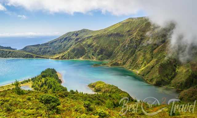
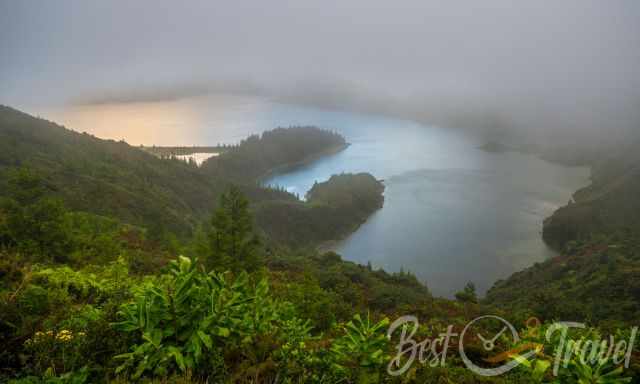
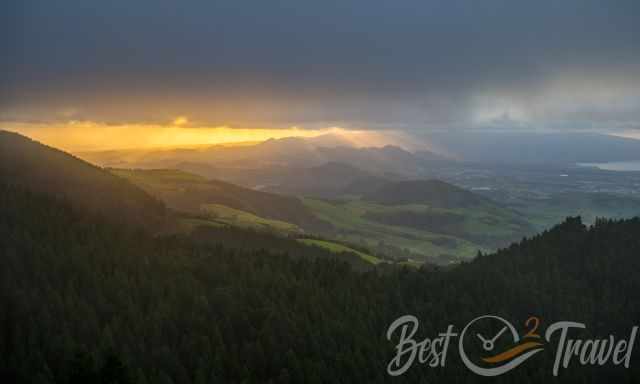
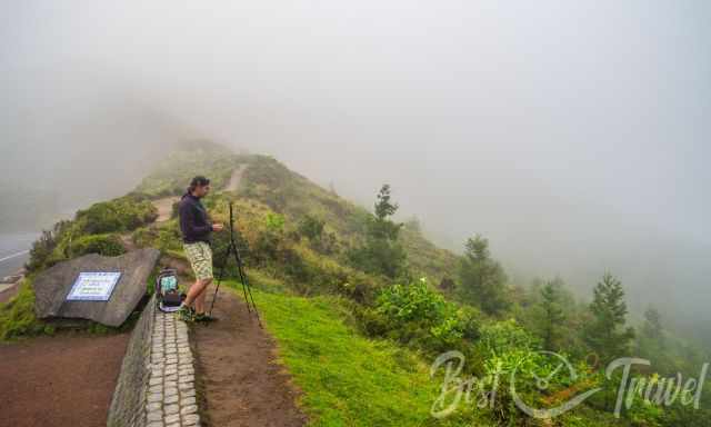
The centre of Sao Miguel is notorious for clouds and rain. The coast is frequently sunny, but you may end up in clouds or fog when you reach higher elevations. The best time to visit Lagoa do Fogo and the Azores is the drier time of the year, from April until October. However, check out the weather forecast and webcam first; the viewpoint is frequently covered in clouds.
Don't miss out on:
- all my Azores Islands Guides
- and our Ultimate Azores Guide - 19 Must-Visit Places on YouTube
We are real travellers; we took all these pictures and footage. I provide honest content from our own experience, not generated by AI!
Weather Forecast Tip
You can trust these forecasts just for two days. Rain and clouds frequently spoil these terrific views. I recommend this forecast because it gives you an idea for each hour for today and tomorrow. We checked the forecast daily and experienced all the sights in perfect weather.
- Weather Forecast Ponta Delgada
- Webcam: currently, none of it is working
The Azores are located in the Atlantic Ocean, more than 1.800 km from the Portuguese mainland therefore, the weather is influenced by the sea. If you wish to know more about the typical climate and weather in the Azores, check out my additional article Miradouro Boca do Inferno.
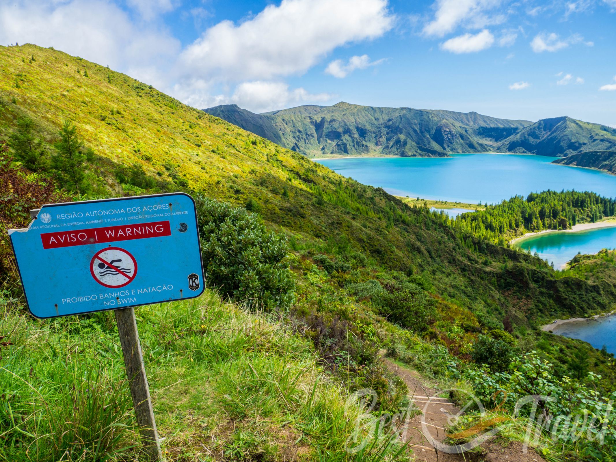
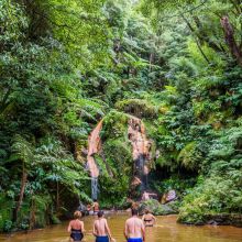
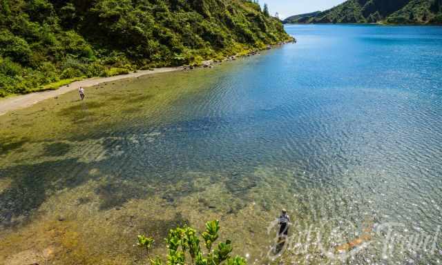
Can You Swim in Fogo Lake?
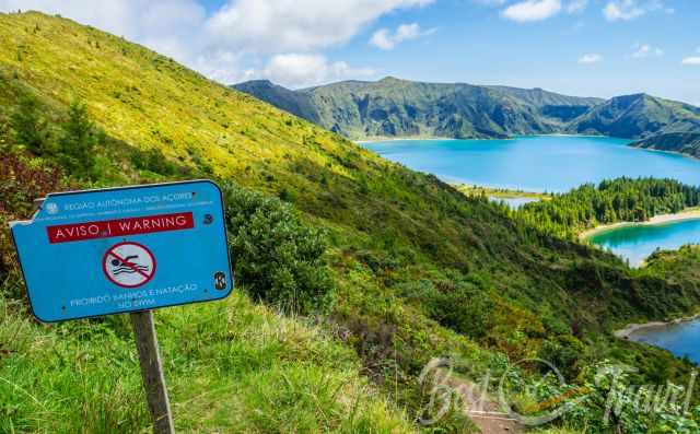
The water of the lagoon is lukewarm because of volcanic activity. It looks awesome for swimming, and there are famous pumice beaches, called one of the "Seven Wonders of Wild Beaches", but it is prohibited because it is a nature-protected area; Reserva da Lagoa do Fogo was developed in 1982.
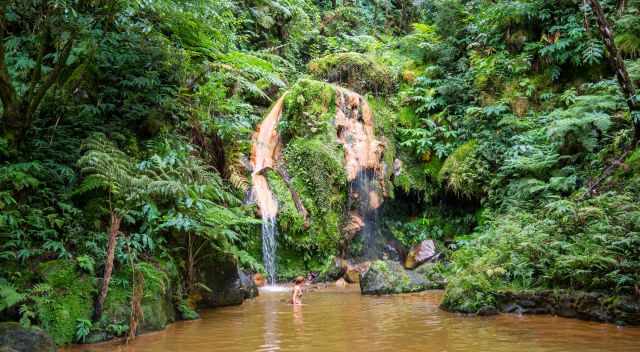
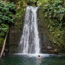
However, Caldeira Velha nearby is fed by the thermal waters of Fogo Volcano, and here you can take a bath in hot pools. Check out my additional article and combine Fogo Lake with Caldeira Velha in one day.
2 Viewpoints and Parking
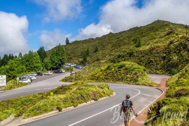
You first reach the “Miradouro do Pico da Barrosa” with a small parking area if coming from the south. The next viewpoint has plenty of parking; one smaller one next to the road EN5 2A at the “Miradouro do Fogo” and a bigger one on the right curve Google Maps Location.
It was busy here during the day, but there was always parking available, and we passed by multiple times. Most people stop for a closer look only and continue their journey. Of course, it is busier during weekends when locals and tourists alike make a picture stop.
2 Lookouts and Hiking Trails plus Maps
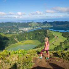
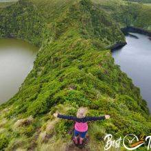
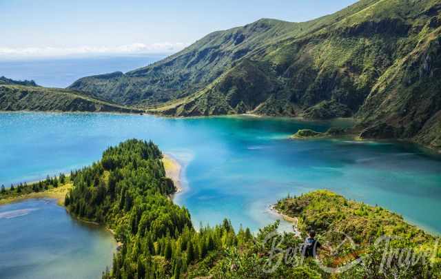
1 Miradouro Lagoa do Fogo
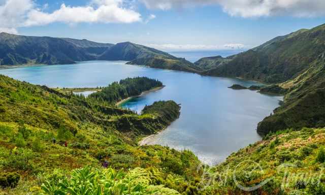
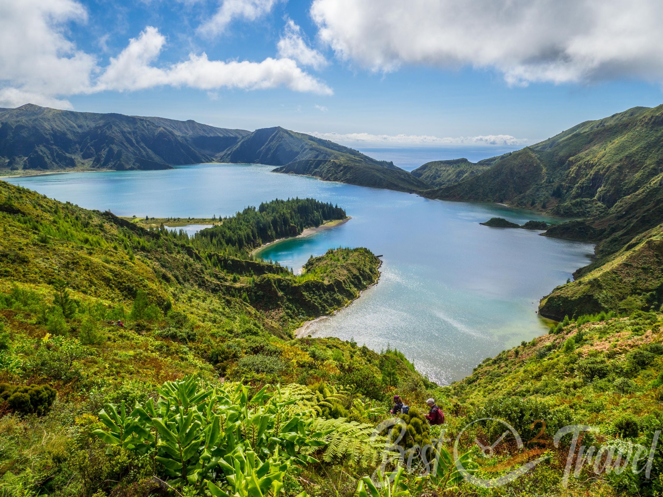
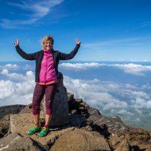
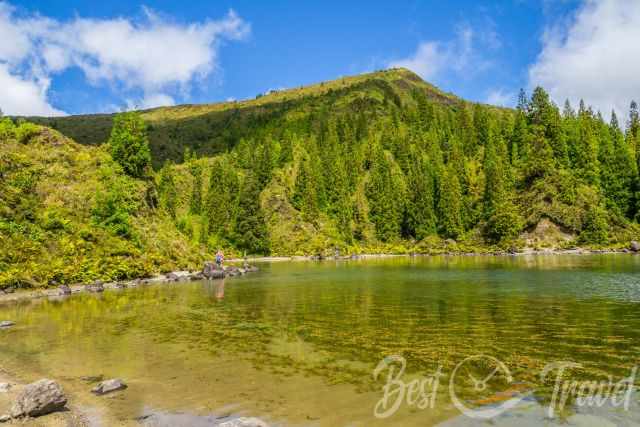
We did not plan to hike down to the lake, but we couldn’t resist getting more magnificent views of this emerald, green lake and its pristine nature. Not many people hike down; they just stop for a look from the viewpoints. Cete Cidades and Boca do Inferno are definitely busier. We walked along the rim to the left for ten minutes until we saw a walking path to the right leading down.
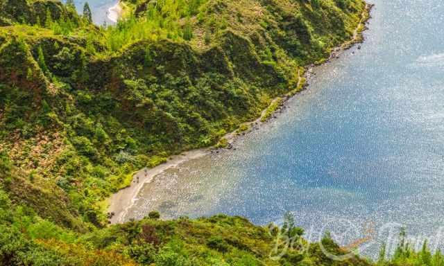
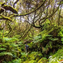
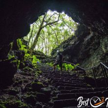
It is roughly an elevation loss of 375 m/ 1.230 feet and took us half an hour. The crater rim and track down are covered with bushes and scrubs, leaving only a narrow hiking trail. Lots of these plants are endemic to the Azores. The trail is a bit slippery due to the frequent rain showers.
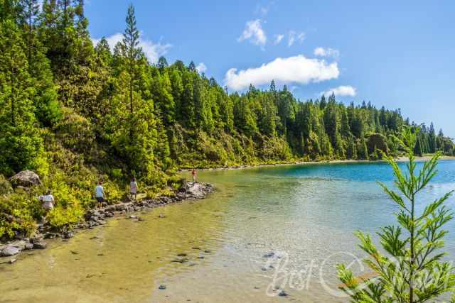
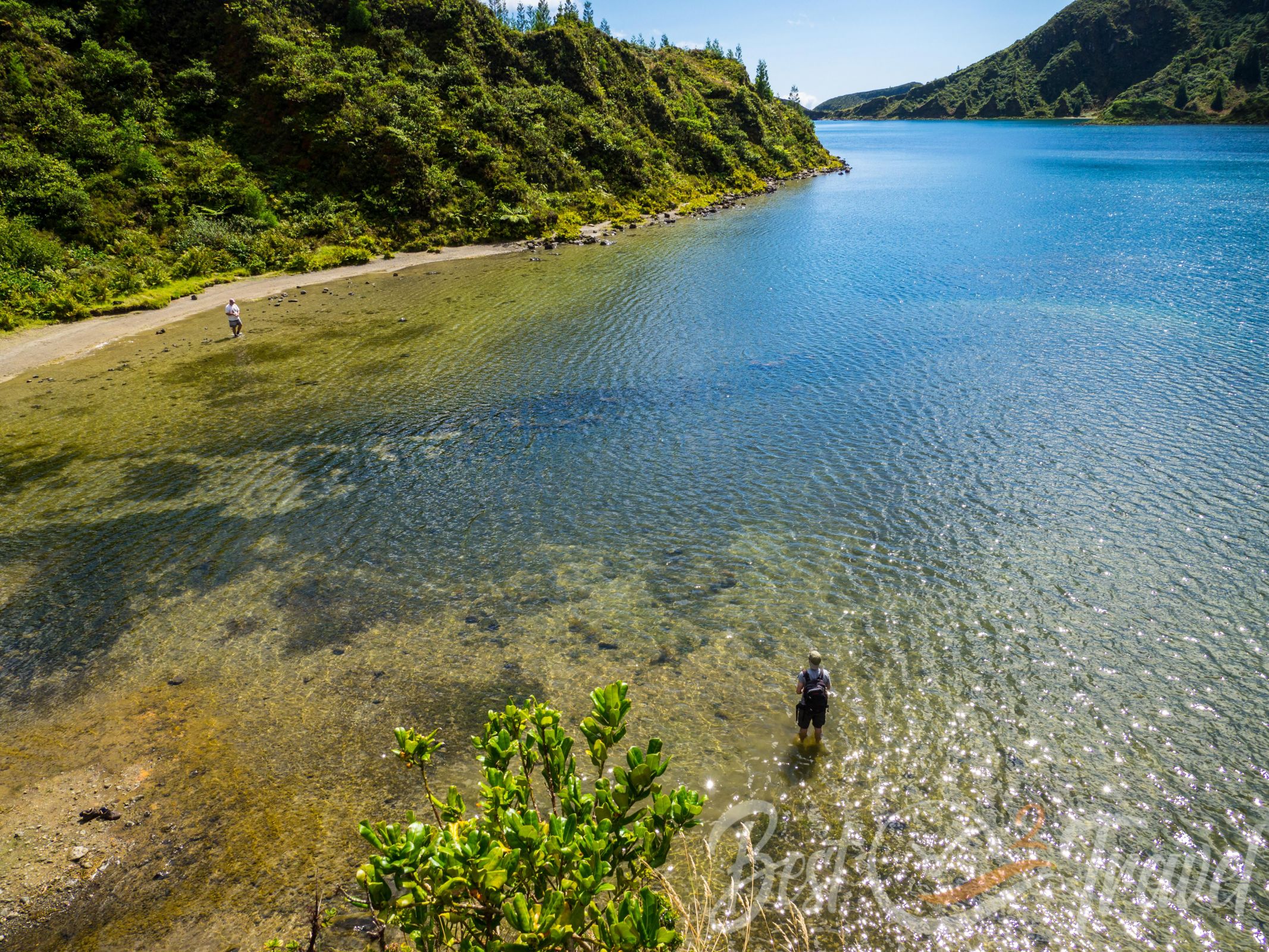
You can either continue hiking along the lake or just a short part like we did before the trail ascends back to the Miradouro do Fogo. We spent 1 ½ hours on this trail, with many photo stops and a break at the lake. Our Trail Map by Locus Pro
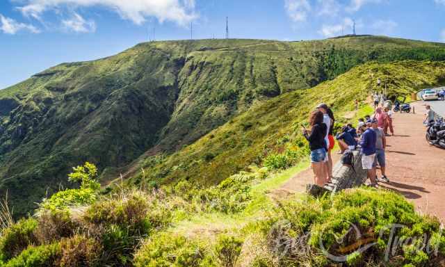
2 Miradouro do Pico da Barrosa
The second great viewpoint is “Miradouro do Pico da Barrosa” - Barrosa Mountain. There is one lookout next to the road, and another is a 500-meter stroll in higher elevations. Location and Walk
Packing Checklist
- Plenty of water – it is hot on a sunny day.
- A picnic for one of the beautiful spots at the bottom of the lake.
- Hiking Poles are helpful on this steep, narrow, and slippery trail.
- Sun protection is essential. I use a special SPF 50+ sunscreen for exposed areas like my arms and face. I have never gotten sunburnt since I started using this cream.
- Always carry a rain jacket and a waterproof bag for your valuables in your backpack..
Volcanic History – How Fogo Lake was Developed
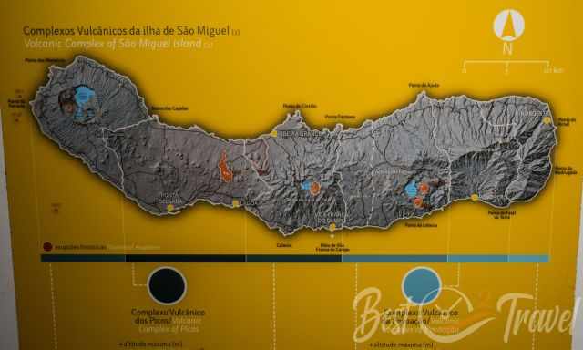
The Azores Islands originated from volcanic eruptions. Sao Miguel – Nordeste emerged roughly 4 million years ago. Fogo is one of three active volcanos in Sao Miguel. A part of this complex is Fogo Lake in the caldera. Mostly it is mentioned that Fogo is extinct, but a volcano is categorised as extinct after one thousand years without eruptions. The eruptive history started already 300 thousand years ago. The Fogo caldera was formed by heavy eruptions and by the collapse of one vent of volcano Pico do Fogo or Agua de Pau.
The first heavy eruptions occurred estimated at 15 thousand and again 5 thousand years ago. Fogo Lake is a crater lake and the youngest caldera in Sao Miguel, formed by the last eruptions in 1563 and 1564. When the magma chambers emptied, this part collapsed and filled up with rainfall. It is the first documented event where ash clouds appeared and the sky darkened. You can still witness the activity of Fogo on the northern flank at the thermal pools of Caldeira Velha.
My Personal Hotel Tips for Sao Miguel
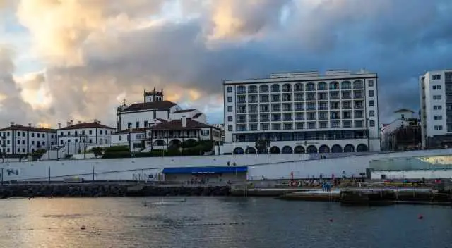
There are plenty of hotels and rental houses. I recommend staying in the north or south. This island is round about 64 km long. It is a long drive to get to the other side of the island, whether from the east or west.
We always went swimming after a wonderful day in Sao Miguel. Piscina naturals are safe for swimming. These are my recommendations with a pool nearby or even in front.
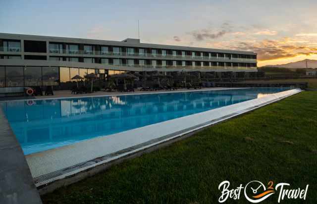
Pedras do Mar Resort & Spa has a fantastic location with spectacular mountains and Atlantic views. I highly recommend a room with a sea view. There is an indoor and outdoor pool, which is fantastic for swimming. In front of the hotel is a huge parking for rental cars. A bike rental is offered. A rich breakfast is included to start the day.
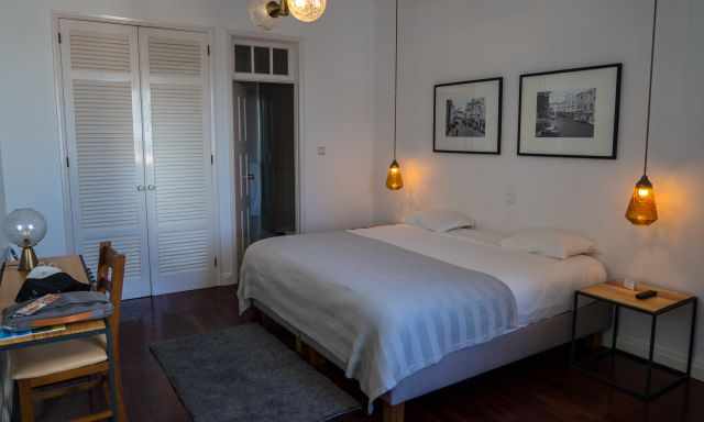
Before we left the Azores, we spent two nights in the ILHA Hostel & Suites. Although in the centre of PDL, it is very quiet at night. The owner of this beautiful hostel walked an extra mile for us.
19 Best Places in the Azores
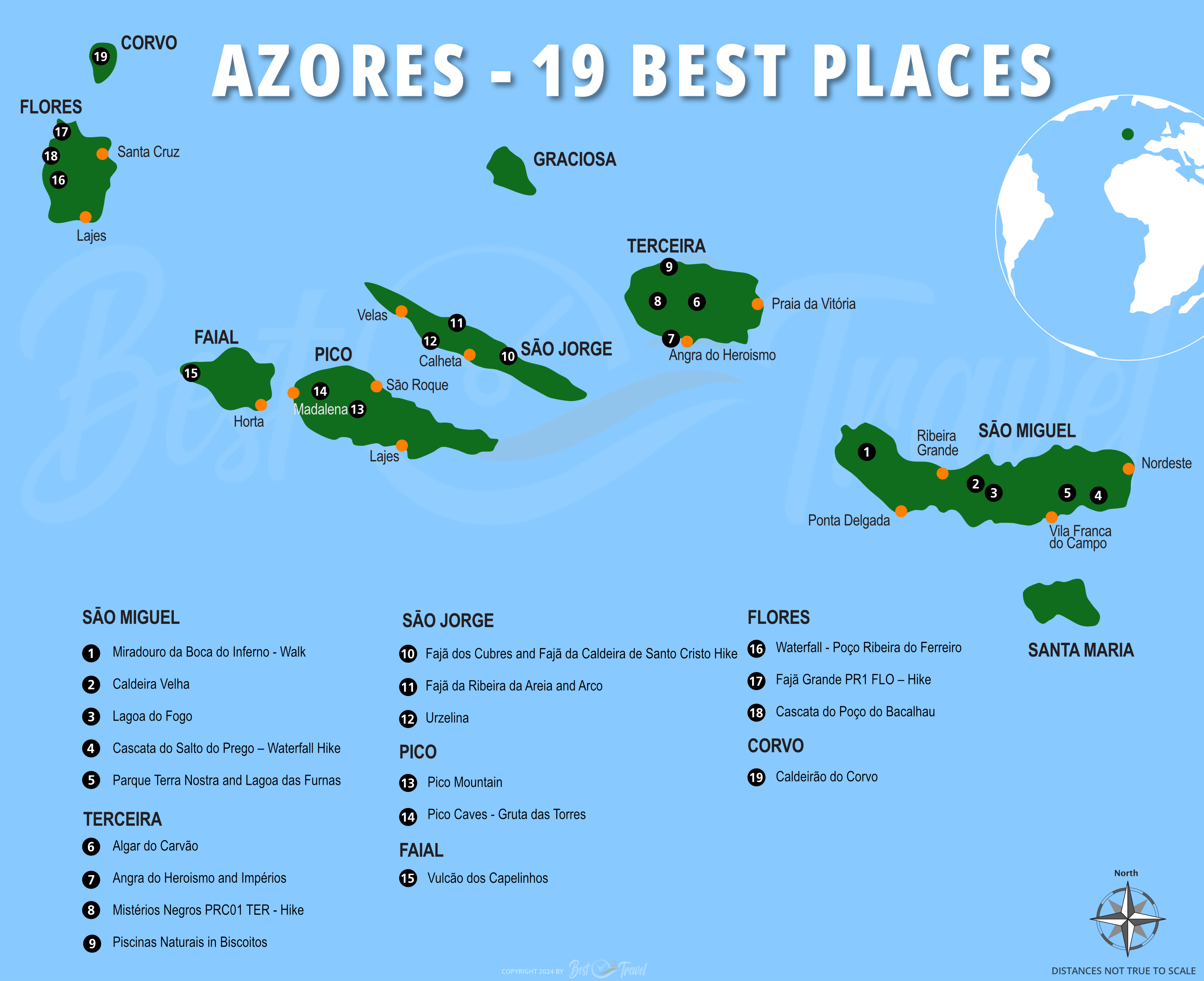
Don't miss out on my 9 Azores Guides; hikes, waterfalls, things to see and do, the best time, and my personal tips.
Best Months to Visit
Location and Tips

Fogo Lake is a magical place during all weather patterns. The weather can change quickly; it is sunny with a blue sky, and the clouds roll in five minutes later. We passed by several times and always stopped to soak in the beauty of this picturesque lagoon. I'll give you all the information for the best lookouts and how to monitor the weather to experience this beautiful lake on a sunny day and not completely covered in clouds.
Where Does My Knowledge Come From?
Volcanoes are fascinating, and I got addicted when I stood at the rim of the lava-spitting Mount Yasur in Vanuatu. Recently, we travelled to Lanzarote, and I met the incredible guide, Mash, who taught me a lot about volcanoes.
If you wish to use any of my pictures, contact me, but I take action against picture theft.