
When Is the Best Time
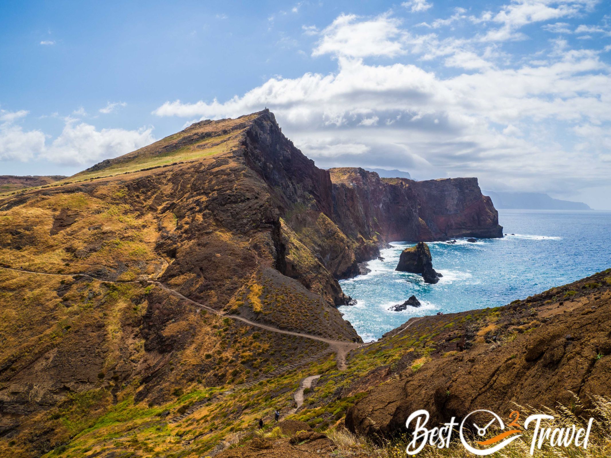
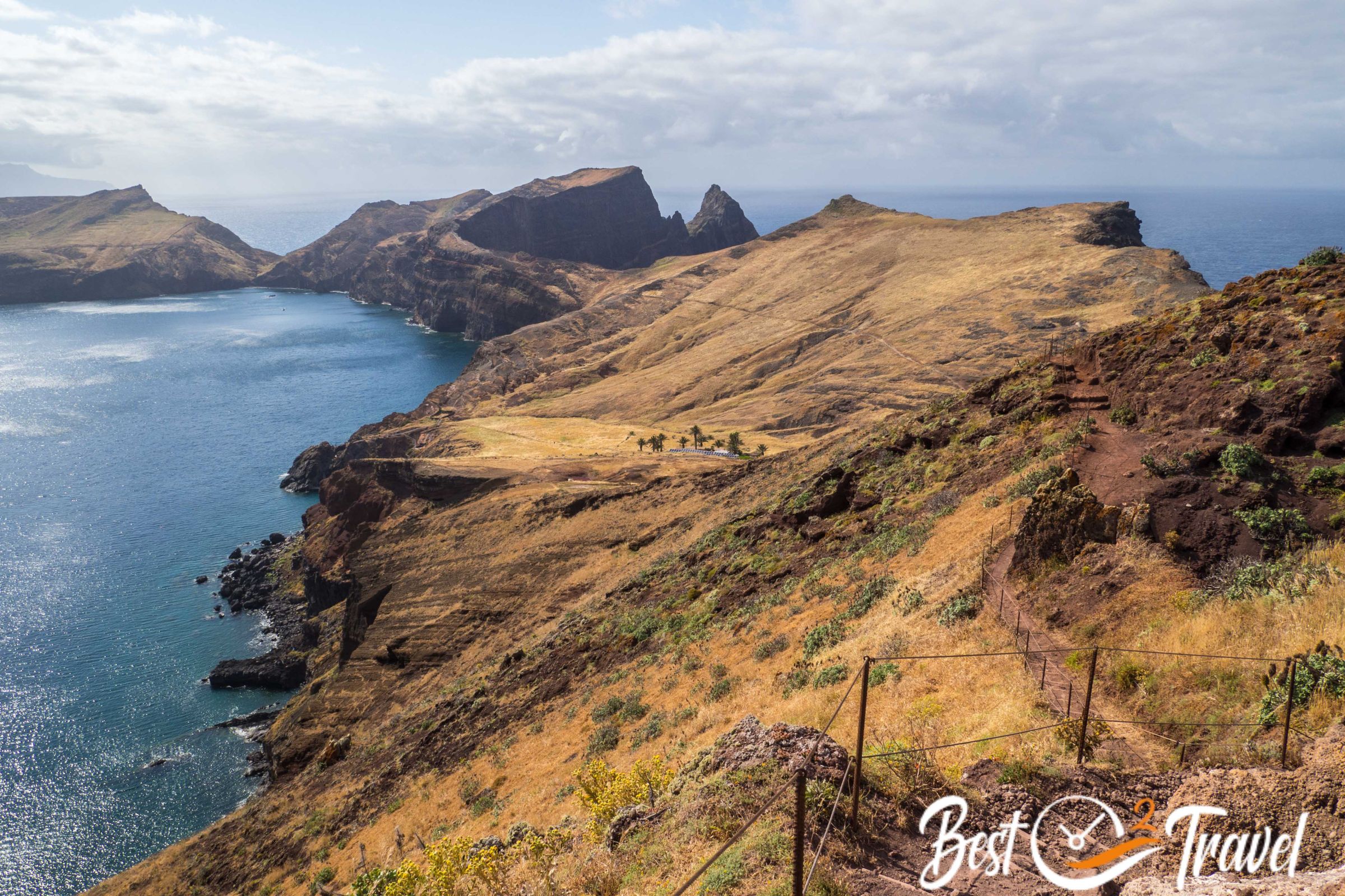
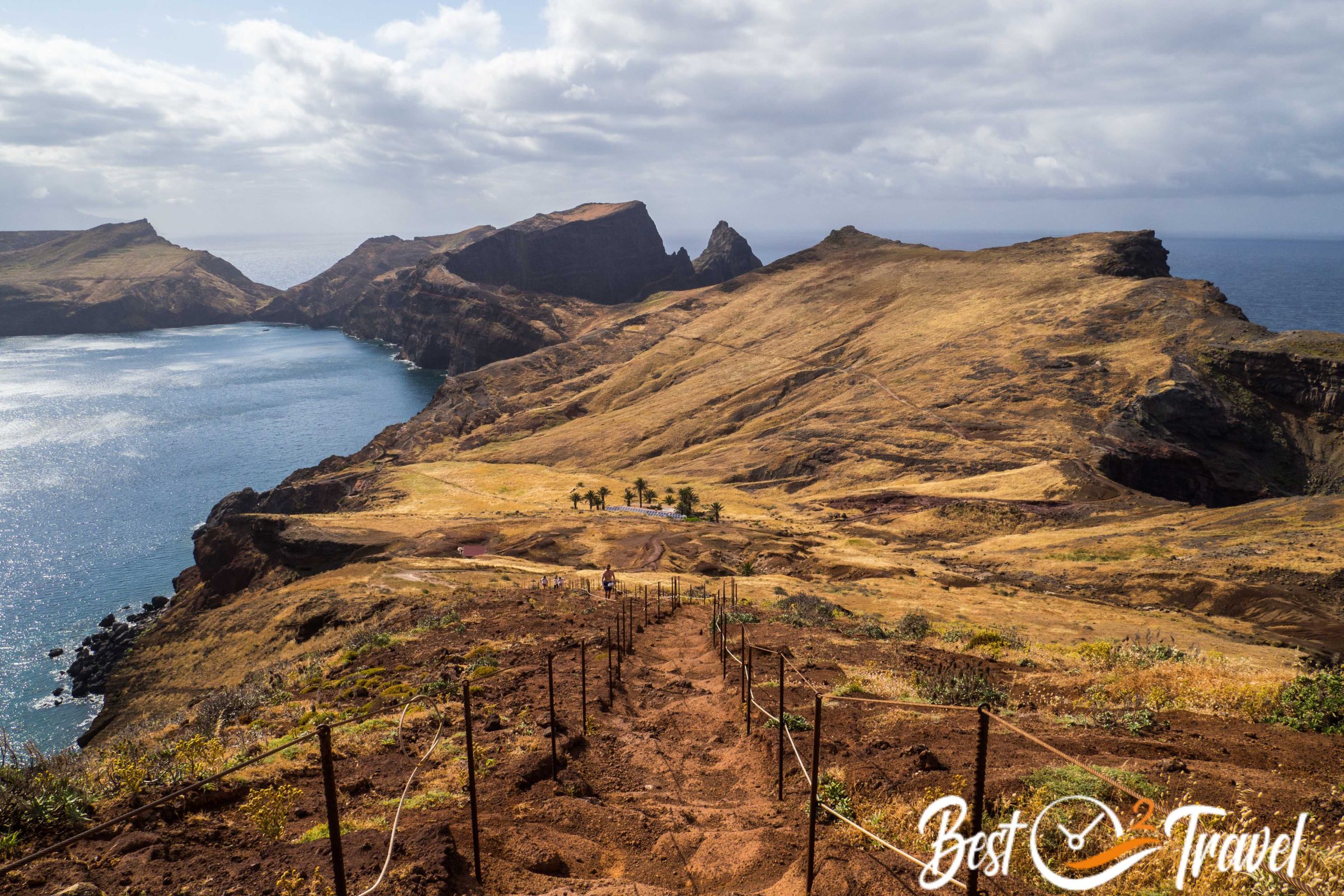
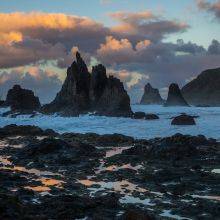
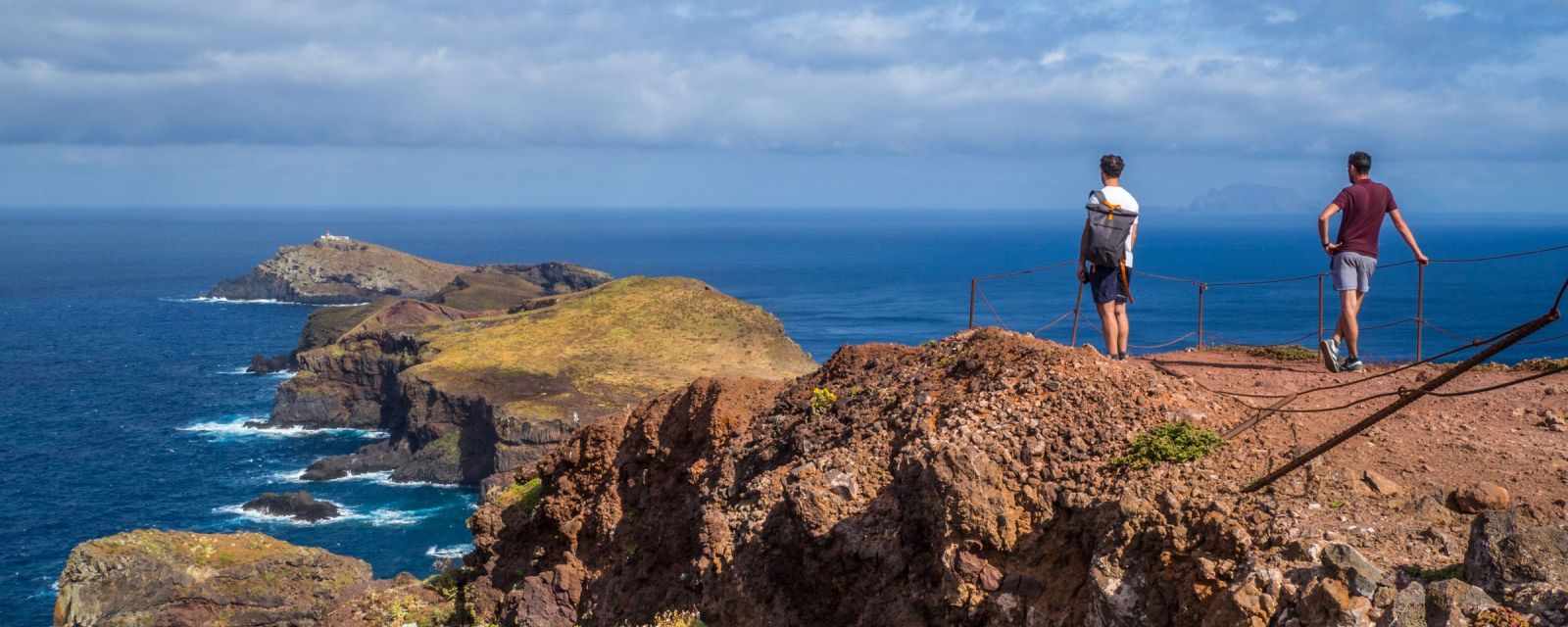
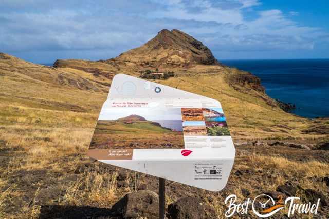
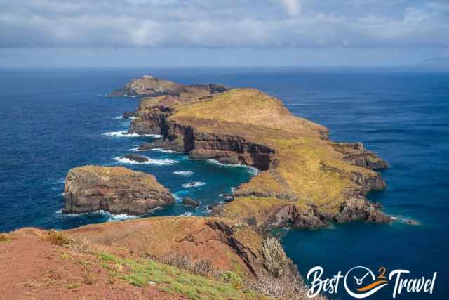
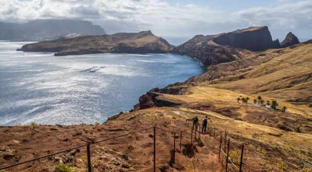
This is one of the best hikes along the rugged coastline at the eastern tip of Madeira. In contrast to the Levada hikes, the track is exposed to the sun and wind leading through the geological history of Madeira.
If you plan to hike this exciting narrow track, check out the weather forecast a day or two before. There is no shelter or protection from the elements from wind, rain, and the intense sun in summer. Link weather
Best Time for Ponta de Sao Lourenco
Regarding the temperatures, the best time to hike the PR8 track - Vereda da Ponta de Sao Lourenco is from October until May. In summer, from June until September, temps can top 30°C in the sun. A sunny winter day can be pleasant, around 20°C. However, check the weather forecast before because rain is more likely to occur from October to March.
Best Daytime
If you plan to visit Madeira between June and September, I highly recommend starting early before it gets scorching hot. Although frequently windy along the exposed path until the end of the peninsula, the way back on this partly circular trail is protected from the wind, and you may break a sweat during midday.
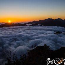
Watching the Sunrise at Sao Lourenco
Of course, watching the sunrise from here must be breathtaking, but depending on where you stay, it may take one hour to get to the parking, plus half an hour of hiking for an excellent viewpoint. This means hiking this exposed track in darkness with a headlight, and maybe it is windy, something we did not want. We enjoyed one sunrise and plenty of sunsets because we are not early risers – more in my additional Sunrise and Sunset Guide for Madeira.
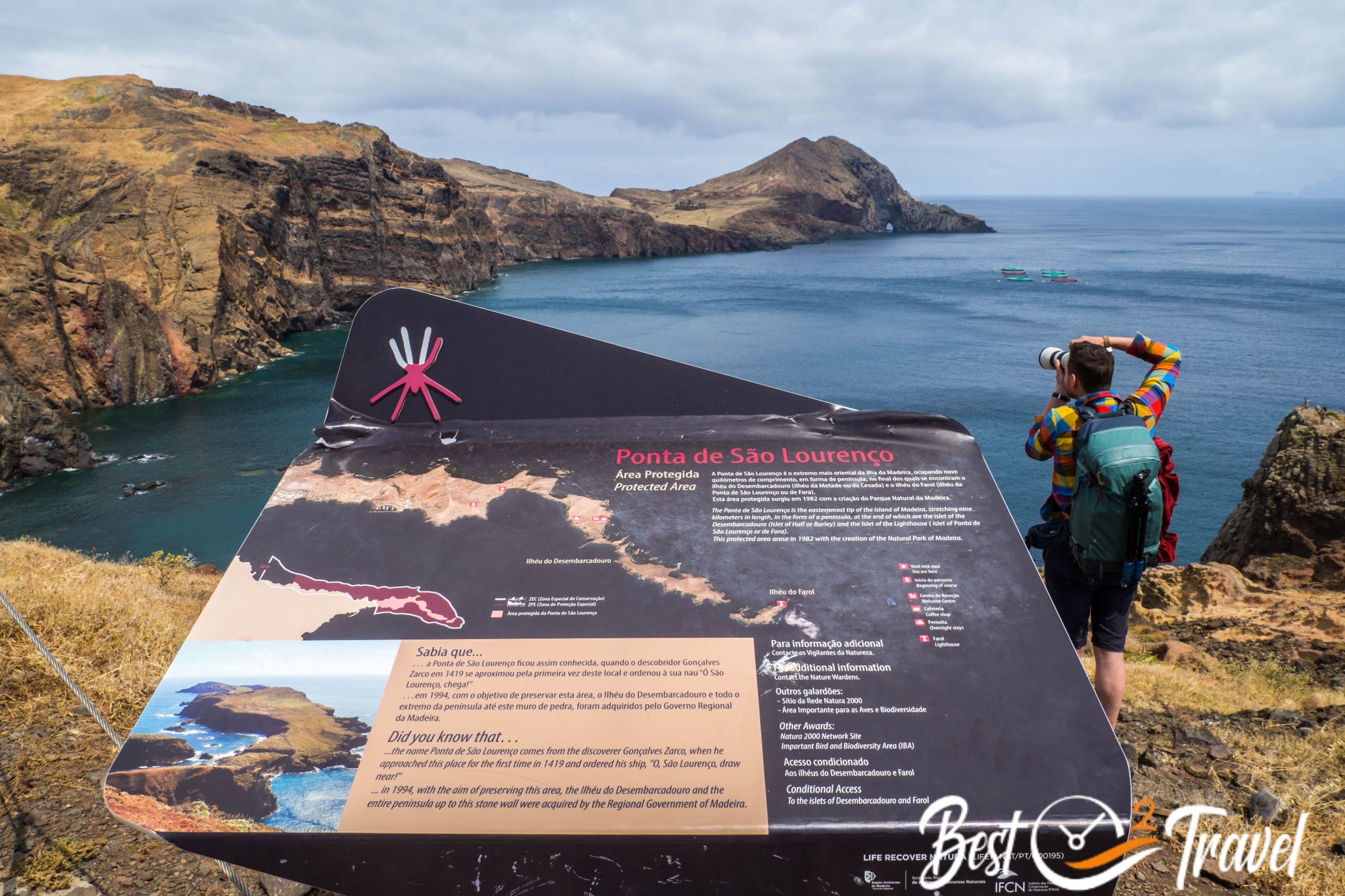
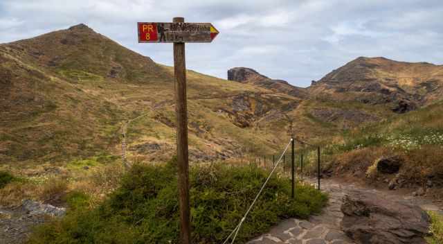
How to Get to Sao Lourenco
This hiking trail is located at the most easterly point. It takes half an hour by car from Funchal, and from the south, like Ponta de Sol already 50 minutes to one hour. We had a break in Canical for lunch before we continued to Vereda da Ponta Sao Lourenco.
Avoiding Crowds

The peninsula hike is one of the most popular ones. To dodge the crowds in the peak season, either come early or start your hike in the afternoon. The pros are that you avoid the midday heat, and either you start before the majority arrives or when the crowds thin out.
We started the hike after 2 pm lots of people had already left, and nearby parking was available. Nevertheless, many visitors come for a quick look, and the beginning is crowded. The further you walk on this trail, the quieter it gets.
Parking Trailhead Vereda Sao Lourenco
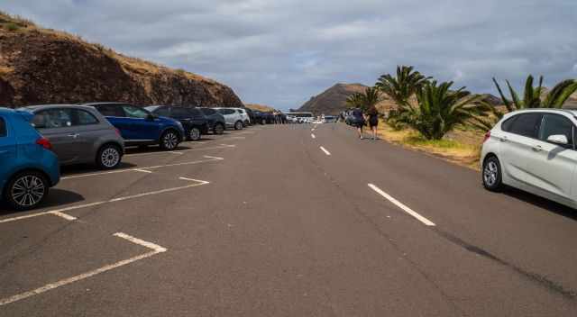
Although a huge car park with more than a hundred spaces at the trailhead, it can be totally full at midday during the peak season, the summer months, and you are forced to park at the shoulder.
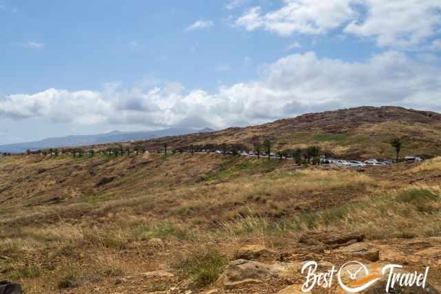
The most easterly tip is a popular place; many day trippers stop here for an hour or so to get a glimpse of this beautiful coastline, plus the many hikers. Therefore, either come in the morning or early afternoon (in summer, until 3-4 pm works well). Parking Google Maps Location
New Hiking Fee since October 2024
A hiking fee of 3€ per hiker for the most popular trails is mandatory! Permits are controlled. If you enter this hiking trail without a permit you risk a fine of 500€.
Request your permit here: Madeira Island Hiking fees
5 Tips for Vereda da Ponta de Sao Lourenco
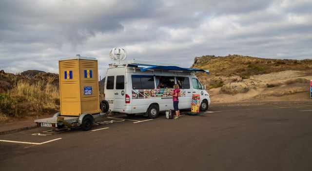
- Go Before You Go; There aren’t any facilities at the trailhead, a van offering beverages, ice cream, snacks, and the only available restroom.
- Bring plenty of water for this track without any shade; you definitely get thirsty.
- At the end of the track is a beautifully located but a bit high-priced cafe; half a litre beer for 5€. Of course, everything must be transported by boat, but a fee of 1€ for a dirty restroom is unacceptable.
- Due to the exposed location, you never know how the weather will be on the peninsula. It changes quickly, so a wind and rain jacket is needed.
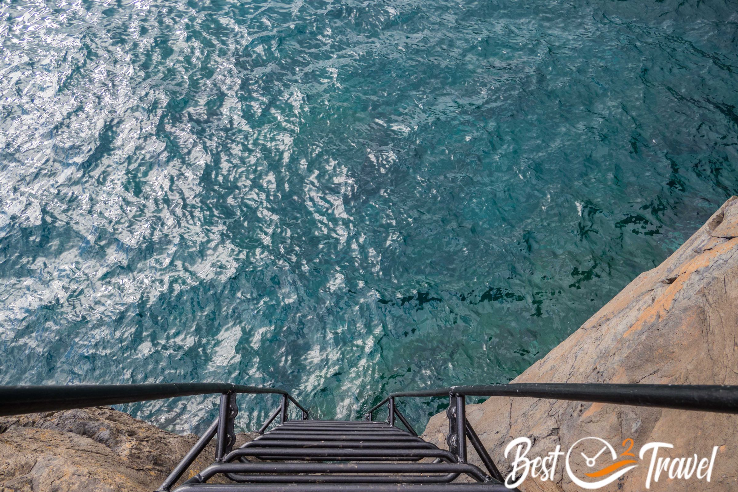
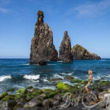
- Beaches and swim spots are along the trail on the calmer side to the south. Start early, and carry a lunch, towel, and swimsuit in your backpack.
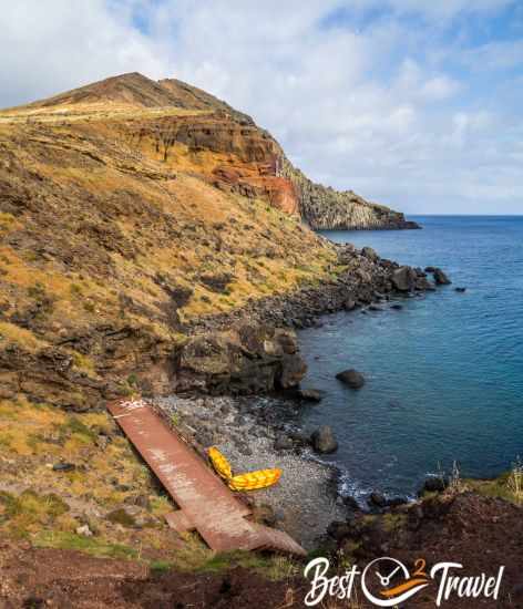
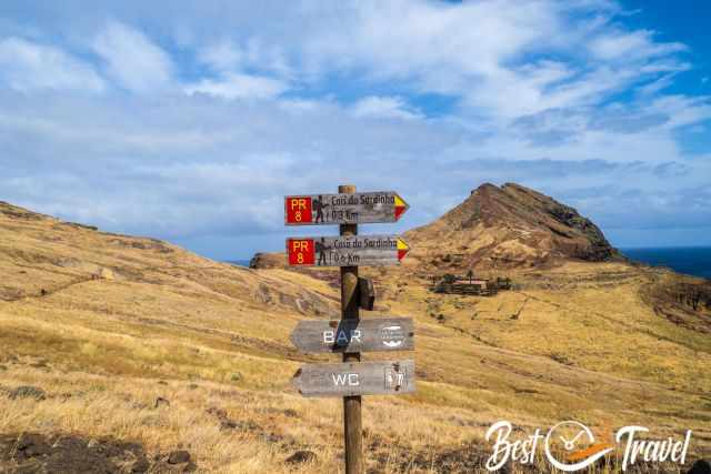
The two beaches are Praia do Sardinha, close to the cafe and Praia da Baia D'Abra, one-kilometre distance from the car park.
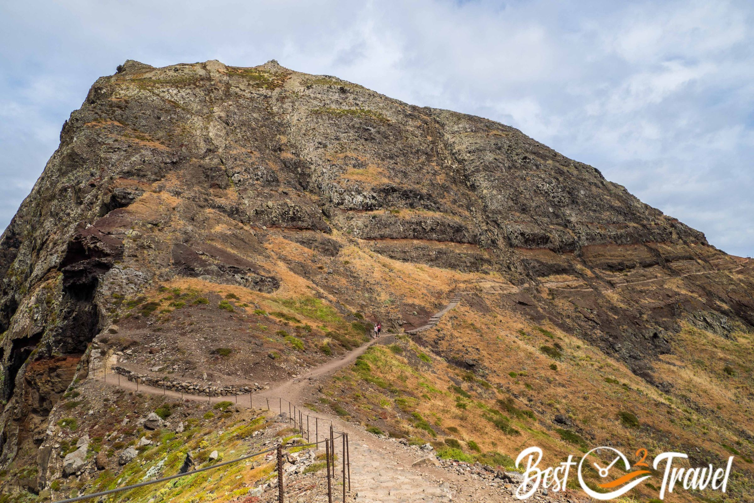
Vereda Sao Lourenco Trail Details
- Duration: The trail takes roughly 4-5 hours if you like to enjoy the fantastic views and volcanic landscape. Often it is mentioned that the hike can be done in 2-3 hours, but I can't agree, although we hike quite fast.
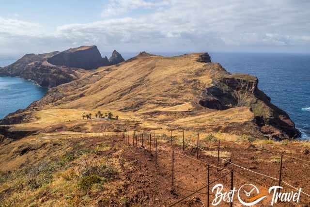
- Length: 8 km long trail - first and last three kilometres are the same; the two in between at the end are circular
- Difficulty: Moderate
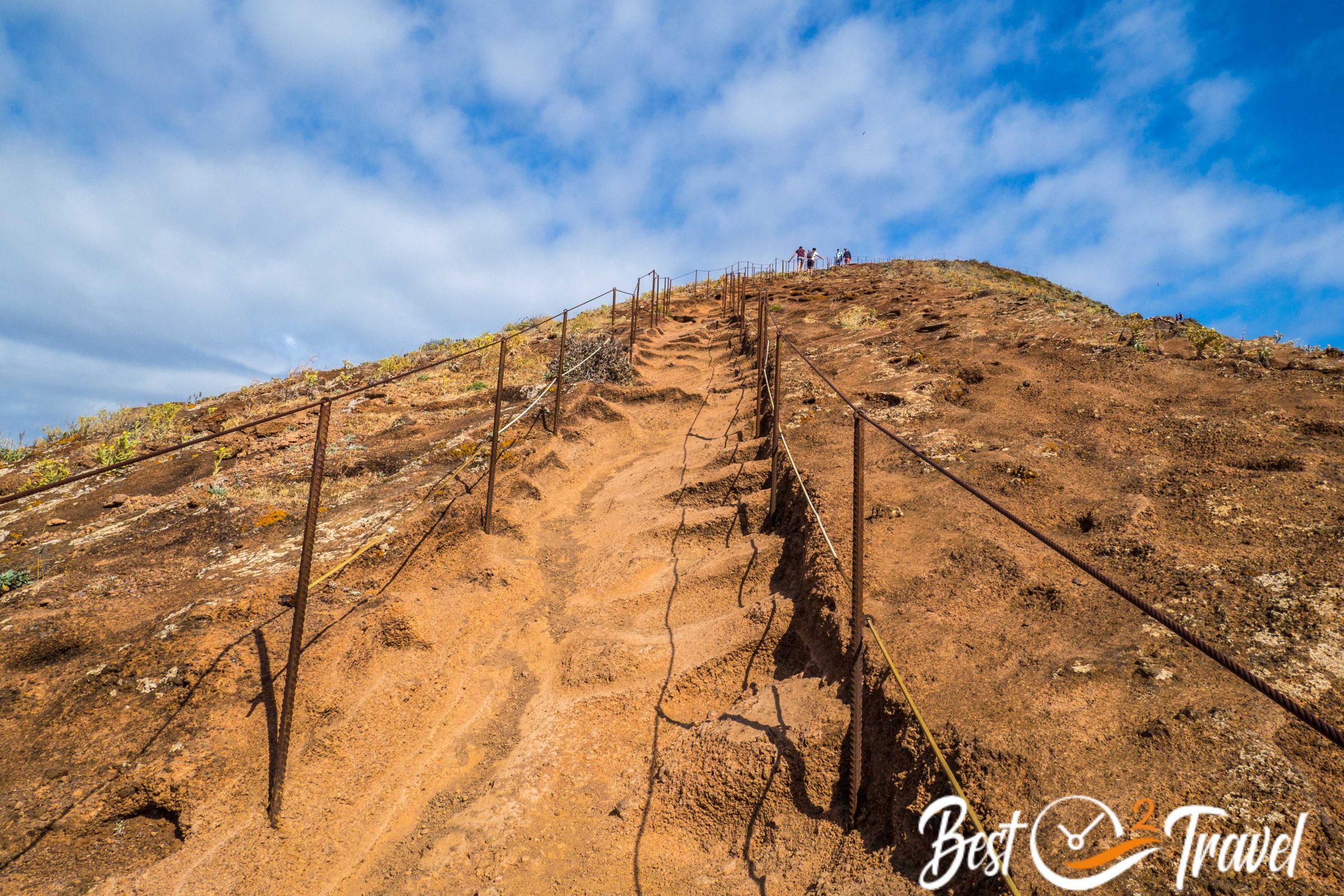
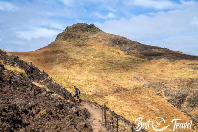
Although a rugged trail, it is well secured with metal ropes. It is more challenging during a hot summer day, and you must carry more water. - Altitude difference on this hike is 790 m
- Hiking Map by Locus Map App, including beaches
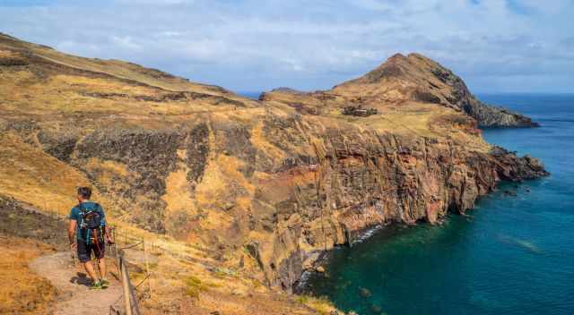
The entire trail is well-maintained, the first 200 meters or so are cobbled pave leading into a gravel path. The track is up and downhill but easy to walk and even suitable for children and dogs.
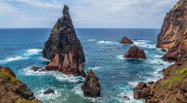
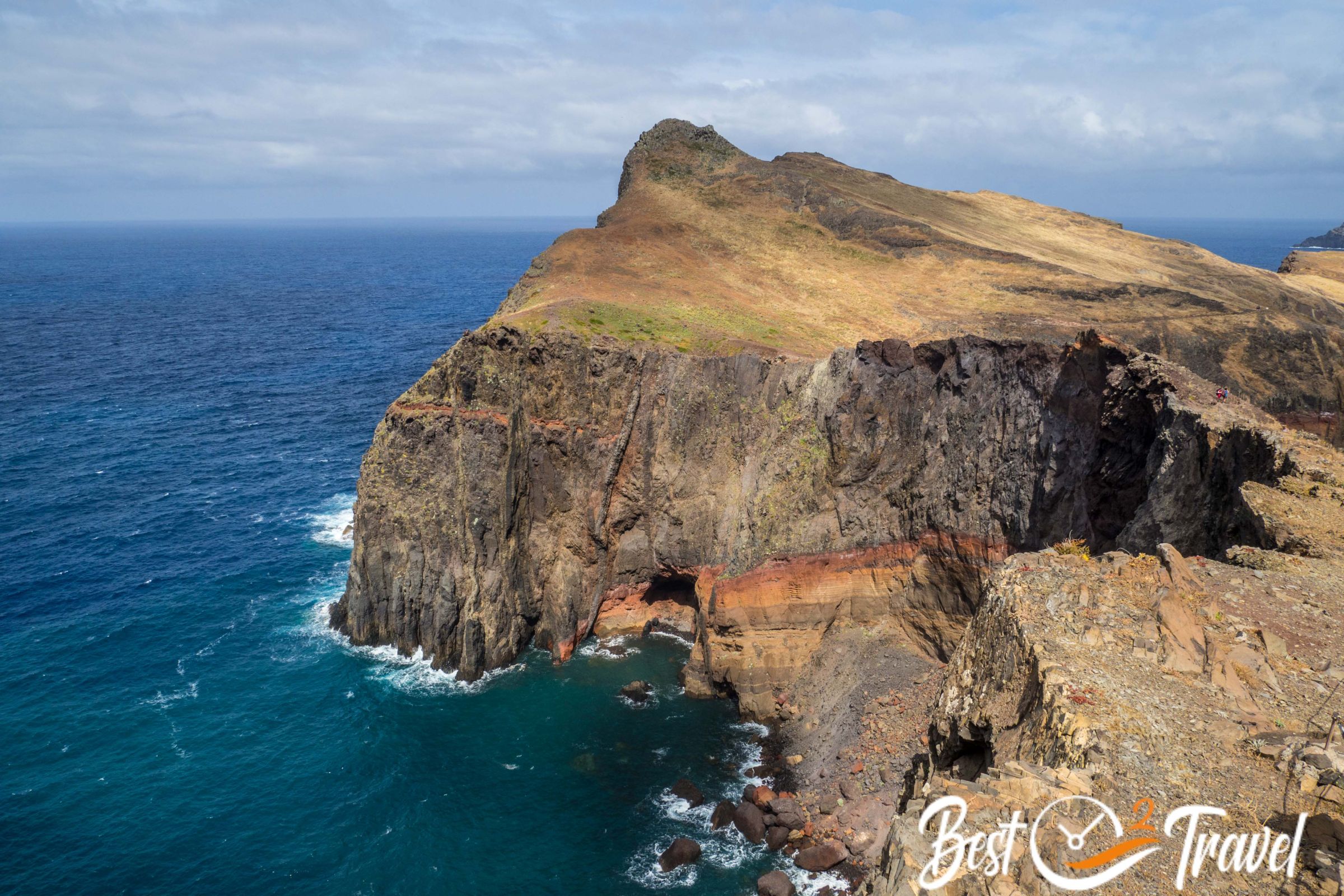
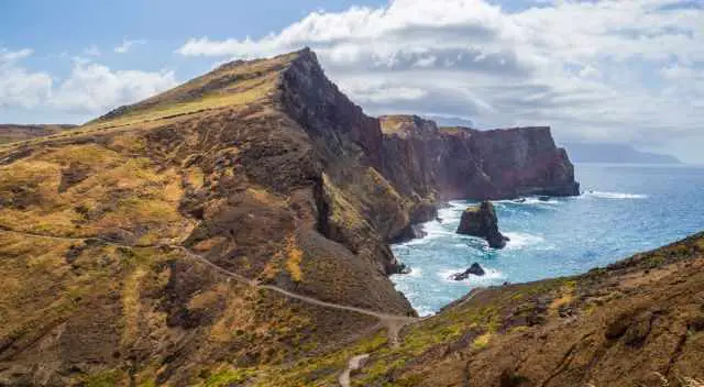
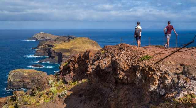
The trail traverses the peninsula offering exceptional views of the untamed ocean in the north on your walk to the tip of the peninsula and the calm sea in the south on the hiking path back to the car park.
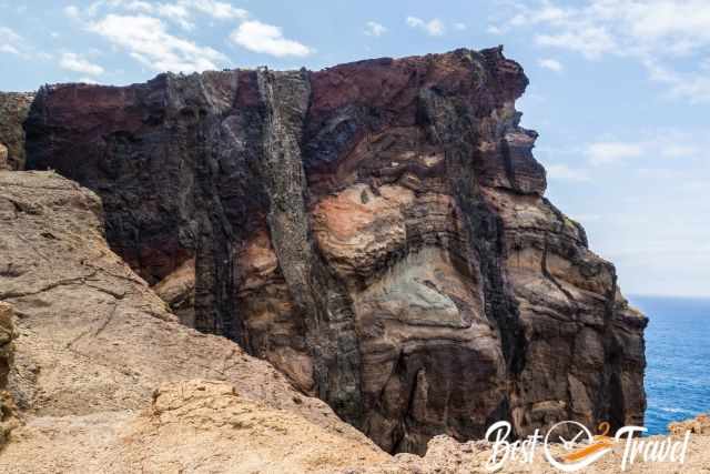
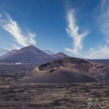
You witness the volcanic erosions from millions of years ago along the trail. It is a breathtaking colour explosion on the rugged coastline track.
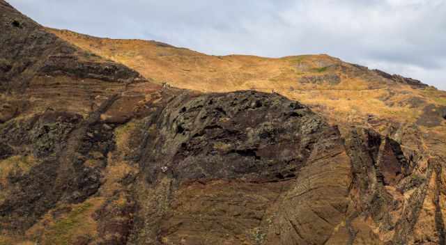
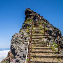
Some sections are exposed but always secured with metal ropes. You can't miss the well-marked path. There are scenic outlooks and beaches on this hiking trail.
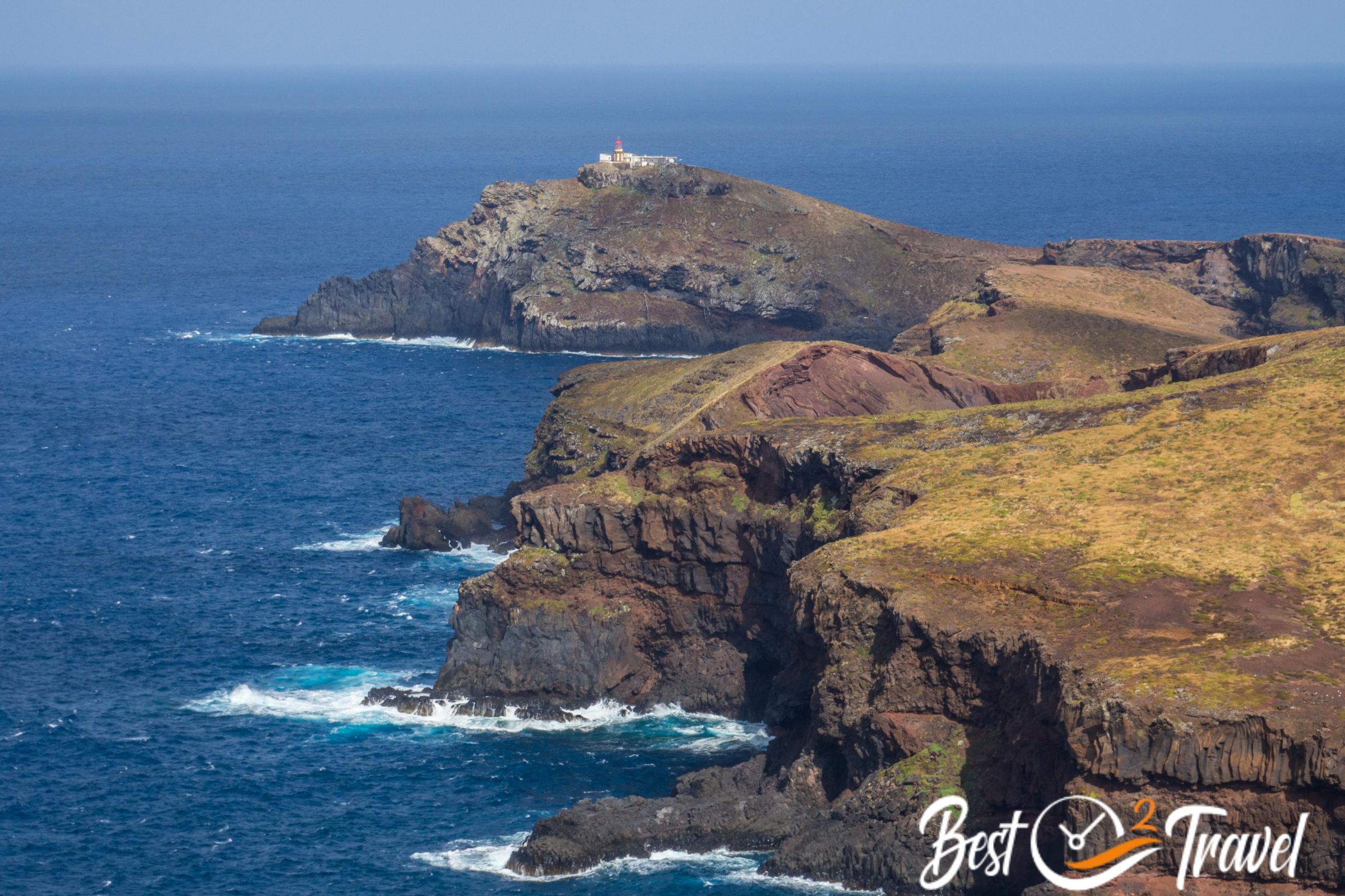
The trail ends after a steep climb to Pico- Miradouro do Furado. You can't walk furthermore. The path after the outlook is not maintained, steep, and you reach the sea.
Overall, plan at least 4-5 hours for photo stops to enjoy the beautiful scenery, and definitely bring a picnic. Wear proper shoes for the gravel, dusty, and slippery trail. Some people went swimming at one of the picturesque spots.
Where to Stay? My Top Recommendations
Calheta
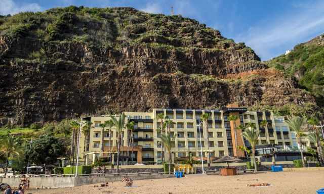
The Calheta Beach Resort is excellently located in front of the beach and sea, and within walking distance is a small supermarket Pingo Doce. It is shallow water here and, in combination with the sand beach excellent for children. Swimming is best at high tide, and snorkelling is amazing. Due to the breakwater, the bay and beach are well protected from powerful waves and currents. It is one of the very few sandy beaches in Madeira.
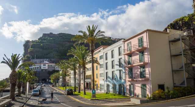
Ponta do Sol
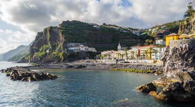
This town is located in the south, and it is one of the sunniest places in Madeira. There is an interesting historic town centre, lovely restaurants, and one of our favourite spots for swimming. The protected bay is well laid out.
There are lots of highly-rated hotels in Ponta do Sol. These hotels (by Stay22 and booking.com) are opposite the awesome sunny bay.
Thanks for booking via my website. With your support, I am able to provide all my guides for free.
Best Months to Visit
Location and Tips

Vereda Ponta de Sao Lourenco leads to the easternmost tip of Madeira, and this is one of the top five hikes IMO.
If you wish to use any of my photos, contact me, but I will take action against picture theft. Why do I write this here? Hundreds of my pictures are used worldwide without any credit, nor did they get my permission. I don’t mind giving permission, but I want to get asked for it and to be mentioned. The world wide web changed a lot, and rewriting honest travel content is the new business for many fake travel websites. Do you wish to know more about this topic and how to unmask such websites quickly? Read my article “The Truth About Fake Travel Websites and Picture Theft.”