
When Is the Best Time
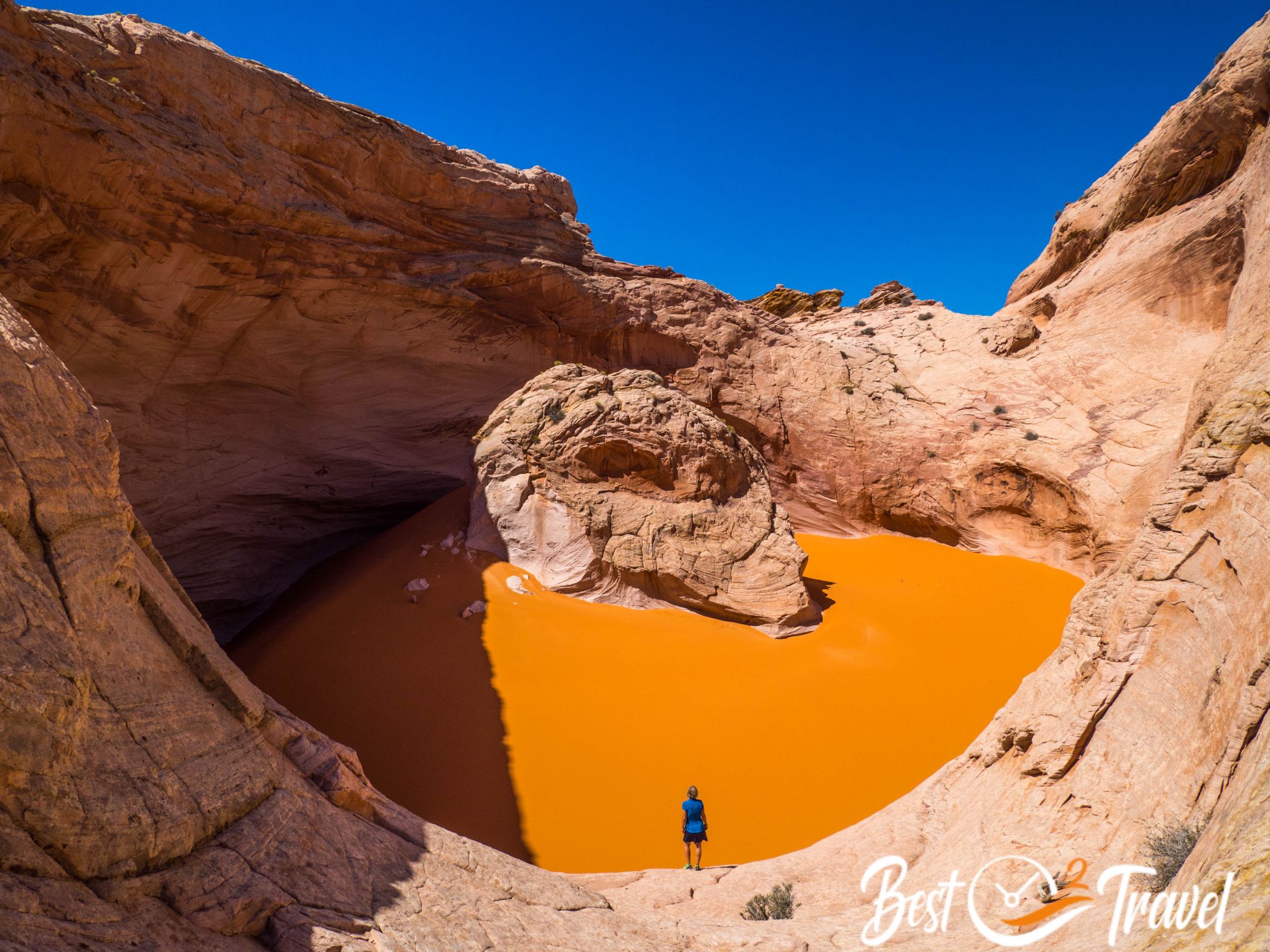
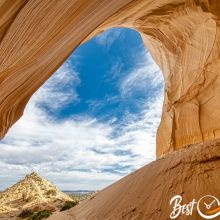
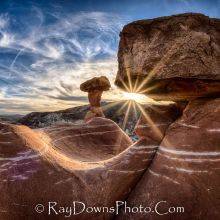
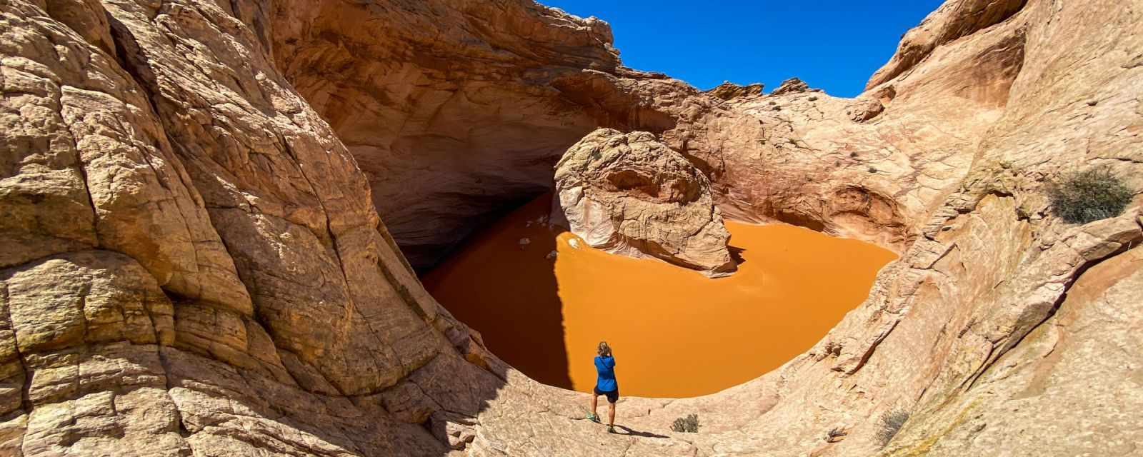
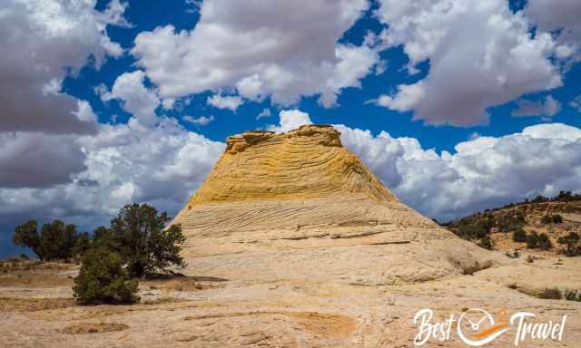
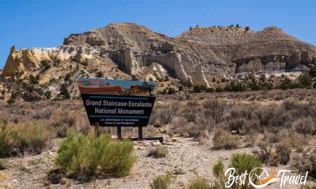
The name is already promising, and this place looks like being on another planet. The Cosmic Ashtray, also called the Volcano or Cosmic Navel, is located in the Grand Staircase Escalante National Monument, abbreviation GSENM.
It is the largest weathered sandstone pit in the world and unique in its kind. Geologists name this type of landform "Inselberg Pit", which is German and means island mountain. I will give you all the details about this hike, how to get to Cosmic Ashtray, our hiking route (map), and what to pack for this exceptional remotely located hidden gem.
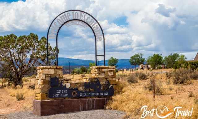
It is half an hour's drive from the town of Escalante and one hour from Bryce Canyon City to the trailhead. None of the hidden gems in Escalante is easy to reach, only on a gravel and sandy road that turns into clay if it rains.
The best time to visit the Cosmic Ashtray is from late September to October and April until mid-June, and the best daytime with sunlight into the Cosmic Ashtray is the morning.
During summer, the rainy season starts in mid-June and lasts until late September. If it is raining, it is pouring from one moment to the other. Roads and trails can get flooded, and cars stuck on Spencer Flat Road and Hole in the Rock Road, the most famous for getting to Grand Staircase Escalante's main spots.

Day temperatures reach 90°F/ 32°C in the shade, and hiking is challenging without any shelter.
What Is the Cosmic Ashtray?
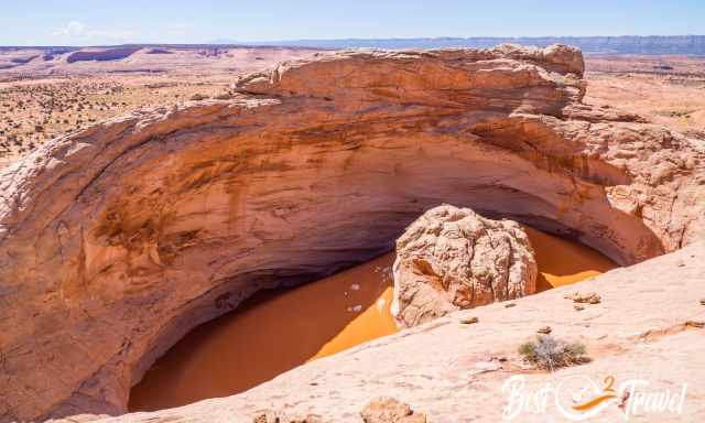
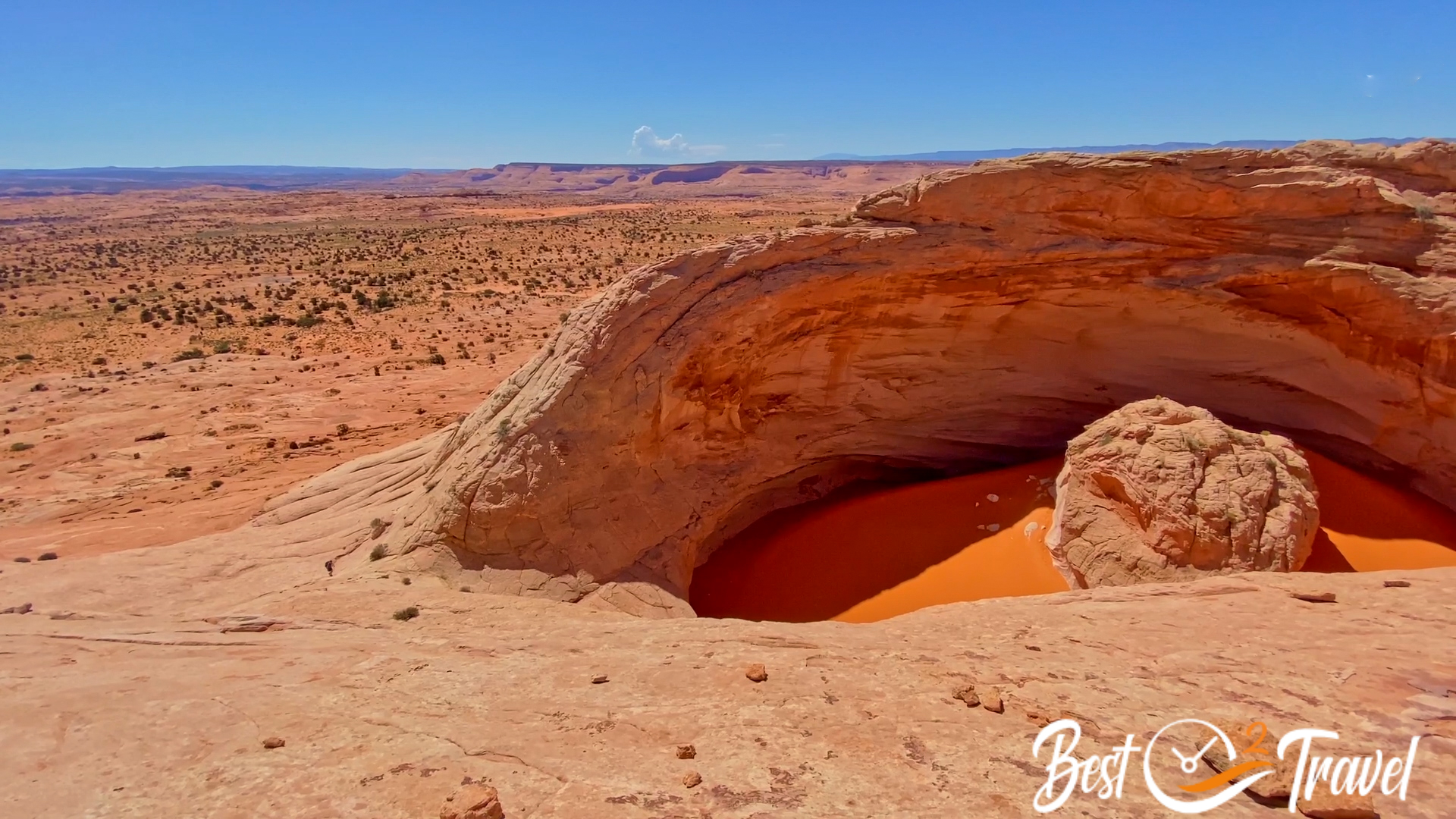
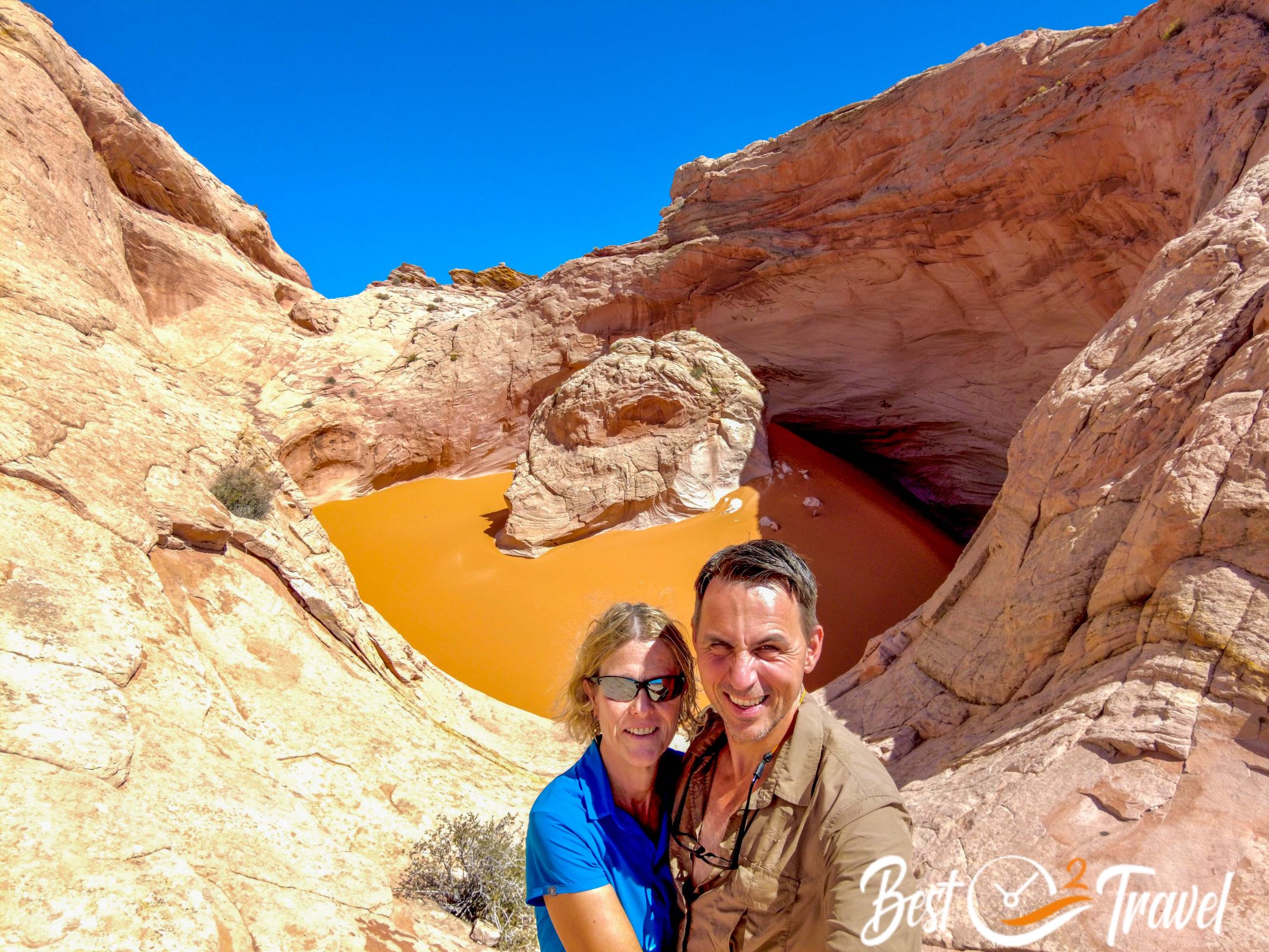
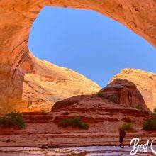
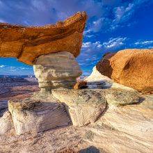
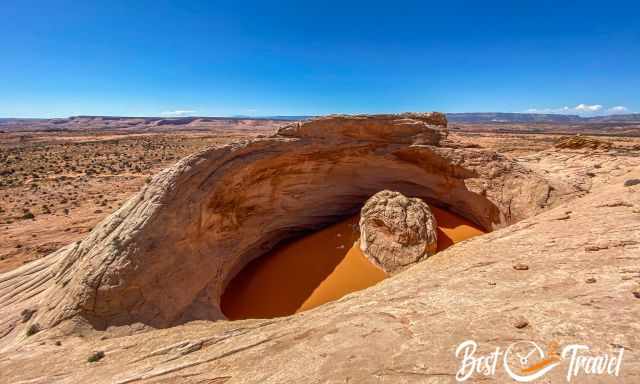
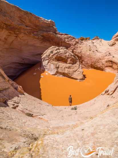
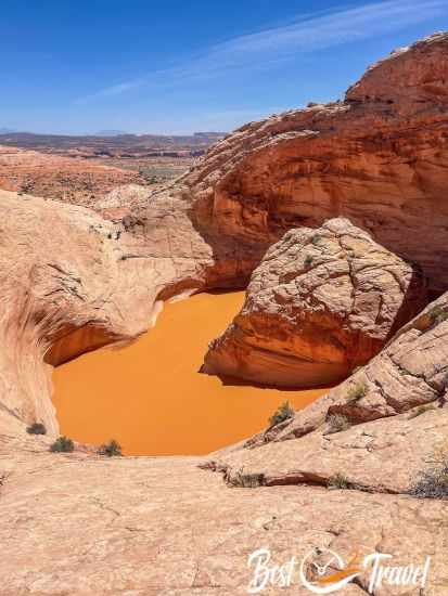
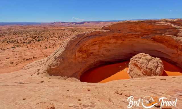
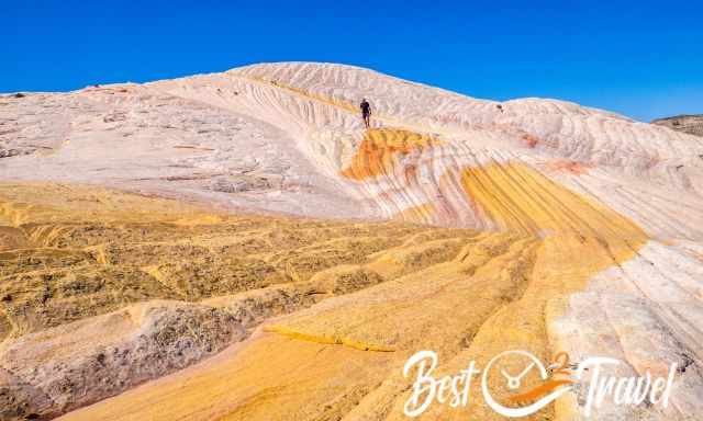
The Cosmic Ashtray is dome-like with a hollow and a rock island in the middle. The rock pillar in the middle is surrounded by reddish-orange sand developed by erosion.
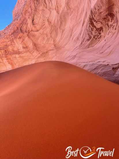
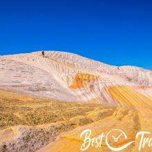
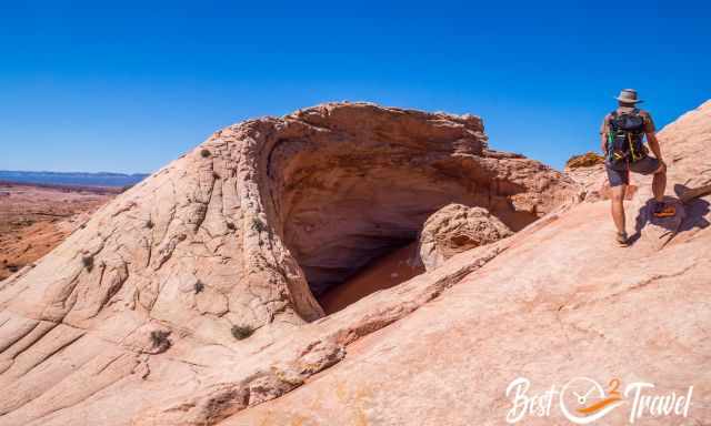
This orange sand in the pit is a moving sand dune changing its appearance by strong wind events. The cylindrical sandstone pit has an estimated depth of 65 ft/ 20m at the highest point and 16 ft/ 5m at the fractured part of the rim, where you can enter the Cosmic Ashtray.
How to Get to Cosmic Ashtray?
It is off the beaten path and not easily found. Two hiking trails lead to the Cosmic Ashtray. It doesn’t matter which route you choose; you definitely need a 4 WD with high clearance.
Please take it seriously and don’t come in a 2 WD. There are deep sand potholes, and you find yourselves quickly stuck. These two trails are not marked! You need a mobile hiking app or excellent map and navigation skills to find the Cosmic Ashtray!
 |
Do NOT go into the expansive Grand Staircase without this detailed map. For large amounts of time, you will not have cell phone service. It's a great alternative to a mapping app or for planning. The map delivers unmatched detail and valuable information to assist you in exploring this remote and colourful wilderness. It is printed on durable synthetic paper, making it waterproof, tear-resistant and tough. In case you need an emergency contact, we recommend the Lightweight and Compact Satellite Communicator from Garmin. |
1 From Harris Wash (Southern Route) Google Maps
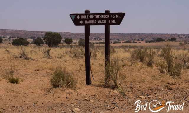
It is an almost 11-mile drive on Hole in the Rock Road until Harris Wash to the left. It is another 6 miles from here on a narrow, sandy road to the trailhead. This hike is roughly 9 mi/ 15 km long, longer than our chosen one. Honestly, this track is a bit boring just walking through a bushy plane field in the sand.
2 From Spencer Flat Road (Northern Route) Trailhead Google Maps
Trail Summary:
- Trail Length: 8,5-9,5/ 13,7-15,3 km - no trail markers - a hiking app and navigation skills are essential!
- Duration: 4-6 hours, depending on your fitness level and the heat
- Difficulty: Moderate in the winter with cooler temps but challenging in the scorching summer
- Elevation Gain: roughly 950 ft/ 290 m
- Hiking Map: Map by Locus Map App but you will not hike the exact route, there is no hiking path
- Rating: One of the best day hikes in the US!
More pictures and details about this hiking trail are below.
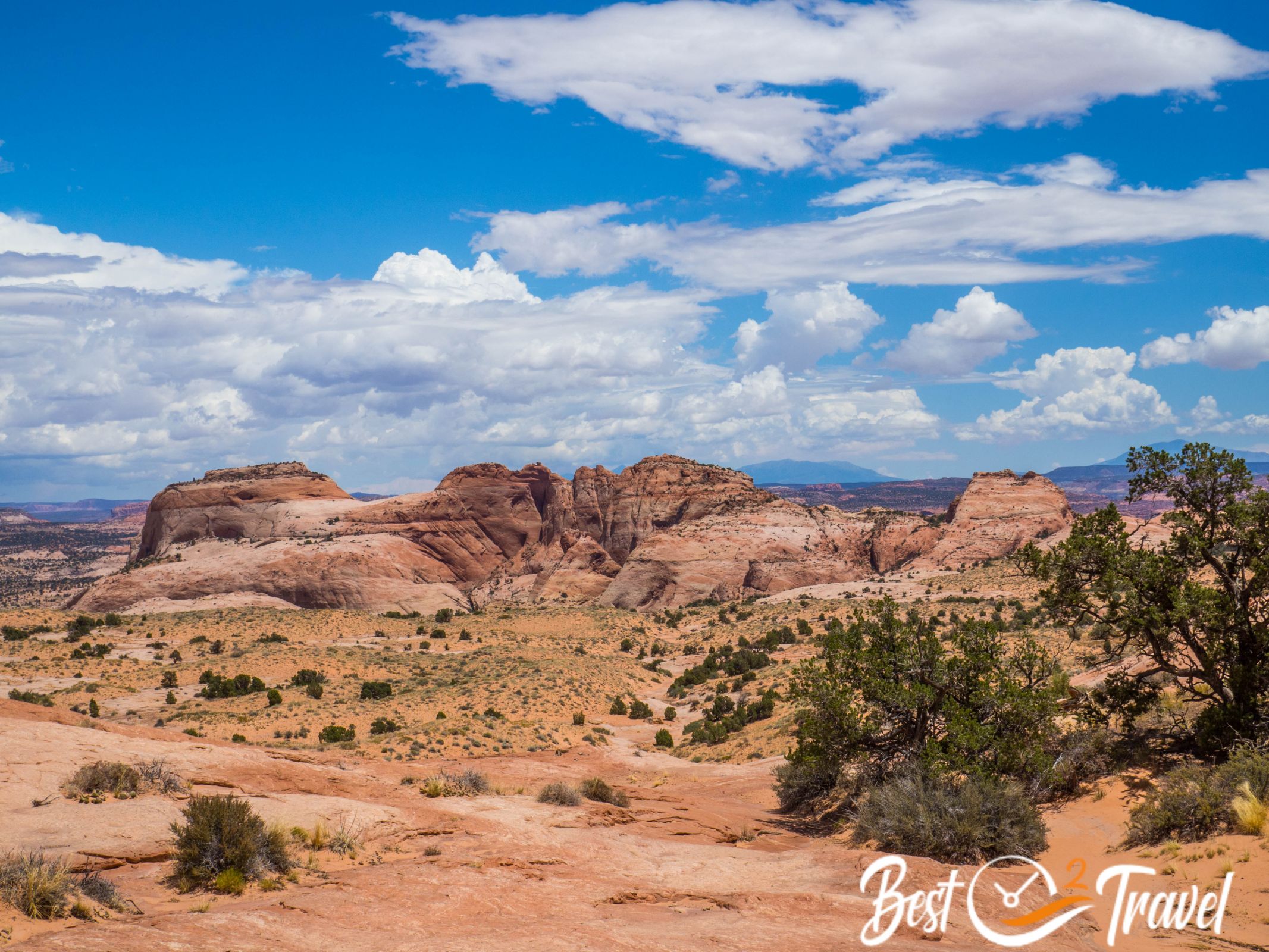
A shorter hike to Cosmic Ashtray is coming from the north from Scenic Road 12 to Spencer Flat Road to the right. Continue on this gravel road for 9.5 miles until the dirt road forks.
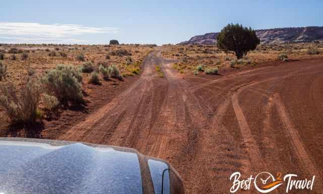
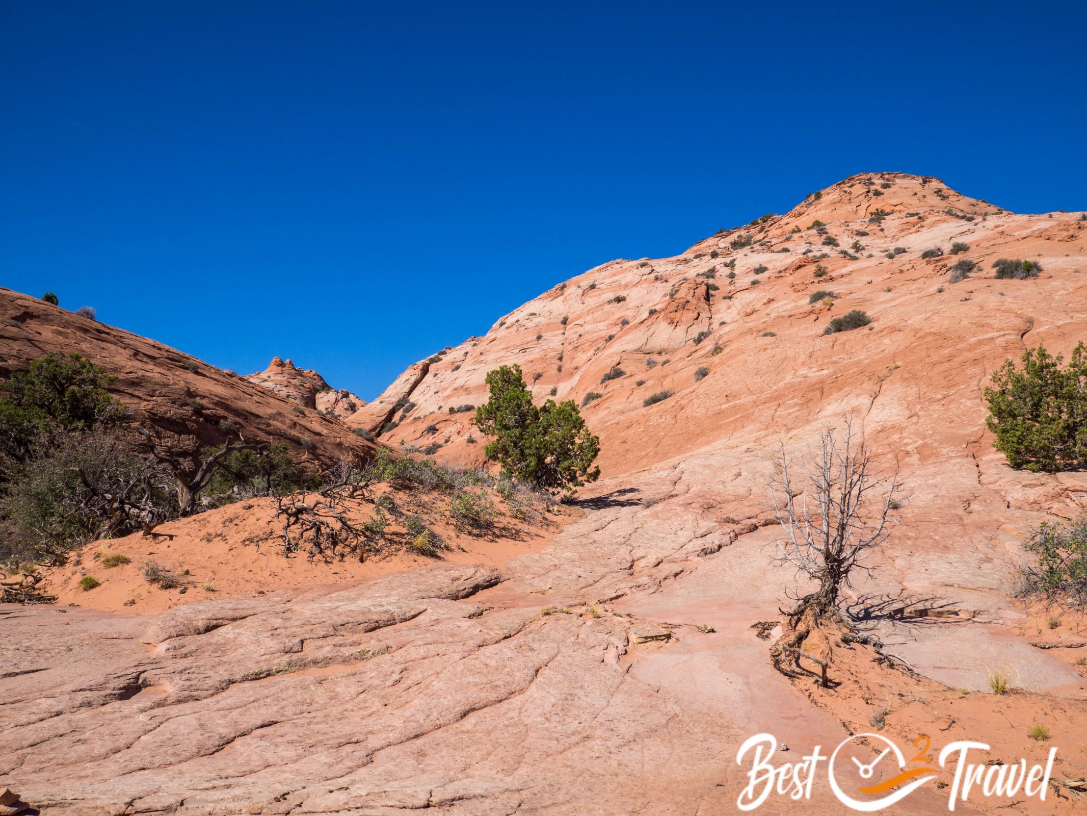
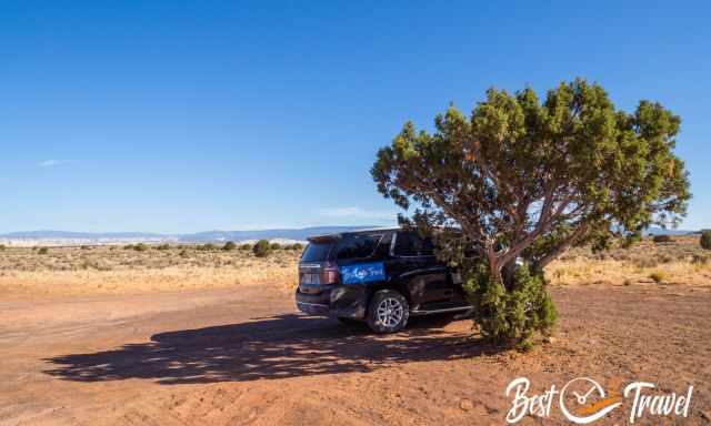
Take the minor left road for 1.2 miles until you reach a huge tree and flat area. This is the new trailhead; you can’t continue further by car. The Spencer Flat Road is already spectacular, with incredible rock formations and buttes to the right and left.
It took us 4.30 hours – 8.8 mi/ 14.13 km return and elevation gain of 950ft/ 290 m. However, there is no track; you need good navigation skills in the end; your hike can be shorter or longer. Our hiking route
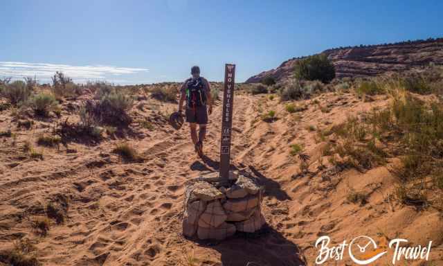
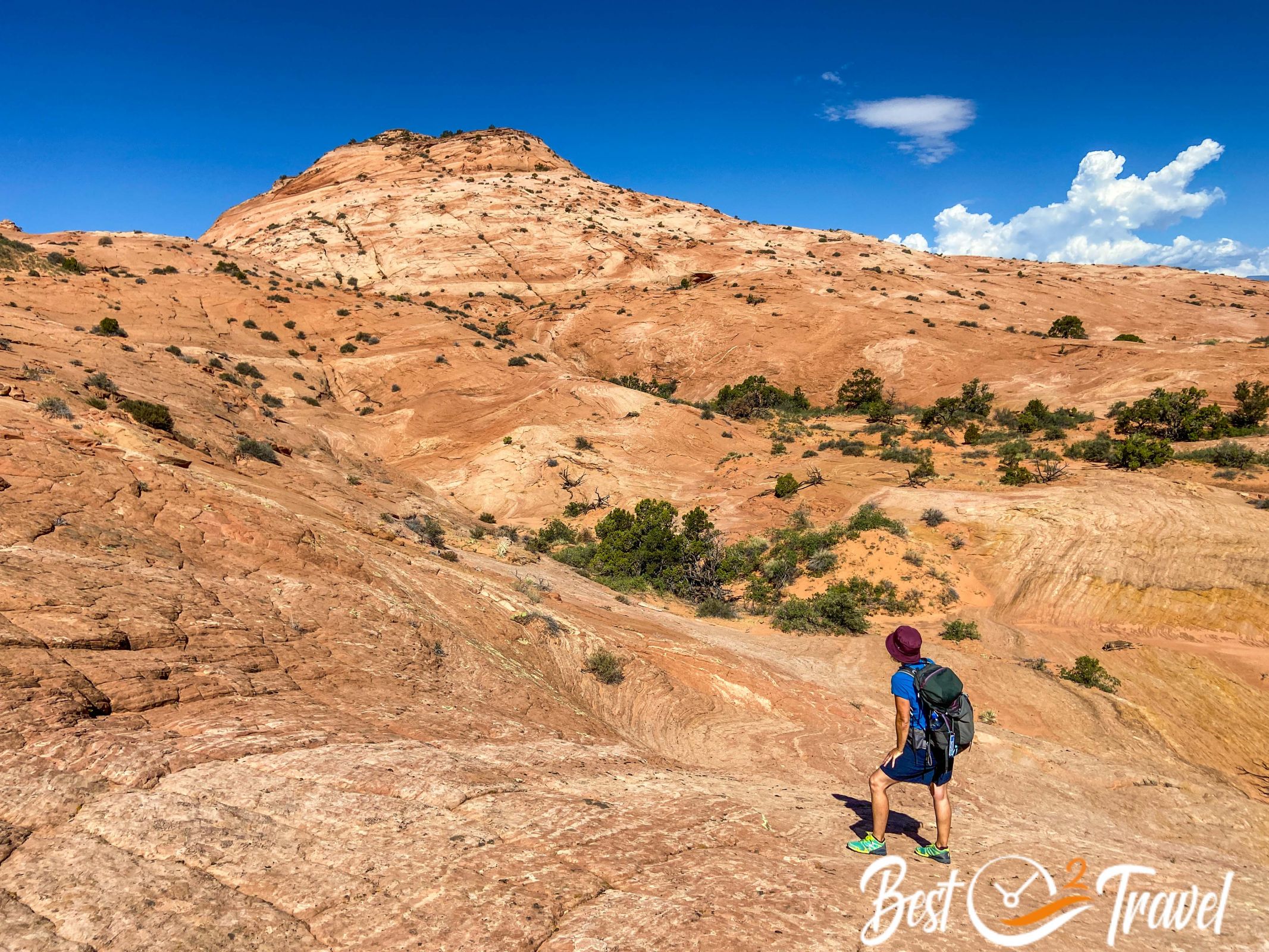
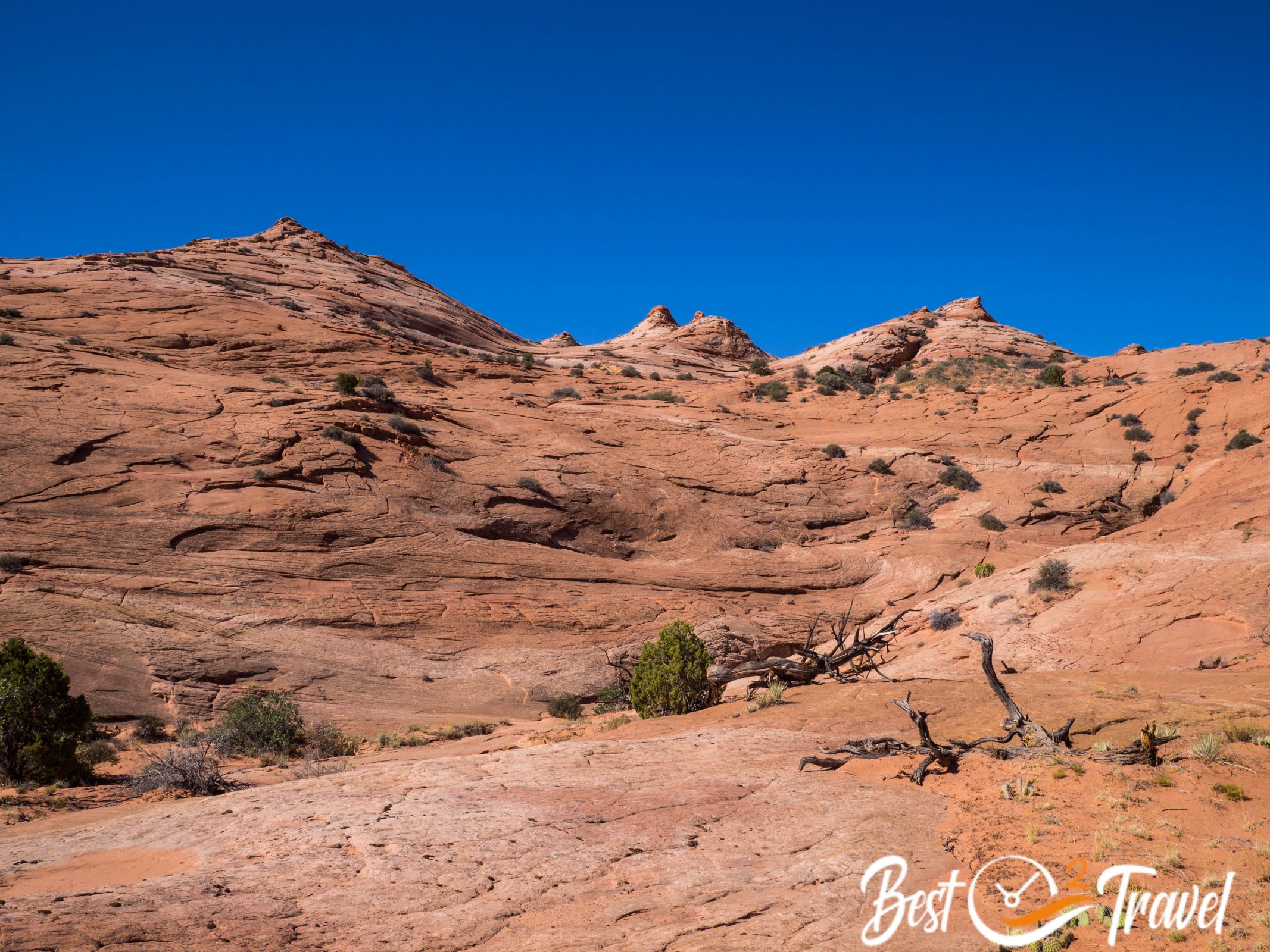
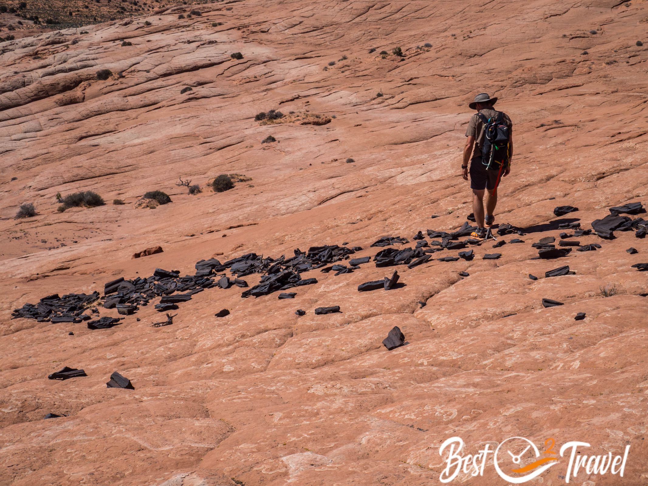
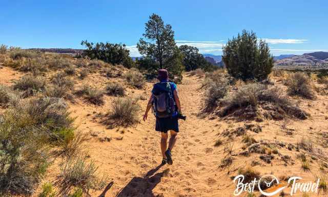
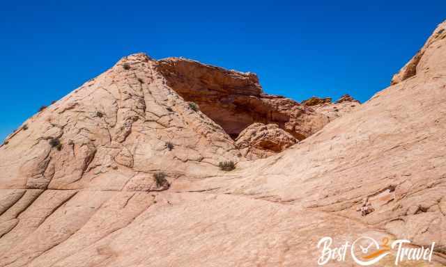
First, you walk on a sandy path, and it looks like it always goes straight forward, but you have to turn right, going downhill direction southeast.
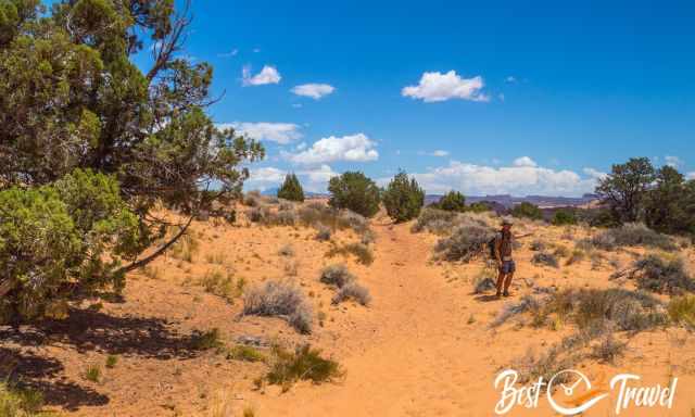
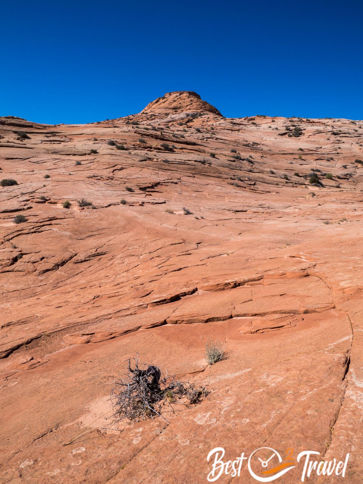
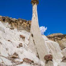
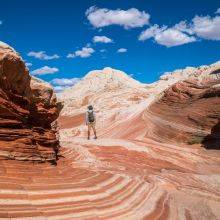
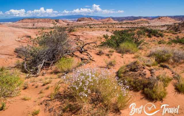
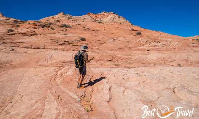
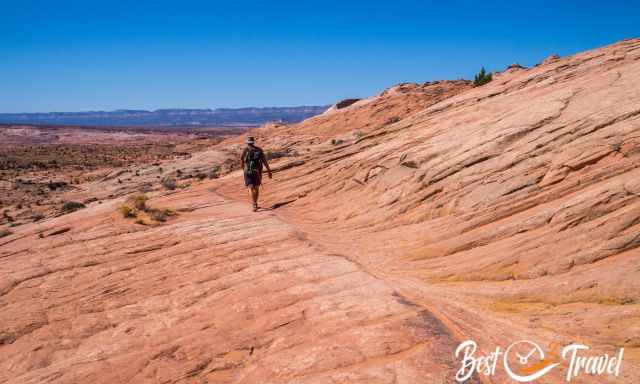
You continue another 10 minutes through sand but then most of the time over fascinating colourful rock formations with patterns like the Wave. The entire landscape is spectacular, with huge rocks in the distance. During the drive and hike, I already took tons of pictures.
The later you start, the hotter it gets from spring to autumn. Bring plenty of water, at least one gallon for each hiker and a snack for this not-marked track. To find the Cosmic Ashtray, you definitely need a mobile hiking app!
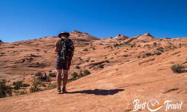
You climb up and down on the rocks until you can see a piece of the Cosmic Ashtray. It looks so close, but it still takes 20 minutes to get there.
How Do I Get Into the Cosmic Ashtray?
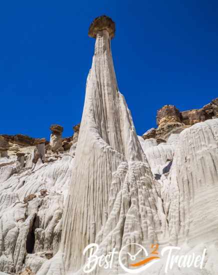
The Cosmic Ashtray is otherworldly and pristine. If you wish to climb into the Cosmic Ashtray, you leave footprints inside.
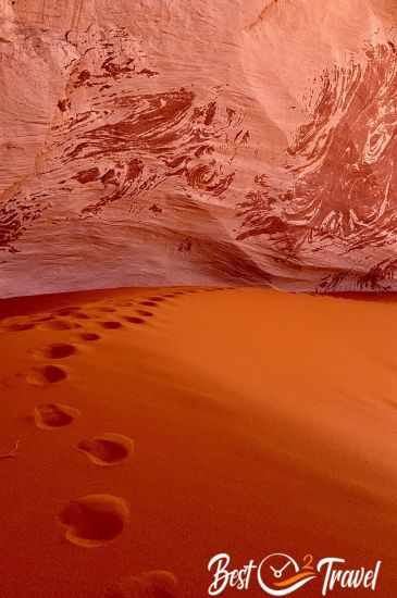
This unique and natural wonder gets destroyed until the wind erases all human traces. Definitely, don't climb into the Cosmic Ashtray if you are hiking alone.
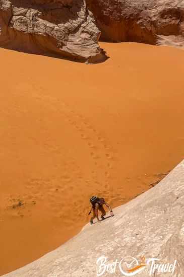
It is possible to climb out but much safer with a 33ft/ 10m long rope.
Enjoy the solitude of this stellar place and be aware of the desert-like climate.
My Packing Tips for Cosmic Ashtray Hike
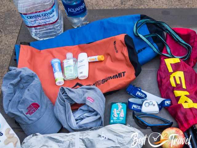
- In summer, sun protection is essential, sunscreen, especially for the face, a hat, and sunglasses. I have never gotten sunburnt since I started using this cream.
- Plenty of water, especially in the summer. I recommend putting electrolytes into the water bottle. Everybody loses magnesium, potassium, calcium, and sodium while sweating, which we replenish in this way.

- In case of an emergency or a hike that takes longer than expected, especially in GSENM; we never go without our rechargeable Petzl Headlamp in our backpacks.
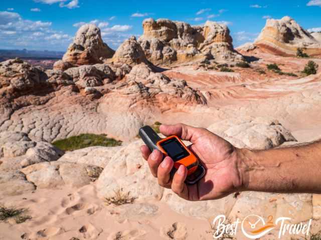
- There is almost no cell phone reception in the entire GSENM; let someone know your plans and when you want to return or carry a Garmin Inreach Mini, and never get lost. The Garmin Inreach Mini 2 is a handheld satellite communication device that allows users to send and receive text messages, track their location, and access emergency services outside of cellular range.
Grand Staircase Escalante Map - Access Roads
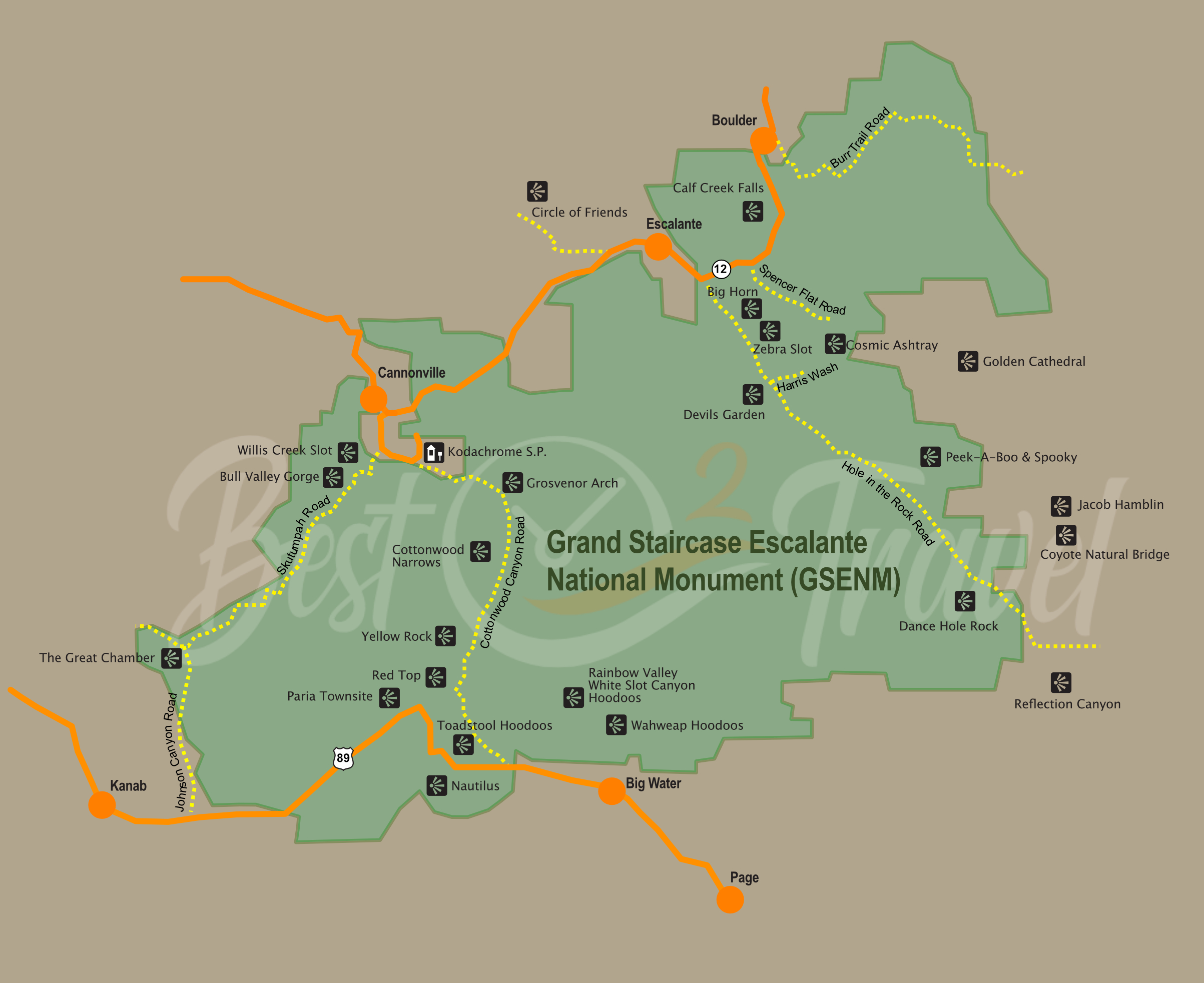
I have drawn this map to give you an overview of the massive Grand Staircase Escalante National Monument (follow the link for my 18-Must-Visit Guide), the location of each of the places, and a more detailed view. So, there is not only one entrance and exit to access Escalante; there are multiple entrances from highways and gravel roads. Afterwards, you must hike to get to these spots from half an hour to an entire day.
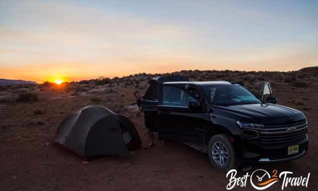
Can I Camp at the Cosmic Ashtray?
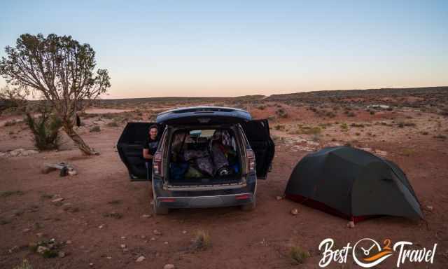
Literally, yes, but you need an overnight permit if you want to stay there during your hike. You quickly get your permit at the information centre. What I like most about Grand Staircase Escalante it is located on BLM Land, Buro of Land Management. This means you are allowed to camp almost everywhere.
It is allowed without a permit if you plan to stay at the trailhead, Spencer Flat Road or the Harris Wash, where you get to by car. However, try pitching your tent or parking your vehicle where others have already done. Take out what you took in.
Geology – How Did Cosmic Ashtray Form?
The Cosmic Ashtray is estimated to be at least 200.000 years old, a giant pothole filled with sand. It is mainly created by weathering and erosion. Strong winds occur; sandblast the pit and modelled the walls. The wind in the Cosmic Ashtray constantly changes the sand's height.
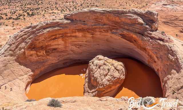
According to the Smithsonian, the sand inside the pit can be as high as the rock island in the middle and as low as you can see the bedrock.
 |
If you want to learn more about hikes in Grand Staircase Escalante, check out this guidebook. |
Gear Tips
- Merino Socks
My favourite hiking socks which regulate the temperature and even if they are wet, they are still comfy. On top merino socks are no stink. - Electrolytes
Plenty of water, especially from spring to fall. Cosmic Ashtray is remotely located; the closest town is Escalante. However, water alone is not sufficient enough during high temperatures. We always dissolve an electrolyte tablet in the water for better hydration. - Rechargeable Petzl Headlamp
Most of the hikes in GSENM are hidden gems and you rarely meet other hikers. Trails are not marked and it can happen that you spend more time at the spot or on the trail than planned. For such cases, we always carry a headlamp in our backpack.
Best Months to Visit
Location and Tips

The Cosmic Ashtray in the GSENM is otherwordly and a hidden gem. I'll give you all the driving and hiking details to find this unique place in the greater Escalante National Monument, which always provides new fascinating masterpieces of Mother Earth. We got addicted to this monument in Utah, and I also added a guide about the 18 outstanding spots here.
Looking for more hidden gems? Are you sick of trying to win the Wave lottery? This is the best Wave alternative, which we checked out in late June and again in September.
And there are more such places off the beaten path, not overrun, with no soul in sight, just you and this magnificent piece of mother nature, the Wahweap Hoodoos, just half an hour from Page.
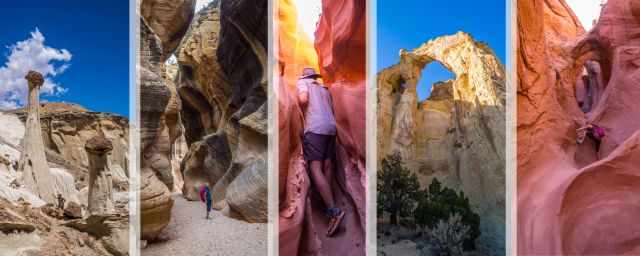
Do you wish to know more about the Grand Staircase Escalante National Monument? Check out my new guide and the 18 Must-Visit Places and where they are located. Not all are difficult to get to; some are even family and dog friendly.
Who We Are
We are passionate travellers, have been married for 25 years, and love discovering hidden gems around the globe. I am passionate about sharing some of the most beautiful places in the world with you, but I still can't live from my work, and we have regular jobs, too.
It is a tough business nowadays because fake travel websites rewrite content without effort and expense. Would you like to know more about fake travel websites, picture theft, and how to unmask them? Check out "The Truth About Fake Travel Websites"
Do you like my Cosmic Ashtray Guide? Please share it with your friends and on social media, subscribe to our YouTube Channel.
Do You Like to Support Me - It's easy; use the Paypal Button below 😍
Do you want to obtain the usage right for some images? Contact me, but we will take action against picture theft.
** pictures by Rob