
When Is the Best Time
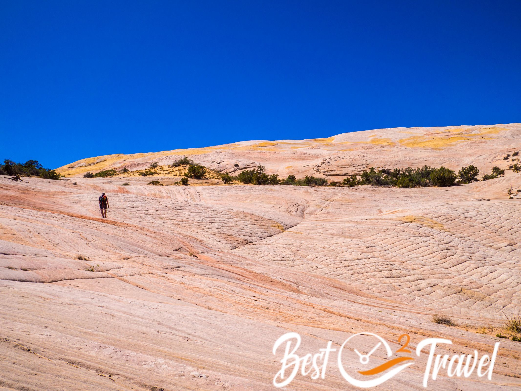
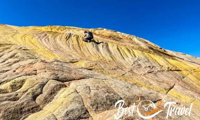
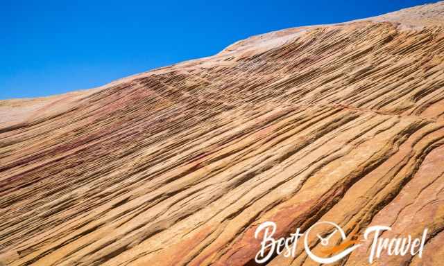
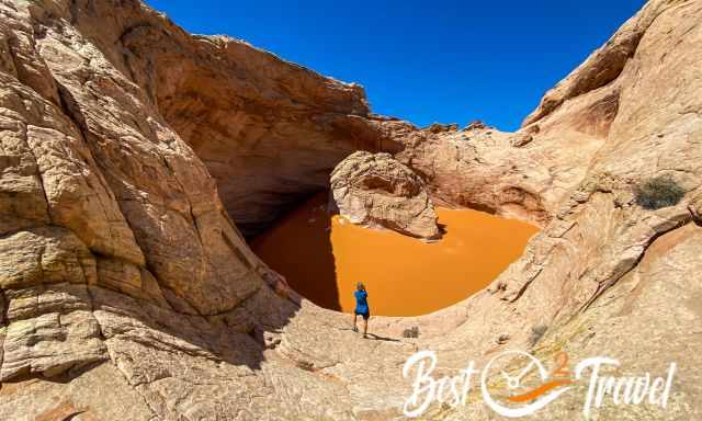
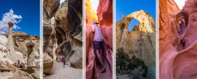
Yellow Rock is another otherworldly place in the Grand Staircase Escalante National Monument or GSENM. IMO, Yellow Rock is an excellent alternative for the Wave; no permit is required, and you have this place for yourselves.
I will give you all the information to find this hidden spot, hiking details and what to consider for a memorable day in the majestic national monument located close to Page and Kanab. We have visited the sandstone rock formation twice, once in June 2022 and again in September 2023, and would go immediately again.
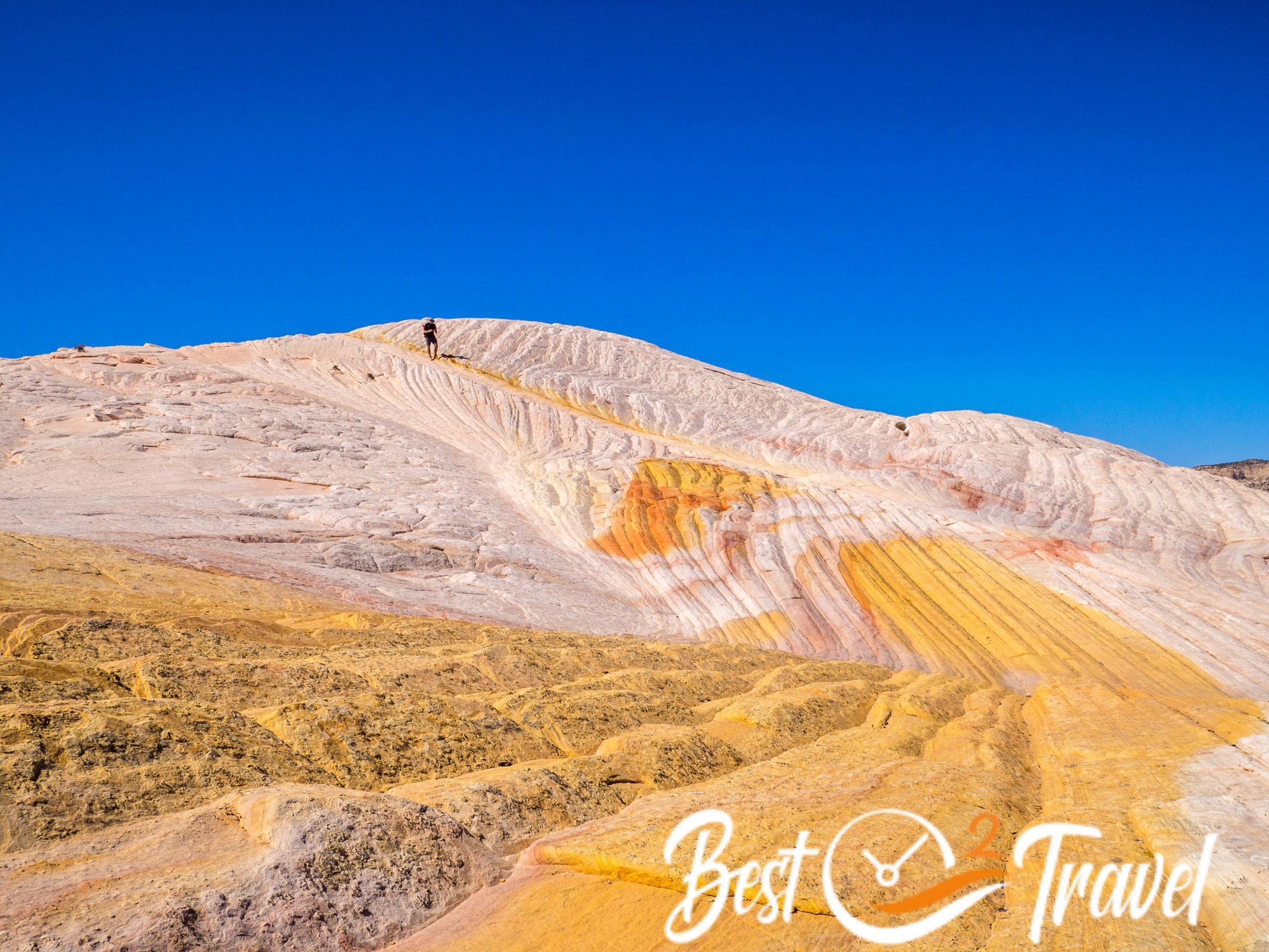
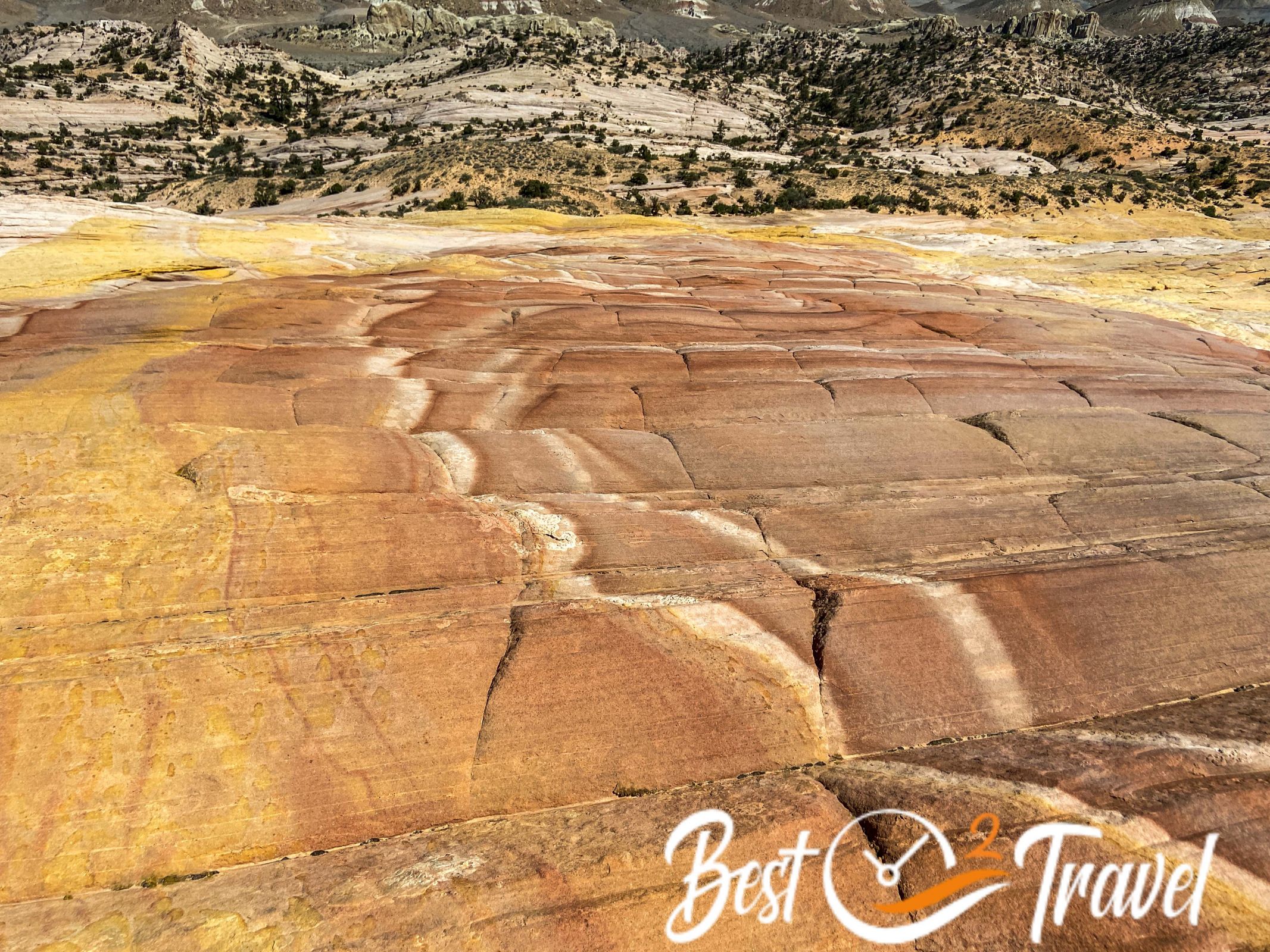
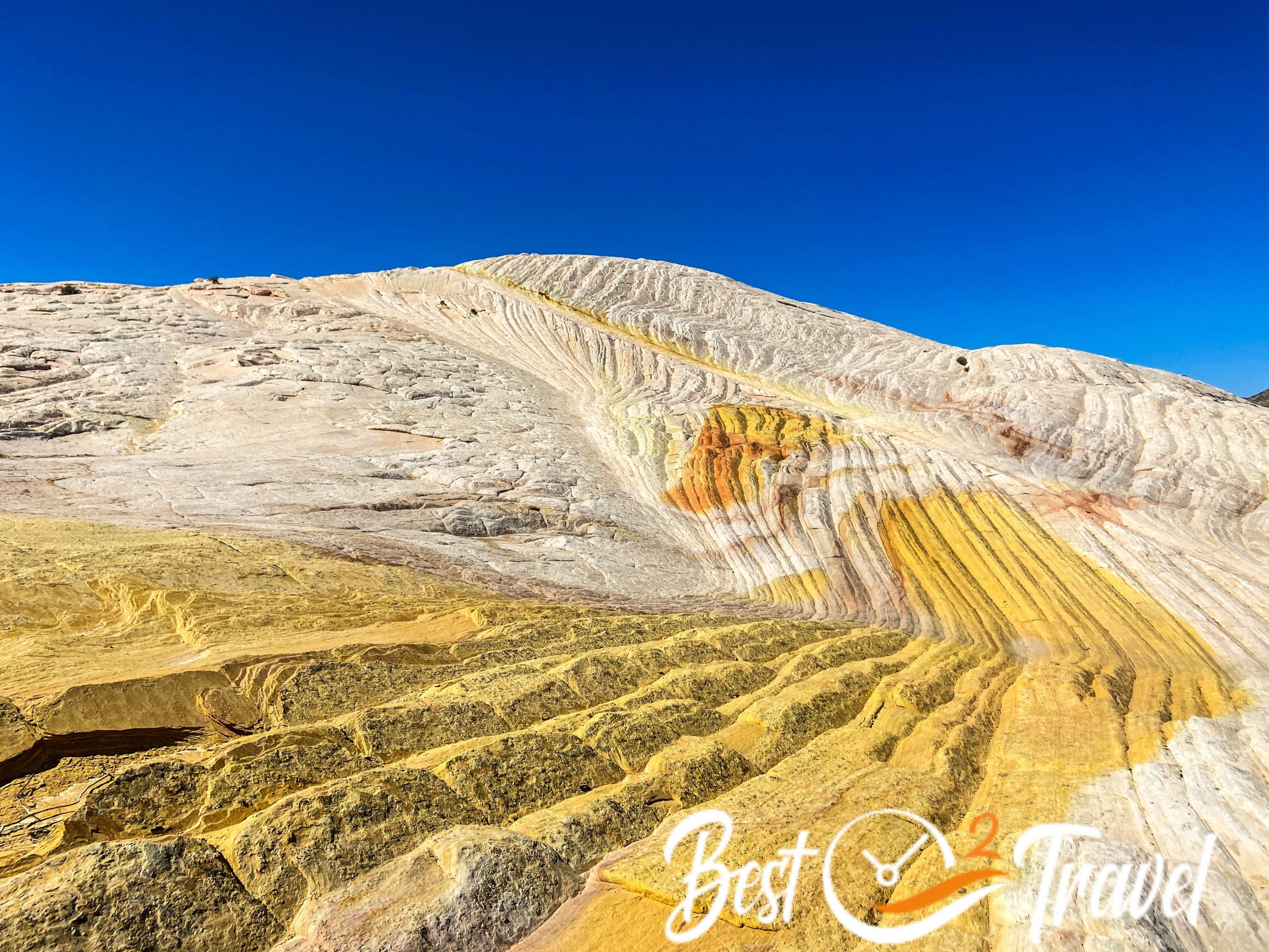
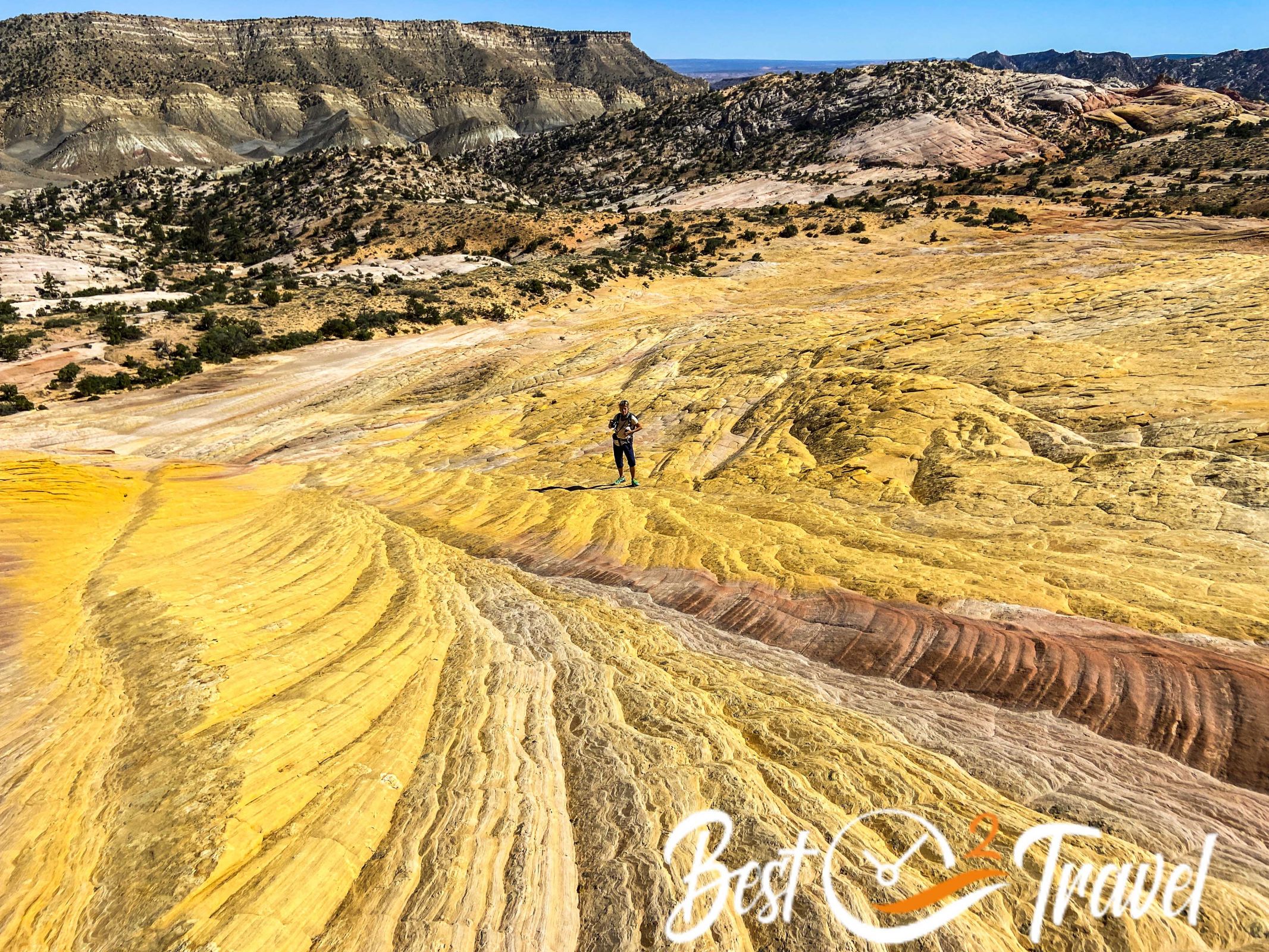
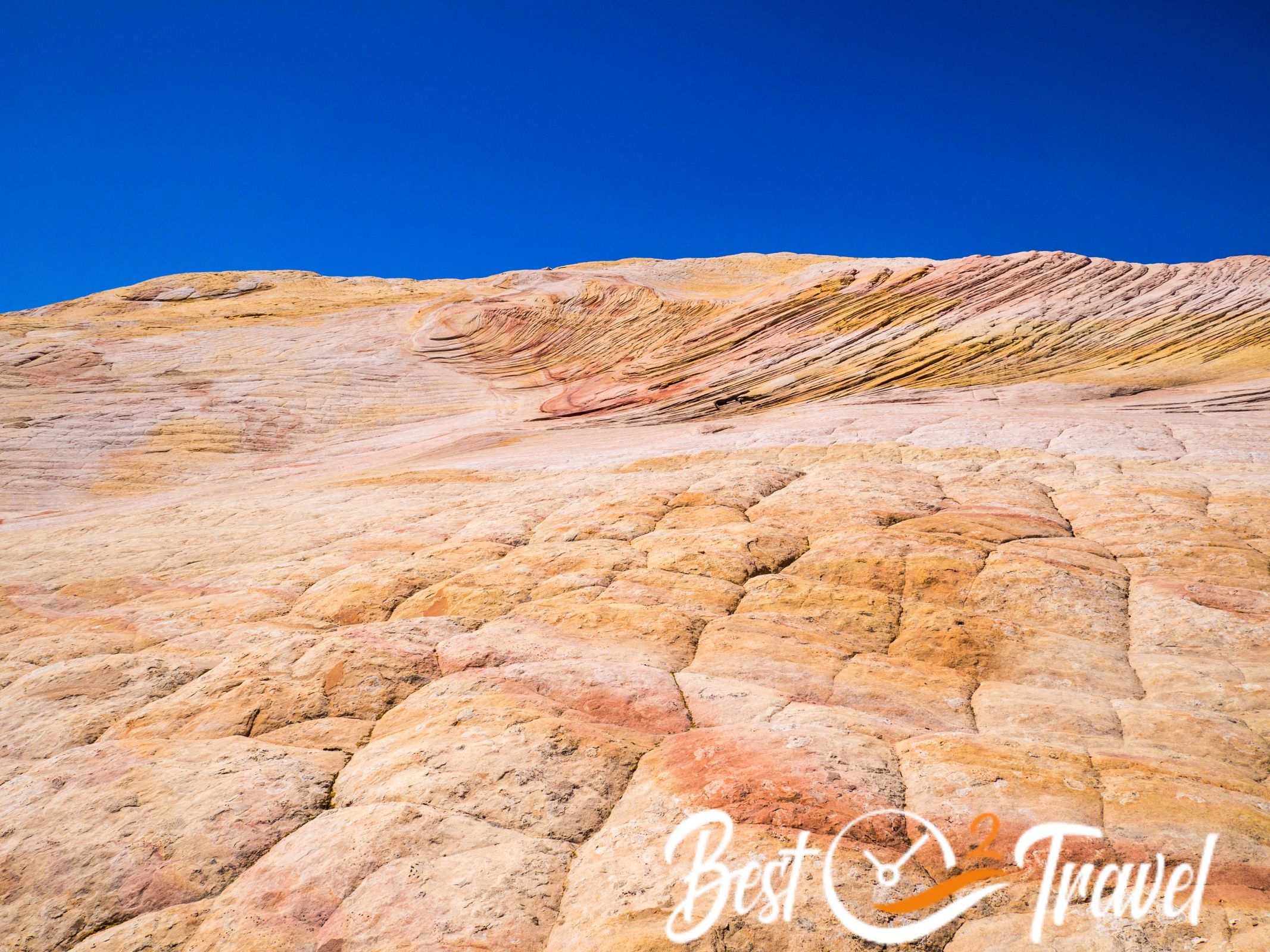
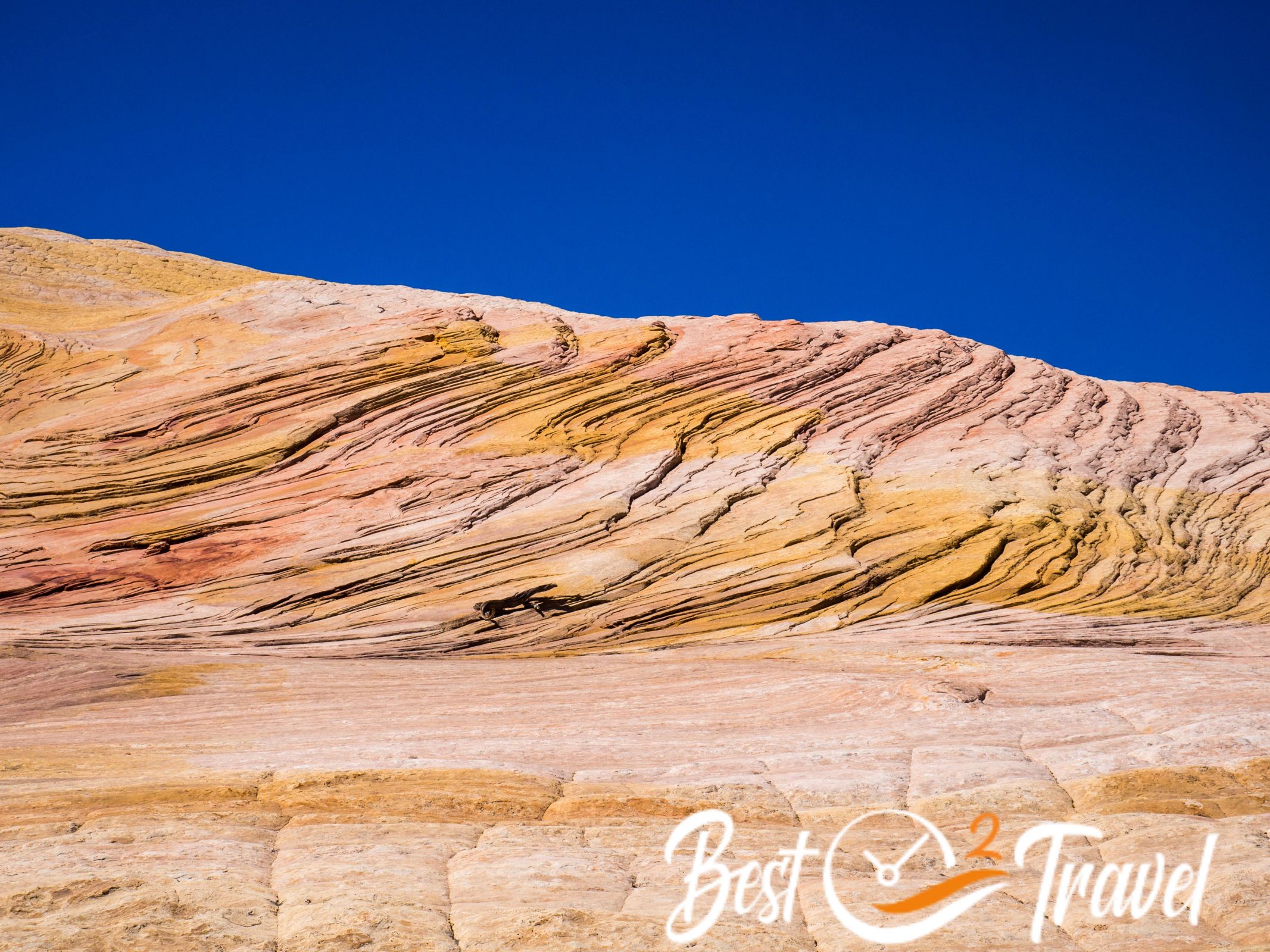
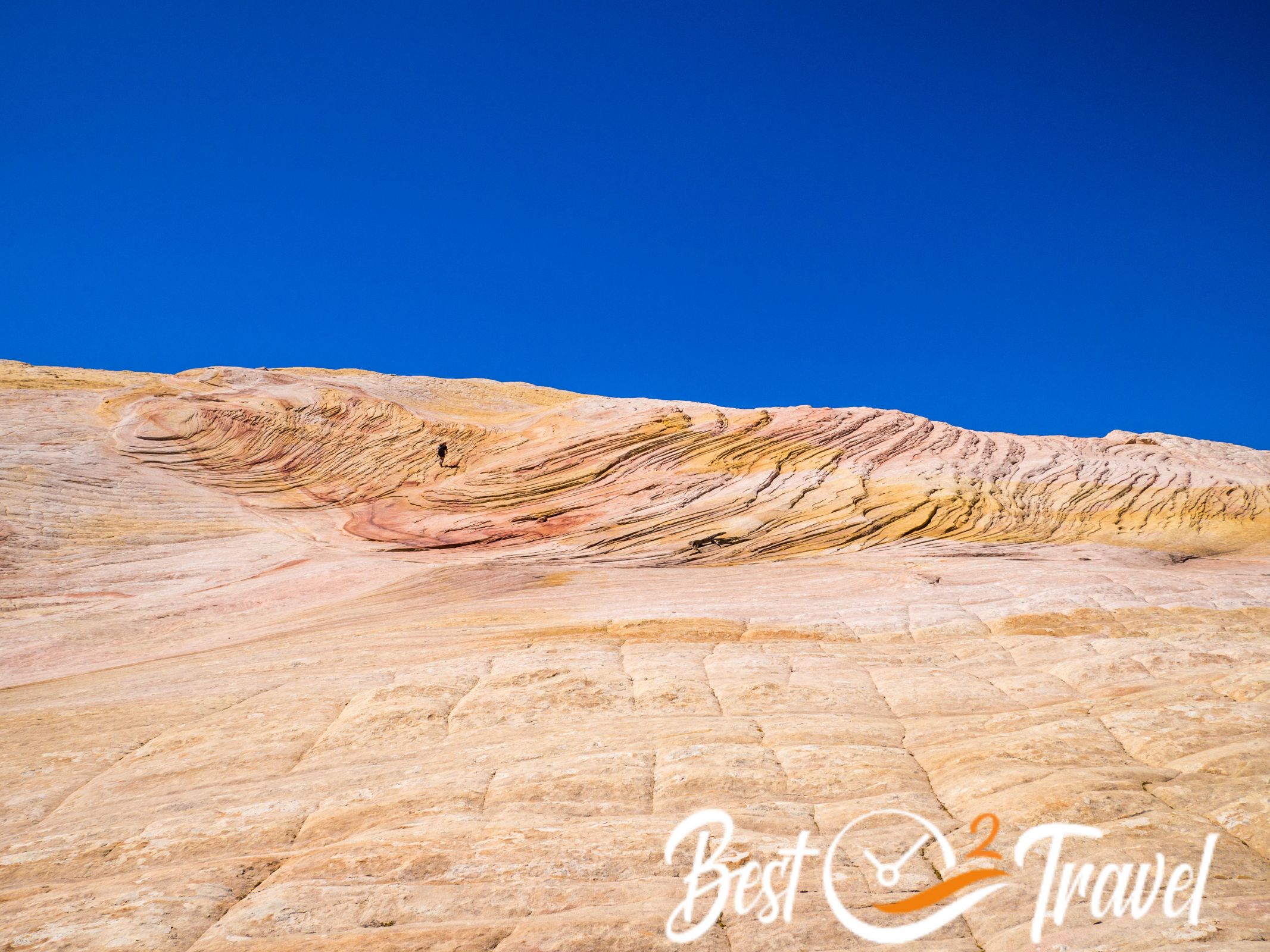
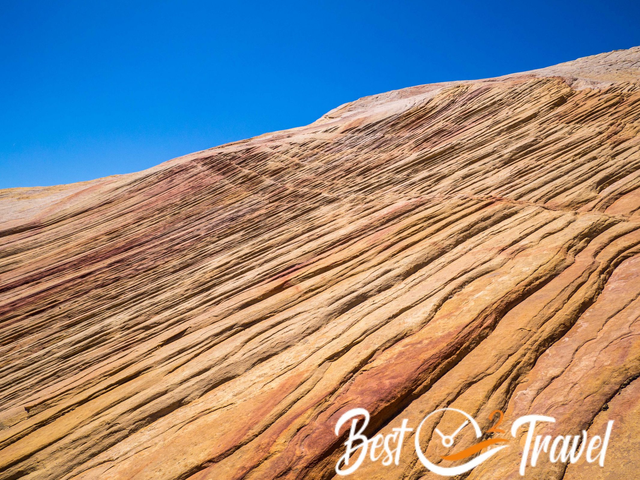
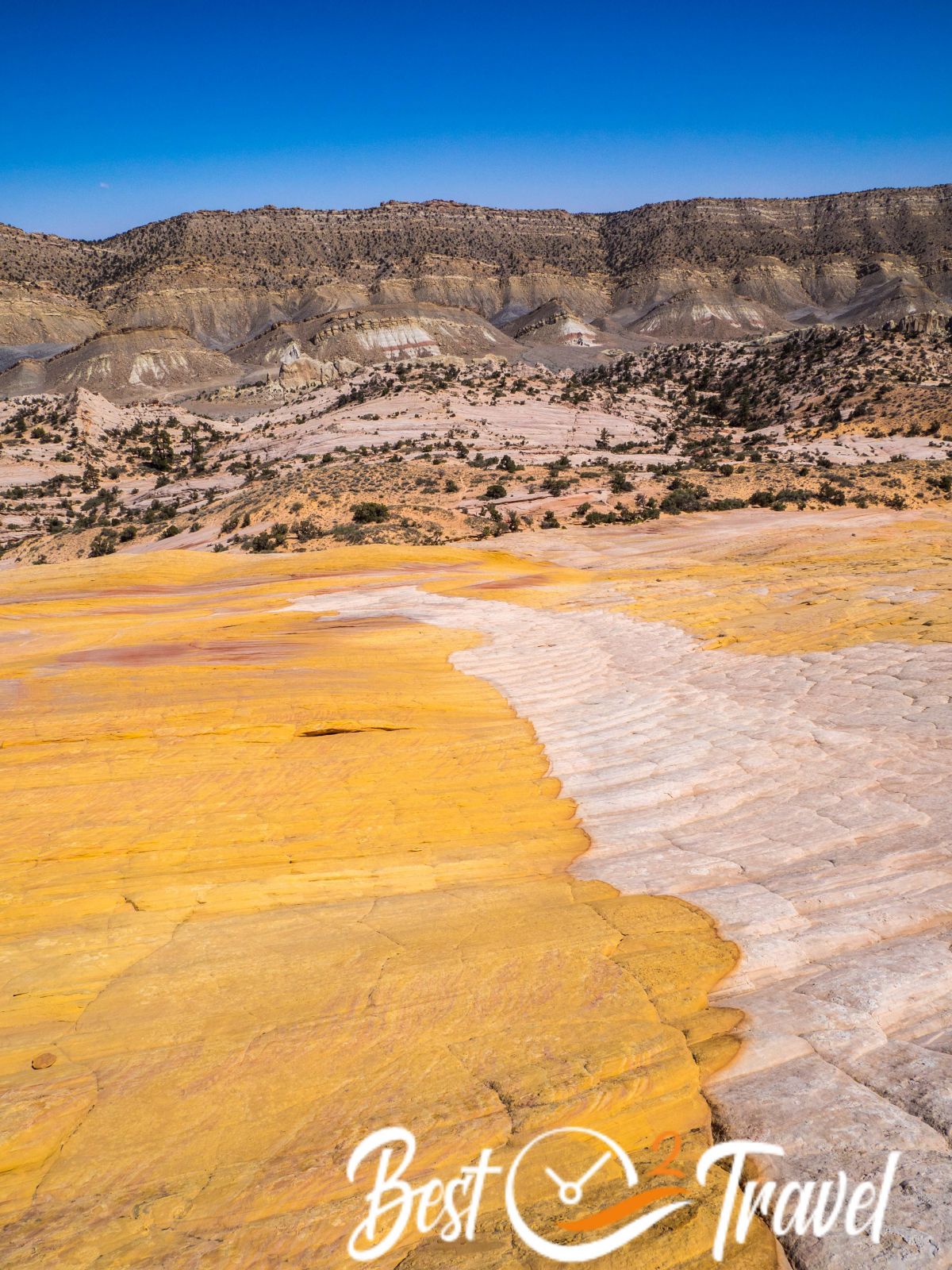
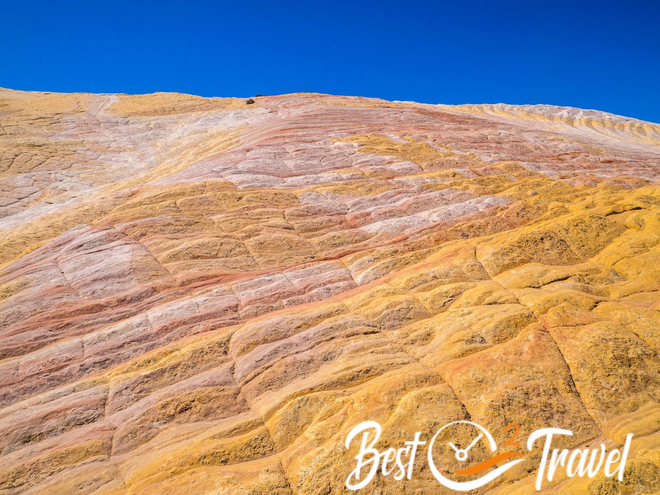
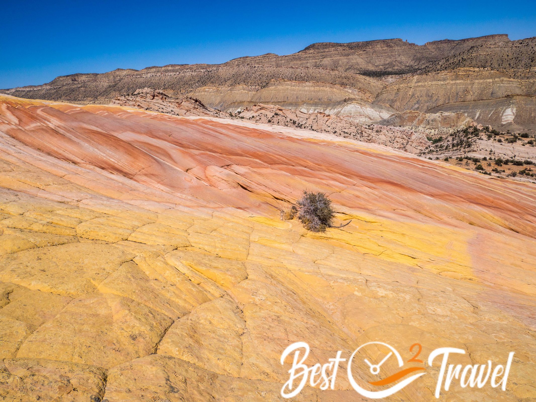
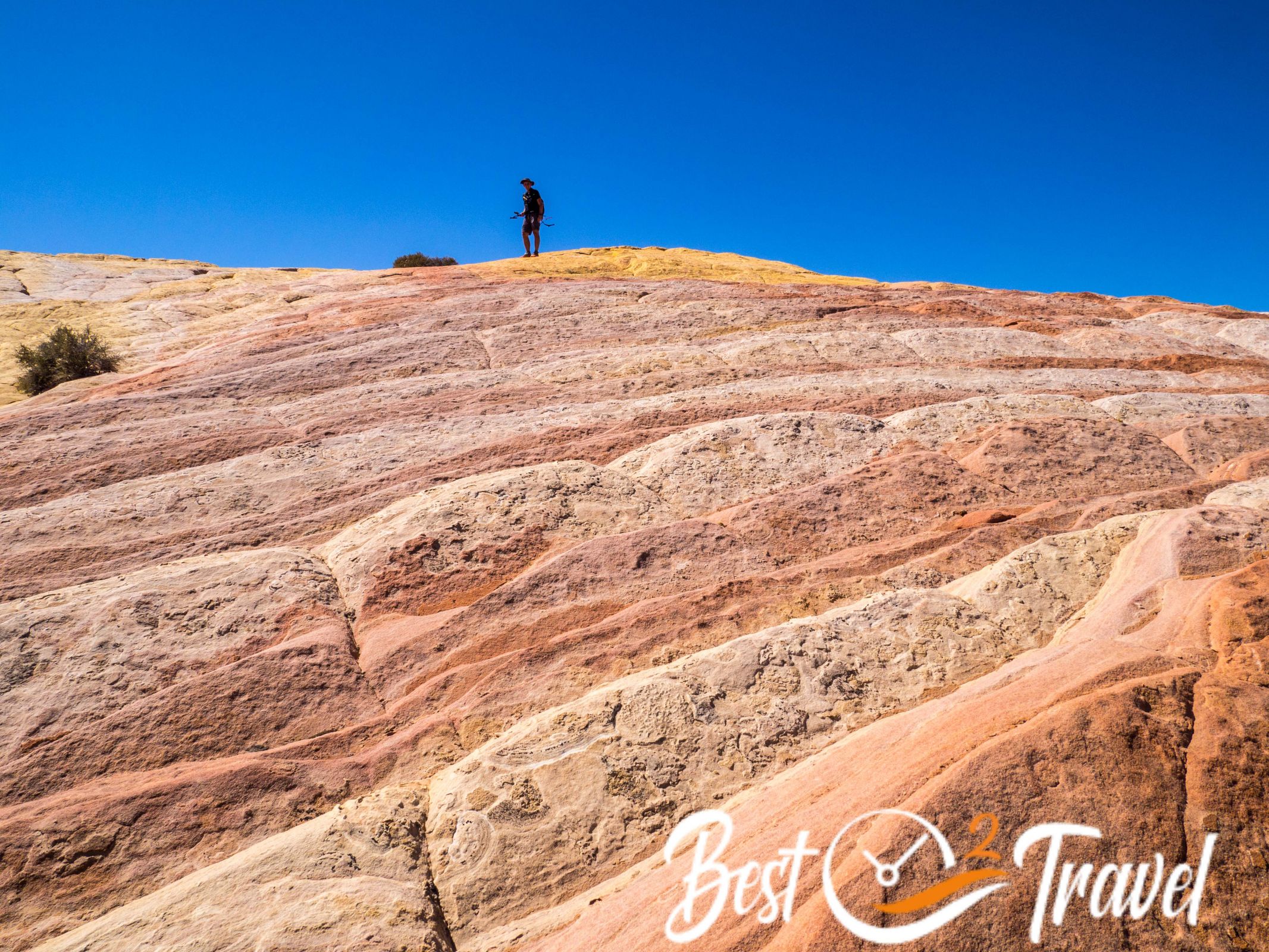
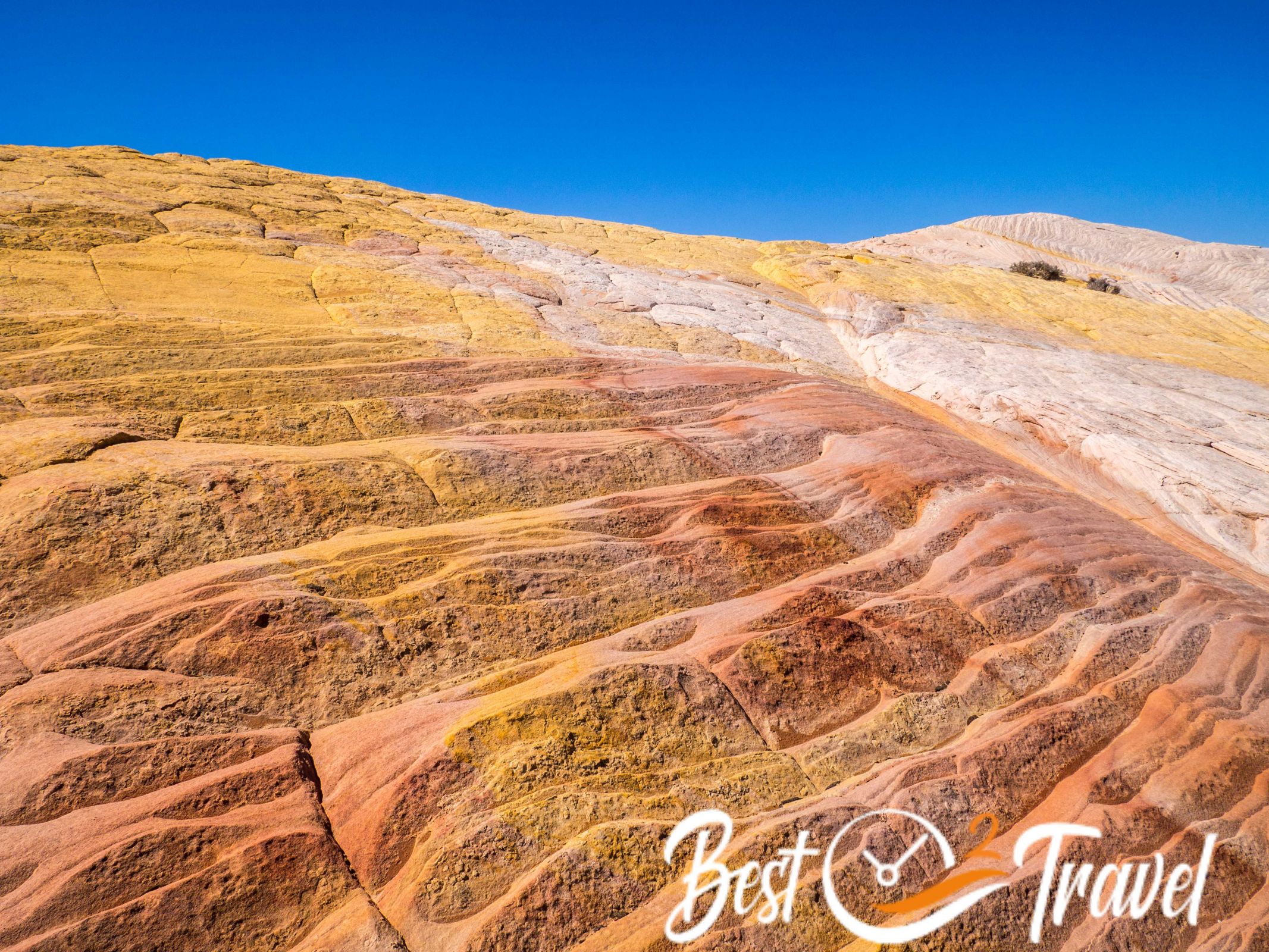
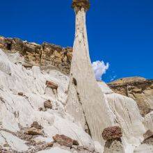
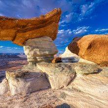
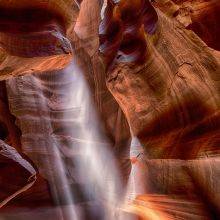
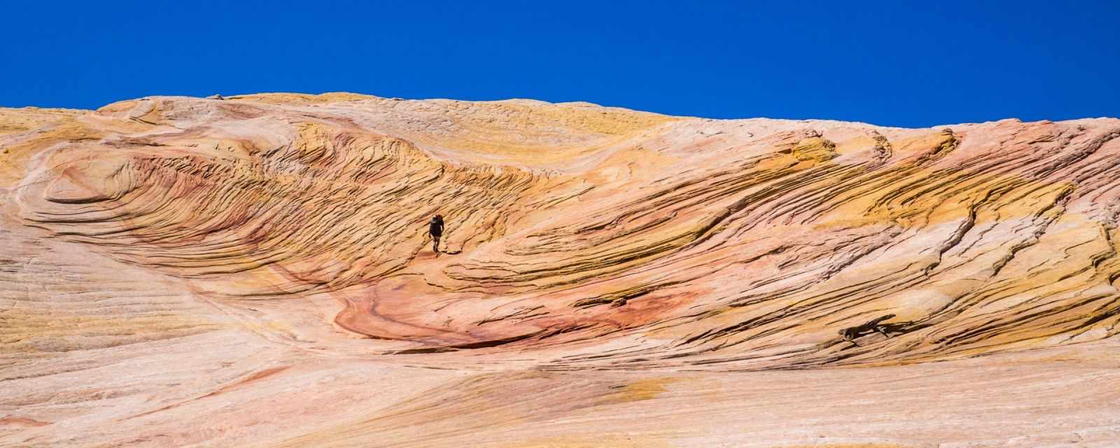
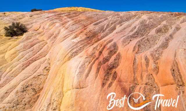
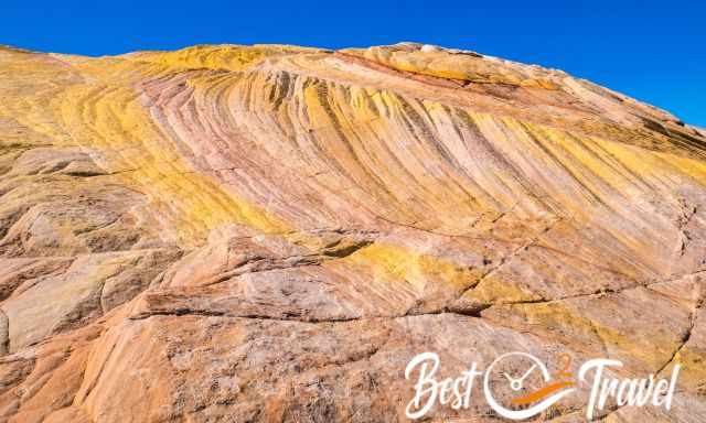
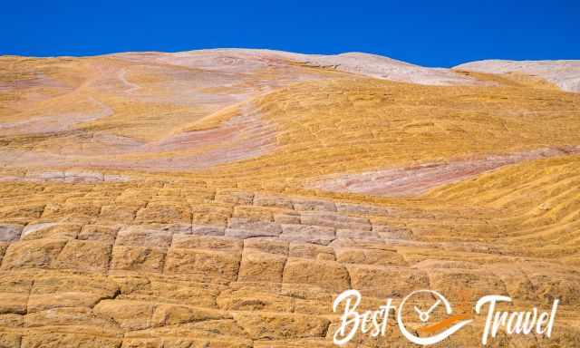
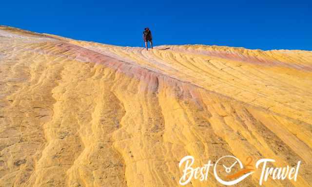
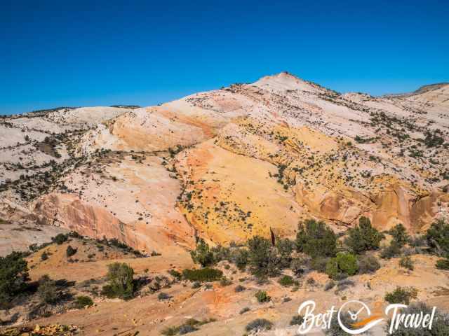
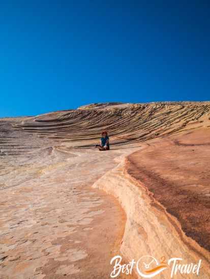
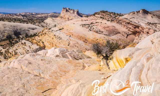
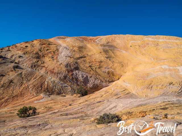
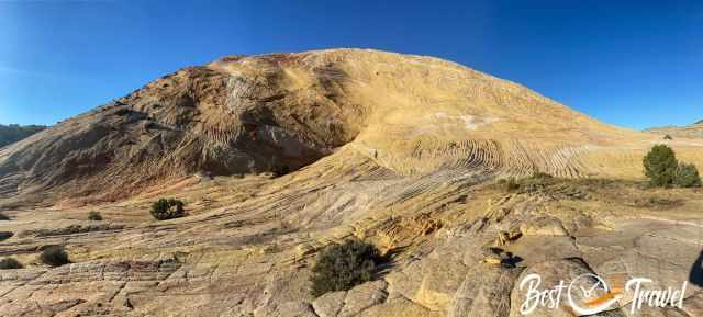
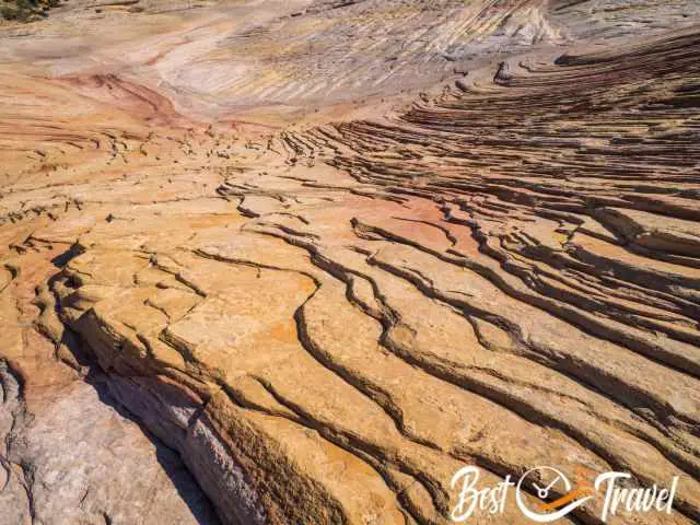
The entire dome is multi-coloured with different Navajo sandstone formations in shades of white to orange, red, pink, and yellow. It deserves a far more exciting name due to the unique mixture of Wave-like shapes and colours.
When we were seeking the right track to ascend the hill, we met one hiker coming from Yellow Rock. He was in awe, telling us he had seen the Wave, the Fire Wave, White Pocket, Monument Valley, and more, and none of these places was that beautiful, and we got excited.
We spent many hours here but couldn’t explore the entire rock during our first visit; it is too vast. The hike is off the beaten path, it is quite a ride to get here in a 4 WD. We agree with this hiker - we were overwhelmed by the beauty of this magical place and revisited Yellow Rock a year later in fall 2023.
Where is Yellow Rock - How to Get to Yellow Rock?
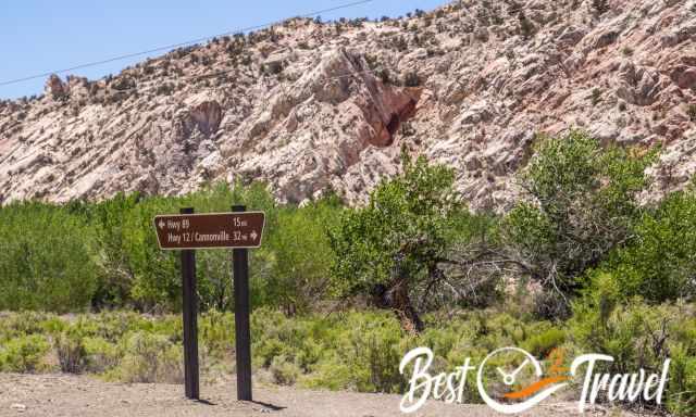
The trailhead of Yellow Rock is situated at the 46-mile-long Cottonwood Canyon Road in the Paria River Valley, a loose gravel road which is not accessible during and after heavy rainfall.
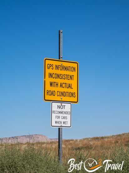
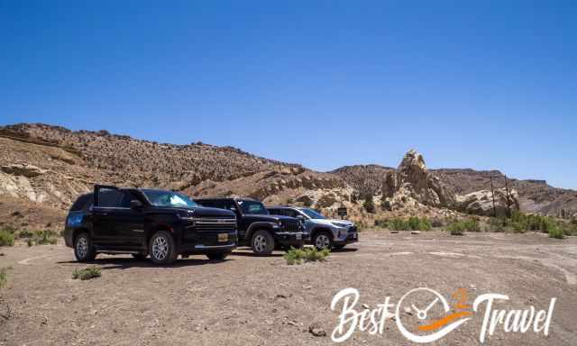
The sand turns into clay, and cars get stuck. You can access this dirt road by 4 WD from the north of HW 12 or south of HW 89. Parking at Lower Hackberry Canyon Trailhead Google Maps Location
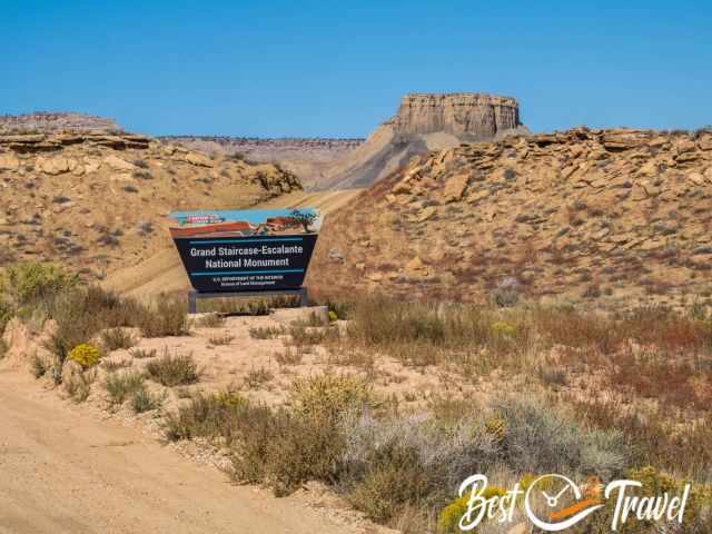
Yellow Rock is one of the many unique places and jewels of the Grand Staircase Escalante National Monument (follow the link to my complete guide with 18 gems). The monument has a size of 7.610 km², which is more than 12 times bigger than Zion National Park. Yellow Rock is one of these exceptional places in the Southwest.
 |
Do NOT go into the expansive Grand Staircase without a detailed map. For large amounts of time, you will not have cell phone service. It's a great alternative to a mapping app or for planning. The map delivers unmatched detail and valuable information to assist you in exploring this remote and colourful wilderness. It is printed on durable synthetic paper, making them waterproof, tear-resistant and tough. |
1. North from Kodachrome State Park - 25 mi 1.30 h or HW 12 Cannonville 31 mi
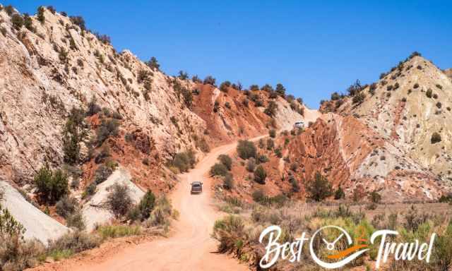
We camped in the Kodachrome State Park and accessed the road from the north. The entire road is uneven in parts, bumpy with deep potholes filled with sand. Coming from the north, you pass by Grosvenor Arch and the Cottonwood Narrows, both worth a stop.
2. South from Page 42 mi 1.15 h - Kanab 60 mi 1.30 h
Coming from Page or Kanab from HW 89, only 14 miles lead along the gravel Cottonwood Road; therefore, easier to drive. However, we loved the journey on the entire Cottonwood Canyon Road, one of the most fascinating dirt roads and travelled here again in the fall. Watch our new YouTube Short about Yellow Rock, Nautilus, and Grosvenor Arch. Subscribe to our channel and don't miss out on our following videos and tips.
There aren’t any signs for Yellow Rock, nor is the trail marked. You need good navigation skills and, most importantly, a mobile hiking app. In September 2023, the vegetation was too thick, and we found better access to the trail. More below.
The best time for Yellow Rock is the drier and cooler months, from late September to October and April to mid-June. Summer is scorching, with temps above 86°F/30°C in the shade. It is also the monsoon season, with thunderstorms in the afternoon or evening. It can pour for hours, and your 4 WD gets stuck on the dirt road. Cottonwood Canyon Road is frequently closed in winter due to snow in higher elevations.
The best daytime for excellent shots is the morning and late afternoon, with perfect sunlight. In the afternoon, the west side is shimmering golden, and sunglasses are essential. The exact hiking details and a map are added below.
Grand Staircase Escalante Map - Access Roads
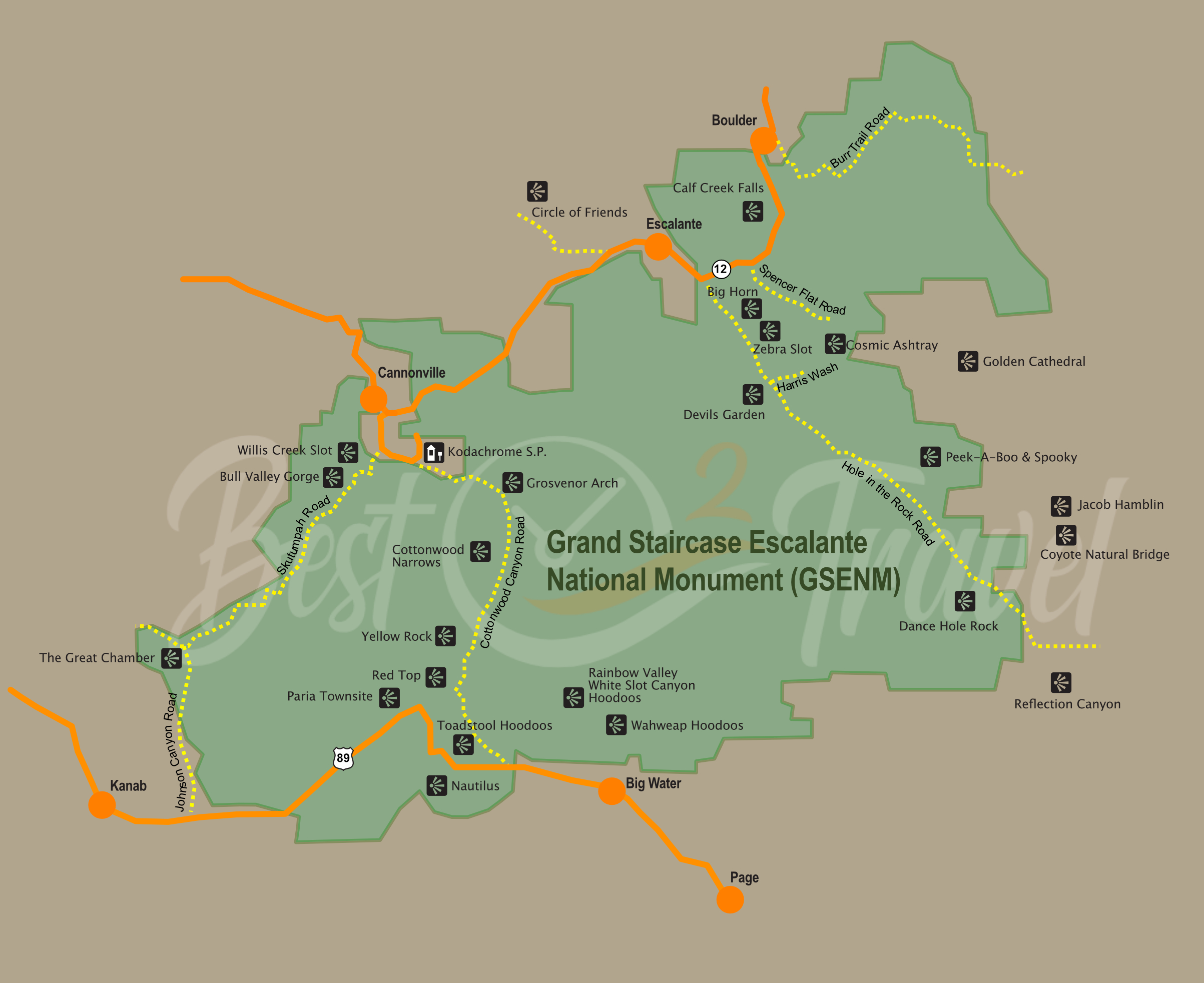
I have drawn this map to give you an overview of the massive Grand Staircase Escalante National Monument, the location of each Must-Visit place, and a more detailed view. So, there is not only one entrance and exit to access Escalante but multiple entrances from highways and gravel roads. Afterwards, you must hike to get to these spots from half an hour to an entire day.
Trail and Hiking Details for Yellow Rock
- Track Length until Yellow Rock: roughly 1.2 mi/ 2 km plus walking above the rock - in and out roughly 3,1-3,7 miles/ 5-6 km.
- Hiking Duration: about one hour to the Yellow Rock because the track is not marked
- Difficulty: Moderate, just the 10-15 minutes steep ascent on loose rock is challenging but can be mastered with hiking poles.
- Elevation gain: roughly 745 ft/227 m plus Yellow Rock itself
- Rating: One of the best rock formations we have ever seen, and we returned to explore more around Yellow Rock.
- Locus Map Hiking App from the parking to Yellow Rock. This unique rock is almost impossible to find without a map! There aren't any signs or a real path. You get the first glimpse after the steep ascent. However, this time, in September 2023, we found a more accessible entrance to the trailhead of Yellow Rock.
Shorter access for winter and spring with low vegetation:
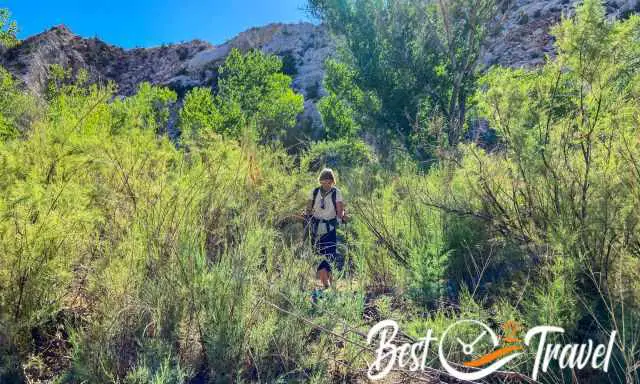
From the parking, head to the south along the road for about 165 ft/ 50 m, then turn right and find a way through the thick bush for roughly 655 ft/ 200 m until you reach the creek bed, which was dry in June; in the summer but the rest of the year a shallow creek is running here.
Easier access but a little longer:
Due to heavy rainfall in the summer of 2023, it was impossible to get through the thick bush, and we found easier access. Roughly 650 ft/ 200 m after the parking, you can see the creek to the left if coming from Page/Kanab. You can also park your car here to the right. We followed the dry creek bed, crossed it and continued to the left on the right side of the stream.
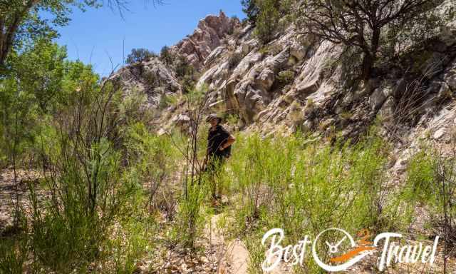
Cross the creekbed, either dry or the water level is below 2 inches, and turn left. Now, you may see some footprints. Follow the riverbed for about 490 ft/ 150 m, then turn right into the small canyon. We saw a few cairns in 2023, but I wouldn’t count on it.
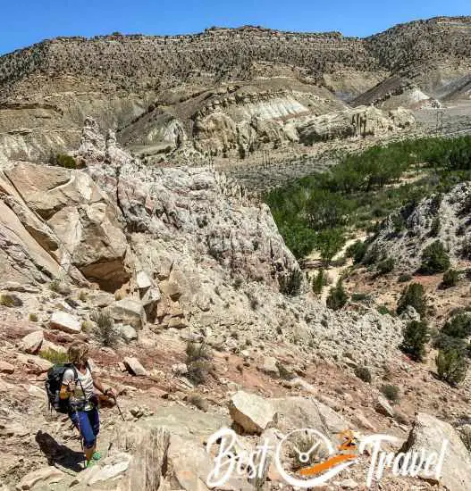
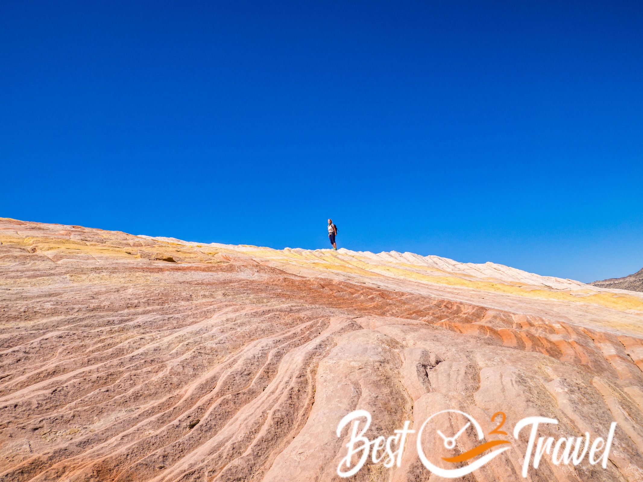
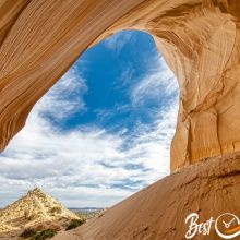
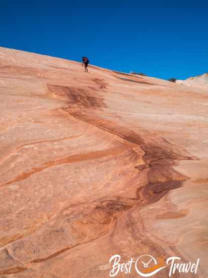
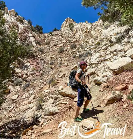
A steep and exposed escarpment is covered with red sand, ascending to the top for roughly 10 minutes. This section is slippery, and we were glad to carry our hiking poles. Please use rubber tips on your hiking poles in slickrock areas. Formations like the Wave and Yellow Rock are being etched if using metal tips.
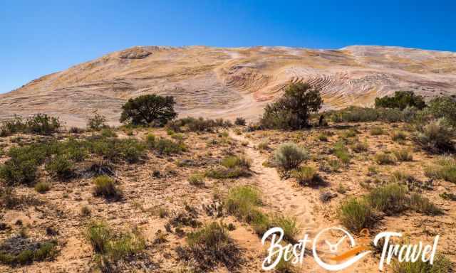
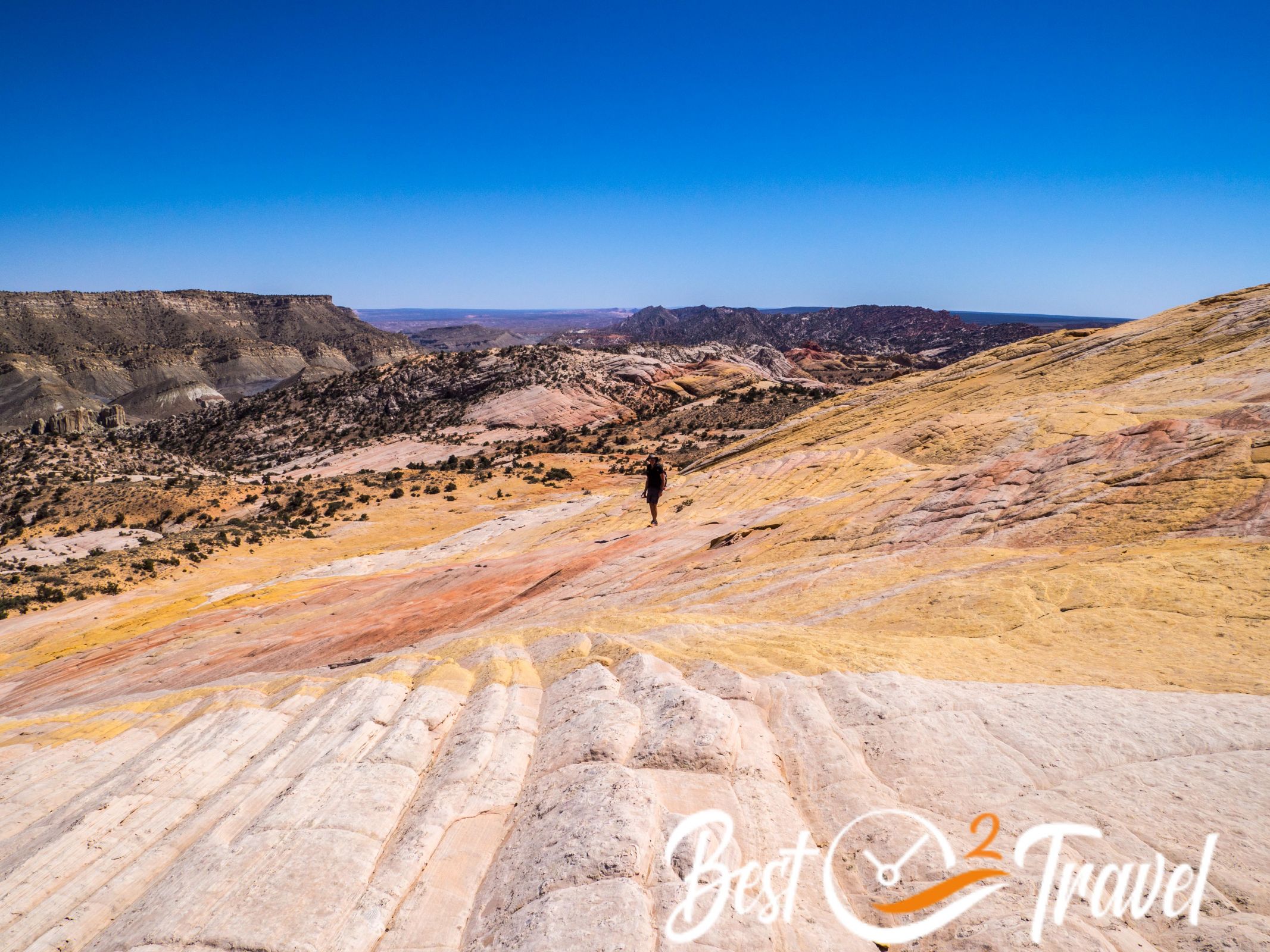
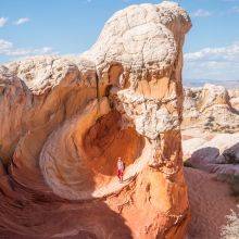
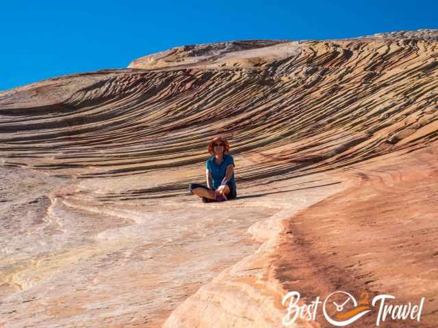
When we reached the top, we followed the ridge to the left, and soon after, we got the first glimpse of this unique dome and colour explosion. We continued left to reach the rock and now explored this spectacular piece of nature.
I promise your time is running too fast here. Carry a picnic in your backpack and enjoy the breathtaking scenery.
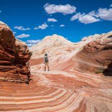
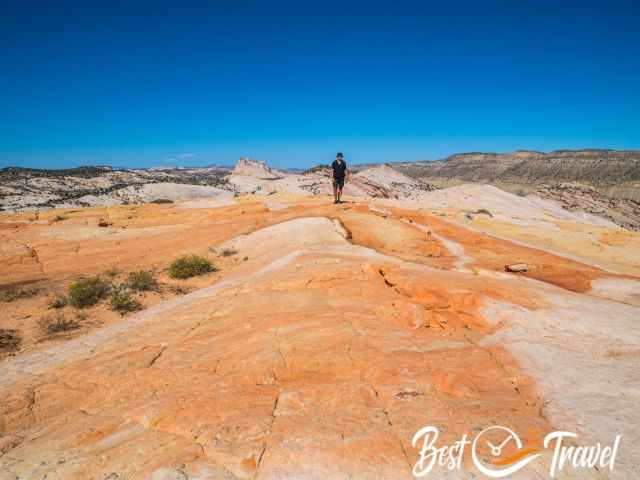
On windy days, climbing on this exposed dome was a little challenging, but it wasn't slippery on the rock itself. We had strong winds during our visit. It was sometimes challenging not to lose the balance.
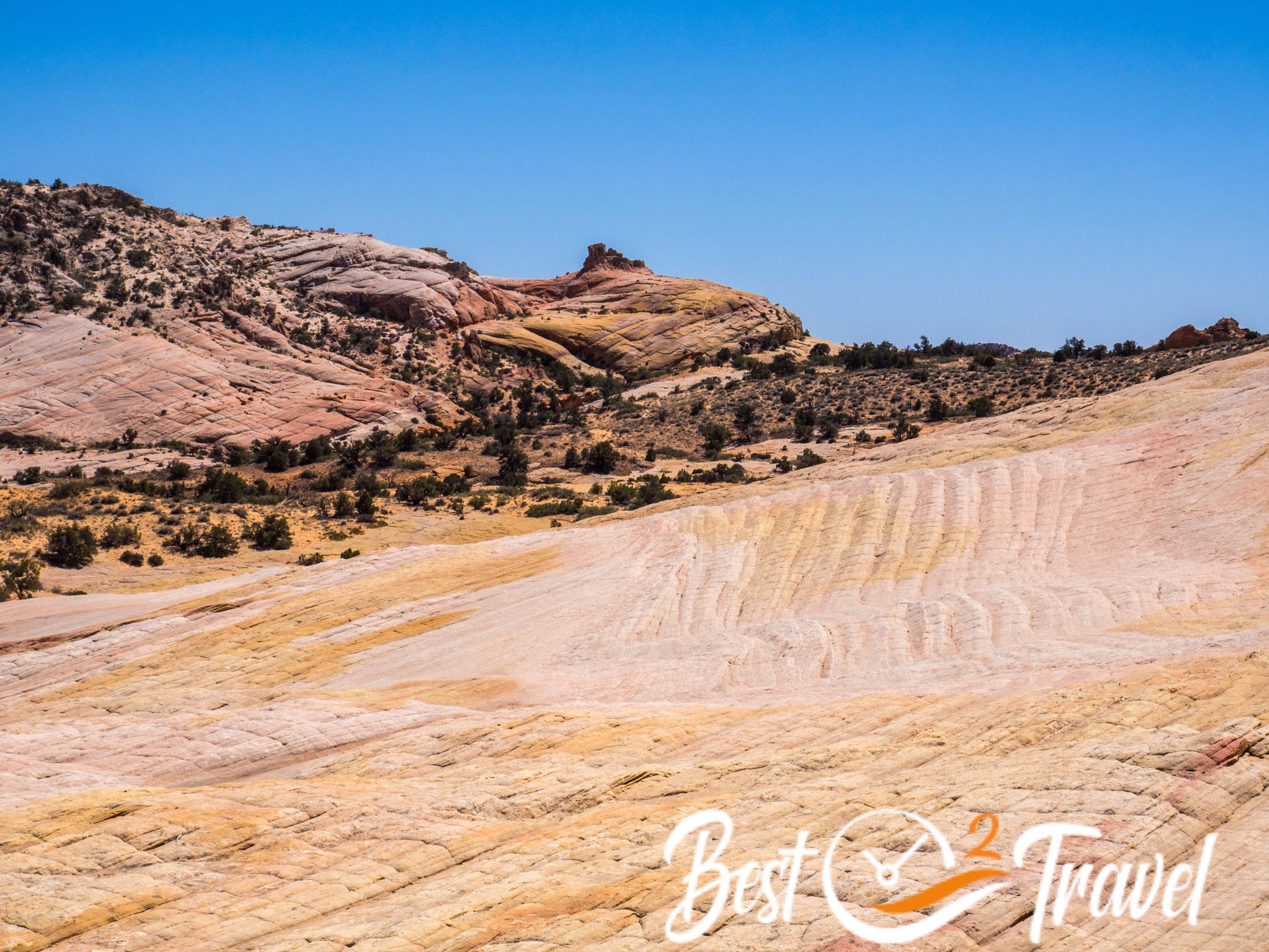
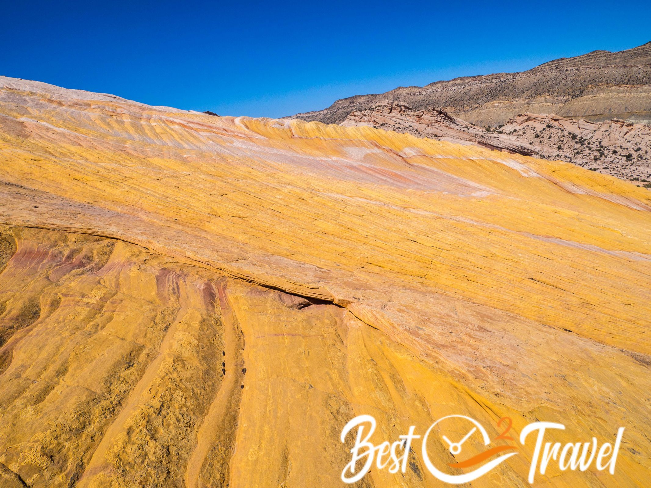
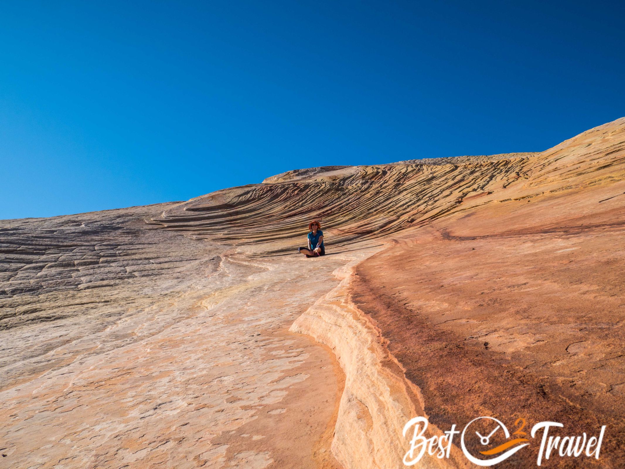
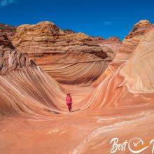
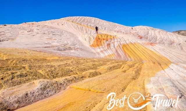
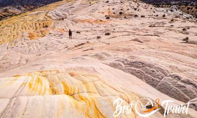
The 360° view from Yellow Rock is spectacular, and you see other colourful rock formations in the distance. On our second visit, we were primarily focused on the west side.
On the top, the rock was neon orange, and the west side itself is entirely yellow with some orange and white patches. I assume that's the reason for its name, Yellow Rock.
My tip: reach the west side in the afternoon, and you get rewarded with exceptional photo options.
Bring plenty of time for the exceptional Cottonwood Canyon Road. The entire gravel road is an adventure.
Is There Snow at Yellow Rock in the Winter?
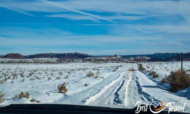
The main part of Yellow Rock is situated to the south, and Yellow Rock is not covered if it is sunny the days before. However, getting there is tricky, and you may need snow chains. Cottonwood Canyon Road is frequently inaccessible and closed in the winter because of snow and wet conditions. Due to the high elevation, the first snow occurs already in November. We experienced lots of snow in January 2023.
Our Packing List for Yellow Rock

1 Proper Lunch in the Wilderness
When we travel through the US to remote places, getting a proper meal during the day is usually impossible. We tried out dehydrated meals, which are convenient and time-saving. I have to confess we didn't expect such good quality and taste.
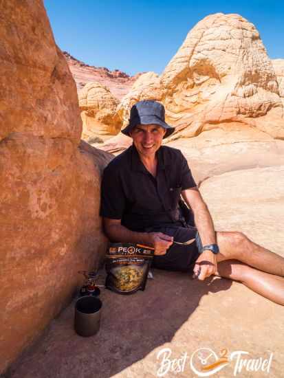
To quickly boil some water either for a hot drink or to prepare some dried food, we count on a MiniMo Cooking System from Jetboil. The Jetboil always joins us, like to The Wave or at the Wahweap Hoodoos close to Page.
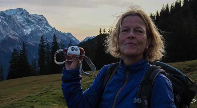
2 Rechargeable Headlamp
In case of an emergency or a hike that takes longer than expected, we never go without our rechargeable Petzl Headlamp in our backpacks.
3 Hiking Poles
I highly recommend hiking poles for the dry and slippery soil on the narrow path for the short but steep ascent to Yellow Rock and especially for the descent.
But please use rubber tips on the fragile sandstone rock formation.
4 Comfortable Hiking Shoes With Grip
Markus and I love the INOV-8 Trailtalon because of the flexible sole and the excellent grip. We have used this type of shoes for many years already.
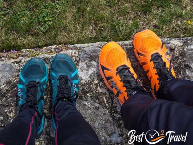
We have different pairs and colours of INOV-8 - the most important for us is the shoes' flexibility.
5 Sun Protection
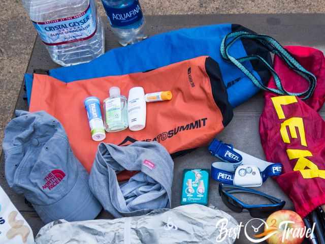
There is no shade at Yellow Rock - sun protection and a hat is important, like elsewhere in this area. I use a special SPF 50+ sunscreen for exposed areas like my arms and face. I have never gotten sunburnt since I started using this cream.
6 Plenty of Water Plus Electrolytes
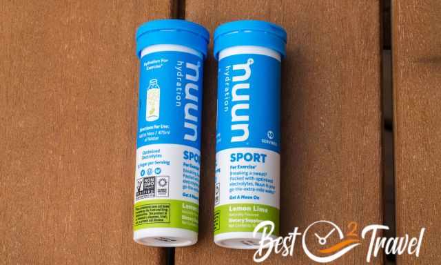
We always drink plenty of water with electrolytes (above in the picture to the left), as we usually sweat a lot on such hikes. Everybody loses magnesium, potassium, calcium, and sodium, which we replenish in this way.
7 Garmin Inreach Mini
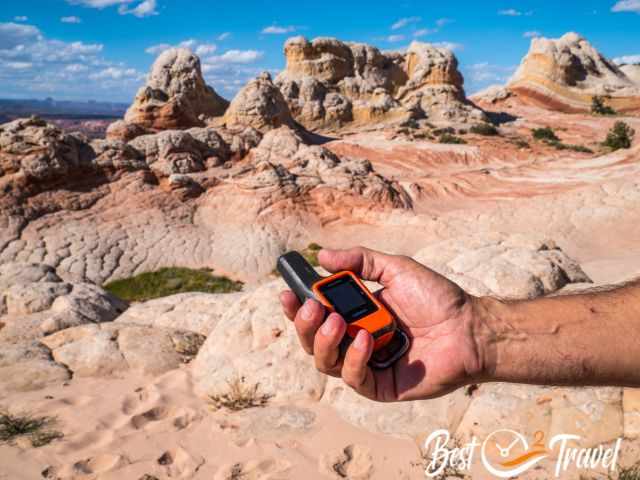
Our Garmin Inreach Mini in case of an emergency.
We went to several remote areas like Yellow Rock, where cellphone service and internet were unavailable. In case of an emergency, we invested in a Garmin Inreach Mini.
Best Months to Visit
Location and Tips

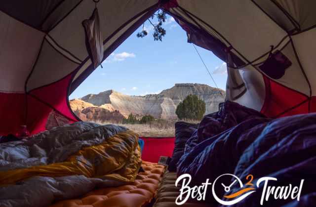
Yellow Rock, the Wave Alternative, is a photographer's dream with plenty of outstanding spots. If you plan to explore Yellow Rock, it is best to stay close either in Kodachrome State Park, like we did, in Page, Kanab or camp along Cottonwood Canyon Road.
Can I Camp at Yellow Rock?
Most of the Grand Staircase Escalante National Monument and so the Cottonwood Canyon Road are situated on BLM land, and it is permitted to camp in this area. A permit is required for overnight hikes, which you get easily at the information centres of GSENM.
Where to Stay?
Page is the main service hub and a good starting point with a population of 7.500. Page is excellently located at the Colorado and Lake Powell.
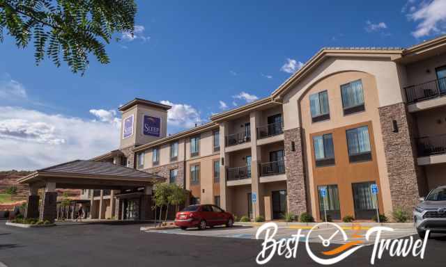
You may think there are plenty of hotels in Page, and that's right, but each evening, we figured out the hotels; also, ours were fully booked. Many visitors stay here for a few nights to visit Horseshoe Bend, Antelope Canyon, the Toadstools, and more beautiful places. If you plan to travel to Page during the peak season or on weekends, I highly recommend booking a room in advance.
To explore the area, you either stay in Page or in Kanab. Last winter, we spent two nights in Kanab because of a guided tour. Kanab is a fantastic town to explore the Vermillion Cliffs Wilderness's unique landscape and sandstone formations.
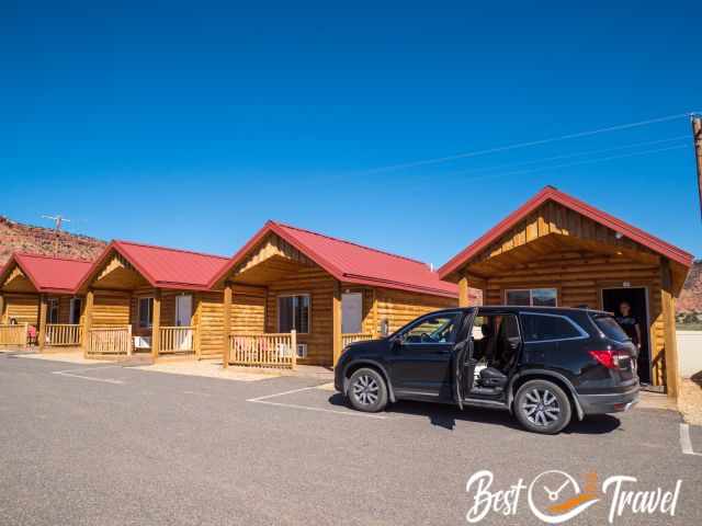
This September, we tried out another accommodation, the Red Canyon Cabins. You can park your vehicle in front of the hut. There is a seating area outside, and you are able to open a window. We spent five nights here, and it was super quiet and ideally located.
Thx for booking via my website 😊 - More pictures and tips are below.
More of Grand Staircase Escalante
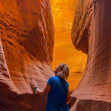
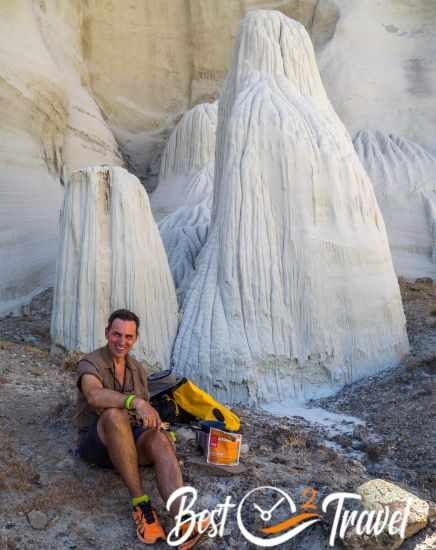
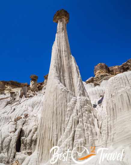
Another hidden gem that also belongs to Escalante is the otherworldly Cosmic Ashtray. And there are more such places off the beaten path, not overrun, with no soul in sight, just you and this magnificent piece of mother nature, the Wahweap Hoodoos, just half an hour from Page.
Do you wish to know more about the Grand Staircase Escalante National Monument? Check out my new guide and the 18 Must-Visit Places and their locations. Not all are difficult to get to; some are family- and dog-friendly.
Who We Are
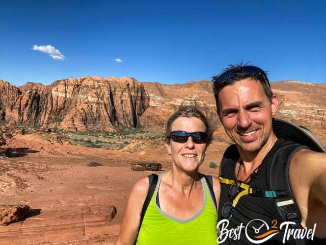
We are passionate travellers, have been married for 25 years, and love discovering hidden gems around the globe. I am passionate about sharing some of the most beautiful places in the world with you, but I still can't live from my work, and we have regular jobs, too.
It is a tough business nowadays because fake travel websites rewrite content without effort and expense "thanks" to AI. Do you like to know more about fake travel websites and how to unmask them? Check out "The Truth About Fake Travel Websites"
Do you like my Yellow Rock Guide? Please share it with your friends and on social media, subscribe to our YouTube Channel. That would already help us a lot!
Do You Like to Support Me - It's easy; use the Paypal Button below 😍
If you wish to use any of my photos, contact me, but I will take action against picture theft. Why do I write this here? Hundreds of my pictures are used worldwide without any credit, nor did they get my permission. I don’t mind giving permission, but I want to get asked for it and to be mentioned with my specific article.