
When Is the Best Time
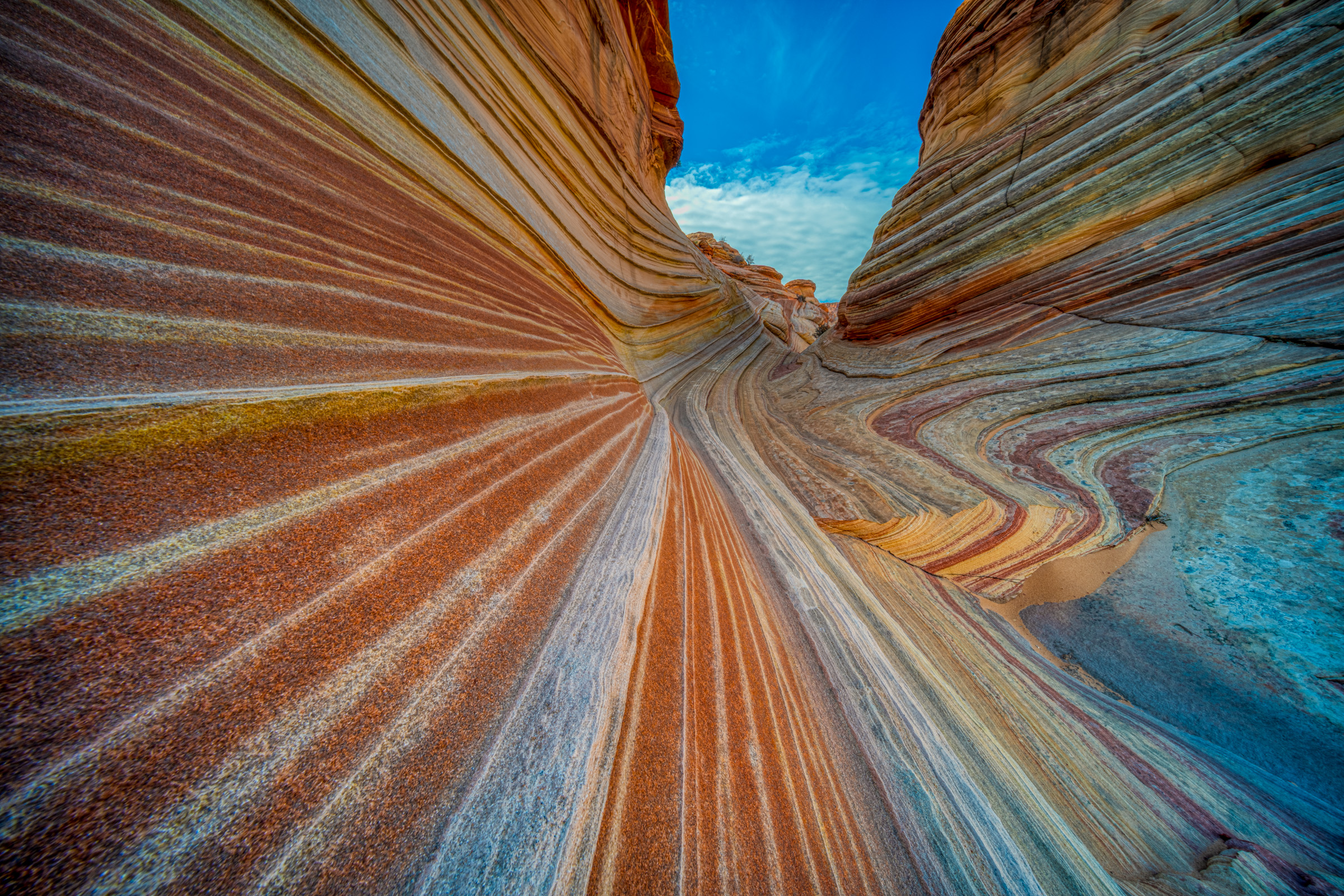
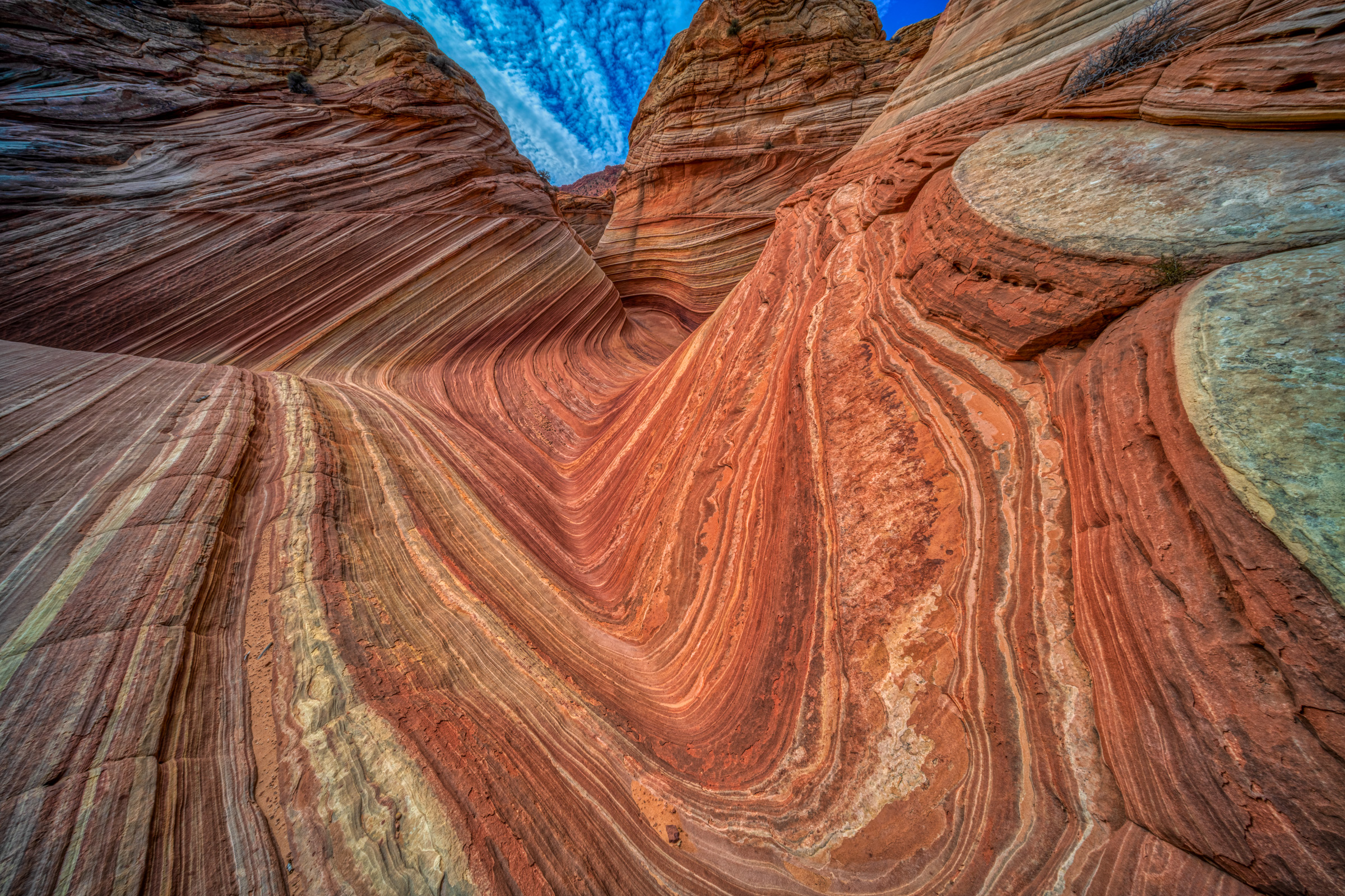
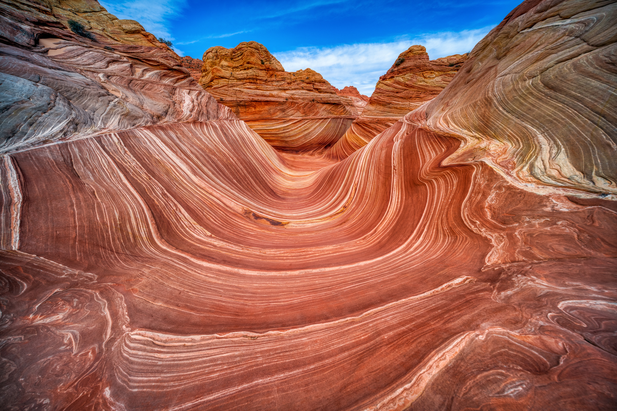
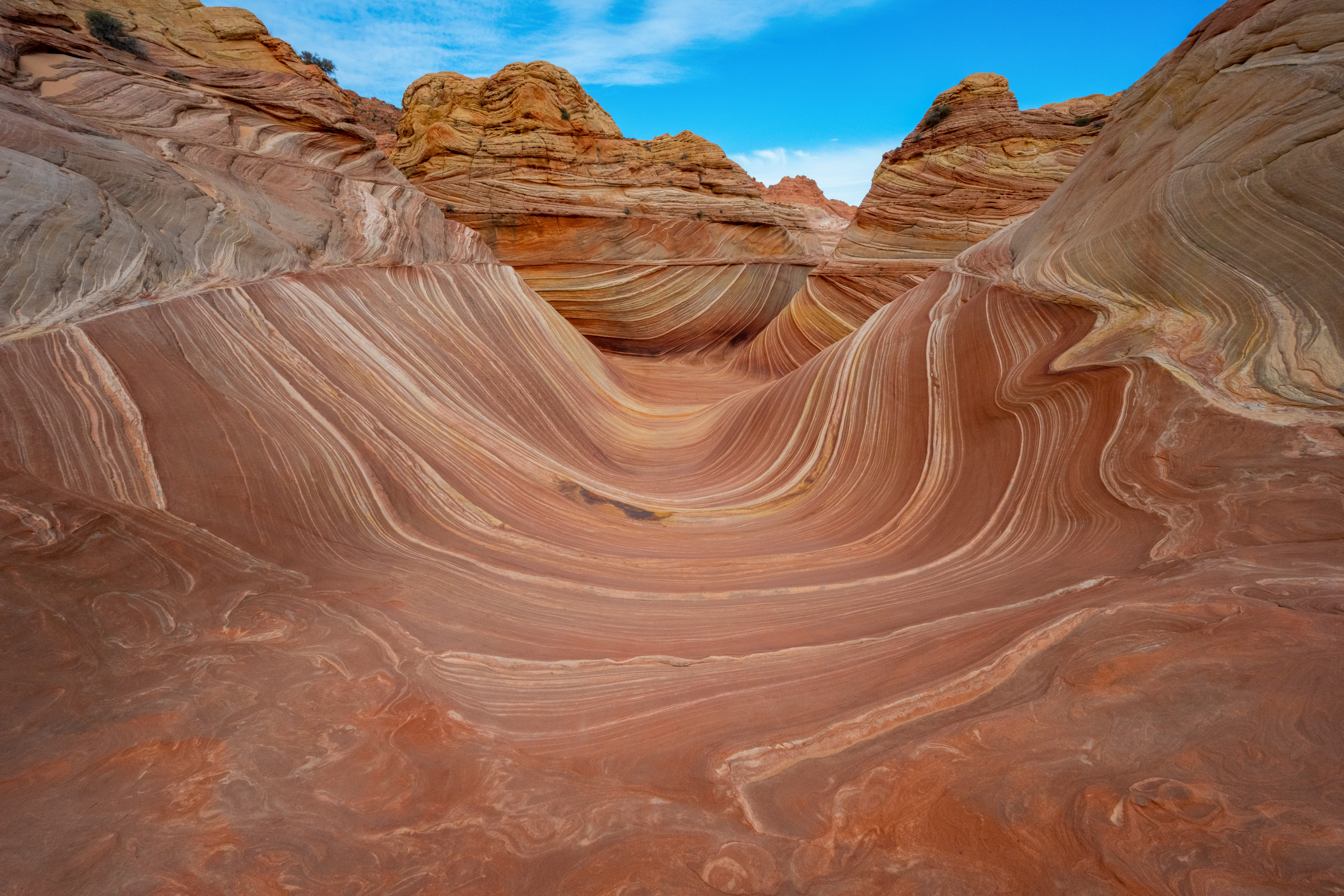
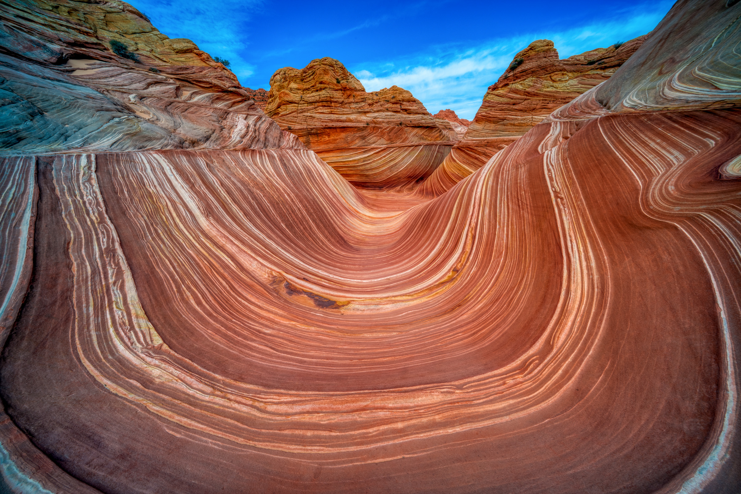
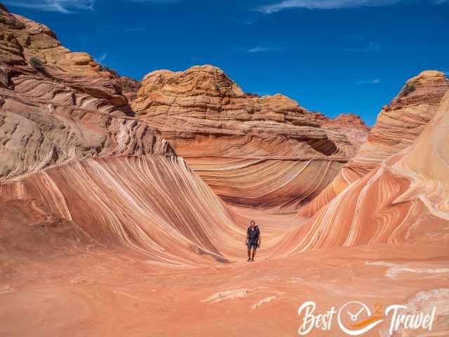
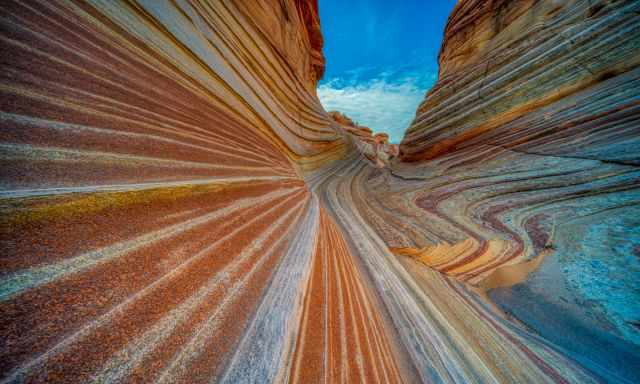
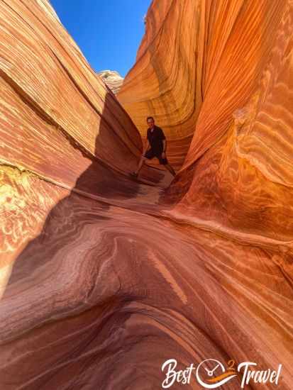
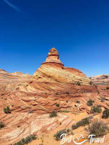
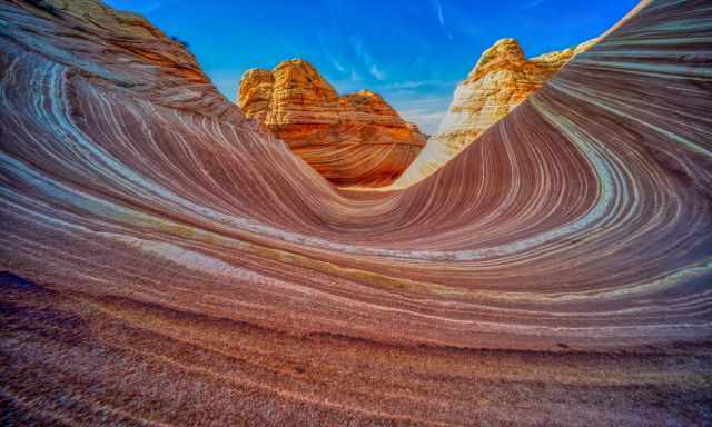
The Wave is one of the most fascinating natural wonders in the world. For a good reason, access is restricted. This sandstone rock formation is extremely delicate and fragile. We finally won a permit in September 2023 because I followed all the rules to increase our chances of getting one.
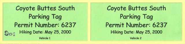
My first attempt was in 2000. I will give you all the details of how we won a permit, a detailed trail description, and what to carry in your backpack for this bucket list hike. You can find everything you need to know about the advanced and last-minute lottery below, including a tip from a local guide to double your chance. I highly recommend applying at the last minute to increase your chances. Only people in the geo-fence area are able to apply, and this is what we did.
What to do around Kanab while applying for the Wave permit?
I asked myself this question and compiled a list of incredible hikes we've all done. All of these places are close to Kanab. My tip: Apply for the Wave Permit in the morning, and afterwards, check out these breathtaking places. Even if you don't get a permit, you won't regret heading to Kanab. 13 Best Places Around Kanab
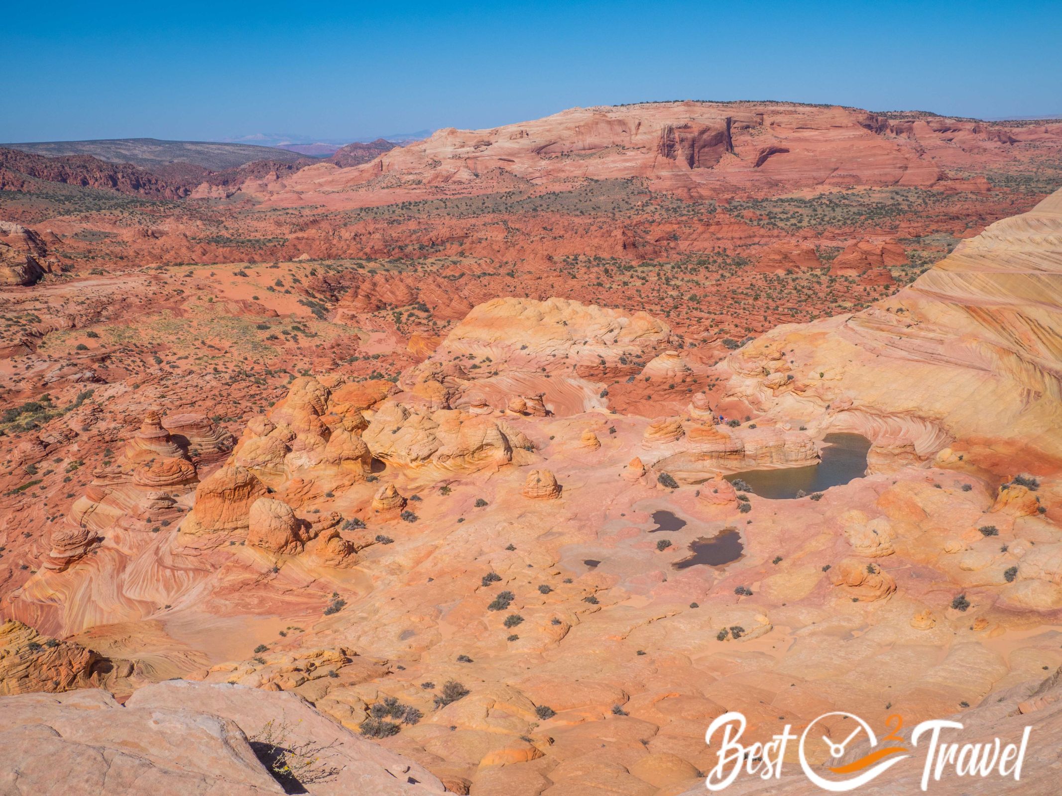
First, this permit to Coyote Buttes North covers much more than just the Wave. Many hikers passed by on our hike to the Wave, already returning to their vehicles. Don't make this mistake; there is so much more that you can't explore all in one day, but I added some of the highlights for you that you shouldn't miss.
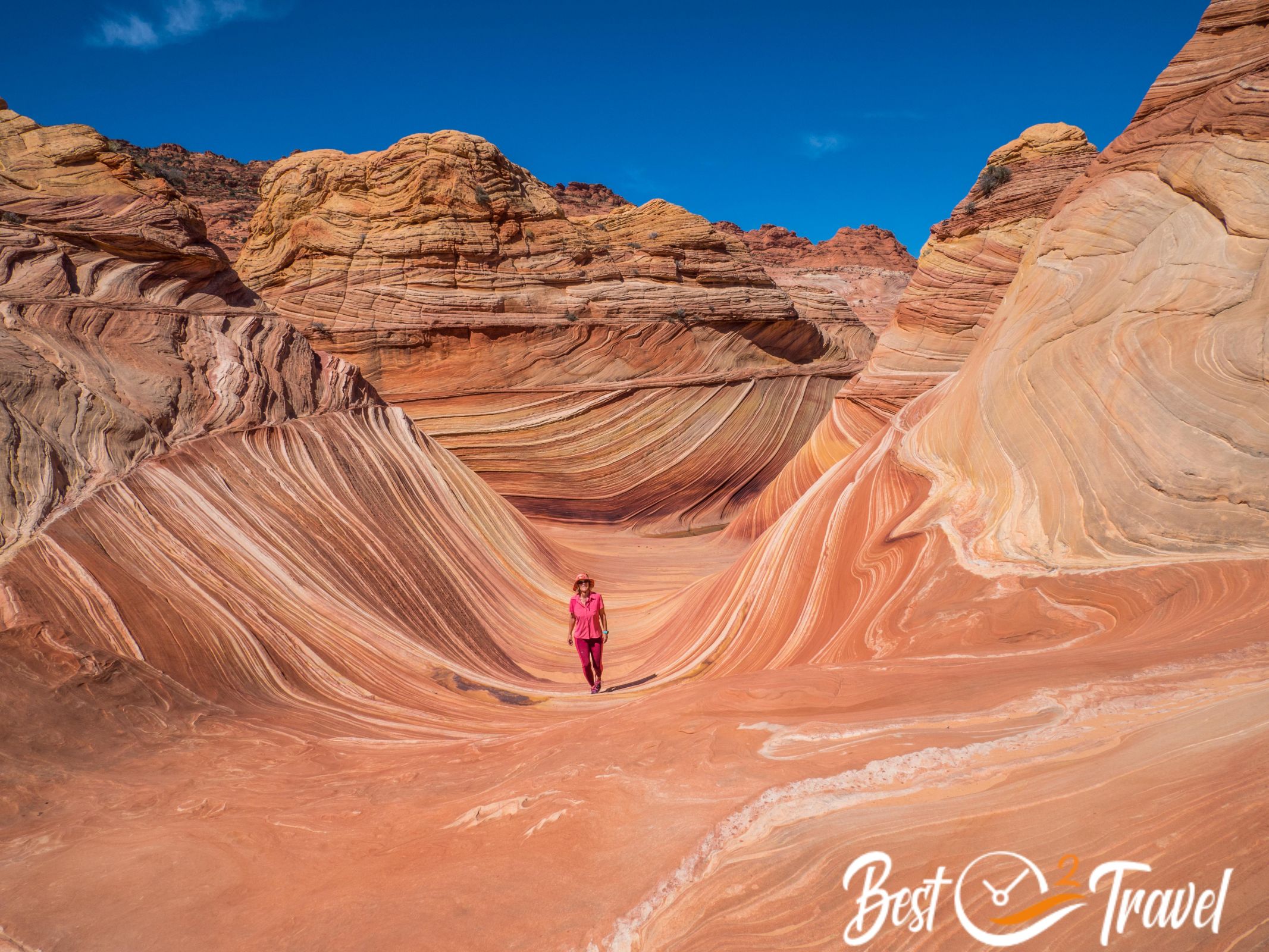
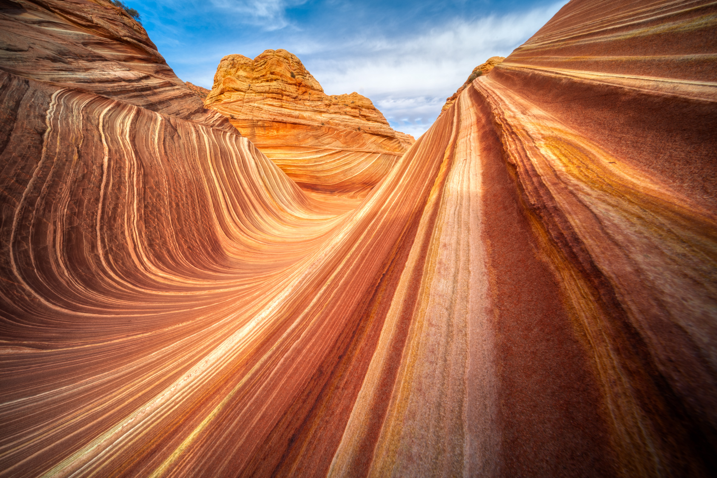
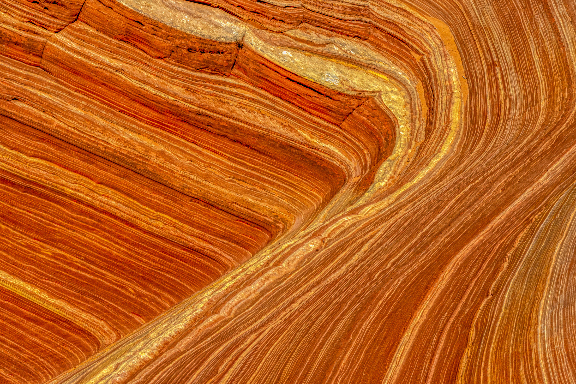
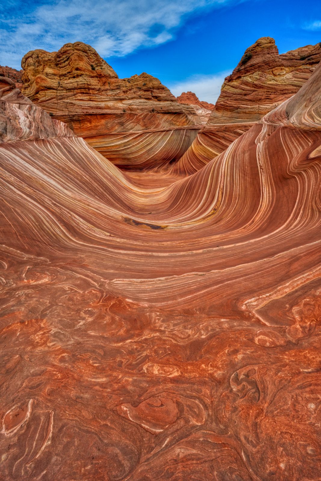
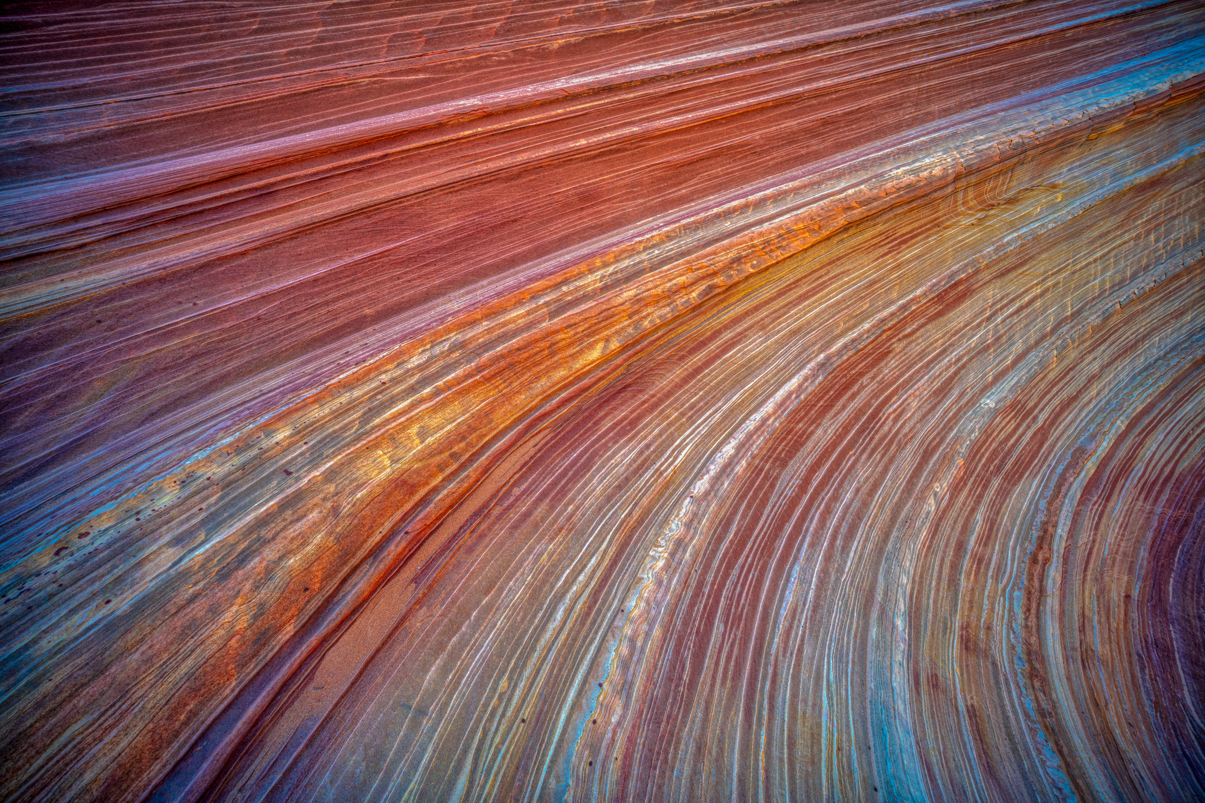
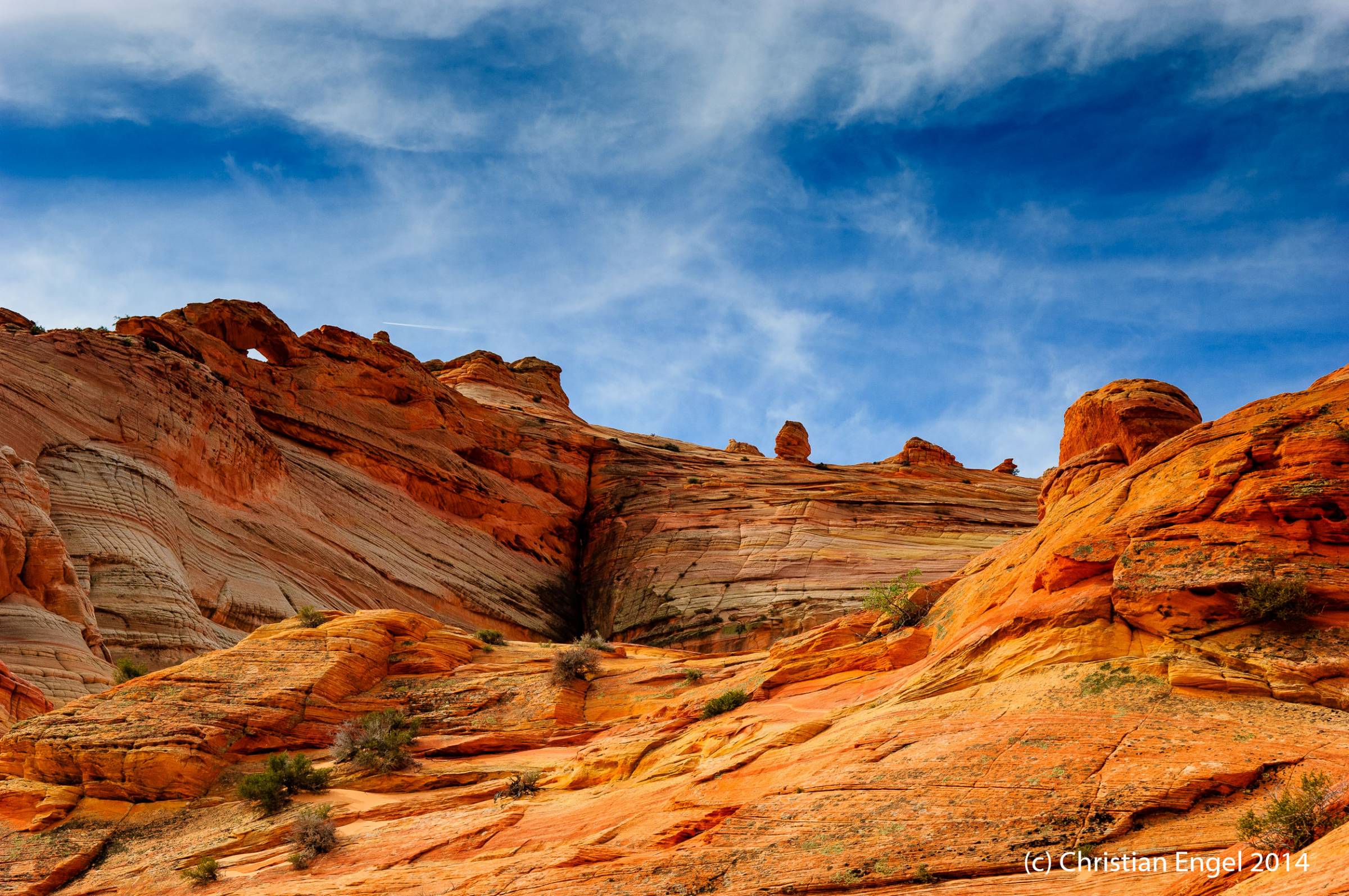
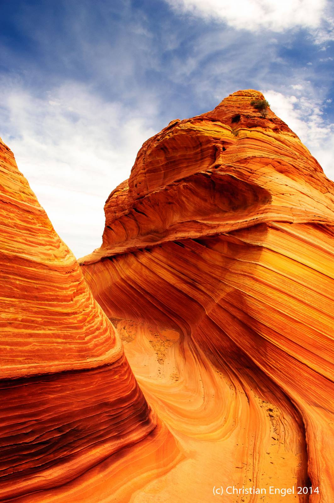
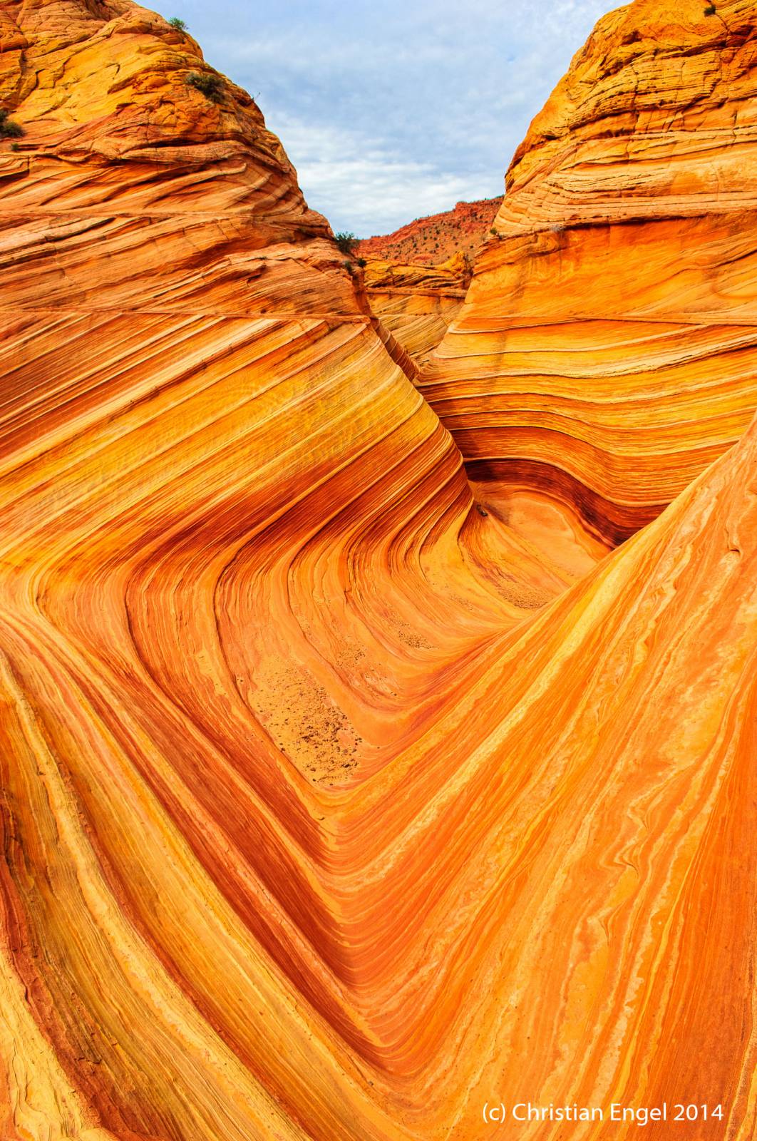
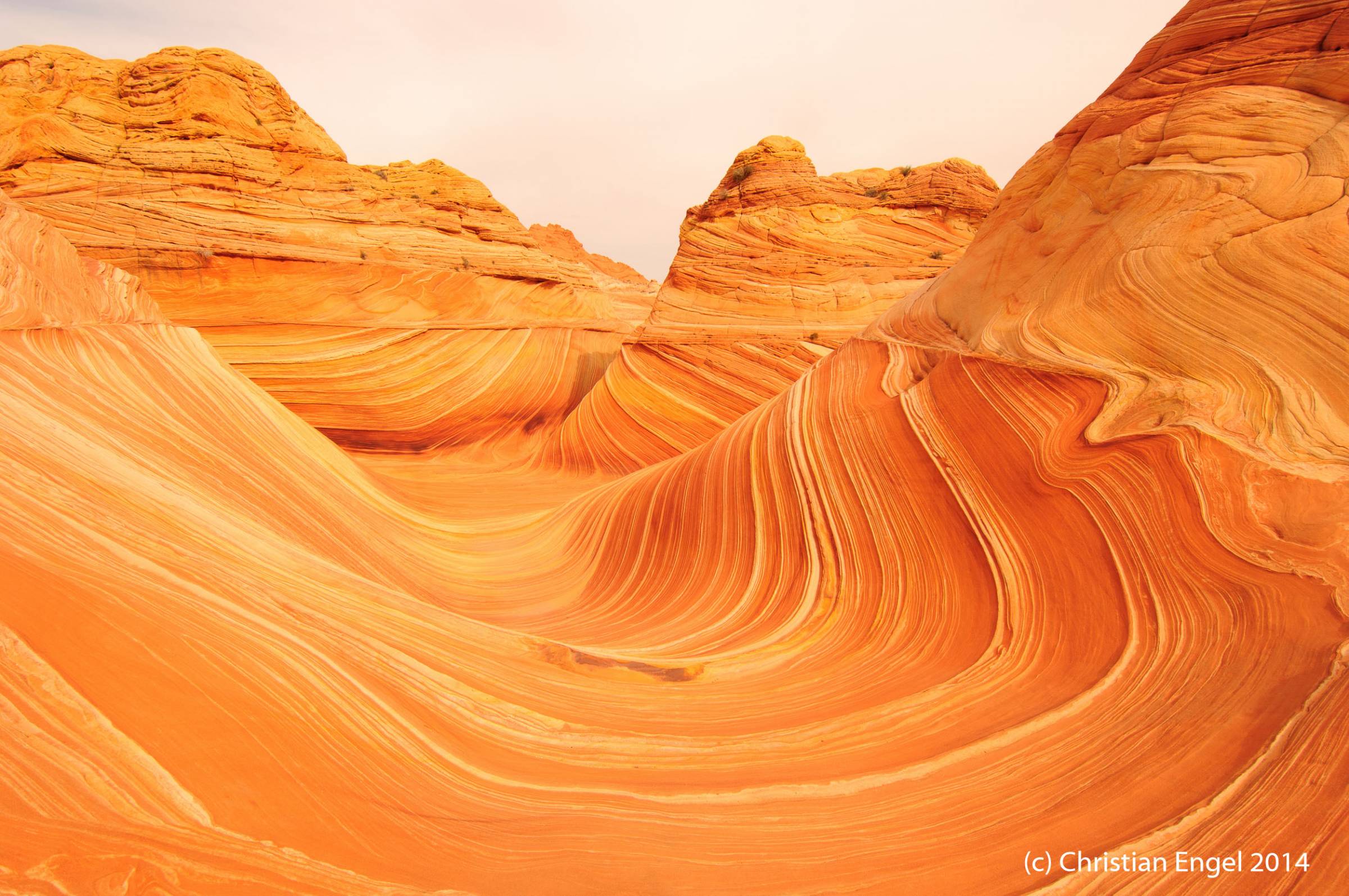
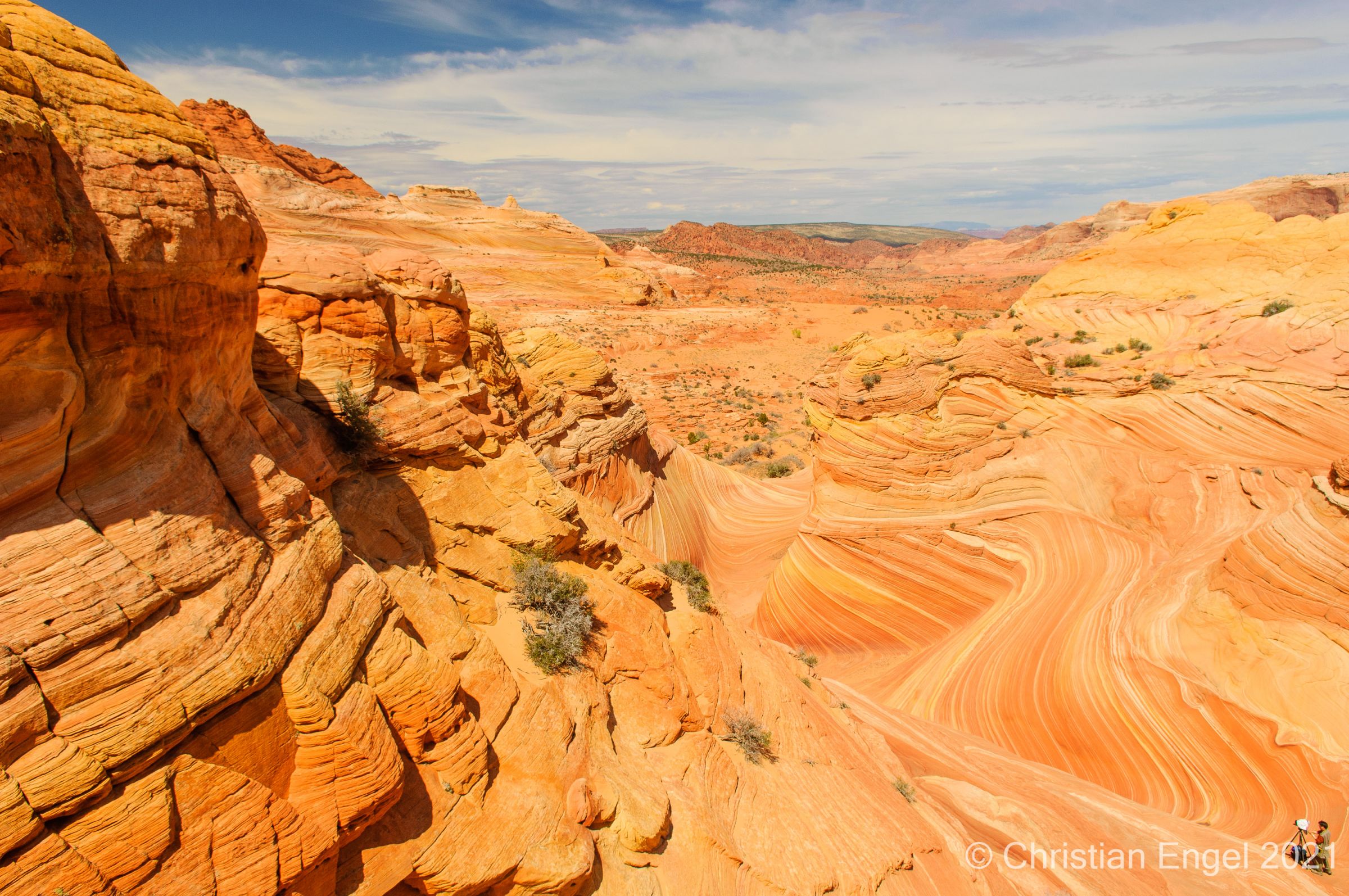
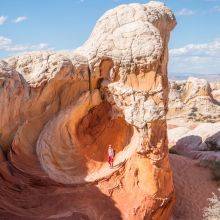
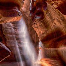
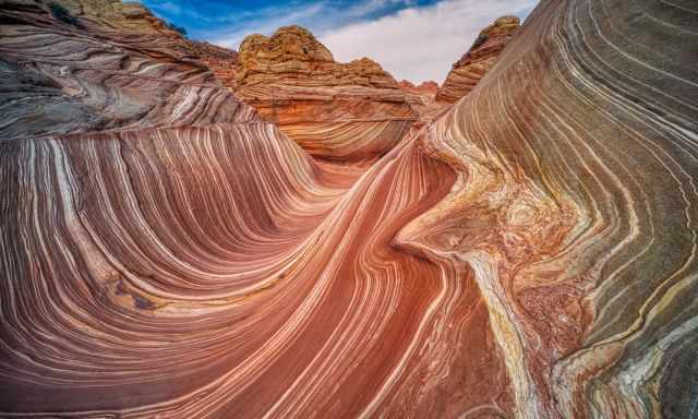
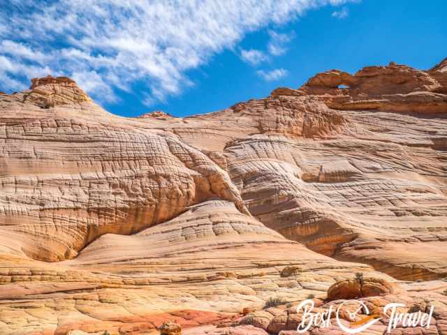
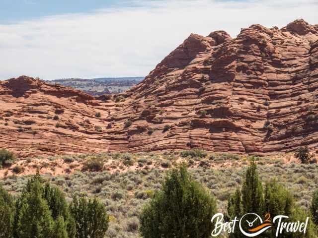
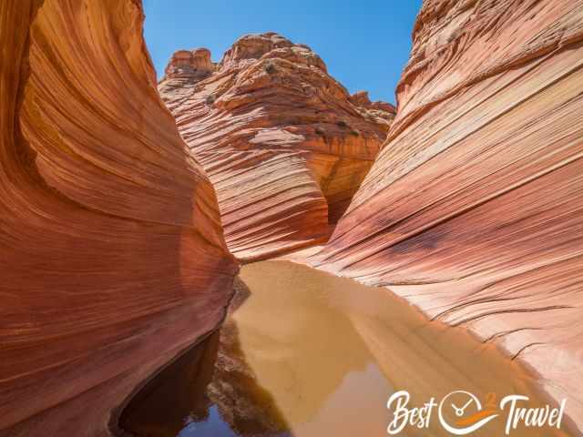
Wandering here in this pristine landscape estimated 190 million years old from Jurassic Time is a once-in-a-lifetime experience.
To protect what was carved from wind and rain, a permit system was introduced before 2000. Read my newly updated guide from October 2023 and learn everything you need to know to increase your chance for a permit. I added a Table of Contents for a better overview of all topics.
 |
For many years, I’ve been relying on Kelsey’s guidebooks to unlock the secrets of the Colorado Plateau. And let me tell you, Kelsey doesn’t hold back—he crams an AMAZING amount of information into each book. As I explore the rugged canyons of Utah and Arizona, Kelsey’s detailed insights have been my trusty companions. Sure, the maps might be rough, but when paired with a solid phone GPS app, you’re all set for an unforgettable adventure. The 7th Edition is a genuine update, keeping you in the loop with the latest info. So, fellow adventurers, if you’re ready to create photos and memories of a lifetime, grab your copy of Michael Kelsey’s Non-Technical Canyon Hiking Guide. Let’s explore those red rock canyons and share your experience on my Facebook Channel. |
The Permit System
A new lottery permit system was introduced on March 15, 2022. Now, you are able to apply two days in advance via your mobile instead of the walk-in system. The interested hikers have to be in the area between Kanab and Page. It is a mobile-based geofence system that gives you access when nearby. However, it depends on the available mobile signal. Although we were in the geofence area, the signal was frequently too weak to apply.
- Permit
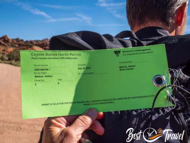
A permit is mandatory for Coyote Buttes North and South. Park rangers and BLM volunteers patrol the area daily and control if you have a valid permit. We were controlled by a volunteer on the track to the Wave and again at the Wave by a second volunteer. Don't go without a permit; you risk a high fine. I visited South Coyote Buttes, and it can’t compete with the Wave, but the White Pocket does, although utterly different! - Limited Access
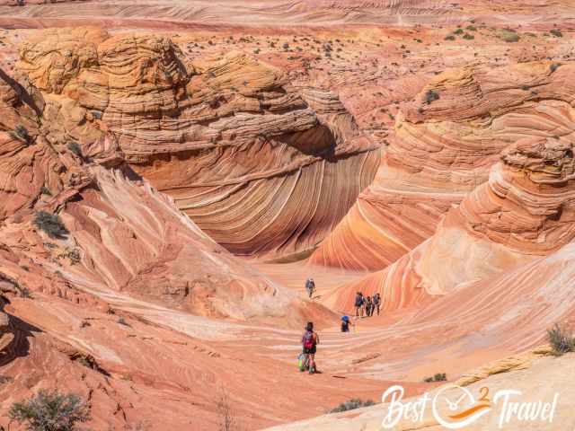
To protect the fragile landscape and preserve this unique rock formation for future generations, a maximum of 64 people or 16 groups with a max. of 6 are allowed to access the Wave. The permit gives you 24-hour access, but camping is prohibited. Soak in this exceptional landscape. Spend the entire day here. We returned to the car park at sunset, and even ten hours were too short. - Increasing number of visitors permitted since 2021
48 people or 12 group permits are available online four months in advance.
16 people or 4 groups, last-minute permits are available two days in advance in the geofence area.
How to Win a Permit? My 3 Must-Know
- Apply for the winter from mid-January to February online - lowest application rate (apply in September and October). However, keep in mind the Wave could be half covered in snow. In January 2023, after heavy snowfall, it was the case. However, it can happen that the road is not accessible even in a 4 WD, and you are forced to book a guided tour.
- Don't go in the summer for two reasons. First, it is too hot and second, everybody hikes early, and all visitors reach the Wave at the same time. This is what a park ranger told me: the Wave was crowded, and everybody had to line up for a picture.
- I highly recommend applying in spring or fall mid-week for the two days in advance lottery between Tuesday and Thursday, best on a Wednesday, the quietest day. This is also what we did. We planned to spend at least a week in Kanab to try it 8 or 9 times, but we won with the first attempt on a Wednesday for Friday in September 2023. Roughly one thousand people try it daily in the geofence area. Everybody recommended we should go to Las Vegas afterwards. Therefore, get here for a week and try it daily! My Wave guide has one more tip to increase your chances, but you must read this guide to figure out the tip from a local guide.
How to get the Permit?
Online Lottery
48 hikers or 12 group permits, what is reached first with a max. of 6 are available online – Not a high chance, but you never know. On average, you may win after the 25th attempt, a guide told me. Link online lottery
- You can choose three days for your whished month - 4 months ahead. For example, for February, you already applied in October. One application per month only!
- You get notified on the first day of the following month whether you won.
- Some still mention you should watch the application number for each day to apply on the last day of a month to pick the days with the fewest applications. But this is wrong! It is not shown any longer, which is fair.
2 Days in Advance Lottery - The Most Important Questions and Answers
- How many permits are available? 4 last-minute permits or max. 16 people – Slightly higher chance.
- How to apply? 2 days before the wished hiking day within the geofence perimeter
- Which locations belong to the geofence area?
North: Orderville and Glendale
West: West of Kanab until Zion East Entrance and Coral Pink Sand Dunes
South: Jakob Lake
East: Page
Geofence Map - When to apply? Between 6 a.m. and 6 p.m., after applying, you can leave the geofence area.
- When do I get the confirmation? The same day, around 7.15 pm
- What happens if I win the permit? You must accept and pay for the permit until the next day, 8 a.m. Utah time. Pick up your permit at 8.30 a.m, but this is all mentioned in your e-mail.
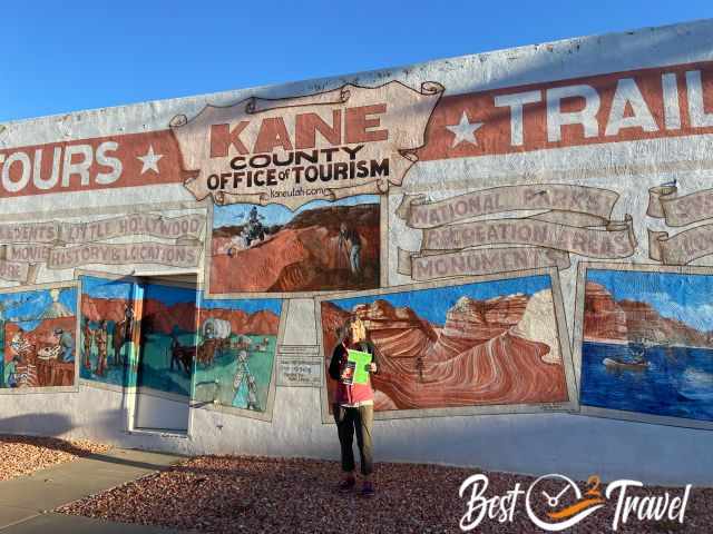
- Pick up location: 78 S 100 E The Kane County Office of Tourism, Kanab Visitor Center.
- Where can I get the app to apply? Follow this link and download the app, then create an account.
- How often is the lottery held? It is held daily.
- Do I have to pay anything for the application? Yes, $9 application fee for each request. This is pretty expensive if you try it more often. If you are successful, another $7 recreational fee has to be paid.
The Wave Permit Fee
- $9 application fee
- $7 recreational fee if you won the permit
Are dogs permitted at the Wave?
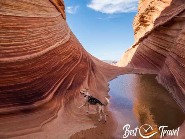
Yes, but you must apply for your dog, too. Permit Fee $7 per dog. We saw several hikers with their dogs taking pictures inside the Wave.
Can I hike to the Wave without a permit?
Don't even think about it! People get caught every year. The fine is substantial for getting caught, and there are rangers there - looking like hikers. They ask for your permit and write down your number.
We were controlled twice, once along the trail to the Wave and again at the Wave. In the evening, a ranger controlled the left cars at the parking. The fine is $1,000 to $10,000 plus up to 1 year in jail. Accept the fact if you don't win, but please don't risk such fines!
We also saw a people counter at a tree.
You can find the driving directions, road conditions, the trail description, more sandstone formations, plus pictures below.
Packing Checklist - 7 what to bring for the Wave hike
If you win a permit, spend as much time as possible at Coyote Buttes North. There is more to discover than just the Wave. Therefore, good prep is essential.
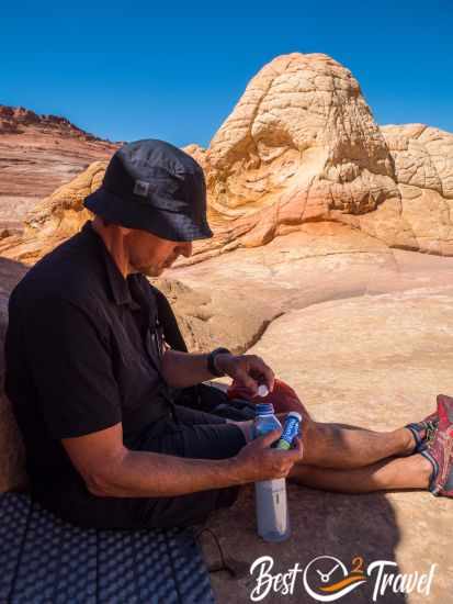
- Most importantly, plenty of water, food, and snacks. Our guide at White Pocket recommended 5 l/ 1,3 gallon for each of us, and he was right. We took less, but luckily, we had an additional bottle in the car when we returned at sunset.
- For such long day hikes, we drink plenty of water with electrolytes for new energy throughout the adventure.
- Sun precaution, hat, and sunscreen, sunglasses for the walk only. There is shade at the Alcove and Melody Arch but not around the Wave. The entire hike is exposed to the sun. I use my special SPF 50+ sunscreen for exposed areas like my arms and face. I have never gotten sunburnt since I started using this cream.
- You need shoes with good traction for hiking above the sandstone. Even more important are these kinds of shoes to climb the sandstone up to the Alcove and Melody Arch and back. My Inov trail shoes were perfect for all the sandstone formations we explored around Kanab.
If you are trained, don't miss out on these highlights!! If you are used to hiking pools, take them with you, but please use rubber tips on the delicate sandstone. - Always carry a headlamp. This place is otherworldly, and you may forget to return in time, especially if you continue to other highlights as we did. Thanks to our Petzl headlamps, we were relaxed and returned late.
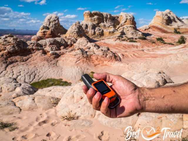
- We went to several remote areas in the Southwest where cellphone service and internet were not provided. In case of an emergency, we invested in a Garmin Inreach Mini.
- If you plan to check out more than the Wave, I highly recommend carrying a Nylon Climbing Sling Runner. We live close to the European Alps and always carry such a short rope in our backpack. Climbing the sandstone wall up was manageable, but I was glad that Markus took the two to assist me, giving me safety for the descent.
Thanks for buying your gear via my website. With your support, I am able to provide all this information.
For more impressions of our Wave and White Pocket tour, watch our YouTube Short.
Wave Location – How to get there
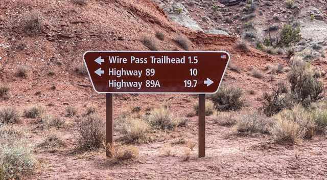
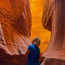
The Wave is situated on the Paria Plateau, Coyote Buttes North in Arizona, close to the Utah border. Getting there is easy on the gravel Rock House Valley Road. You pass by the Buckskin Gulch Trailhead, one of the best hikes on earth, and continue until you reach Wire Pass.
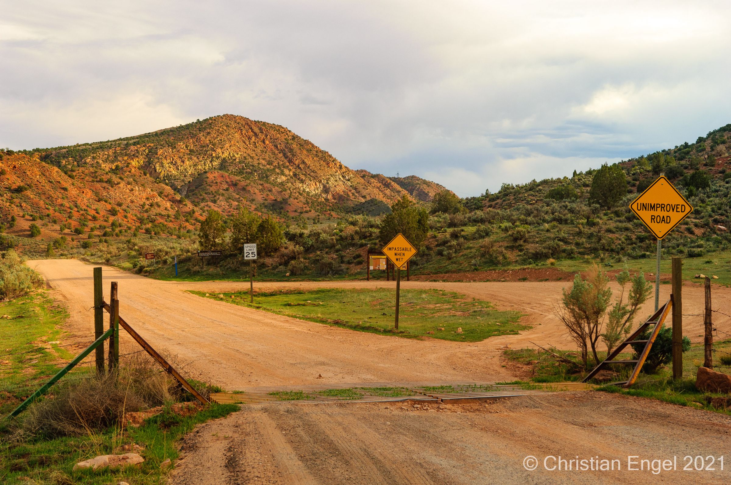
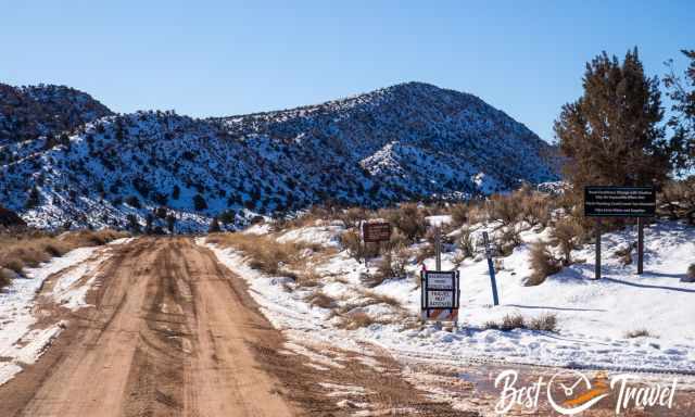
I recommend a 4WD or at least a 2WD with high clearance, and it’s a stress-free drive to Wire Pass Trailhead. After heavy rainfall, the Rock House Valley Road may be impassable.
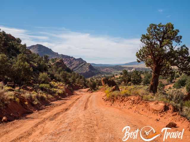
Although the gravel road gets graded twice a year, drive carefully here. Parts of the road have collapsed due to the recent heavy rains. As you can see in the picture above, if this road gets wet, you may get stuck which is an expensive event.
Necessary: Display your parking permit on the windshield!

Google Maps direction from Kanab to the Wire Pass Trailhead
Google Maps direction from Page to the Wire Pass Trailhead
Wave trail in detail - tips and markers in pictures

- This return hike is 5.6 miles/ 9 km long. If you like to explore more of the breathtaking Coyote Buttes North, add roughly 2 miles/ 3,2 km.
- The track is poorly marked. I highly recommend a mapping app like GAIA for the outstanding hike.
- Ascent: 690 ft/ 210 m and descent 345 ft/105 m to the Wave and vice versa on the hike back.
- Difficulty: medium but exposed to the sun and scorching temperatures in the summer.
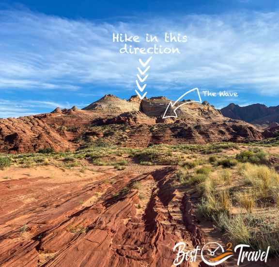
With your Wave permit, you will also receive a flyer with hiking directions. Photos are showing you how to find the trail. I have to confess it wasn't that clear, and we were glad to have a hiking app and that we met a BLM volunteer who controlled our permit. He pointed out the important landmarks. So here is my trail description and more pictures:
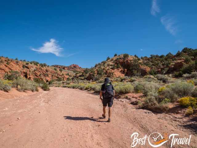
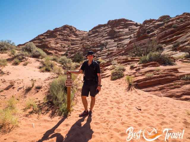
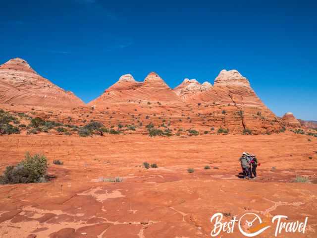
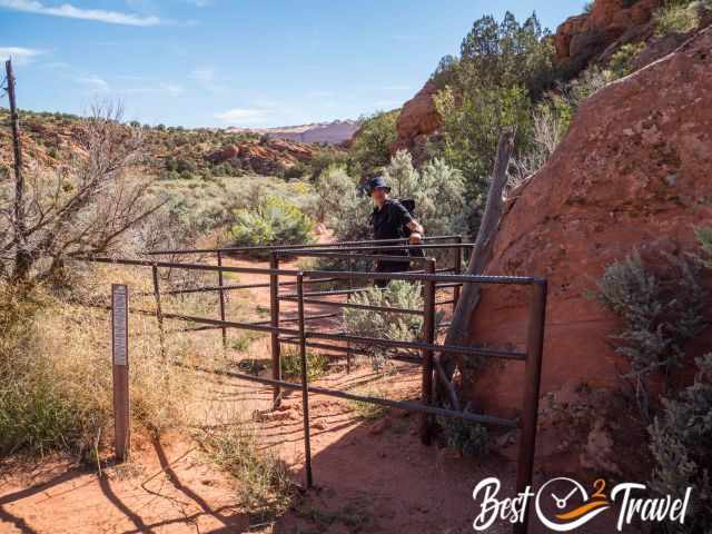
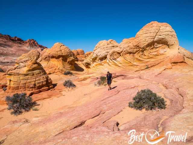
Leave the wash and follow the trail for half a mile until you access the Coyote Buttes North permit area.
You pass by the Coyote Buttes entrance sign from where it is mandatory to carry the permit outside your backpack.
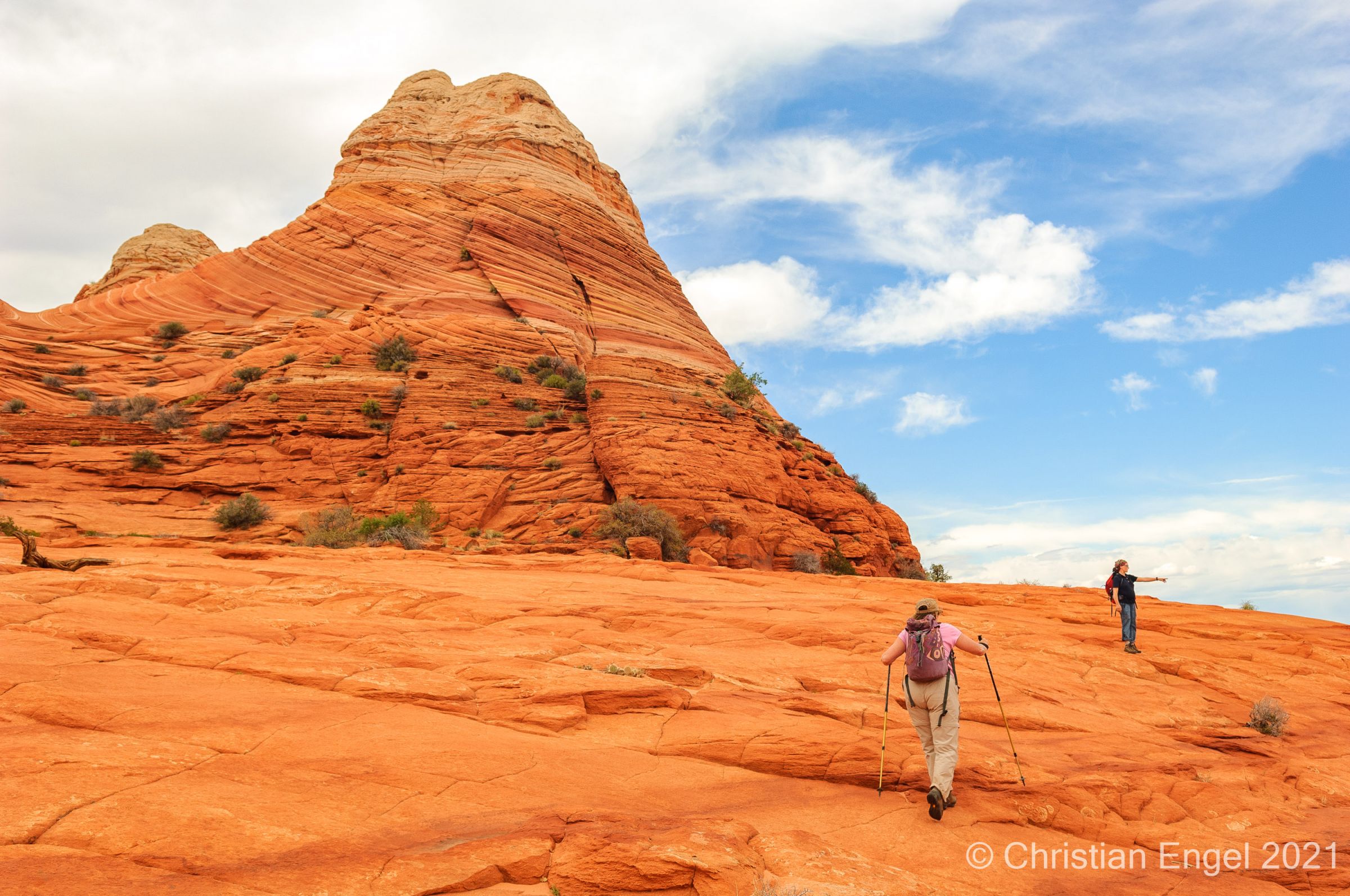
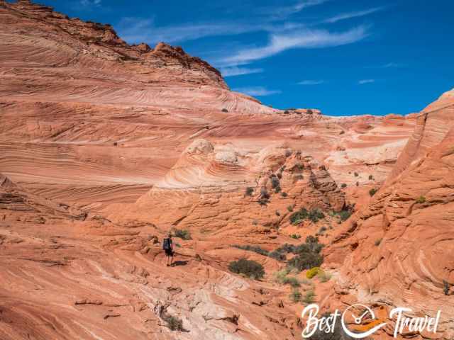
The first part leads mainly through the sand until you reach the saddle and first sandstone formations.
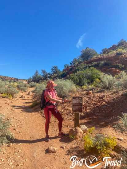
Soon after you reach a sign and the permit area, from now on, you MUST have a permit for this track. Hiking signs are scarce, but there are a few because hikers have repeatedly lost their way.
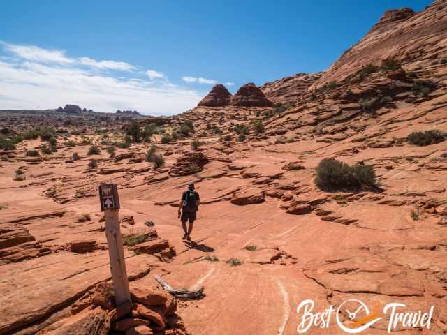
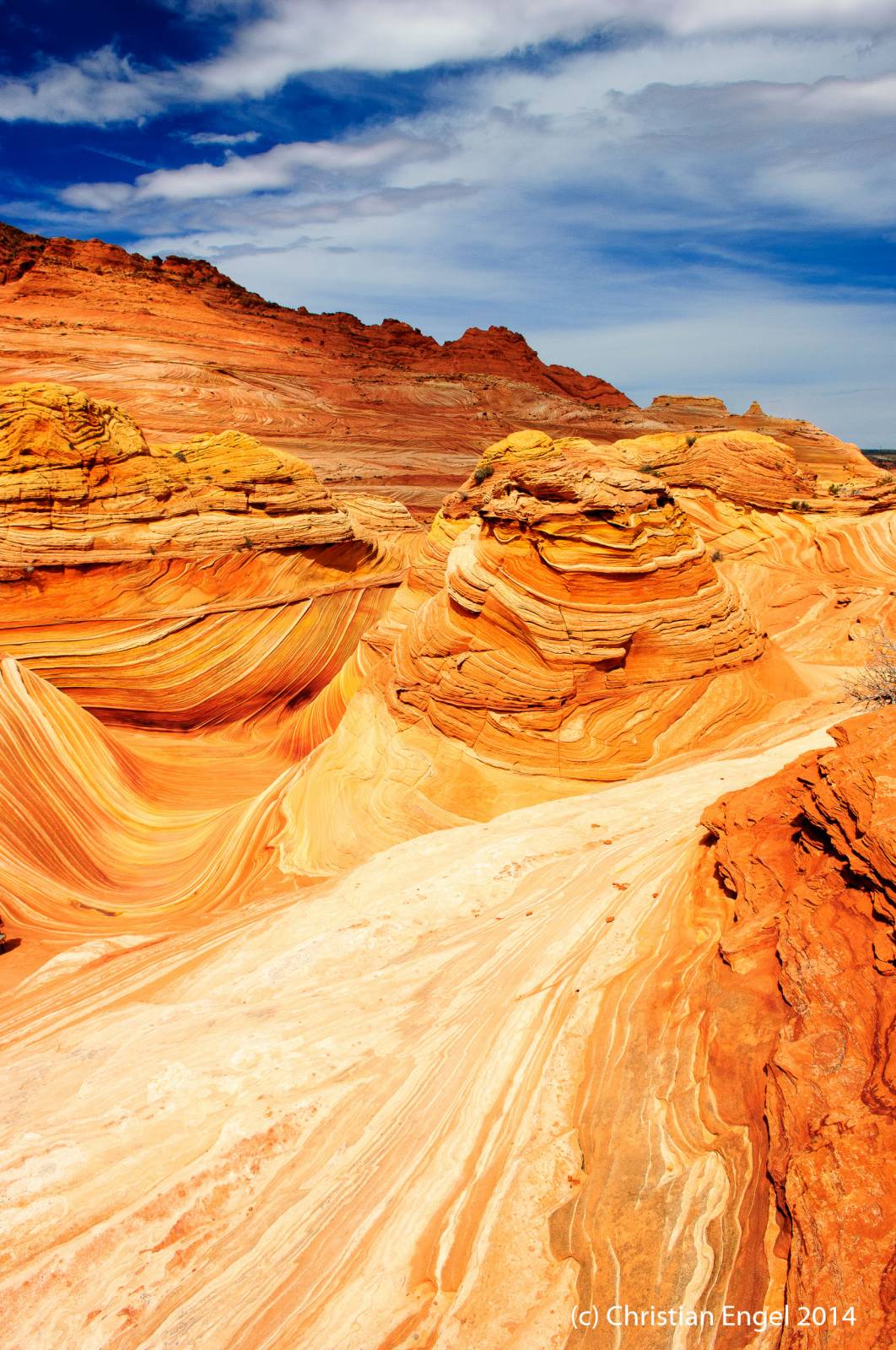
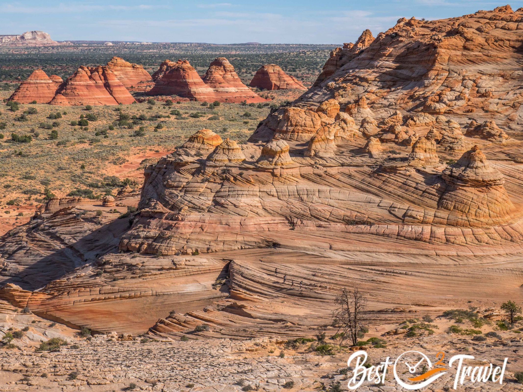
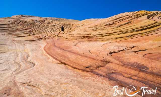
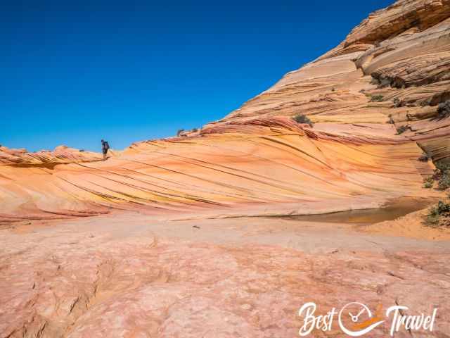
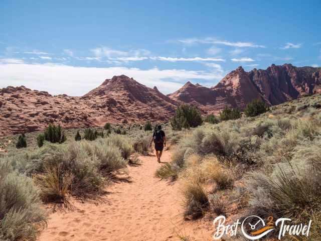
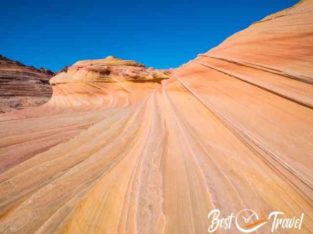
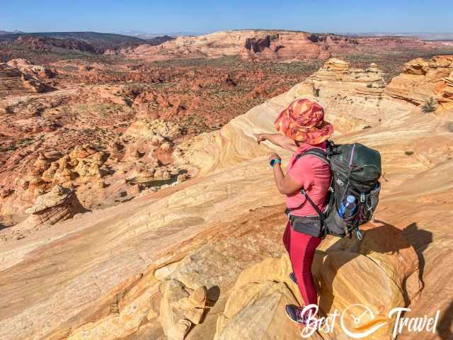
The path continues to the right side of the Twin Buttes and through this beautiful sandstone slope - next picture.
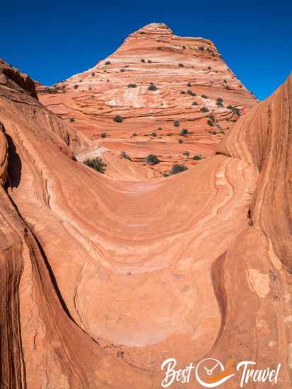
Remember this view on the way back to the car park. From here, we continued forward and admired the beautiful buttes, some of which we checked out before we reached the Wave.
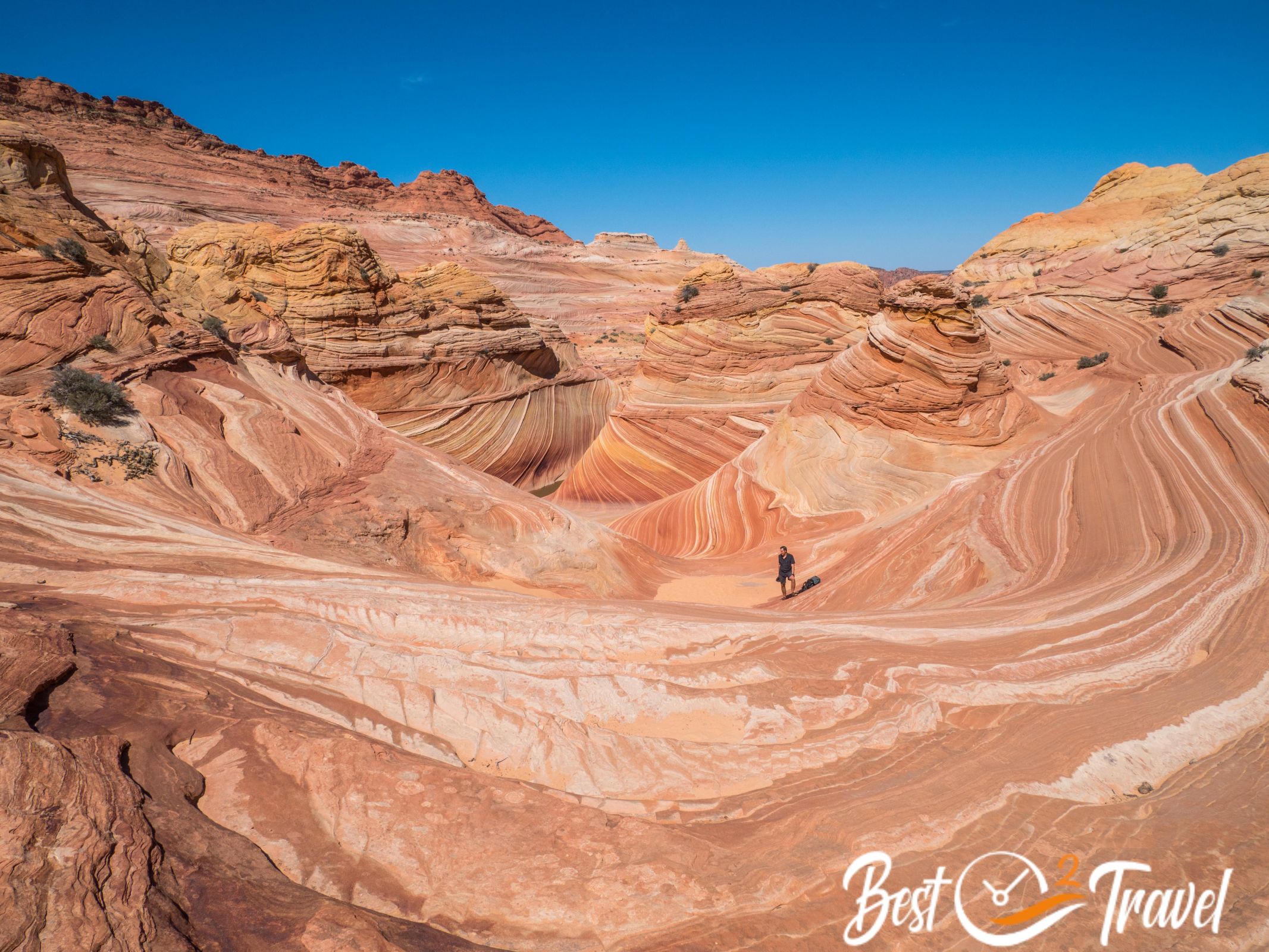
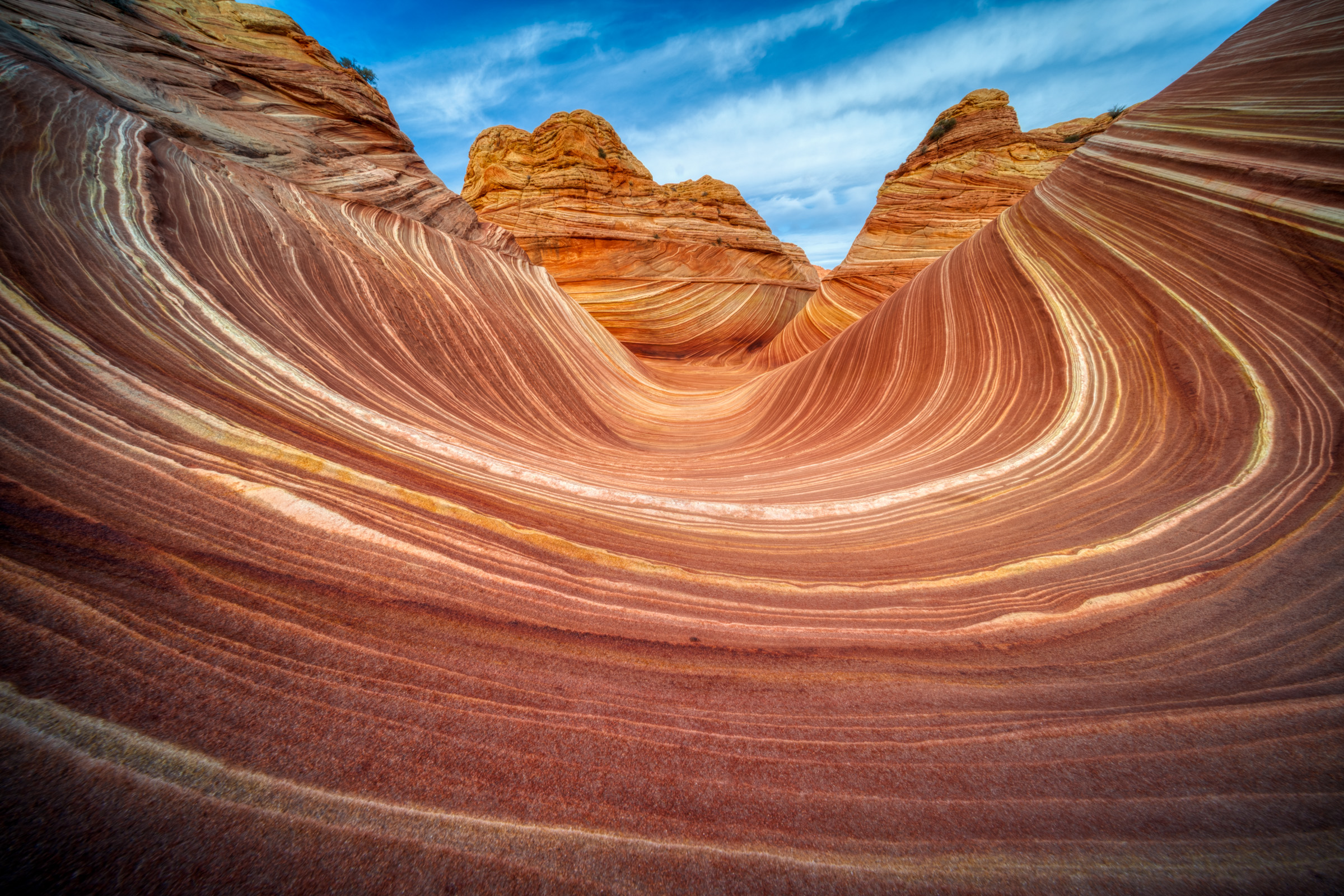
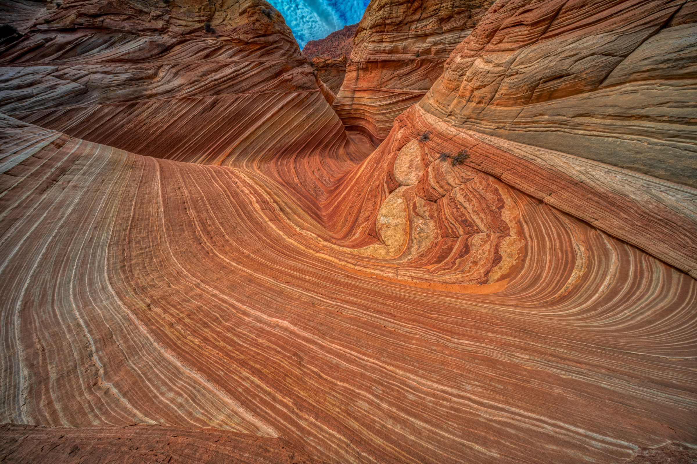
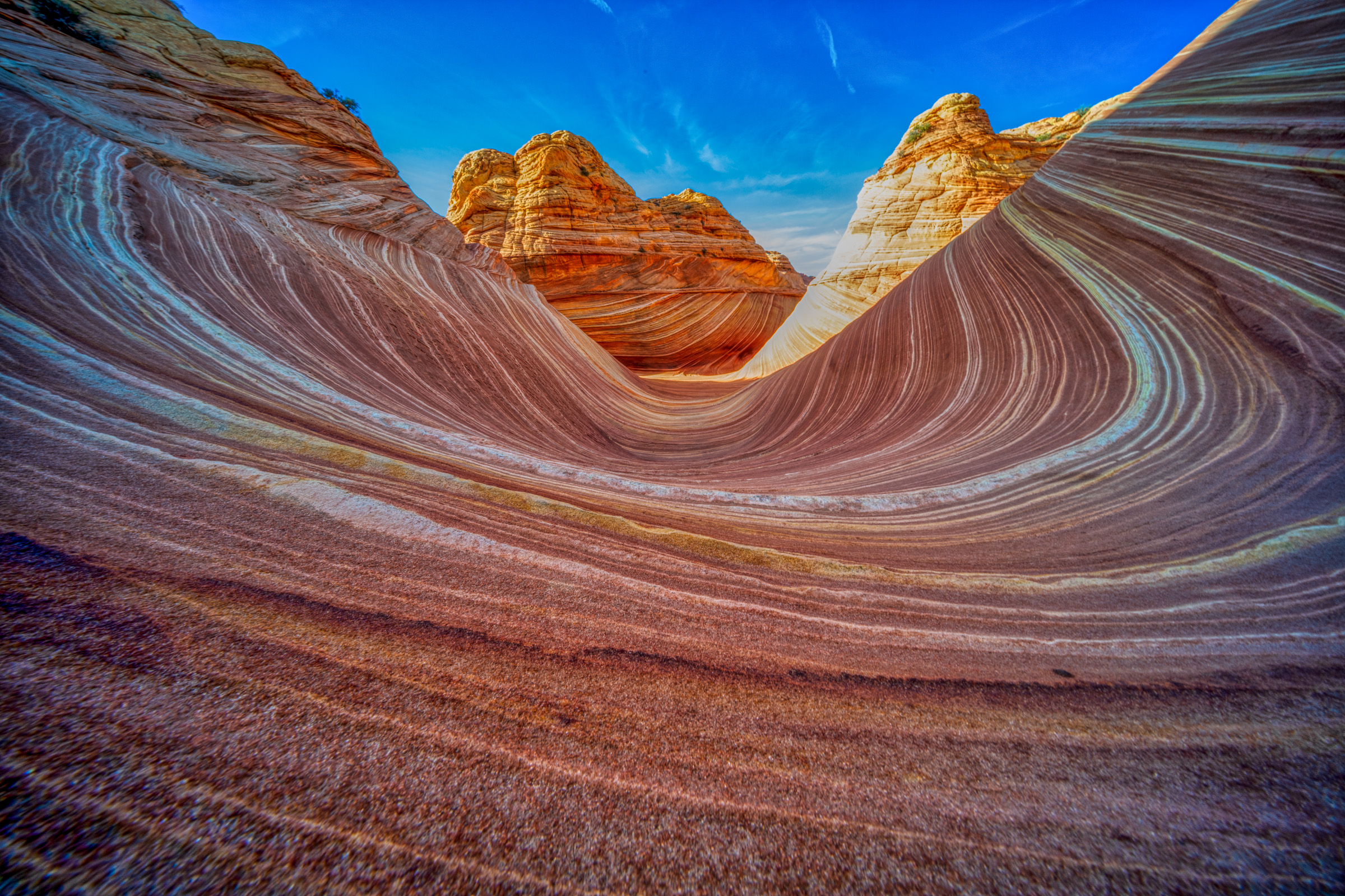
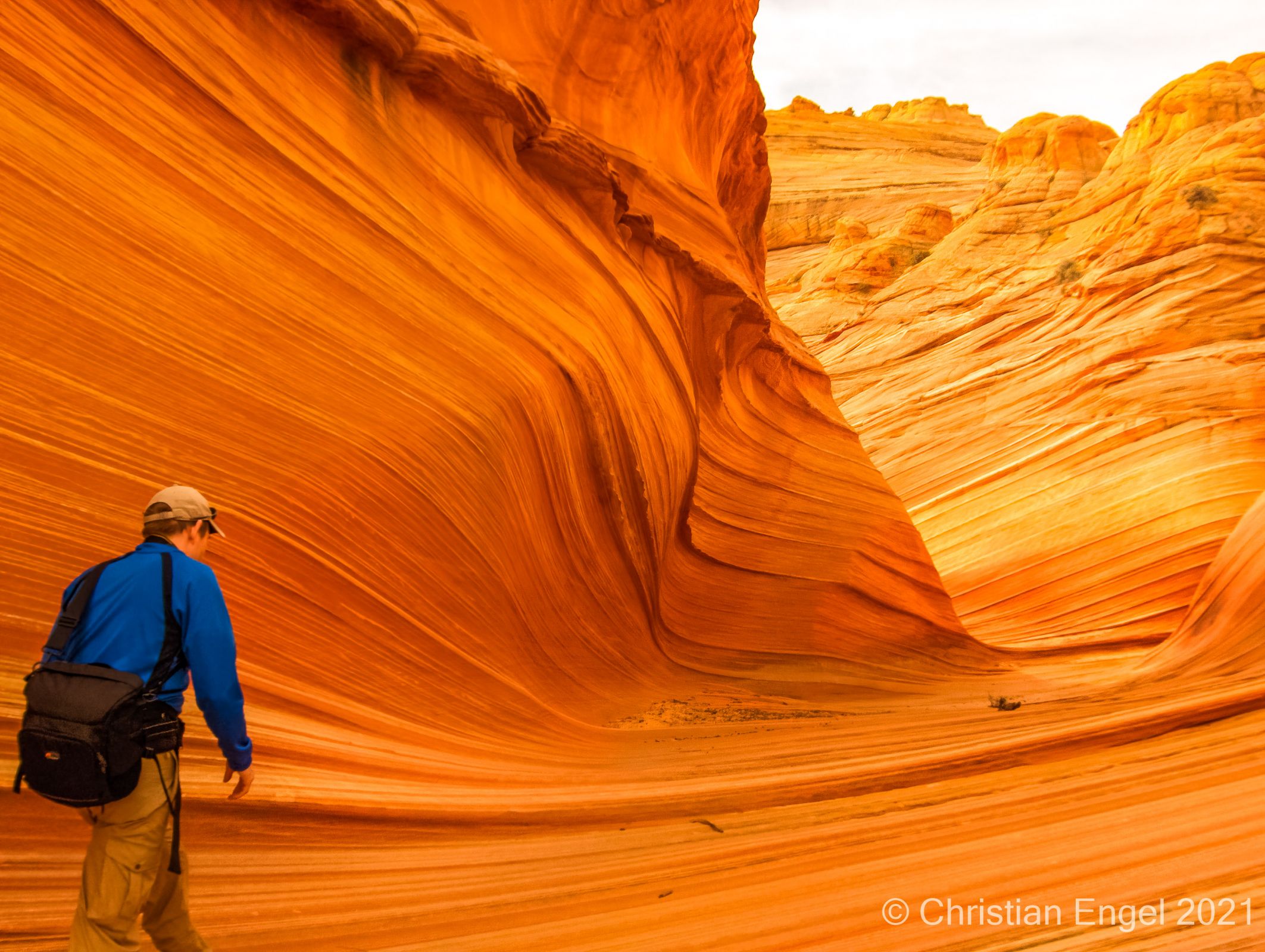
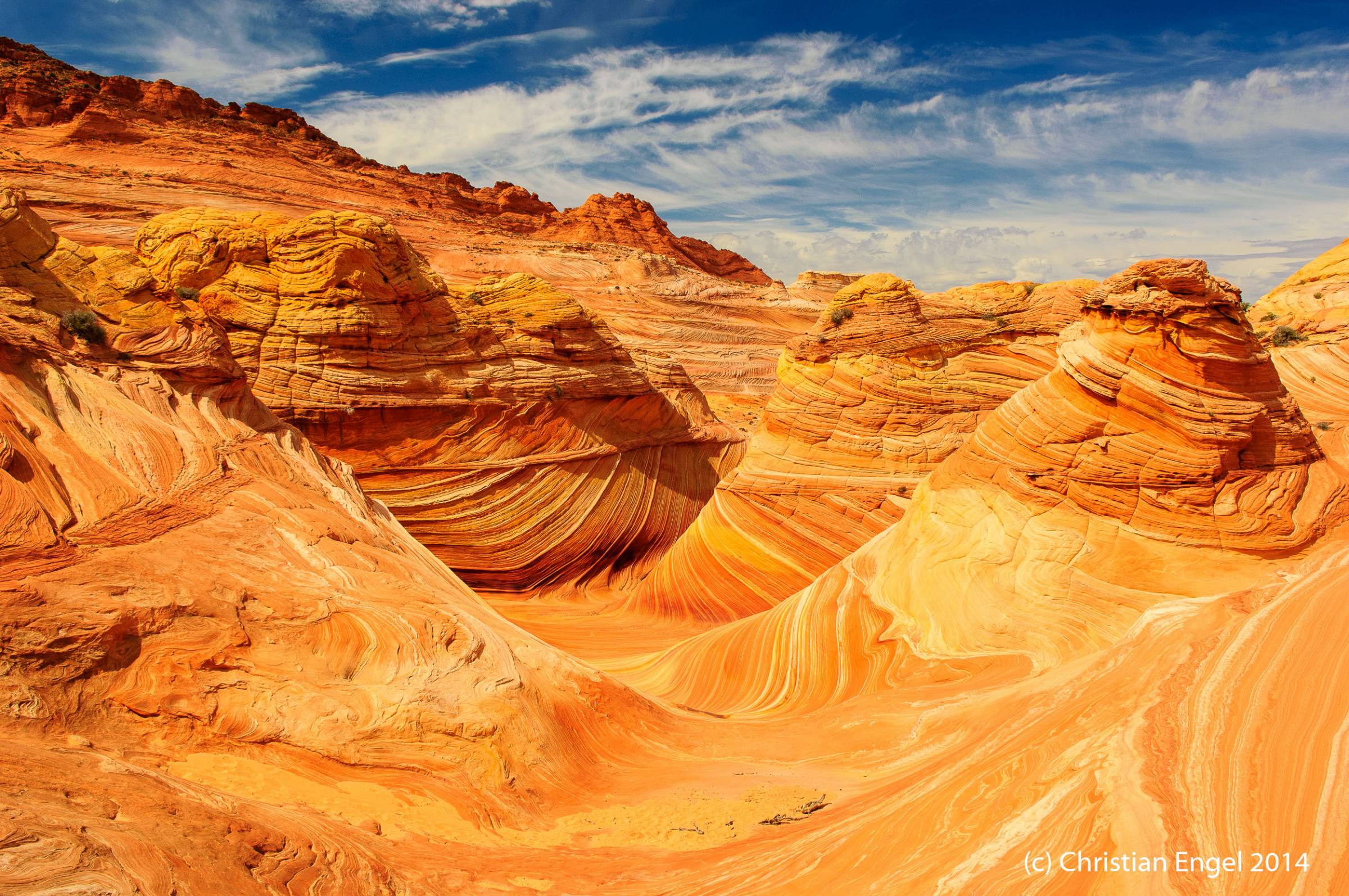
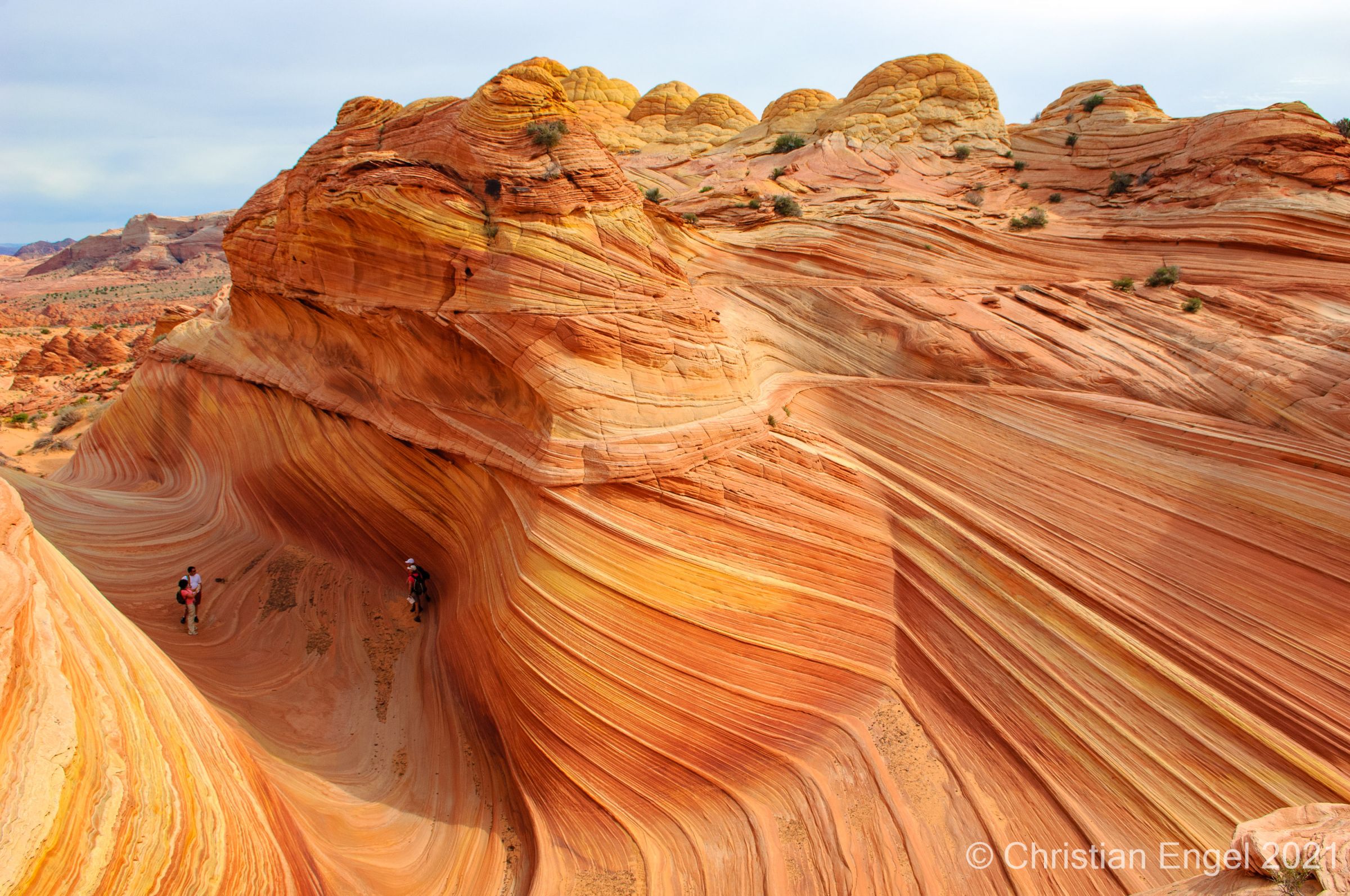
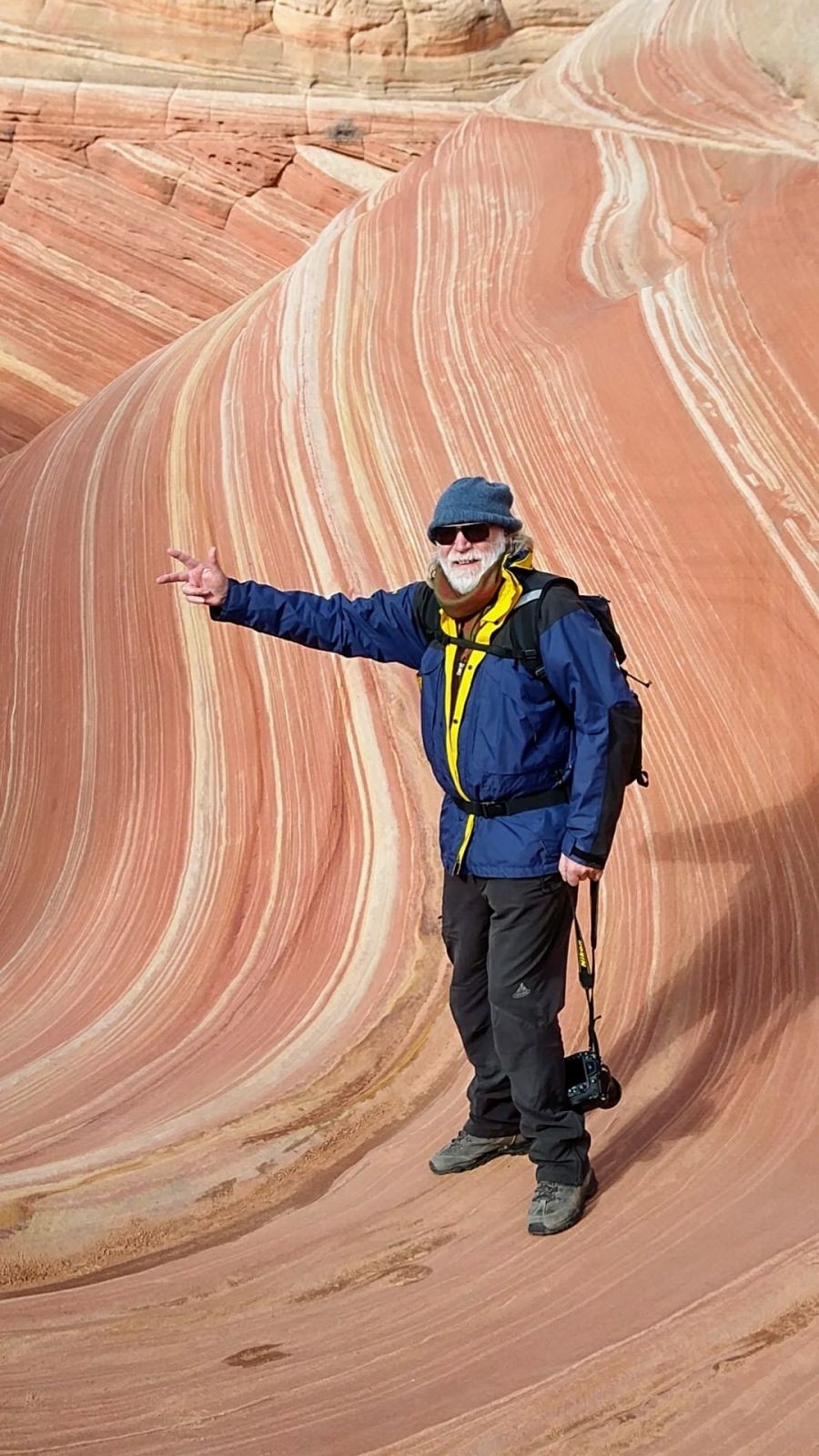
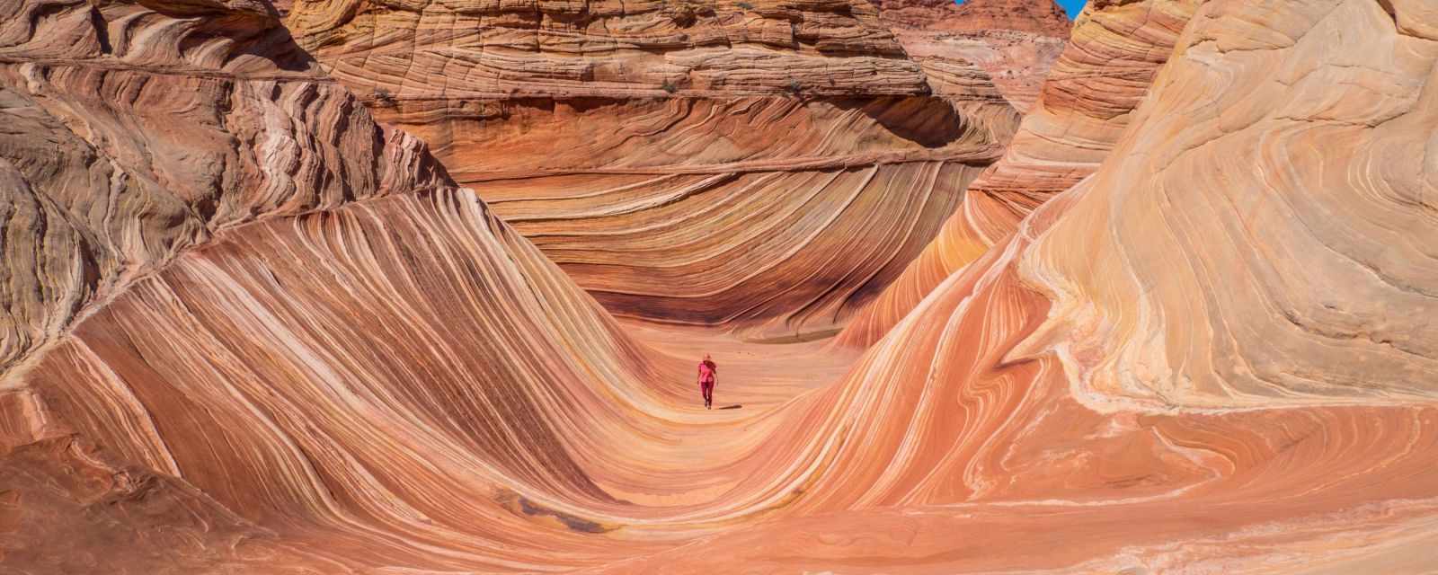
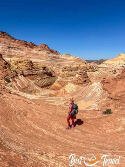
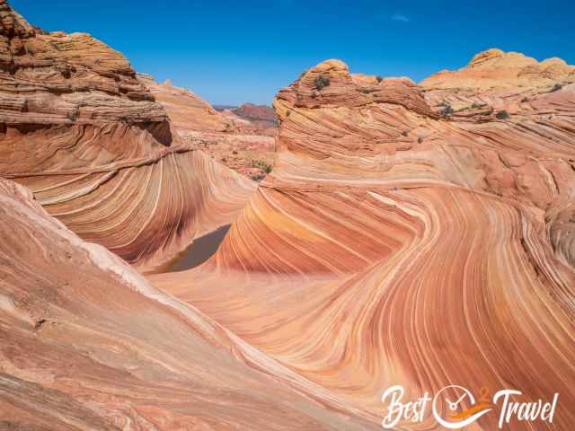
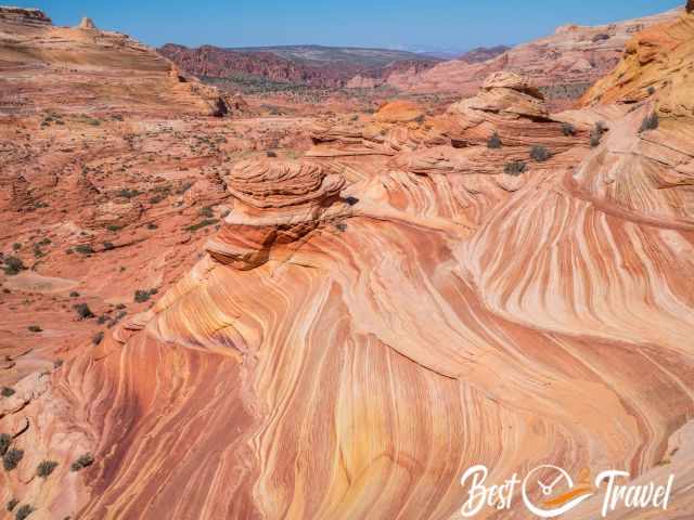
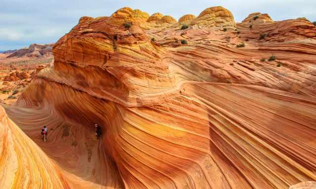
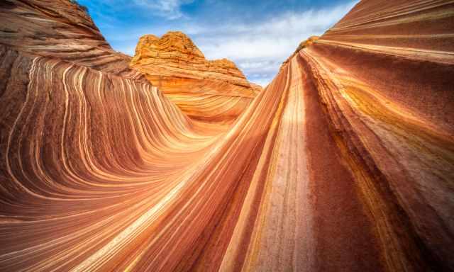
Soon after, we reached the Wave Formation, and the next BLM volunteer controlled our permit. We were absolutely in awe that there wasn't anybody else around.
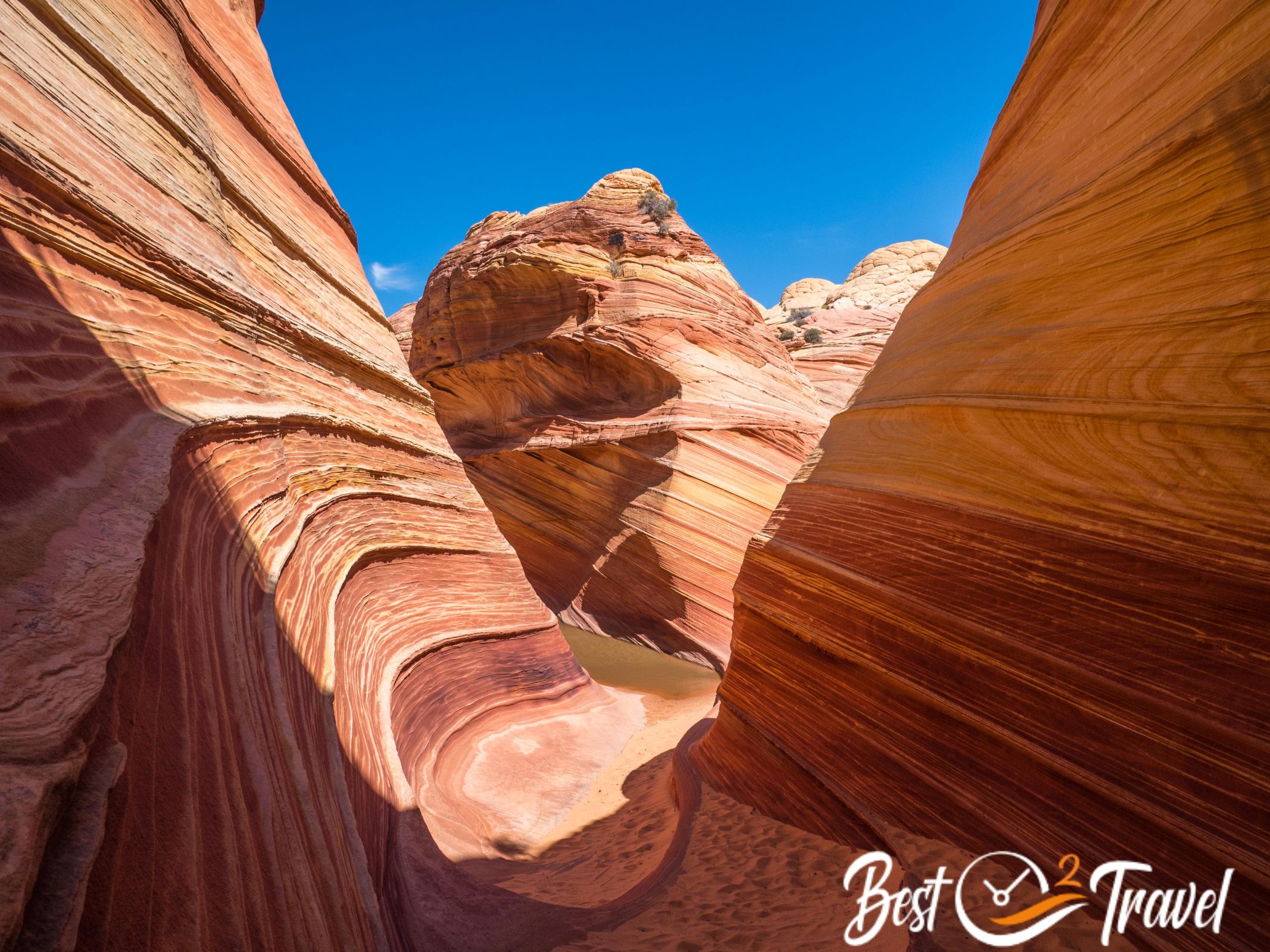
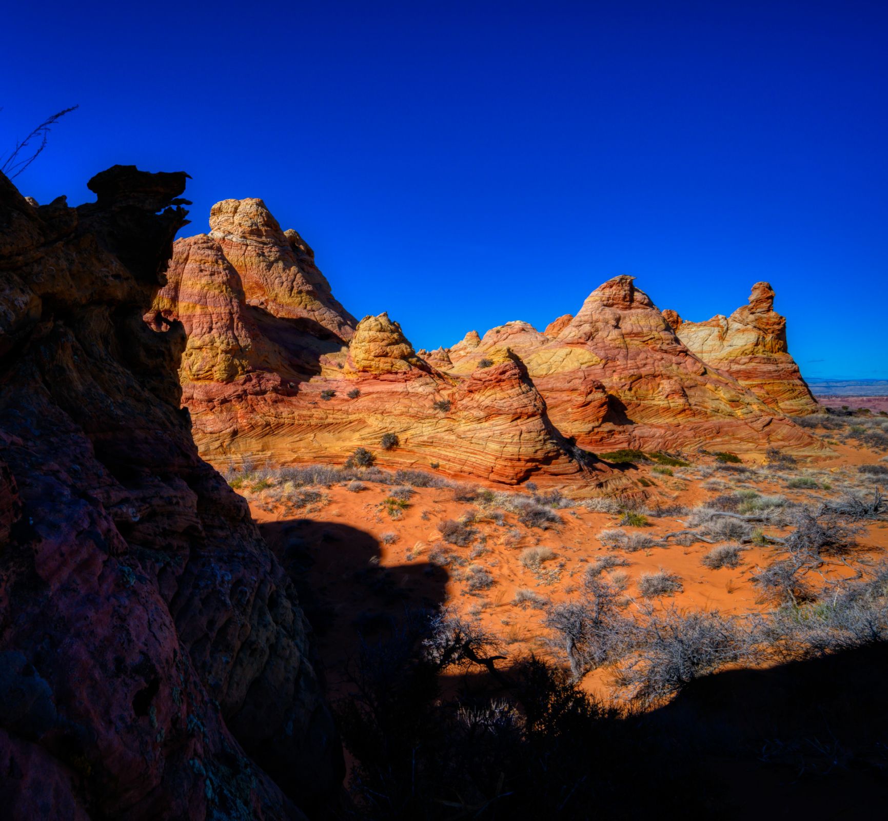
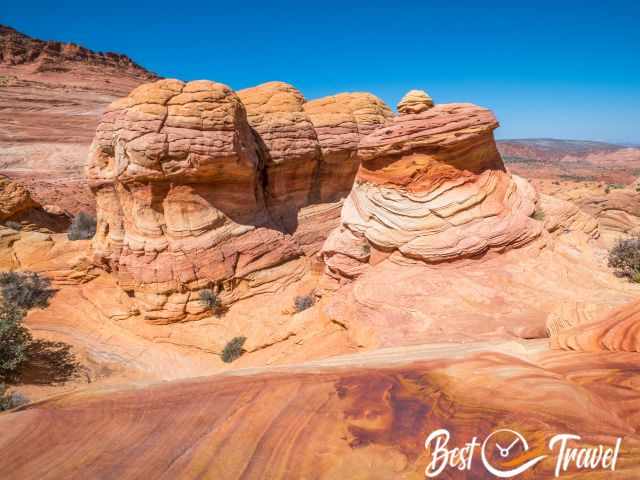
Highlights in Coyote Buttes North after the Wave
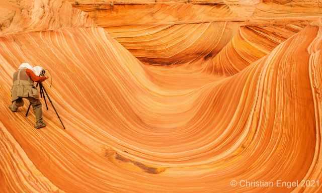
We hiked through the Wave and climbed up different formations for other perspectives of the famous Wave. The following spot is just an easy 20-minute walk.
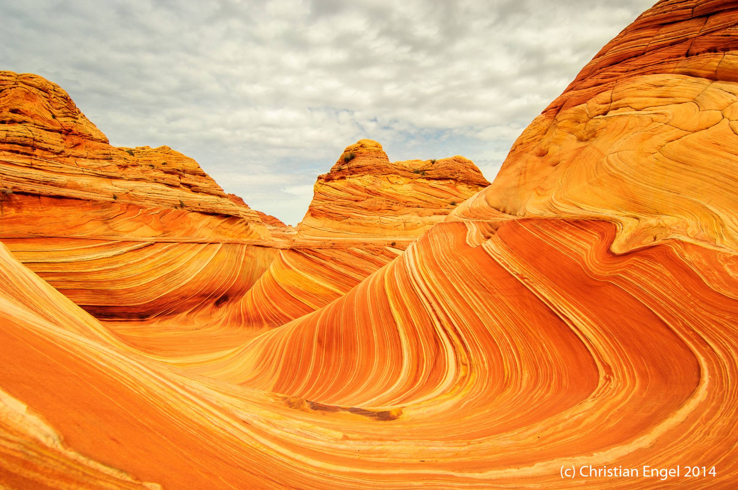
The Second Wave
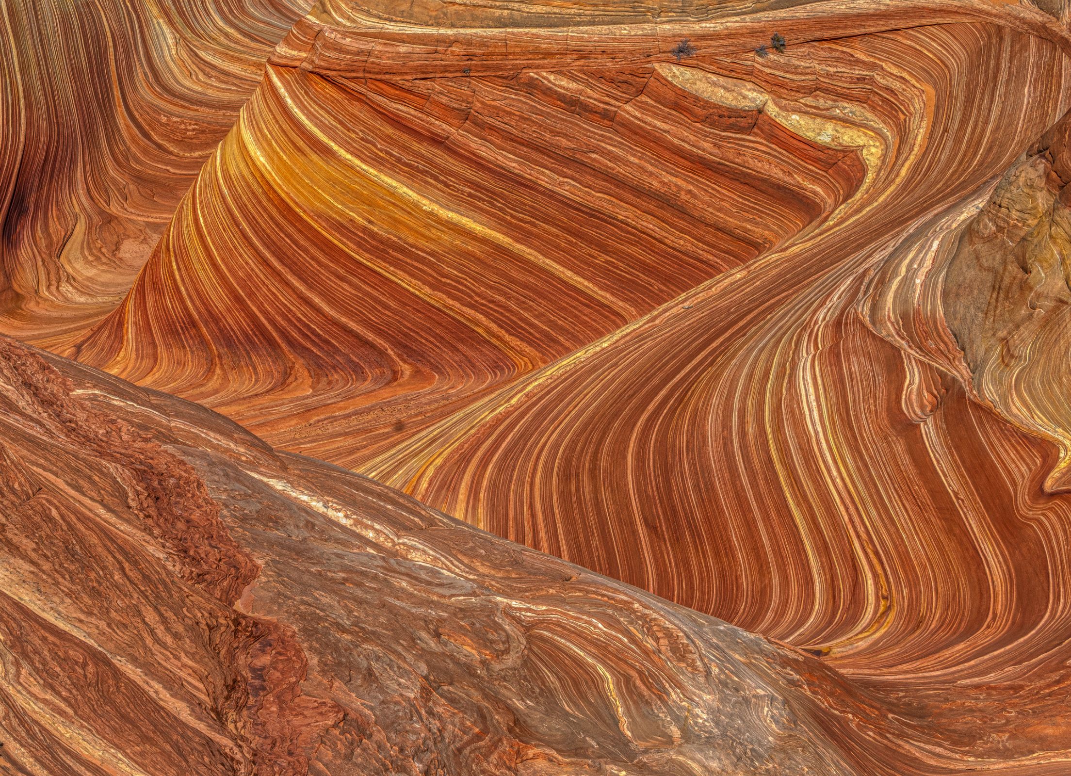
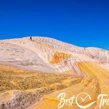
The sandstone formations are from the Jurassic Period - created by Mother Nature 190 million years ago. Our expectations were absolutely exceeded, and we couldn't wait to find more of these excellent spots.
Behind the Second Wave is a huge and steep wall called Top Rock. For more unique hidden gems in Coyote Buttes North, you must climb up through this crevice. On the way back, we were glad to have our climbing slings in our backpacks to assist each other.
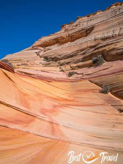
This is the key passage, the crevice through which you must climb up to get to more fantastic spots on the plateau. It took us roughly 20 minutes to find a manageable track to the top.
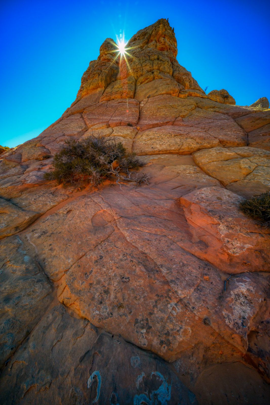
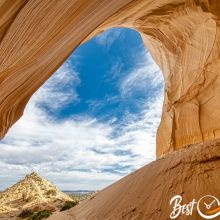
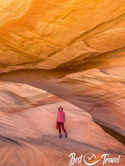
The view from the plateau to the Wave and the other pastel-coloured formations is fantastic. After a short walk of ten minutes, we reached another highlight, my favourite of all.
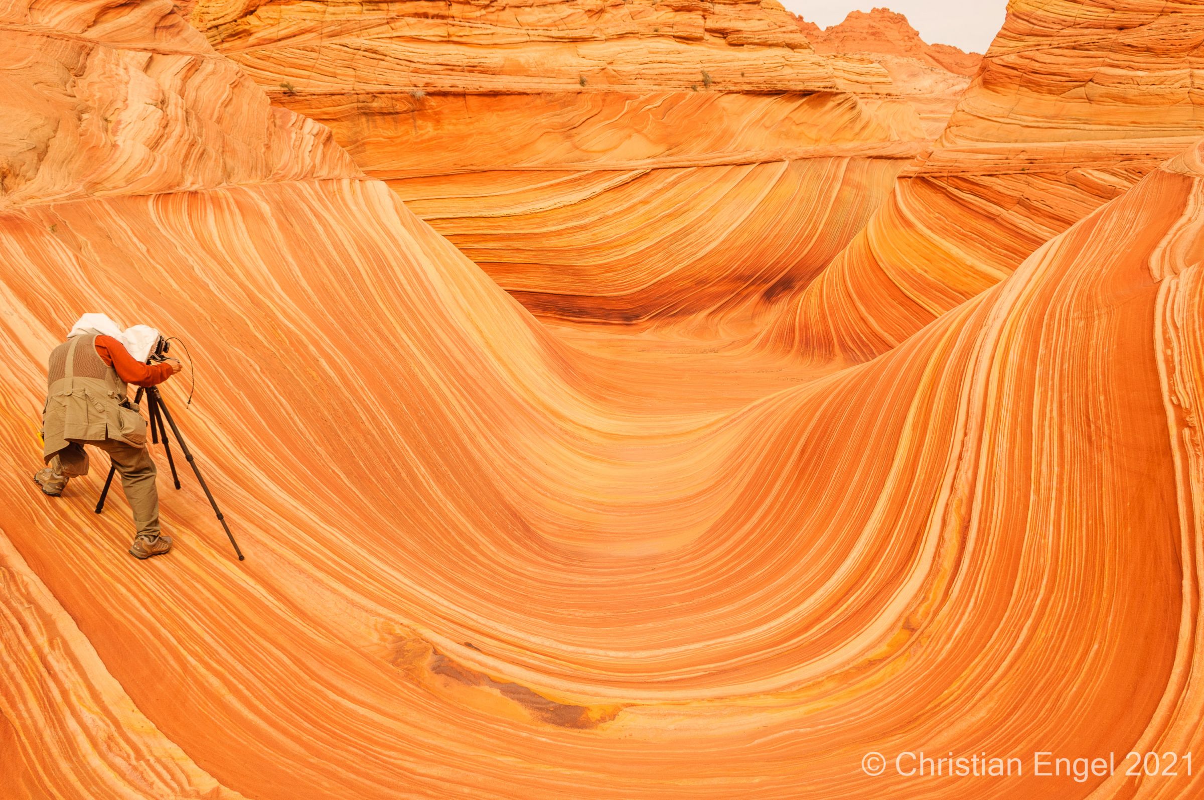
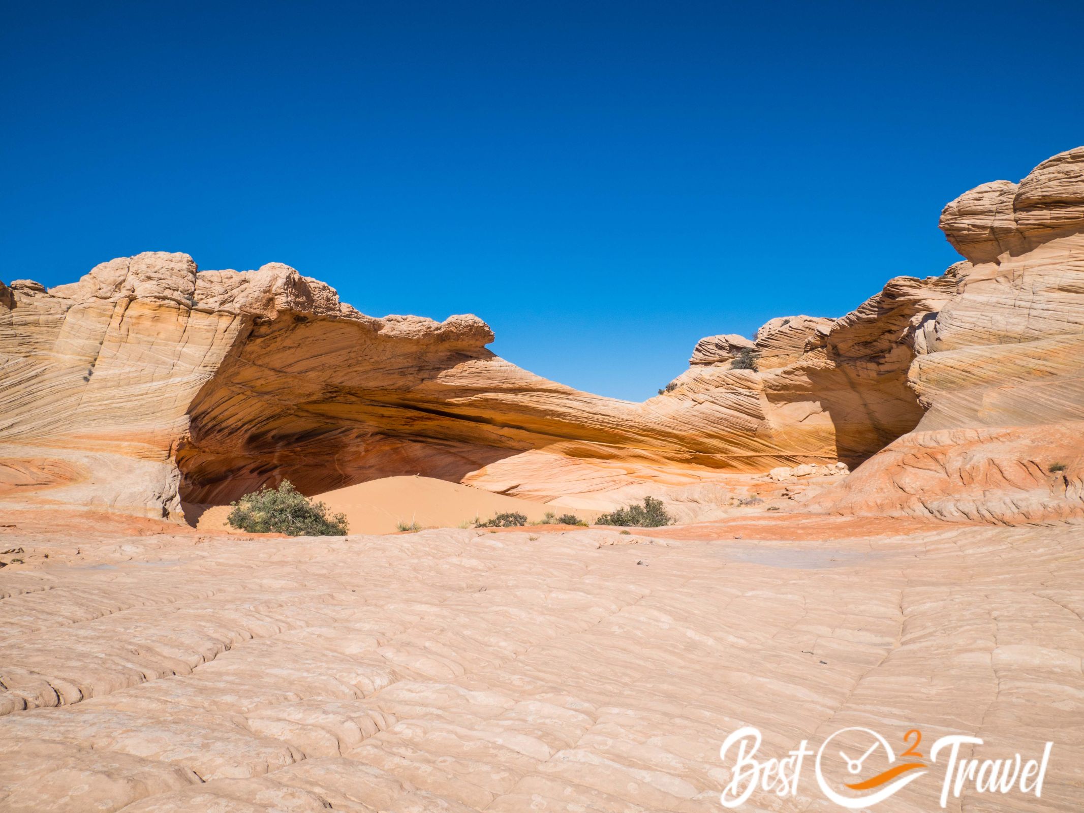
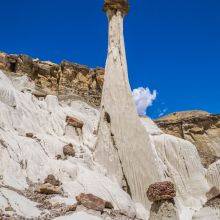
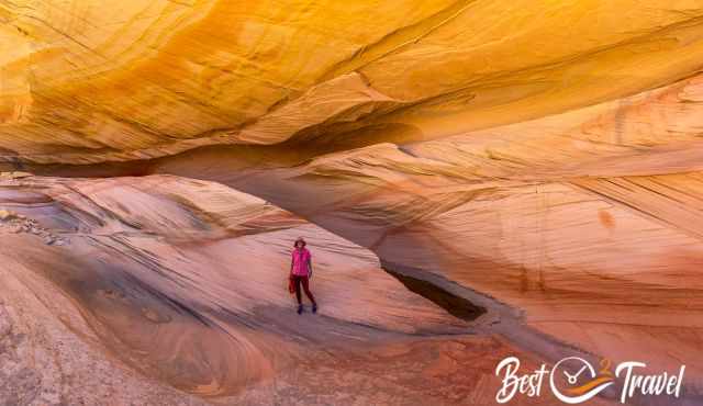
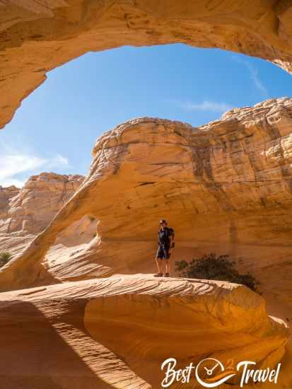
The Alcove on Top Rock
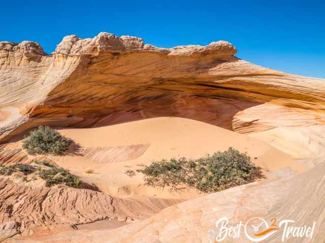
You can get the best shots from inside the Alcove, but during our visit, we experienced a storm. To protect my camera, I was forced to put it in my orange windproof bag.
These sandstone formations looked like silk, made in another world. I have rarely seen such a beautiful place. We continued our hike, and another ten minutes later, we found the last exceptional sandstone formations.
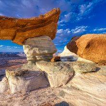
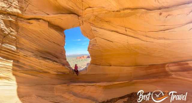
Melody Arch and the Grotto
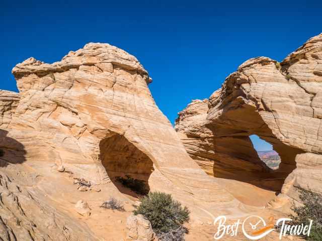
Both highlights are at the same location. The stunning arch is absolutely picturesque, and so is the Grotto. The view from here to the Teepees and the Big Mac is fantastic.
We'd loved to continue, but it was already after 5 p.m., and the sunset was at 7.30 p.m.
Link for the exact track to the Wave from Wire Pass Trailhead - zoom in, and you will be able to see the other highlights which are mentioned here.
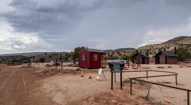
You get a map handed with some landmarks to find the wave, but IMO, none of this is safe. Hike with a mapping app, and you never get lost. The last restroom is at Wire Pass Trailhead.
Are guided tours available for the Wave?
All tour companies in Kanab offer the Wave; my tour company recommendation is below. And what most people don't know is that the tour company can participate in the Wave lottery for you and you. That's what we did, and we doubled our chances. This was my second tip for you to win a permit. Go to Kanab on weekdays, try the two-day advance lottery from Tuesday to Thursday, and double your chances with your tour company. Fingers crossed! In the meantime, check out all the other unique places around Kanab. You can't get bored here.
However, we were glad we did this tour independently because there is so much more to explore. Guided tours last roughly eight hours, including the drive and hike. However, if your sense of navigation is not that good, a tour company is definitely a good choice. In the winter, poor road conditions make getting to the Wave trailhead difficult, and a tour company is also a good idea.
Where to stay?
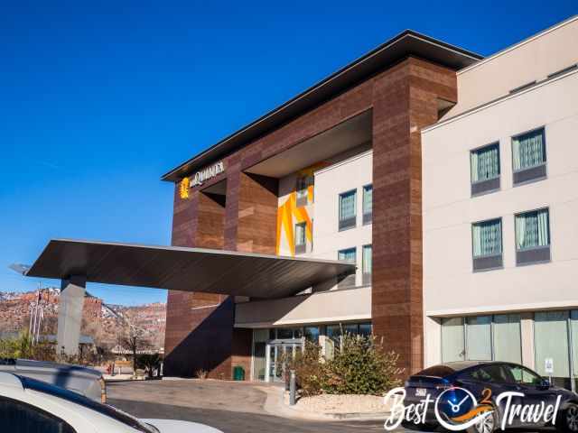
To explore the area, you either stay in Page or in Kanab. Last winter, we spent two nights in Kanab because we of a guided tour. Kanab is a fantastic town to explore the Vermillion Cliffs Wilderness's unique landscape and sandstone formations.
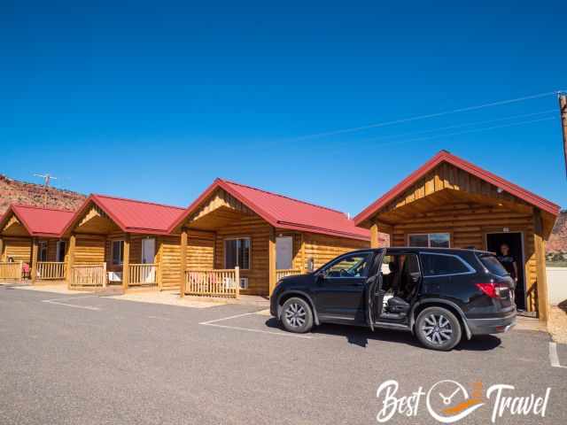
This September, we tried out another accommodation, the Red Canyon Cabins. You can park your vehicle in front of the hut. There is a seating area outside, and you are able to open a window. We spent five nights here, and it was super quiet and perfectly located.
Page is the main service hub and a good starting point with a population of 7.500. Page is excellently located at the Colorado and Lake Powell.
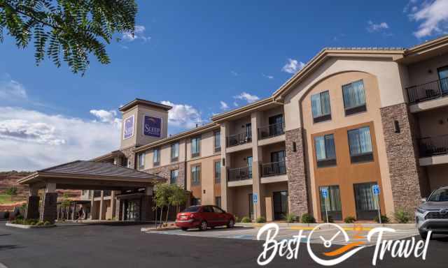
You may think there are plenty of hotels in Page, and that's right, but each evening, we figured out the hotels; also, ours were fully booked. Many visitors stay here for a few nights to visit Horseshoe Bend, Antelope Canyon, the Toadstools, Yellow Rock, and more beautiful places. If you plan to travel to Page in the peak season or at weekends, I highly recommend booking a room in advance. Thx for booking via my website 😊
Weather Coyote Buttes
Honestly, if you win the lottery, you don’t care about the weather except in the winter. The Wave, located on the Paria Plateau experiences a high desert climate and little precipitation only. It is frequently sunny in the summer but scorching during midday.
Snow can occur in the winter. What does snow mean? We experienced it, and we left Kanab because White Pocket and the Wave were half covered in snow. We met a couple who won the lottery after 13 attempts, and they were so disappointed.
Start early or late in the summer, check out all other attractions first and the Wave when all others have left. Keep in mind there were already several heat-related fatalities. It is more challenging to get to the trailhead after heavy rainfall. Nevertheless, the gravel Rock House Valley Road is in relatively good condition, but a high clearance vehicle is recommended.
Best Time to Visit the Wave for Photography
Spring
Frequent blue sky, especially in April and May. Often very windy, with its peak in the afternoon. Protect your camera from the sand. I used my waterproof bag to carry my camera in late September.
June
June is the best month of the entire year. Precipitation and cloud cover is low. Exceptional for day and night photography.
Summer
Not too bad to take good shots, but be aware of the midday heat. It is utterly crowded in the morning therefore first visit other places in the Coyote Buttes North and afterwards the Wave or come in the afternoon.
Autumn
It's not as good as April and May, with more cloud cover. The pro, Kanab and Page are quieter after the crazy summer season. It can be windy in September, and you need to protect your camera from the sand.
Winter
Hiking in snow is challenging. Due to the high elevation, snow occurs. It is also tricky to take good pictures of the Wave, especially when snow-covered. It is frequently overcast. From our last trip, we know the Wave can be fully or at least half covered in snow on the north side. It is likely to happen in January and February, and we experienced this in 2023.
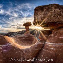
I got some of the pictures provided by Ray Downs Photography, some from my friend Chris, and we finally won a permit in September, and most of the pictures were taken by me. Thanks, Ray, you encouraged me to stay in Kanab and apply again!
Tour Company Recommendation
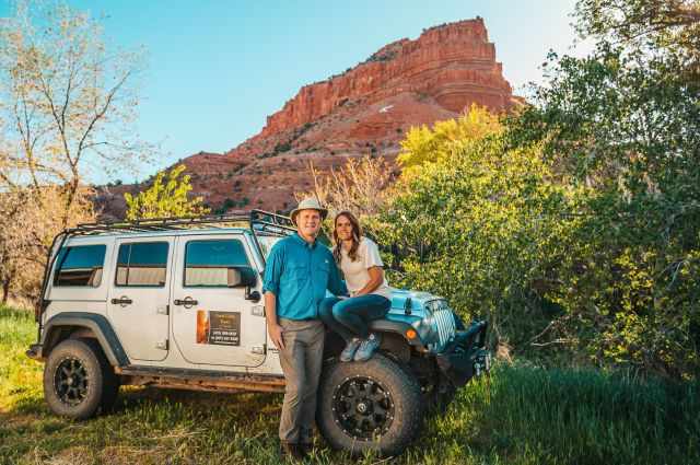
Do you wish to explore the Wave and other unique rock formations in the Vermillion Cliffs Wilderness with an excellent tour company? I highly recommend the Coral Cliffs Tours and Townhomes of Kanab. This is not an Affiliate Link. This was our own experience with Julie; she walked the extra mile for us and made the impossible possible. This company is totally different their primary focus is on making guests happy. If you haven't booked anywhere yet, give them a call: (435) 899-0697 All their guides are fantastic!
Best Months to Visit
Location and Tips

I will give you tips from a local guide on how to win a permit. Thanks to that, we won the lottery after more than 20 years. And there is so much more in Coyote Buttes North, not only the Wave, but most visitors leave this breathtaking area around midday already. There is so much more to explore that one day is too short. I will give you more highlights with plenty of pictures, a detailed hiking description and my 7 Essentials for the backpack.
The daily visitor number for the Wave has increased from 20 to 64 or 16 groups per day, so your chance to win the lottery is more than three times higher now. I'm crossing my fingers for you! Let me know when you win the permit, and don't miss out on my tips on how to win a permit above 😉.
Who We Are
We are passionate travellers. We have been married for 25 years and love discovering hidden gems around the globe. I am passionate about sharing some of the most beautiful places in the world with you, but I still can't live from my work, and we have regular jobs, too.
It is a tough business nowadays because fake travel websites rewrite content by AI without effort and expense. Would you like to know more about fake travel websites and how to unmask them? Check out "The Truth About Fake Travel Websites"
Do you like my Saguaro Guide? Please share it with your friends and on social media, subscribe to our YouTube Channel.
Do You Like to Support Me - It's easy; use the Paypal Button below 😍 TIA.