
When Is the Best Time
Kanarra Falls, located in Kanarraville just outside of Cedar City in Utah, is a popular destination for resident hikers but not well-known among tourists abroad. This easy-to-moderate hike depending on the creek level is a great alternative for the Narrows in Zion, especially in the hot summer months.
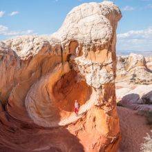
The Kanarra Creek Falls are suitable for most ages and fitness levels and are a great destination for families and children. The beginning of the Kanarraville Falls trail and canyon provides a fun and exciting adventure for kids, but the further you get, the more challenging and quieter it is. No soul was in sight when we reached the end of the track.
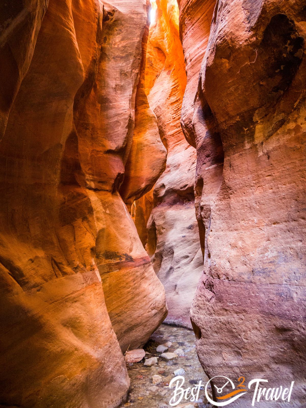
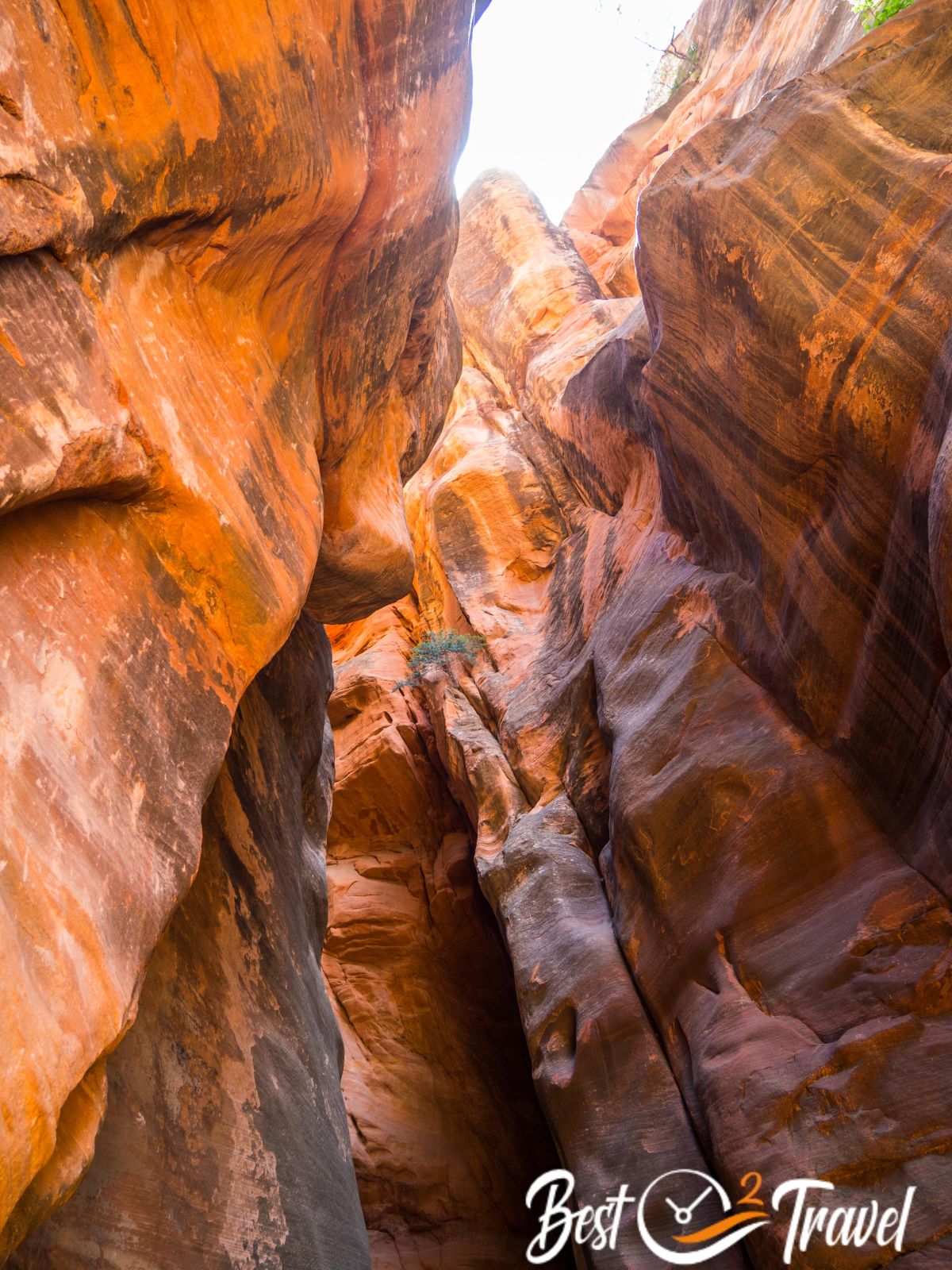
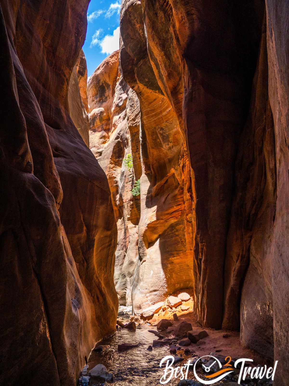
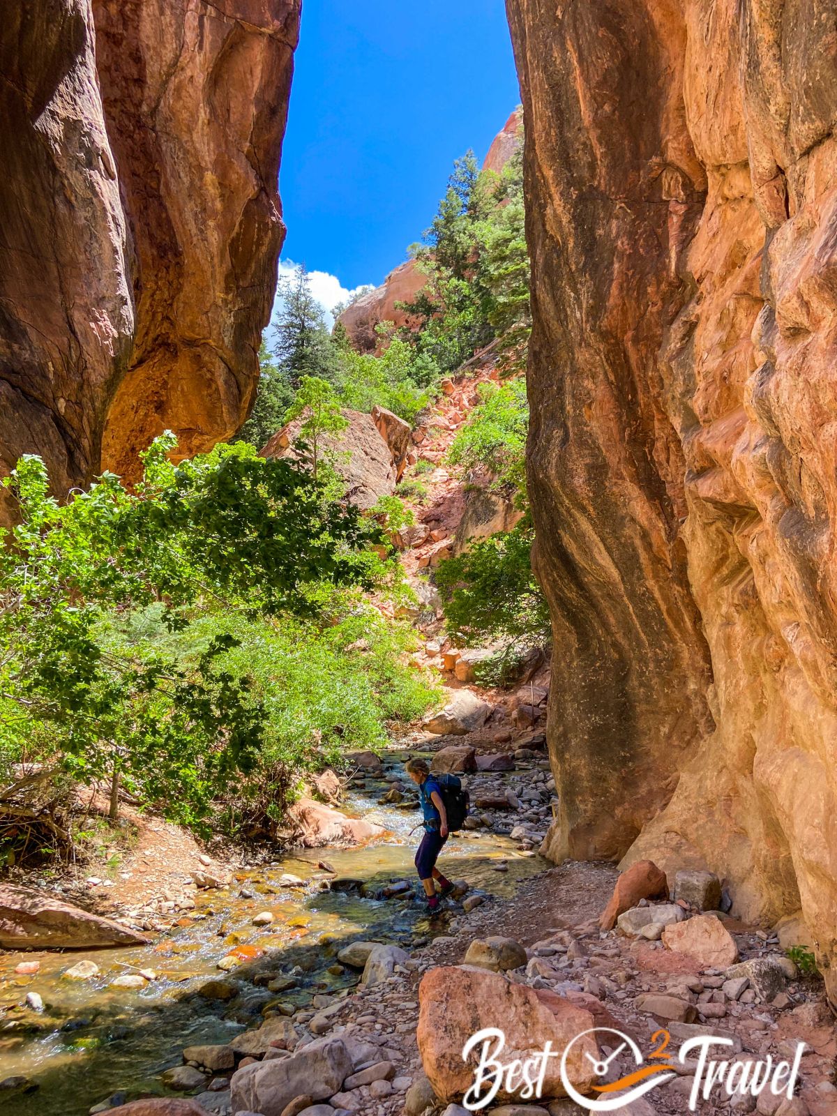
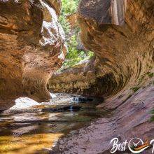
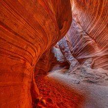
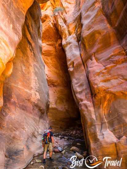
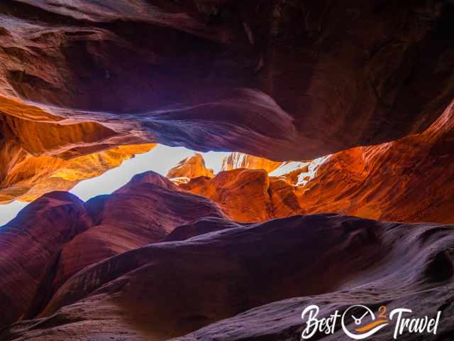
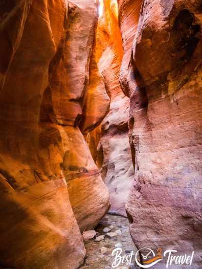
The Kanarra Falls track leads through a spectacular narrow slot canyon. You have to wade through the crystal-clear creek upstream through the cascading water and different pools. Do you plan to visit this spectacular gorge? Here you will find what you need to know, what you have to wear, where to apply for the permit and a hiking map app.
The best time for this outstanding hike is late May until roughly mid-October because of the water level and temperature.
Summer is fantastic for escaping the heat. However, always check the weather forecast first. This adventure leads through a narrow slot canyon prone to flooding, especially in the summer when heavy thunderstorms occur in the afternoon.
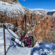
Do you wish to know more about the typical weather in this area? Check out my detailed guide for the Narrows in Zion; Kanarraville is a little cooler in the summer and less cold in the winter, although both slot canyons are located at a similar elevation and experience snow and ice.
Permit Required
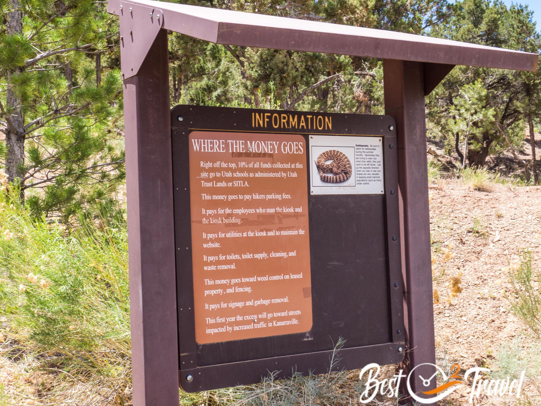
The Kanarra Falls is located on private property, and a permit is required to access the falls. There are 200 permits available daily but fully booked for months in advance for weekends in the summer. Due to the permit system, crowds were bearable even on a Sunday.
The permits can be purchased online through the Kanarra Falls website. Before you book your online ticket, check out the entire guide and my packing checklist. Online Ticket Booking
Entrance Fee: $15 per person
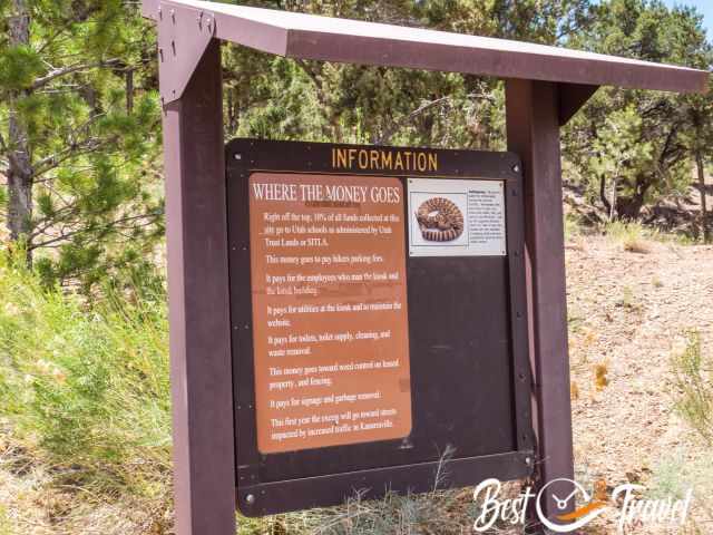
No refunds or ticket transfers if the falls are closed due to hazardous weather or high spring levels from melted snow. I highly recommend booking your permit online to access this breathtaking half-day hike, which is also great fun for children, especially in July and August.
You receive a confirmation which you must download on your mobile or print. There is a ticket counter and control, so you can’t access this track without a permit!
Avoiding Crowds
The falls are less busy in spring and autumn, and permits are usually left. The advantage is that you can check the weather before and either book them a few days in advance or purchase the tickets on the day of your arrival. However, I wouldn’t count on that and highly recommend a pre-reservation.
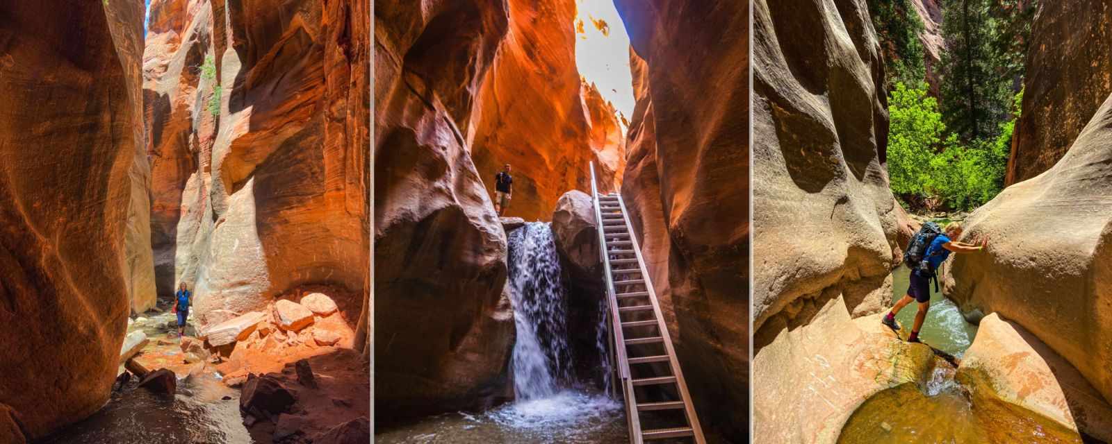
Trail Description in Pictures
- Elevation Gain from the parking and trailhead to the official second waterfall 978 ft/ 298 m
- Trail Length: Return hike 3.6 mi/ 5.8 km
- Duration: 3-4 hours – a great half-day hike
- Trail Difficulty: For experienced hikers: easy – for all others, moderate with difficulties in sections
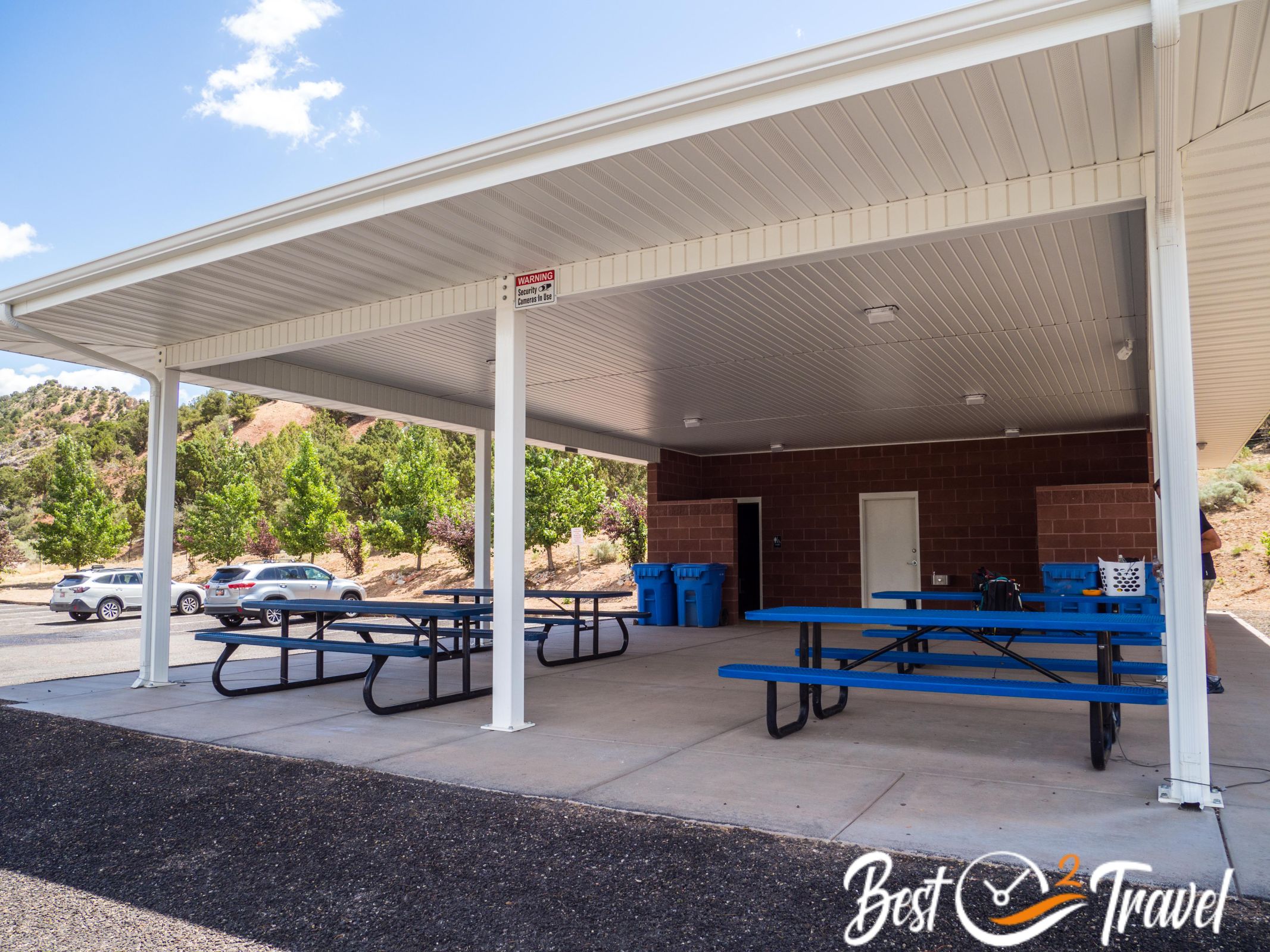
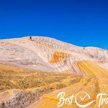
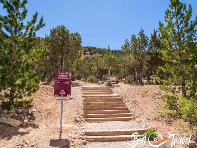
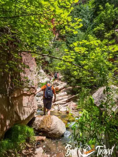
There is plenty of parking, a covered picnic area with four tables and an absolutely clean restroom at the trailhead. After 5 minutes walk, you pass by the permit kiosk – no access without a permit (150 daily). There is another restroom before you start walking through the creek. The trail is exposed to the sun until you reach the slot canyon and again fully in the sun when the canyon widens.
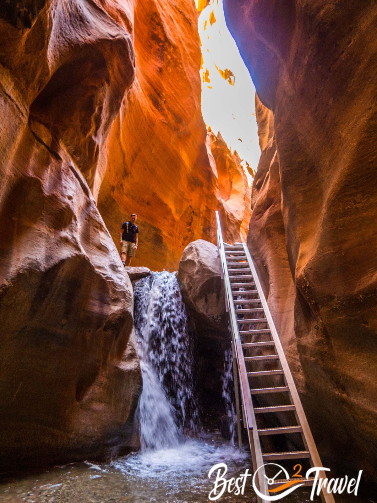
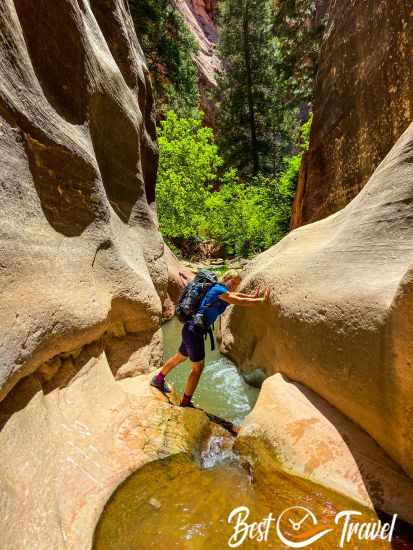
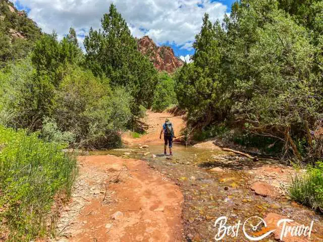
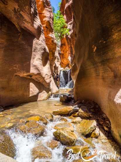
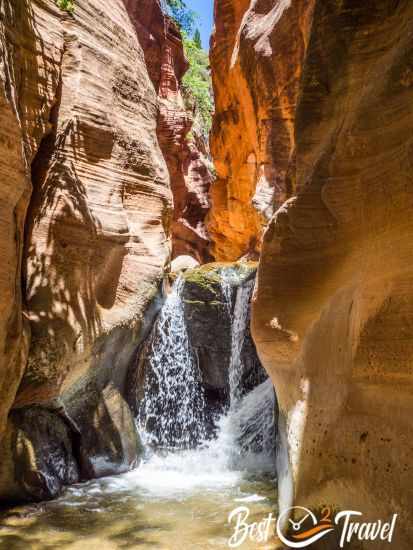
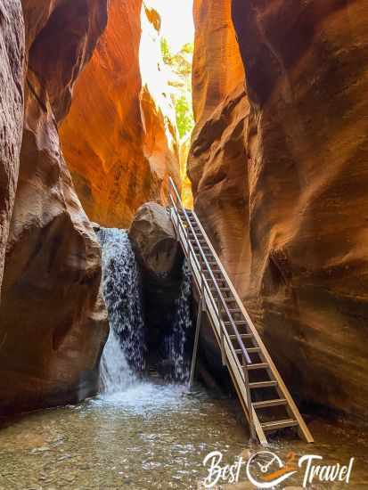
First Waterfall and Ladder – 1.55 mi

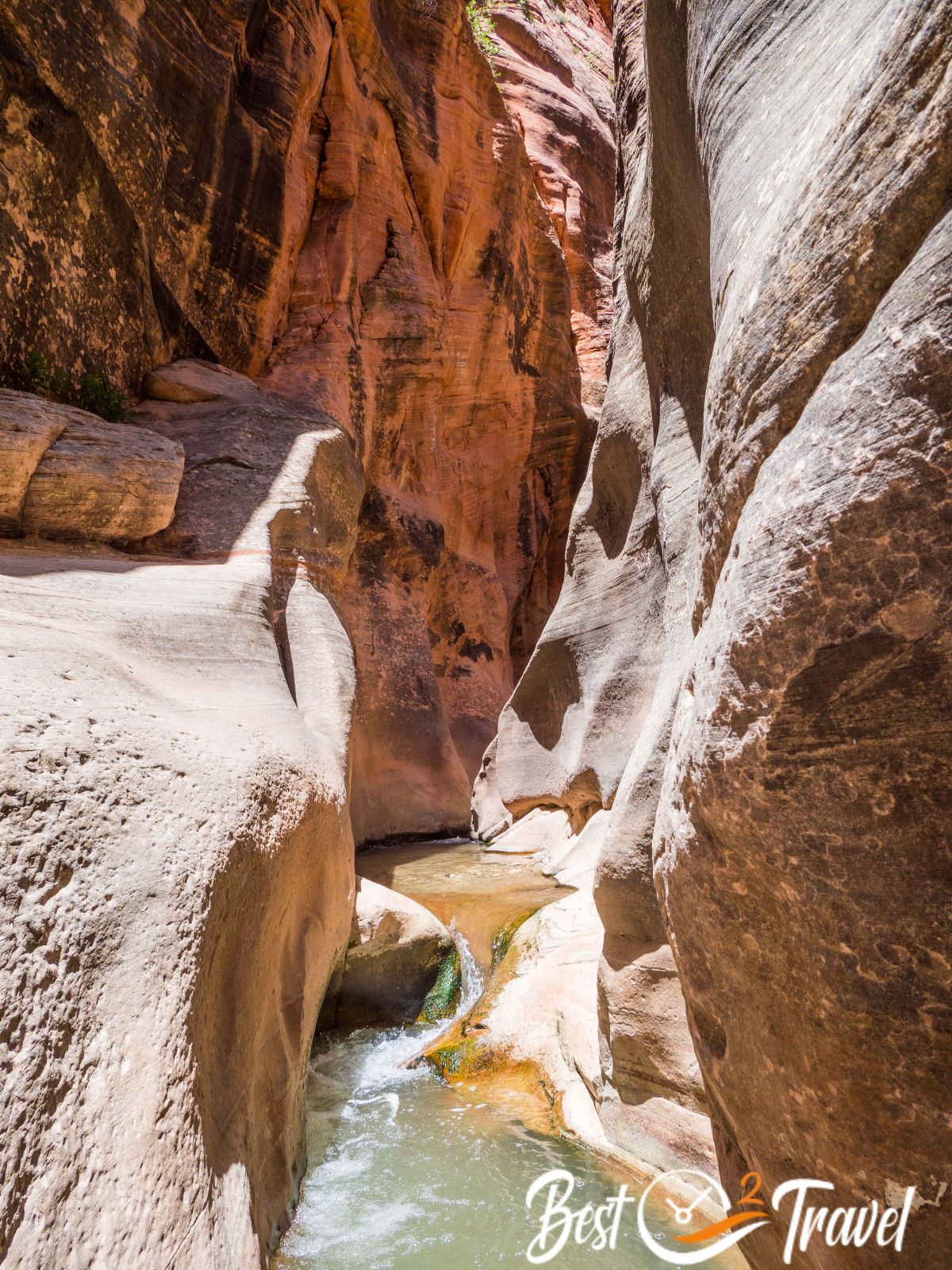
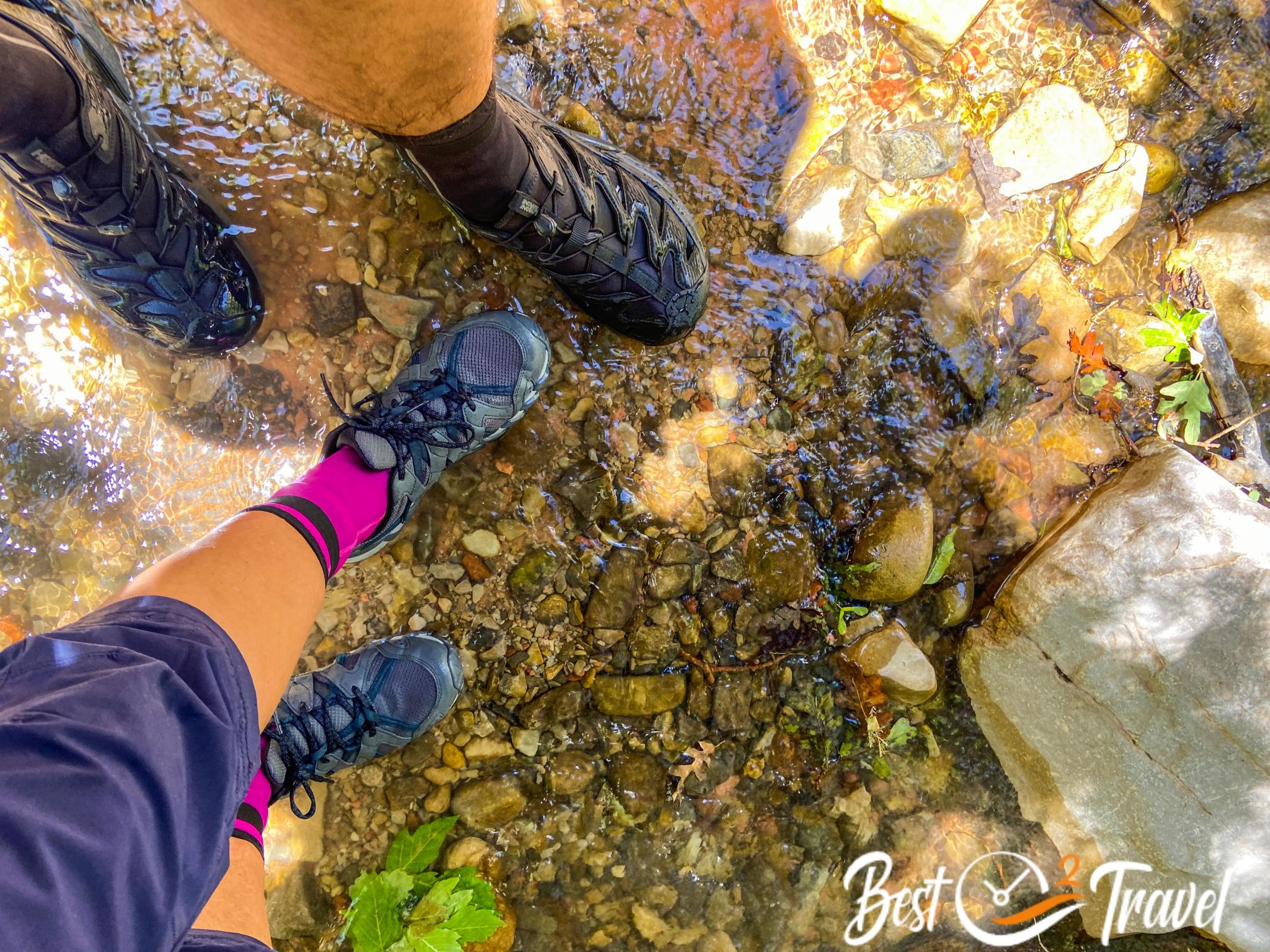
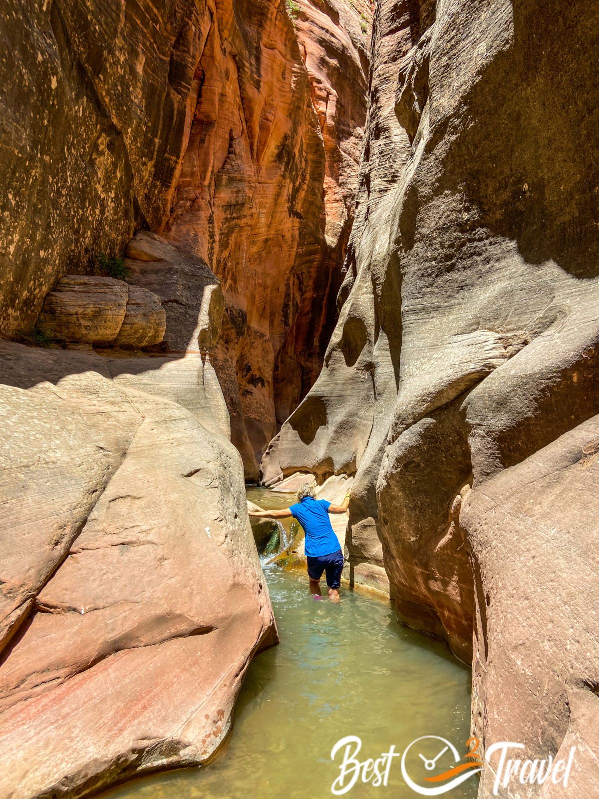
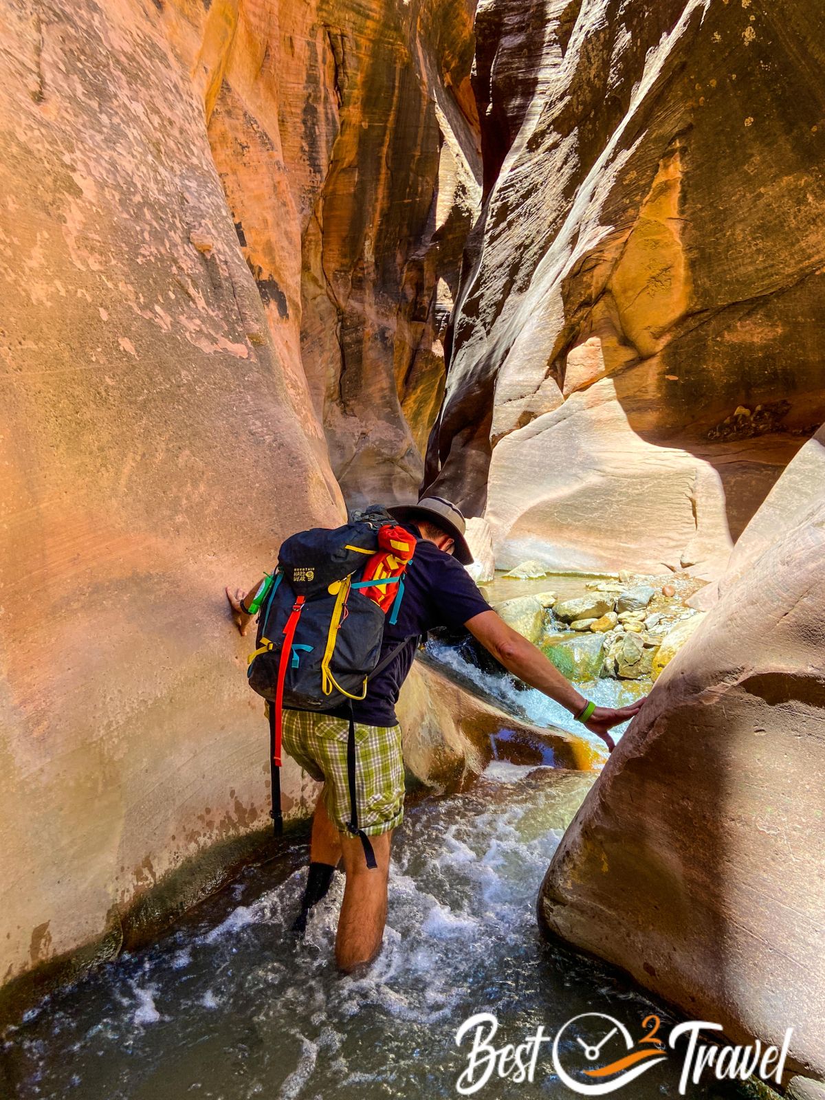
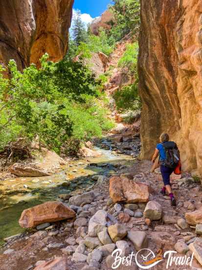
The trail crosses the creek several times until the stream becomes the only track. The trail and canyon narrow, offering spectacular scenery. We’d worn our water shoes from the beginning because less weight in our backpacks, and getting wet feet was part of the experience.
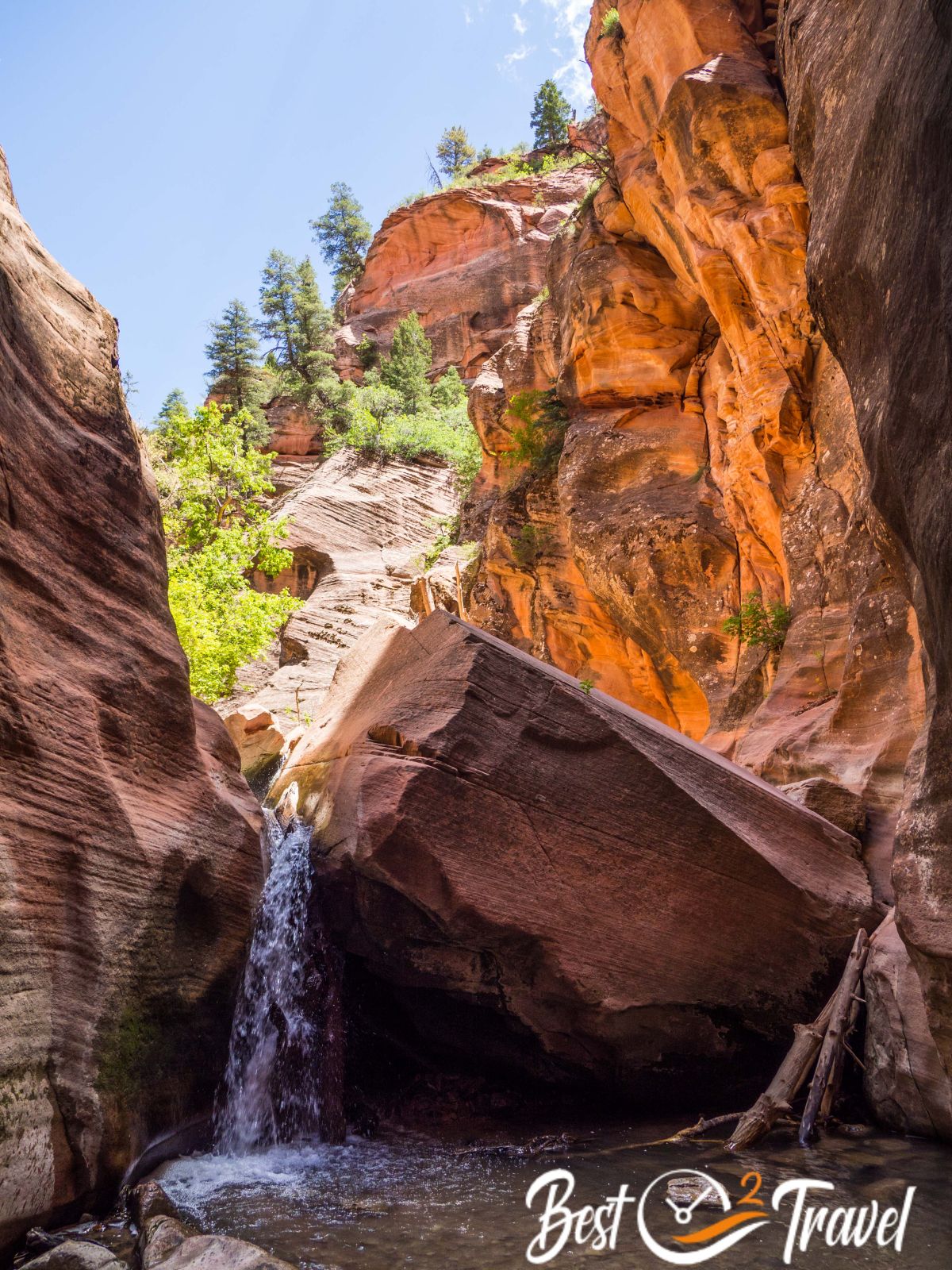
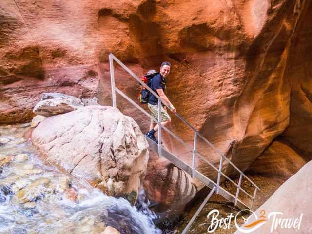
The stream was shallow end of June. After 1.55 mi/2.5 km, you reach the "Lower Waterfall" and the 20 ft iron ladder. In former times, overcoming the elevation gain on the wooden ladder was harder. It is a lot safer now.
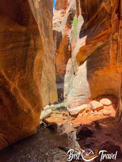
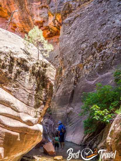
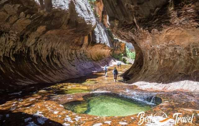
Second Waterfall and Boulder – 1.7 mi
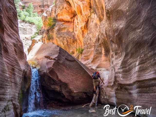
After the ladder, soon after, it is a lot more climbing to overcome a huge boulder without any ropes.
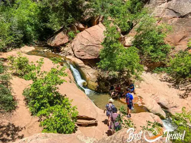
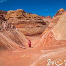
Some families with small children turned around. Here the narrow slot canyon widened, most visitors took a break, and families turned around.
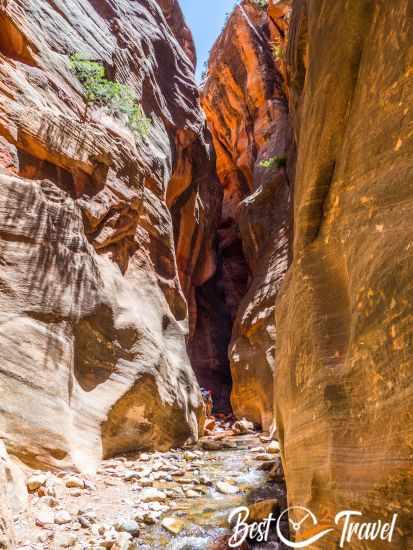
Third Waterfall – Trail End 1.9 mi
These falls are called the second, but IMO, these are the third because the second appears at the "Boulder", the obstacle that blocks the creek. To continue along the creek track, you head uphill. More precaution is required in this last section, although only 1,050 ft/ 350 m long. We were alone on the last part of the creek trail and soaked in beauty and solitude.
Our favourite parts were the narrow winding gorge in the beginning and the deep pools in the end with water cold as hell. After a total of 1.8 mi/ 2.9 km, you reach the last waterfall and the trail’s end. Please, turn around and don’t continue.
Packing Checklist
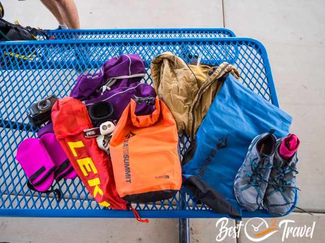
- Most important are water shoes to protect your feet, Merino wool socks for warm feet even when wet and neoprene socks. The Kanarra Creek is cold.
- I carried my Olympus OMD 10 in a waterproof back (the orange sea-to-summit bag).
- Do you want to capture these splendid moments with your mobile? Don't forget a waterproof phone pouch. This is definitely a "lifesaver".
- If a hike takes longer, I always carry my Petzl headlamp in my backpack.
- An additional long-sleeve layer and vest in case I started freezing in the slot canyon, but it was a warm summer day topping 80°F.
- Carry a snack or sandwich before you turn around. We enjoyed lunch at the picnic area and left all the food in the car.
- During such hikes through water, drink plenty of water with electrolytes for new energy throughout the adventure.
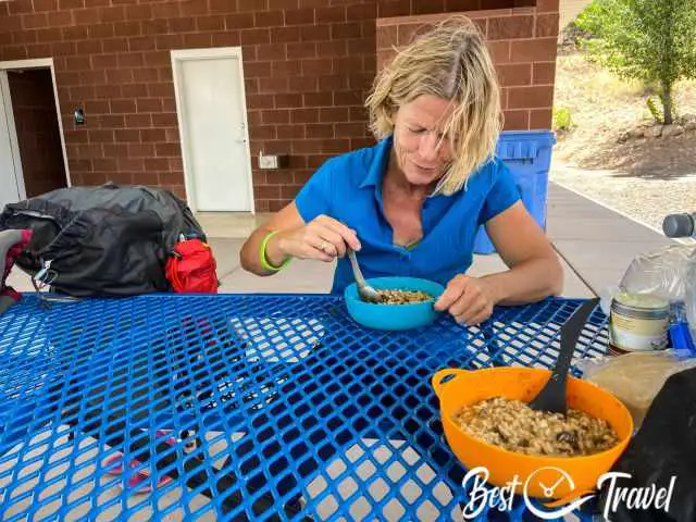
What did we eat on our trip? Mainly dehydrated meals, which were convenient and time-saving. Usually, I am the chef, but Markus takes care of our meals on such trips.

Nearby Tip
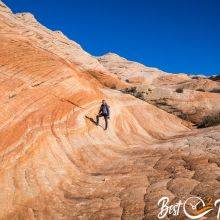
Do you like to hike off the beaten path in a fascinating landscape? Check out the Candy Cliffs at Yant Flat, not far from Zion National Park.
Best Months to Visit
Location and Tips

The Kanarra Falls hike is a family-friendly fun hike through a creek in a narrow slot canyon in Kanarraville.
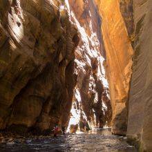
Kanarra Falls vs Zion Narrows
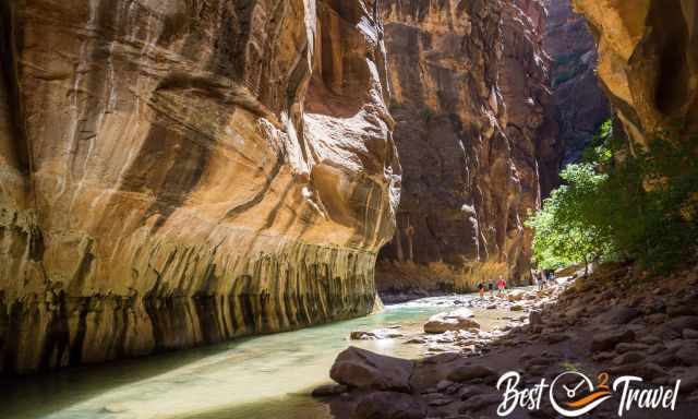
You can’t compare the Kanarra Falls Slot Canyon hike with the Narrows in Zion. Both tracks are fantastic, but utterly different, especially in the hot summer. IMO, Kanarra is not a smaller version of the Narrows but a great alternative. However, there are five pros to the Kanarra Falls Track compared to the Narrows.
- The Kanarra Creek level is lower, and the current is less strong, therefore, much safer, especially for children - More suitable for families and children.
- The entire return hike takes 3-4 hours only, not a full day.
- Less busy because of the permit system and less known. In the Narrows, we had hundreds of hikers around us.
- In Zion, you must take the shuttle bus to get to the trailhead of the Narrows, which is time-consuming during busy days. For the Kanarra Falls track, you are able to park at the trailhead.
- Overall, the walls of the Narrows are a lot more towering and impressive, but also, in the Kanarra Creek Slot Canyon, I took some great shots of mother nature.
There are three water hikes in this area; the Kanarra Falls, which are perfect to start with, the breathtaking Narrows, and the unique Subway in Zion.
Another alternative to escape the crowds in summer in Zion is the Subway Hike, with 80 hikers daily. A permit is required, but this track is still not well-known, and frequently, you can get a last-minute permit.
Who We Are
We are passionate travellers, married for almost 25 years, and we love discovering hidden gems around the globe. I am passionate about sharing some of the most beautiful places in the world with you, but I still can't live from my work, and we have regular jobs, too.
It is a tough business nowadays because fake travel websites rewrite content without effort and expense. Do you like to know more about fake travel websites, picture theft, and how to unmask them? Check out "11 Sneaky Ways Travel Websites May Trick You"
Do you like my Kanarra Falls Guide? Please share it with your friends and on social media, subscribe to our YouTube Channel.
Do You Like to Support Me - It's easy; use the Paypal Button below 😍
Do you want to obtain the usage right for my images? Contact me, but we will take action against picture theft.