
When Is the Best Time
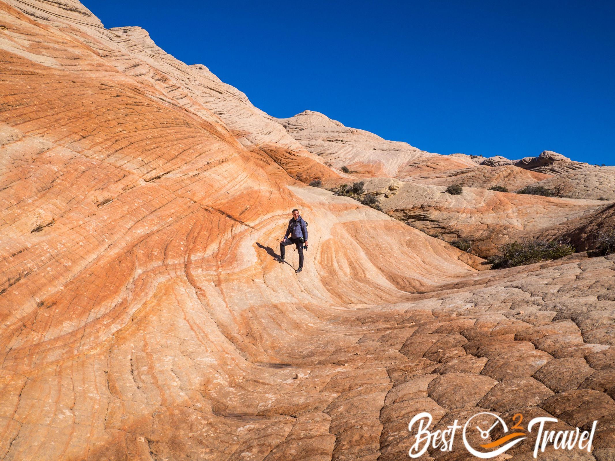
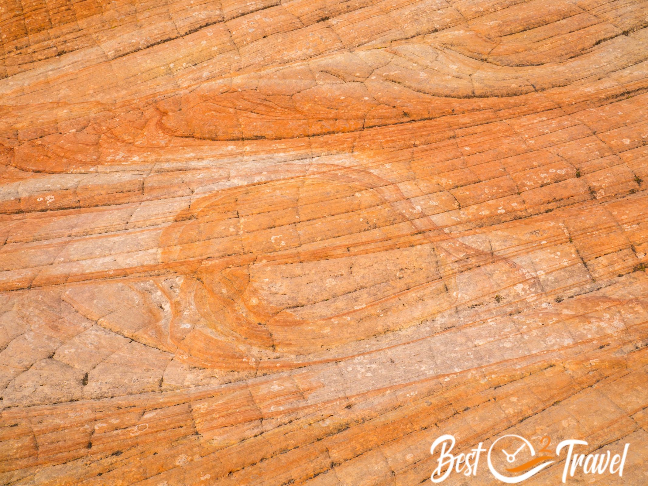
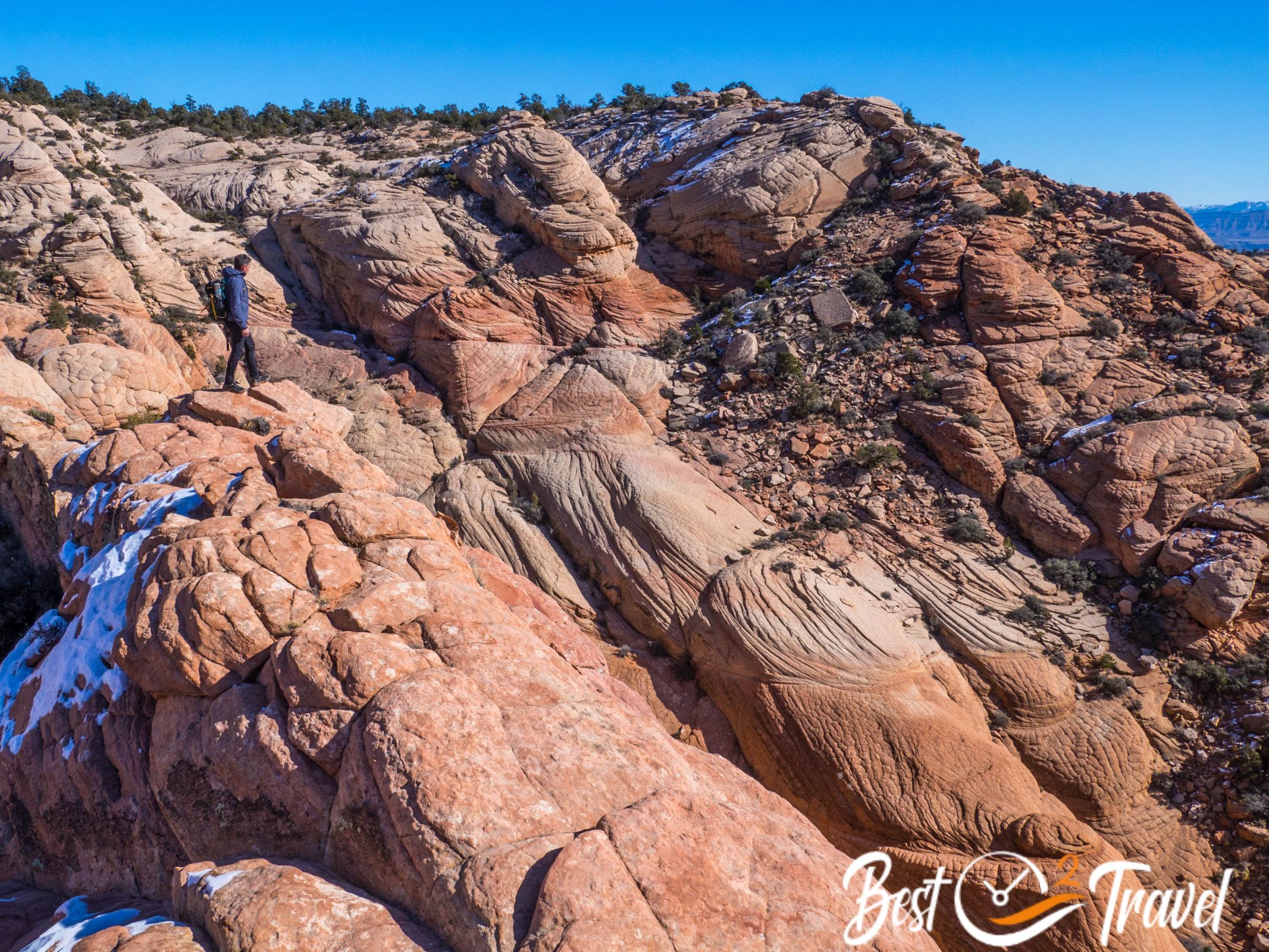
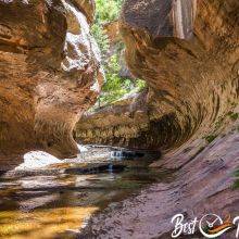
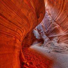
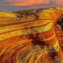
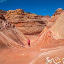
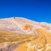
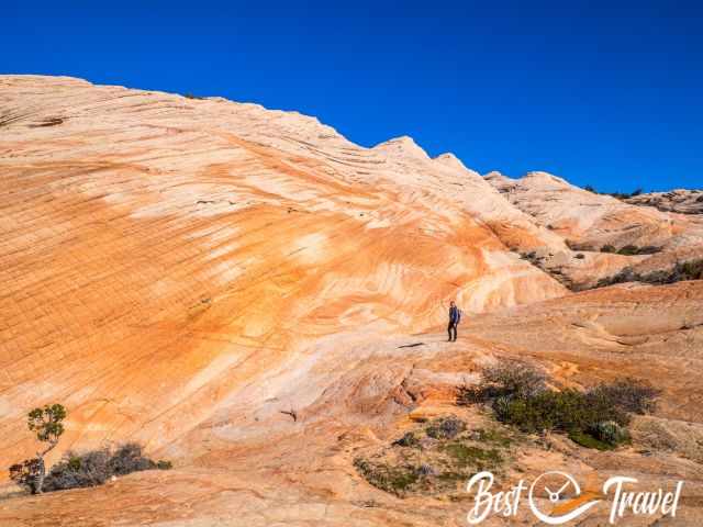
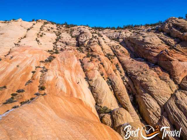
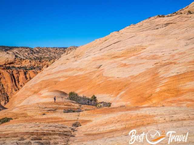
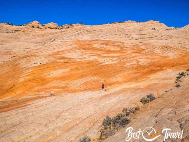
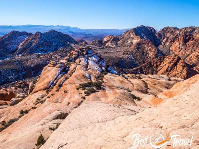
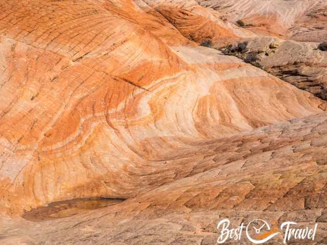
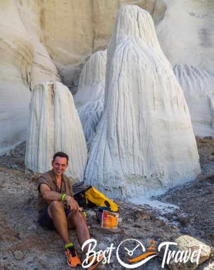
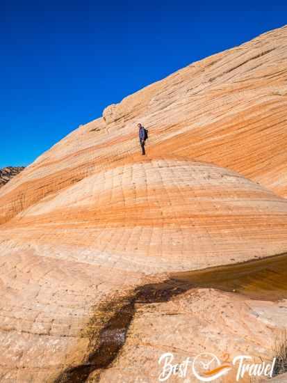
The Candy Cliffs at Yant Flat are breathtaking, vast, and colourful rock formations and still a hidden gem. They are among the most beautiful sandstone areas and can compete with the Vermillion Cliffs Wilderness or Yellow Rock.
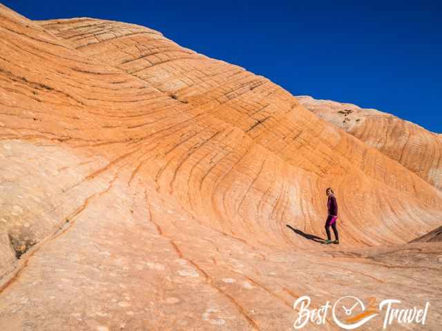
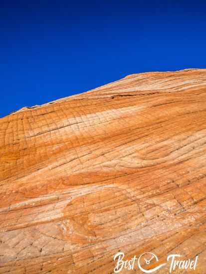
This type of rock, the petrified dunes, is harder and less fragile than the Wave or Yellow Rock. Although the Candy Cliffs are in proximity to the Snow Canyon State Park and St. George, you can experience real solitude.
I will provide all the details on how to get here, where to park, how much time you need and where you can camp nearby. The Candy Cliffs are off the beaten path and a great place to escape the crowds in Zion National Park or Snow Canyon State Park.
Where Are the Candy Cliffs of Yant Flat in Utah?
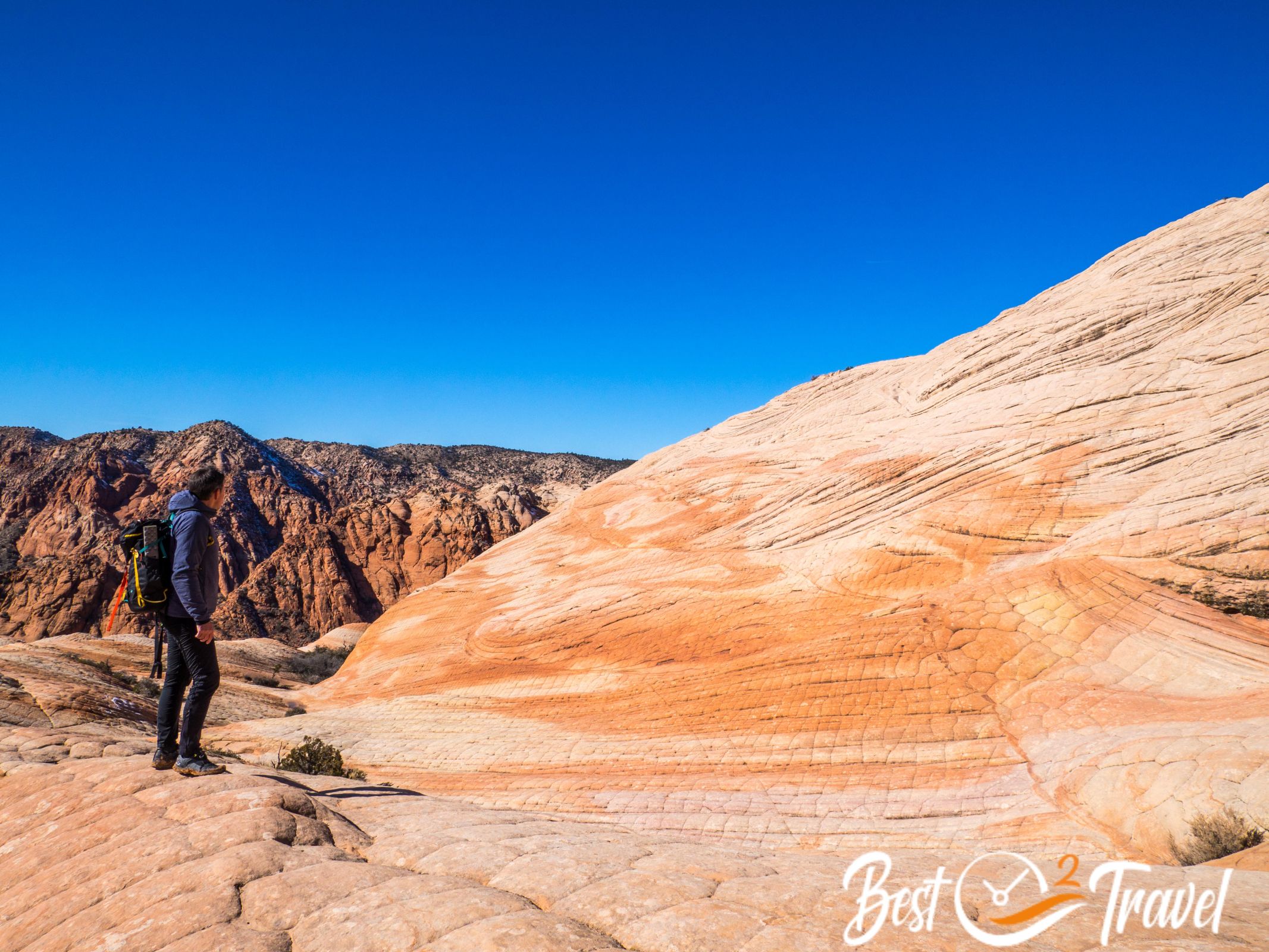
Yant Flat is a sandy plateau overgrown with bushes and trees. The Candy Cliffs, which look like orange and white striped candies, are below the escarpment just a few miles northeast of Saint George. When you follow the dirt road along canyons and meadows with cattle, you may ask yourself if this road leads to such colourful swirled rock formations, and it does.
Parking and Trailhead
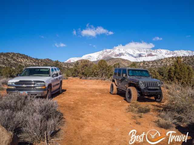
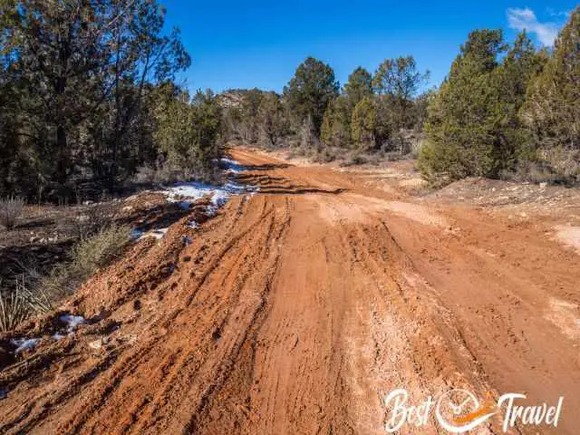
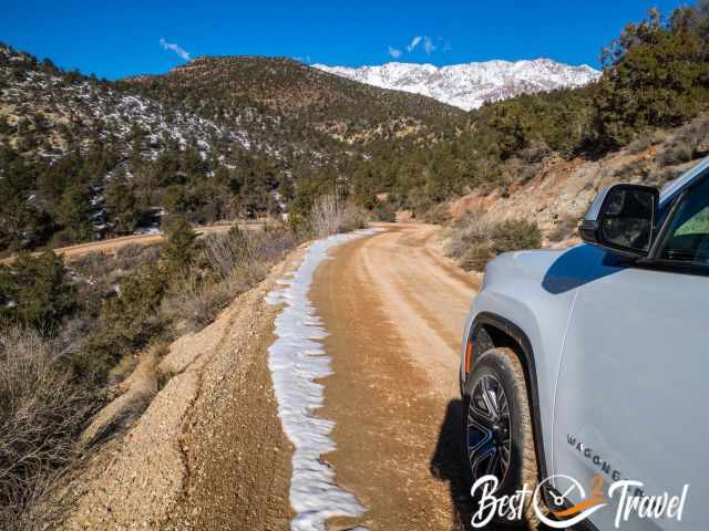
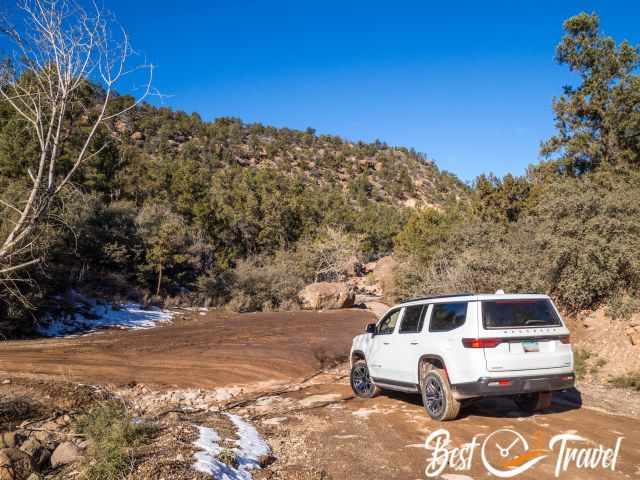
The parking and trailhead are located on a dirt road. I highly recommend getting here by 4 WD with high clearance during dry conditions. If the road is wet from precipitation, you may get stuck in the clay. We had a 4 WD, but it was a rental with road tyres instead of all-terrain tyres.
I have often read about stuck vehicles that could not move forward or backwards and had to be pulled out. Our tyres became slick, and this sticky mud stuck to our shoes like glue. We had to park our car before the official parking and trailhead and hiked a little longer.
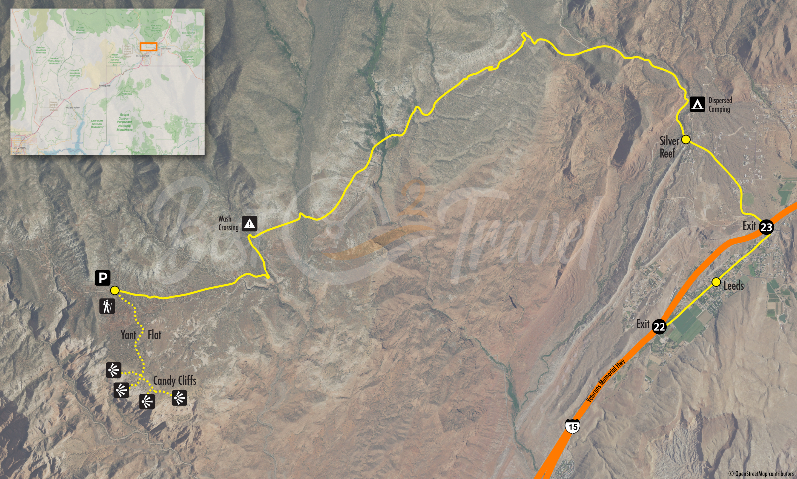
Limited parking but still sufficient: Parking and Trailhead Google Maps
How to Get to Yant Flat?
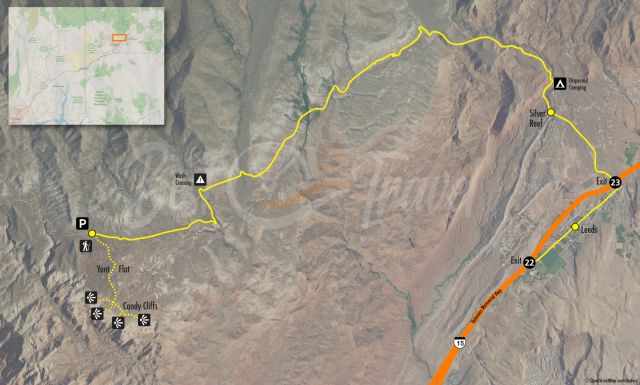
Directions to Yant Flat Parking: You can access the trailhead of Yant Flat or Candy Cliffs by dirt road, Danish Ranch Road 031, from the east and west. The eastern forest road is easier to drive and less muddy if it has rained before. Coming from St. George, Google leads you on the paved Cottonwood Springs Road to Yant Flat from the west, but this access road is rough.
Ignore the directions and continue on Hwy 15 until exit 22 Leeds. If you are coming from the other direction – Kanarraville, Hurricane, Zion – it is exit 23. The last 1.4 miles are the worst in wet conditions. We parked the car half a mile before the trailhead because of the clayish soil wet from the snow.
Location and Trail Map
How Long Is the Hike to Yant Flat?
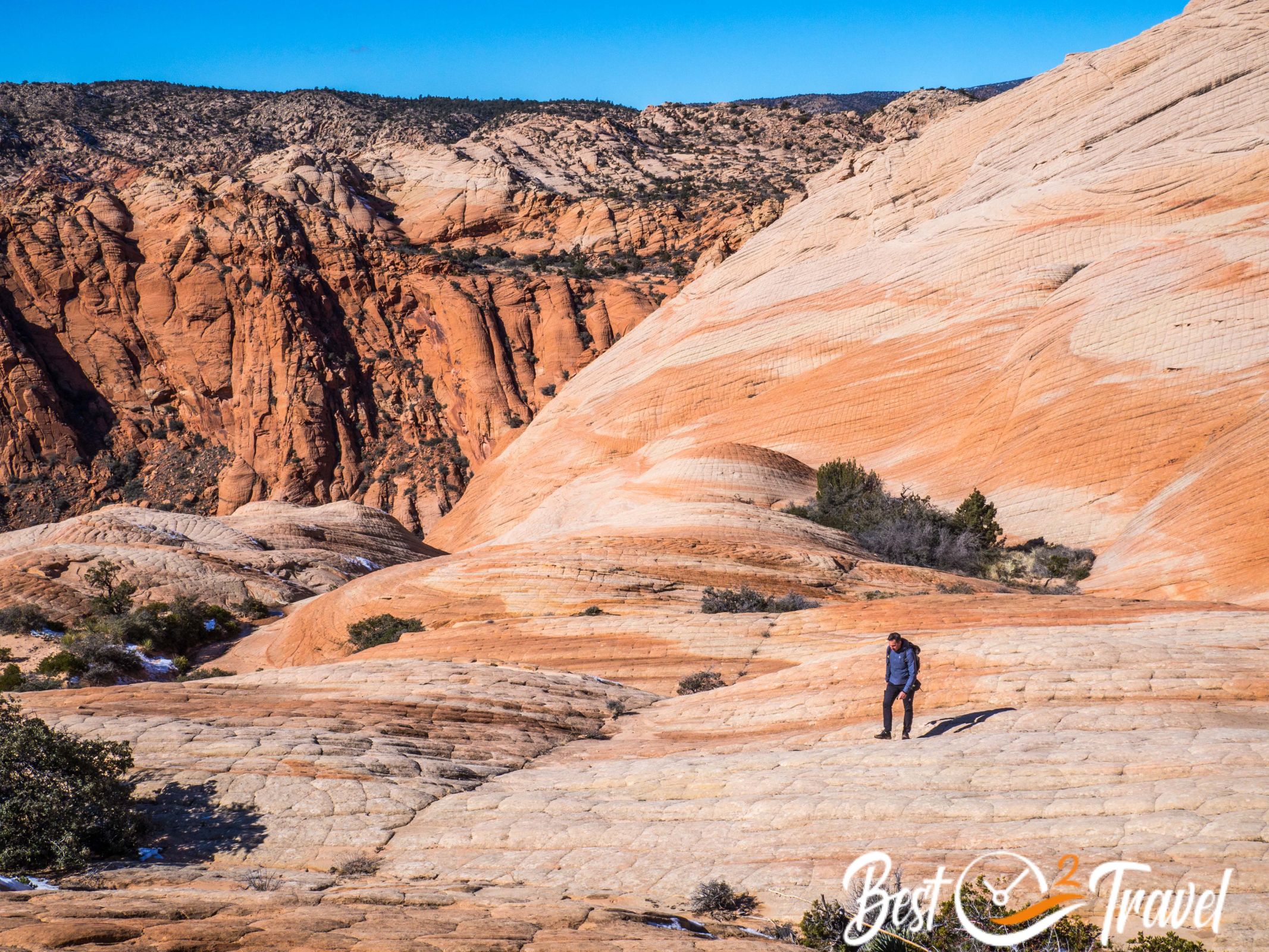
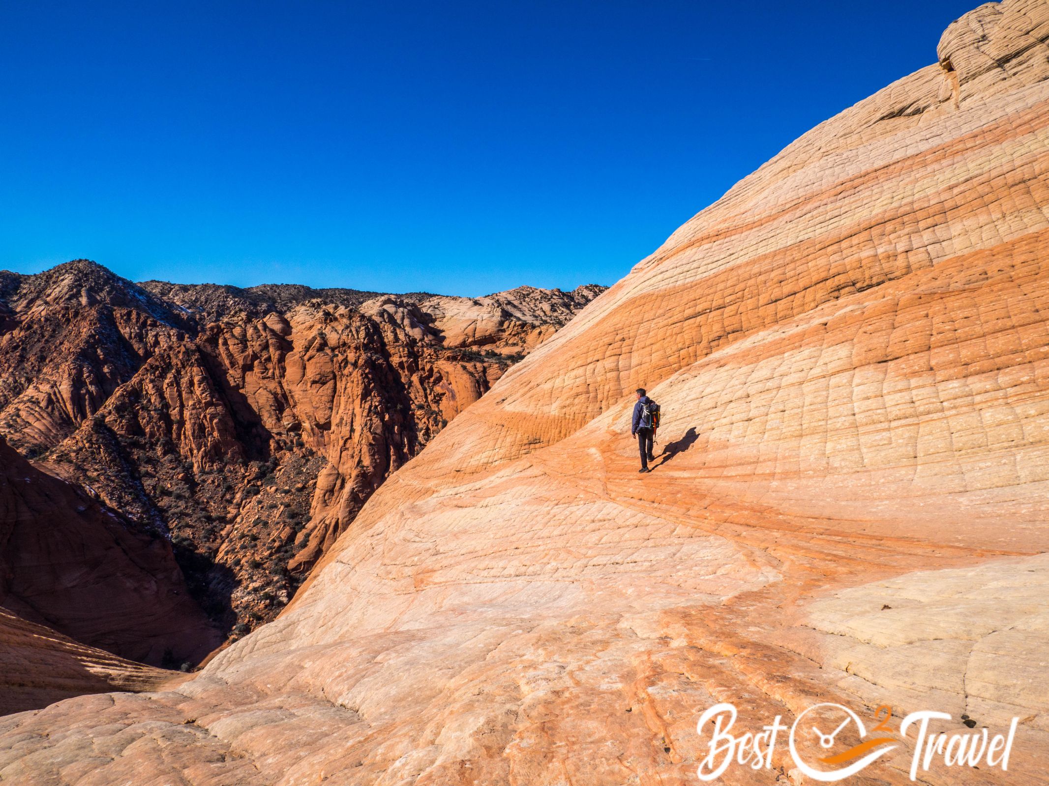
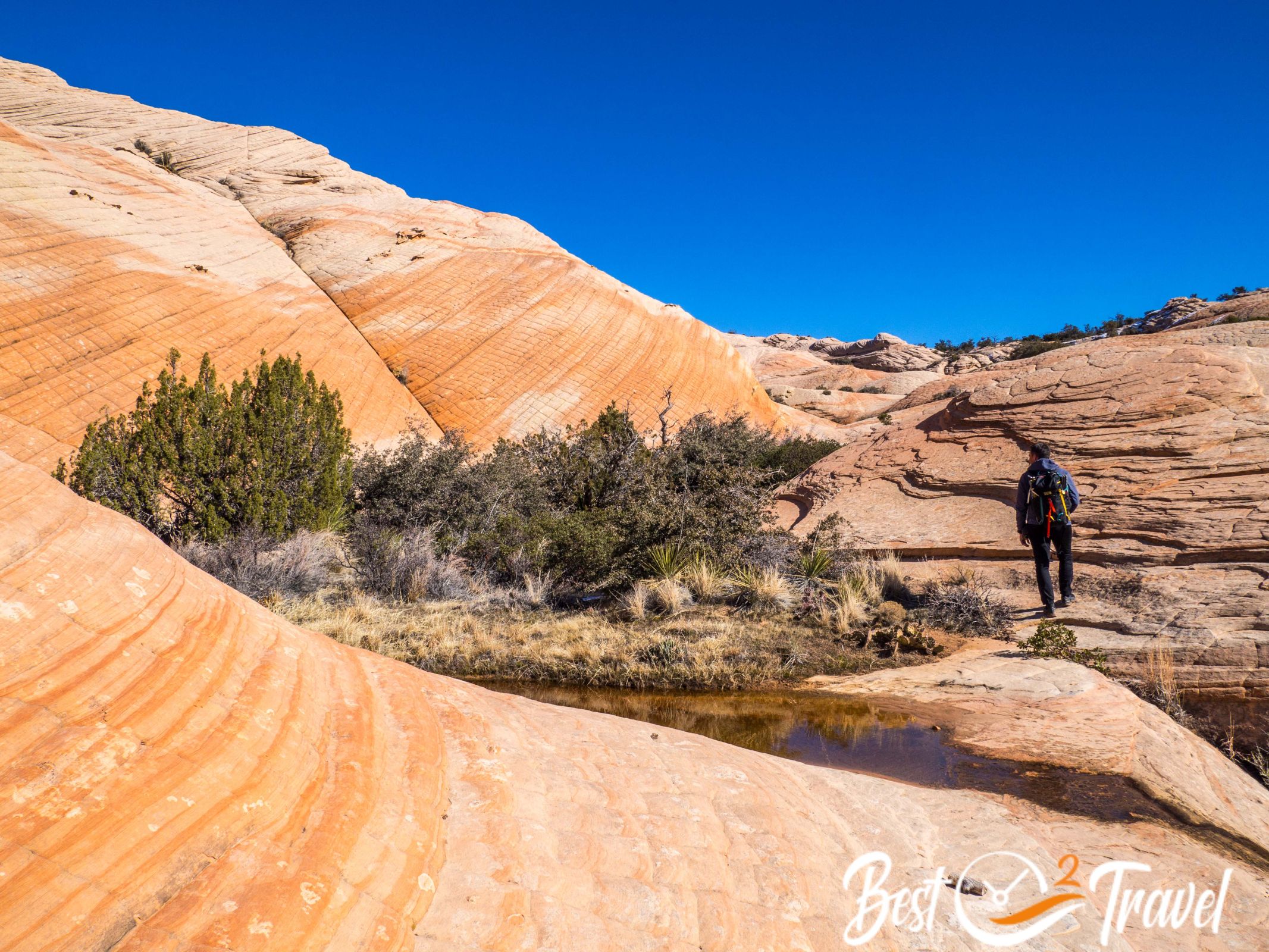
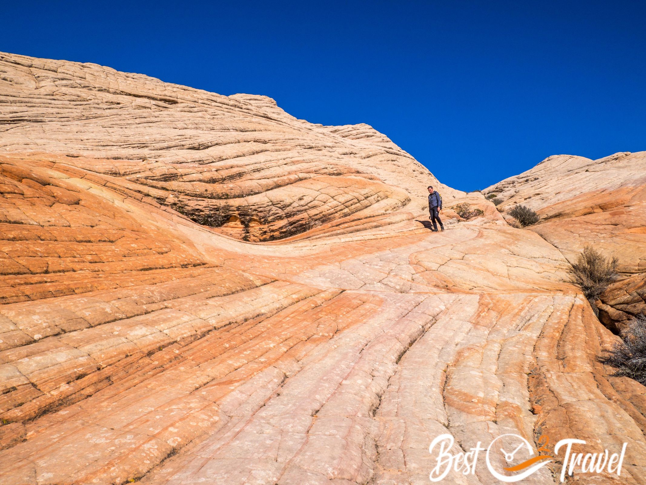
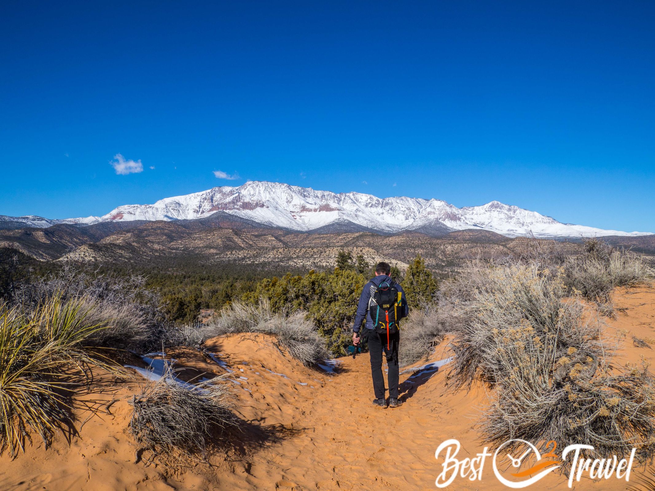
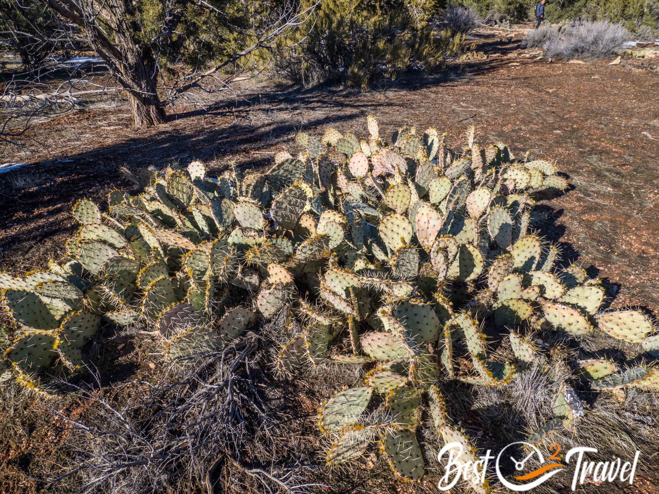
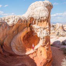
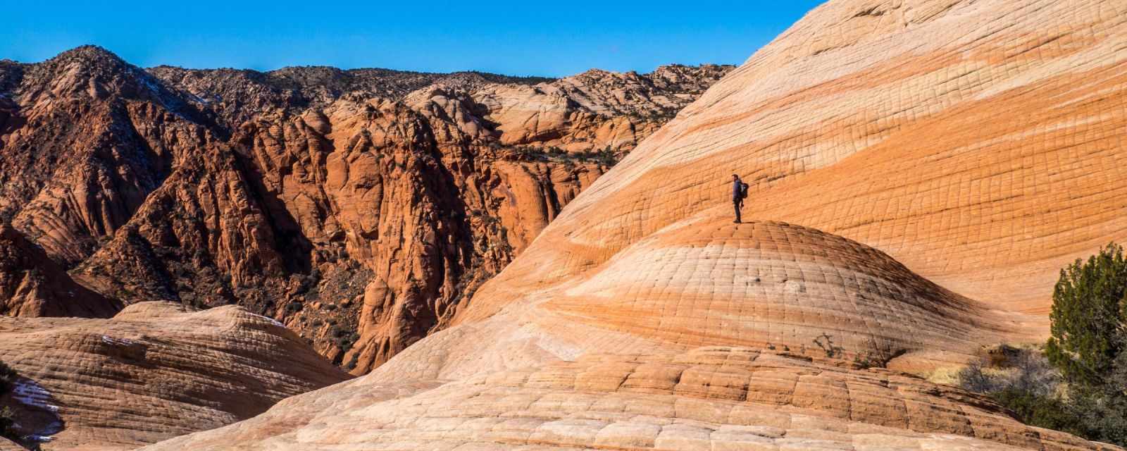
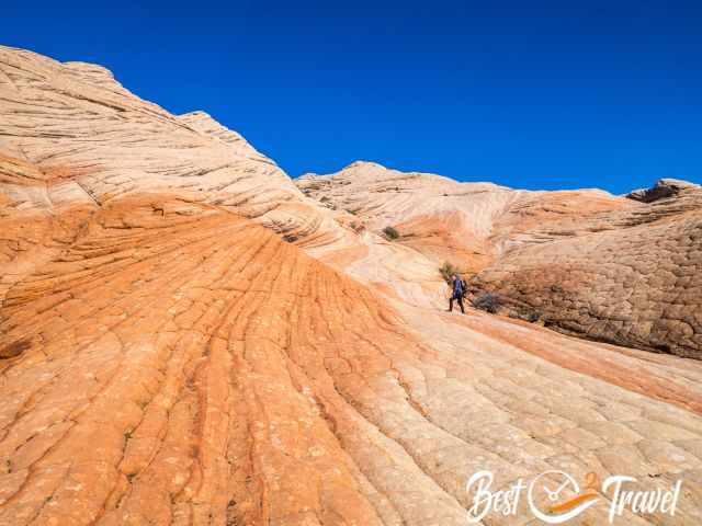
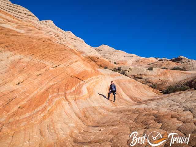
From the trailhead, it takes roughly 45 minutes to get to the easy to moderate 1.5 mi/2.5 km to the Candy Cliffs. The trail leads through the sand and a low pine forest with desert plans.
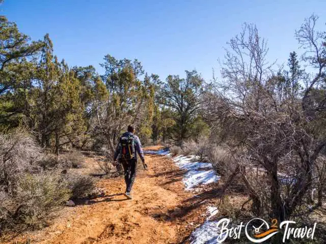
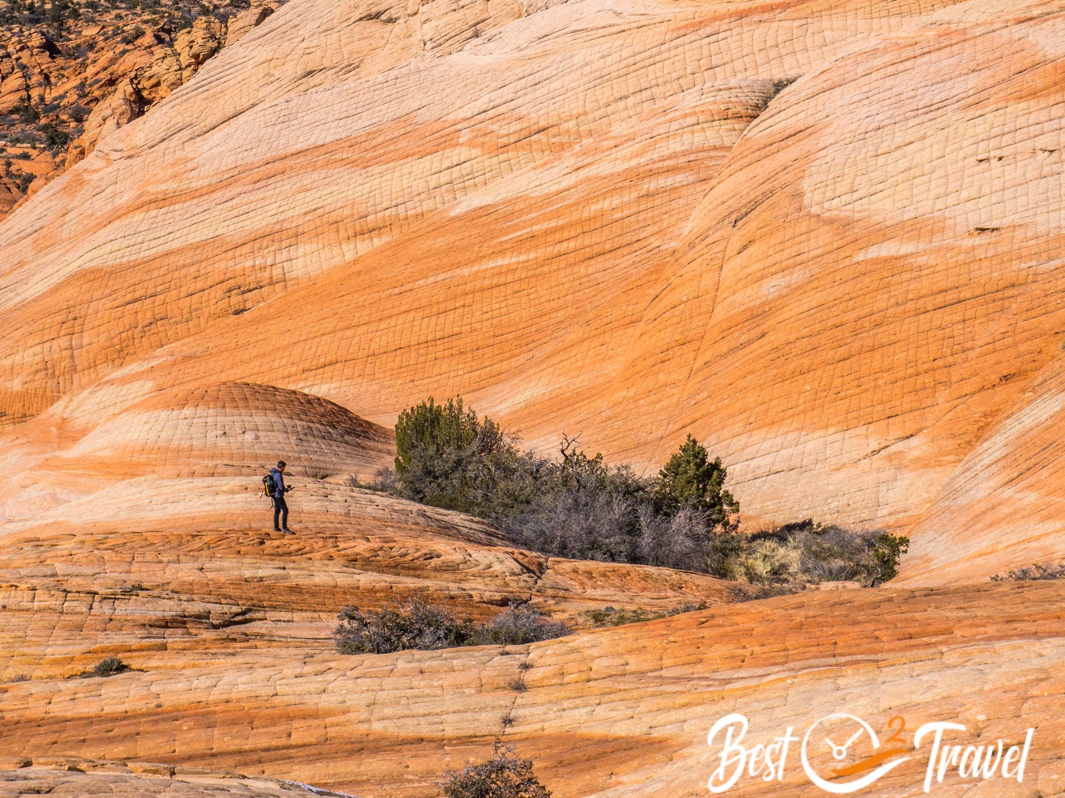
You can’t walk fast through the sandy track. When you reach the plateau, you can descend straight forward or walk to the right or the left. Depending on the time and sunlight, there are plenty of photo options. The cliffs are steep in sections; however, the cube-patterned rock surface is easy to handle if you wear shoes with good traction.
Hiking Map to the Candy Cliffs by Locus Map App, our mobile hiking app. We never go without it —more in my Tips and Gear section.
Our return hike to Yant Flat and above the Candy Cliffs was 4.5 mi/7 km long with a 558 ft/170 m elevation difference.
How Much Time Do I Need for the Candy Cliffs?
It takes roughly an hour to get here from St. George. From the trailhead to the rock formations, plan roughly 45 minutes. Now it is up to you how much time you like to spend here and how much you want to explore. It is best to have at least two or three hours to explore the fossilized dunes and the colourful and swirled formations.
Best Time and Daytime for the Candy Cliffs
Spring and fall, with pleasant temperatures, are the best months. Summer from June to September is hot on the sun-exposed plateau. After rainfall in summer, the dirt road is impassable, and the same is true in winter with snowfall.
Yant Flat is situated at 4,600 ft/1.400 m above sea level. We experienced some snow in January. Several feet of snow fell in February 2023.
The best daytime for great shots is in the morning and late afternoon. At midday, the sun is too bright.
Hotel and Camping Tip for Yant Flat – Candy Cliffs

Our room was huge, clean, the beds comfy, and the staff super attentive. Just around the corner is a Starbucks where we got our cappuccino in the morning. The location is perfect as it is right on the interstate and close to Yant Flat and Snow Canyon State Park.
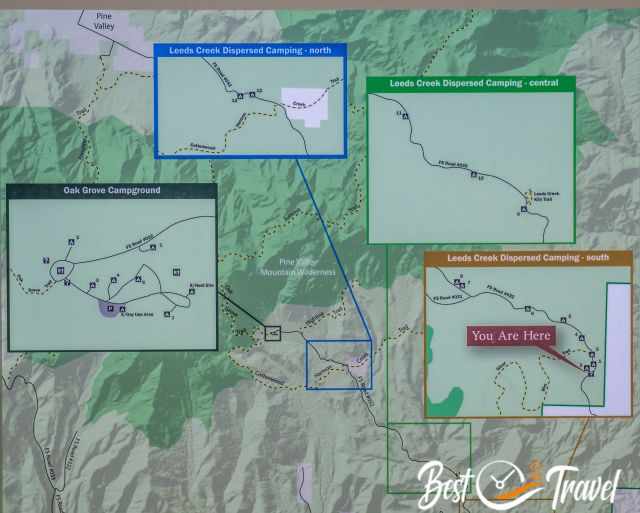
You can’t pitch your tent next to these rock formations, however, dispersed camping is allowed at four camp areas nearby with much space at Leeds Canyon, part of the huge Dixie National Forest and free of charge.
You pass by the Silver Rim Trail, where the dispersed campsites are located. These are the Leeds Creek dispersed camping areas in the south, central, and north and the fourth is Oak Grove Campground. You can’t miss them; all are well-signed. From here, it is another 8.5 miles to the Yant Flat Trailhead.
Location Silver Rim Trail Google Maps: here is the first campsite soon after to the left.
Our Packing List for Yant Flat

When we travel through the US to remote places, getting a proper meal during the day is usually impossible. We tried out dehydrated meals, which are convenient and time-saving. I have to confess we didn't expect such good quality and taste.
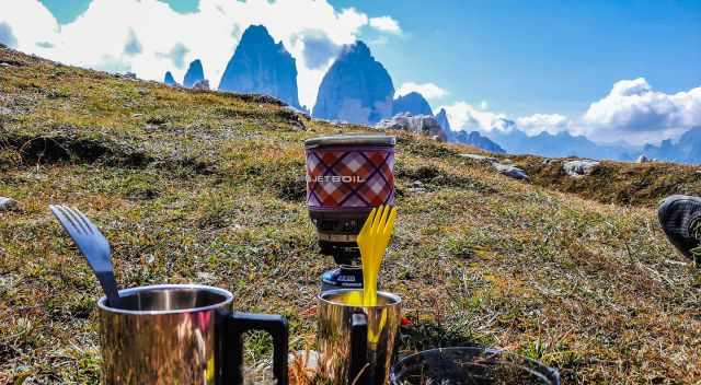
To quickly boil some water either for a hot drink or to prepare some dried food, we count on a MiniMo Cooking System from Jetboil. The Jetboil always joins us, like in the Italian Dolomites or at the Wahweap Hoodoos close to Page.
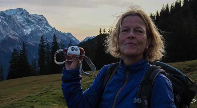
In case of an emergency or a hike that takes longer than expected, we never go without our Petzl Headlamp in our backpack.
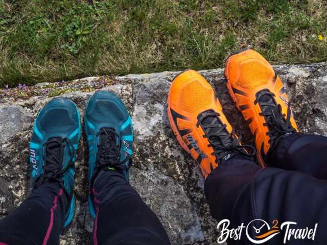
Please do not use hiking poles on the sandstone rock formations; instead, wear proper shoes with grip. Markus and I love the INOV-8 Trailtalon because of the flexible sole and the excellent grip. We have used this type of shoes for many years already.
Best Months to Visit
Location and Tips

The Candy Cliffs are bizarre, swirled rock formations, fossiled dunes close to Zion National Park and St. George, and a hidden gem. I will give you the details on how to find the parking and trailhead and which gravel road to choose. I added a customized map and many pictures for this colourful rock formation off the beaten path.
From the cliffs of Yant Flat, you can look into the nearby Snow Canyon State Park, situated along the upper rim of the Cottonwood Canyon Wilderness.
Who We Are
We are passionate travellers, married for almost 25 years, and we love discovering hidden gems around the globe. I am passionate about sharing some of the most beautiful places in the world with you, but I still can't live from my work, and we have regular jobs, too.
It is a tough business nowadays because fake travel websites rewrite content without effort and expense. Do you like to know more about fake travel websites and how to unmask them? Check out "The Truth About Fake Travel Websites"
Do you like my Yant Flat Guide? Please share it with your friends and on social media, subscribe to our YouTube Channel.
Do You Like to Support Me - It's easy; use the Paypal Button below 😍
Do you want to obtain the usage right for my images? Contact me, but we will take action against picture theft.